Areas of Severe Thunderstorms and Excessive Rainfall Sunday
Scattered strong to severe thunderstorms may pose a risk for damaging wind gusts over the Carolinas, southeast Virginia, and the Tennessee Valley Sunday afternoon then the northern Plains from late afternoon into Sunday night. Monsoonal thunderstorms may cause locally considerable flash, urban, and small stream flooding in the Southwest U.S. the next few days.
Read More >
A strong storm system brought multiple rounds of severe weather to the ArkLaTex beginning during the morning of Sunday, May 10, 2015, and continuing into the morning hours of Monday, May 11. The worst of the severe weather occurred Sunday evening and early Monday morning.
During the morning, a complex of thunderstorms moved from North Texas into Northeast Texas and Southeast Oklahoma. Very little severe weather was produced with this first round of thunderstorms. The main round of severe weather began early Sunday evening. One supercell in particular led to several reports of a funnel cloud from north of Horatio in Sevier County, AR, to De Queen, to the northwest corner of Howard County, AR, west of Umpire. No tornado was found with this storm in the ArkLaTex.
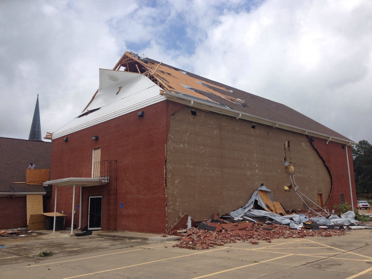
Additional thunderstorms continued to develop. Another supercell with strong rotation developed a few hours later between Ashdown, AR, and Texarkana. Rotation continued to develop with this storm as it moved north-northeast. This storm produced an EF2 tornado in Nashville. The most significant damage occurred in the D&J Mobile Home Park on the southwest side of Nashville. Five mobile homes were completely destroyed. Two people were killed in this mobile home park and eight other people were injured.
At the same time, another supercell developed farther south in Harrison and Cass Counties in East Texas. This storm eventually produced two EF0 tornadoes in Marion and Cass Counties between Jefferson and Linden. Damage with these two tornadoes consisted mainly of snapped and uprooted trees.
Most of the thunderstorms eventually congealed into a large quasi-linear convective system (QLCS), sometimes called a squall line. This line of storms would sweep eastward through East Texas, Southern Arkansas, and Northern Louisiana through the mid-morning hours of Monday. Although the line would weaken as it moved into Southern Arkansas and Northern Louisiana, it was much stronger when it initially developed farther west. Surveys teams from the National Weather Service in Shreveport found straight-line wind damage between Millwood Lake and Hope, AR. Estimated peak wind speeds in this area were between 80-90mph. Additional straight-line wind damage was found in northern and northeastern Bowie County, TX, particularly near the Red River Army Depot and northeast of Maud.
If the tornadoes and wind damage weren't enough, these storms also produced very heavy rainfall and flash flooding across much of Southeast Oklahoma, Southwest Arkansas, and portions of Northeast and East Texas. Many of these areas had already experienced heavy rainfall and flash flooding over the previous few days. Some roads were impassable due to high water in Texarkana, New Boston, and Maud. Some of the worst flooding was reported in Harrison County, TX, particularly in and around Marshall.
Damage survey crews were deployed in the days following the storms from the National Weather Service in Shreveport to investigate the various reports of possible tornado damage. The details of the surveys can be found in the table and the damage map below. The survey information should be considered preliminary and subject to change.
TOTAL TORNADO COUNT = 6
EF0 = 2
EF1 = 3
EF2 = 1
Tornado Table
Photos
Damage Map
TOR. #
START POINT
END
POINT
RATING
PEAK WIND
START TIME
END TIME
LENGTH/
WIDTH
FATALITIES/
INJURIES
REMARKS
MAY 10, 2015
#1
5.74 miles SW of Mineola, Smith County, TX
5.44 miles WSW of Mineola, Smith County, TX
EF1
100-110 mph
9:19pm CDT
9:20pm CDT
1.42 miles/ 440 yards
None
The most extensive damage was located along County Road 1253 and County Road 462, just west of 1253. There were several homes that sustained roof damage, and several outbuildings and barns were damaged or destroyed. Numerous trees were snapped and/or uprooted.
#2
6.19 miles SW of Mineola, Smith County, TX
5.38 miles SW of Mineola, Smith County, TX
EF1
100-110 mph
10:50pm CDT
10:51pm CDT
1.18 miles/
450 yards
None
The most extensive damage was located east of County Road 1253 and along County Roads 460 and 458. Several outbuildings were damaged or destroyed and numerous trees were snapped and/or uprooted.
#3
1.36 miles SW of Nashville, Howard County, AR
5.57 miles NNW of Nashville Howard County, AR
EF2
115-125 mph
11:18pm CDT
11:34pm CDT
6.71 miles/ 400 yards
2 fatalities/
8 injuries
The most extensive damage with this tornado was located on the southwest side of Nashville at the D&J Mobile Home Park. Five mobile homes were completely destroyed. There were 2 fatalities in this mobile home park and 8 additional injuries. There were 40 to 60 homes suffering minor to moderate damage from the tornado, mainly from fallen trees. Other damage consisted of numerous trees snapped and/or uprooted with wooden power poles snapped as well.
#4
5.7 miles NNE of Jefferson, Marion County, TX
5.9 miles NNE of Jefferson, Marion County, TX
EF0
70-85 mph
11:25pm CDT
11:27pm CDT
0.51 miles/
172 yards
None
This brief tornado snapped and/or uprooted several trees near Highway 248 northeast of Jefferson, TX.
#5
8.1 miles NNE of Jefferson, Marion County, TX
10 miles SE of Linden, Cass County, TX
EF0
70-85 mph
11:28pm CDT
11:32pm CDT
2.66 miles/
345 yards
None
This tornado developed from the same parent thunderstorm as the previous Jefferson tornado. This tornado began along Highway 248 just south of the community of Lodi in Marion County. It remained on the ground for just over two and half miles and crossed into Cass County before lifting near the intersection of Highway 248 and County Road 1780. Damage consisted mostly of numerous tress being snapped and/or uprooted.
MAY 11, 2015
#6
2.88 miles SE of New Summerfield, Cherokee County, TX
3.36 miles SSE of New Summerfield, Cherokee County, TX
EF1
95-105 mph
1:34am CDT
1:36am CDT
1.25 miles/
76 yards
None
Most of the damage was located west of County Road 2274 between County Roads 235 and 4504. Several trees were snapped and/or uprooted.
Millwood Lake, Howard County, AR
Near Saratoga, Howard County AR
Straight-line
winds
80-90 mpn
1:45am CDT
2:00am CDT
N/A
None
A survey team has concluded that damage is this area is consistent with that of straight line thunderstorm winds near 80-90 mph. The damage consisted of numerous trees snapped and/or uprooted near the shore of Millwood Lake with the damage oriented in a northeast direction towards the community of Saratoga. Some structures also suffered minor to moderate damage, mainly from fallen trees.
Other sporadic straight-line wind damage was in Hempstead County near the intersection of State Highways 73 and 195.
Center, Shelby County, TX
N/A
Straight-line winds
70 mph
4:30am CDT
N/A
N/A
None
Damage in Center was consistent with that of straight-line wind gusts near 70 mph. Scattered trees were down mainly on the west side of Center, and five homes suffered moderate to major damage from uprooted and/or snapped trees. The damage was mostly concentrated in a small subdivision off of FM 138 and Highway 96.
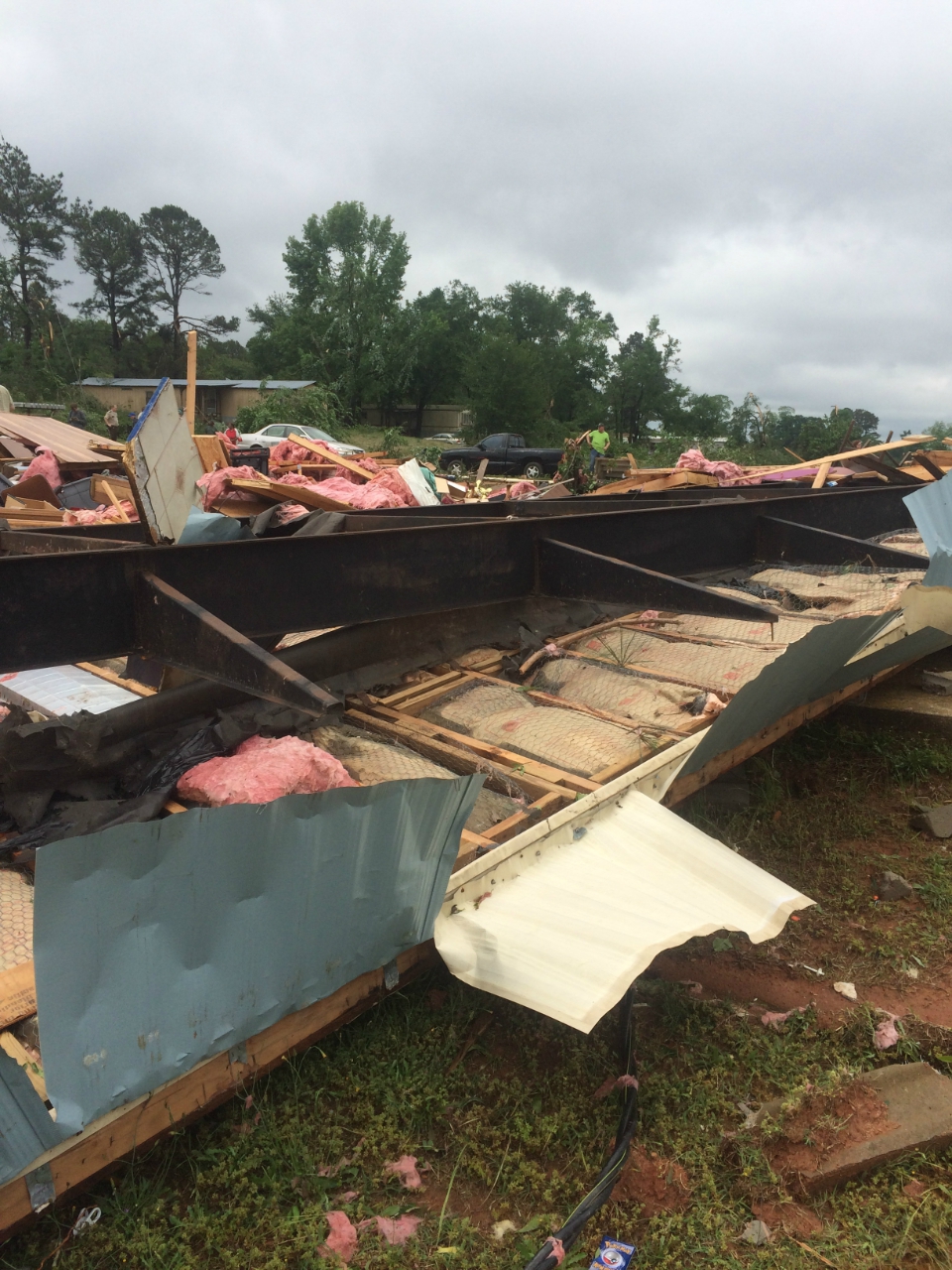
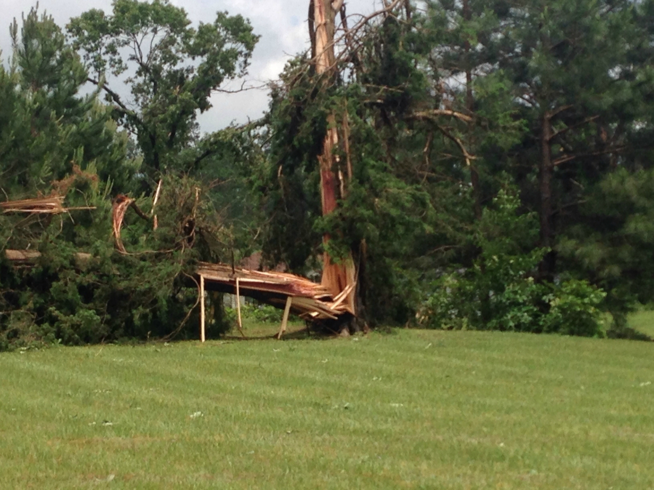
EF2 tornado damage in Nashville, AR. Five mobile homes
were completely destroyed at the D&J Mobile Home Park.
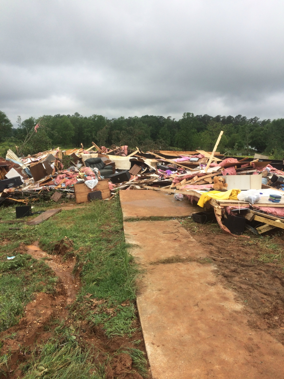
EF2 tornado damage in Nashville, AR.
Five mobile homes were completely
destroyed at the D&J Mobile Home Park.
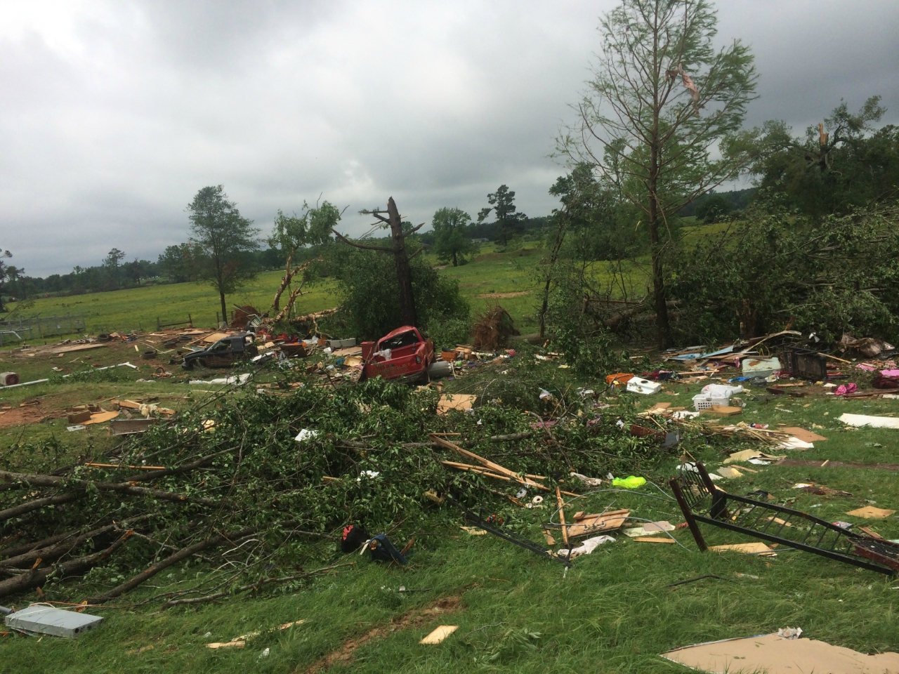
Additional EF1 tornado damage in and around Nashville, AR.