Severe Thunderstorms; Excessive Rainfall; Dangerous Heat; Air Quality Concerns and the Tropics
Wildfire smoke will push into the Midwest, worsening air quality. A frontal system brings severe storms from the Northern Plains to the Mid‑Atlantic the next few days. Heavy Gulf Coast rain is possible as Tropical Depression Two has formed, while monsoonal storms persist in the Southwest with heavy rainfall. Hazardous heat expands from the Plains into the Lower Mississippi Valley.
Read More >
LOADING...
Shreveport, LA
Weather Forecast Office
January 21, 2017: Tornadoes in the Four State Region
A very strong storm system brought severe weather and a tornado outbreak to the Four State Region during the afternoon and evening of January 21, 2017. Several reports of large hail, some up to two inches in diameter, were received from Northwest Louisiana and Southern Arkansas. Several reports, pictures, and videos of tornadoes were also received by the NWS office in Shreveport. Survey teams from the NWS confirmed a total 12 tornadoes occurred. Details of the survey are listed below. The information on this web page is considered preliminary and subject to change.
0.35 miles WNW of Scottsville,
Harrison County, TX
END
POINT
5.27 miles NNE of Scottsville,
Harrison County, TX
RATING /
PEAK WIND
EF2 /
120 mph
DATE
January 21, 2017
START TIME
4:18pm CST
END TIME
4:35pm CST
LENGTH/
WIDTH
7 miles/
230 yards
FATALITIES/
INJURIES
None
Summary:
Damage consisted of numerous trees snapped and/or uprooted along with numerous downed power lines. The tornado began along Highway 80 one mile west of FM 2199 and continued northeast crossing FM 1998. The tornado did its most destructive damage on Tramel Lane where trees were downed on several homes. One home had its roof removed. The tornado continued north northeast along Harkins Lane where more trees were uprooted. The tornado finally dissipated on Cowpen Road.
Numerous trees were snapped and/or uprooted and numerous power lines were downed. This short-tracked tornado did most of its damage on Kellyville Cutoff Road just south of FM 729 before lifting near Highway 49 in the Kellyville community. One home was damaged with the roof removed from a single-wide mobile home. One large tree fell on an outbuilding near Highway 49. The tornado lifted before reaching the Berea community.
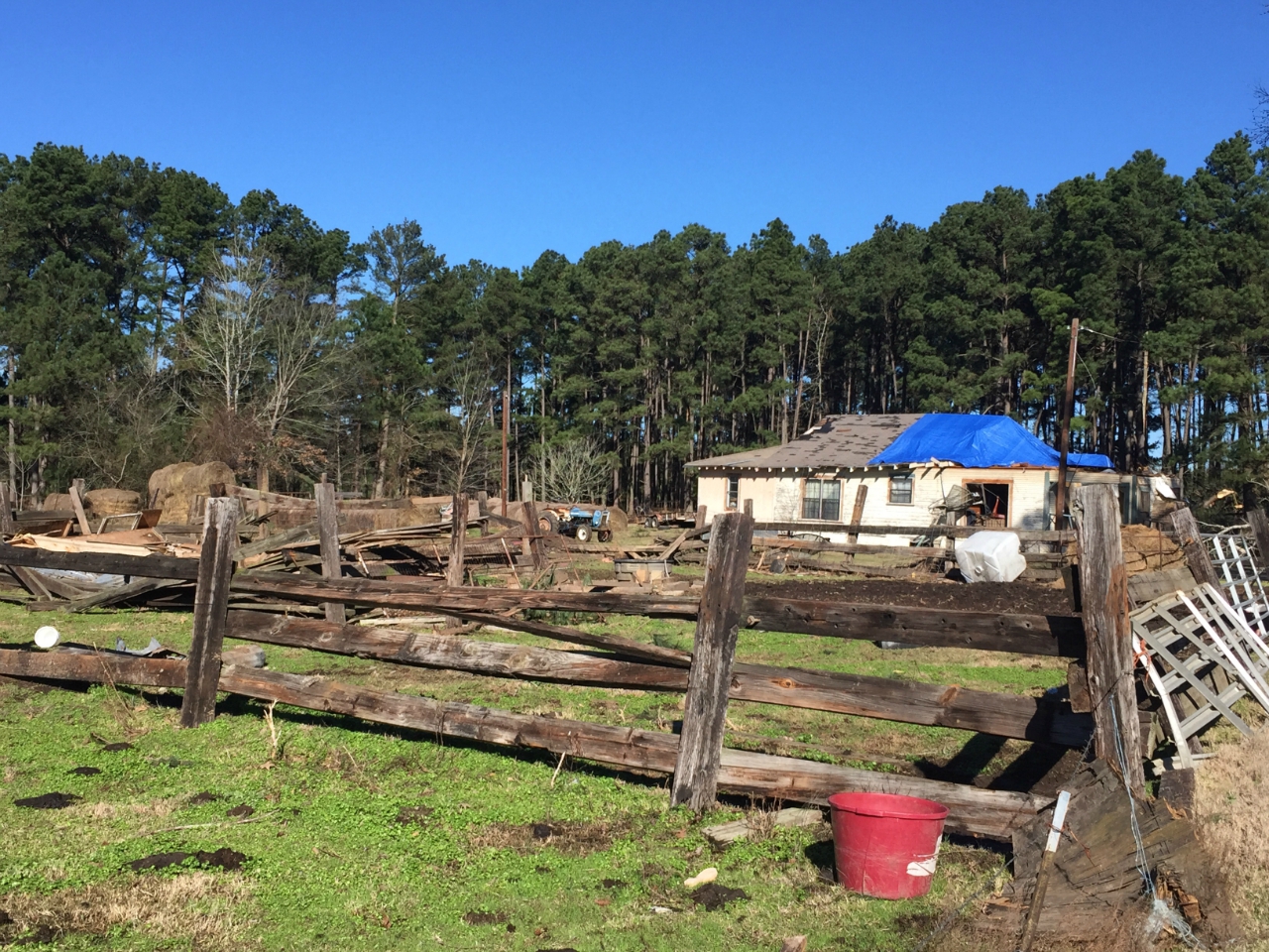
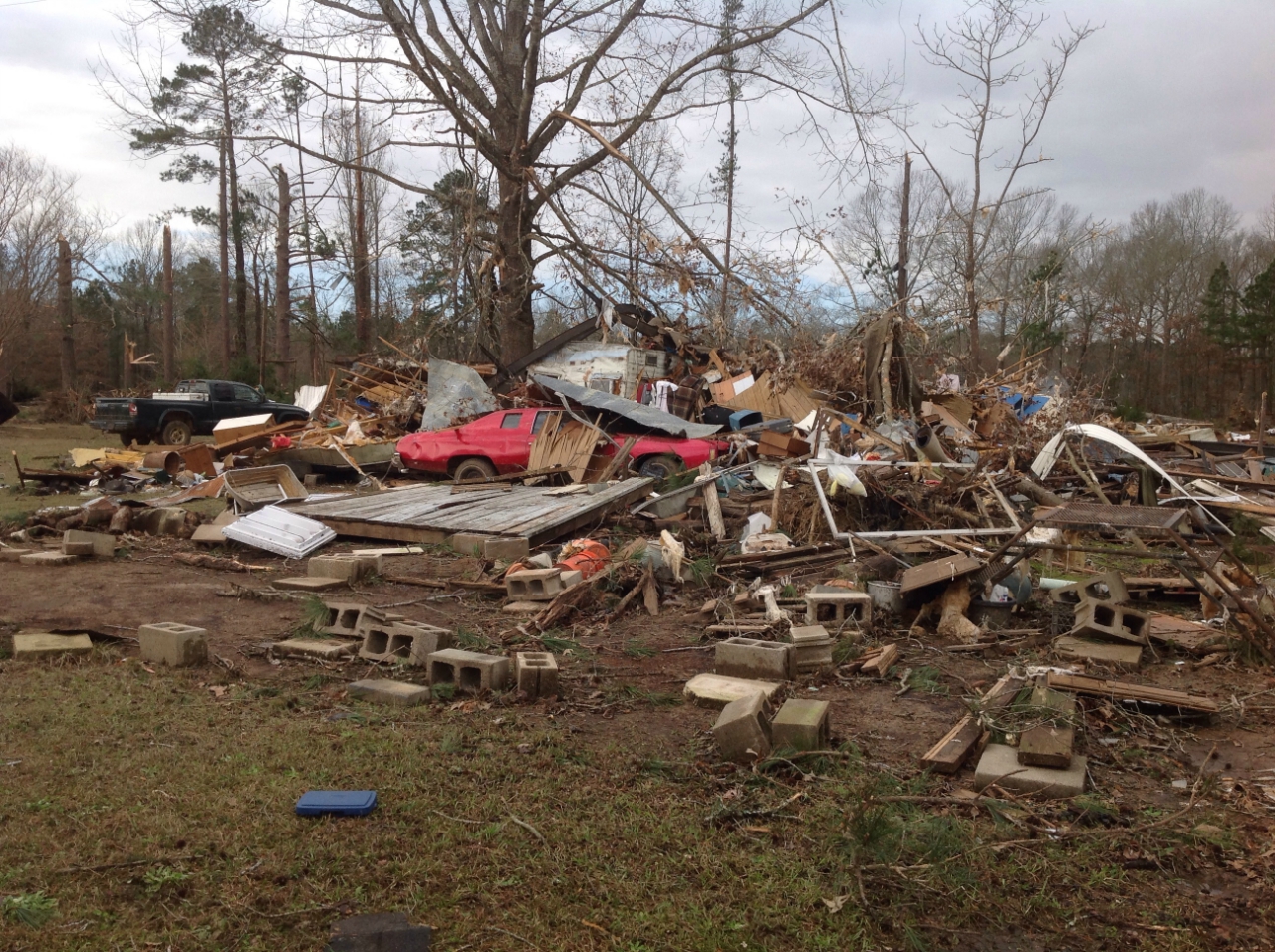
Damage consisted of numerous trees snapped and/or uprooted and numerous downed power lines. The tornado began just west of Smithland, TX, near Highway 43 and intensified near Highway 49. The tornado moved several vehicles and deposited a party barge boat 200 yards into a grove of trees. Trees were downed on several homes, and a travel trailer was flipped.
The tornado continued in a northeast direction, crossing CR 3300 at which point it removed the roof of a home. A woman inside took shelter in a bathtub, and the tornado lifted the tub out of the home and deposited in in the woods with the woman still in the tub, but the woman was not injured.
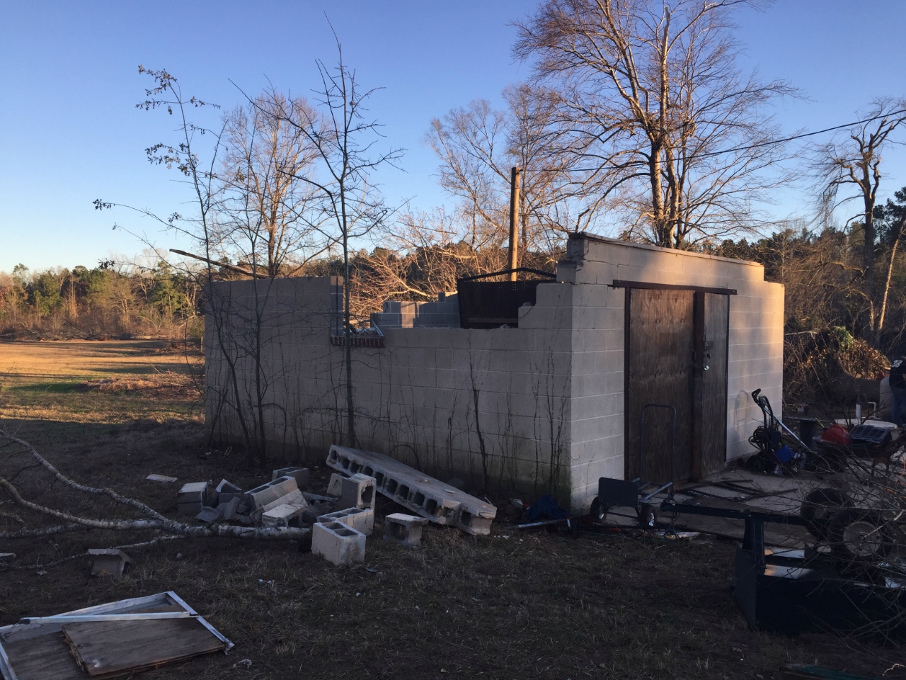
The storm then moved along CR 3306 before entering far southeast Cass County, TX, on CR 4455. The storm then crossed over State Line Road and moved into northwest Caddo Parish, LA, northeast of Vivian, LA, and southwest of Rodessa, LA, where the roof was removed from a cinder block storage building. A single-wide mobile home was also shifted several feet off its foundation.
The tornado lifted on Old Atlanta Road just south of Myrtis Texas Line Road.
3.75 miles ESE of Plain Dealing,
Bossier Parish, LA
END
POINT
2.22 miles SW of Springhill,
Webster Parish, LA
RATING /
PEAK WIND
EF2 /
115 mph
DATE
January 21, 2017
START TIME
5:12pm CST
END TIME
5:37pm CST
LENGTH/
WIDTH
10.90 miles/
990 yards
FATALITIES/
INJURIES
1 injury
Summary:
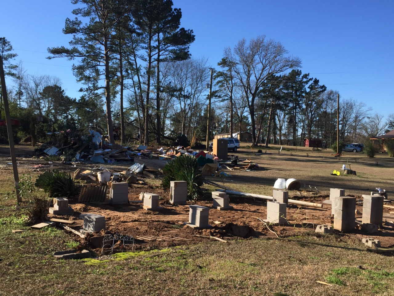
Damage consisted of numerous hardwood and softwood trees snapped and/or uprooted. Numerous power lines were also downed along the storms path. Several structures were damaged by falling trees. The most significant structural damage was sustained by 2 mobile homes which were rolled and completely destroyed, along with several outbuildings. One injury was reported when a resident was hit in the head by a piece of lumber and was rendered briefly unconscious in a manufactured home that lost its roof and a couple of exterior walls. The worst structural damage was observed in a small area near and adjacent to Mott Road and Mott Oilfield Road.
The tornado continued in a northeast direction uprooted trees and downing power lines along its track, hitting the Muddy Bottoms ATV Park in extreme northwest Webster Parish. In the park, the tornado removed a portion of the roof of a building before lifting in the extreme northern portion of the park.
This tornado began along Elmer Moore Road and continued northeast across Rodney Martin Road to Wortham and Thomas Rhone Roads before crossing Highway 159 just south of Shongaloo. The tornado continued northeast before lifting along Hearn Road. Damage consisted of numerous trees that were snapped and/or uprooted. A tree fell on a carport and a portion of a mobile home on Wortham Road.
2.52 miles ENE of Natchez,
Natchitoches Parish, LA
RATING /
PEAK WIND
EF2 /
125 mph
DATE
January 21, 2017
START TIME
5:56pm CST
END TIME
6:03pm CST
LENGTH/
WIDTH
2.05 miles/
300 yards
FATALITIES/
INJURIES
1 injury
Summary:
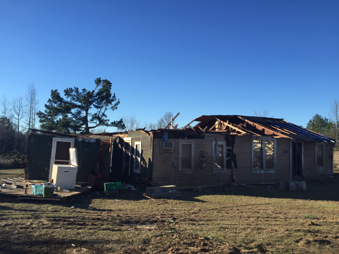
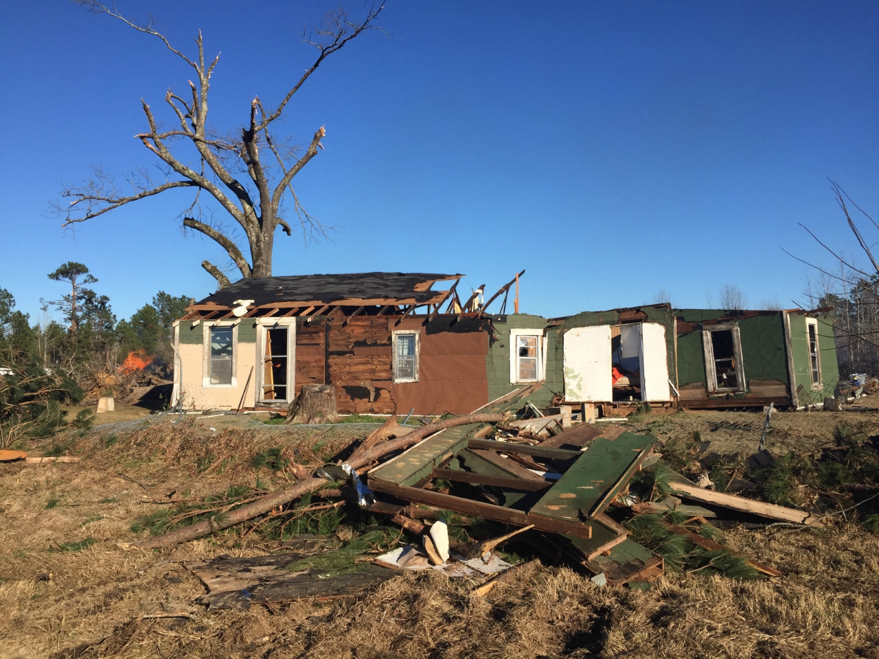
Damage consisted of numerous trees snapped and/or uprooted, and numerous downed power lines. Five homes sustained significant damage. One home lost its roof and had three exterior walls collapse. One man injured his arm inside his home. Several outbuildings were also severely damage in and around the Cane River. The tornado dissipated just short of the Red River.
Damage consisted mainly of numerous trees snapped and/or uprooted and numerous downed power lines. A single-wide mobile home was flipped injuring a woman inside. A tree also fell on a home causing major damage. Several trees also fell on a local cemetery. Several barns and/or outbuildings sustained damage. A 3000-pound trailer was flipped and blocked Highway 71. A large TV antenna was also toppled onto a home.
Several small pine trees were snapped at the start of the damage path. As the storm continued north northeast towards Guinn Road and Highway 82, the tornado intensified and uprooted several large pine trees. The tornado traveled in a near northerly direction and lifted without much more damage.
Damage consisted of a few small trees snapped near the Lawson community. The tornado hit a single-wide mobile home peeling back a portion of the roof with one portion of the wall detached. The tornado dissipated shortly thereafter.
This tornado began on Highway 165 and moved east-northeast damaging Camp Hardtner where numerous trees were snapped and/or uprooted. Shingles were removed from several structures, and a tree fell on a home causing severe damage.
A brief EF1 tornado occurred in Jena. Snapped trees were observed west of Highway 3104 near Highway 8. A wooded barn was damaged, and an uprooted tree fell on a church. A gas station canopy was blown 50 yards away, and a brick facade from a local business collapsed from the wall of the building. Other storage buildings were also heavily damaged.
A few small trees were snapped at the initial point of touchdown. The tornado moved east northeast and caused considerable damage to a metal shed and removed a metal roof from another outbuilding and deposited it in an open field before dissipating.
This survey data is preliminary and subject to change as more information becomes available. Road accessibility and inconsistencies between mapping and GPS software may limit the accuracy of the tracks plotted on this map. Line widths are not representative of actual tornado widths. The information plotted on this map is intended for general reference use only.