|
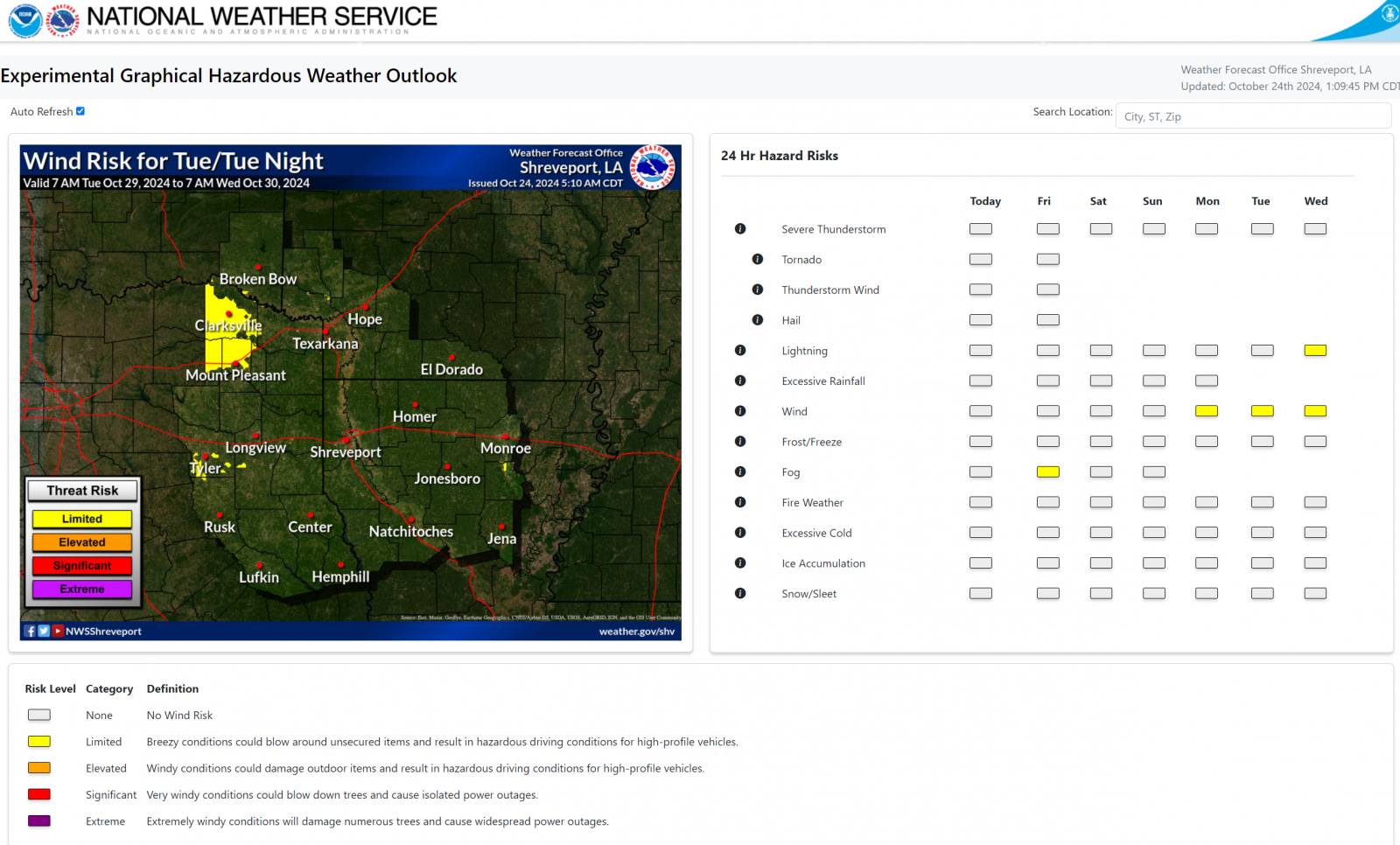
Effective December 1, 2024, the National Weather Service (NWS) office in Shreveport, LA, (SHV) will discontinue the Hazardous Weather Outlook (HWO) product and will replace it with a Graphical Hazardous Weather Outlook (gHWO). Currently, the HWO provides a plain language overview of any hazardous weather expected within the NWS SHV County Warning Area (CWA) during the next seven days. The HWO is divided into three sections: Day 1, usually titled “Today and Tonight,” Days 2 through 7, and the Spotter Information Statement. The HWO is issued at 6 AM local time and updated as needed around midday. Much of the information in the HWO is being duplicated within other NWS graphical and text products, which are available from NWS websites and social media. In particular, the Area Forecast Discussion (AFD) has been a source of hazard information for years. Therefore, the NWS SHV office has determined that it makes sense to consolidate these products. NWS partner and user feedback has indicated that the Spotter Information Statement is the most used section of the HWO, primarily because some local organizations use software to parse the text for their situational awareness. When the text-based HWO is discontinued, the Spotter Information Statement will be included as a new section within the AFD. This should allow those organizations to maintain situational awareness with minimal changes. Over the last few years, the NWS has developed a new gHWO product to replace the HWO. The gHWO provides a map-based display rather than a plain language text product of the expected hazardous weather within the next seven days. The gHWO is color-coded based on the expected threat levels. The gHWO is also automatically updated anytime the NWS forecast is updated. In addition, the graphics allow NWS partners, users, and the public to view them more easily on computers and mobile devices. Thus, the increased timeliness, map-based precision, and easier interpretation of the gHWO make it an improvement of the legacy HWO text product. The gHWO can be found on the NWS SHV website at https://www.weather.gov/erh/ghwo?wfo=shv |
 |
| Screenshot showing an example of the new Graphical Hazardous Weather Outlook webpage. |
If you have questions or concerns about the discontinuation of the Hazardous Weather Outlook product, please contact:
Chris Nuttall
Warning Coordination Meteorologist
National Weather Service, Shreveport, LA
318-631-3669, ext. 223
chris.nuttall@noaa.gov
Brad Bryant
Meteorologist-in-Charge
National Weather Service, Shreveport, LA
318-631-3669, ext. 222
brad.bryant@noaa.gov