Scattered severe thunderstorms are possible Saturday afternoon into early evening across parts of the southern High Plains. Damaging winds, large hail, isolated tornadoes, and heavy to excessive rainfall are possible. Along the Atlantic Coast, widespread minor to isolated moderate coastal flooding at high tides is forecast through the weekend. Read More >
|
June 1, 2011 Severe Weather Event Widespread Large Hail, Heavy Rain and Flooding, and Some Damaging Winds To the right is a National Weather Service Radar loop The NWS Hastings coverage area is located within the orange (Click Radar Loop To Enlarge)
|
|
|
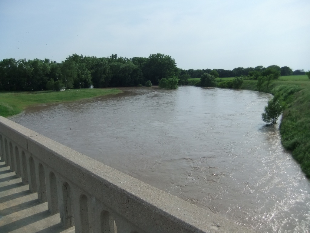
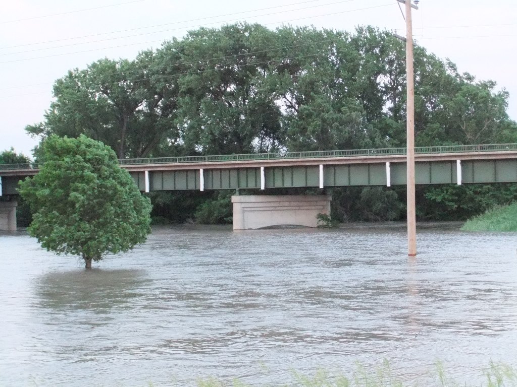
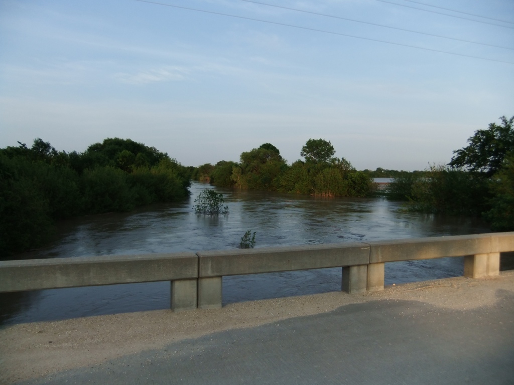
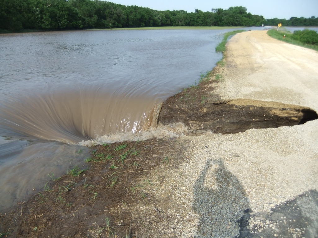
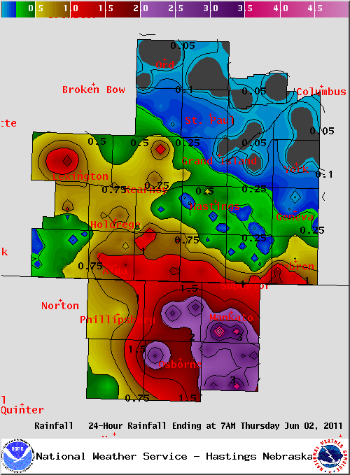
Severe Weather Summary: South Central Nebraska and North Central Kansas found itself starting out the month of June with yet another round of severe weather, with the main impact being across the southwestern half of the Hastings CWA. This severe weather was not driven by a notable, strong storm system, but rather by a weaker, more subtle wave in the upper level flow. Southeasterly winds throughout the day allowed for warmer, more moist air to be drawn north into the area, resulting in high levels of instability across the entire CWA, but especially across the west. Combined with modest shear, any thunderstorms that developed had the potential to become severe, and many did. The main threat of these thunderstorms was hail anywhere from the size of quarters to baseballs and heavy rainfall, along with a few wind gusts at/over 60 mph. There were a few reports of funnel clouds and tornadoes across the area, and these reports are currently being investigated. The heaviest rain, which ranged from 2 to almost 5 inches, targeted North Central Kansas and resulted in extensive flooding along rivers and low land areas, along with numerous water covered roads. River gauges along the North and South forks of the Solomon River went into flood at several locations, including Portis, Osborne and Beloit (see below for more heavy rain and flooding details). Here are a few "highlights" of this severe weather event Wednesday evening, June 1st, based on reports from storm spotters/chasers, local law enforcement, emergency management, and the public:
For a complete listing of the PRELIMINARY storm reports, please click the linked image below.
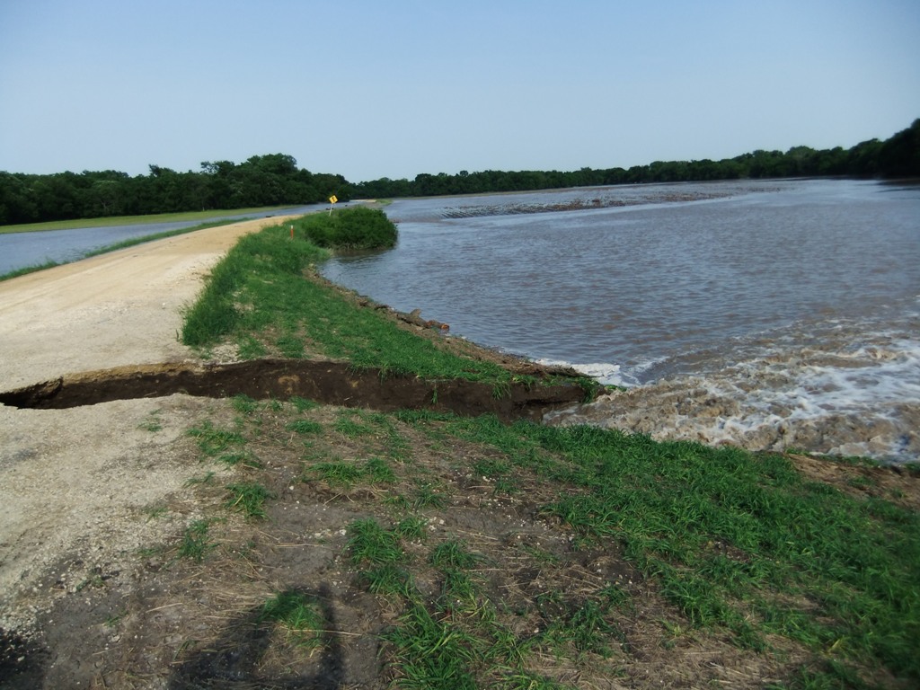
The following photos of flooding in North Central Kansas were taken on Thursday, June 2, 2011, by NWS Hastings staff. (CLICK TO ENLARGE)
|


.gif)
.png)