A low pressure system will bring heavy to excessive rainfall and high winds across Montana this afternoon. Heavy rainfall totals may lead to scattered flash flooding concerns. A line of showers and strong to severe thunderstorms will move into the mid Missouri Valley region this afternoon producing severe winds and isolated large hail with stronger storms. Read More >
Hastings, NE
Weather Forecast Office
|
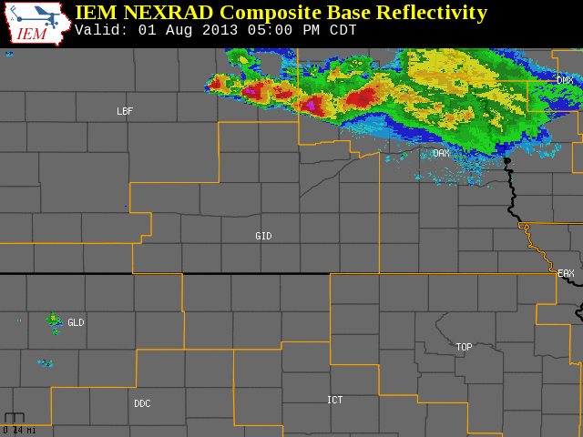
The NWS Hastings coverage area is located within the orange outlined area labeled "GID". (Click Radar Loop To Enlarge)
|
|
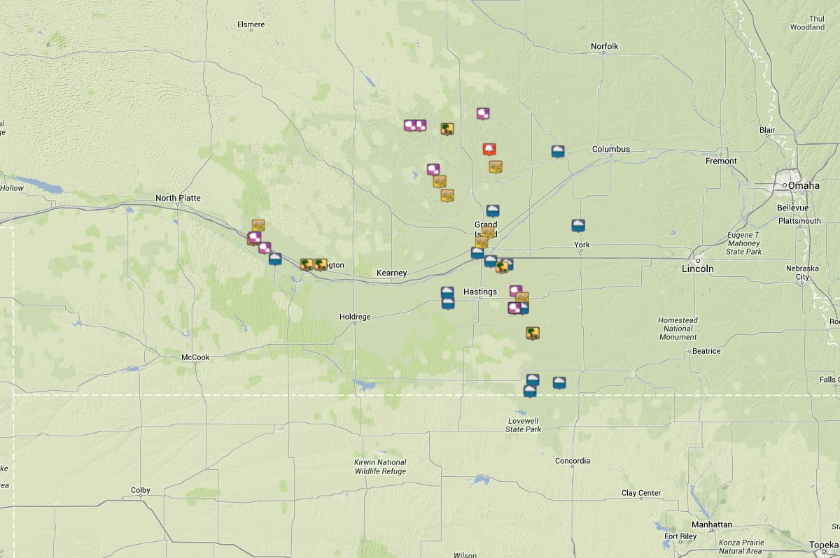
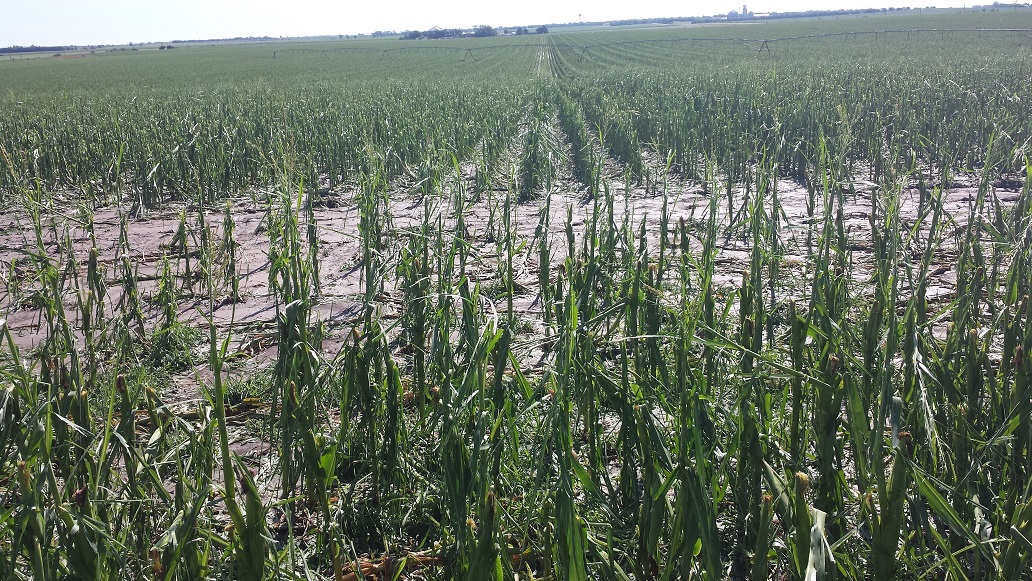
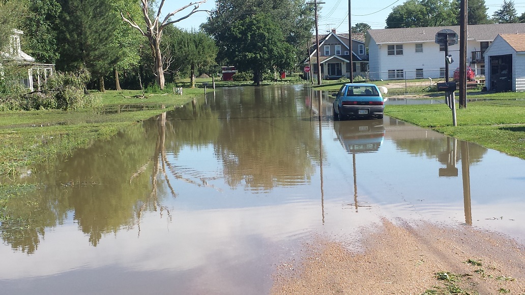
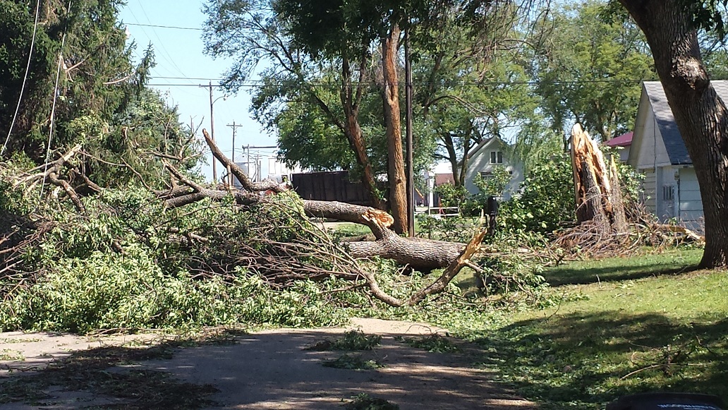
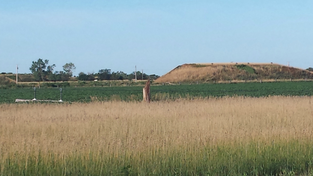
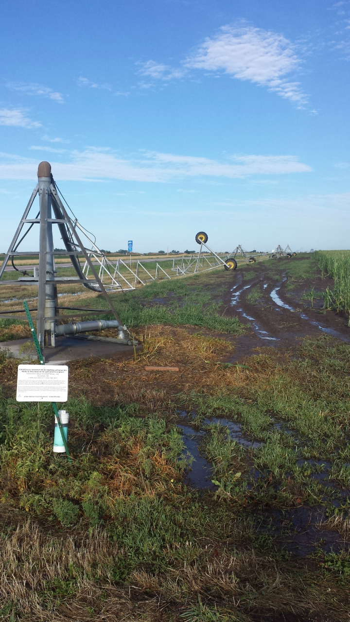
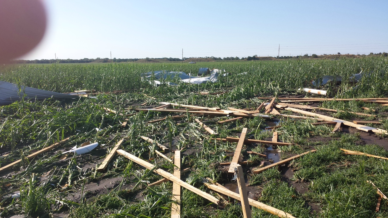
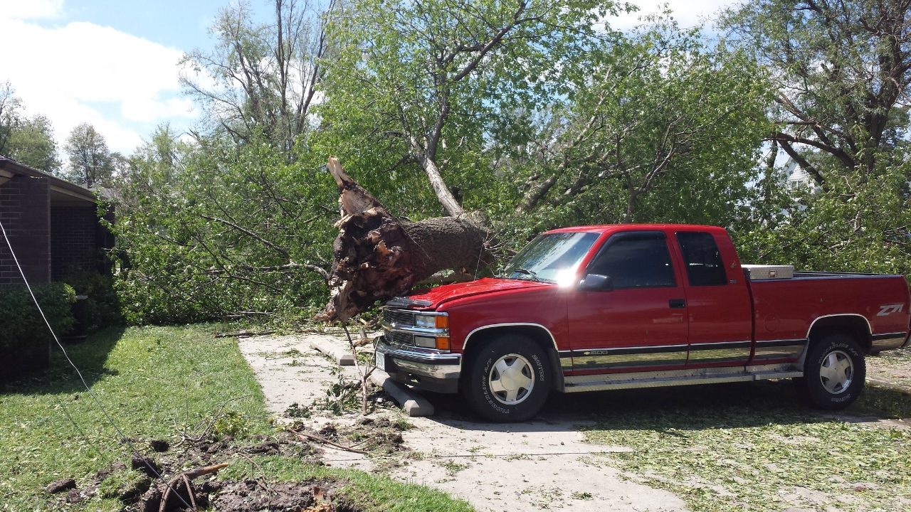
Event Summary During the afternoon hours of Thursday, August 1, 2013, isolated thunderstorms developed over portions of northern Nebraska. These thunderstorms moved south and eventually merged into a line bringing large hail, strong thunderstorms wind gusts, and heavy rainfall to the area mainly during the evening. Some of the worst damage was concentrated within portions of Dawson and Clay counties, including extensive tree and structural damage in and near the community of Edgar (which was also struck by an EF-2 tornado on May 27th!). Much of South Central Nebraska received much-needed rainfall of 1.50-3.50", with some locally higher amounts closer to 4", including 3.90" measured 4 miles south of Cozad. Storm Reports
|
Hazardous Weather
Experimental Graphical Hazardous Weather Outlook
Submit A Storm Report
Storm Prediction Center
Local Storm Reports
Forecasts
Activity Planner
Area Forecast Discussion
Regional Weather Summary
Fire Weather
Aviation Weather Center
Winter Weather
Winter Storm Severity Index
Experimental Winter Storm Outlook
Current Conditions
Current Area Observations
Text Products
Satellite
Rivers and Lakes
Local 24 Hour Precip Maps
Local Archived Precip Maps
NWPS Precipitation Analysis
Local Snowfall Maps
Snowfall Analysis
Snow Cover
Climate
Local Database (NOWData)
Local Climate Webpage
Hastings/G. Island Records
Local Historical Tornado Info
U.S. Drought Monitor
Grand Island - Daily
Grand Island - Monthly
Hastings - Daily
Hastings - Monthly
Kearney - Daily
Kearney - Monthly
Ord - Daily
Ord - Monthly
US Dept of Commerce
National Oceanic and Atmospheric Administration
National Weather Service
Hastings, NE
6365 North Osborne Drive West
Hastings, NE 68901-9163
402-462-4287
Comments? Questions? Please Contact Us.