
A low pressure system will bring heavy to excessive rainfall and high winds across Montana this afternoon. Heavy rainfall totals may lead to scattered flash flooding concerns. A line of showers and strong to severe thunderstorms will move into the mid Missouri Valley region this afternoon producing severe winds and isolated large hail with stronger storms. Read More >
Hastings, NE
Weather Forecast Office
Thunderstorms produced heavy rainfall across south central Nebraska and north central Kansas beginning last Wednesday night and continuing through Friday night. Three day rainfall totals ranged from over one inch to over seven inches. The heavy rainfall resulted in widespread lowland flooding and river flooding.
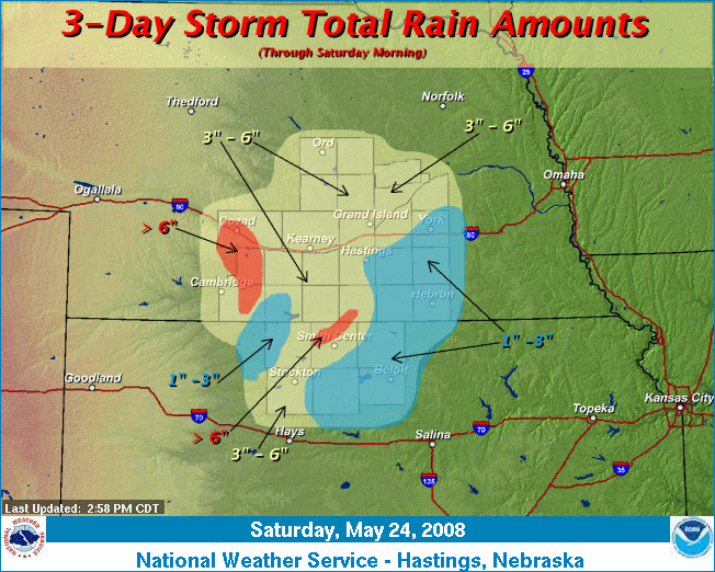
The following rainfall totals are from National Weather Service cooperative observers, automated rain gauges and weather spotters.
|
Rainfall Totals
May 22 - 24 |
|
| Location | Amount |
| Cozad | 7.25 |
| Red Cloud | 6.75 |
| Edison | 6.19 |
| Phillipsburg | 5.83 |
| Riverton | 5.63 |
| Lexington | 5.51 |
| Damar | 5.36 |
| Wilsonville | 5.29 |
| Smith Center | 5.23 |
| Cambridge | 5.08 |
| Arcadia | 4.96 |
| Loup City | 4.64 |
| Wolbach | 4.35 |
| Franklin | 4.30 |
| Saint Paul 4n | 4.26 |
| Ashton | 4.23 |
| Wood River | 4.21 |
| Lebanon | 4.17 |
| Kearney 4NE | 4.12 |
| Naponee | 4.12 |
| Ord | 4.10 |
| North Loup | 4.06 |
| Grand Island | 4.03 |
| Plainville 4WNW | 4.02 |
| Palco | 3.90 |
| Ord | 3.86 |
| Greeley | 3.84 |
| Fullerton | 3.74 |
| Phillips 4SE | 3.53 |
| Holdrege | 3.48 |
| Belgrade | 3.48 |
| Hastings 4N | 3.47 |
| Blue Hill 4SW | 3.18 |
| Aurora | 3.08 |
| Osceola | 3.05 |
| Guide Rock | 3.04 |
| Minden | 3.01 |
| Logan | 2.89 |
| Orleans | 2.66 |
| Clay Center | 2.46 |
| Hastings | 2.45 |
| York | 2.44 |
| Hebron | 2.42 |
| Bruning | 2.24 |
| Superior | 2.13 |
| Fairmont | 1.92 |
| Beloit | 1.88 |
| Clay Center 6ESE | 1.87 |
| Burr Oak | 1.81 |
| Cawker City | 1.20 |
| Ionia | 1.12 |
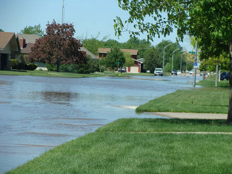
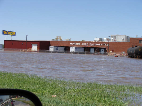
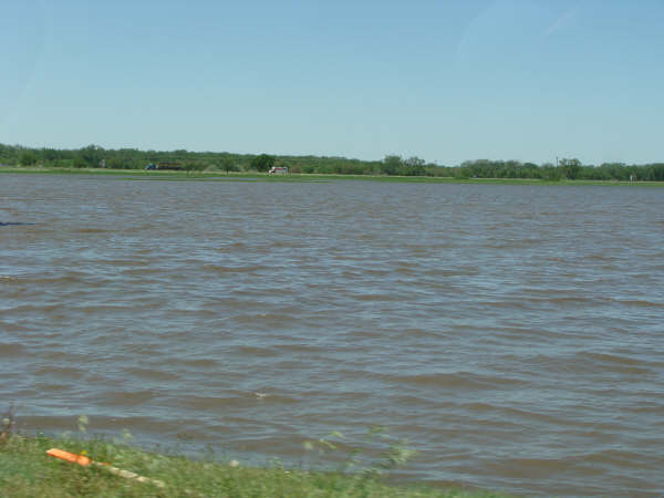
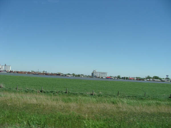
The heavy rainfall caused flooding throughout towns, rural areas, and rivers. The following pictures were taken in Cozad, NE. The photographs are courtesy of Michele Starman.
Hazardous Weather
Experimental Graphical Hazardous Weather Outlook
Submit A Storm Report
Storm Prediction Center
Local Storm Reports
Forecasts
Activity Planner
Area Forecast Discussion
Regional Weather Summary
Fire Weather
Aviation Weather Center
Winter Weather
Winter Storm Severity Index
Experimental Winter Storm Outlook
Current Conditions
Current Area Observations
Text Products
Satellite
Rivers and Lakes
Local 24 Hour Precip Maps
Local Archived Precip Maps
NWPS Precipitation Analysis
Local Snowfall Maps
Snowfall Analysis
Snow Cover
Climate
Local Database (NOWData)
Local Climate Webpage
Hastings/G. Island Records
Local Historical Tornado Info
U.S. Drought Monitor
Grand Island - Daily
Grand Island - Monthly
Hastings - Daily
Hastings - Monthly
Kearney - Daily
Kearney - Monthly
Ord - Daily
Ord - Monthly
US Dept of Commerce
National Oceanic and Atmospheric Administration
National Weather Service
Hastings, NE
6365 North Osborne Drive West
Hastings, NE 68901-9163
402-462-4287
Comments? Questions? Please Contact Us.

