
Event Summary
During the afternoon of January 3rd, a strong upper level low was moving through the central Plains and a cold front began to move into the region. Across the Lower Mississippi River Valley, peak heating and upper 60s to low 70s dewpoints contributed to decent instability in the developing warm sector in advance of the front. Strong low level wind shear and winds aloft were in place, which made a favorable environment for tornadoes. This helped to support widespread thunderstorms along with a few supercell storms.
A long lived, persistent, storm tracked across the southeastern counties (Lawrence, Jefferson Davis, Covington, Jasper and Lauderdale County) and produced eight tornadoes. Considerable damage occurred in Jasper County, north of Rose Hill, and also near Mount Olive in Covington County and Meehan and Bailey in Lauderdale County. Severe storms moved out of the region by early Saturday evening. The front slowly moved to the east through the area through the evening of January 3rd.
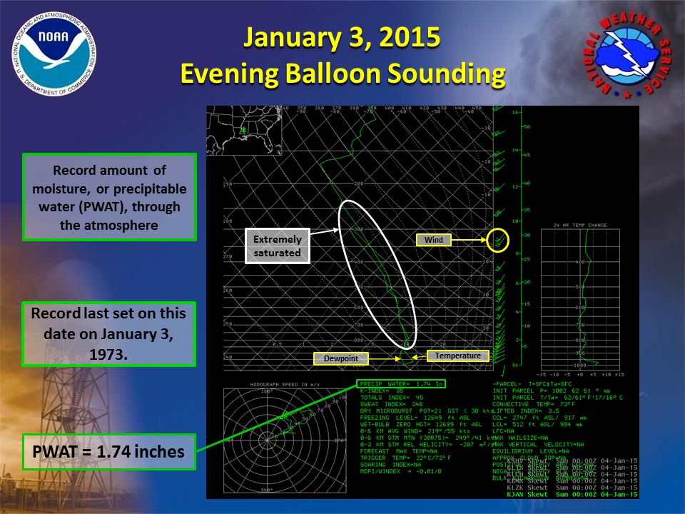
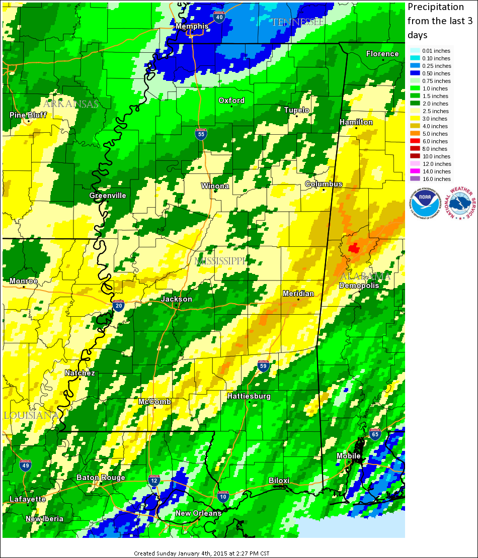
In addition to the severe storms and tornadoes, widespread flooding occurred in southeast Mississippi where 3-5 inches of rain fell. Record amounts of moisture for the month of January were observed in the evening weather balloon sounding at the Jackson International Airport, where precipitable water value of 1.74 inches tied the record last set on January 3, 1973. This led to widespread heavy rainfall and flooding. Water covered some roads and water was entering homes near Bay Springs, with one road washed out nearby.
Tornado Track Map
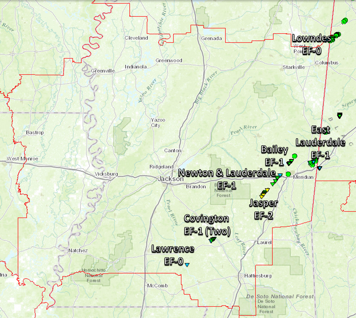
Click on map above to see entire event tracks and damage point notation. Individual track maps also available on individual tornado pages.
Survey Information
Click on the location in the table for additional maps and details
| Location | Start/ End Time |
Event Type | Fatalities/ Injuries |
Path Length | Path Width |
| Lawrence County S Oak Vale |
2:05 PM | EF-0 Tornado 70 mph |
none | 100 yards | 50 yards |
| Covington County 5 NE Lone Star to 4 S Mount Olive |
2:36 PM- 2:39 PM |
EF-1 Tornado 90 mph |
none | 1.7 miles | 50 yards |
| Covington County 4 S Mount Olive to 4 SSE Mount Olive |
2:39 PM- 2:40 PM |
EF-1 Tornado 110 mph |
none | 1.0 mile | 100 yards |
| Jasper County 5 WSW Rose Hill to 6 N Rose Hill |
3:04 PM 3:17 PM |
EF-2 Tornado 130 mph |
none | 8.1 miles | 200 yards |
| Newton and Lauderdale County 4 S Chunky to 3 WSW Nellieburg |
3:24 PM 3:36 PM |
EF-1 Tornado 110 mph |
none | 9.9 miles | 100 yards |
| Lauderdale County 5 ENE Suqualena to 5 WSW Meridian Stations |
3:48 PM 3:55 PM |
EF-1 Tornado 110 mph |
none | 3.5 miles | 50 yards |
| Lauderdale County 3 SE Lauderdale to 4 ESE Lauderdale |
4:31 PM 4:35 PM |
EF-1 Tornado 90 mph |
none | 2.7 miles | 50 yards |
| Lowndes County 4 NNE Caledonia |
4:53 PM 4:53 PM |
EF-0 Tornado 70 mph |
none | 0.25 miles | 50 yards |
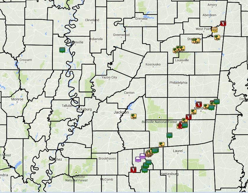
Local Storm Reports
Click on the map below for additional details.

Balloon Sounding
Tied previous record value for the month of January of 1.74 inches of precipitable water (PWAT), last set on 1/3/1973.
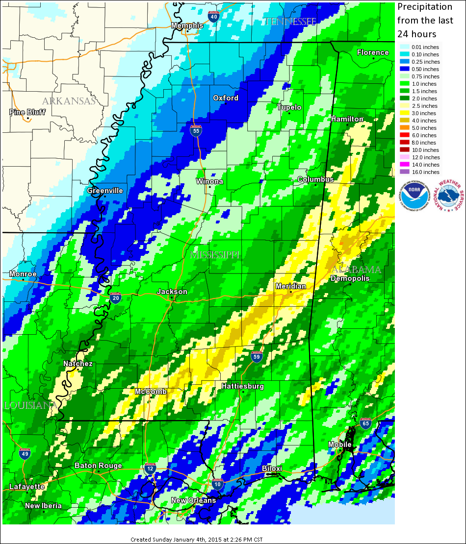
Rainfall Totals
Storm Total Rainfall
| 24 hour Rainfall | 3 Day Rainfall |
 |
 |

