Remembering Sandy 5 years later
October 29, 2012

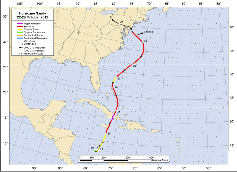
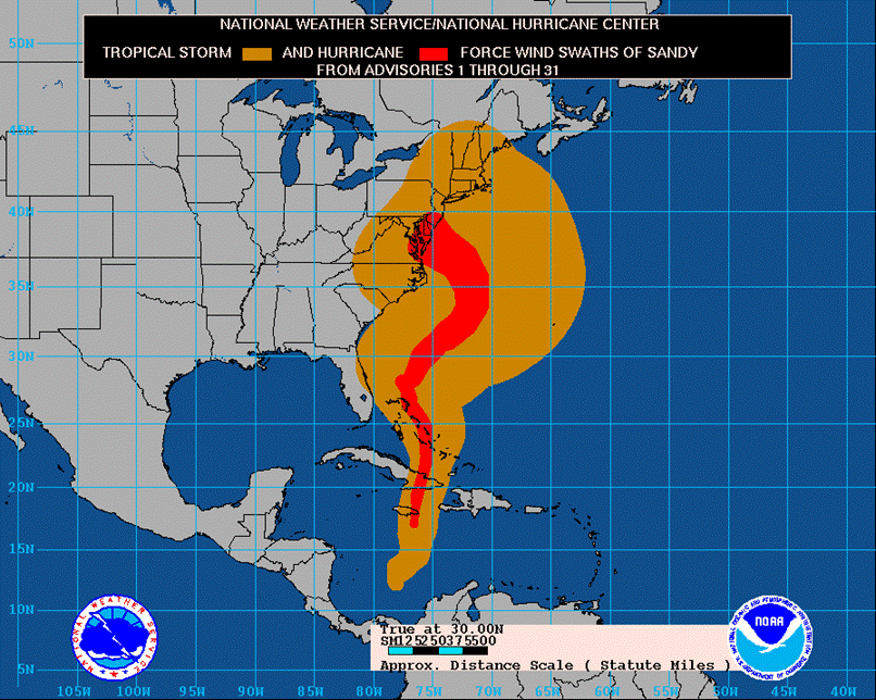
At approximately 7:30 PM EDT (23:30 UTC) on October 29, 2012, Post Tropical Cyclone Sandy made landfall near Brigantine, New Jersey. It was, for our region, an unprecedented natural disaster especially along the central and northern New Jersey Shore. The storm caused 72 fatalities in the United States, and 147 fatalities total (the storm had previously made land fall in Jamaica and eastern Cuba before moving through the central and northwestern Bahamas). At the time, it was the second costliest Atlantic hurricane on record (behind only Hurricane Katrina in 2005).
Storm Surge and Inland Flooding
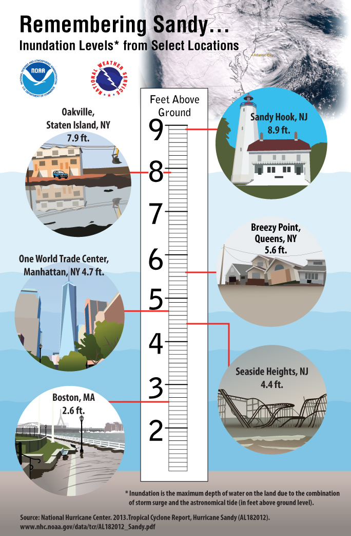
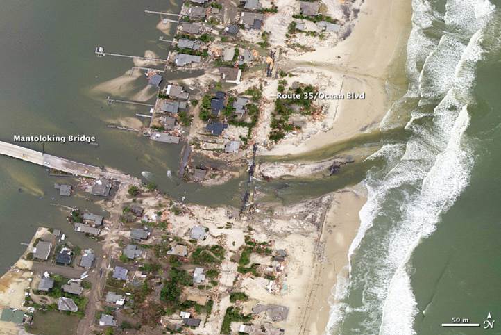
Record storm surge was observed along the central and northern New Jersey Shore. At Sandy Hook, the water level reached 8.9 feet above ground level. However, the tidal gauge failed and stopped reporting in the midst of the storm, so the actual storm surge was likely higher. Near Mantaloking, NJ, the surge was high enough to carve a path through the barrier island creating two new inlets. The image below shows the inundation levels for several locations in our region and is courtesy of the NWS office in Upton, NY.
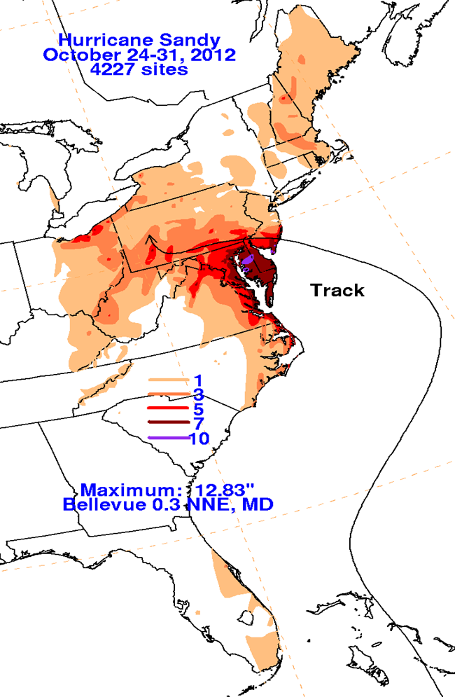
Heavy rain occurred across the region, resulting in widespread flooding, even far inland. Moderate to major flooding occurred on rivers and streams across northern Delmarva and southeastern Pennsylvania, including the Brandywine Creek, White Clay Creek, and the Christina River. Below shows the storm total rainfall recorded across the region.
Winds
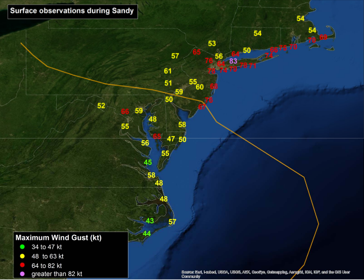
The highest winds were recorded along the shore, but tropical storm force winds were observed across our entire region. Severe gusts extended well inland, even across eastern Pennsylvania. Note: the wind gust map below is the maximum wind gust in knots, to convert to mph, multiply the number by 1.15
Snow
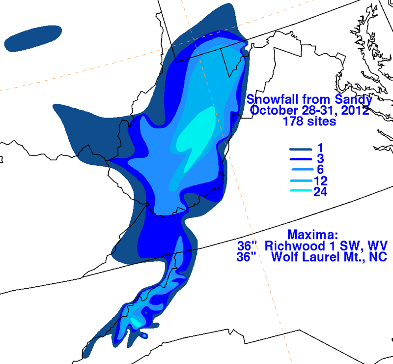
One unusual impact from a storm that has so recently transitioned from tropical to post-tropical at this time of year, was widespread heavy snow. Snow was reported from the mountains of western North Carolina to southwestern Pennsylvania. The highest snowfall amount with this storm came from Richwood, WV and Wolf Laurel Mountain, NC which both had 36 inches.
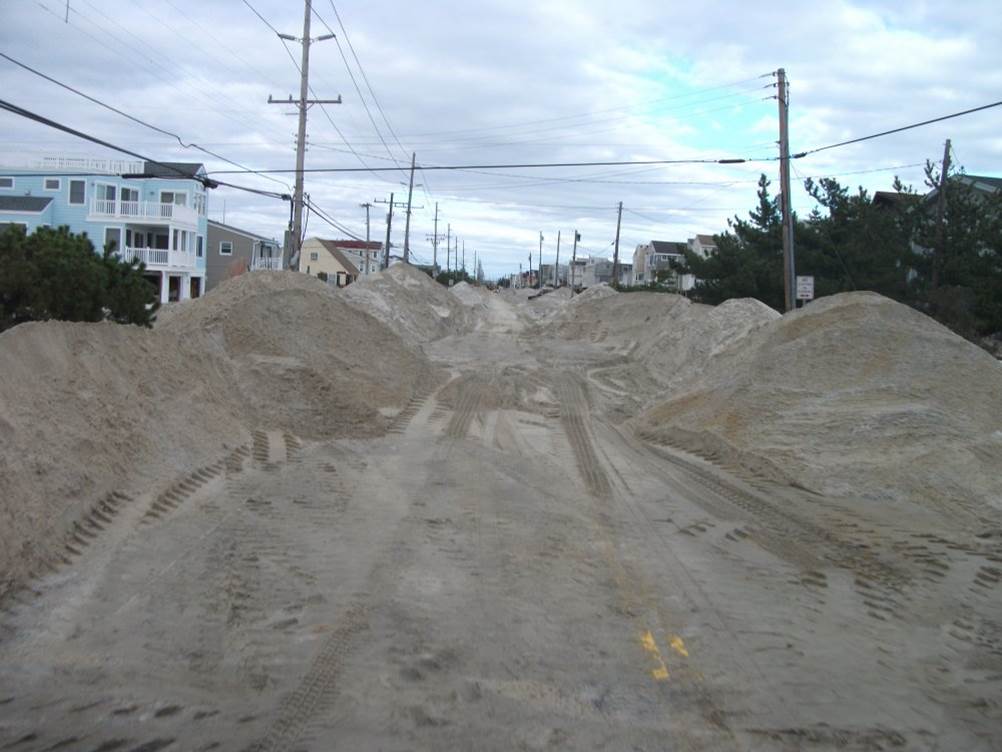
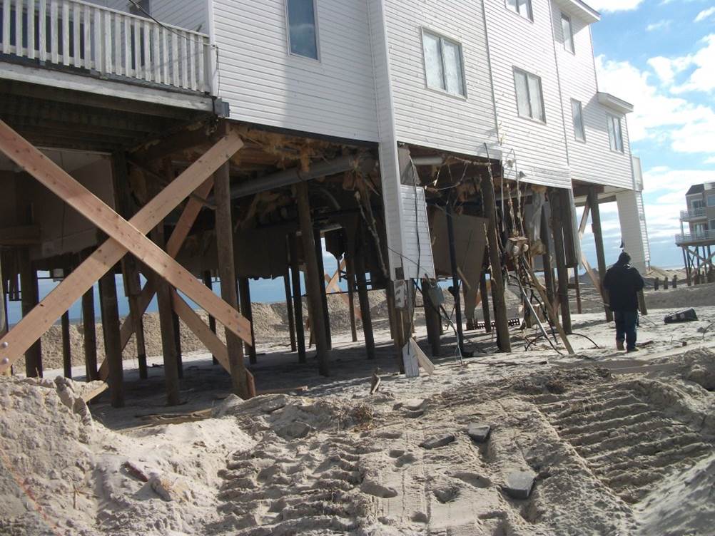
Images from the aftermath
The images below are courtesy of Bob Wanton, retired forecaster of NWS Philadelphia/Mount Holly.
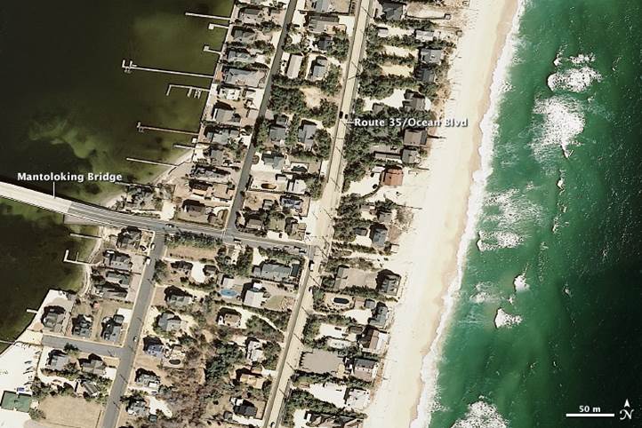
The images below are satellite images of the barrier island near Mantoloking where surge from the storm created two new inlets. The first image was taken March 18, 2007. The second is from October 31, 2012, two days after Sandy made landfall. Additional before and after satellite images can be found here: https://geodesy.noaa.gov/web/news/NGS_Responds_to_Hurricane_Sandy.shtml
Lessons Learned from Sandy
Through the 2012 hurricane season, hurricane and tropical storm watches and warnings were discontinued once a storm transitioned to a post-tropical storm (that is to say, the storm takes on characteristics of low pressure systems that are more typically found in mid latitudes, including the Mid Atlantic). With Sandy, this transition occurred just a few hours before it made landfall in our region; however, non-tropical warnings were already in effect. Surveys showed that this caused confusion among many people in our area and led some people to believe the storm had significantly weakened. As a direct result of this storm, the policy was changed by the next year. Now if a tropical system transitions to a post-tropical storm, the hurricane or tropical storm watches and warnings will continue for areas affected.
Other resources
NWS Upton, NY web story on the 5 year anniversary
NWS National Hurricane Center official report on Sandy


 Coastal Flood
 Marine Forecasts
 Text Products
 Climate Information
 Skywarn
 Submit Storm Report
 Weather Event Archives
 Forecast Discussion
 Emergency Managers
 Briefing Page