|
|
|
|
|
|
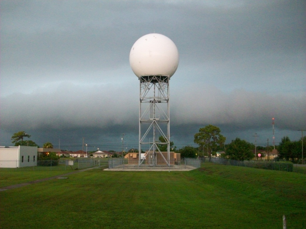
Ruskin is home to one of the 159 WSR-88D Doppler radars that the National Weather Service maintains around the country. Doppler radar has been one of the most important technological advances in hazardous weather prediction over the past quarter century. Forecasters using the WSR-88D can issue more timely and accurate hazardous weather information than was ever possible before.
The radar dome (which is often said to resemble a soccer ball or golf ball) protects a 28 foot wide antenna. The antenna is made up of a transmitter and a receiver. The transmitter samples the environment by sending out a pulse of energy, which reflects off objects (like raindrops) and scatters the energy pulse in all directions. Part of the energy will be reflected back to the antenna and is measured by the receiver. |
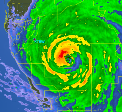
The returned energy is then processed into three types of base data: reflectivity, velocity, and spectrum width. Reflectivity is calculated from the fraction of signal that is reflected back to the radar. Velocity is calculated by measuring the Doppler shift from one pulse to the next to determine the speed with which the object is moving towards or away from the radar. Spectrum width is calculated based on how much variation there is in velocity readings in a given area.
Additionally, a host of derived products are computed from these base data, including precipitation estimates and probabilistic severe weather parameters, such as tornadoes and hail. During a potentially hazardous weather episode, many of these products will be examined by a forecaster to make decisions on issuing warnings.
The radar does not sample the entire atmosphere at once. Rather, the antenna makes a 360 degree rotation pointed at a particular elevation angle, then changes elevation and completes another rotation. The number and selection of elevation angles, along with the speed the antenna rotates, varies based on the weather conditions. During calm conditions, the antenna will rotate slowly, completing a scan of five slices in 10 minutes. |
|
|
|
| At this rate, the radar can dwell longer,making it more sensitive, and picking up such elements as insects and birds. During active weather conditions, the antenna will rotate faster, completing a scan of as many as 14 elevation slices in 4.5 minutes. This rapid scan is imperative during developing hazardous weather, as conditions can change by the minute. |
|
|
|