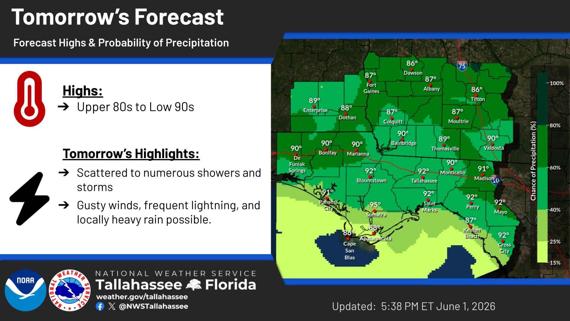
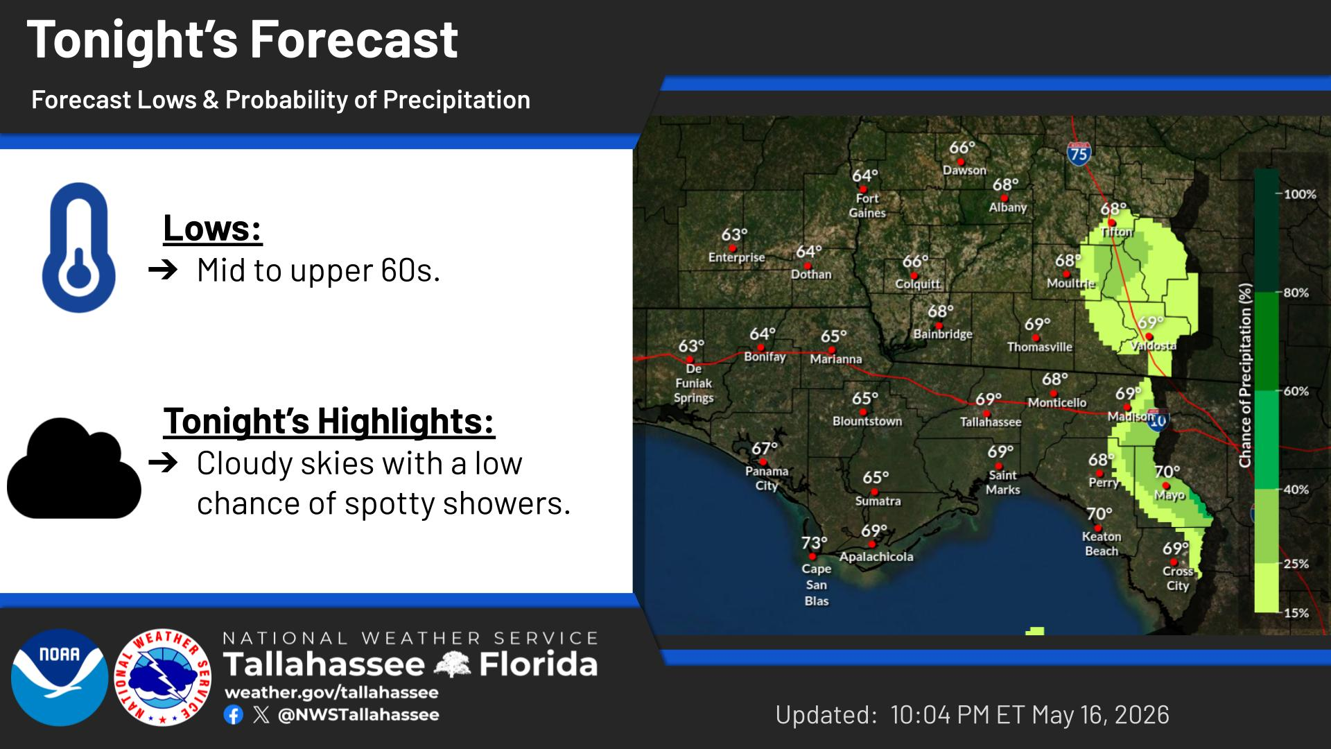
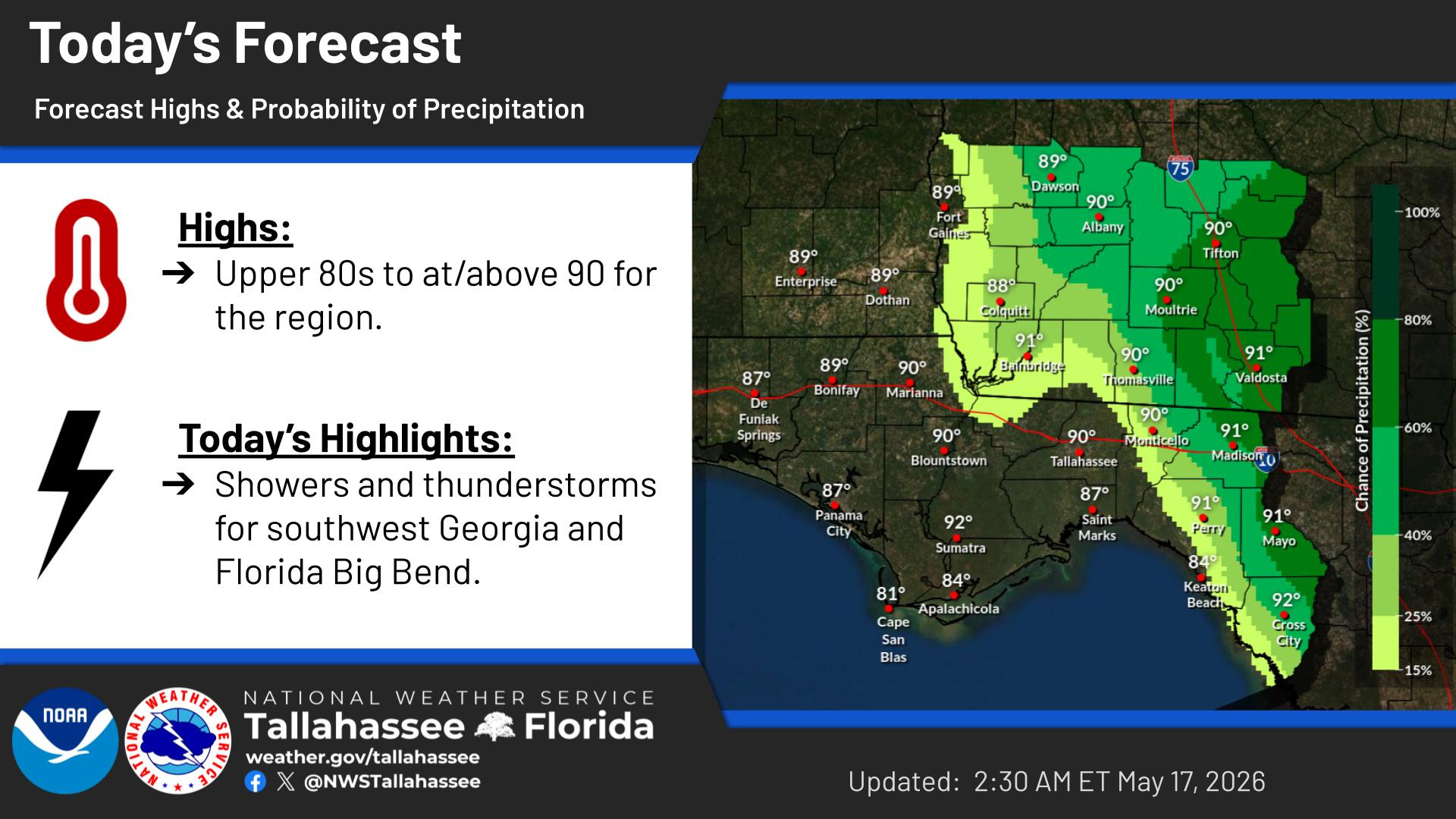
National Weather Service United States Department of Commerce
Click a location below for detailed forecast.

Last Map Update: Wed, Jun 17, 2026 at 6:12:33 am EDT

Forecast high temperatures and probability of precipitation for today.
On Thursday and Friday, a Flood Watch is in effect for Southeast Alabama, the Florida Panhandle, and portions of Southwest Georgia. Rainfall totals of 2 to 5 inches are expected with isolated high-end totals of 5 to 10 inches. Dangerous and life-threatening flash flooding is possible where isolated higher end totals occur.
With the potential for heavy rainfall to result in flash flooding on Thursday and Friday, here are some safety tips: Ensure Wireless Emergency alerts (WEA) are enabled on your smartphone and never enter flood waters in a vehicle or on foot. Turn Around, Don't Drown!
On Thursday, there is a Marginal Risk (Level 1 of 5) of severe weather across much of the region. Isolated to scattered damaging wind gusts to 60 mph and a few tornadoes are possible.
High Risk of Rip Currents for the Walton, Bay, Gulf County beaches today through Saturday night. Rip Currents can sweep even the best swimmers away from shore into deeper water! Residents and visitors are strongly encouraged to stay out of the surf where red flags are flying.


Text Product Selector