Overview
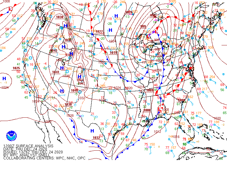
On the morning of December 24th, a deep upper trough was oriented north-south just west of the Mississippi River Valley. At the surface, strong low pressure was centered north of the Great Lakes, with a strong trailing cold front extending south to the eastern Gulf coast. A secondary area of low pressure was developing along the front across the Deep South while the associated warm front bisected the Wakefield CWA during the morning of 12/24. By the afternoon on 12/24, the warm front had lifted north of the area and temperatures warmed into the upper 50s NW with 60s elsewhere. Additionally, dew points increased into the low to mid 60s by afternoon across southeast VA and NE NC with SSE flow originating in the Gulf Stream waters off the coast of NC. See images in “Environment” section for more details. A pre-frontal band of showers (with a few thunderstorms) crossed the area of west to east during the afternoon through mid evening. Despite strong low level wind fields, the atmosphere was largely capped when this line crossed the area.
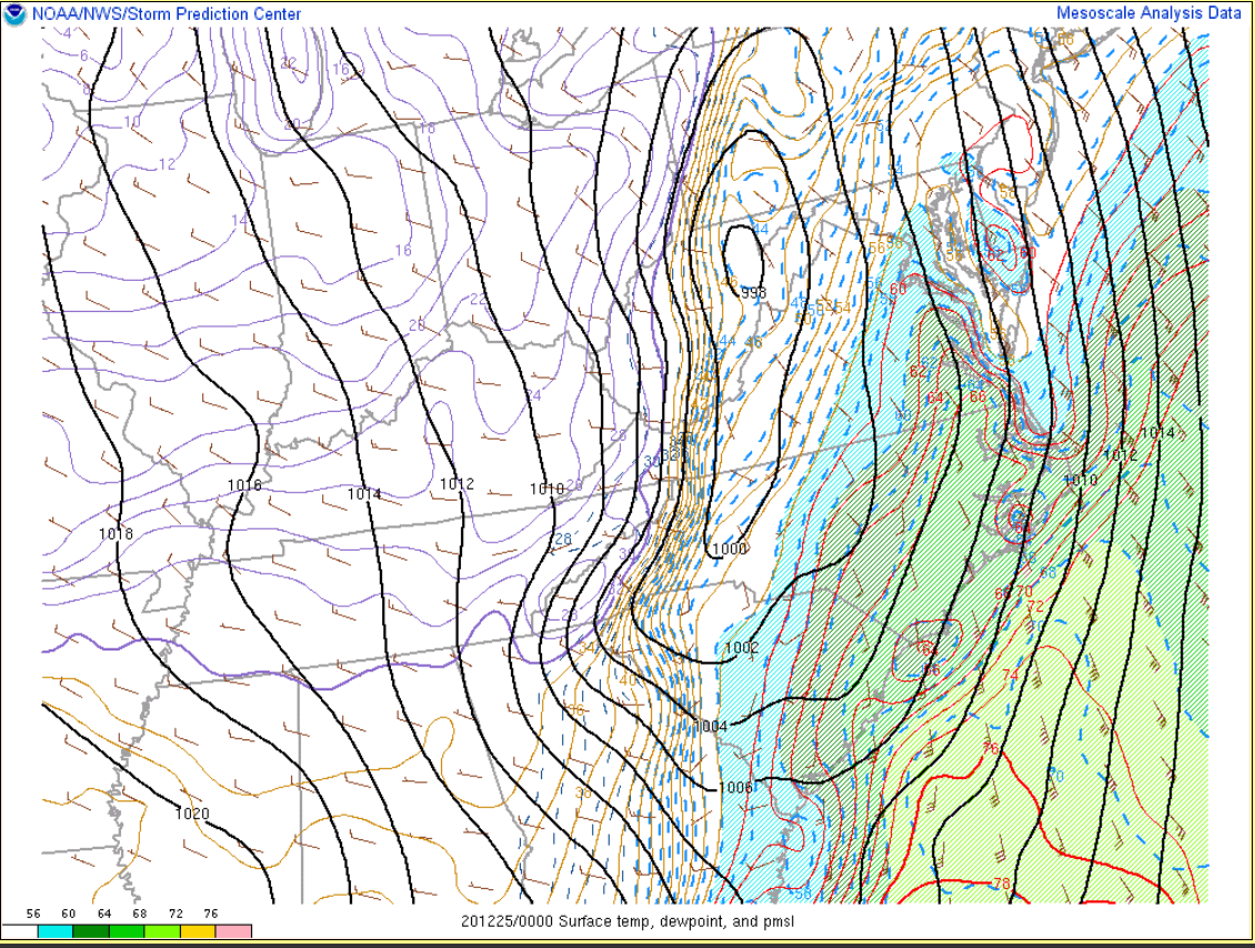
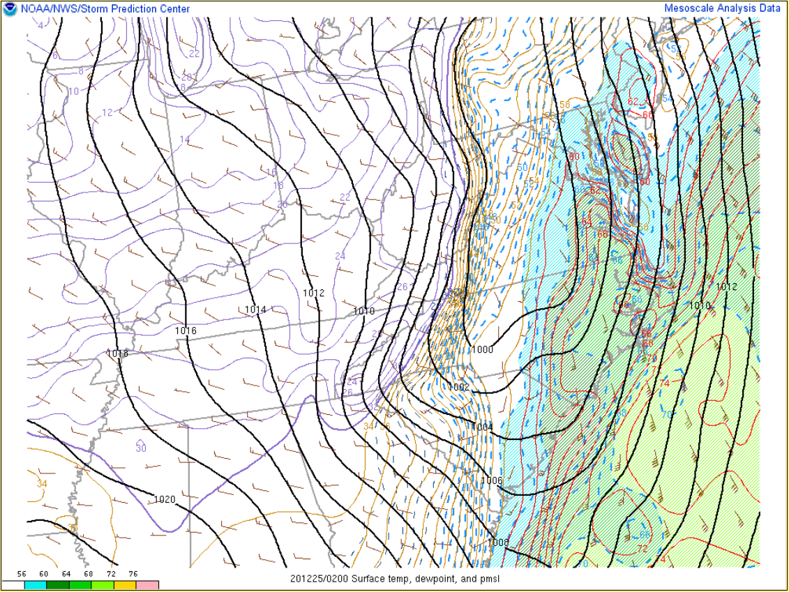
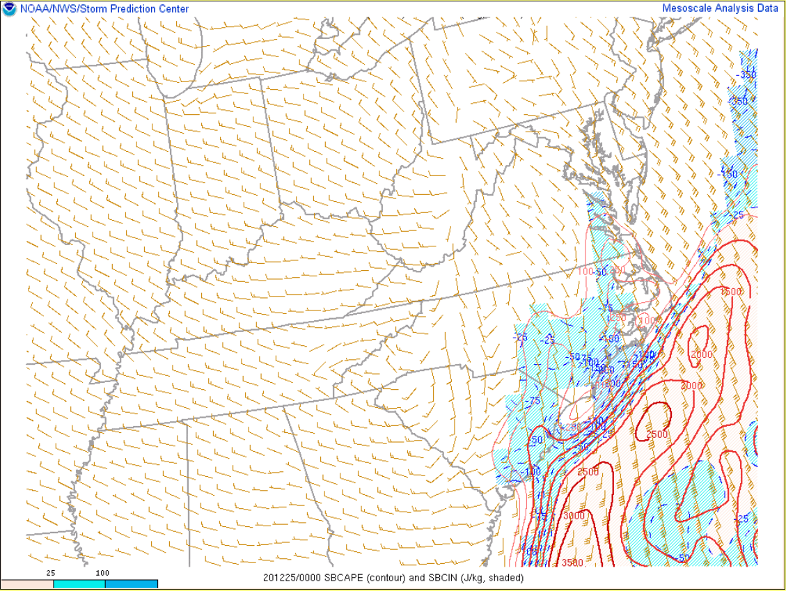
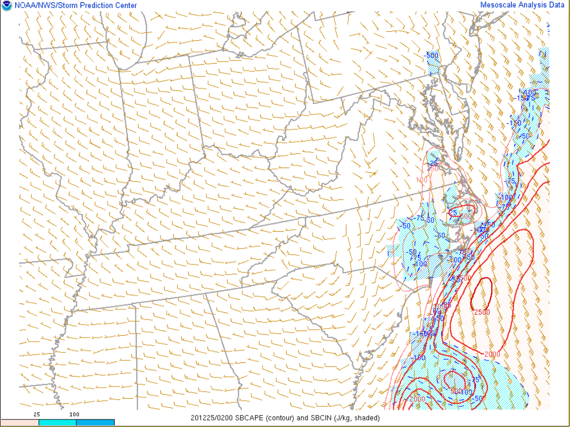
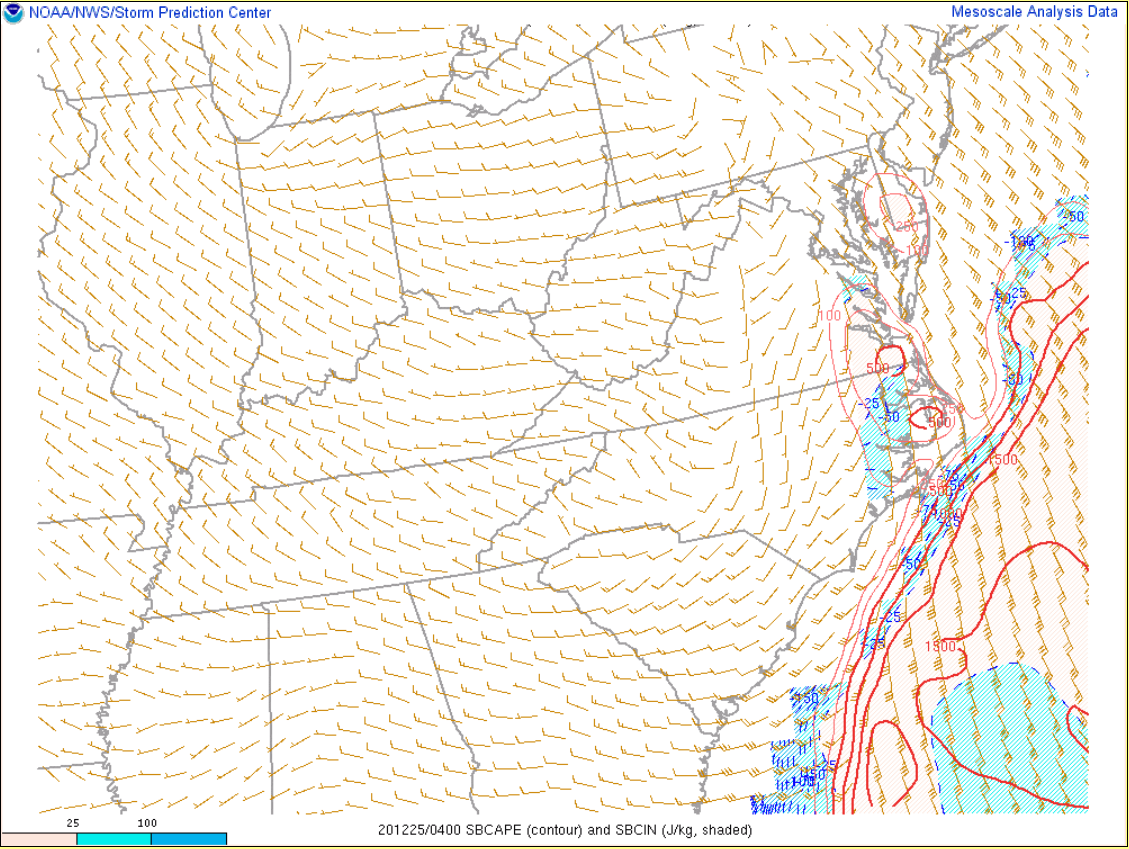
By late evening (9-10 PM) the secondary area of low pressure had rapidly deepened while tracking NNE to just NW of the Wakefield CWA. At the same time, the strong cold front was rapidly approaching the Virginia Piedmont. Despite it being late evening, strong low-levels S-SSE flow allowed temperatures and dew points to rise into the mid to locally upper 60s across SE VA/NE NC (especially away from the immediate coast…where the airmass was modified by the cooler near-sfc marine layer). The mid-upper 60s temperatures/dew points were enough for 250-750 J/kg of surface based CAPE across interior SE VA/NE NC. Meanwhile, a 60-80 kt+ south-southwesterly 925-850 mb jet was in place across this same area. A thin line of convection accompanied the cold front as it crossed the area from 9 PM-2 AM. There were multiple reports of 60+ mph wind gusts across SE VA in addition to two brief, EF-1 tornadoes over Southampton County/the City of Suffolk. Elsewhere, the lack of appreciable surface-based instability was likely a limiting factor. Temperatures dropped sharply following the frontal passage Christmas morning.
Tornadoes:
|
Tornado - Cornith Chapel Road
Track Map 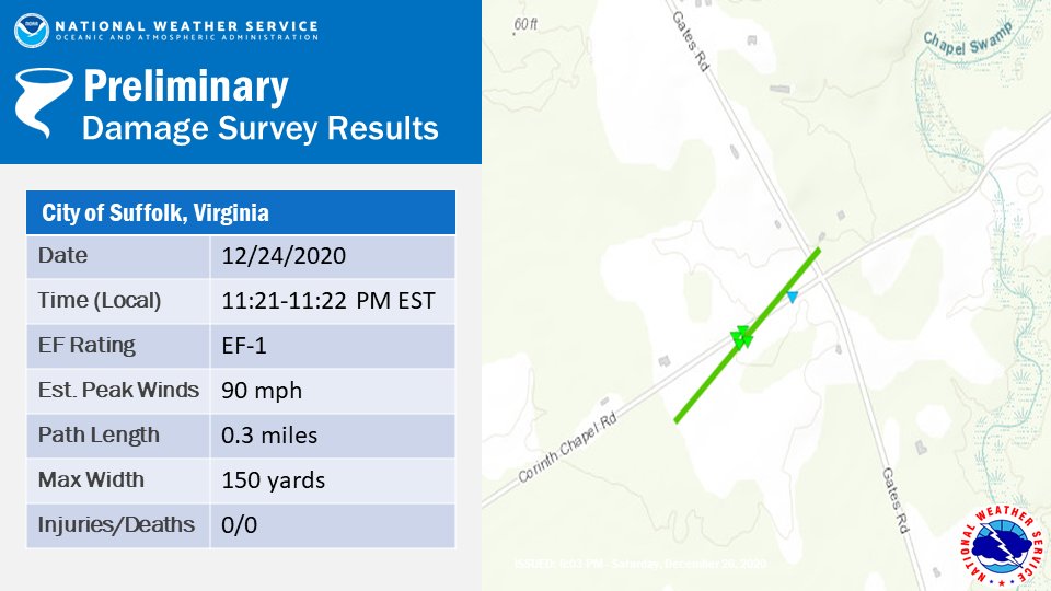 
|
||||||||||||||||
|
Tornado - Dutch/Lummis Road
Track Map 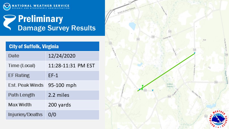
|
||||||||||||||||
The Enhanced Fujita (EF) Scale classifies tornadoes into the following categories:
| EF0 Weak 65-85 mph |
EF1 Moderate 86-110 mph |
EF2 Significant 111-135 mph |
EF3 Severe 136-165 mph |
EF4 Extreme 166-200 mph |
EF5 Catastrophic 200+ mph |
 |
|||||
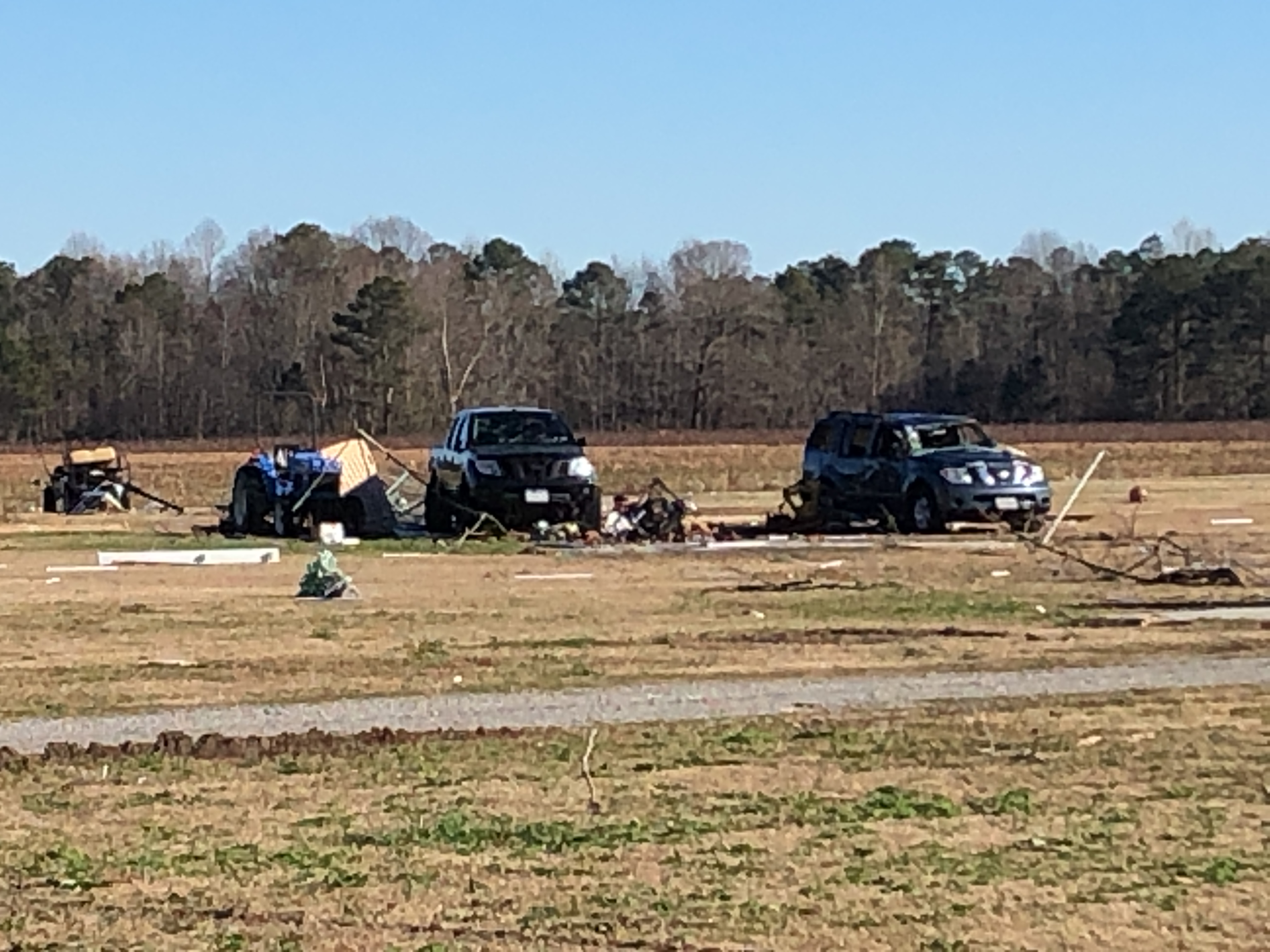
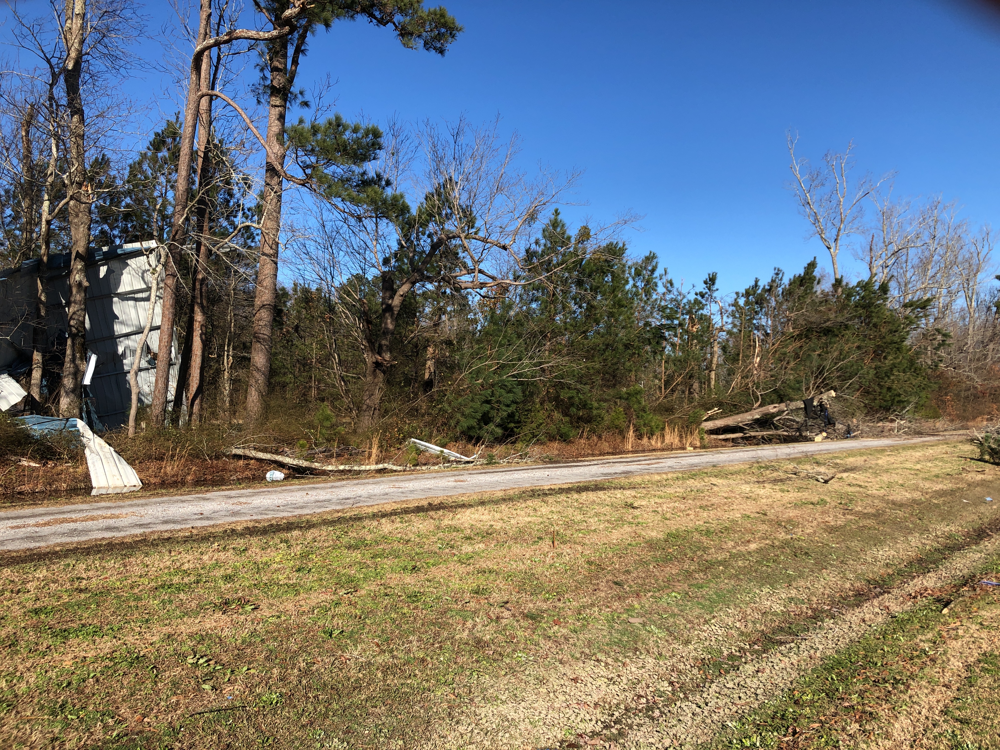
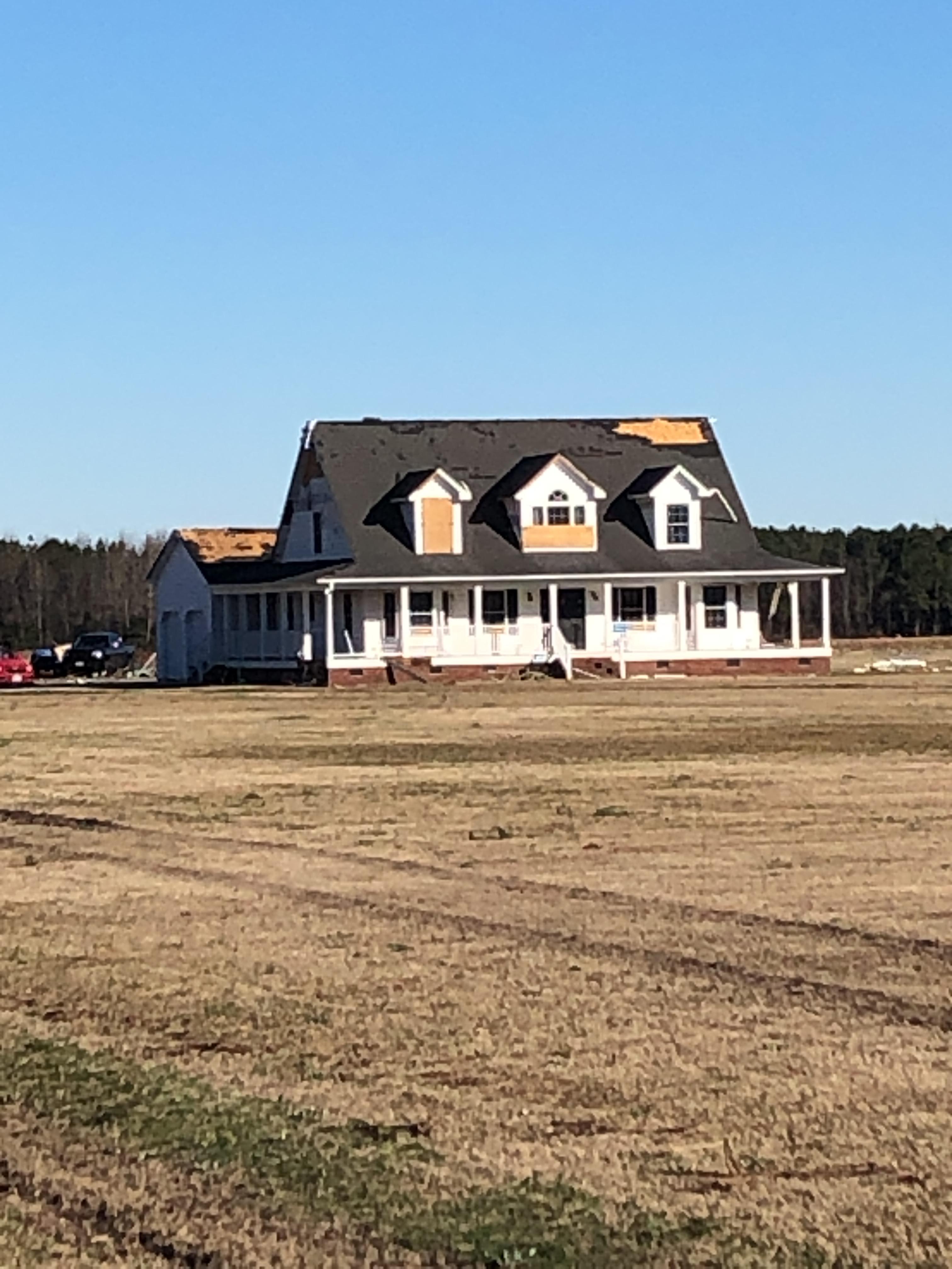
Photos
Tornado Damage Photos from NWS Storm Survey
 |
 |
 |
 |
Radar
Selected Radar Images
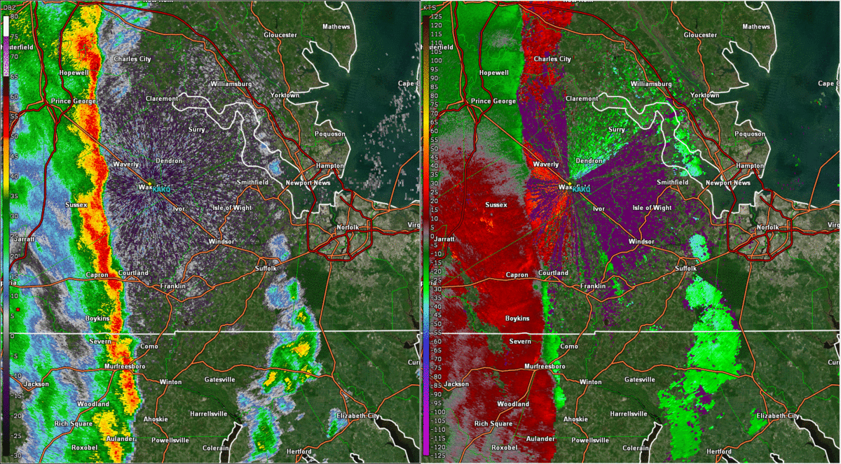 |
| Loop of 0.5° Base Reflectivity (left) and Storm Relative Velocity (right) from 11:00 to 11:40 PM on December 24th |
Storm Reports
PRELIMINARY LOCAL STORM REPORT
NATIONAL WEATHER SERVICE WAKEFIELD VA

..TIME...   ...EVENT...      ...CITY LOCATION...     ...LAT.LON...
..DATE...   ....MAG....      ..COUNTY LOCATION..ST.. ...SOURCE....
            ..REMARKS..

0900 PM     FLASH FLOOD      1 SE EWELL              37.31N 76.73W
12/24/2020                   YORK               VA   COUNTY OFFICIAL

            INTERSECTION OF AIRPORT AND MOOORESTOWN
            CLOSED DUE TO HIGH WATER OVER ROADWAY.
1152 PM     TSTM WND GST     PATRICK HENRY FIEL      37.13N 76.50W
12/24/2020  M61 MPH          CITY OF NEWPORT NEWVA   ASOS

            ASOS STATION KPHF NEWPORT NEWS.
1210 AM     TSTM WND GST     WARDS CORNER            36.92N 76.27W
12/25/2020  M61 MPH          CITY OF NORFOLK    VA   AWOS

            AWOS STATION KNGU NORFOLK NAS CHAM.
1250 AM     TSTM WND DMG     4 WNW EXMORE            37.56N 75.88W
12/25/2020                   ACCOMACK           VA   UTILITY COMPANY

            TREES DOWNED AT INDIAN TRAIL RD AND
            SCARBOROUGHS NECK RD.
1101 PM     TSTM WND DMG     3 WSW COURTLAND         36.70N 77.11W
12/24/2020                   SOUTHAMPTON        VA   NWS STORM SURVEY

            MULTIPLE TREES AND LARGE BRANCHES AS WELL AS
            POWER LINES DOWN FROM JUST NORTH OF BARROW
            RD TO NORTH OF RT 58 IN SOUTHAMPTON, VA.
            WINDS ESTIMATED AROUND 70 MPH.
1127 PM     TSTM WND DMG     1 SW ISLE OF WIGHT      36.90N 76.72W
12/24/2020                   ISLE OF WIGHT      VA   PUBLIC

            TREES DOWN NEAR CENTRAL HILL.
1210 AM     TSTM WND DMG     1 WSW PORTLOCK          36.77N 76.30W
12/25/2020                   CITY OF CHESAPEAKE VA   COAST GUARD

            THE GILMERTON BRIDGE WAS DAMAGED DUE TO HIGH
            WIND. THE BRIDGE WAS INOPERABLE FOR SEVERAL
            DAYS FOLLOWING THE STORM.
1150 PM     TSTM WND DMG     2 E LUMMIS              36.69N 76.67W
12/24/2020                   CITY OF SUFFOLK    VA   NWS STORM SURVEY

            TREES DOWN ALONG MANNING RD.
Environment
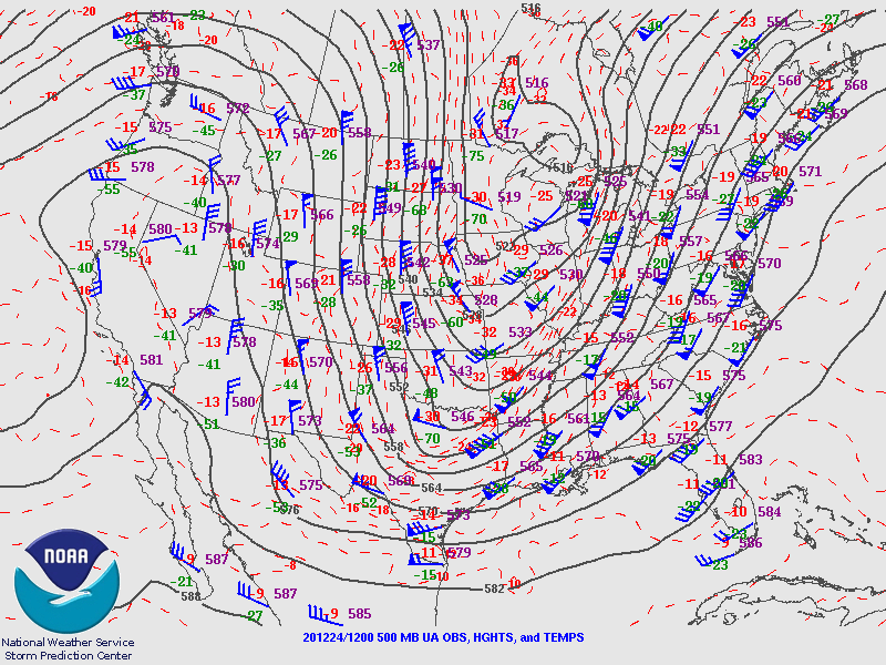
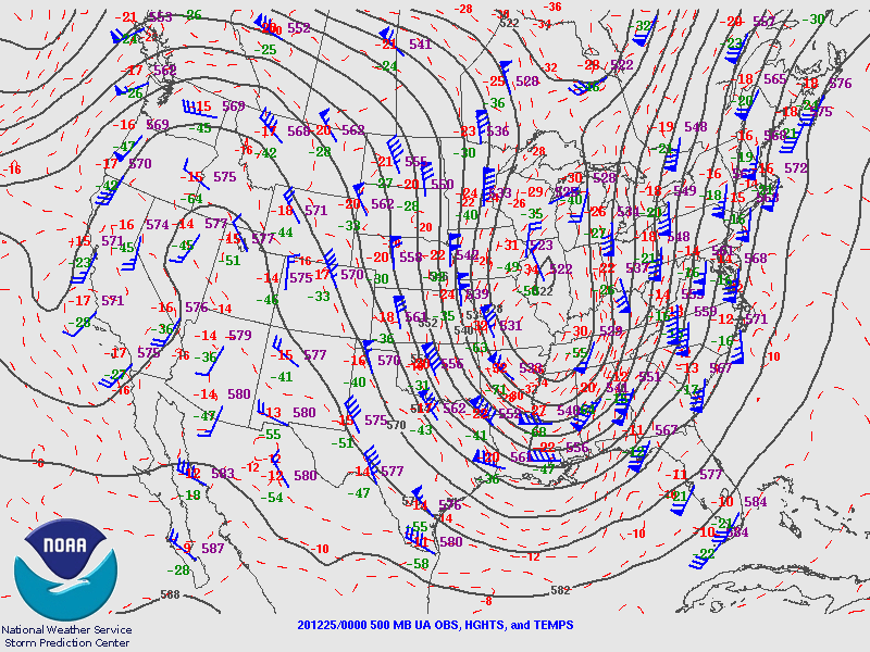
Synoptic summary.
 |
 |
 |
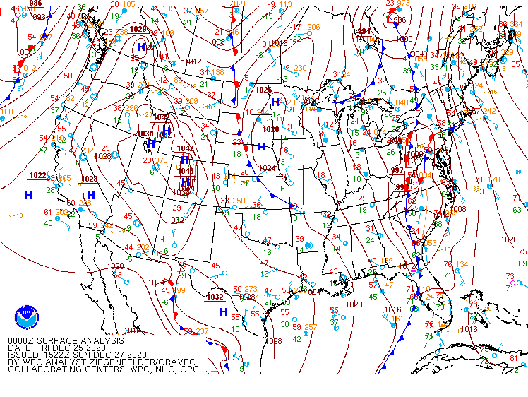 |
| 12z/7 AM 500 mb Analysis | 00z/7 PM 500 mb Analysis | 12z/7 AM WPC Surface Analysis | 00z/7 PM WPC Surface Analysis |
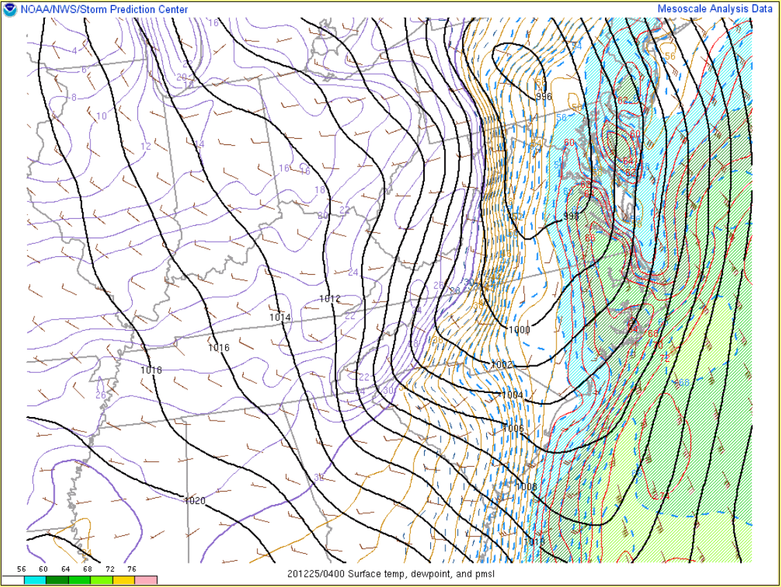
Near-storm environment summary.
 |
 |
 |
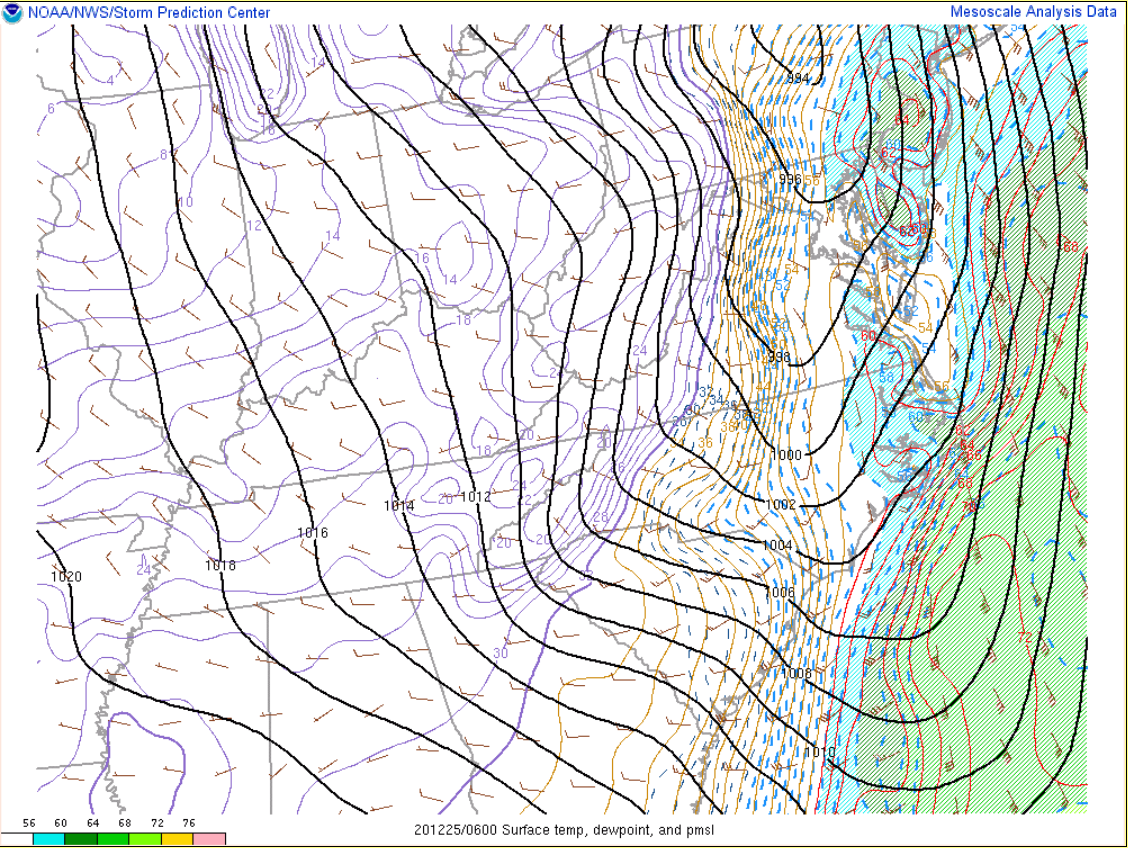 |
| 00z/7 PM MSLP/T/Td | 02z/9 PM MSLP/T/Td | 04z/11 PM MSLP/T/Td | 06z/1 AM MSLP/T/Td |
Near-storm environmental instability.
 |
 |
 |
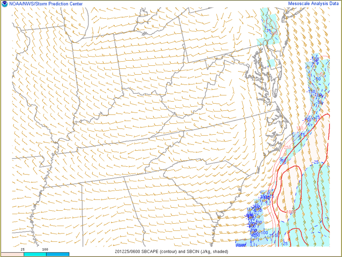 |
| 00z/7 PM SBCAPE/CIN | 02z/9 PM SBCAPE/CIN | 04z/11 PM SBCAPE/CIN | 06z/1 AM SBCAPE/CIN |
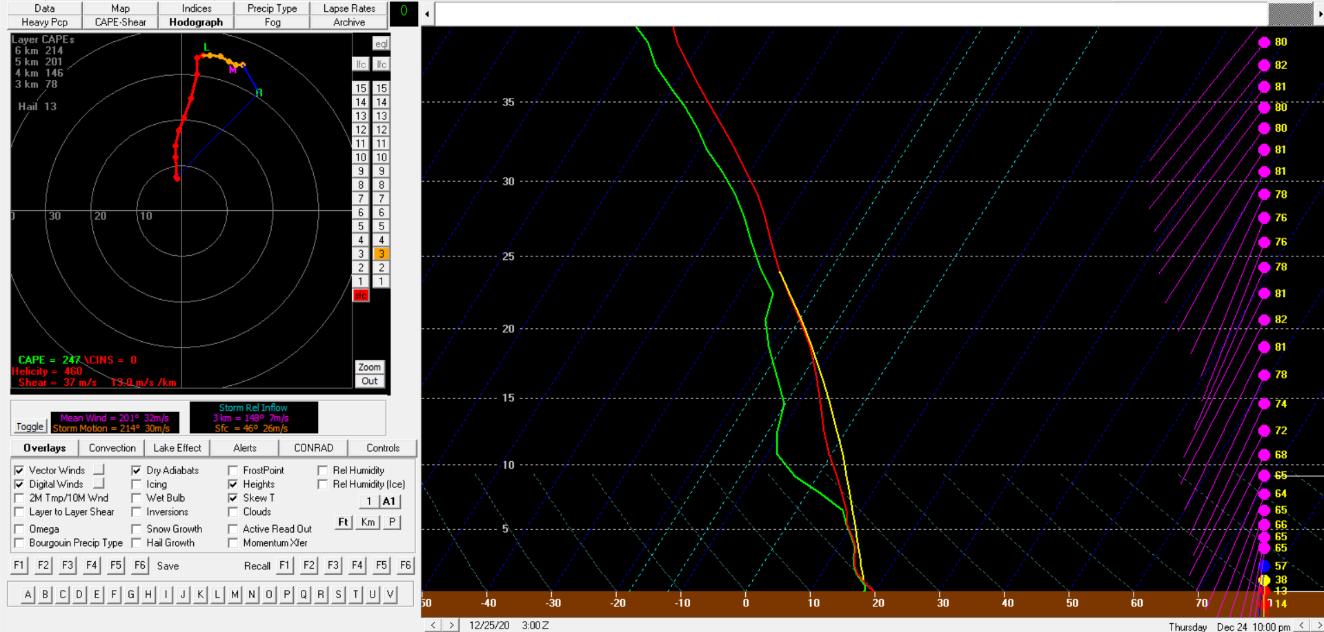
Environmental sounding data.
 |
 |
| 03z/10 PM HRRR Analysis Sounding for KORF (Norfolk) | 03z/10 PM HRRR Analysis Sounding for KPHF (Newport News) |
 |
Media use of NWS Web News Stories is encouraged! Please acknowledge the NWS as the source of any news information accessed from this site. |
|


 Coastal Flood
 Heat
Heat