Overview
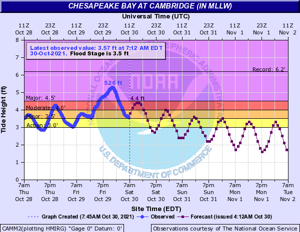
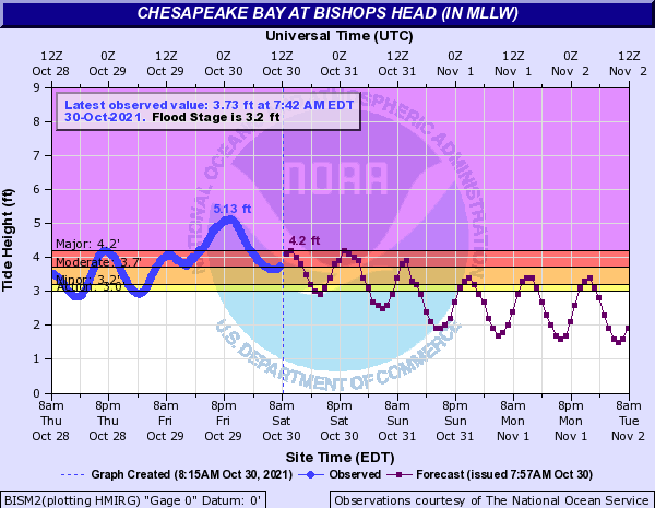
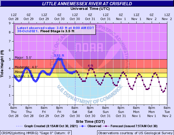
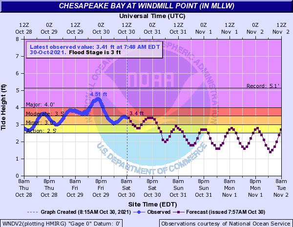
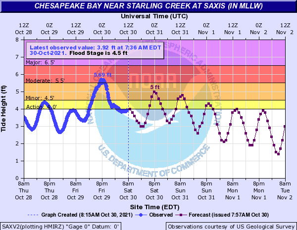
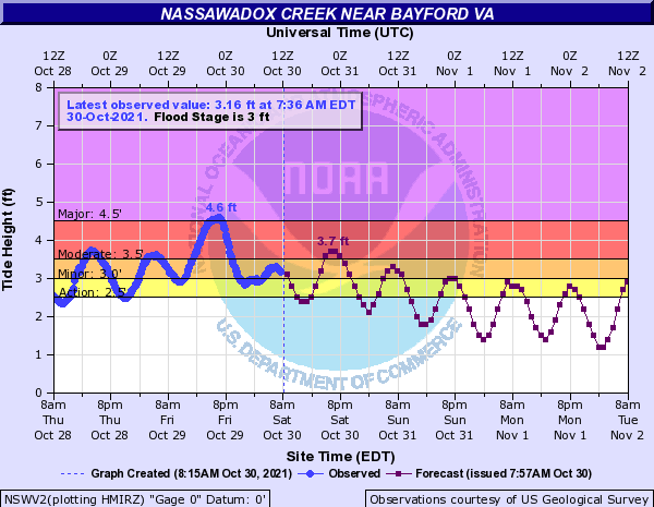
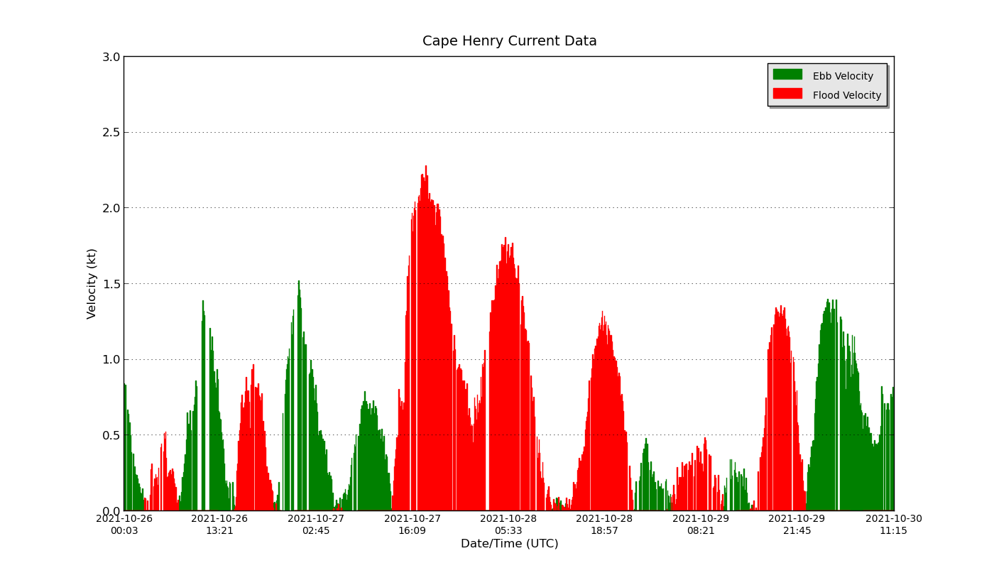
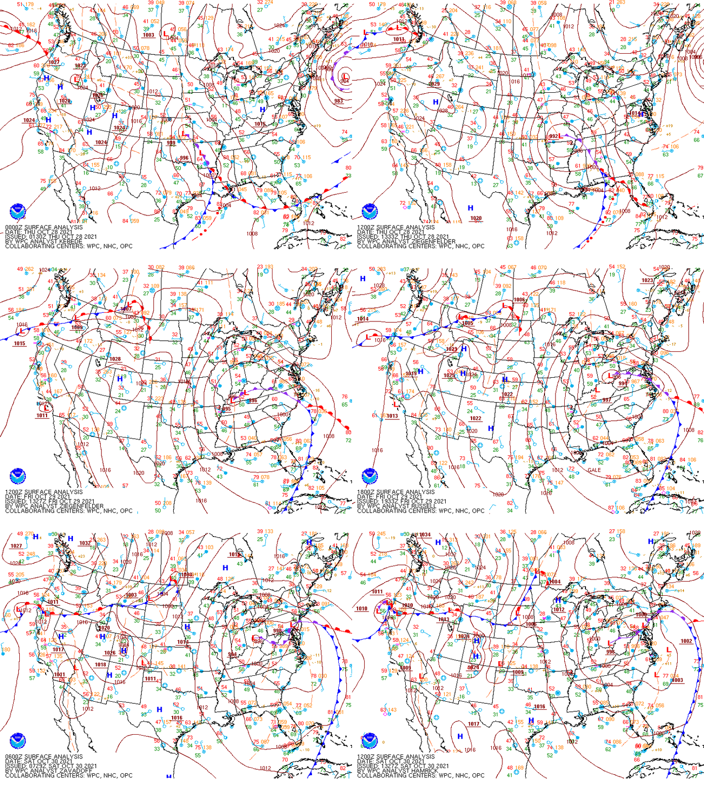
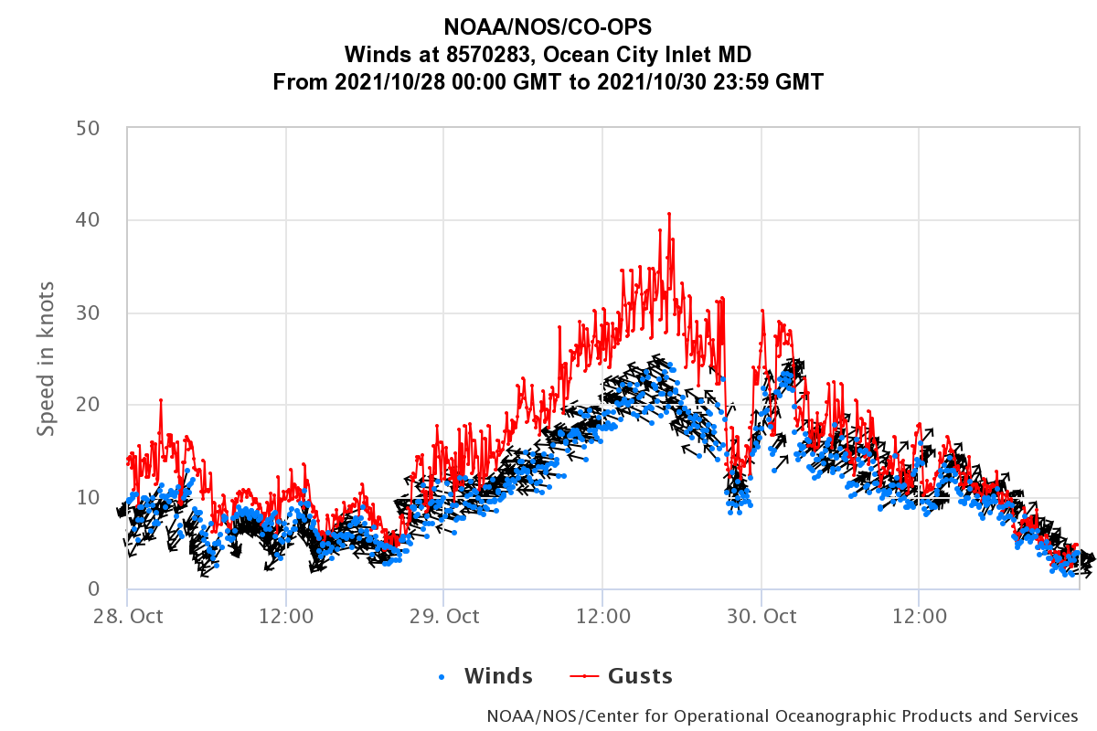
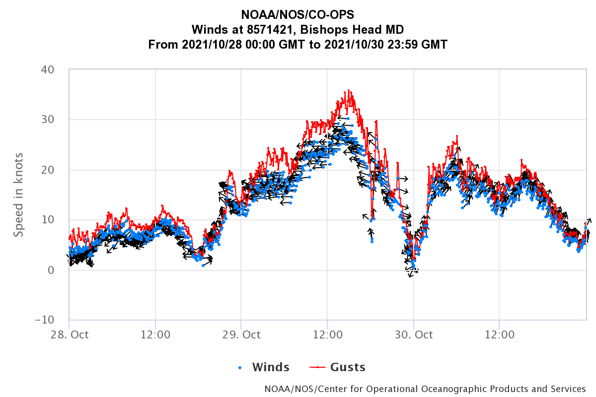
A strong low pressure system that deepened offshore of the northeast US coast during the night of October 27 (and especially by October 28th) was responsible for sending long-period swell our way that served to increase water levels in areas adjacent to the Chesapeake Bay (especially the mid and upper bay). This is evidenced by the two large, successive flood tides that were observed at Cape Henry (which is near the mouth of the bay). Water levels were already above moderate flood thresholds in many locations adjacent to the bay by the early morning hours of the 29th. Then, another strong low pressure system slowly approached from the west-southwest during the day on the 29th, while its associated occluded front approached from the SSW. Moderate to strong easterly winds were observed during the day on the 29th (ahead of the front), with gusts of 40-50 mph in spots near the coast. These strong easterly winds served to increase tidal anomalies further, reaching 4ft (or more) above normal in spots near the mid/upper bay by the afternoon of the 29th (where major flooding was already occurring in multiple locations). However, the worst of the flooding was observed across the mid/upper bay during the evening high tide cycle on the 29th, as winds were veering to the SSW in the wake of the occluded front. Despite the fact that astronomical tides were relatively low, water levels during the evening high tide on 10/29 at Cambridge, Bishop's Head, and Crisfield, Maryland were the highest observed since Hurricane Sandy in 2012 (at Crisfield) and Hurricane Isabel in 2003 (at Cambridge and likely Bishop's Head). In fact, water levels were so high that the entire village of Lewisetta, Virginia had to be evacuated. In Cambridge, MD, shelters had to be opened for residents impacted by the extremely high water levels.
Tidal Flooding Hydrographs
Upper Chesapeake Bay Hydrographs
 |
 |
 |
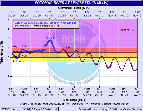 |
| Cambridge, MD | Bishop's Head, MD | Crisfield, MD | Lewisetta, VA |
Middle Chesapeake Bay Hydrographs
 |
 |
 |
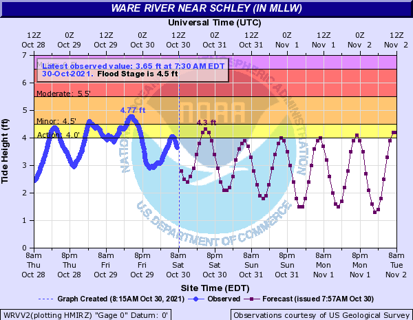 |
| Windmill Point, VA | Saxis, VA | Bayford, VA | Schley, VA |
Lower Chesapeake Bay Hydrographs
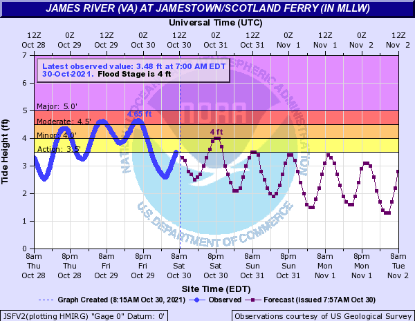 |
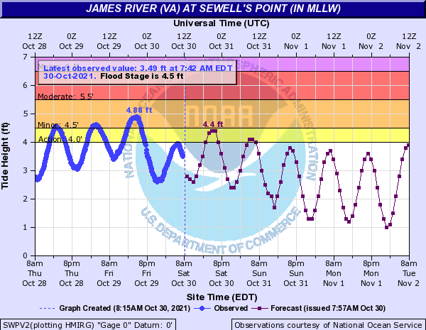 |
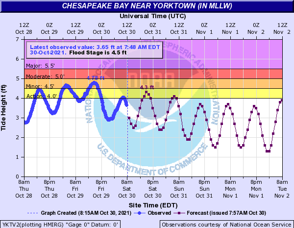 |
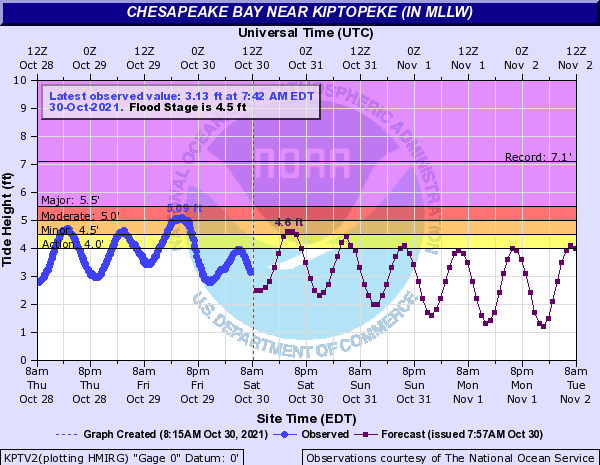 |
| Jamestown, VA | Sewell's Point, VA | Yorktown, VA | Kiptopeke,VA |
Cape Henry Currents Data
 |
Photos & Videos
Selected Videos
 |
 |
 |
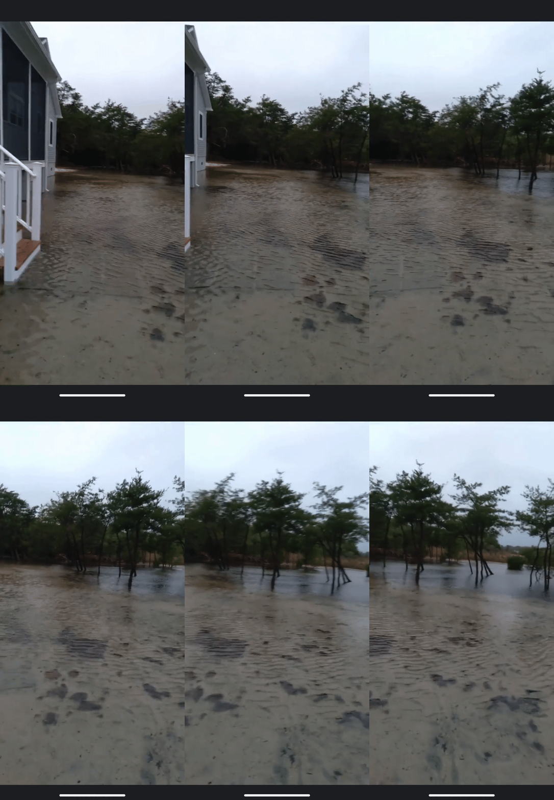 |
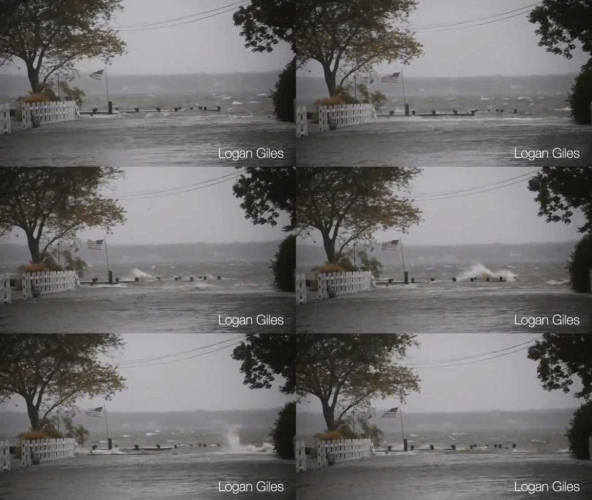
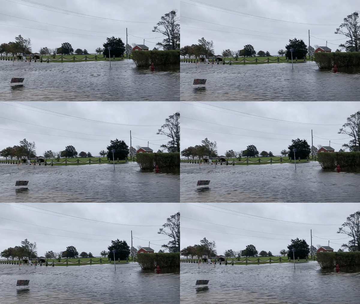
| High winds and aggressive surf spotted in Cambridge, MD. Video taken by Logan Giles. | Bay Street in Cambridge was closed for high water. Video taken by Logan Giles | McCready Hospital's Parking lot was completely flooded in Crisfield. Video taken by Joshua Griffin. | Tidal Flooding in the VA Northern Neck. (Credit: Rush Bush) |
 |
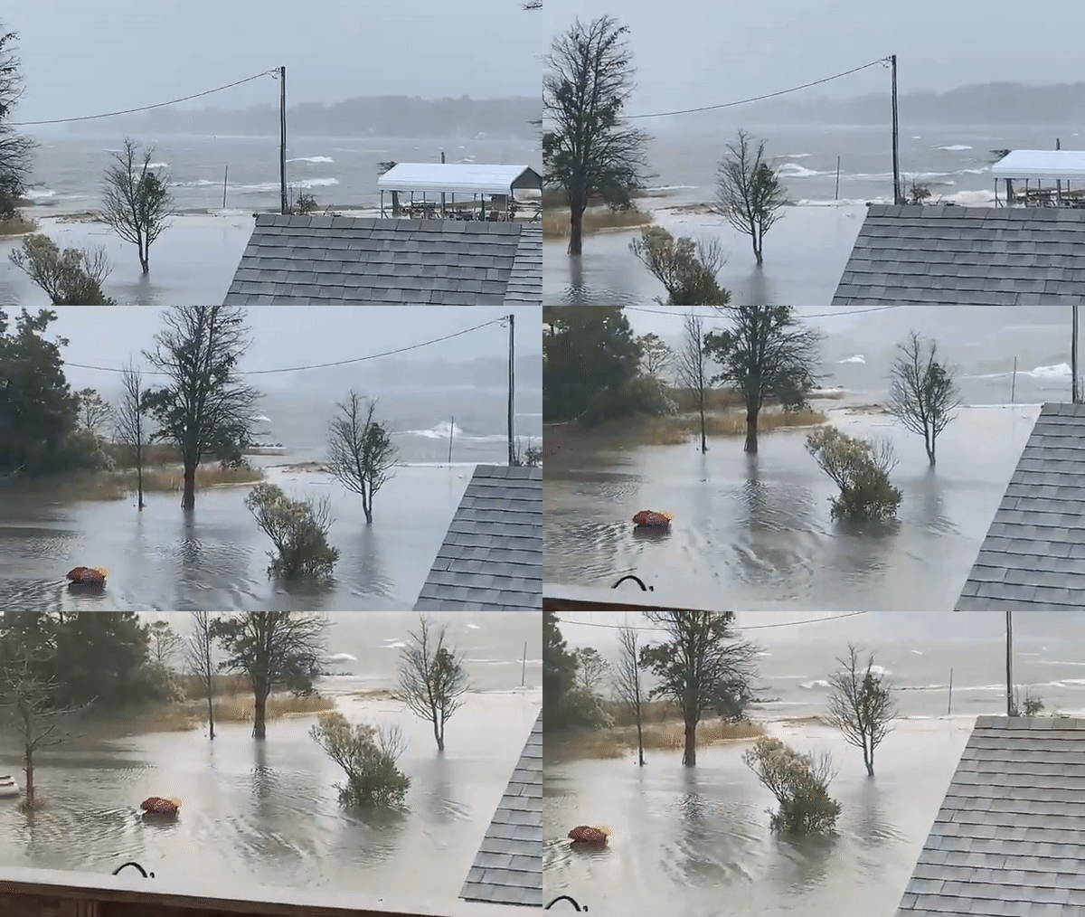 |
| Despite its relatively inland location on the Eastern Shore, Salisbury, MD experienced flooding as well (due to flooding of the tidal Wicomico River). Video taken by Daniel Johnson. | This video shows the rough surf and flood conditions in White Stone, which is across the Rappahannock River from Lewisetta. Video taken by Sandy Spicer-Glave. |
Selected Photos
 |
 |
 |
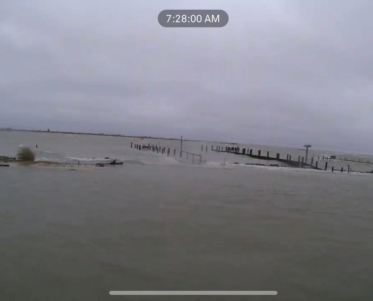 |
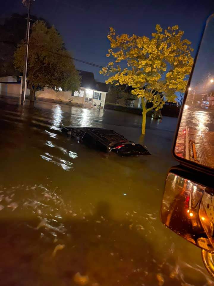
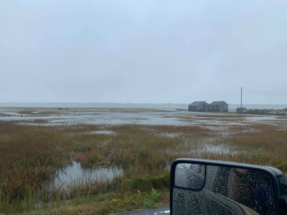
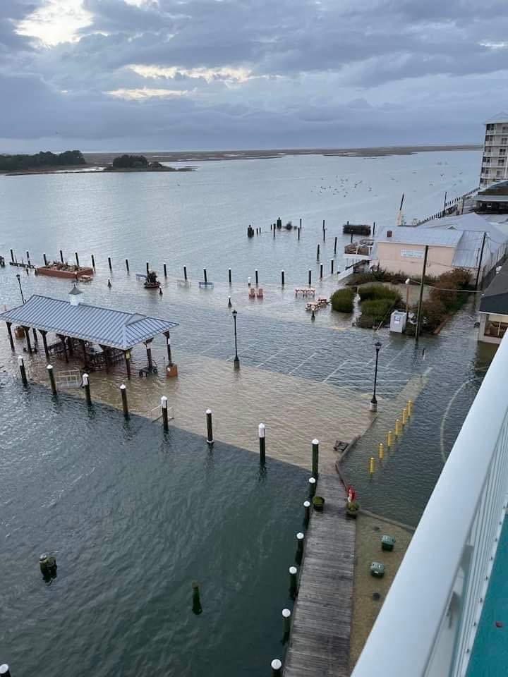
| Crisfield, MD saw major flooding during this event. Photo by @Leannrockin on Twitter. | The Atlantic Coast experienced high water as well, although to a lesser extent than the bay. This photo from Chincoteague shows high water in the marsh. Photo from Bay Country 97.9. | Another photo of tidal flooding in Crisfield, MD from @Leannrockin. | Lewisetta saw some of the worst impacts from this event. Due to its low-lying nature, the entire village had to be evacuated. Photo by Ashley Clements Voltz. |
Synoptic Setup & Winds
Loop of WPC Surface Analysis
 |
Wind/Wind Gust Observations at Selected Sites
 |
 |
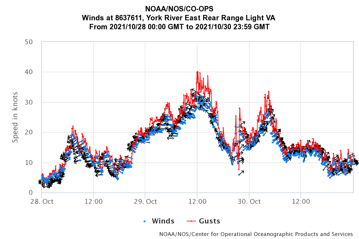 |
| Ocean City Inlet, MD | Bishop's Head, MD | York River East Range Light (in the middle to lower Chesapeake Bay) |
 |
Media use of NWS Web News Stories is encouraged! Please acknowledge the NWS as the source of any news information accessed from this site. |
 |