Overview
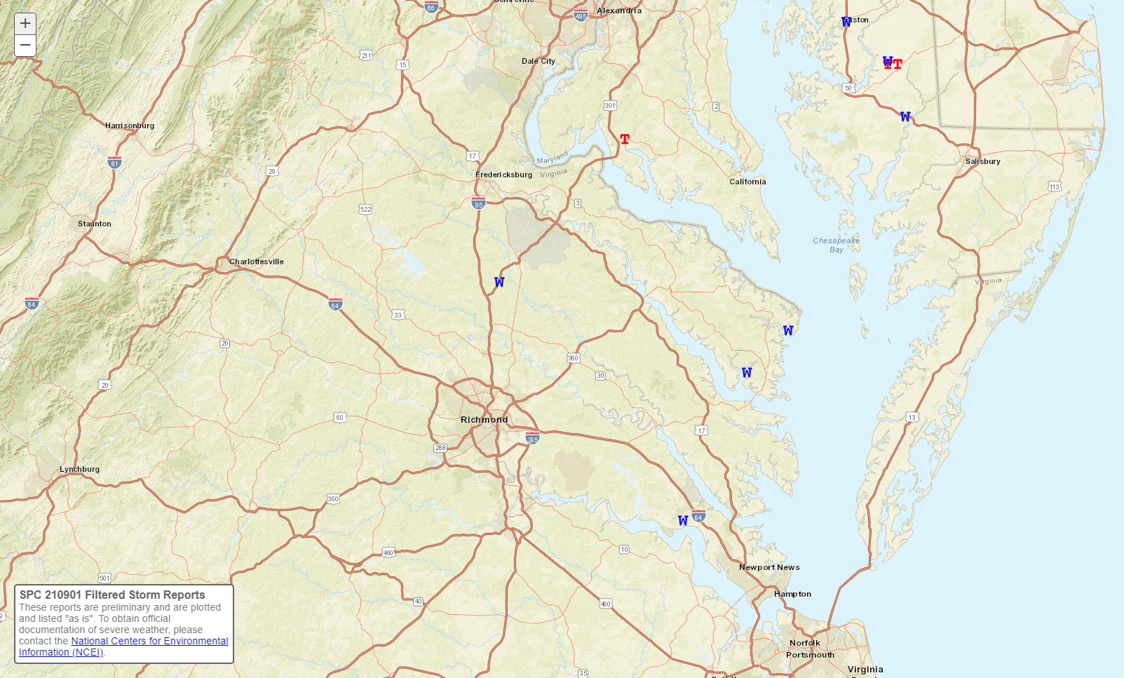
Ida made landfall in Louisiana as a Category 4 Hurricane on Sunday, August 29th. Ida weakened to a tropical depression as it tracked northeast through northern/western Mississippi. Ida transitioned into an extratropical cyclone as it approached the Appalachians on Tuesday (8/31). Ida tracked to the east-northeast from the central Appalachians to southern New Jersey from the morning through evening hours on Wednesday, 9/1. Almost all of the widespread flooding/flash flooding impacts occurred near or to the northwest of Ida's track. A warm front remained just to our north on 9/1, and the entire Wakefield forecast area remained in the warm sector through the duration of the event (before the trailing cold front moved through Wednesday night). There were multiple strong (EF-2 to EF-3) tornadoes near that warm front just to our north and northeast. In our area, there was one EF-0 tornado in northeast Dorchester County, MD.
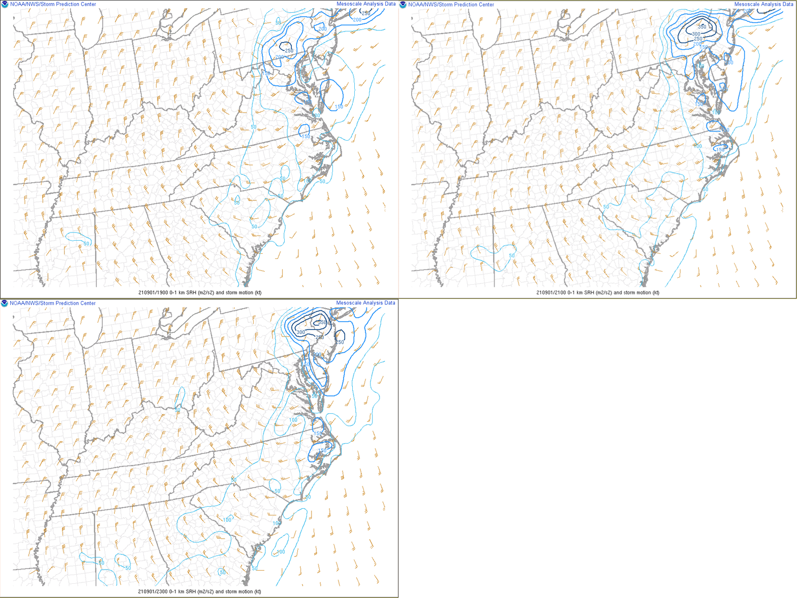
A broken line of showers and a few t-storms developed across central portions of the forecast area by midday. During the afternoon, these showers/storms strengthened as they moved into eastern VA and the Lower Eastern Shore (into an environment with higher instability thanks to daytime heating). Temperatures were generally in the 80s during the afternoon with mid 70s dew points. As with any remnant tropical system, it is important to watch for the potential for tornadoes. Surface winds were more out of the south than southeast in most of the AKQ CWA, with more backing of the winds from Dorchester County MD and especially near and north of a Washington D.C. to Dover, DE line (closer to the warm front). This yielded effective SRH values of 100-200 m2/s2 in our area (highest over the MD Eastern Shore). While this certainly signaled the potential for rotating storms, other environmental parameters (as well as the overall setup) were a bit less than ideal for a tornado outbreak in our area (LCLs were around 1000 meters AGL with no discernable surface boundaries nearby, no prominent mid-level dry air punch behind the storms, and only a marginal amount of low-level directional shear with winds more S than SE for most of the area). There were multiple storms from Caroline County to the VA Northern Neck that exhibited rotational velocities (Vrot) of around/just above 20 knots at ~5000 ft ARL, but no tornadoes were reported with these cells until after they crossed the Potomac and moved into an environment with slightly better low-level directional shear and lower LCLs. Lastly, with the fairly strong speed shear from the surface to ~700 mb, some of the storms that tracked across eastern VA during the afternoon were able to produce strong to severe winds (the KJGG AWOS recorded a 49 knot/56 MPH thunderstorm wind gust with one of these storms, which is not that common to see with an AWOS in our area). Several trees were downed from these severe storms. The tornado in Dorchester County, MD overturned several irrigation systems and caused a ~40 foot wide hole in the roof of a metal building.
Tornadoes:
|
Tornado - LOCATION
Track Map 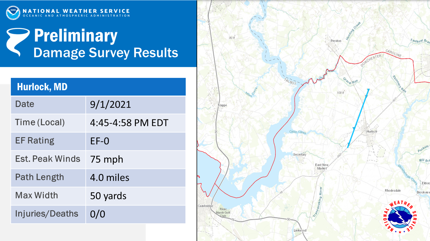 
|
||||||||||||||||
The Enhanced Fujita (EF) Scale classifies tornadoes into the following categories:
| EF0 Weak 65-85 mph |
EF1 Moderate 86-110 mph |
EF2 Significant 111-135 mph |
EF3 Severe 136-165 mph |
EF4 Extreme 166-200 mph |
EF5 Catastrophic 200+ mph |
 |
|||||
Photos
Coming Soon
| Caption (source) |
Caption (source) |
Caption (source) |
Caption (source) |
Radar
Selected Radar Images and Loops
 |
 |
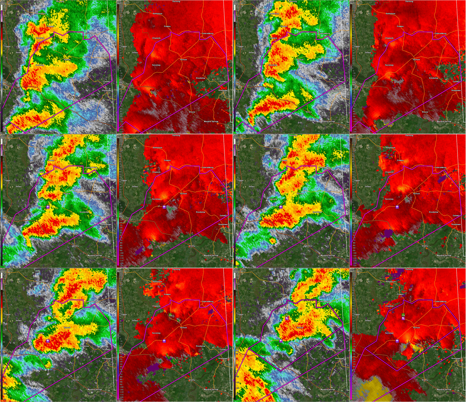 |
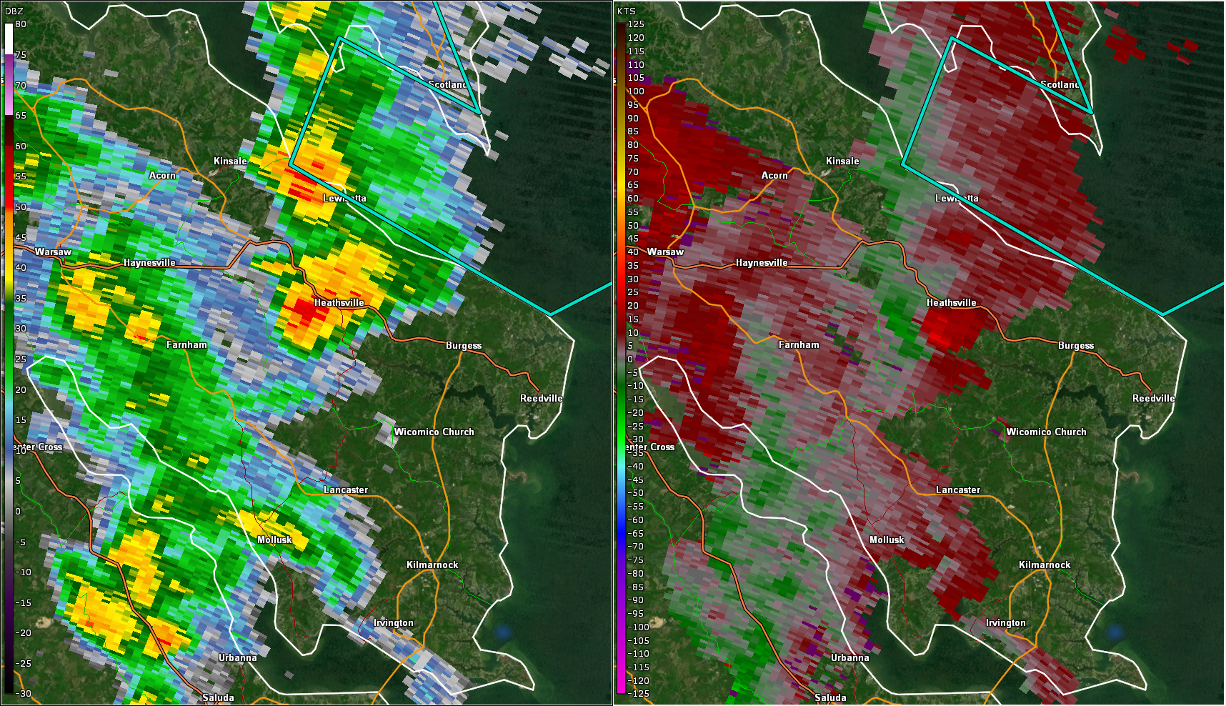
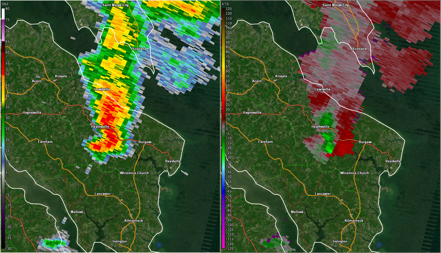
| 2:47 PM 0.5° Base Reflectivity (left) and Storm Relative Velocity (right). This shows one of several cells that tracked across the Virginia Northern Neck with broad rotation (Vrot~20 knots) that did not produce a tornado. | 3:19 PM 0.5° Base Reflectivity (left) and Storm Relative Velocity (right). This is another example of a cell that tracked across the Virginia Northern Neck with broad rotation (Vrot~20 knots) that did not produce a tornado. | Loop of 0.5° Base Reflectivity (left) and Storm Relative Velocity (right) from 4:35 PM to 4:58 PM in ~2 minute increments. Note that storm reports are labeled. Tornado Warning polygons are also displayed. This shows the cell that produced a tornado just west of Hurlock, MD from 4:45 to 4:58 PM. The second cell just to its southwest showed fairly strong rotation, but did not produce a tornado. |
Storm Reports Map
Environment
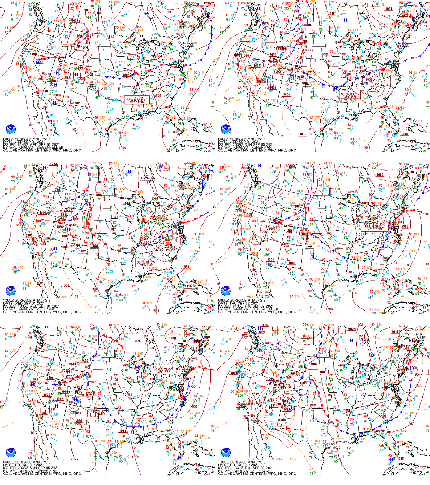
Synoptic summary.
 |
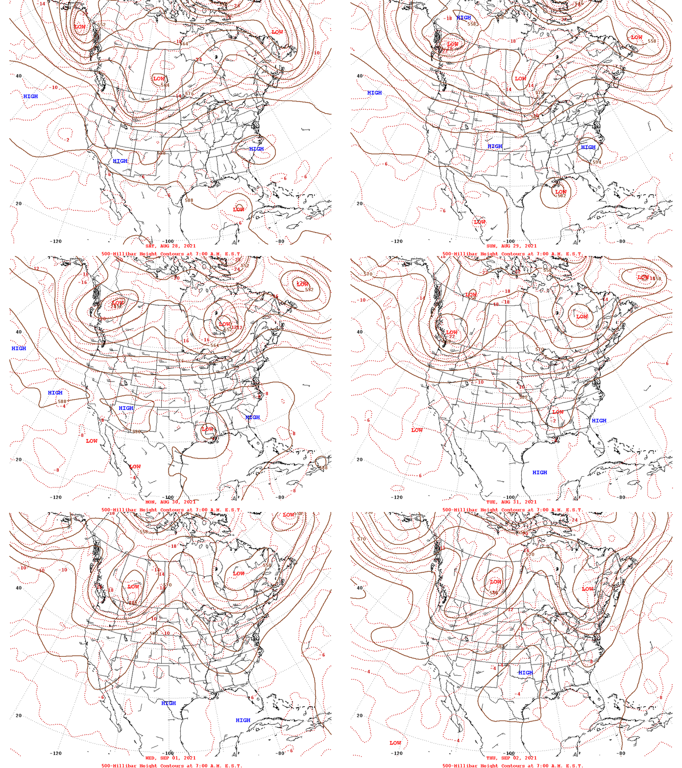 |
| Loop of WPC Surface Analysis Maps from 00z on 9-1 (8 PM on 8-31) to 12z/8 AM on 9-2 (in 6 hour increments) | Loop of 500 mb Analysis from 12z on 8-28 to 12z on 9-2 (in 24 hour increments) |
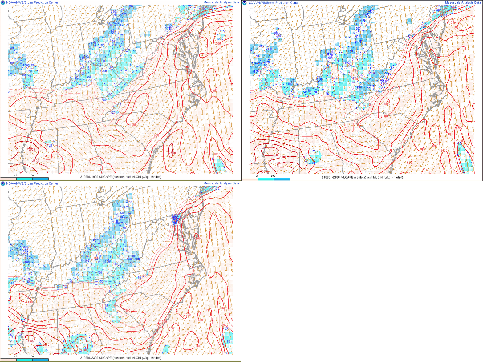
Near-storm environment summary.
 |
 |
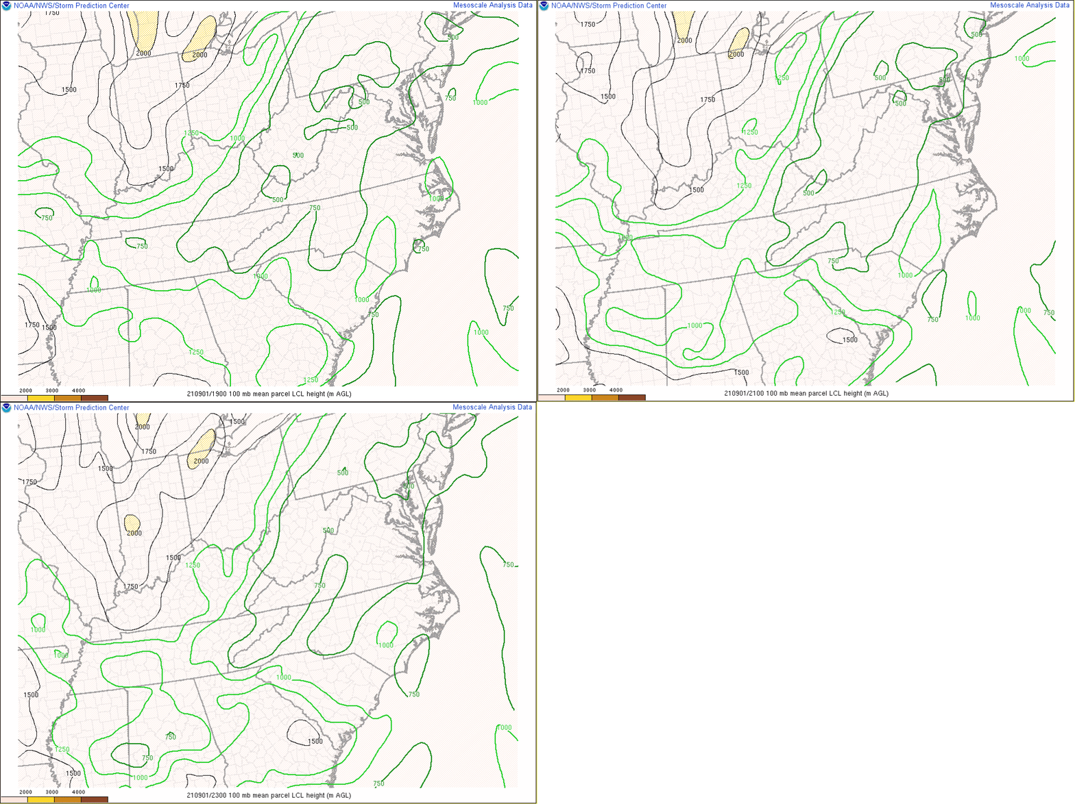 |
| Loop of MLCAPE from 19z/3 PM to 23z/7 PM in 2 hour increments | Loop of 0-1km SRH from 19z/3 PM to 23z/7 PM in 2 hour increments | Loop of LCL height (in meters) from 19z/3 PM to 23z/7 PM in 2 hour increments |
Additional environmental data.
| Figure 7: Caption | Figure 8: Caption | Figure 9: Caption |
 |
Media use of NWS Web News Stories is encouraged! Please acknowledge the NWS as the source of any news information accessed from this site. |
 |