Overview
A very strong low pressure system deepened to ~978mb as it tracked from the Plains to the Great Lakes. This allowed the pressure gradient to rapidly tighten in the warm sector well to the southeast of the center of the low. Locally, south to southeast winds increased during the day on 1/9 before peaking between 4 and 10 PM prior to the passage of a cold front, which shifted winds to the southwest. Gusts of 50 to 60 (locally 70 mph) were observed over coastal land areas during this time, with high-end gale to storm force gusts over the marine area. Even after winds turned to the southwest, gale-force gusts were observed.
In addition to the high wind, widespread heavy rain (with embedded severe thunderstorms) moved across the area during the day, and especially during the evening. Numerous Severe Thunderstorm and Flash Flood Warnings were issued, with widespread road closures across much of the area (except for far SE VA and NE NC). Rainfall totals of 2 to locally 6 inches were observed, which was extrememly impressive for January.
Wind:
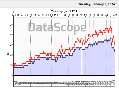
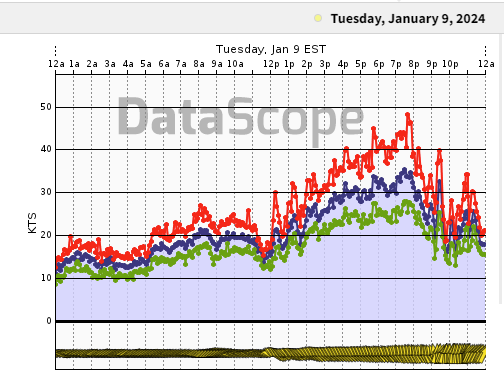
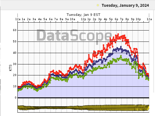
Wind Graphs
Storm force gusts were observed over the marine area with gradient wind gusts in excess of 50 knots/58 mph observed at coastal ASOS/AWOS sites.
 |
 |
 |
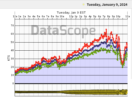 |
| 44009 | Thimble Shoals | TGI Light | Ches Light |
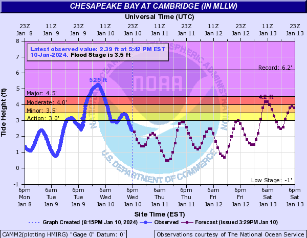
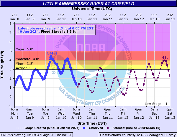
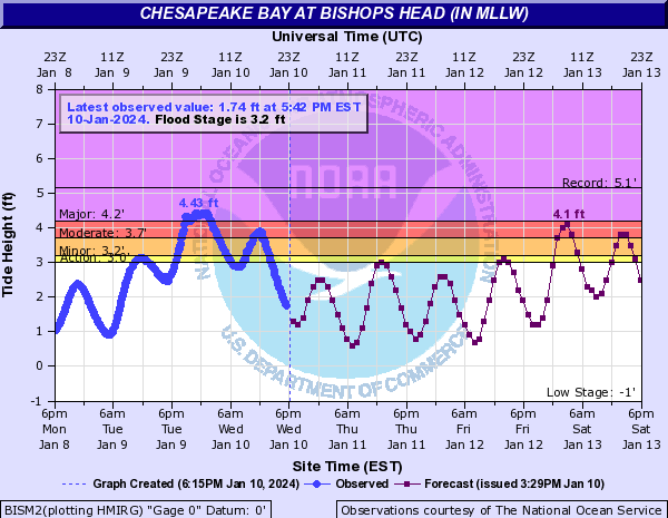
Tidal/River Flooding
Tidal Flooding Hydrographs
 |
 |
 |
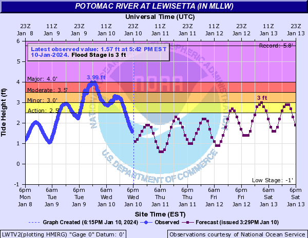 |
| Cambridge, MD | Crisfield, MD | Bishop's Head, MD | Lewisetta, VA |
River Flooding Hydrographs
| Caption | Caption | Caption | Caption |
Radar
Header
| Caption | Caption | Caption | Caption |
Storm Reports
Insert storm reports here. Copy in PNS or paste map.
Environment
Insert synoptic summary.
| Figure 1: Caption | Figure 2: Caption | Figure 3: Caption |
Near-storm environment summary.
| Figure 4: Caption | Figure 5: Caption | Figure 6: Caption |
Additional environmental data.
| Figure 7: Caption | Figure 8: Caption | Figure 9: Caption |
 |
Media use of NWS Web News Stories is encouraged! Please acknowledge the NWS as the source of any news information accessed from this site. |
|


 Coastal Flood
 Heat
Heat