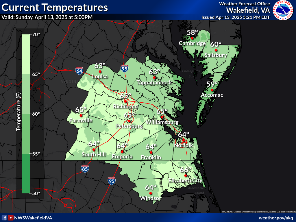
| VA/MD/NC Weather Roundup as of 5:00 PM EDT Sat Apr 25 2026
|
| Location |
Sky & Wx |
Tmp
(°F) |
DP
(°F) |
RH
(%) |
Wind
(mph) |
Pres
(in) |
Remarks |
| Ocean City, MD | CLOUDY | 54 | 48 | 80 | NE8 | 29.87R | | | Salisbury, MD | CLOUDY | 55 | 48 | 77 | E10 | 29.86S | | | Wallops Island, VA | CLOUDY | 56 | 51 | 84 | E15G24 | 29.83F | HAZE | | Cambridge, MD | CLOUDY | 54 | 48 | 82 | E14G22 | 29.85F | | | Accomack, VA | NOT AVBL | | | | | | | | Stafford, VA | NOT AVBL | | | | | | | | Fredericksburg, VA | N/A | N/A | N/A | N/A | N/A | N/A | N/A | | Charlottesville, VA | LGT RAIN | 58 | 57 | 97 | NE10 | 29.82F | FOG | | Hanover, VA | CLOUDY | 67 | 58 | 72 | MISG | 29.81R | | | Tappahannock, VA | CLOUDY | 61 | 57 | 86 | NE5 | 29.82R | | | Tangier, VA | CLOUDY | 64 | 58 | 81 | E17 | 29.80 | | | Richmond, VA | PTSUNNY | 72 | 59 | 63 | N14 | 29.77R | | | Chesterfield, VA | CLOUDY | 75 | 61 | 61 | N9 | 29.76S | | | Petersburg, VA | LGT RAIN | 76 | 58 | 53 | N8 | 29.75R | | | Fort Picket, VA | CLOUDY | 81 | 80 | 99 | NE10 | 29.72R | | | Farmville, VA | TSTM | 65 | 64 | 96 | NW3 | 29.82R | VSB 1 | | Clarksville, VA | PTSUNNY | N/A | N/A | N/A | SW5 | 29.71S | | | South Hill, VA | PTSUNNY | 87 | 49 | 27 | SW9 | 29.76S | | | Emporia, VA | PTSUNNY | 83 | 51 | 32 | S6 | 29.71F | | | US460-Wakefld, VA | MOSUNNY | 82 | 61 | 48 | VRB7 | 29.71F | | | Williamsburg, VA | MOSUNNY | N/A | N/A | N/A | CALM | 29.73F | | | Newport News, VA | MOSUNNY | 71 | 61 | 70 | NE10 | 29.76S | | | Franklin, VA | MOSUNNY | 87 | 46 | 23 | SW5 | 29.71S | | | Norfolk, VA | MOSUNNY | 66 | 59 | 78 | NE14 | 29.73F | | | Virginia Beach, VA | PTSUNNY | 73 | 59 | 61 | SE10 | 29.73F | | | Elizabeth City, NC | PTSUNNY | 84 | 53 | 34 | S12 | 29.72F | | | Currituck, NC | PTSUNNY | 80 | 58 | 46 | SE7 | 29.73F | | | Edenton, NC | PTSUNNY | 86 | 55 | 35 | SE6 | 29.74S | | | Roanoke Rapids, NC | MOSUNNY | 86 | 59 | 39 | SW12 | 29.71S | |
| Marine Observations as of 5:00 PM EDT Sat Apr 25 2026
|
| Location |
UTC TIME
|
Air Temp
(°F) |
Water Temp
(°F) |
Wind
(DIR/SP/G) |
Pres
(mb) |
Wave&Swell
(HT/PER) |
| Baltimore Harbor | N/A | N/A | N/A | N/A | N/A | N/A | N/A | | Tolchester Beach | N/A | N/A | N/A | N/A | N/A | N/A | N/A | | Francis S Key Br | N/A | N/A | N/A | N/A | N/A | N/A | N/A | | Cambridge MD | N/A | N/A | N/A | N/A | N/A | N/A | N/A | | Thomas Pt, MD | N/A | N/A | N/A | N/A | N/A | N/A | N/A | | Gooses Reef, MD | N/A | N/A | N/A | N/A | N/A | N/A | N/A | | Cove Pt, MD | N/A | N/A | N/A | N/A | N/A | N/A | N/A | | Piney Pt, MD | N/A | N/A | N/A | N/A | N/A | N/A | N/A | | Bishops Head, MD | N/A | N/A | N/A | N/A | N/A | N/A | N/A | | Potomac, MD | N/A | N/A | N/A | N/A | N/A | N/A | N/A | | Solomons Island, MD | N/A | N/A | N/A | N/A | N/A | N/A | N/A | | Lewisetta, VA | N/A | N/A | N/A | N/A | N/A | N/A | N/A | | Dahlgren, VA | N/A | N/A | N/A | N/A | N/A | N/A | N/A | | Rappahannock Light | N/A | N/A | N/A | N/A | N/A | N/A | N/A | | StingRay Pt | N/A | N/A | N/A | N/A | N/A | N/A | N/A | | Yorktown, VA | N/A | N/A | N/A | N/A | N/A | N/A | N/A | | Buoy 44072 York | N/A | N/A | N/A | N/A | N/A | N/A | N/A | | Jamestown, VA | N/A | N/A | N/A | N/A | N/A | N/A | N/A | | Willouby Stn, VA | N/A | N/A | N/A | N/A | N/A | N/A | N/A | | Dominion Term Stn | N/A | N/A | N/A | N/A | N/A | N/A | N/A | | Money Pt | N/A | N/A | N/A | N/A | N/A | N/A | N/A | | Sewells Pt | N/A | N/A | N/A | N/A | N/A | N/A | N/A | | Kiptopeke, VA | N/A | N/A | N/A | N/A | N/A | N/A | N/A | | Ches Bay Bridge | N/A | N/A | N/A | N/A | N/A | N/A | N/A | | Cape Henry,VA | N/A | N/A | N/A | N/A | N/A | N/A | N/A | | Lewes, DE | N/A | N/A | N/A | N/A | N/A | N/A | N/A | | Buoy 44009 | N/A | N/A | N/A | N/A | N/A | N/A | N/A | | Brandywine Light | N/A | N/A | N/A | N/A | N/A | N/A | N/A | | Ocean City Inlet | N/A | N/A | N/A | N/A | N/A | N/A | N/A | | Wachapreague, VA | N/A | N/A | N/A | N/A | N/A | N/A | N/A | | Wallops Island Buoy | N/A | N/A | N/A | N/A | N/A | N/A | N/A | | Cape Henry Buoy | N/A | N/A | N/A | N/A | N/A | N/A | N/A | | Cape Charles Buoy | N/A | N/A | N/A | N/A | N/A | N/A | N/A | | 1st Landing Buoy | N/A | N/A | N/A | N/A | N/A | N/A | N/A | | Buoy 44014 | N/A | N/A | N/A | N/A | N/A | N/A | N/A | | Duck Pier | N/A | N/A | N/A | N/A | N/A | N/A | N/A | | Buoy 44056 | N/A | N/A | N/A | N/A | N/A | N/A | N/A | | Buoy 44100 | N/A | N/A | N/A | N/A | N/A | N/A | N/A | | Oregon Inlet, NC | N/A | N/A | N/A | N/A | N/A | N/A | N/A | | Buoy 41025 | N/A | N/A | N/A | N/A | N/A | N/A | N/A | | Cape Lookout, NC | N/A | N/A | N/A | N/A | N/A | N/A | N/A |
|

Current Conditions Images

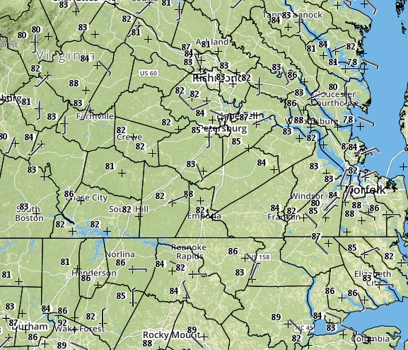
Mesonet Observations

CoCoRaHS

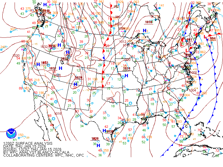
Surface Analysis

Lunar Phase
|
