National Weather Service United States Department of Commerce

Coastal Threats for the East and Gulf; Record Warmth for the Central U.S.

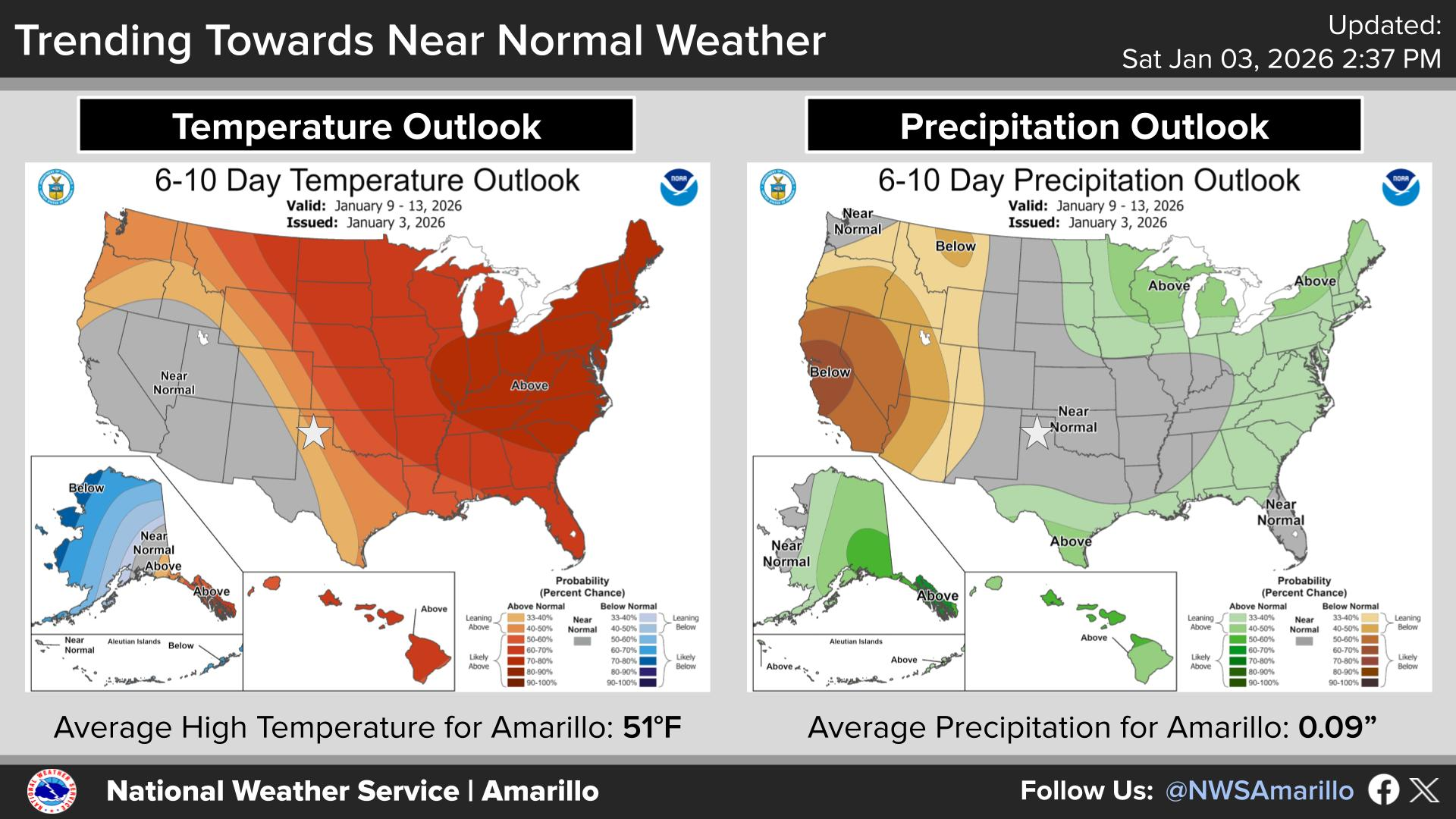
Persistent onshore flow across the Southeast and portions of the mid-Atlantic will keep the risk of rip currents through the weekend. Rainfall could be locally heavy across Florida, especially along the eastern shoreline. Meanwhile, record warmth for portions of the Plains and Midwest with elevated fire concerns. For the west, a trough will keep the pattern unsettled with wet conditions. Read More >

Click a location below for detailed forecast.

Last Map Update: Sat, Oct 4, 2025 at 3:40:41 am CDT

We will see breezy to windy conditions in the Panhandles today. Southwesterly winds are expected in the morning will turn more southerly by the afternoon. Remember to practice fire safety and secure loose outdoor objects!
We could see off-and-on rounds of showers and thunderstorms starting as early as Sunday night and lasting as late as Wednesday night. This could result in some modest rainfall totals. However, the extent of the rain chances and the rain totals will depend upon whether or not a cold front will stall out in the Panhandles. Stay tuned as details become clearer in the coming days!
High temperatures are expected to remain in the mid to upper-80s across the Panhandles today which is around 5-10 degrees warmer than normal for this point in October.

Text Product Selector (Selected product opens in current window)


Current Observations ( )
Location Sky/Weather Temp (°F) Dewpt (°F) RH (%) Wind (mph) Pressure (inHg) Remarks
 Amarillo
N/A
N/A
N/A
N/A
N/A
N/A
N/A
 Borger
N/A
N/A
N/A
N/A
N/A
N/A
N/A
 Canadian
N/A
N/A
N/A
N/A
N/A
N/A
N/A
 Dalhart
N/A
N/A
N/A
N/A
N/A
N/A
N/A
 Dumas
N/A
N/A
N/A
N/A
N/A
N/A
N/A
 Guymon
N/A
N/A
N/A
N/A
N/A
N/A
N/A
 Hereford
N/A
N/A
N/A
N/A
N/A
N/A
N/A
 Pampa
N/A
N/A
N/A
N/A
N/A
N/A
N/A
 Perryton
N/A
N/A
N/A
N/A
N/A
N/A
N/A
 Amarillo 9NNE
N/A
N/A
N/A
N/A
N/A
N/A
N/A
 Amarillo 7SSE
N/A
N/A
N/A
N/A
N/A
N/A
N/A
 Bootleg 11WNW
N/A
N/A
N/A
N/A
N/A
N/A
N/A
 Canadian 6E
N/A
N/A
N/A
N/A
N/A
N/A
N/A
 Clarendon 2WSW
N/A
N/A
N/A
N/A
N/A
N/A
N/A
 Claude 12SW
N/A
N/A
N/A
N/A
N/A
N/A
N/A
 Hereford 2NW
N/A
N/A
N/A
N/A
N/A
N/A
N/A
 McLean 1E
N/A
N/A
N/A
N/A
N/A
N/A
N/A
 Palo Duro SP
N/A
N/A
N/A
N/A
N/A
N/A
N/A
 Pampa 2E
N/A
N/A
N/A
N/A
N/A
N/A
N/A
 Umbarger 3NNE
N/A
N/A
N/A
N/A
N/A
N/A
N/A
Note: "N/A" or "MISG" will be displayed if values are not available. In the LOCATION column, click on links for a list of recent observations at sites of interest. In the WIND column, VRB is "variable" and G is "gust". In the REMARKS column, HX is "heat index", WCI is "wind chill index", and VSB is "visibility" (if shown).


Aviation Drought Fire Weather Hydrology Severe Weather Winter Weather
 
Climate Graphs Hourly Forecast Long Range Local Model Data Precip Maps Heat
 
Education Local Research News Skywarn Weather Calculator Weather Radio