Overview
|
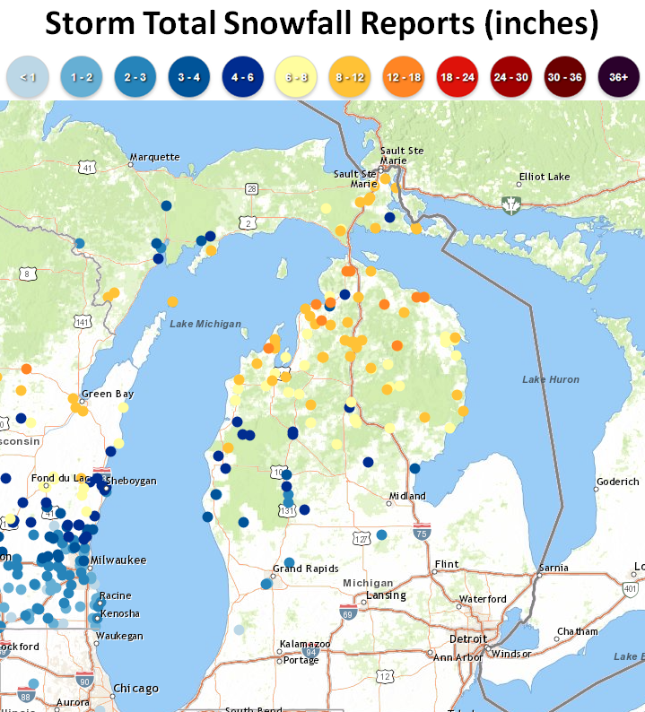
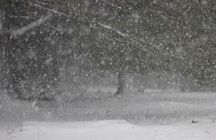
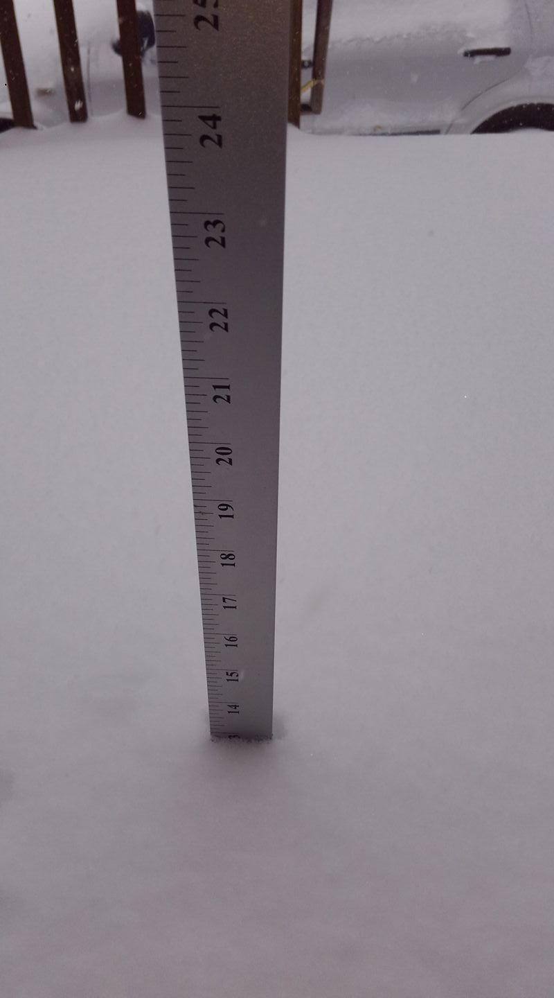
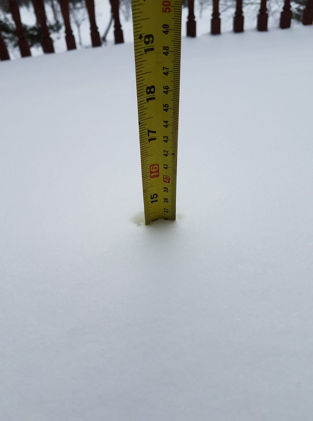
A strong, prolonged storm system passing just south of Michigan April 3-4 interacted with a cold and very moist environment over the region to produce widespread, significant accumulations of heavy, wet snow across northern Michigan. The snow came in waves, with the first round arriving Monday night. Another band of snow overspread northern Michigan during the day Tuesday, with some reports of thundersnow along and south of M-55 Tuesday afternoon. The final and most intense band of heavy snow with this system came Tuesday night, with snowfall coming down as quickly as 2 inches or more per hour. Some light lake enhanced snow lingered across northern Michigan Wednesday morning, diminishing quickly through the afternoon. Most of northern Michigan received at least 8 inches of total snowfall, with several areas reporting a foot or more. Gusty winds of 35-45 mph (up to 50 mph near the lakeshores) behind the departing system led to significant blowing and drifting snow through the day Wednesday. |
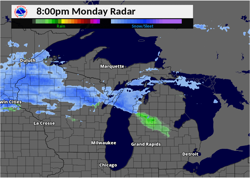 Radar loop of the April 3-4, 2018 winter storm |
Snowfall Map
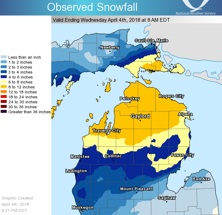 Storm total snowfall April 3-4, 2018 |
 Storm total snowfall April 3-4, 2018 |
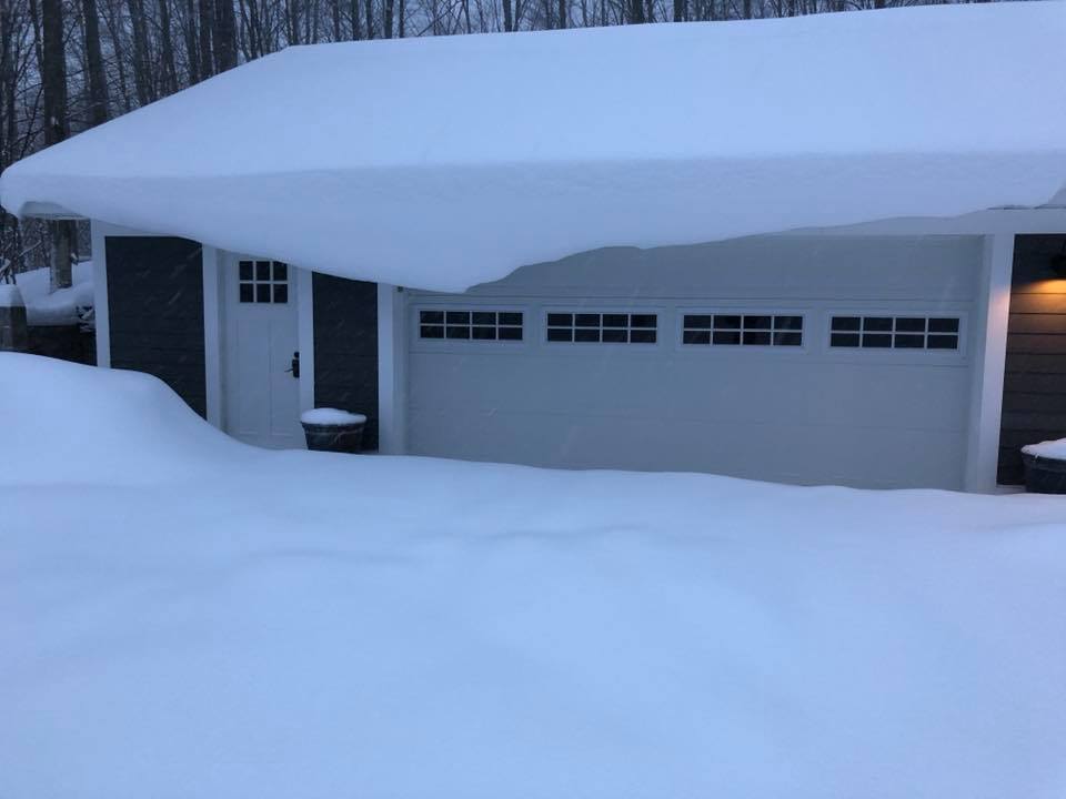
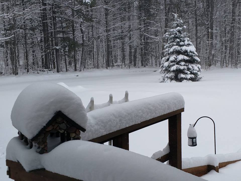
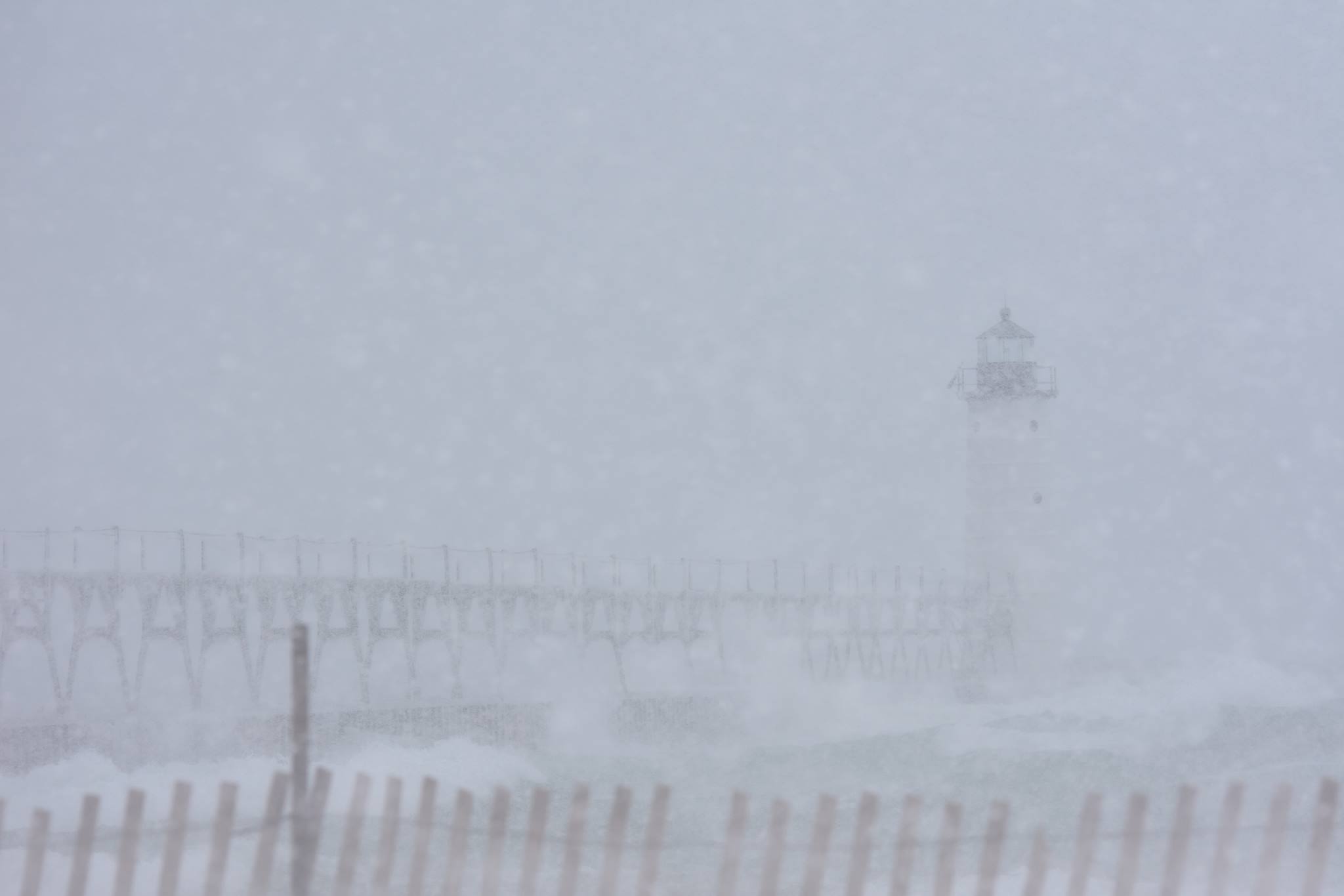
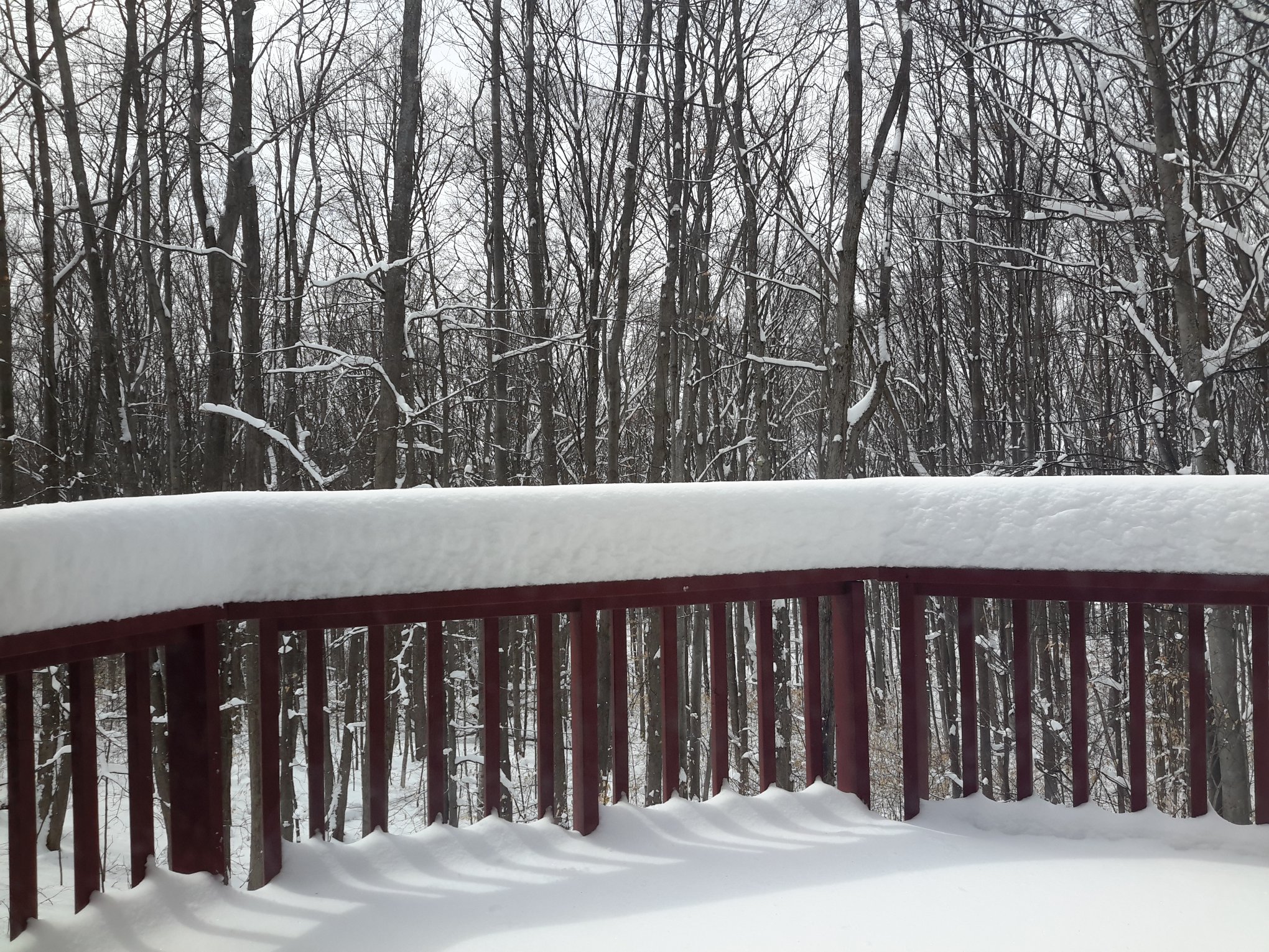
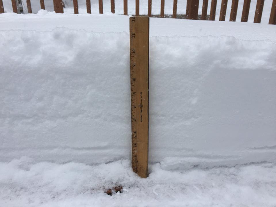
Photos & Video:
Header
 |
 |
 |
 |
| Alanson, MI Dawn Croff |
Fairview, MI Larry Sawasky |
Manistee Lighthouse Kurt Schindler |
Vanderbilt, MI Mike Kurz |
 |
 |
 |
 |
| Old Mission Peninsula Kimberly Ciesla |
Alpena, MI Lisa Roskey |
Afton, MI Jennifer Drake |
Alba, MI Amber Cunningham |
Snowfall Reports
Public Information Statement
National Weather Service Gaylord MI
1027 PM EDT Wed Apr 4 2018

...Storm Total Snowfall Reports From April 3-4 Winter Storm...

Location                     Amount    Time/Date       Lat/Lon

...Michigan...

...Alcona County...
Mikado                       8.0 in    0926 AM 04/04   44.57N/83.42W
Glennie 2se                  4.5 in    0730 AM 04/04   44.54N/83.70W

...Alpena County...
Alpena                       10.0 in   0902 AM 04/04   45.07N/83.44W
KAPN ASOS                    9.4 in    0200 PM 04/04   45.03N/83.56W
5 S Cathro                   7.8 in    0800 AM 04/04   45.07N/83.56W
4 NW Devils Lake             7.8 in    0800 AM 04/04   45.03N/83.56W
Alpena - Phelps Collins Fiel 7.1 in    0754 PM 04/04   45.08N/83.56W
1 N Ossineke                 7.0 in    0930 AM 04/04   44.92N/83.43W
1 SSW Alpena                 6.0 in    0700 AM 04/04   45.05N/83.45W

...Antrim County...
Mancelona                    10.5 in   0830 AM 04/04   44.90N/85.06W
2 NNE Central Lake           7.5 in    0830 AM 04/04   45.10N/85.25W

...Arenac County...
2 ENE Alger                  3.6 in    1000 AM 04/04   44.13N/84.07W
4 SSE Standish               3.5 in    0800 AM 04/04   43.93N/83.93W

...Benzie County...
4 NW Honor                   9.0 in    0127 PM 04/04   44.71N/86.09W
Beulah                       7.0 in    0600 AM 04/04   44.63N/86.10W
5 ENE Arcadia                6.3 in    0800 AM 04/04   44.53N/86.13W

...Charlevoix County...
4 S Horton Bay               14.0 in   1130 AM 04/04   45.22N/85.07W
2 W Bayshore                 12.8 in   0934 AM 04/04   45.36N/85.14W
Charlevoix                   11.3 in   0800 AM 04/04   45.32N/85.27W
6 NW Vanderbilt              10.0 in   0919 AM 04/04   45.20N/84.76W
Ironton                      10.0 in   0700 AM 04/04   45.26N/85.22W
2 NNW East Jordan            9.0 in    0800 AM 04/04   45.19N/85.15W
Boyne City                   8.5 in    0844 AM 04/04   45.18N/84.96W

...Cheboygan County...
3 E Levering                 14.0 in   0903 AM 04/04   45.64N/84.72W
Tower                        13.0 in   0859 AM 04/04   45.36N/84.30W
Cheboygan                    8.5 in    0600 AM 04/04   45.64N/84.47W
Indian River                 8.4 in    0840 AM 04/04   45.42N/84.62W

...Chippewa County...
Kinross                      11.5 in   0845 AM 04/04   46.27N/84.48W
Dafter                       10.5 in   0730 AM 04/04   46.37N/84.43W
Rudyard                      10.0 in   0530 AM 04/04   46.23N/84.60W
Kincheloe                    10.0 in   0500 AM 04/04   46.25N/84.50W
11 ESE Goetzville            9.0 in    0745 AM 04/04   46.00N/83.91W
6 ENE Mccarron               8.0 in    0530 AM 04/04   46.35N/84.16W
5 SE Sault Ste. Marie        8.0 in    0530 AM 04/04   46.43N/84.29W
Trout Lake                   7.0 in    0630 AM 04/04   46.18N/85.02W
Stalwart                     4.0 in    0522 AM 04/04   46.10N/84.24W
Sault Ste Marie - Municipal  2.4 in    0755 PM 04/04   46.47N/84.37W
Sault Ste Marie              2.0 in    0800 AM 04/04   46.49N/84.40W
2 E Sault Ste. Marie         1.4 in    0700 AM 04/04   46.49N/84.32W

...Crawford County...
Lovells                      8.5 in    0600 AM 04/04   44.81N/84.47W
1 SSE Lovells                7.0 in    0600 AM 04/04   44.80N/84.46W
1 NE North Higgins Lake      6.0 in    0800 AM 04/04   44.51N/84.71W

...Emmet County...
Levering                     13.0 in   1158 AM 04/04   45.64N/84.77W
Petoskey                     12.0 in   0600 AM 04/04   45.37N/84.96W
Petoskey Ncmc                9.2 in    0800 AM 04/04   45.36N/84.95W
Harbor Springs               7.5 in    0700 AM 04/04   45.43N/84.98W

...Gladwin County...
Gladwin                      4.0 in    0700 AM 04/04   43.98N/84.50W

...Grand Traverse County...
4 SW Bates                   10.2 in   0700 AM 04/04   44.73N/85.51W
2 N Grawn                    9.0 in    0900 AM 04/04   44.70N/85.68W
Mapleton                     7.5 in    0855 AM 04/04   44.90N/85.51W
Interlochen                  6.5 in    0613 AM 04/04   44.65N/85.75W
Traverse City Munson         6.3 in    0730 AM 04/04   44.76N/85.64W
2 ENE Kingsley               6.2 in    0845 AM 04/04   44.60N/85.48W
Fife Lake                    6.0 in    0700 AM 04/04   44.58N/85.35W

...Iosco County...
Oscoda                       9.5 in    0136 PM 04/04   44.43N/83.34W
Hale                         8.0 in    1000 AM 04/04   44.38N/83.81W
4 NNE National City          7.8 in    0900 AM 04/04   44.29N/83.68W
East Tawas                   6.8 in    0830 AM 04/04   44.28N/83.50W
Loud Dam                     6.0 in    0900 AM 04/04   44.46N/83.72W

...Kalkaska County...
Kalaska                      9.6 in    0800 AM 04/04   44.73N/85.17W
Kalkaska 11se                8.1 in    0830 AM 04/04   44.59N/85.05W
Rapid City                   6.3 in    0700 AM 04/04   44.83N/85.28W

...Leelanau County...
3 W Suttons Bay              12.2 in   0946 AM 04/04   44.98N/85.72W
2 W Omena                    10.4 in   0700 AM 04/04   45.06N/85.65W
Maple City                   10.0 in   0924 AM 04/04   44.85N/85.87W
NW Michigan Res Farm         8.0 in    0800 AM 04/04   44.88N/85.68W
Suttons Bay                  8.0 in    0500 AM 04/04   44.98N/85.65W
Maple City 1e                6.8 in    0735 PM 04/04   44.85N/85.84W

...Mackinac County...
Moran                        9.5 in    0800 AM 04/04   45.99N/84.84W
Hessel                       8.0 in    0500 AM 04/04   46.01N/84.42W
1 NW Allenville              7.0 in    0530 AM 04/04   46.00N/84.83W
Engadine MDOT                1.0 in    0700 AM 04/04   46.13N/85.57W

...Manistee County...
Wellston                     5.6 in    0616 AM 04/04   44.22N/85.95W
4 W Wellston                 5.0 in    0800 AM 04/04   44.23N/86.04W
3 E Norwalk                  5.0 in    0745 AM 04/04   44.34N/86.11W

...Missaukee County...
4 SW Smithville              8.5 in    0645 AM 04/04   44.49N/85.21W
Lake City                    6.0 in    0645 AM 04/04   44.33N/85.21W
3 NNE Lucas                  4.8 in    0700 AM 04/04   44.27N/85.26W

...Montmorency County...
Atlanta                      14.0 in   1200 PM 04/04   45.00N/84.15W
1 SW Atlanta                 9.0 in    0834 AM 04/04   44.99N/84.16W

...Ogemaw County...
West Branch                  6.0 in    0930 AM 04/04   44.28N/84.24W
1 S Lupton                   5.0 in    0800 AM 04/04   44.42N/84.02W

...Oscoda County...
Luzerne                      10.0 in   0900 AM 04/04   44.62N/84.27W
4 SE Lewiston                7.6 in    0847 AM 04/04   44.84N/84.26W
2 NE Luzerne                 6.0 in    0700 AM 04/04   44.64N/84.24W
1 SSE Mio                    6.0 in    0830 AM 04/04   44.65N/84.12W

...Otsego County...
NWS - 9 SSW Gaylord          12.5 in   0200 PM 04/04   44.91N/84.72W
3 ESE Elmira                 11.0 in   0911 AM 04/04   45.05N/84.79W
3 SSE Gaylord                10.0 in   0858 AM 04/04   44.99N/84.65W
Sparr                        9.8 in    0931 AM 04/04   45.05N/84.58W
Gaylord                      8.0 in    0800 AM 04/04   45.03N/84.68W
2 W Gaylord                  8.0 in    0800 AM 04/04   45.03N/84.71W

...Presque Isle County...
3 SSW P H Hoeft State Park   14.0 in   0930 AM 04/04   45.42N/83.91W
1 WNW Rogers City            12.0 in   0858 AM 04/04   45.42N/83.82W
Onaway State Park            12.0 in   0600 PM 04/04   45.43N/84.23W
Rogers City                  11.0 in   0800 AM 04/04   45.42N/83.81W
3 S Millersburg              8.0 in    0545 AM 04/04   45.29N/84.06W

...Roscommon County...
3 NE Prudenville             6.3 in    0800 AM 04/04   44.33N/84.64W
1 ENE Roscommon County Airpo 6.3 in    0800 AM 04/04   44.36N/84.67W
1 NE North Higgins Lake      6.0 in    0800 AM 04/04   44.51N/84.71W
Higgins Lake                 5.8 in    0800 AM 04/04   44.46N/84.73W
Houghton Lake - Roscommon Co 3.8 in    0753 PM 04/04   44.35N/84.67W

...Wexford County...
1 S Cadillac                 5.0 in    0730 AM 04/04   44.23N/85.42W
Cadillac                     4.0 in    0630 AM 04/04   44.25N/85.42W

...Maritime Stations...
19 E Goetzville              10.7 in   0900 AM 04/04   46.05N/83.69W
Detour Village               9.0 in    0800 AM 04/04   46.02N/83.92W

Observations are collected from a variety of sources with varying
equipment and exposures. We thank all volunteer weather observers
for their dedication. Not all data listed are considered official.
Wind Reports
Public Information Statement
National Weather Service Gaylord MI
1059 PM EDT Wed Apr 4 2018

...Strongest Wind Reports From April 3-4 Winter Storm...

Location                     Speed     Time/Date       Lat/Lon

...Michigan...

...Alcona County...
1 SE Barton City             35 MPH    0446 PM 04/04   44.66N/83.59W

...Alpena County...
1 W Ossineke                 51 MPH    1210 PM 04/04   44.91N/83.45W
1 SSW Alpena                 39 MPH    0430 PM 04/04   45.05N/83.45W
Alpena - Phelps Collins Fiel 37 MPH    0358 PM 04/04   45.08N/83.56W
Alpena                       37 MPH    1230 PM 04/04   45.06N/83.43W
1 SE Lachine                 36 MPH    0317 PM 04/04   45.07N/83.72W

...Antrim County...
2 WNW Elmira                 30 MPH    0717 AM 04/04   45.08N/84.89W

...Benzie County...
2 S Benzonia                 38 MPH    0532 AM 04/04   44.59N/86.10W
Frankfort - Dow Memorial Fie 36 MPH    0735 AM 04/04   44.63N/86.21W
3 S Empire                   32 MPH    0808 AM 04/04   44.76N/86.06W

...Charlevoix County...
3 W Bayshore                 42 MPH    0632 AM 04/04   45.36N/85.18W
Charlevoix - Municipal Arpt  33 MPH    0555 AM 04/04   45.30N/85.27W

...Cheboygan County...
Cheboygan - Cheboygan County 37 MPH    0255 PM 04/04   45.65N/84.53W
Mackinaw City                34 MPH    0254 PM 04/04   45.78N/84.73W
Wolverine                    34 MPH    0232 PM 04/04   45.27N/84.59W

...Chippewa County...
Dafter                       41 MPH    0318 PM 04/04   46.37N/84.43W
1 NNW Sault Ste. Marie       40 MPH    0442 PM 04/04   46.50N/84.37W
3 E Sault Ste. Marie         39 MPH    0436 PM 04/04   46.49N/84.30W
Kinross - Chippewa County In 39 MPH    0340 PM 04/04   46.25N/84.47W
Sault Ste Marie - Municipal  39 MPH    0337 PM 04/04   46.47N/84.37W
4 NW Bay Mills               36 MPH    0324 PM 04/04   46.48N/84.63W
3 SE Rudyard                 35 MPH    0302 PM 04/04   46.19N/84.56W
Kincheloe                    32 MPH    0314 PM 04/04   46.24N/84.51W
4 W Raco                     30 MPH    0704 PM 04/04   46.36N/84.80W

...Crawford County...
Grayling - Army Airfield     33 MPH    0517 PM 04/04   44.68N/84.73W
3 S Grayling                 32 MPH    0302 PM 04/04   44.61N/84.71W
2 SSW Hartwick Pines State P 30 MPH    0112 PM 04/04   44.72N/84.71W

...Emmet County...
Pellston - Rgnl Airport Of E 37 MPH    0252 PM 04/04   45.57N/84.80W
Petoskey                     32 MPH    0138 PM 04/04   45.36N/84.95W
Harbor Springs - Municipal A 32 MPH    0235 PM 04/04   45.42N/84.91W

...Grand Traverse County...
Traverse City - Cherry Capit 38 MPH    0953 AM 04/04   44.74N/85.58W

...Iosco County...
2 SE East Tawas              44 MPH    0239 PM 04/04   44.25N/83.46W
Oscoda - Wurtsmith AFB       38 MPH    0315 PM 04/04   44.42N/83.35W
4 W Sid Town                 33 MPH    0247 PM 04/04   44.45N/83.69W

...Kalkaska County...
1 SW Kalkaska                32 MPH    0317 PM 04/04   44.72N/85.19W

...Leelanau County...
Leland                       47 MPH    0628 AM 04/04   45.02N/85.76W
3 SW Maple City              34 MPH    0632 AM 04/04   44.81N/85.90W

...Mackinac County...
Mackinac Island              37 MPH    0755 AM 04/04   45.87N/84.64W
2 WSW Engadine               34 MPH    0517 PM 04/04   46.10N/85.62W
1 WNW Rexton                 31 MPH    0913 AM 04/04   46.16N/85.27W

...Manistee County...
Manistee                     50 MPH    0740 AM 04/04   44.25N/86.35W
1 SE Manistee                44 MPH    0832 AM 04/04   44.22N/86.31W
Manistee - Blacker Airport   43 MPH    0805 AM 04/04   44.27N/86.25W
3 WSW Onekama                38 MPH    0832 AM 04/04   44.35N/86.27W

...Montmorency County...
Clear Lake State Park        33 MPH    0408 PM 04/04   45.15N/84.19W

...Ogemaw County...
2 SSE West Branch            45 MPH    1232 PM 04/04   44.25N/84.23W
3 ESE West Branch            37 MPH    0215 PM 04/04   44.24N/84.18W

...Oscoda County...
Mio                          35 MPH    0200 PM 04/04   44.68N/84.13W

...Otsego County...
Gaylord - Otsego County Airp 32 MPH    0527 PM 04/04   45.02N/84.70W
1 WNW Waters                 32 MPH    1059 AM 04/04   44.91N/84.72W

...Presque Isle County...
5 WNW Presque Isle           37 MPH    0402 PM 04/04   45.33N/83.58W
Rogers City - Presque Isle C 36 MPH    0435 PM 04/04   45.41N/83.81W

...Roscommon County...
Houghton Lake - Roscommon Co 45 MPH    0100 PM 04/04   44.35N/84.67W
3 NW Houghton Lake           34 MPH    1032 AM 04/04   44.33N/84.81W
2 SE Roscommon               30 MPH    0210 PM 04/04   44.47N/84.57W

...Wexford County...
Cadillac - Wexford Count Arp 38 MPH    1115 AM 04/04   44.28N/85.42W
6 ENE Dublin                 33 MPH    1247 PM 04/04   44.22N/85.81W

...Maritime Stations...
Leland                       47 MPH    0628 AM 04/04   45.02N/85.76W
14 ESE Au Sable              46 MPH    0200 PM 04/04   44.30N/83.10W
1 N Munuscong                39 MPH    0354 PM 04/04   46.26N/84.19W
10 ESE Goetzville            38 MPH    0300 PM 04/04   46.00N/83.90W
2 NNW Munuscong              38 MPH    0454 PM 04/04   46.28N/84.21W
19 E Harrisville             38 MPH    0800 PM 04/04   44.70N/82.90W
9 SE Seul Choix Point        34 MPH    1200 PM 04/04   45.80N/85.80W
6 WSW Marquette Island       34 MPH    1200 PM 04/04   45.90N/84.50W
1 E Evergreen Shores         32 MPH    1000 AM 04/04   45.90N/84.70W
2 NE Mackinaw City           32 MPH    1000 AM 04/04   45.80N/84.70W
5 SW Beaver Island           32 MPH    0556 AM 04/04   45.63N/85.61W

Observations are collected from a variety of sources with varying
equipment and exposures. We thank all volunteer weather observers
for their dedication. Not all data listed are considered official.
 |
Media use of NWS Web News Stories is encouraged! Please acknowledge the NWS as the source of any news information accessed from this site. |
|

