
Severe storms will be possible this evening and tonight, with additional severe storms possible again late Monday. Read More >
Overview
|
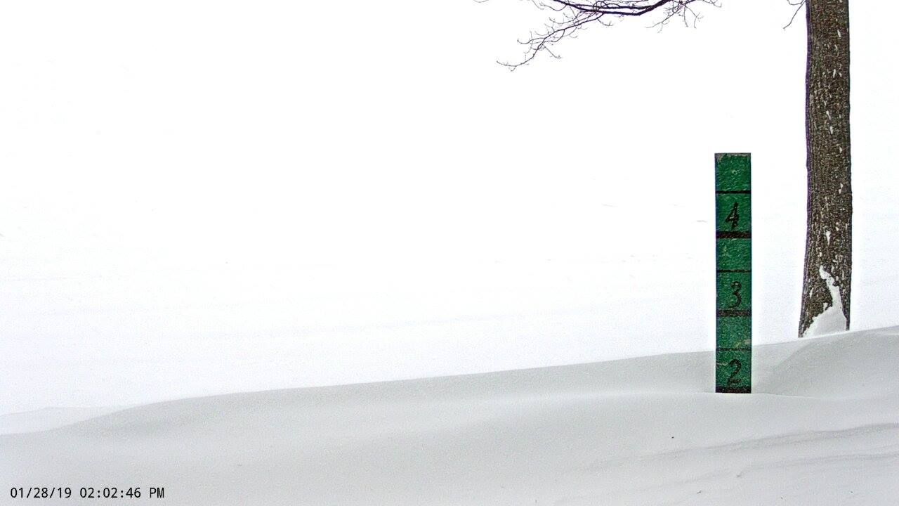
An Alberta Clipper dropping through the Upper Midwest late Sunday night pivoted across the southern Great Lakes through the day on Monday. A large band of snow on the system's northern edge rotated across northern Michigan between early Monday morning and late Monday evening. With a very cold airmass in place, the snow was powdery and dense. Winds gusting 25 to 35 mph caused widespread blowing and drifting snow to produce occasional whiteout conditions as well as very cold wind chills. Some of the heaviest accumulations across northern Michigan were along the M-55 corridor from Manistee to Missaukee counties, where a few locations reported more than 16 inches of snowfall. As the system lifted into the Thumb by Monday evening, the axis of heavy snowfall pivoted into northeast Lower, with some enhancement coming off of Lake Huron. This produced another swath of heavier snowfall from near Rogers City to Atlanta to Tawas City. Most schools were closed due to the hazardous travel conditions, and most state offices and some business closed early. Numerous vehicle accidents were reported, resulting in closures to M-55 in Wexford County and US-131 in Grand Traverse County, where one fatality occurred. |
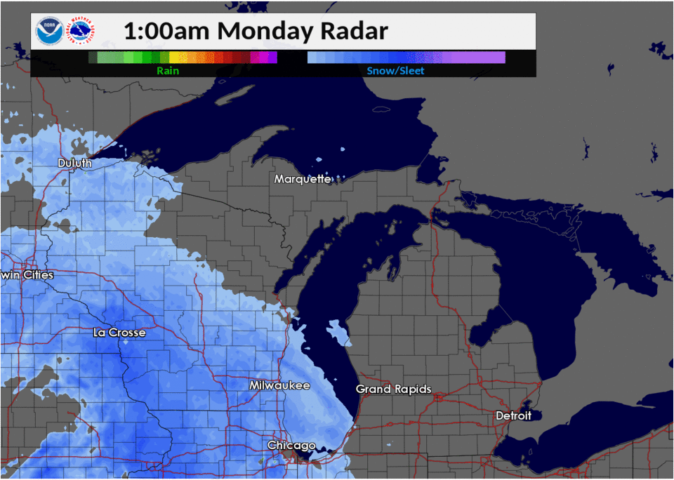 Radar loop of the January 28, 2019 winter storm |
Snowfall Map
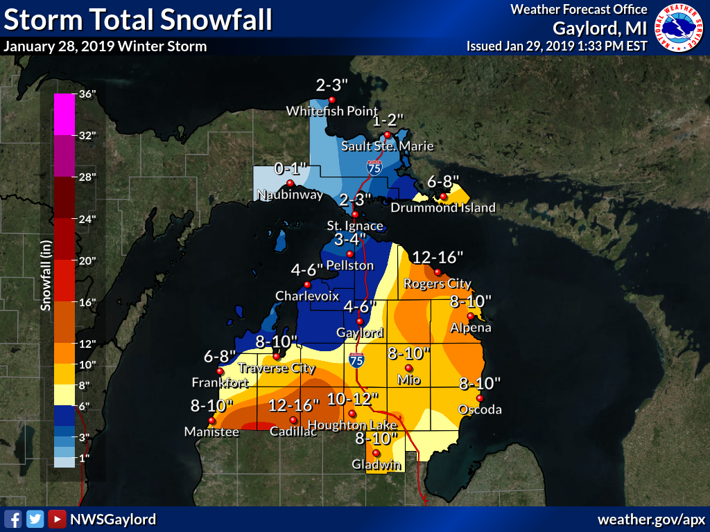 Storm total snowfall January 28, 2019 |
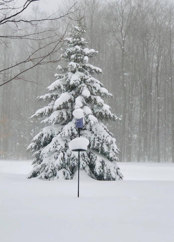
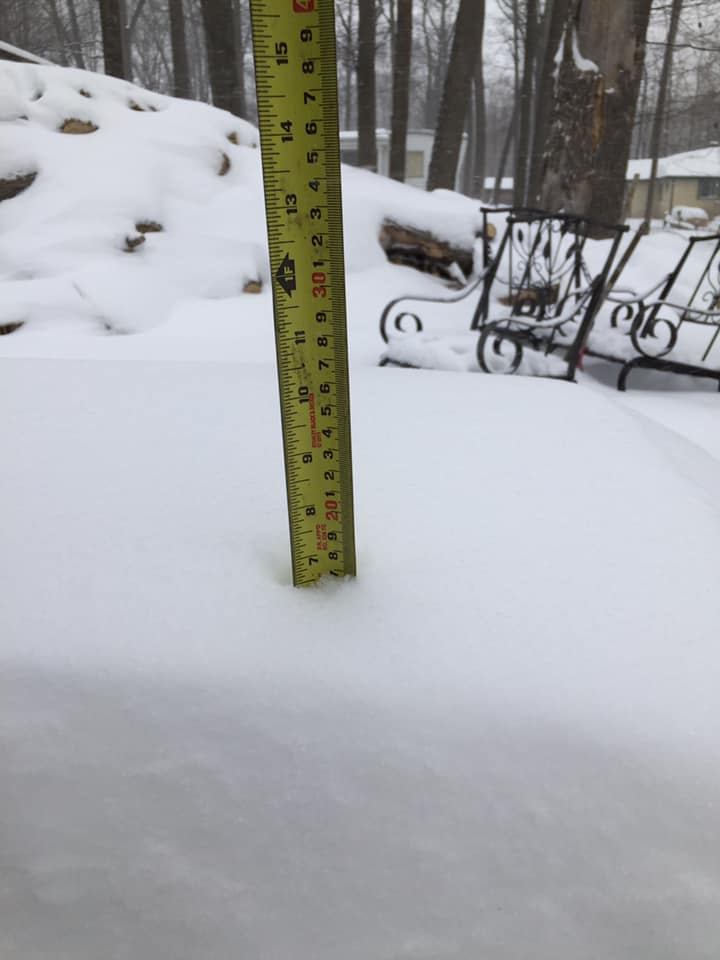
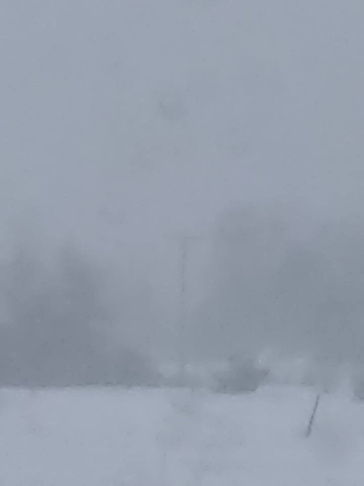
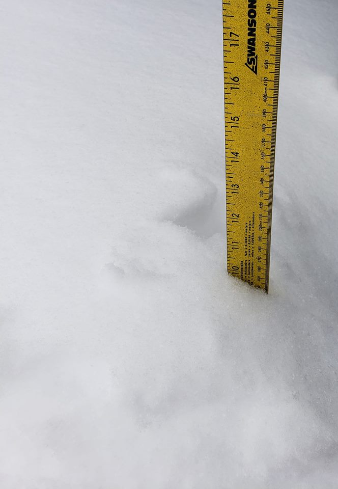
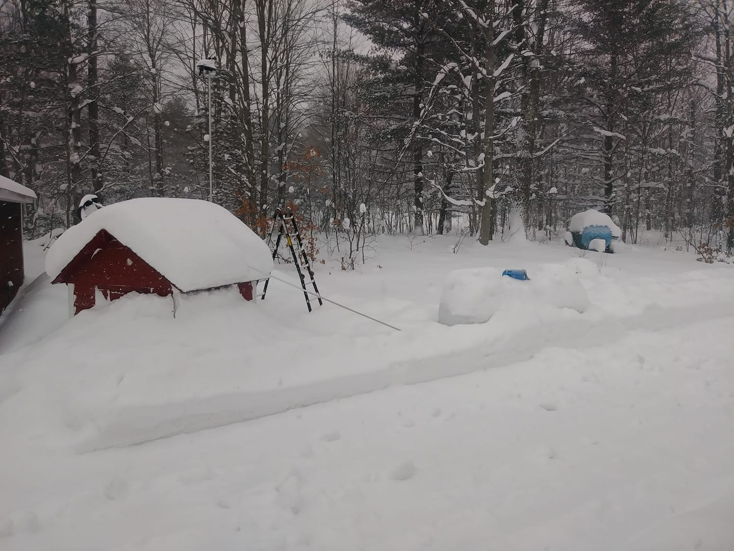
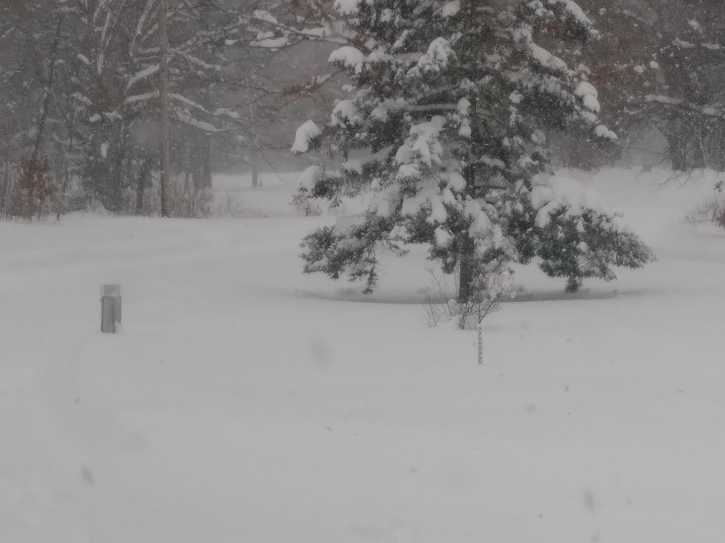
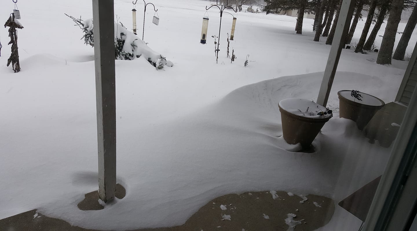
Photos & Video:
Submitted Via Social Media
 |
 |
 |
 |
| Lake Ann, MI Susanelou Samsa Adair |
Lupton, MI Roberta Wickwire |
Millersburg, MI Bridgite Lakies |
Traverse City, MI Tammy Mosher |
 |
 |
 |
 |
| Wellston, MI Phil Webber |
Wellston, MI Phil Webber |
West Branch, MI Gerry Garden Laura |
West Otsego Lake, MI Jack Aumann |
Snowfall Reports
PUBLIC INFORMATION STATEMENT
NATIONAL WEATHER SERVICE GAYLORD MI
1204 PM EST TUE JAN 29 2019

...STORM TOTAL SNOWFALL REPORTS FOR JANUARY 28-29, 2019...

LOCATION                     AMOUNT    TIME/DATE       LAT/LON

...MICHIGAN...

...ALCONA COUNTY...
LINCOLN                      11.0 IN   0933 PM 01/28   44.69N/83.41W
GLENNIE 2SE                  8.8 IN    0730 AM 01/29   44.54N/83.70W

...ALPENA COUNTY...
SNOW OBSERVER FOR KAPN       12.3 IN   0700 AM 01/29   45.03N/83.56W
1 W OSSINEKE                 11.5 IN   0600 PM 01/28   44.91N/83.45W
ALPENA                       9.5 IN    1215 AM 01/29   45.07N/83.44W
LACHINE                      8.0 IN    0700 PM 01/28   45.08N/83.73W

...ANTRIM COUNTY...
MANCELONA                    6.5 IN    0300 PM 01/28   44.90N/85.06W
ELK RAPIDS                   4.0 IN    0300 PM 01/28   44.89N/85.40W

...ARENAC COUNTY...
4 WSW STANDISH               7.6 IN    0700 AM 01/29   43.95N/84.04W
5 E TURNER                   7.5 IN    0855 AM 01/29   44.13N/83.69W
4 SSE STANDISH               7.0 IN    0800 AM 01/29   43.93N/83.93W
STERLING                     7.0 IN    0543 PM 01/28   44.03N/84.02W
AU GRES                      6.8 IN    0400 PM 01/28   44.04N/83.69W

...BENZIE COUNTY...
LAKE ANN                     6.5 IN    0111 PM 01/28   44.73N/85.84W
5 ENE ARCADIA                5.6 IN    0700 AM 01/29   44.53N/86.13W
1 E LAKE ANN                 5.0 IN    0435 PM 01/28   44.72N/85.82W
5 S BENZONIA                 4.9 IN    0800 AM 01/29   44.54N/86.11W

...CHARLEVOIX COUNTY...
CHARLEVOIX                   5.2 IN    0700 AM 01/29   45.32N/85.27W
EAST JORDAN                  5.0 IN    0758 PM 01/28   45.16N/85.13W
2 NNW EAST JORDAN            4.2 IN    0700 AM 01/29   45.19N/85.15W

...CHEBOYGAN COUNTY...
INDIAN RIVER                 3.7 IN    0930 PM 01/28   45.42N/84.62W
WOLVERINE                    3.0 IN    1247 PM 01/28   45.27N/84.61W

...CHIPPEWA COUNTY...
2 E SAULT STE. MARIE         1.8 IN    0730 AM 01/29   46.49N/84.32W
SAULT STE MARIE              1.7 IN    0800 AM 01/29   46.49N/84.40W

...CRAWFORD COUNTY...
1 NE NORTH HIGGINS LAKE      9.8 IN    0644 PM 01/28   44.51N/84.71W
LOVELLS                      9.0 IN    0600 AM 01/29   44.80N/84.46W

...EMMET COUNTY...
2 S PETOSKEY                 5.0 IN    0530 AM 01/29   45.34N/84.97W

...GLADWIN COUNTY...
GLADWIN                      10.0 IN   0925 PM 01/28   43.98N/84.49W

...GRAND TRAVERSE COUNTY...
TRAVERSE CITY MUNSON         10.8 IN   0606 AM 01/29   44.76N/85.64W
5 SSE TRAVERSE CITY          8.5 IN    0500 PM 01/28   44.69N/85.58W
3 SSW TRAVERSE CITY          8.0 IN    1258 PM 01/28   44.72N/85.63W
4 WSW BATES                  7.9 IN    0700 AM 01/29   44.73N/85.51W
FIFE LAKE                    7.7 IN    0119 PM 01/28   44.57N/85.35W
4 WSW BATES                  7.2 IN    0700 AM 01/29   44.73N/85.51W
3 WSW FIFE LAKE              7.1 IN    0700 AM 01/29   44.56N/85.41W
2 ENE KINGSLEY               7.1 IN    0830 AM 01/29   44.60N/85.48W

...IOSCO COUNTY...
EAST TAWAS                   12.4 IN   0830 AM 01/29   44.28N/83.50W

...KALKASKA COUNTY...
RAPID CITY                   3.0 IN    0300 PM 01/28   44.83N/85.28W

...LEELANAU COUNTY...
MAPLE CITY 1E                7.0 IN    0515 PM 01/28   44.85N/85.84W
3 S BURDICKVILLE             6.0 IN    1245 PM 01/28   44.81N/85.96W
1 NE BINGHAM                 4.0 IN    0700 AM 01/29   44.88N/85.68W
NW MICHIGAN RES FARM         3.0 IN    0800 AM 01/29   44.88N/85.68W
2 W OMENA                    3.0 IN    0700 AM 01/29   45.06N/85.65W

...MACKINAC COUNTY...
SAINT IGNACE                 3.0 IN    0700 AM 01/29   45.86N/84.72W
CEDARVILLE 3.2 ESE           2.6 IN    0800 AM 01/29   45.99N/84.30W
MORAN                        2.2 IN    0800 AM 01/29   45.99N/84.84W

...MANISTEE COUNTY...
1 NNW WELLSTON               16.9 IN   0630 AM 01/29   44.23N/85.96W
DUBLIN                       15.0 IN   1058 PM 01/28   44.18N/85.93W
3 N WELLSTON                 10.0 IN   0700 AM 01/29   44.26N/85.94W
3 SSW PIERPORT               9.0 IN    0100 PM 01/28   44.40N/86.25W
1 SW MANISTEE                8.5 IN    0900 PM 01/28   44.23N/86.35W

...MISSAUKEE COUNTY...
4 SW SMITHVILLE              15.5 IN   0700 AM 01/29   44.49N/85.21W
LAKE CITY                    12.0 IN   0438 PM 01/28   44.33N/85.21W

...MONTMORENCY COUNTY...
ATLANTA                      12.0 IN   0551 AM 01/29   45.00N/84.15W

...OGEMAW COUNTY...
2 SSW WEST BRANCH            12.5 IN   0800 AM 01/29   44.25N/84.25W
2 SE WEST BRANCH             11.4 IN   0700 AM 01/29   44.25N/84.20W

...OSCODA COUNTY...
1 SSE MIO                    8.5 IN    0700 AM 01/29   44.65N/84.12W
2 NE LUZERNE                 8.0 IN    0700 AM 01/29   44.64N/84.24W

...OTSEGO COUNTY...
NWS GAYLORD                  7.3 IN    1200 AM 01/29   44.91N/84.72W
5 W WATERS                   5.8 IN    0700 AM 01/29   44.90N/84.81W
2 W GAYLORD                  4.5 IN    0700 AM 01/29   45.03N/84.71W
WATERS                       4.0 IN    1251 PM 01/28   44.90N/84.70W
5 NW OTSEGO LAKE STATE PARK  4.0 IN    0500 PM 01/28   44.99N/84.77W

...PRESQUE ISLE COUNTY...
ROGERS CITY                  13.0 IN   0800 AM 01/29   45.42N/83.81W

...ROSCOMMON COUNTY...
E. SIDE OF HOUGHTON LAKE     9.2 IN    0700 AM 01/29   44.33N/84.64W
HOUGHTON LAKE                7.2 IN    0700 PM 01/28   44.30N/84.76W
PRUDENVILLE                  7.0 IN    1250 PM 01/28   44.30N/84.67W

...WEXFORD COUNTY...
3 S CADILLAC                 16.3 IN   0700 AM 01/29   44.21N/85.41W
5 S CADILLAC                 15.8 IN   0915 PM 01/28   44.18N/85.42W
CADILLAC                     14.0 IN   0647 PM 01/28   44.25N/85.42W

OBSERVATIONS ARE COLLECTED FROM A VARIETY OF SOURCES WITH VARYING
EQUIPMENT AND EXPOSURES. WE THANK ALL VOLUNTEER WEATHER OBSERVERS
FOR THEIR DEDICATION. NOT ALL DATA LISTED ARE CONSIDERED OFFICIAL.

$$
 |
Media use of NWS Web News Stories is encouraged! Please acknowledge the NWS as the source of any news information accessed from this site. |
|

