
Severe storms will be possible this evening and tonight, with additional severe storms possible again especially late Monday. Read More >
Overview
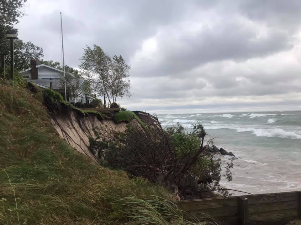
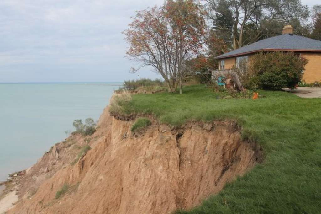
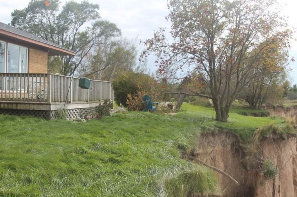
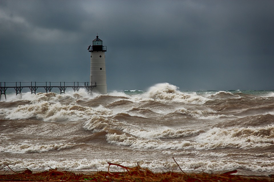
A rapidly developing area of low pressure over the Great Lakes region produced strong and persistent north to northwest winds over an extended time period. The high winds began around midnight on the 16th along the Lake Huron coast and was impacting the entire forecast area by daybreak. This strong and persistent wind caused lakeshore flooding, beach erosion that is beginning to threaten homes, and flooded local parks, roads, and boat launches. Along with these high winds and flooding some parts across the Tip of the Mitt and near the Straits of Mackinac saw between 1-3 inches of rainfall by 8 pm Wednesday.
Heavy Rain/High Winds/Lakeshore Flooding and Erosion:
Heavy rain accompanied the high winds with the highest rainfall amounts across the Tip of the Mitt and near the Straits of Mackinac.
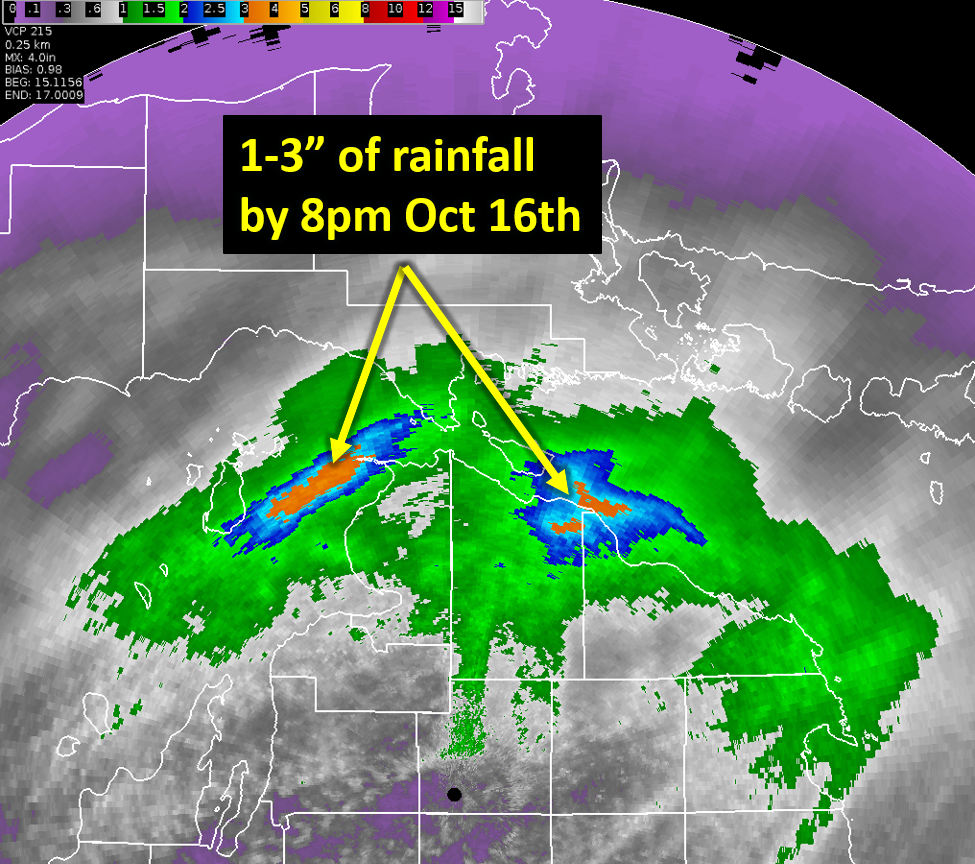 |
| KAPX Doppler Radar Estimated Rainfall Amounts October 16th, 2019 |
.JPG) |
 |
 |
 |
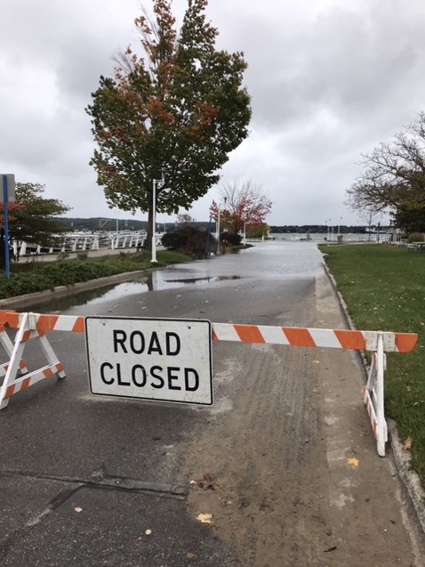
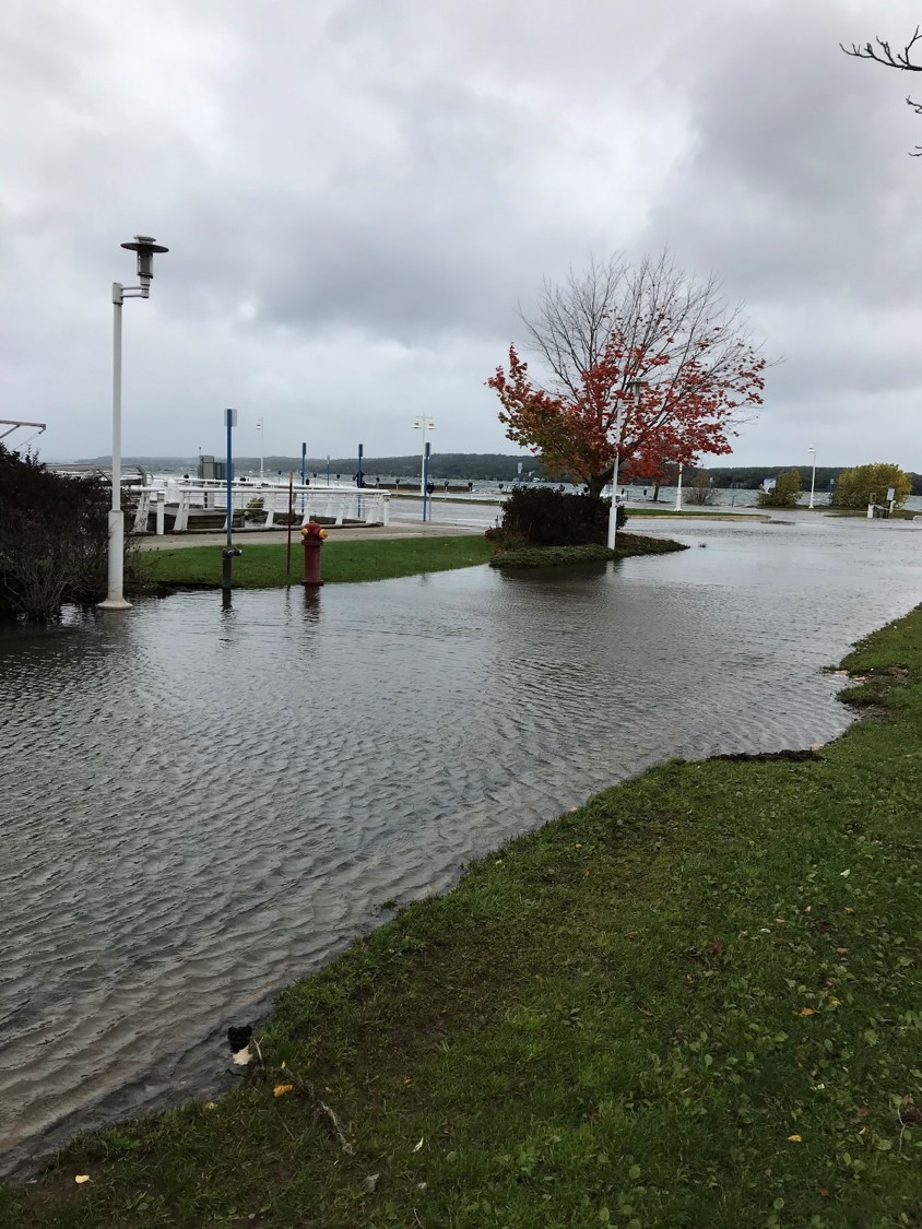
| Clinch Park - Traverse City, MI Matt Gillen |
Clinch Park - Traverse City, MI Matt Gillen |
Clinch Park - Traverse City, MI Matt Gillen |
Clinch Park - Traverse City, MI Matt Gillen |
 |
 |
 |
 |
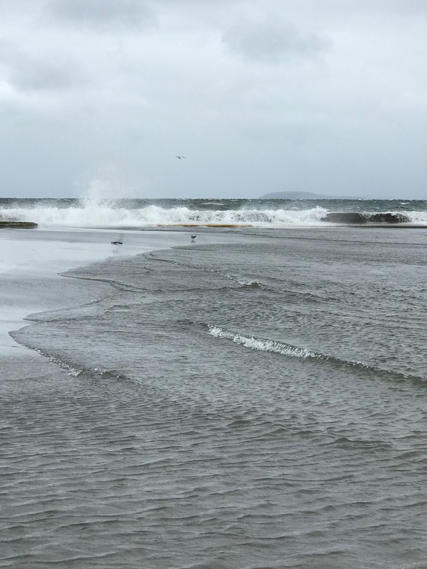
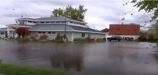
| Grand Traverse Yacht Club - Traverse City, MI Up North Live |
Beach Road - Frankfort, MI Marilyn Fries |
Grand View Parkway & Park Drive, Traverse City, MI Grand Traverse 911 |
Road at Fisherman's Island State Park - Charlevoix, MI Jon Pofahl |
 |
 |
 |
 |
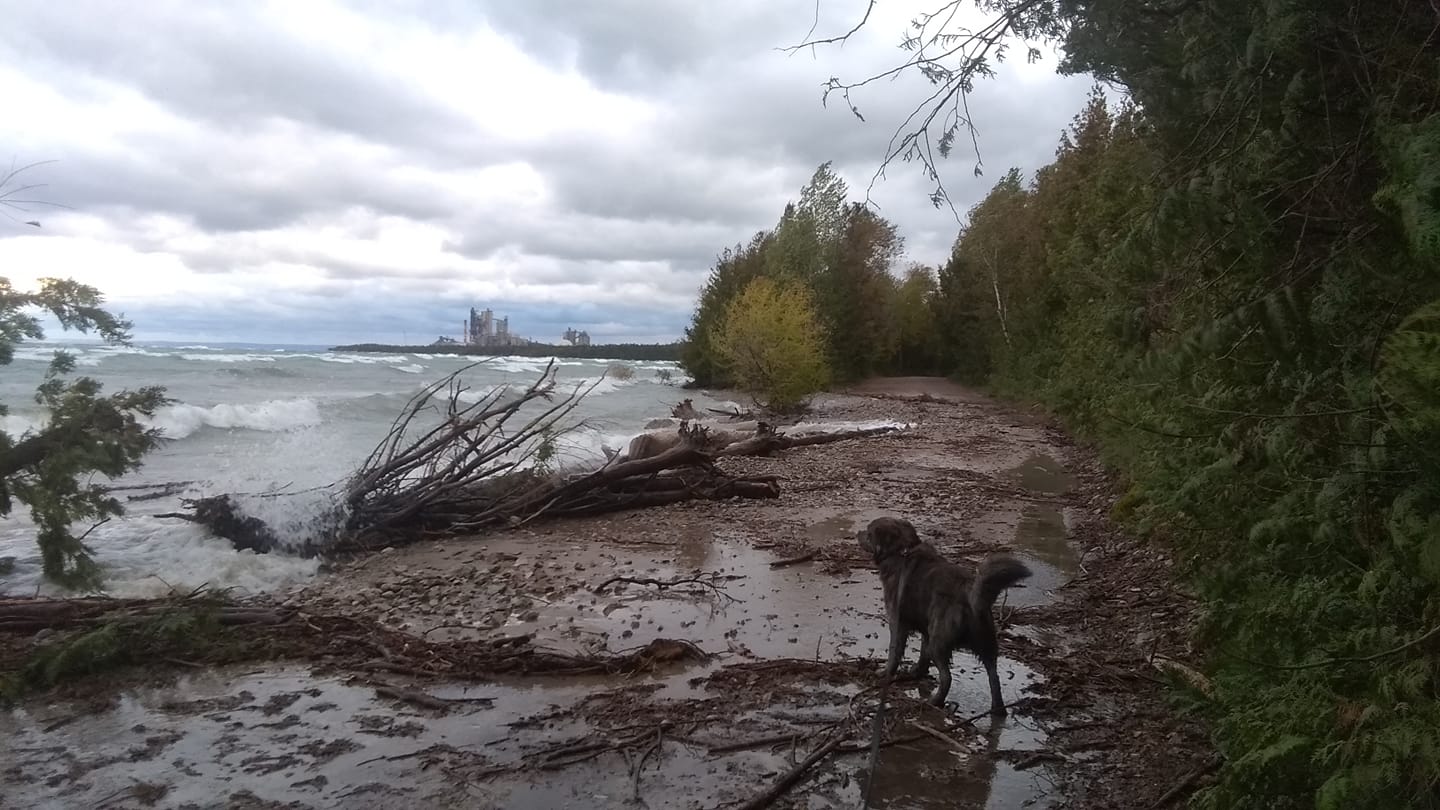
| Lakeshore Rd. - Manistee, MI Scott Fraley/News Advocate |
Lakeshore Rd. - Manistee, MI Scott Fraley/News Advocate |
Merkey Rd. - Manistee, MI Scott Fraley/News Advocate |
Merkey Rd. - Manistee, MI Scott Fraley/News Advocate |
 |
| 5th Avenue Beach - Manistee, MI Beverly Ann Wilkens |
Storm Reports
The following are preliminary storm reports from October 16th, 2019. Beach erosion and lakeshore flooding were reported along the Lake Michigan shoreline...mainly over northwest lower Michigan. Also included are the storm reports for high winds (the highest reported wind speed was 55 mph at Frankfort) and 24 hour precipitation reports.
_________________________________________________________________________
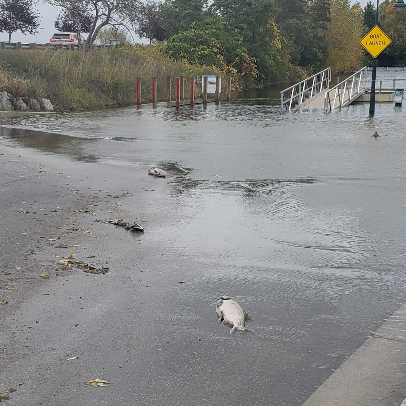
...LAKESHORE FLOODING REPORTS...
..TIME...   ...EVENT...      ...CITY LOCATION...     ...LAT.LON...
..DATE...   ....MAG....      ..COUNTY LOCATION..ST.. ...SOURCE....
            ..REMARKS..
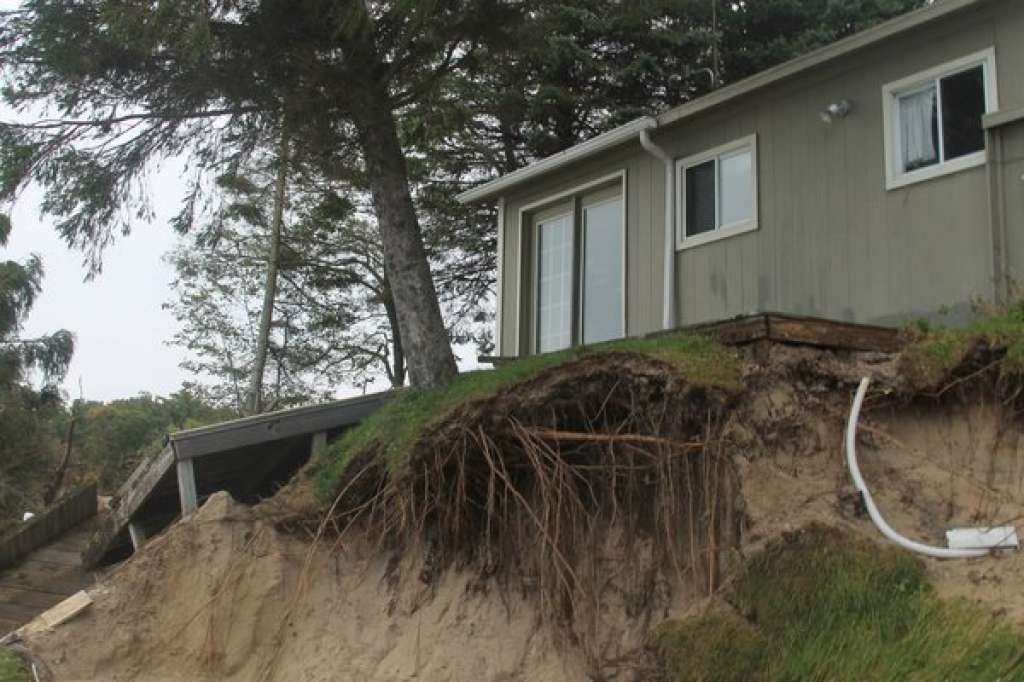
0900 AM     LAKESHORE FLOOD  2 NNW PARKDALE          44.29N 86.31W
10/16/2019                   MANISTEE           MI   PUBLIC

            STRONG NORTHERLY WIND AND WAVES LEAD TO
            SIGNIFICANT BEACH EROSION UP TO HOUSE
            FOUNDATION.
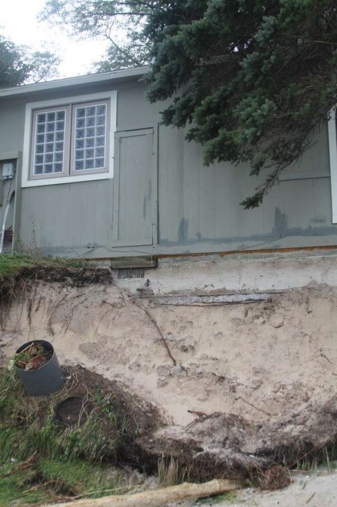
0900 AM     LAKESHORE FLOOD  5 N FRANKFORT           44.70N 86.23W
10/16/2019                   BENZIE             MI   PUBLIC

            BEACH EROSION NEAR HOUSE FROM LAKE MICHIGAN.
            DELAYED REPORT.
1237 PM     LAKESHORE FLOOD  3 E GREILICKVILLE       44.80N 85.58W
10/16/2019                   GRAND TRAVERSE     MI   BROADCAST MEDIA

            UPNORTHLIVE REPORTS PENINSULA DR. CLOSED
            BETWEEN MCKINLEY AND WILSON RDS. DUE TO WAVE
            EROSION THROUGH AT LEAST END-OF-DAY TODAY
            (WEATHER PERMITTING).
1240 PM     LAKESHORE FLOOD  1 NW TRAVERSE CITY      44.77N 85.62W
10/16/2019                   GRAND TRAVERSE     MI   BROADCAST MEDIA

            9&10 NEWS REPORTS EAST END OF MARINA DR.
            CLOSED THROUGH AT LEAST THURSDAY -- FLOODING
            DUE TO HIGH WAVES.
0234 PM     LAKESHORE FLOOD  1 SSE GREILICKVILLE     44.78N 85.64W
10/16/2019                   LEELANAU           MI   PUBLIC

            SOCIAL MEDIA POST/VIDEO OF PARKING LOT
            FLOODED AT GRAND TRAVERSE YACHT CLUB.
0251 PM     LAKESHORE FLOOD  1 NW MANISTEE           44.25N 86.34W
10/16/2019                   MANISTEE           MI   BROADCAST MEDIA

            SOCIAL MEDIA VIDEO OF FLOODING ON LAKESHORE
            DRIVE AT 5TH AVENUE BEACH.
___________________________________________________________________________

...HIGHEST WIND REPORTS...

These are the highest land-based wind gusts as of 5:00pm Oct 16 2019

Location                     Speed     Time/Date       Lat/Lon
Frankfort Light              55 MPH    0835 AM 10/16   44.63N/86.25W
Manistee                     49 MPH    0730 AM 10/16   44.26N/86.32W
Leland Harbor                48 MPH    0649 AM 10/16   45.02N/85.76W
6 NE Northport               46 MPH    0140 PM 10/16   45.21N/85.55W
Manistee - Blacker Airport   43 MPH    0618 AM 10/16   44.27N/86.25W
Mackinaw City, MI            42 MPH    0836 AM 10/16   45.78N/84.73W
Traverse City - Cherry Capit 41 MPH    0850 AM 10/16   44.73N/85.57W
30 E Presque Isle            40 MPH    0450 AM 10/16   45.35N/82.84W
1 SSE Naubinway              40 MPH    0240 PM 10/16   46.09N/85.44W

Observations are collected from a variety of sources with varying
equipment and exposures. We thank all volunteer weather observers
for their dedication. Not all data listed are considered official.
___________________________________________________________________________
THE FOLLOWING ARE 24HR RAINFALL TOTALS FROM LOCATIONS IN OUR FORECAST AREA.

NOTE: ONLY RAINFALL TOTALS EXCEEDING 1 INCH WERE INCLUDED.


..TIME...   ...EVENT...      ...CITY LOCATION...     ...LAT.LON...
..DATE...   ....MAG....      ..COUNTY LOCATION..ST.. ...SOURCE....
            ..REMARKS..

0104 PM     HEAVY RAIN       4 WSW RACO              46.36N 84.80W
10/16/2019  M1.81 INCH       CHIPPEWA           MI   MESONET

            MESONET STATION RACM4 4 W RACO.

0114 PM     HEAVY RAIN       1 SW KINCHELOE          46.24N 84.51W
10/16/2019  M1.80 INCH       CHIPPEWA           MI   MESONET

            MESONET STATION RYDM4 RUDYARD.

0204 PM     HEAVY RAIN       7 ENE CHEBOYGAN         45.66N 84.33W
10/16/2019  M1.78 INCH       CHEBOYGAN          MI   MESONET

            MESONET STATION CW3699 CHEBOYGAN.

0156 PM     HEAVY RAIN       1 SSE KINROSS           46.25N 84.47W
10/16/2019  M1.71 INCH       CHIPPEWA           MI   AWOS

            AWOS STATION KCIU KINROSS - CHIPPEWA COUNTY
            INTERNATIONAL ARPT.

0159 PM     HEAVY RAIN       17 ESE GOETZVILLE       46.00N 83.75W
10/16/2019  M1.59 INCH       CHIPPEWA           MI   AWOS

            AWOS STATION KDRM DRUMMOND ISLAND.

0127 PM     HEAVY RAIN       2 ENE TROUT LAKE        46.19N 84.98W
10/16/2019  M1.57 INCH       CHIPPEWA           MI   MESONET

            MESONET STATION TRLM4 TROUT LAKE.

1255 PM     HEAVY RAIN       1 S SAULT STE. MARIE    46.47N 84.37W
10/16/2019  M1.27 INCH       CHIPPEWA           MI   AWOS

            AWOS STATION KANJ SAULT STE MARIE -
            MUNICIPAL AIRPORT.

0113 PM     HEAVY RAIN       1 E GARNET              46.15N 85.27W
10/16/2019  M1.25 INCH       MACKINAC           MI   MESONET

            MESONET STATION REXM4 1 WNW REXTON.

0154 PM     HEAVY RAIN       1 WNW PELLSTON          45.57N 84.80W
10/16/2019  M1.22 INCH       EMMET              MI   ASOS

            ASOS STATION KPLN PELLSTON - RGNL AIRPORT OF
            EMMET COUNTY.

0200 PM     HEAVY RAIN       ROGERS CITY             45.42N 83.81W
10/16/2019  M1.13 INCH       PRESQUE ISLE       MI   MESONET

            MESONET STATION CW4114 ROGERS CITY.

0201 PM     HEAVY RAIN       3 S PLEASANT VIEW       45.48N 84.93W
10/16/2019  M1.05 INCH       EMMET              MI   MESONET

            MESONET STATION DW7032 NEW HAVEN.
 |
Media use of NWS Web News Stories is encouraged! Please acknowledge the NWS as the source of any news information accessed from this site. |
|

