
High swim risk is in place for Manistee, Alcona, and Iosco county beaches today. Read More >
Overview
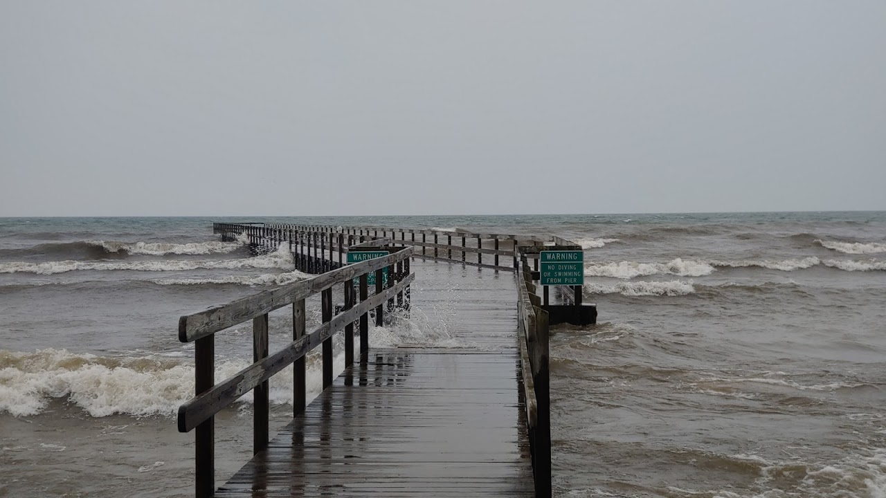
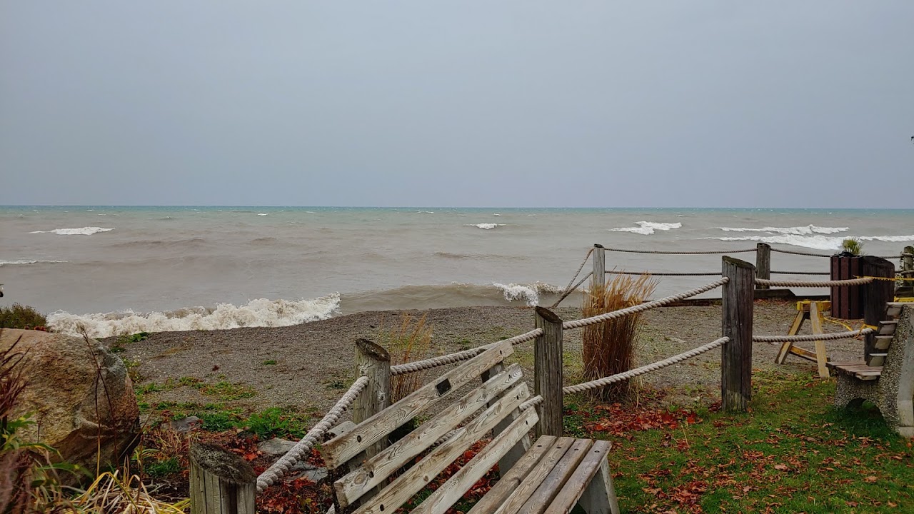
A strong 998mb low pressure system moved through the upper Mississippi Valley on Monday, causing intense southeasterly winds as the system tracked toward Western Lake Superior. Gusty winds ramped up over Lake Huron on Monday morning with sustained winds of 25 - 30 mph and gusts mainly between 40 and 50 mph. This caused large waves to pound the beaches, piers and breakwalls on the Lake Huron shoreline. Damage occurred in numerous places, in particular M-185 on Mackinac Island. A band of light to moderate rain swept across the area from southwest to northeast, with many locations receiving rain off and on throughout the afternoon and evening. Drier air worked its way in overnight, giving us a brief break in precipitation. An occluded front also crossed the area Monday night, switching winds around to southerly and eventually southwesterly. This brought the same threats over to the Lake Michigan side on Tuesday. High waves in conjunction with already high lakes levels caused beach erosion, flooding and some property damage, notably to Empire Beach and Bar Lake Access Beach. Wrap-around precipitation moved in again on Tuesday, but overall 48-hr total rainfall amounts were half and inch or less.
Lakeshore Flooding and Erosion Pictures:
 |
 |
 |
 |
|
Bayview Park - Alpena, MI Sabrina Jauernic |
Blair Street Park - Alpena, MI Sabrina Jauernic |
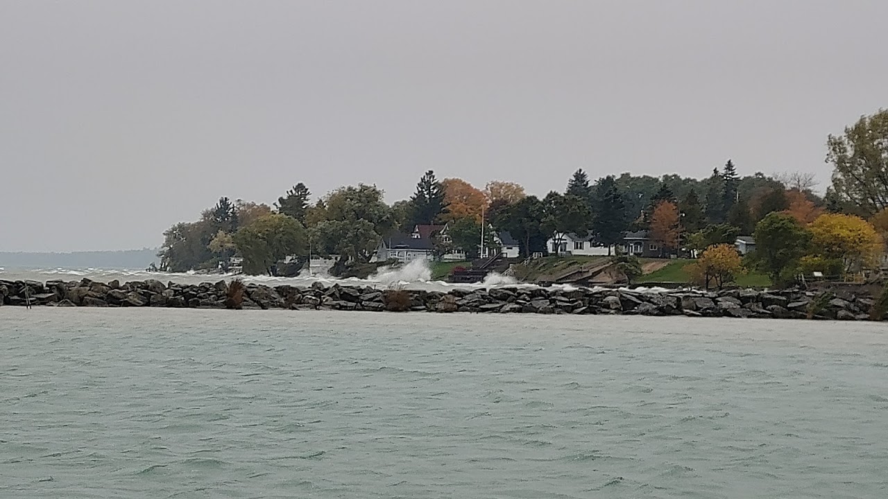
East Main St. - Harrisville, MI Sabrina Jauernic |
East Main St. - Harrisville, MI Sabrina Jauernic |
 |
 |
 |
 |
|
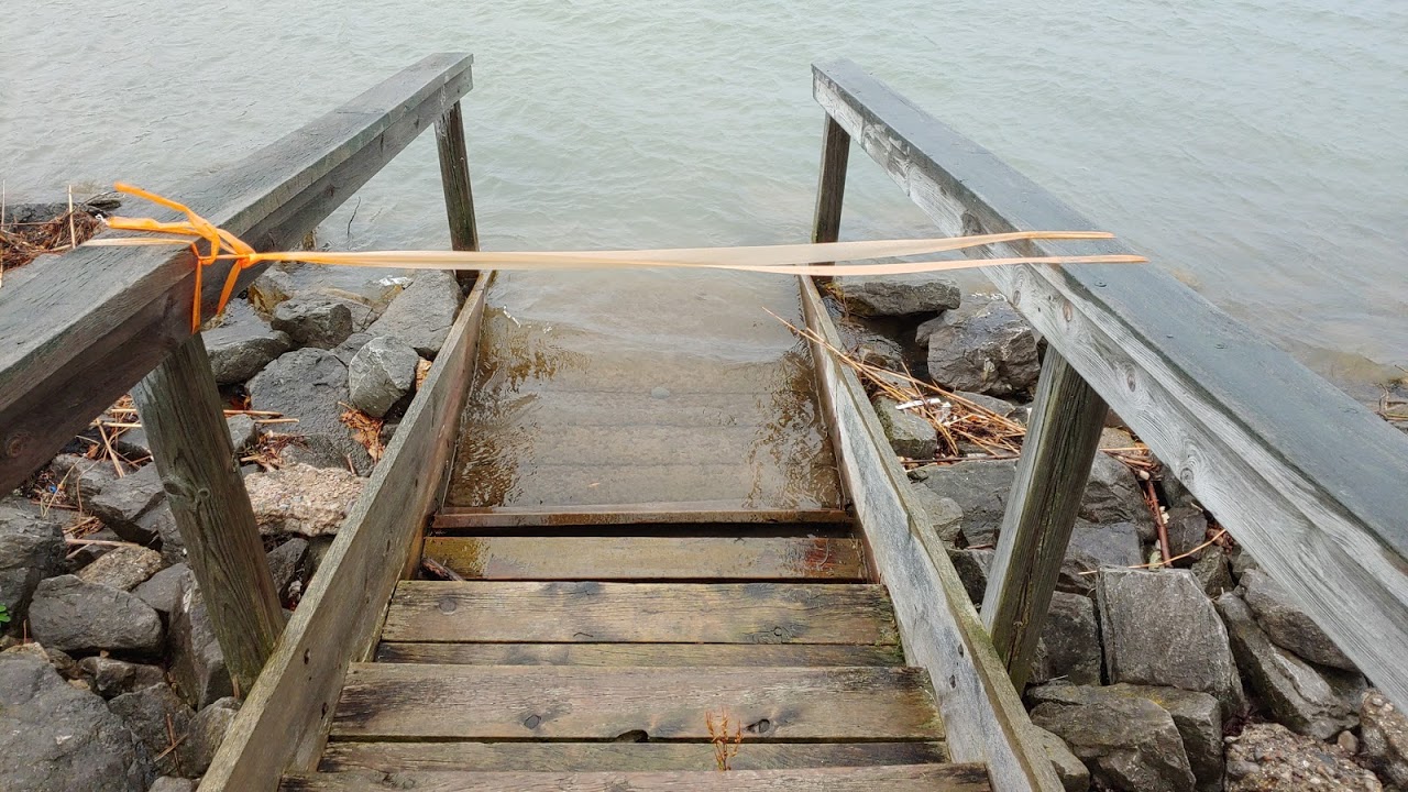
Flooded Stairs in Harbor - Harrisville, MI Sabrina Jauernic |
Waves Crashing Onshore - Harrisville, MI Sabrina Jauernic |
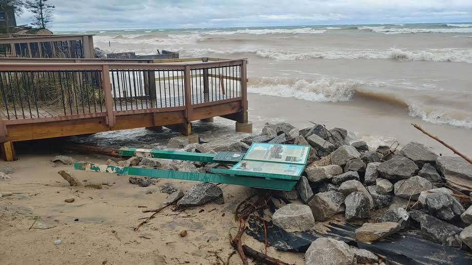
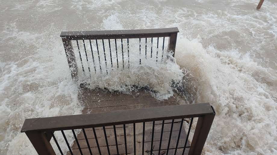
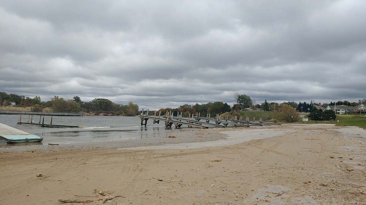
Bar Lake Access Beach - North of Manistee, MI Sabrina Jauernic |
Bar Lake Access Beach Platform Deterioration - North of Manistee, MI Sabrina Jauernic |
 |
 |
 |
 |
|
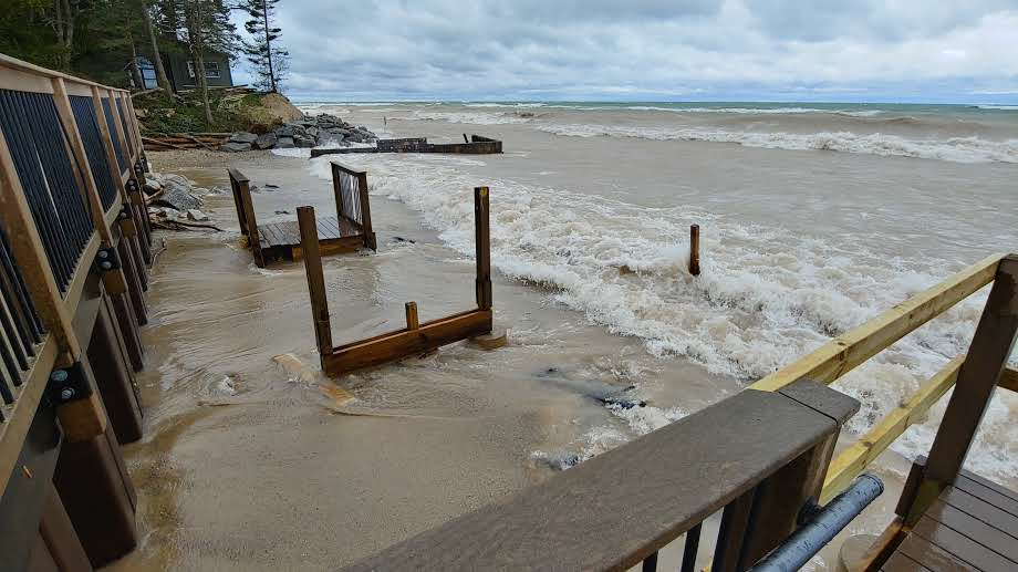
Bar Lake Access Beach Platform - North of Manistee, MI Sabrina Jauernic |
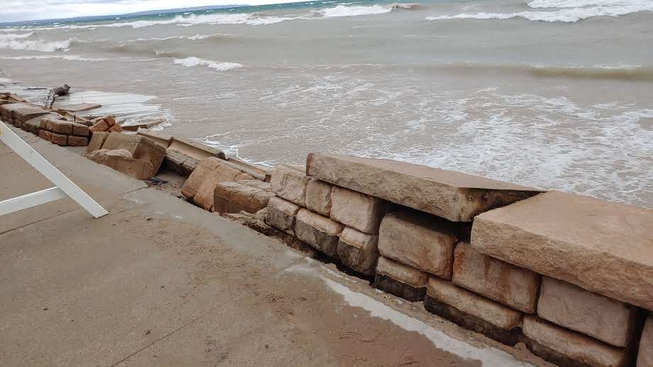
Seawall Deterioration - House near Bar Lake Access Beach Sabrina Jauernic |
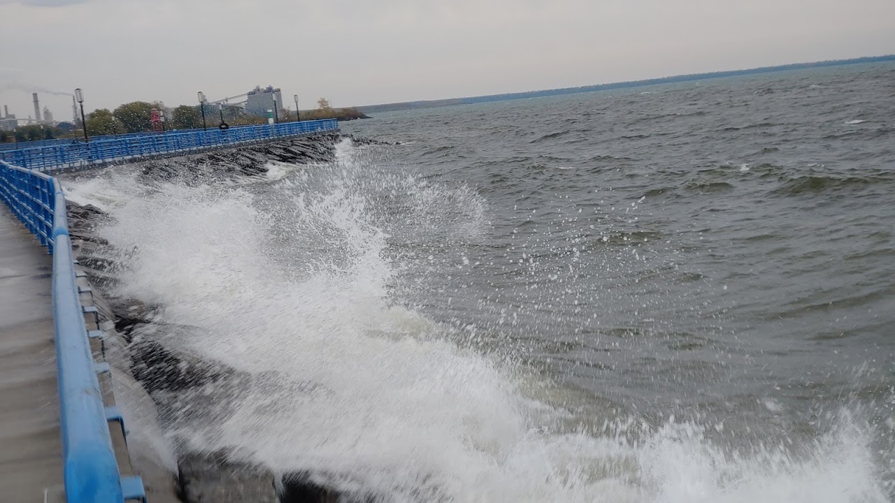
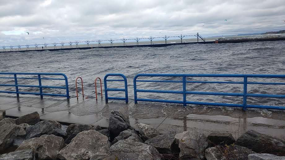
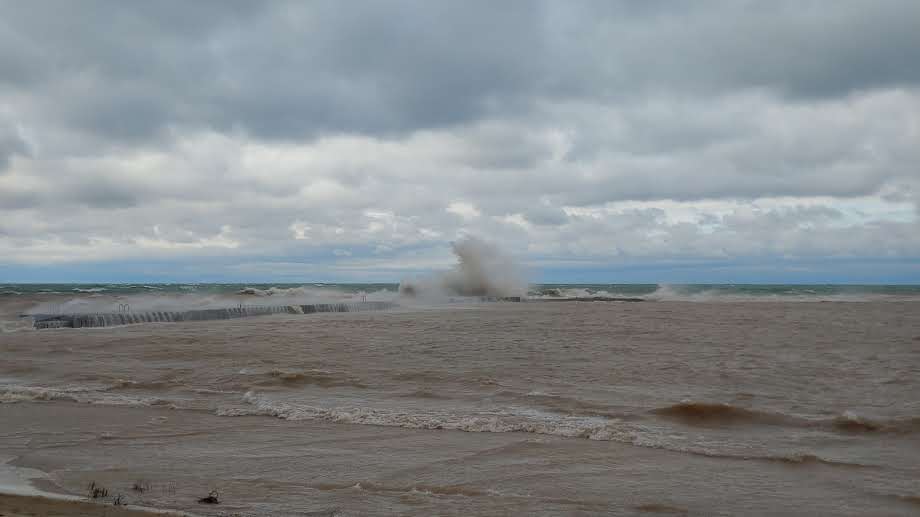
Manistee River pier - Manistee Harbor Sabrina Jauernic |
Waves crashing over south seawall - Manistee Harbor Sabrina Jauernic |
 |
 |
 |
 |
|
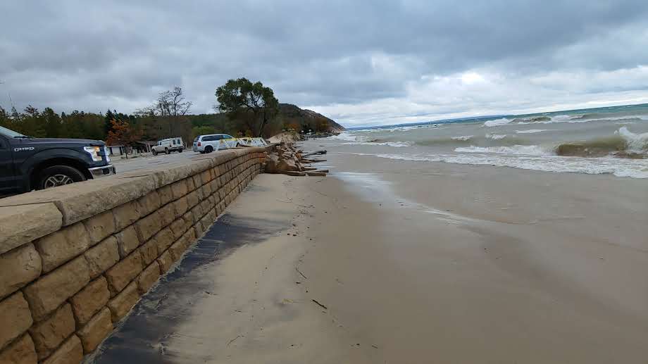
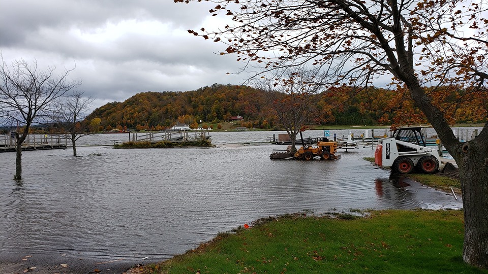
Manistee Harbor Parking Lot Sabrina Jauernic |
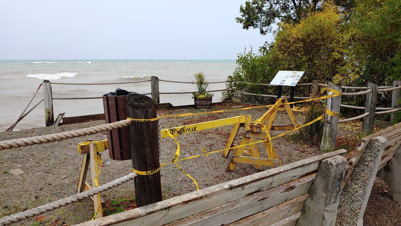
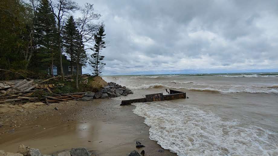
Wall Deterioration - Empire, MI Sabrina Jauernic |
Wall Deterioration - Empire, MI Sabrina Jauernic |
Boat Dock Erosion and Debris - Empire, MI Sabrina Jauernic |
 |
 |
 |
 |
|
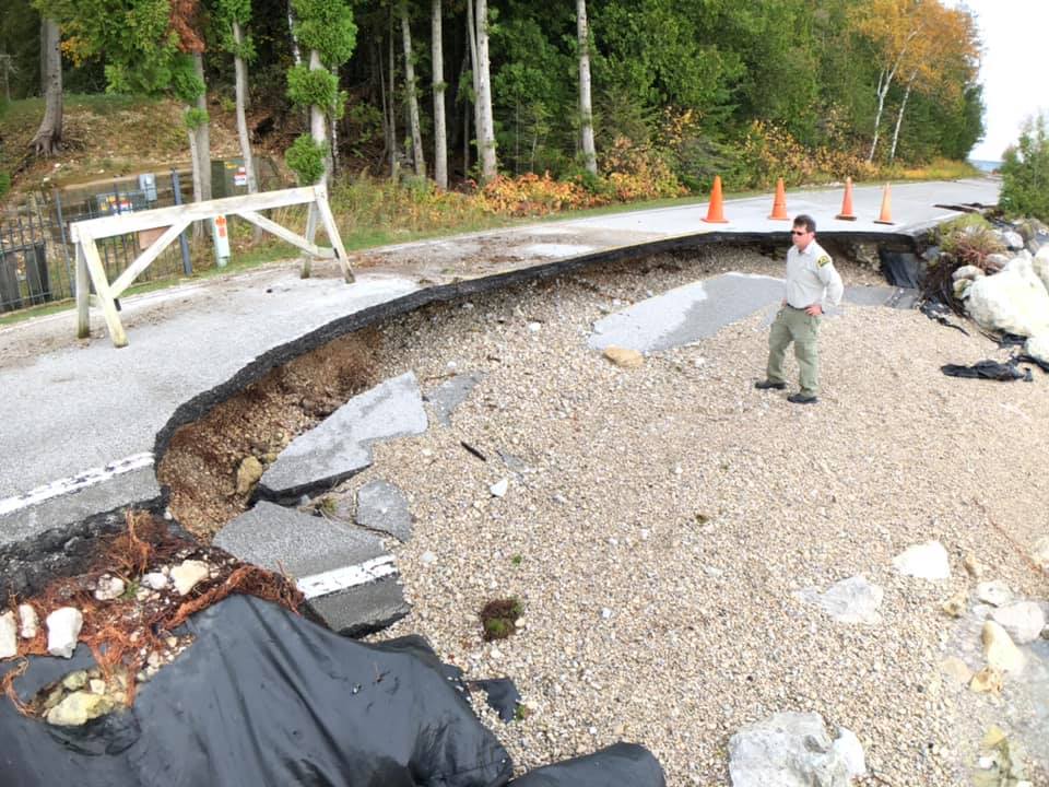
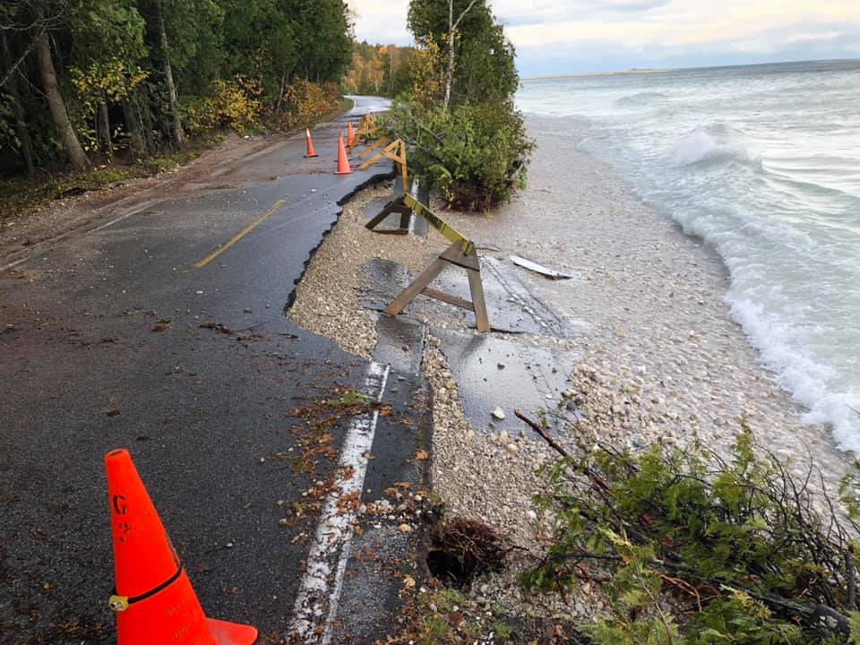
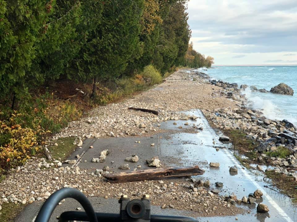
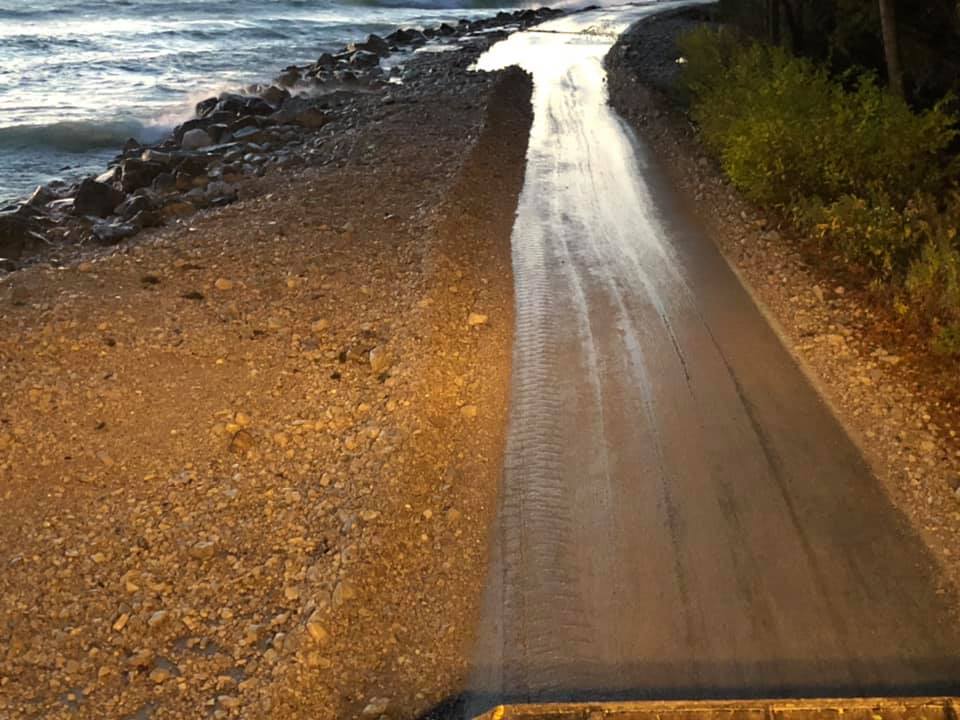
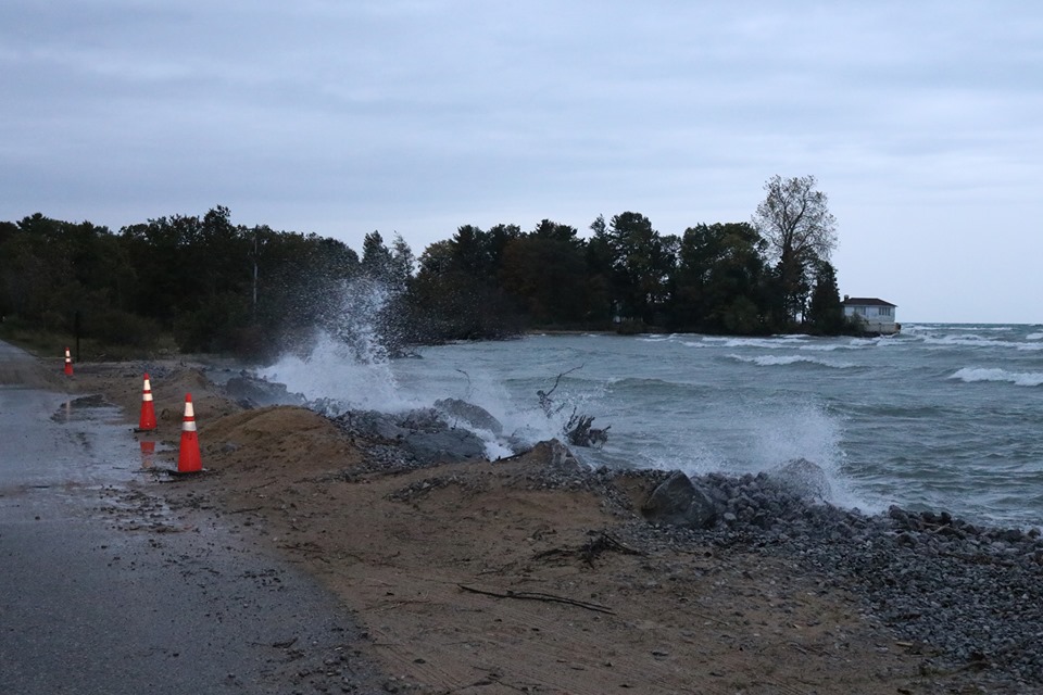
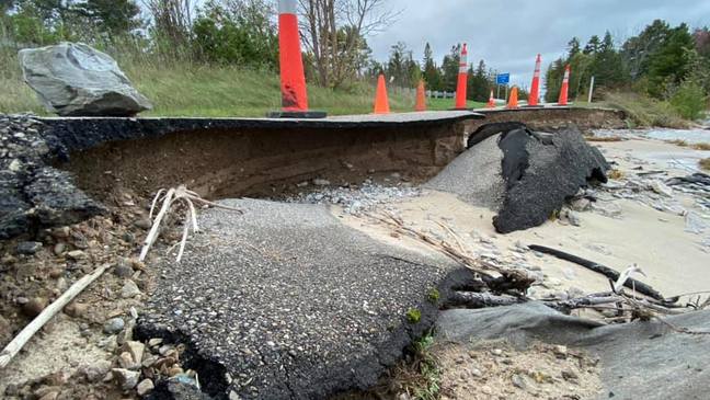
M-185 Erosion - Mackinac Island Robert McGreevy |
M-185 Erosion - Mackinac Island Robert McGreevy |
M-185 Erosion - Mackinac Island Robert McGreevy |
M-185 Erosion - Mackinac Island Robert McGreevy |
 |
 |
 |
 |
|
Harbor Parking Lot - Frankfort, MI Joe Green |
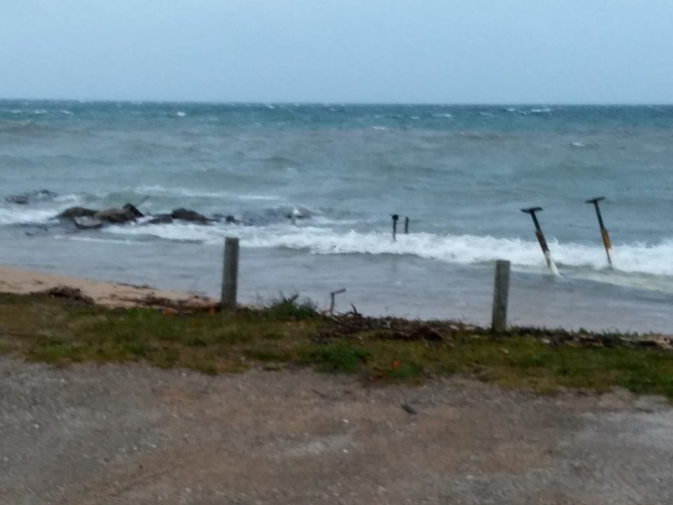
Haserot Beach Pier Damage - Old Mission, MI Pamela Montague-VanderMey |
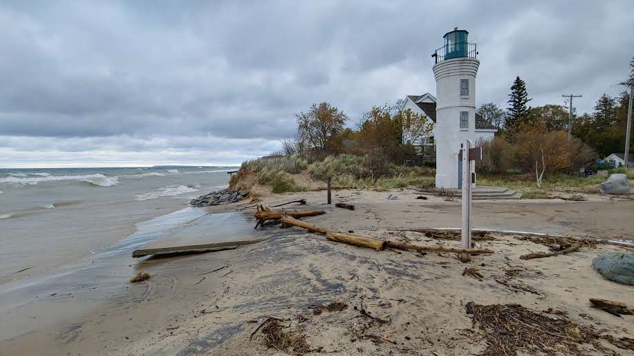
Tawas Point State Park Andrew Kent |
Little Traverse Wheelway bikepath near Burgess Rd UpNorthLive |
Storm Reports
The following are preliminary storm reports from October 21st - October 22nd, 2019. Beach erosion and lakeshore flooding were reported along both the Lake Michigan and Lake Huron shorelines. Also included are the storm reports for high winds (the highest reported wind speed was 57 mph at Frankfort).
_________________________________________________________________________
...LAKESHORE FLOODING REPORTS...
..TIME...   ...EVENT...      ...CITY LOCATION...     ...LAT.LON...
..DATE...   ....MAG....      ..COUNTY LOCATION..ST.. ...SOURCE....
            ..REMARKS..

0115 PM     Coastal Flood    2 NW BAYSHORE           45.37N 85.13W
10/22/2019                   Charlevoix         MI   Broadcast Media

            Broadcast media reported portions of Little
            Traverse Wheelway bike path crumbline due to
            beach erosion.


0800 AM     Coastal Flood    Black River             44.82N 83.30W
10/22/2019                   Alcona             MI   Public

            Report w/photo on Facebook of beach erosion
            at Black River. Time is approximated from
            time photo was posted.


1030 PM     Coastal Flood    5 SSW Tawas City        44.20N 83.56W
10/21/2019                   Iosco              MI   Public

            Delayed report from Facebook -- 1.5-2 feet
            of stone covering beach; dock planks, trees
            washed away; estimated 20 feet of beach
            erosion. Lakeshore flooding occurred over a
            lengthy time period.


0700 PM     Coastal Flood    1 SSE Alpena            45.06N 83.43W
10/21/2019                   Alpena             MI   Public

            Delayed report from Facebook -- bike path in
            Alpena covered in sand and underwater in
            places. Time estimated from photo.


0600 PM     Coastal Flood    1 ENE Mackinac Island   45.87N 84.61W
10/21/2019                   Mackinac           MI   Dept of Highways

            MDOT reports M-185 on Mackinac Island (mile
            marker 1.5 to 4.5) washed out from coastal
            flooding/erosion on October 21st. Delayed
            report, time estimated.


0600 PM     Coastal Flood    1 S Old Mission         44.96N 85.48W
10/21/2019                   Grand Traverse     MI   Public

            Report w/photo from Facebook of dock washed
            out and waves up to wooden posts in parking
            lot at Haserot Beach, Old Mission. Time
            estimated from photo.


0500 PM     Coastal Flood    3 SE East Tawas         44.26N 83.44W
10/21/2019                   Iosco              MI   Public

            Sand/rocks into roadway on road to Tawas
            Point State Park beach/lighthouse. Report
            w/photo on Facebook. Time estimated from
            photo.


0315 PM     Coastal Flood    Northport               45.13N 85.61W
10/21/2019                   Leelanau           MI   Public

            Dock damaged and boat house flooded. Water
            over docks at G. Marsten Dame Marina.


0400 PM     Lakeshore Flood  Frankfort               44.63N 86.24W
10/22/2019                   Benzie             MI   Public

            Parking lot flooding next to Betsie Lake in
            Frankfort. Report w/photo on Facebook. Time
            estimated from photo.


0400 PM     Lakeshore Flood  1 E Harrisville         44.66N 83.29W
10/21/2019                   Alcona             MI   NWS Employee

            Overlook at the end of East Main Street
            damaged and eroded.


0300 PM     Lakeshore Flood  3 N Manistee            44.30N 86.31W
10/21/2019                   Manistee           MI   NWS Employee

            Wooden deck overlook and signage at Bar Lake
            Access Beach severely damaged.
___________________________________________________________________________

...HIGHEST WIND REPORTS...
...HIGHEST WIND REPORTS FOR OCT 21 AND 22 2019...

LOCATION                     SPEED     TIME/DATE       LAT/LON
FRANKFORT LIGHT              57 MPH    0230 PM 10/21   44.63N/86.25W
13 SSW BREVORT               49 MPH    0230 PM 10/21   45.84N/85.14W
WHITEFISH POINT              48 MPH    0840 PM 10/21   46.76N/84.97W
DE TOUR VILLAGE, MI          47 MPH    0806 PM 10/21   45.99N/83.90W
MANISTEE                     47 MPH    0440 PM 10/22   44.25N/86.34W
TRAVERSE CITY - CHERRY CAPIT 47 MPH    0251 PM 10/21   44.73N/85.57W
ELMWOOD TOWNSHIP MARINA      45 MPH    0240 PM 10/21   44.79N/85.63W
MACKINAC ISLAND              45 MPH    0419 PM 10/21   45.85N/84.63W
MACKINAW CITY, MI            45 MPH    0236 PM 10/21   45.78N/84.73W
KINROSS - CHIPPEWA COUNTY IN 44 MPH    0934 PM 10/21   46.25N/84.47W
GAYLORD - OTSEGO COUNTY AIRP 44 MPH    0423 PM 10/21   45.02N/84.68W
GAYLORDNWS; GAYLORD          44 MPH    0409 PM 10/21   44.91N/84.72W
FRANKFORT - DOW MEMORIAL FIE 44 MPH    0238 PM 10/21   44.63N/86.20W
30 E PRESQUE ISLE            43 MPH    0650 PM 10/21   45.35N/82.84W
27 NE PORT HOPE              43 MPH    1250 AM 10/22   44.28N/82.42W
1 SSE NAUBINWAY              43 MPH    0640 PM 10/21   46.09N/85.44W
6 NE NORTHPORT               43 MPH    0940 PM 10/22   45.21N/85.55W
LELAND HARBOR                43 MPH    0355 PM 10/22   45.02N/85.76W
POINT IROQUOIS, MI           43 MPH    0806 PM 10/21   46.48N/84.63W
TAWAS POINT                  43 MPH    0505 PM 10/21   44.25N/83.46W
RUDYARD                      42 MPH    1014 PM 10/21   46.24N/84.51W
SAULT STE MARIE - MUNICIPAL  40 MPH    0905 PM 10/21   46.47N/84.37W
12 E ALPENA                  40 MPH    0550 PM 10/21   45.03N/83.19W
DRUMMOND ISLAND              39 MPH    0817 PM 10/21   46.00N/83.75W
HOUGHTON LAKE - ROSCOMMON CO 39 MPH    0539 PM 10/21   44.35N/84.67W
BELLARIE - ANTRIM COUNTY ARP 39 MPH    0356 PM 10/21   44.98N/85.20W
PELLSTON - RGNL AIRPORT OF E 39 MPH    0354 PM 10/21   45.57N/84.80W
CADILLAC - WEXFORD COUNT ARP 39 MPH    0335 PM 10/21   44.27N/85.42W

OBSERVATIONS ARE COLLECTED FROM A VARIETY OF SOURCES WITH VARYING
EQUIPMENT AND EXPOSURES. WE THANK ALL VOLUNTEER WEATHER OBSERVERS
FOR THEIR DEDICATION. NOT ALL DATA LISTED ARE CONSIDERED OFFICIAL.
___________________________________________________________________________
 |
Media use of NWS Web News Stories is encouraged! Please acknowledge the NWS as the source of any news information accessed from this site. |
|

