Gaylord, MI
Weather Forecast Office
 |
 |
 |
 |
| Here is a look at some New Year's weather statistics for Traverse City*, with data going back to 1897. As can be seen in the data below, there has been a wide spectrum of temperatures and precipitation on New Year's Day in Traverse City, but highs have generally been in the 30s and lows in the teens/20s. It is also fairly common for Traverse City to see measurable snowfall on New Year's Day. Traverse City New Year's Day Climate Extremes (1897-2025): Warmest High Temperature: 55 degrees (1903) Coldest High Temperature: 12 degrees (1999, 1968) Coldest Low Temperature: -7 degrees (1982, 1968) Warmest Low Temperature: 35 degrees (1921) Most Precipitation: 1.00 inches (1898) Most Snowfall: 10.0 inches (1898) Greatest Snow Depth: 29 inches (1904) Traverse City New Year's Day Climate Averages (1897-2025): Average High Temperature: 30 degrees Average Low Temperature: 18 degrees Average Precipitation: 0.07 inches Average Snowfall: 0.9 inches Average Snow Depth: 7 inches Below are graphs showing the frequency distribution of New Year's Day high/low temperatures, precipitation, and snowfall for Traverse City. Click here for a full listing of Traverse City's New Year's Day climate records. 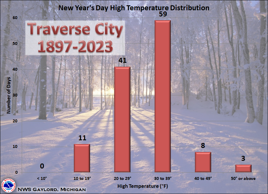 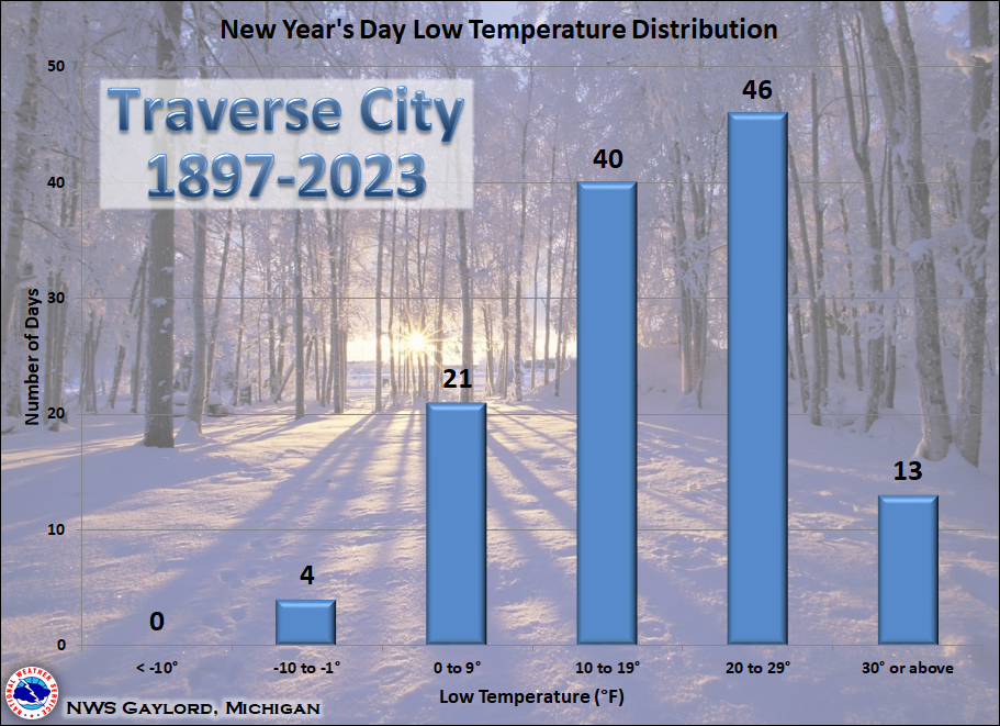 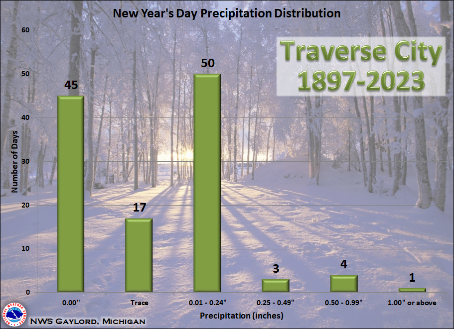 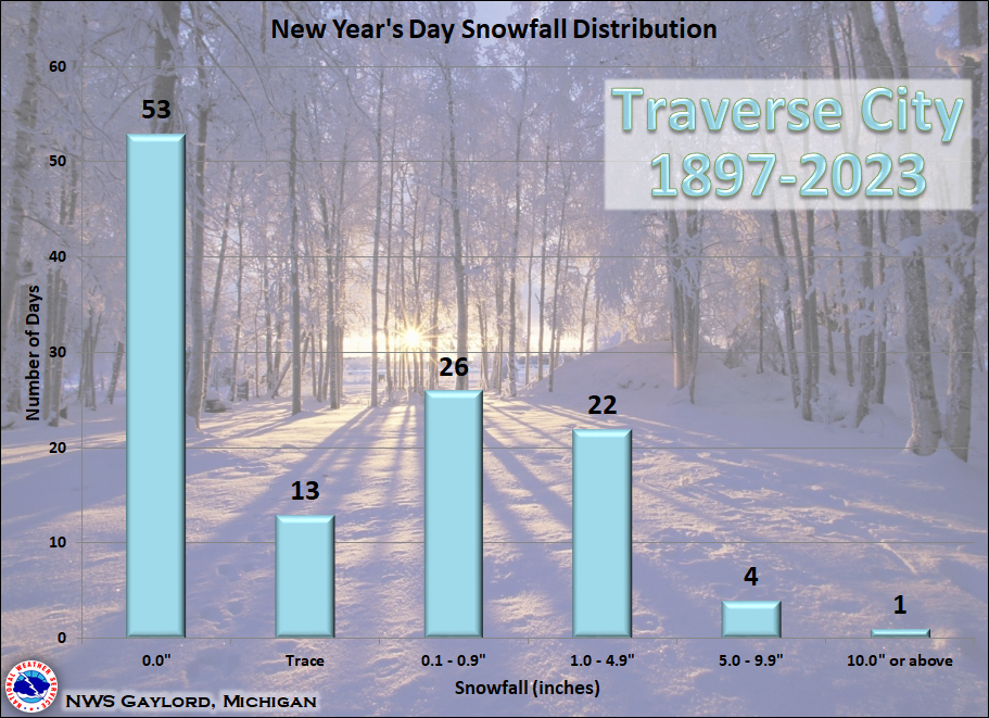 |
*Data for Traverse City is derived from a composite of observations taken at both Cherry Capital Airport and the cooperative observing station at Munson Medical Center. This data is for informational purposes only and does not meet climatological standards. This data set may include periods with missing data.
Local Information
Area Information
Office Webcam
Forecast
Recreational
Great Lakes/Marine
NWS DSS Table
Beach/Surf
Text Products

US Dept of Commerce
National Oceanic and Atmospheric Administration
National Weather Service
Gaylord, MI
8800 Passenheim Road
Gaylord, MI 49735-9454
989-731-3384
Comments? Questions? Please Contact Us.


 Follow us on X
 Follow us on Facebook
 Follow us on YouTube
 APX RSS Feed