Overview
|
An area of low pressure stalled across the Great Lakes region and brought a prolonged period of steady rainfall from Sunday, May 17th through Monday, May 18th. Despite a lack of extraordinarily high rainfall rates, simple persistence of steady rain resulted in significant rainfall totals, along with significant rises on area rivers (historic for some). In addition, gusty east winds accompanied this system, which brought increased lakeshore flooding concerns to portions of northeast lower Michigan coastline. |
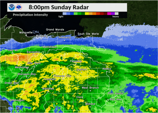 Radar Loop 8:00 PM May 17th - 2:00 AM May 19th, 2020 |
Flooding:
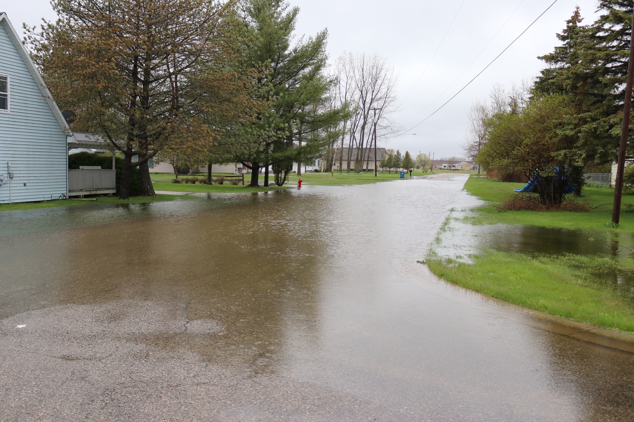
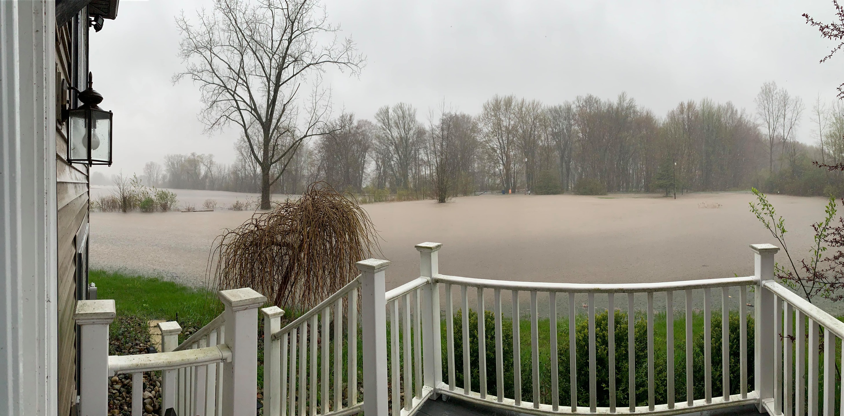
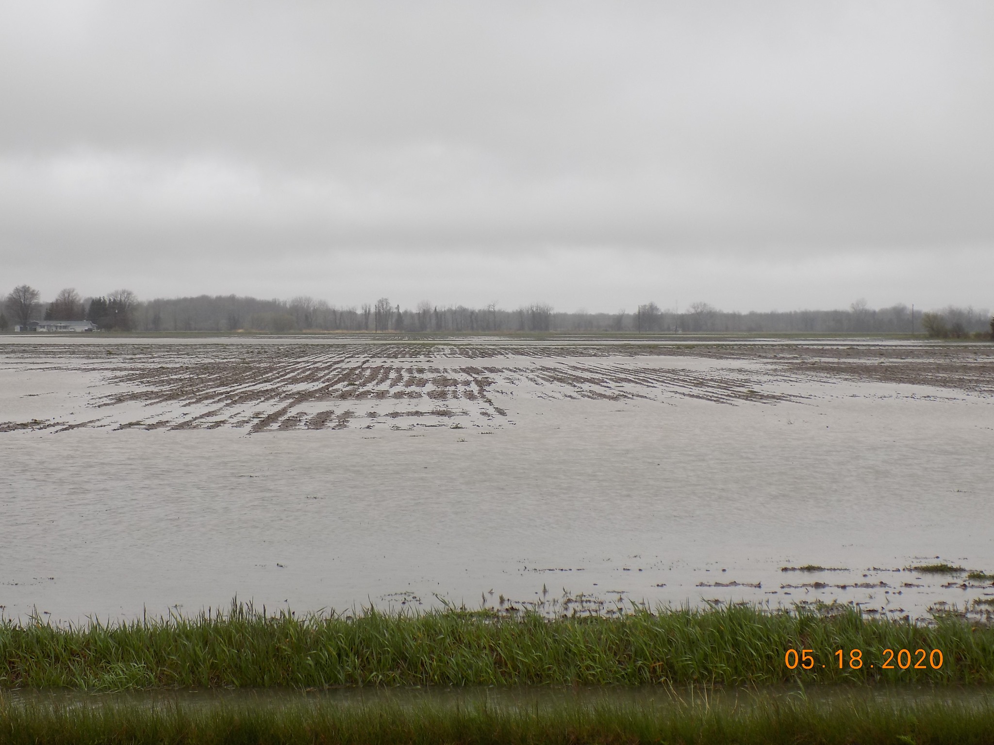
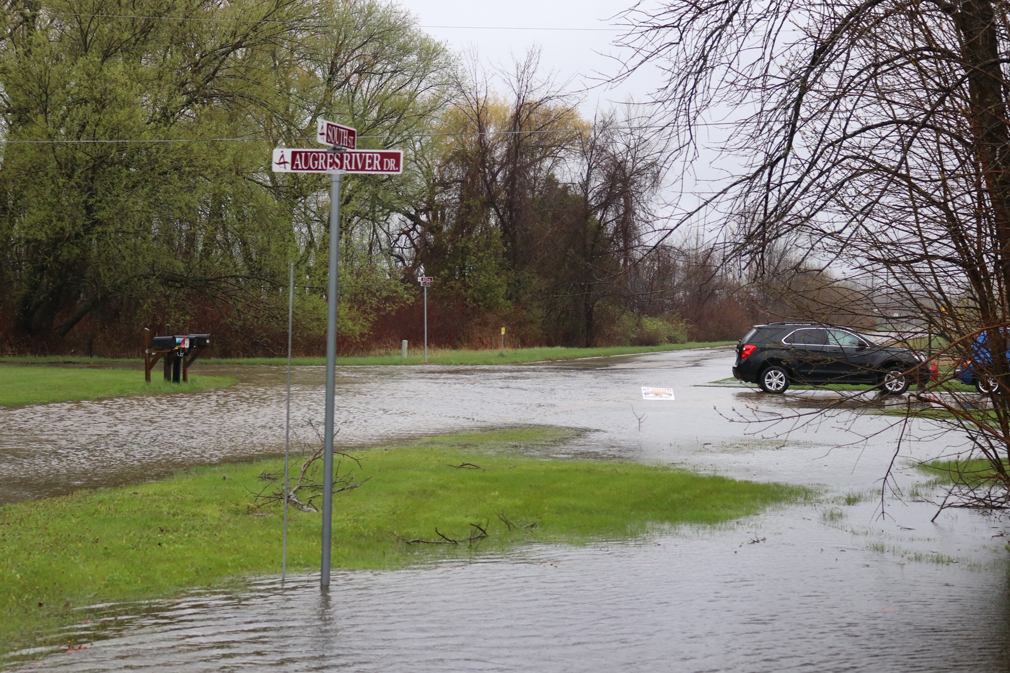
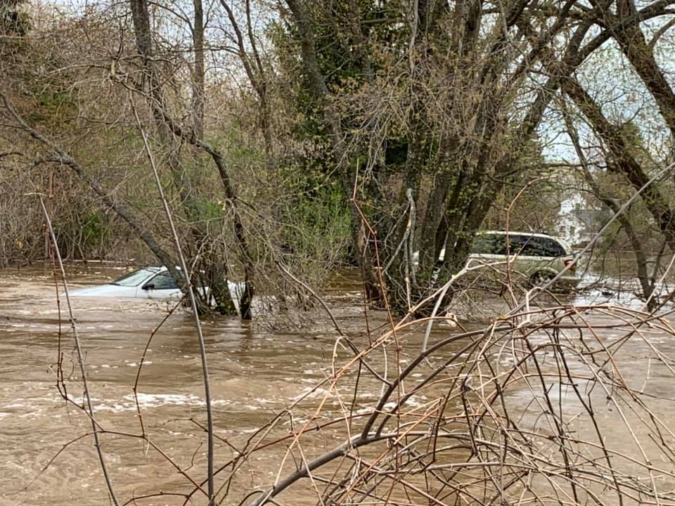
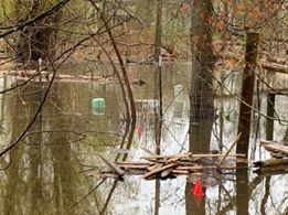
While localized flooding was reported across various locations of northern Michigan, the most widespread and threatening flooding occurred across portions of Gladwin and Arenac counties.
 |
|
 |
 |
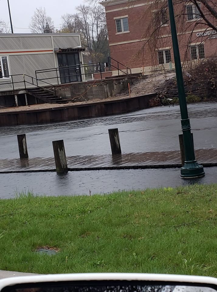
| Standish, MI Near Rifle River Courtesy of Heather Conn |
Au Gres, MI Courtesy of Andrew V. Kent |
Au Gres, MI Courtesy of Andrew V. Kent |
Au Gres, MI Courtesy of Andrew V. Kent |
 |
 |
 |
 |
| Dead Creek near Tawas, MI Courtesy of Michelle Kiddler |
Traverse City, MI Courtesy of Mary Nykerk |
Traverse City, MI Courtesy of Richard J. Piechowski |
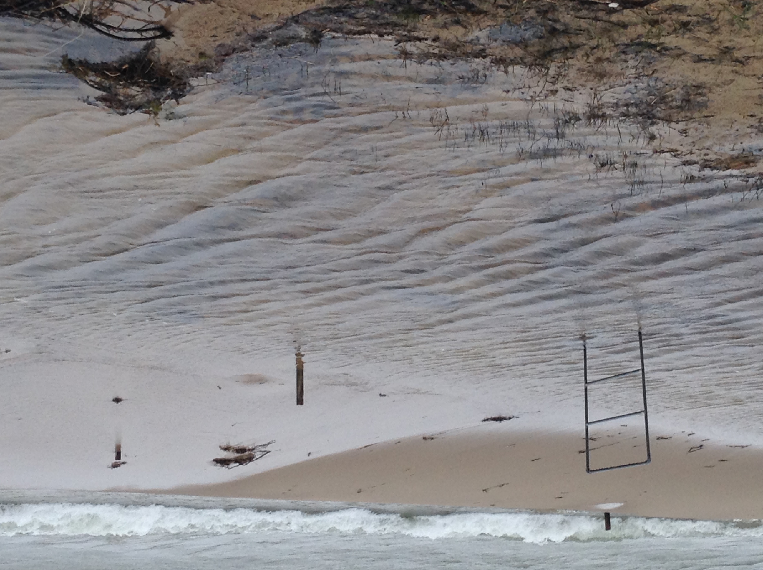
Harrisville, MI Lakeshore Flooding Courtesy of Stan Darmofal |
River Information
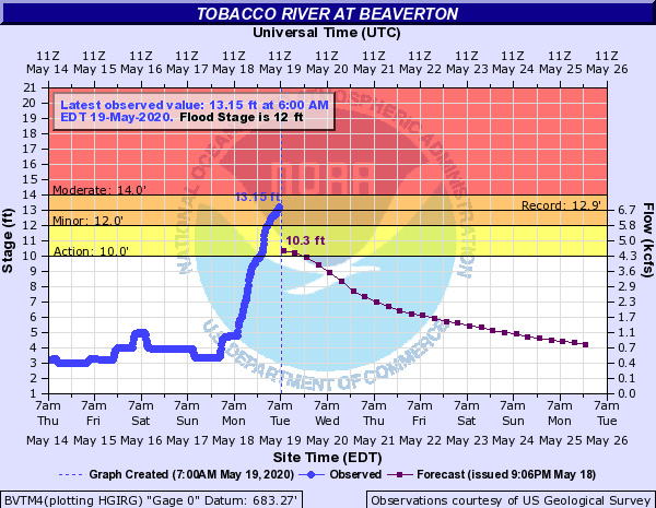
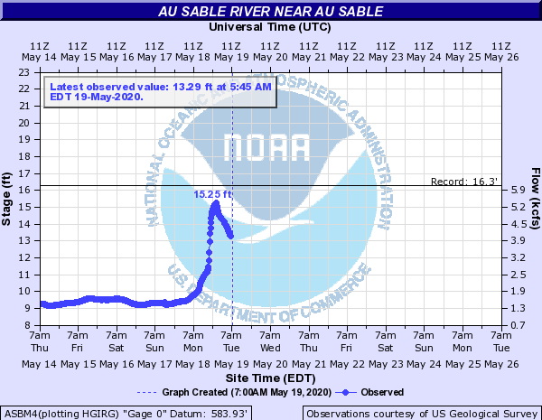
Many rivers across northern Michigan saw a spike in levels in response to the prolonged period of rainfall. Most notable was the Rifle River with the following gage near Sterling, MI showing a new record level of more than 15 feet, more than a foot above the old record of 13.7 feet recorded on March 28th, 1950.
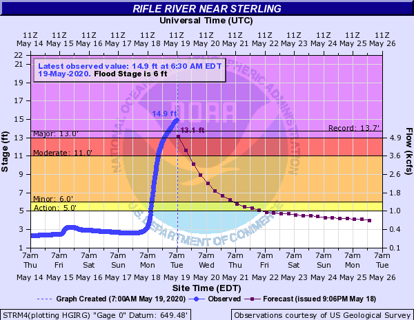
Rifle River new record crest of more than15 feet, exceeding the previous record of 13.7 feet on March 28th, 1950.
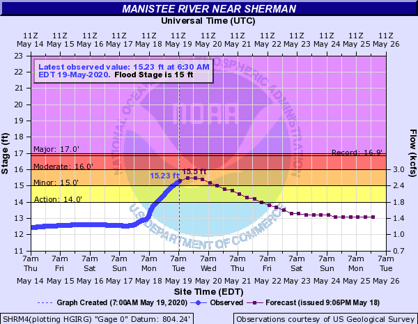
Additional rivers and their associated spike are included below.
 |
|
 |
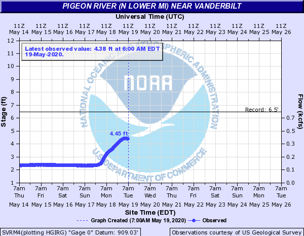 |
| Manistee River near Sherman, MI | Tobacco River at Beaverton, MI | Au Sable River near AuSable, MI | Pigeon River near Vanderbilt, MI |
Rainfall Reports
...HERE IS A LOOK AT SOME OF THE 48 HOUR RAINFALL TOTALS IN EXCESS OF 2 INCHES FROM ACROSS THE AREA. THIS TABLE IS NOT EXHAUSTIVE AND DOES NOT INCLUDE EVERY REPORT RECEIVED, JUST A REPRESENTATION OF WHAT WAS AVAILABLE AT THE TIME OF THIS WRITING... ...PRECIPITATION REPORTS... LOCATION AMOUNT TIME/DATE PROVIDER AU GRES 8.10 IN 0700 AM 05/19 MEDIA EAST TAWAS 7.97 IN 0828 AM 05/19 CWOP AU GRES 9.0 N 7.60 IN 0830 AM 05/19 MEDIA STERLING 7.20 IN 0730 AM 05/19 MEDIA SILVER CREEK 5.57 IN 0702 AM 05/19 RAWS WEST BRANCH 2.1 SSW 5.47 IN 0800 AM 05/19 COCORAHS EAST TAWAS 0.8 WSW 5.41 IN 0800 AM 05/19 COCORAHS ALGER 4.60 IN 0601 AM 05/19 RAWS HOUGHTON LAKE 0.7 SSE 4.48 IN 0800 AM 05/19 COCORAHS LAKE CITY 5.0 SSW 4.28 IN 0700 AM 05/19 COCORAHS GLADWIN 4.13 IN 0700 AM 05/19 COOP HALE 5 SSW #2 3.77 IN 0800 AM 05/19 COOP LAKE CITY EXP FARM 3.63 IN 0800 AM 05/19 COOP WELLSTON 3.46 IN 0711 AM 05/19 CWOP HOUGHTON LAKE - ROSCOMMON CO 3.21 IN 0753 AM 05/19 ASOS CADILLAC 9AND10 NEWS 3.16 IN 0730 AM 05/19 COOP WELLSTON 1 N 3.09 IN 0700 AM 05/19 COOP OSCODA - WURTSMITH AFB 3.09 IN 0656 AM 05/19 AWOS ROSCOMMON 3.04 IN 0610 AM 05/19 RAWS TRAVERSE CITY MUNSON 2.97 IN 0600 AM 05/19 COOP NORTHPORT 5.0 SSW 2.93 IN 0700 AM 05/19 COCORAHS WELLSTON TIPPY DAM 2.86 IN 0800 AM 05/19 COOP HOUGHTON LAKE - ROSCOMMON CO 2.86 IN 0653 AM 05/19 ASOS ROSCOMMON 2.53 IN 0710 AM 05/19 RAWS KINGSLEY 2.7 ENE 2.41 IN 0700 AM 05/19 COCORAHS TRAVERSE CITY 4.7 ESE 2.29 IN 0700 AM 05/19 COOP GAYLORD 9 SSW 2.27 IN 0800 AM 05/19 COOP GREENBUSH 2.5 S 2.22 IN 0700 AM 05/19 COCORAHS TRAVERSE CITY 4.1 E 2.22 IN 0700 AM 05/19 COCORAHS BEAR 2.17 IN 0708 AM 05/19 RAWS |
 |
Media use of NWS Web News Stories is encouraged! Please acknowledge the NWS as the source of any news information accessed from this site. |
|