Overview
|
A warm, humid, moisture-rich air mass was in place across northern Michigan to start the day on Thursday, May 28th, 2020. Scattered showers and thunderstorms developed during the late morning and early afternoon well ahead of an approaching cold front as lake breezes off of Lake Michigan and Lake Huron moved inland. Extremely heavy rainfall was associated with some of these storms, including across parts of western Grand Traverse County where flash flooding was reported, including in Traverse City. A COOP weather station at Munson Hospital on the west side of Traverse City measured 3.12" of rainfall during this event - the second highest 24-hour rainfall since record keeping began at this site in July 2001 (only exceeded by 3.87" on August 22, 2002). |
|
Flooding:
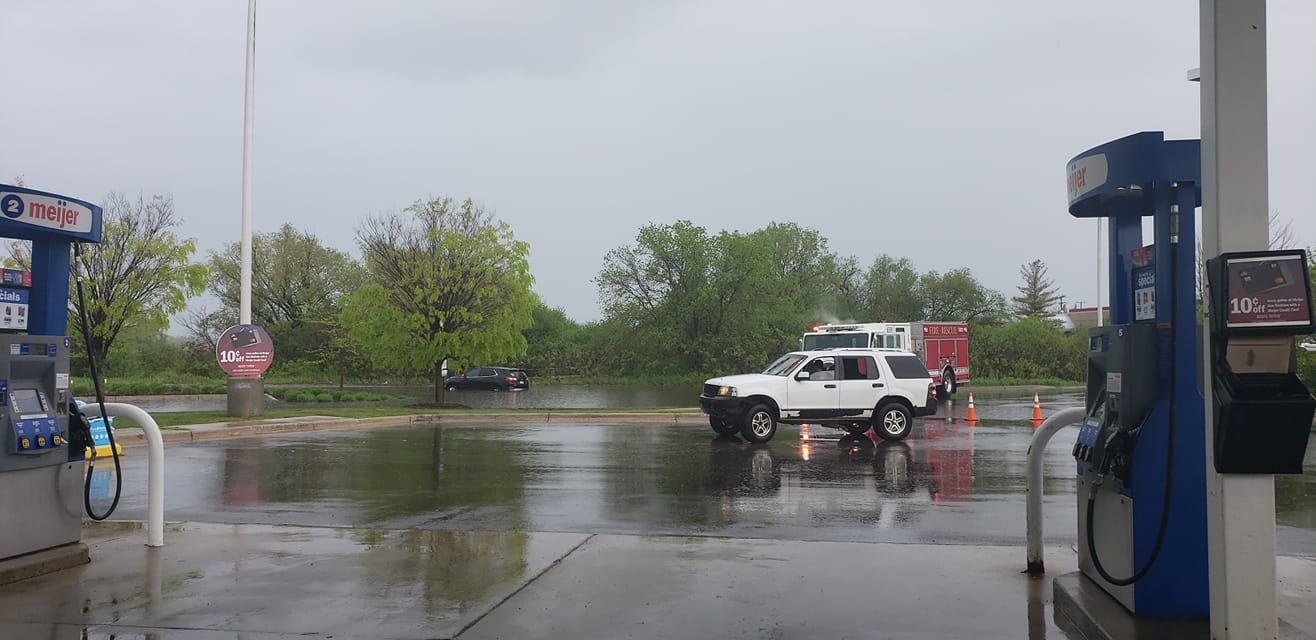
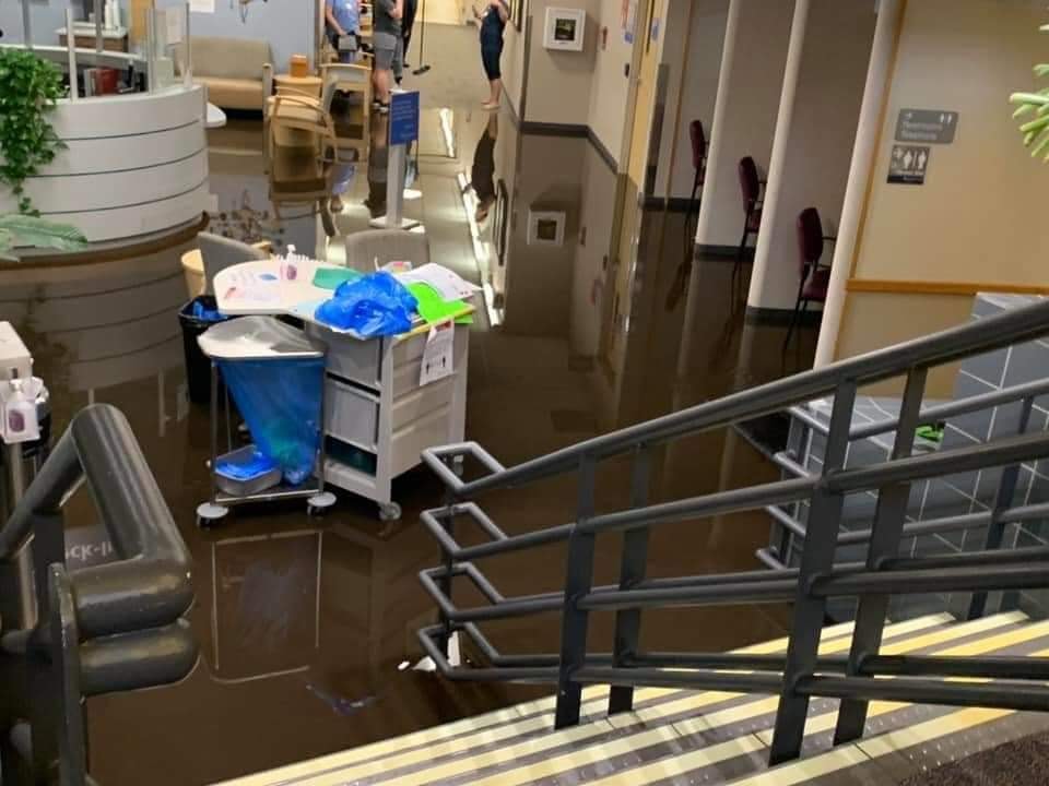
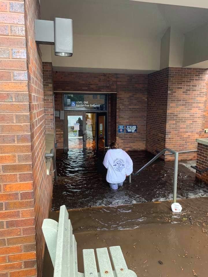
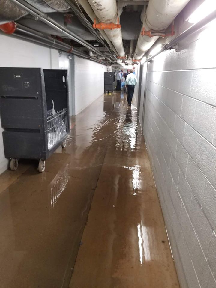
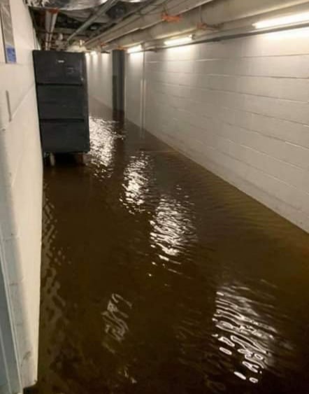
Localized flash flooding occurred across parts of Grand Traverse County, including at Munson Hospital in Traverse City.
 |
|
 |
 |
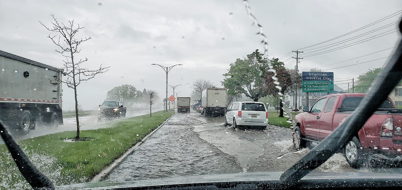
| Traverse City, MI Courtesy of Kimberley Hankamp-Kroupa |
Traverse City, MI Courtesy of Kimberley Hankamp-Kroupa |
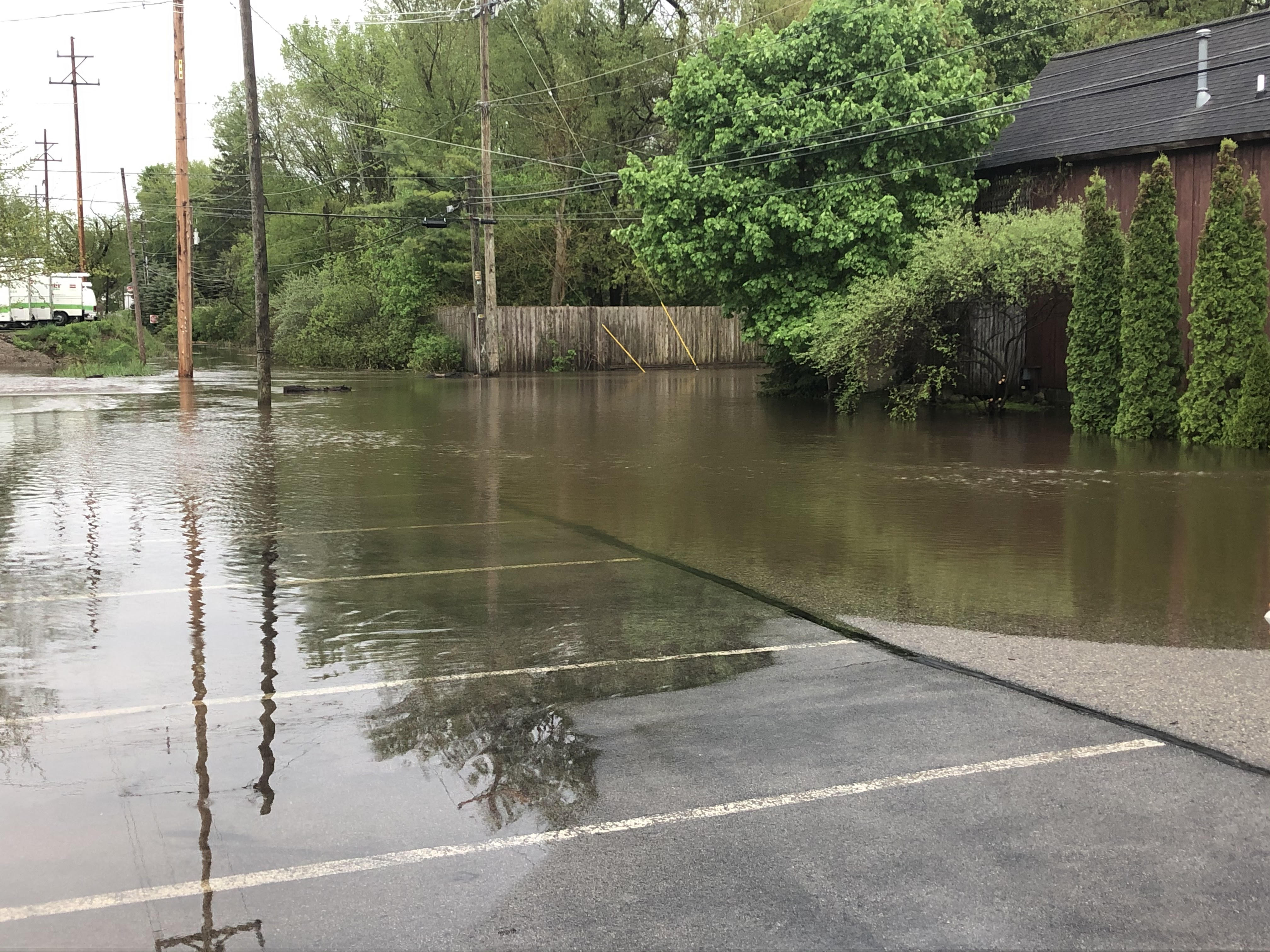
Traverse City, MI (Cedar St.) Courtesy of Grand Traverse Co. Emergency Management |
Traverse City, MI (Munson Hospital) Courtesy of The BEAR FM 98.1/95.3 |
 |
 |
 |
|
| Traverse City, MI (Munson Hospital) Courtesy of The BEAR FM |
Traverse City, MI (Munson Hospital) Courtesy of The BEAR FM |
Traverse City, MI (Munson Hospital) Courtesy of The BEAR FM |
Traverse City, MI (US-31 Meijer) Courtesy of Tammy Mosher |
Rainfall Reports
THE FOLLOWING ARE 24-HOUR RAINFALL REPORTS ACROSS NORTHERN MICHIGAN. NOTE THAT REPORTS BELOW 1.00 INCH HAVE BEEN EXCLUDED. LOCATION AMOUNT TIME/DATE LAT/LON ...MICHIGAN... ...ANTRIM COUNTY... MANCELONA 0.5 ESE 1.31 IN 0800 AM 05/29 44.90N/85.05W CENTRAL LAKE 1.20 IN 0800 AM 05/29 45.07N/85.26W ...CHIPPEWA COUNTY... RUDYARD 1.67 IN 0614 AM 05/29 46.24N/84.51W SAULT STE. MARIE 1.56 IN 0800 AM 05/29 46.49N/84.40W SAULT STE MARIE - MUNICIPAL 1.53 IN 0655 AM 05/29 46.47N/84.37W SAULT STE. MARIE 2.2 E 1.26 IN 0745 AM 05/29 46.49N/84.32W KINROSS - CHIPPEWA COUNTY IN 1.23 IN 0756 AM 05/29 46.25N/84.47W PICKFORD 3 NE 1.13 IN 0600 PM 05/28 46.19N/84.32W DRUMMOND ISLAND 1.06 IN 0655 AM 05/29 46.00N/83.75W 4 W RACO 1.02 IN 0704 AM 05/29 46.36N/84.80W ...EMMET COUNTY... HARBOR SPRINGS 1.34 IN 0701 AM 05/29 45.30N/84.90W ALANSON 1.18 IN 0701 AM 05/29 45.42N/84.79W PETOSKEY 1.03 IN 0706 AM 05/29 45.36N/84.95W ...GRAND TRAVERSE COUNTY... TRAVERSE CITY MUNSON 3.12 IN 0600 AM 05/29 44.76N/85.64W KINGSLEY 2.7 ENE 1.67 IN 0700 AM 05/29 44.60N/85.48W OLD MISSION 3 SSW 1.42 IN 0740 AM 05/29 44.92N/85.52W FIFE LAKE 2 WNW 1.37 IN 0700 AM 05/29 44.58N/85.37W ...IOSCO COUNTY... EAST TAWAS 1.51 IN 0830 AM 05/29 44.28N/83.48W EAST TAWAS 0.8 WSW 1.51 IN 0800 AM 05/29 44.28N/83.50W SILVER CREEK 1.05 IN 0702 AM 05/29 44.38N/83.60W HALE 5 SSW #2 1.02 IN 0800 AM 05/29 44.31N/83.84W ...LEELANAU COUNTY... 2 NW GREILICKVILLE 2.80 IN 0753 AM 05/29 44.82N/85.66W ...MACKINAC COUNTY... MORAN 1.38 IN 0800 AM 05/29 45.99N/84.84W 1 WNW REXTON 1.02 IN 0613 AM 05/29 46.15N/85.27W ...MONTMORENCY COUNTY... ATLANTA 1.47 IN 0808 AM 05/29 45.15N/84.19W ...OGEMAW COUNTY... WEST BRANCH 2.1 SSW 1.00 IN 0730 AM 05/29 44.25N/84.25W ...OTSEGO COUNTY... GAYLORD 2.2 SSE 1.31 IN 0800 AM 05/29 44.99N/84.66W GAYLORD 4.1 S 1.07 IN 0700 AM 05/29 44.96N/84.68W GAYLORD 9 SSW 1.00 IN 0800 AM 05/29 44.91N/84.72W ...PRESQUE ISLE COUNTY... ROGERS CITY 1.65 IN 0902 AM 05/29 45.42N/83.81W ROGERS CITY 0.2 WSW 1.48 IN 0800 AM 05/29 45.42N/83.81W ...WEXFORD COUNTY... MESICK 1.78 IN 0701 AM 05/29 44.45N/85.79W OBSERVATIONS ARE COLLECTED FROM A VARIETY OF SOURCES WITH VARYING EQUIPMENT AND EXPOSURES. WE THANK ALL VOLUNTEER WEATHER OBSERVERS FOR THEIR DEDICATION. NOT ALL DATA LISTED ARE CONSIDERED OFFICIAL. |
 |
Media use of NWS Web News Stories is encouraged! Please acknowledge the NWS as the source of any news information accessed from this site. |
|


.gif)