Overview
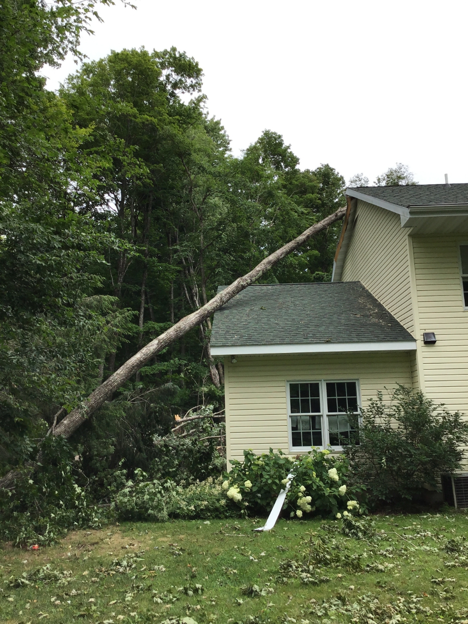
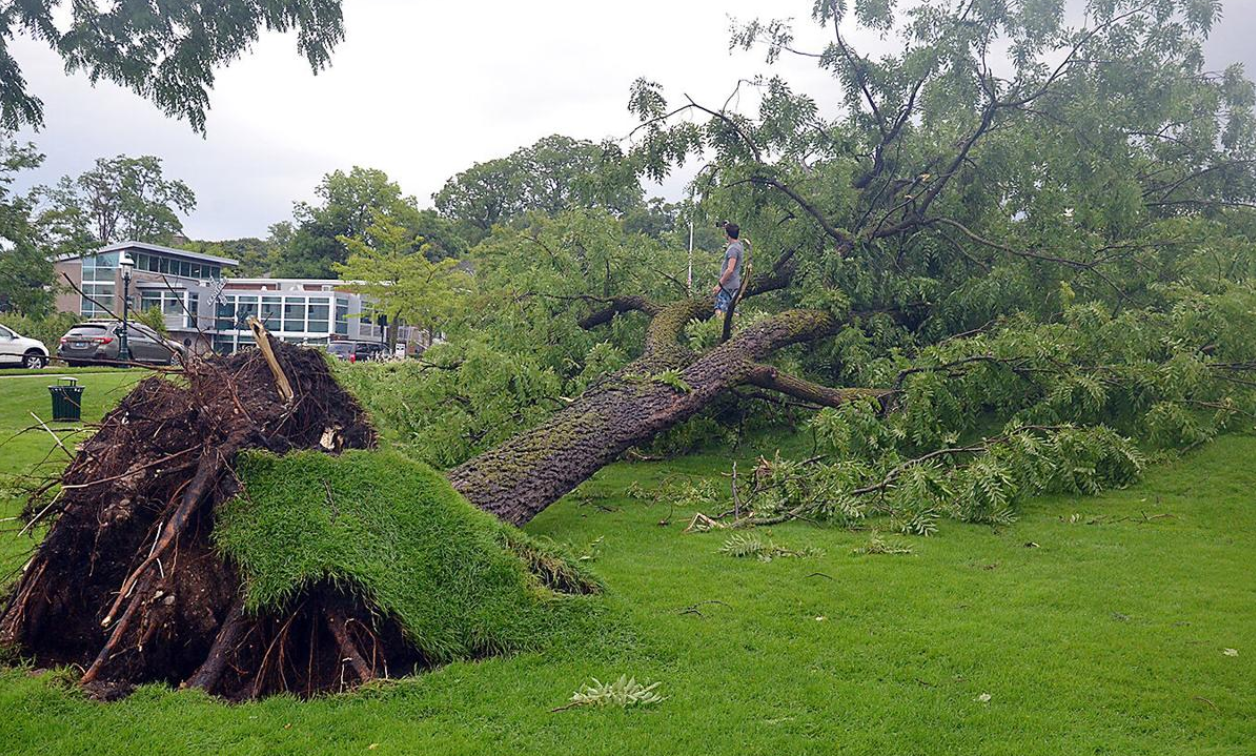
Three separate rounds of strong to severe storms impacted northern Michigan this past weekend. The first line of storms moved through the region during the morning hours of Saturday, producing wind damage across portions of northern lower Michigan, including at the Onaway State Park campground where one injury occurred.
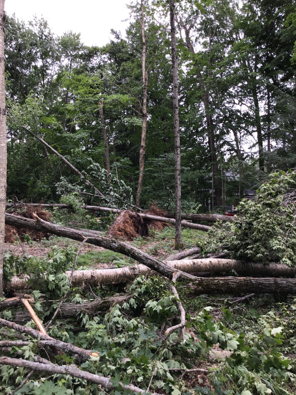
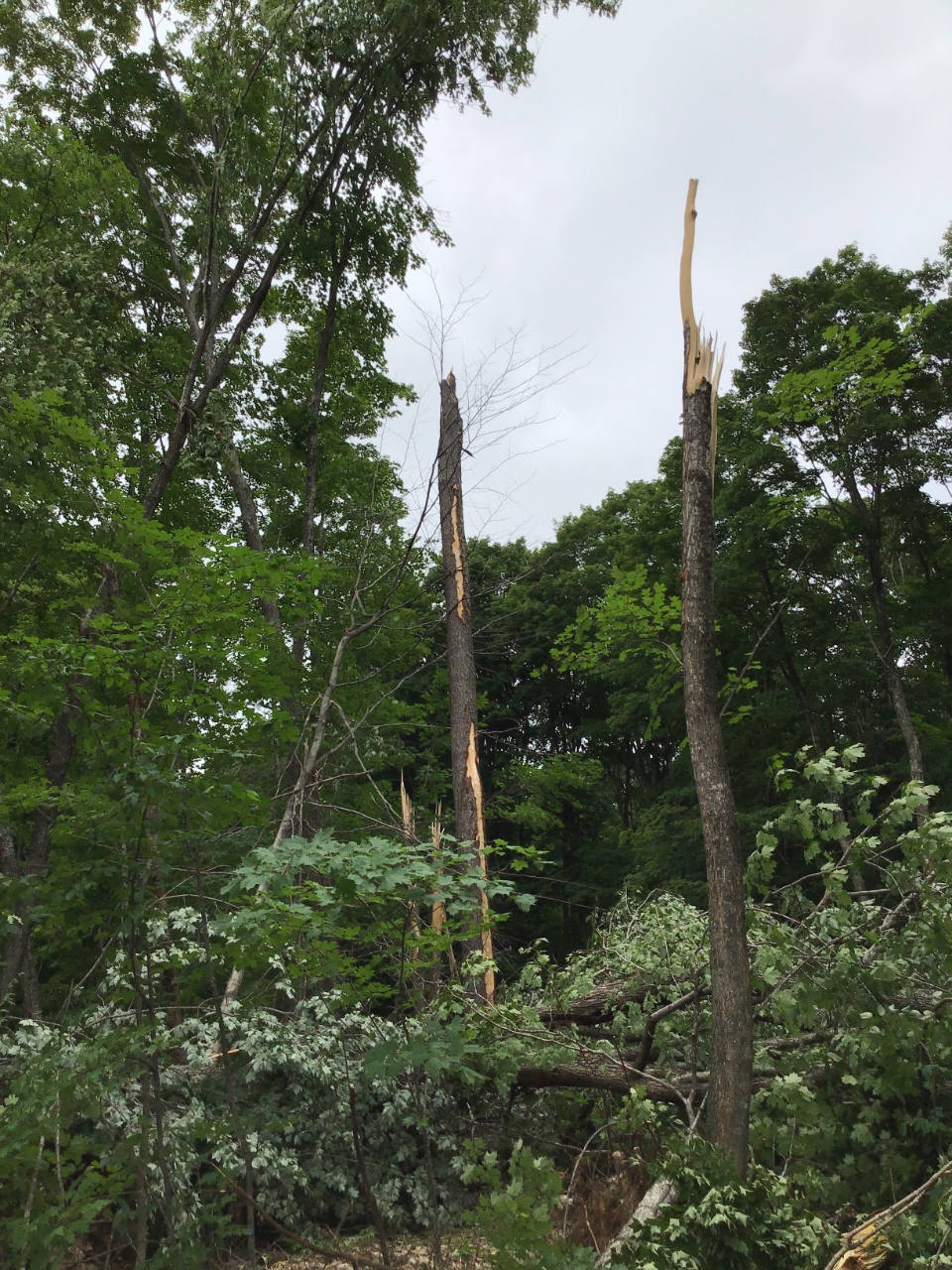
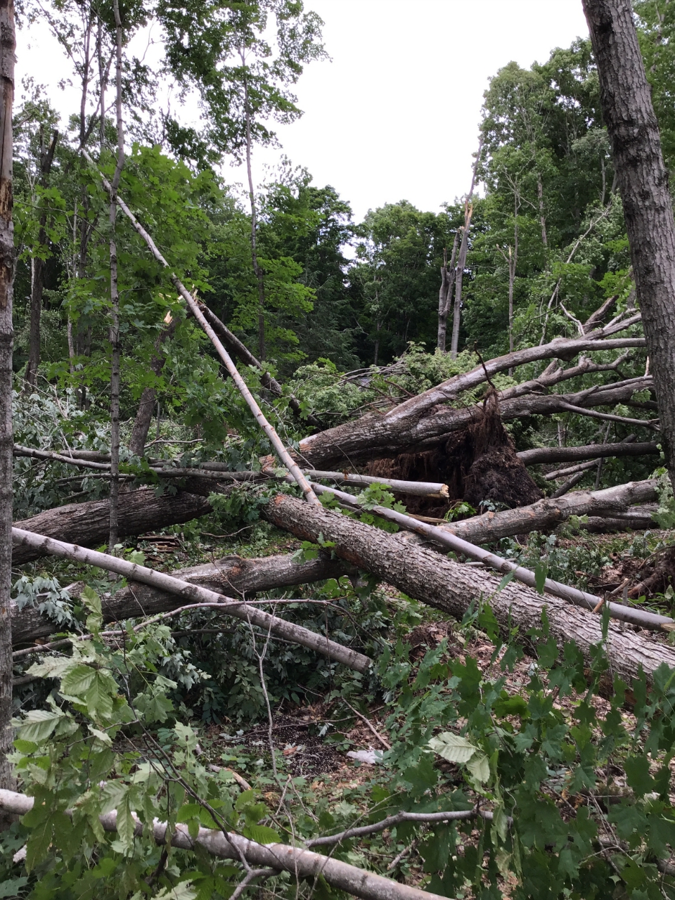
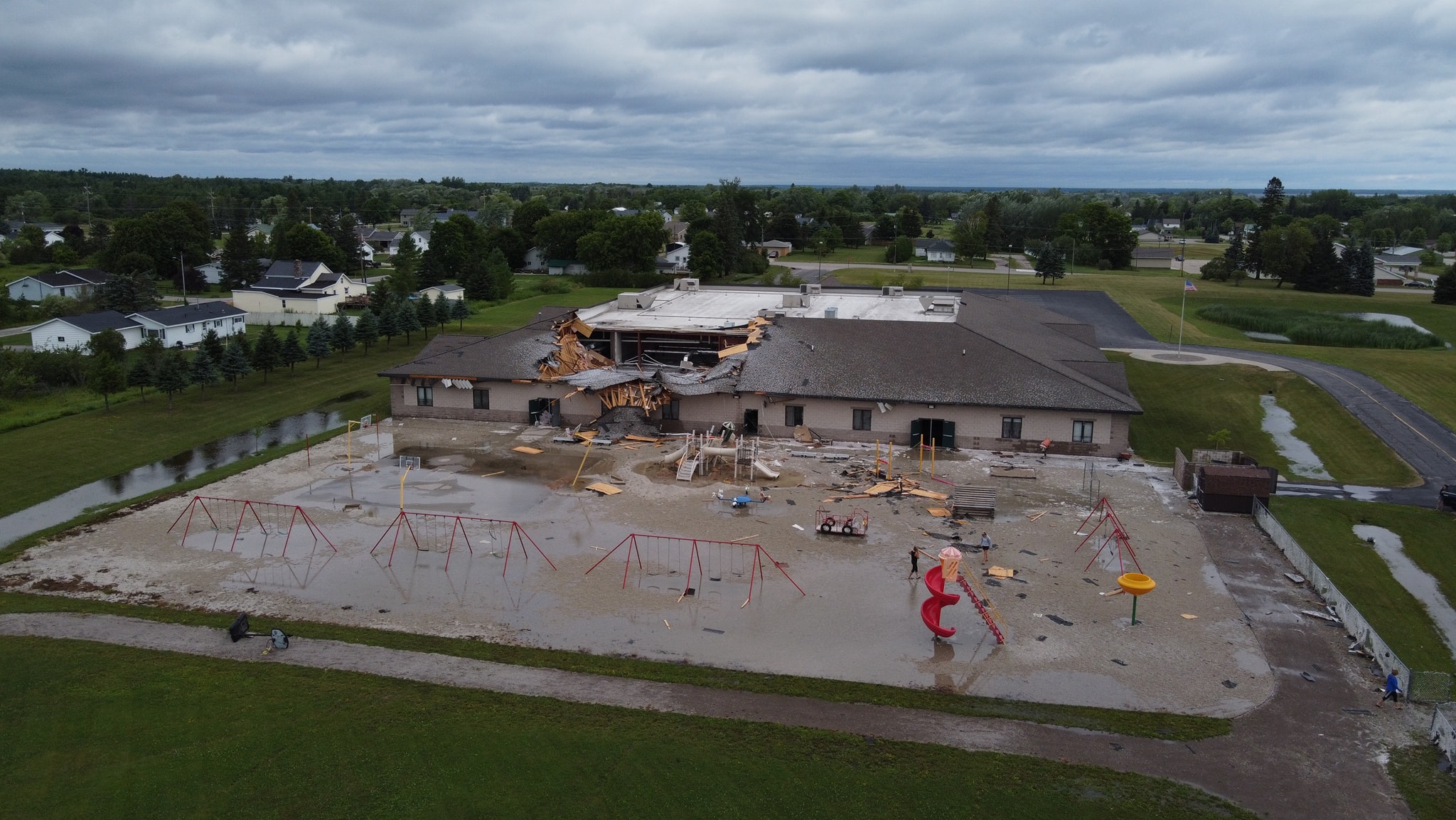
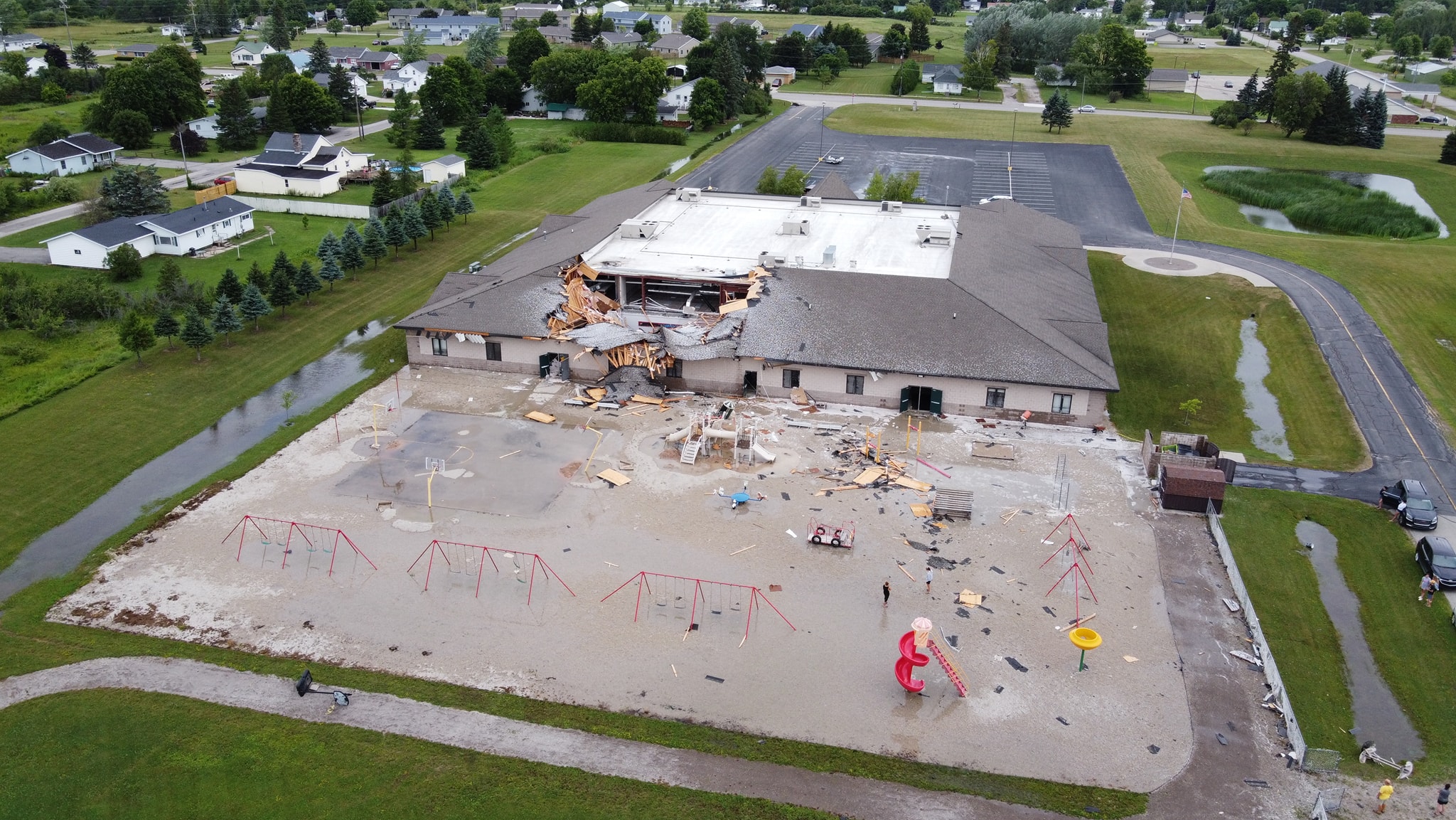
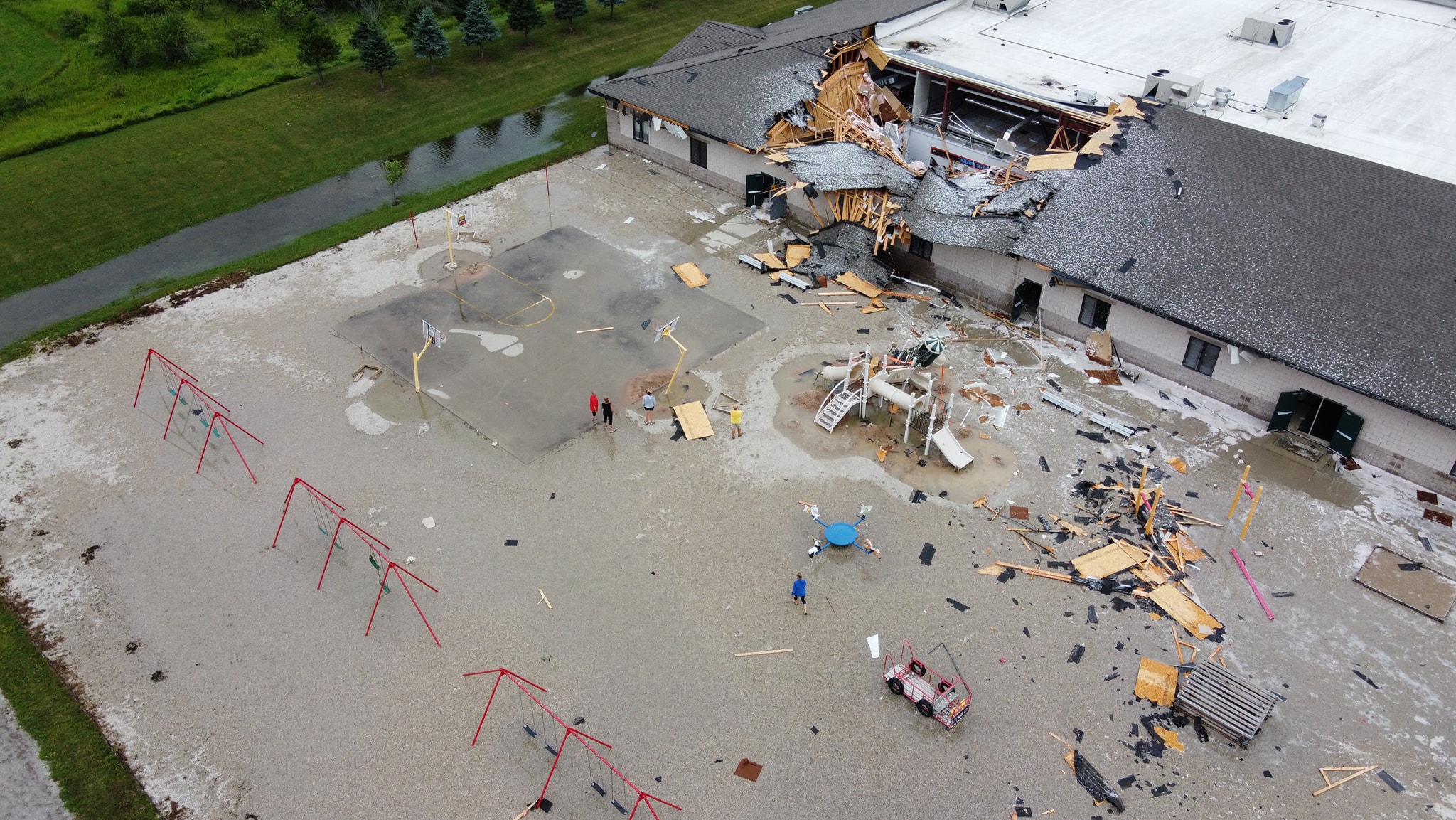
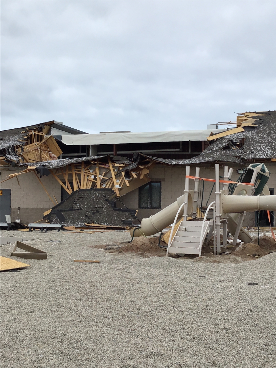
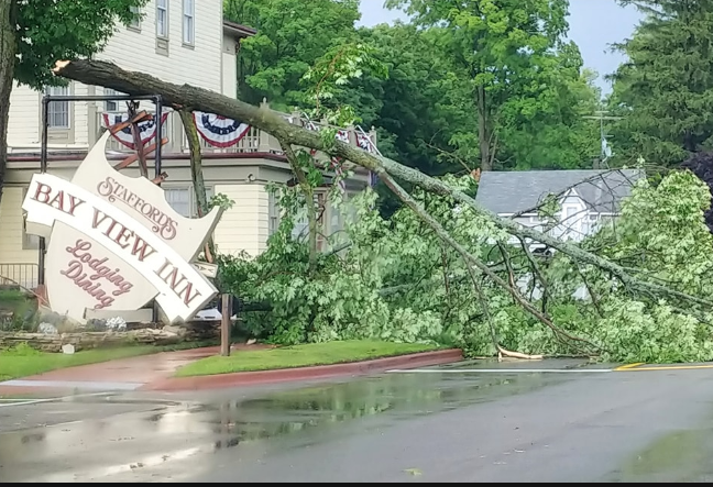
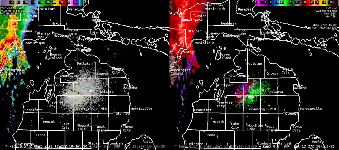
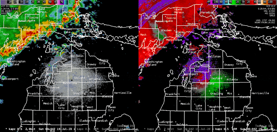
A second narrow line of thunderstorms developed during the mid to late afternoon hours of Saturday from northern Lake Michigan into the Tip of the Mitt, and produced significant damage in a narrow corridor from Petoskey and Harbor Springs, eastward through Indian River. A third squall line developed upstream Saturday night and rolled through the region during the early morning hours Sunday. This third line also produced numerous pockets of wind damage across northern lower Michigan, including the collapse of a roof at the Bishop Baraga School in Cheboygan.
In total, 22 severe thunderstorm warnings were issued, two tornado warnings, three flash flood warnings, and 20 special marine warnings. The last time we issued a comparable number of warnings was July 7-8, 2016, and before that, August 2nd, 2015.
Wind:
|
Downburst/Straight Line Winds - northeast of Harbor Springs
Map 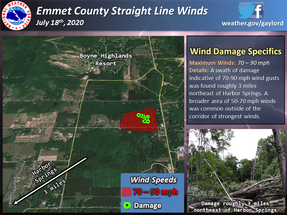 
|
||||||||||||||||||
|
Microburst/Straight line Winds - Cheboygan
Map 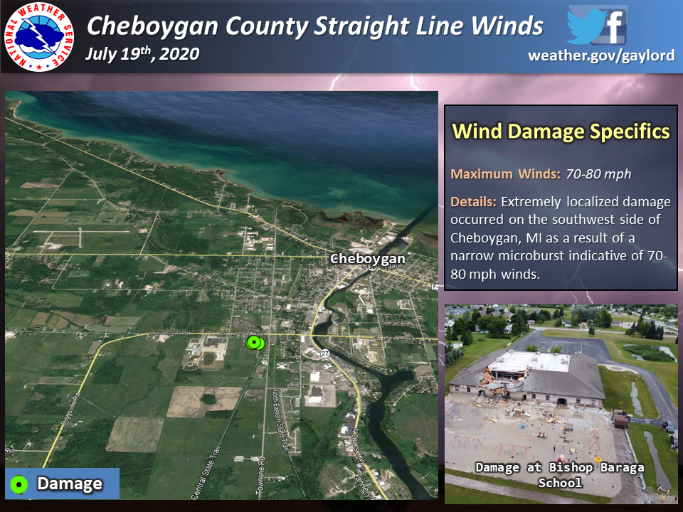
|
||||||||||||||||||
|
Straight Line Winds -
Map .png)
|
||||||||||||||||||
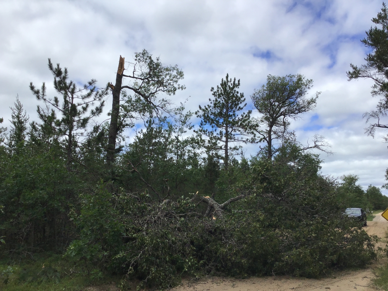
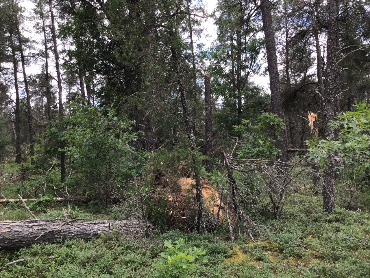
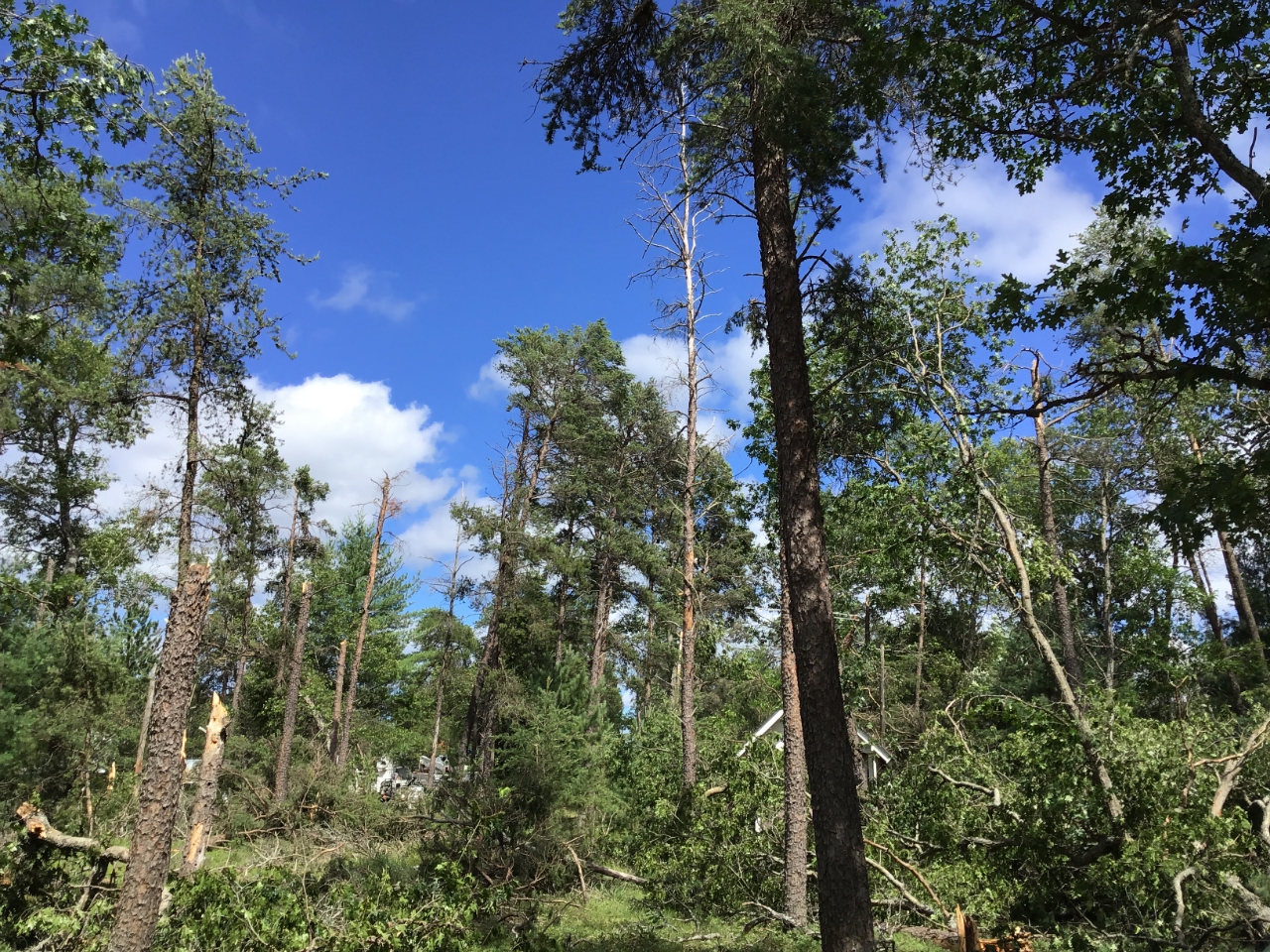
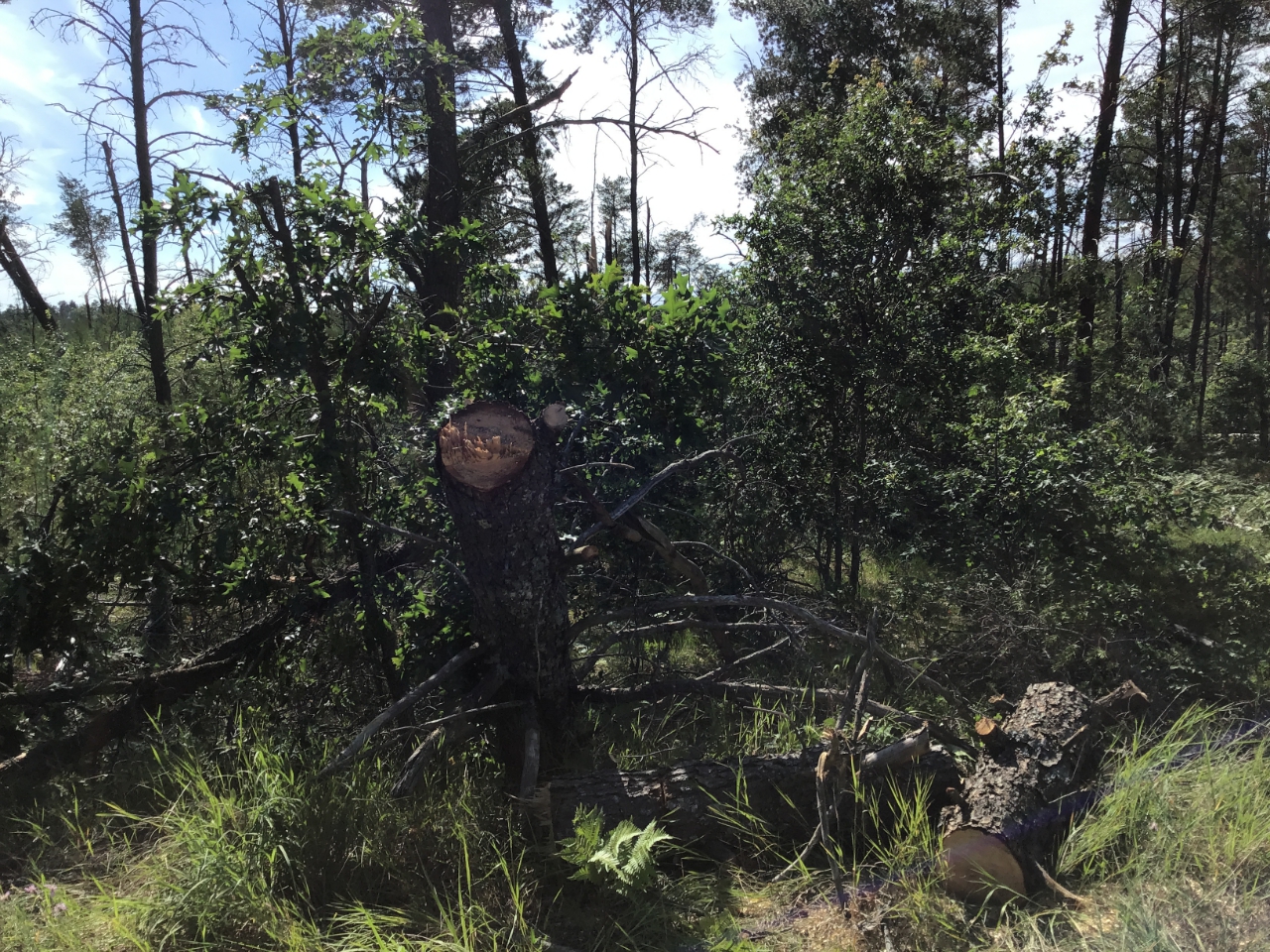
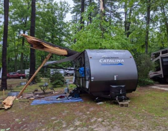
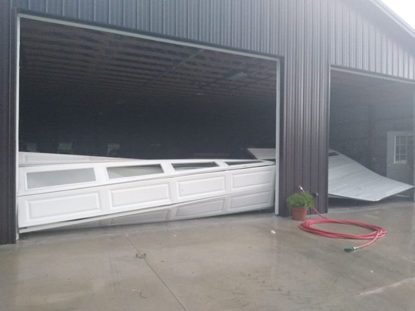
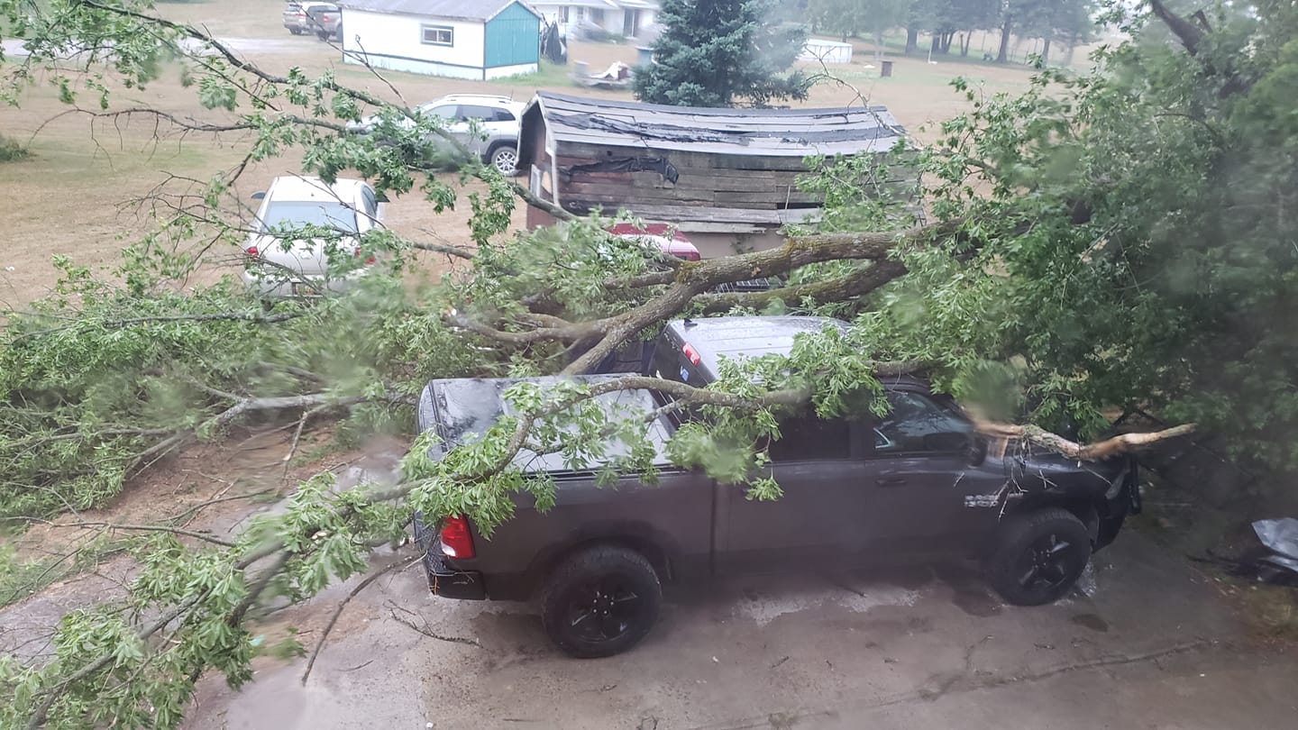
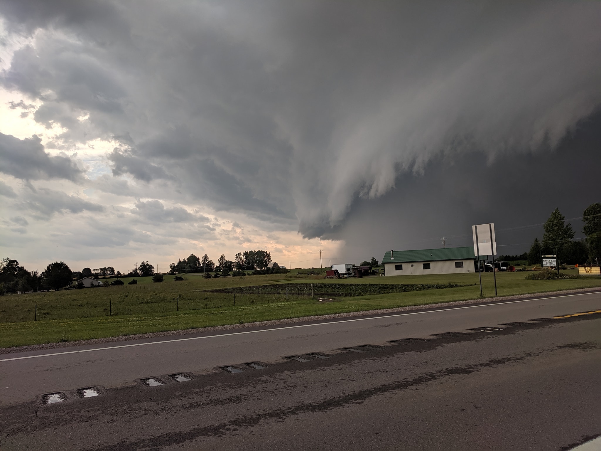
Additional damage / storm images from across northern Michigan:
 |
 |
 |
 |
| Petoskey, MI - July 18th, 2020 Mike Washburn |
Petoskey, MI - July 18th, 2020 Steve Zucker |
Onaway State Park - July 18th Friends of Onaway State Park |
South of Grayling, MI Bill Morrow |
 |
 |
 |
 |
| Millersburg, MI - July 18th, 2020 Randy West |
Onaway State Park - July 18th Heather McFarland |
National City, MI - July 19th Keith Johnson |
Near Onaway, MI - July 18th James Orlandi |
Radar:
KAPX Doppler Radar loop from 8:30 AM - 6:30 PM Saturday July 18th, 2020.
 |
KAPX Doppler Radar loop from 4:00 AM - 10:30 AM Sunday July 19th, 2020.
 |
Storm Reports
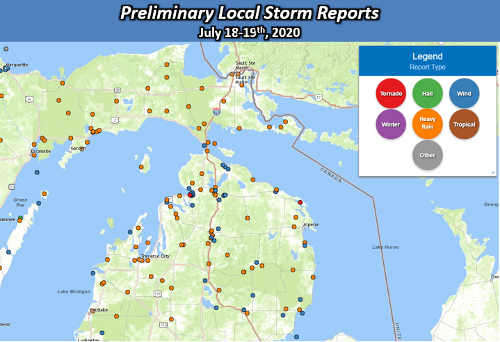
The following are the highest recorded wind gusts and rainfall reports from both Saturday 7/18/2020 and
Sunday 7/19/2020. Keep in mind, wind gust recorded values are not necessarily representative of locations
between observation sites. Locally higher wind gusts of 70+ mph certainly occurred, especially in locations
that experienced significant damage.


Saturday, July 18th, 2020
LOCATION                     SPEED     TIME/DATE       LAT/LON

...MICHIGAN...

...ALPENA COUNTY...
6 S CATHRO                   53 MPH    0551 PM 07/18   45.07N/83.57W

...EMMET COUNTY...
1 E HARBOR SPRINGS           47 MPH    0405 PM 07/18   45.43N/84.97W

...PRESQUE ISLE COUNTY...
1 SSW ROGERS CITY            42 MPH    0522 PM 07/18   45.41N/83.81W
​

Sunday, July 19th, 2020

LOCATION                     SPEED     TIME/DATE       LAT/LON

...MICHIGAN...

...ALPENA COUNTY...
1 S OSSINEKE                 38 MPH    0713 AM 07/19   44.89N/83.43W

...CHARLEVOIX COUNTY...
1 SSW CHARLEVOIX             45 MPH    0515 AM 07/19   45.30N/85.27W

...CHEBOYGAN COUNTY...
3 WNW CHEBOYGAN              49 MPH    0521 AM 07/19   45.65N/84.52W
MACKINAW CITY                40 MPH    0518 AM 07/19   45.78N/84.73W

...EMMET COUNTY...
1 NW PELLSTON                49 MPH    0519 AM 07/19   45.57N/84.80W

...LEELANAU COUNTY...
LELAND                       39 MPH    0528 AM 07/19   45.02N/85.76W

...OTSEGO COUNTY...
GAYLORDNWS; GAYLORD          42 MPH    0608 AM 07/19   44.91N/84.72W
1 NW WATERS                  42 MPH    0608 AM 07/19   44.91N/84.72W

...PRESQUE ISLE COUNTY...
1 SSW ROGERS CITY            45 MPH    0615 AM 07/19   45.40N/83.82W

...MARITIME STATIONS...
FRANKFORT LIGHT              46 MPH    0541 AM 07/19   44.63N/86.25W
3 NW MACKINAW CITY           40 MPH    0509 AM 07/19   45.83N/84.77W
LELAND HARBOR                39 MPH    0528 AM 07/19   45.02N/85.76W


​Rainfall Reports July 18th through late morning July 19th
...ALPENA COUNTY...
1 NE CATHRO                  2.86 IN   1100 AM 07/19   45.16N/83.55W

...BENZIE COUNTY...
4 S EMPIRE                   2.39 IN   0808 AM 07/19   44.76N/86.06W
5 ENE ARCADIA                2.35 IN   0800 AM 07/19   44.53N/86.13W

...CHARLEVOIX COUNTY...
EAST JORDAN                  3.31 IN   0800 AM 07/18   45.19N/85.15W

...CHEBOYGAN COUNTY...
6 ESE INDIAN RIVER           5.25 IN   1249 PM 07/19   45.37N/84.50W
3 W INDIAN RIVER             4.72 IN   0955 AM 07/19   45.41N/84.67W

...EMMET COUNTY...
NEW HAVEN                    2.60 IN   0946 AM 07/19   45.48N/84.93W

...GRAND TRAVERSE COUNTY...
4 SW GREILICKVILLE           3.22 IN   0800 AM 07/19   44.75N/85.70W

...IOSCO COUNTY...
1 WSW EAST TAWAS             2.50 IN   0830 AM 07/19   44.28N/83.50W

...LEELANAU COUNTY...
3 W OMENA                    2.10 IN   0730 AM 07/19   45.06N/85.65W

...PRESQUE ISLE COUNTY...
ROGERS CITY                  2.33 IN   0800 AM 07/19   45.42N/83.81W

OBSERVATIONS ARE COLLECTED FROM A VARIETY OF SOURCES WITH VARYING
EQUIPMENT AND EXPOSURES. WE THANK ALL VOLUNTEER WEATHER OBSERVERS
FOR THEIR DEDICATION. NOT ALL DATA LISTED ARE CONSIDERED OFFICIAL.
 |
Media use of NWS Web News Stories is encouraged! Please acknowledge the NWS as the source of any news information accessed from this site. |
|