Gaylord, MI
Weather Forecast Office
Overview
|
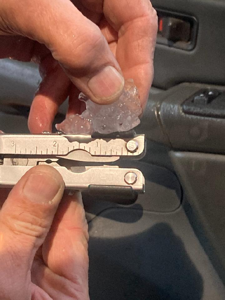
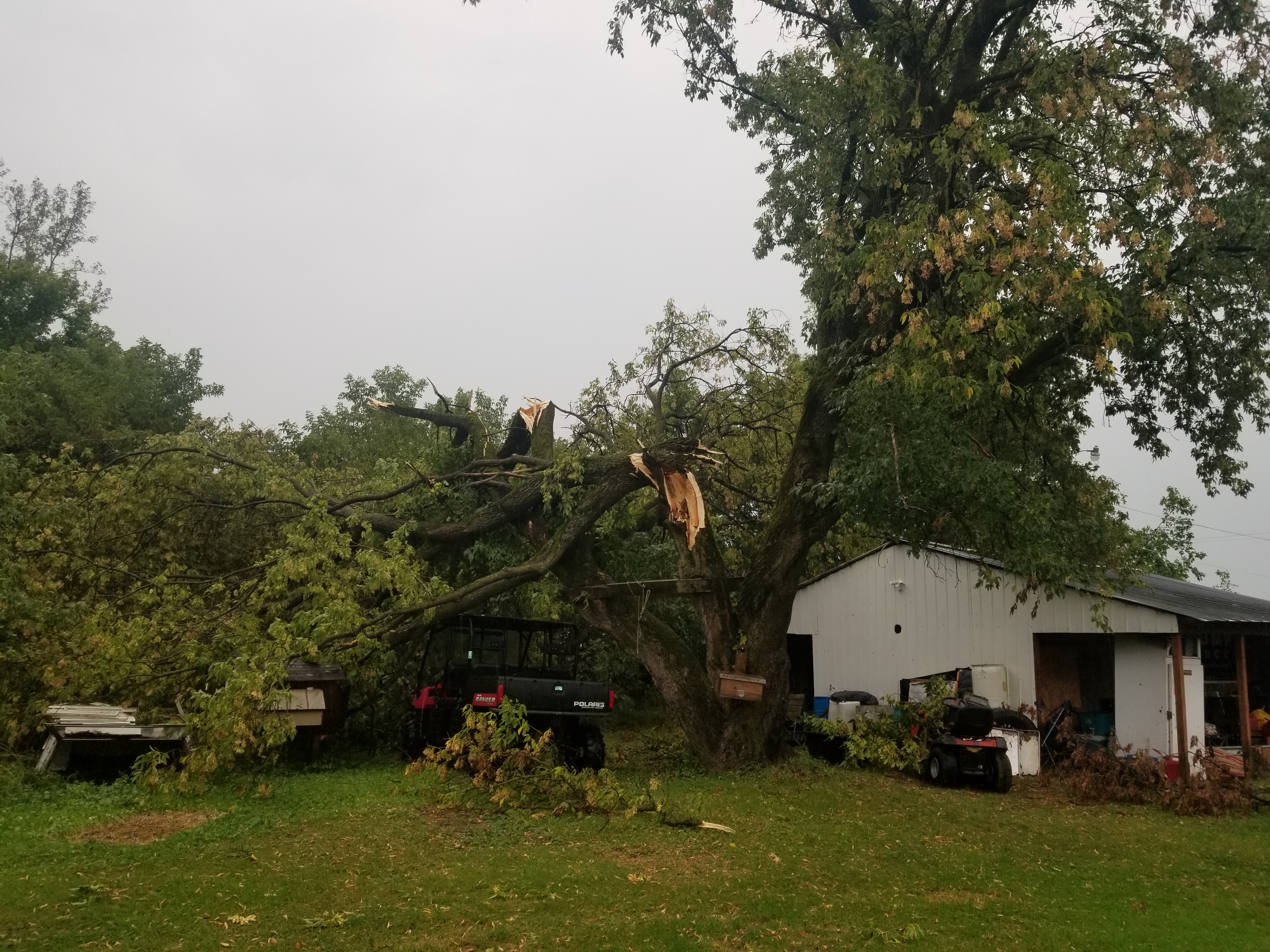
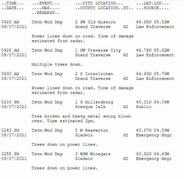
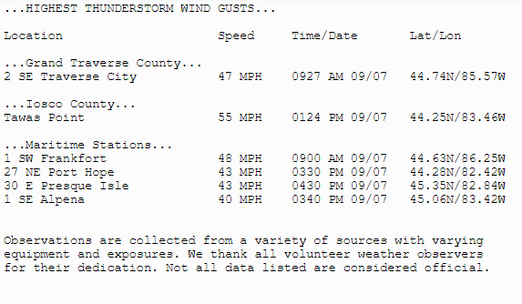
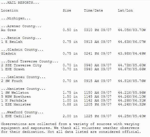
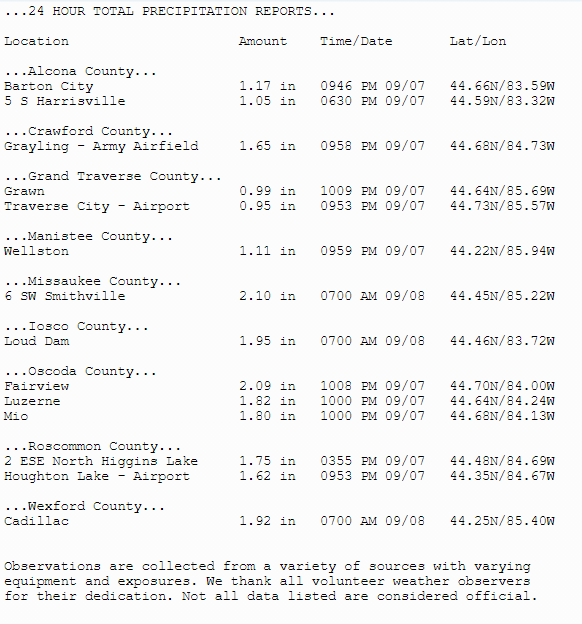
Severe thunderstorms formed in Wisconsin ahead of a cold front and moved across Lake Michigan in the morning hours of Tuesday September 7th, 2021. A few reports of wind damage and trees down originated from gusts mainly between 45 and 50 mph. These storms were prolific hail producers, with a few 2.0” diameter stones in Cadillac. Some areas received multiple rounds of hail through the late morning and early afternoon, with many locations receiving pea-sized hail which completely covered the ground. In addition to hail and wind these storms also produced heavy rain, with many locations along and south of M-72 receiving between 1 and 2 inches. Roscommon county airport in Houghton Lake broke their daily rainfall record with 1.62” through the day. The storms grew into a line during mid-afternoon and pushed southeast out of the area. In total, 19 Severe Thunderstorm Warnings and 8 Special Marine Warnings were issued. |
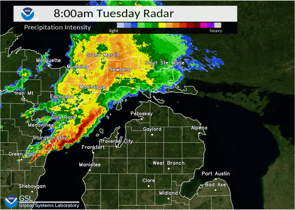 Radar loop of September 7th's thunderstorms |
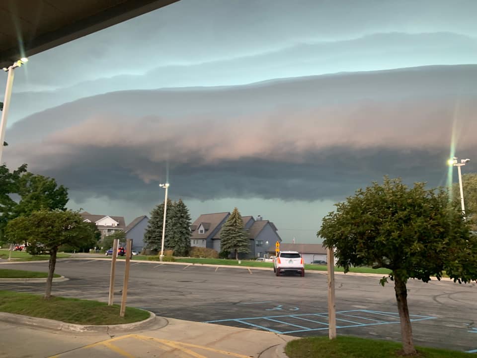
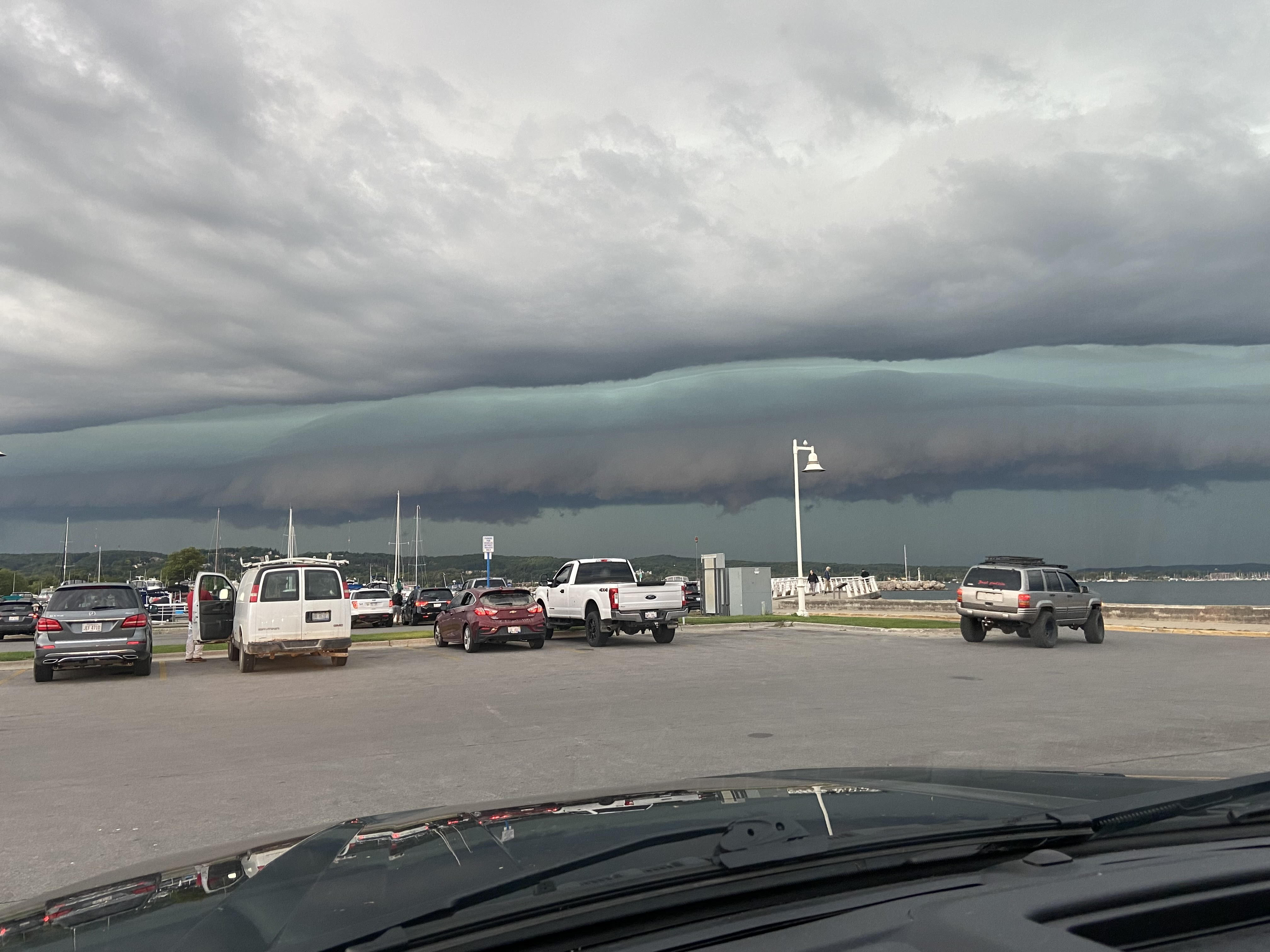
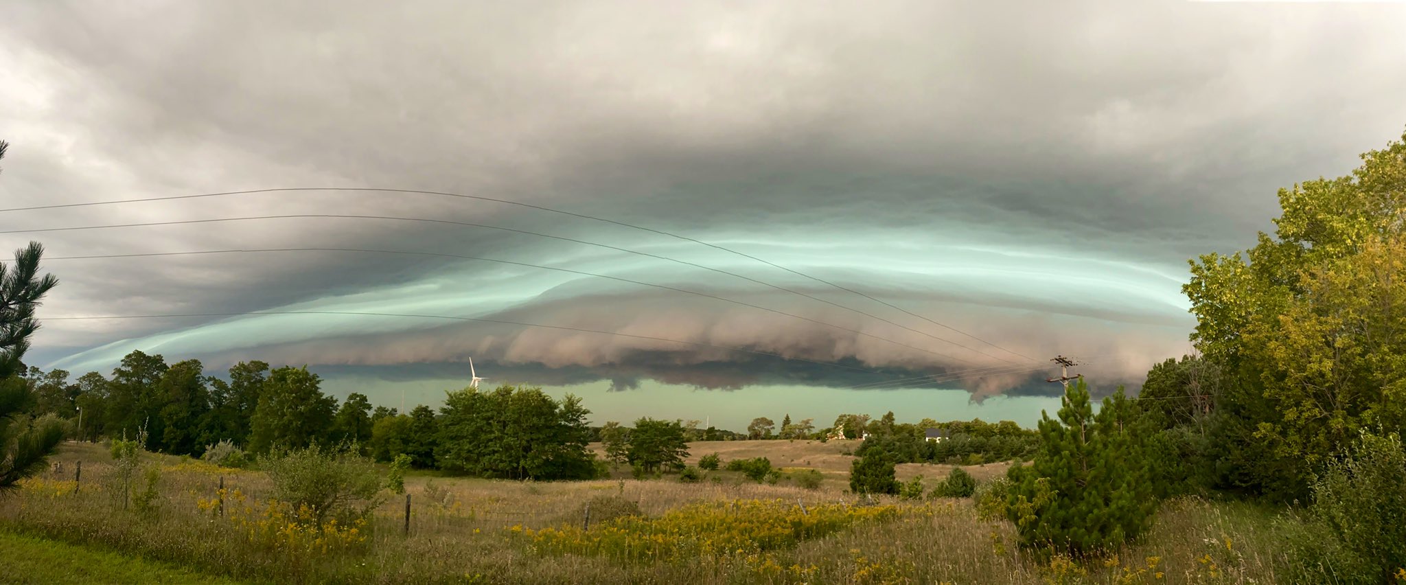
Photos (click to enlarge):
Submitted Via Social Media & Emergency Management
 |
 |
 |
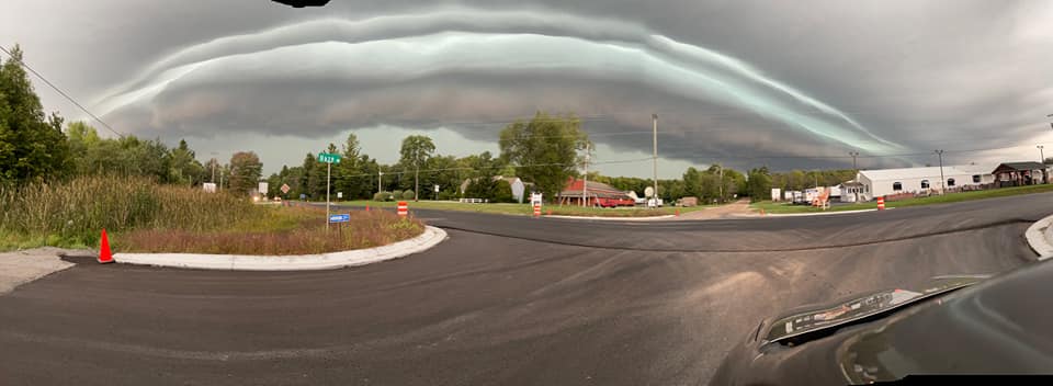 |
| East Bay, Traverse City, MI Richard Piechowski |
Traverse City, MI Gregg Bird |
Traverse City, MI Blake Hansen |
Sault Ste. Marie, MI Marilyn Fries |
 |
 |
 |
 |
| Near Cadillac, MI Michigan State Police |
Near Cadillac, MI | Wellston, MI Chelsie Fairbanks Methner |
Gladwin County, MI Bob North |
Storm Reports
 |
Media use of NWS Web News Stories is encouraged! Please acknowledge the NWS as the source of any news information accessed from this site. |
|
Local Information
Area Information
Office Webcam
Forecast
Recreational
Great Lakes/Marine
NWS DSS Table
Beach/Surf
Text Products
US Dept of Commerce
National Oceanic and Atmospheric Administration
National Weather Service
Gaylord, MI
8800 Passenheim Road
Gaylord, MI 49735-9454
989-731-3384
Comments? Questions? Please Contact Us.

