
Multiple chances exist for severe thunderstorms Monday. The 1st round will be Monday AM as thunderstorms travel SE from ND through MN and into our area. The second round will be Monday afternoon and evening as a cold front drops south across the area and thunderstorms develop. How the morning thunderstorms evolve, will dictate who & when will receive thunderstorms in the afternoon. Read More >
Overview
|
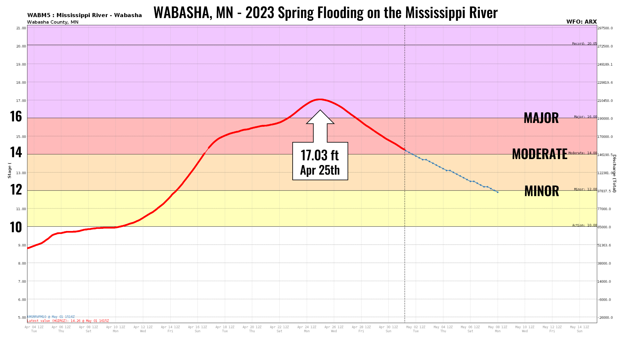
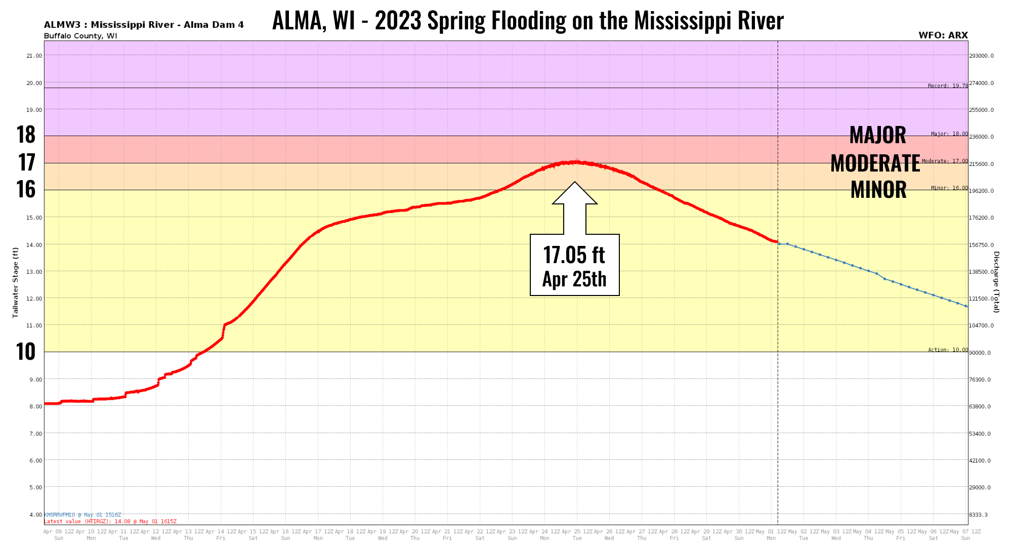
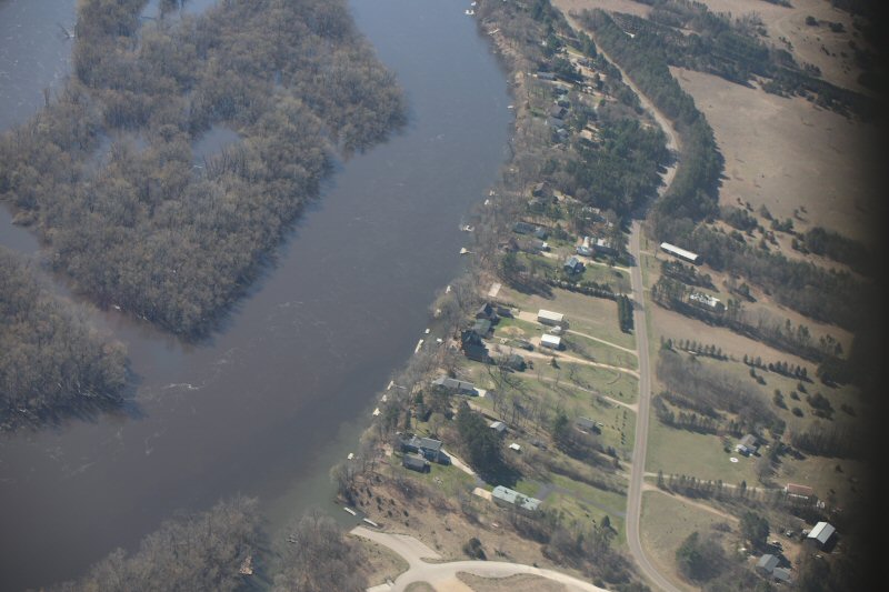
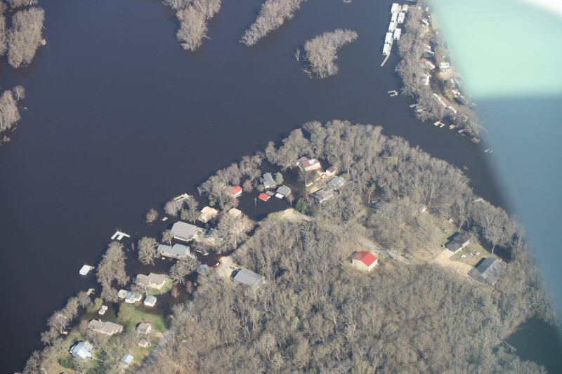
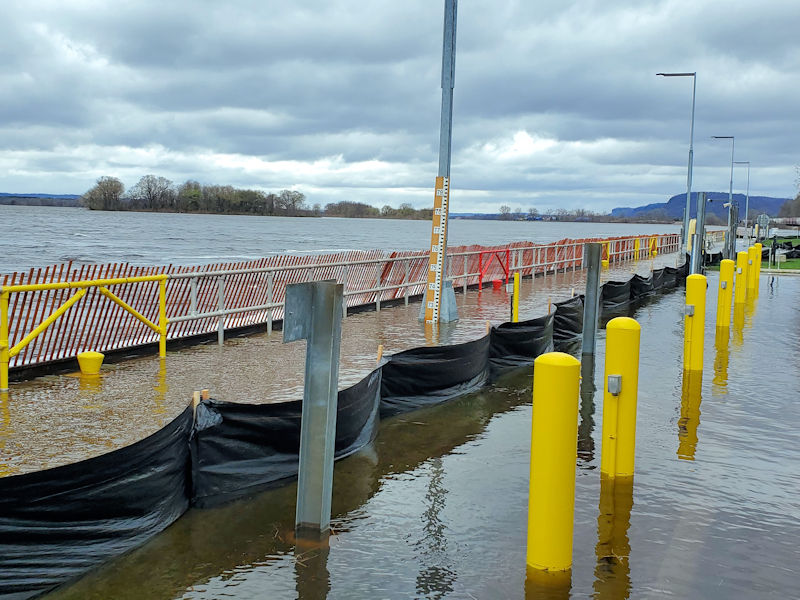
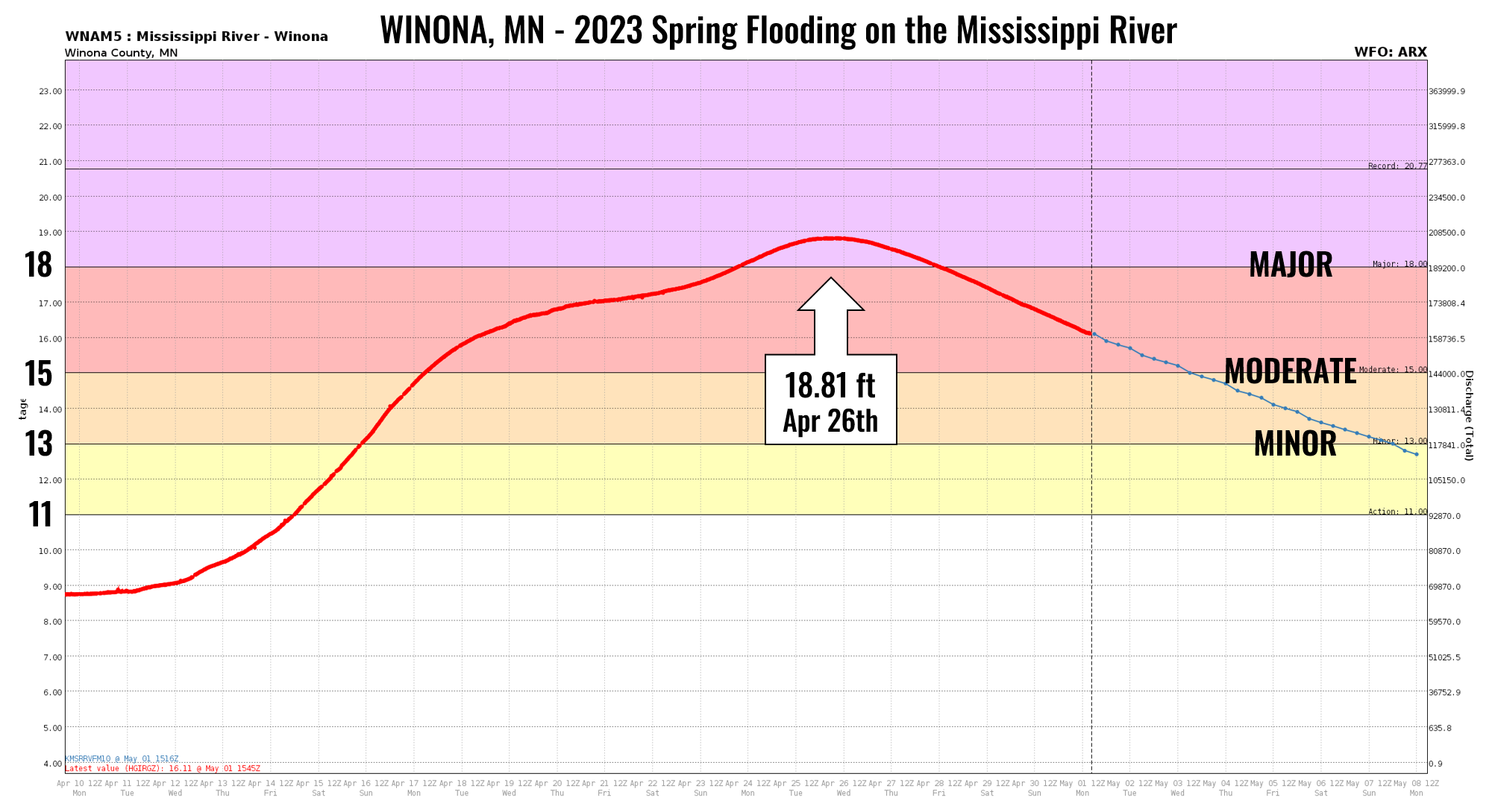
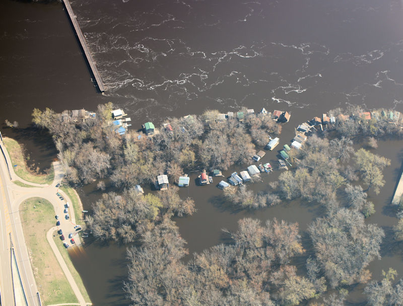
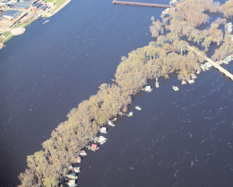
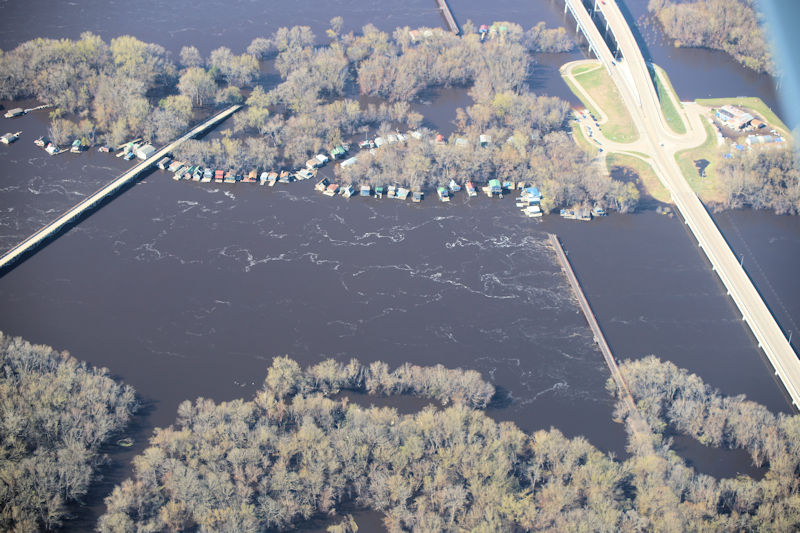
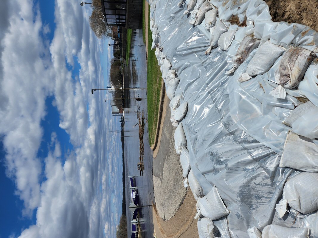
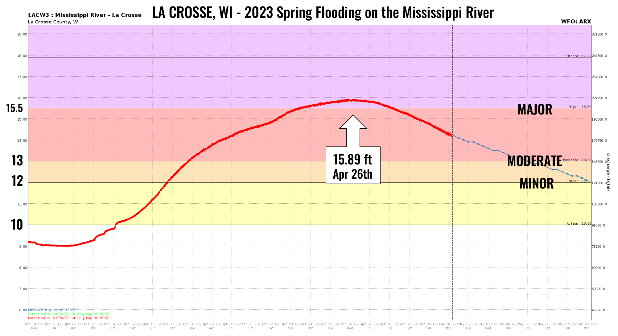
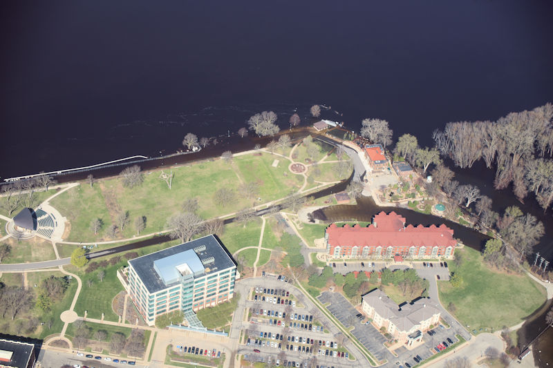
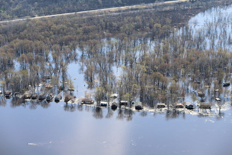
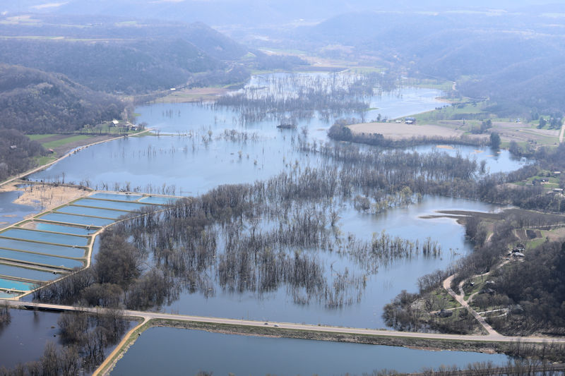
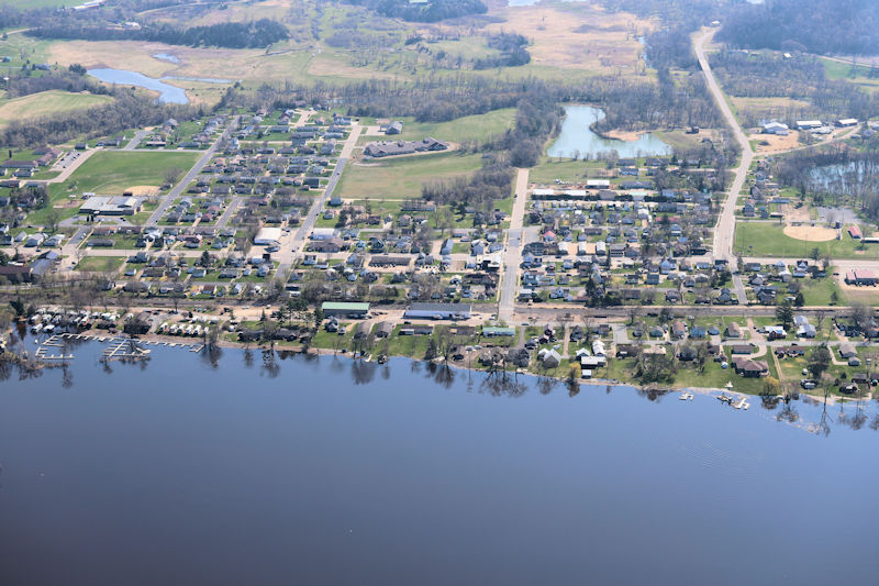
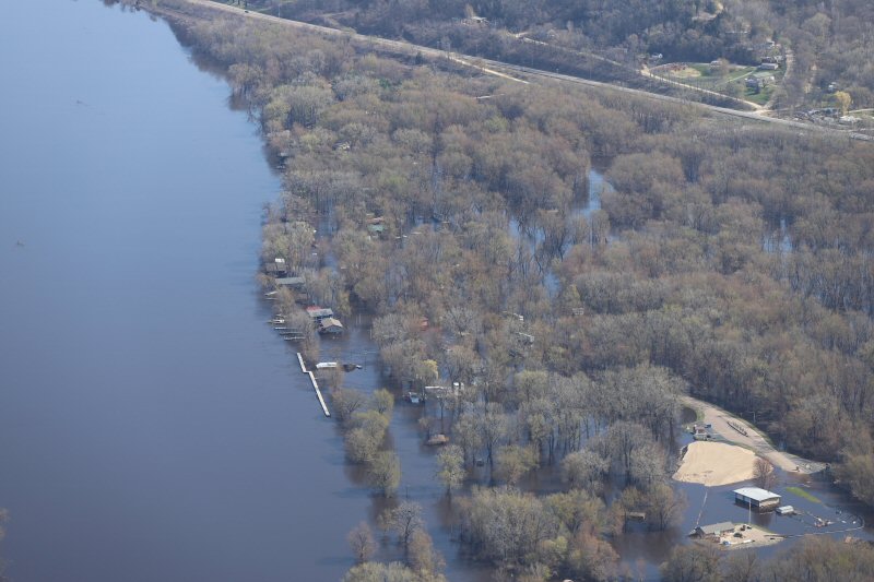
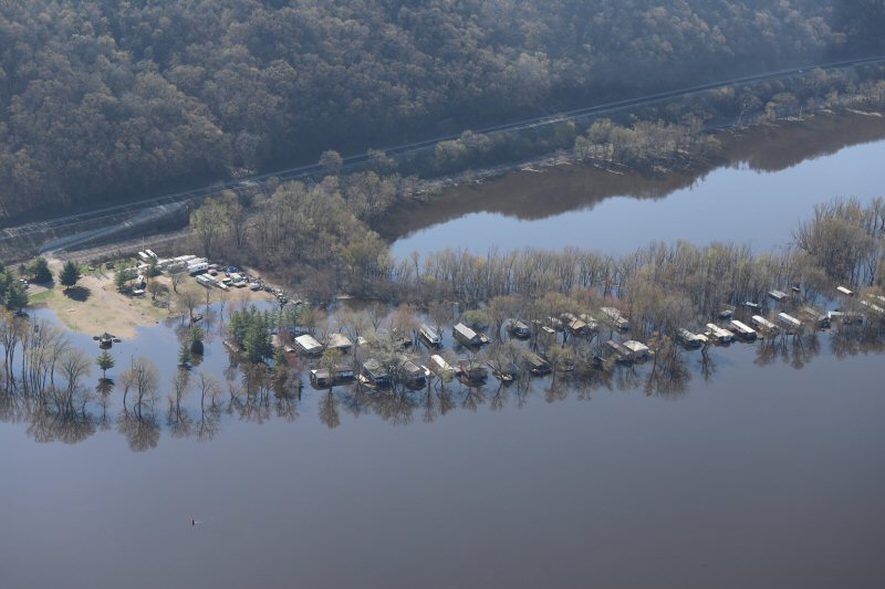
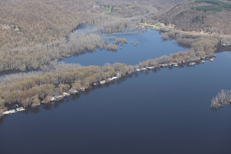
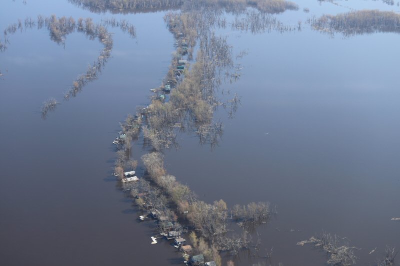
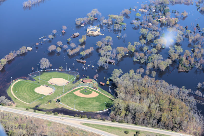
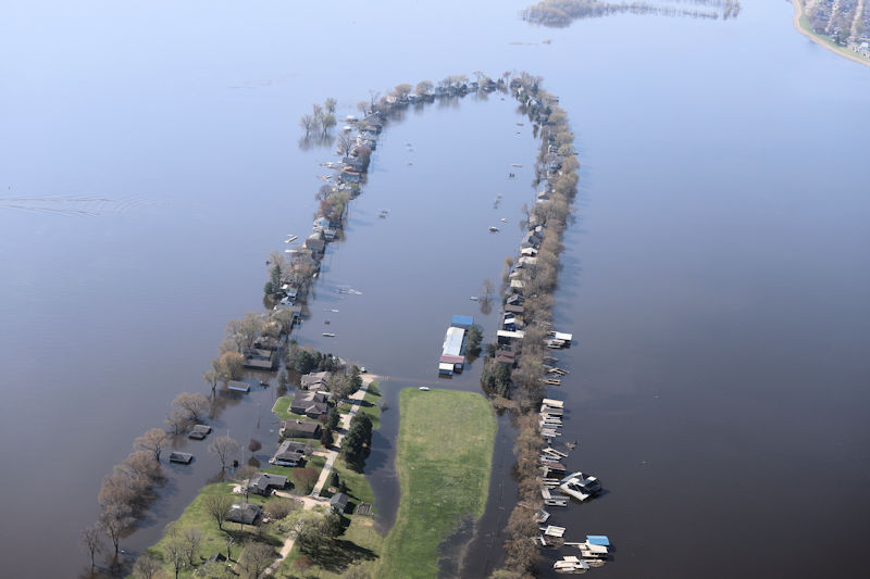
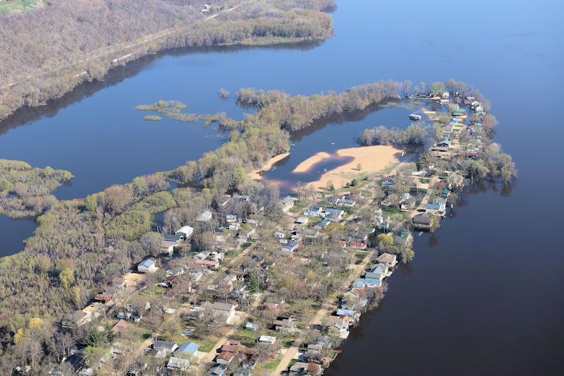
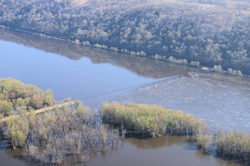
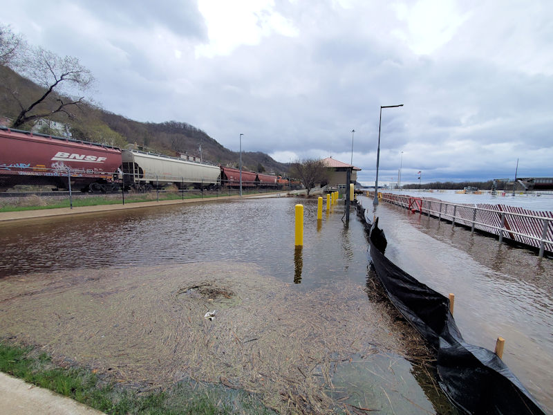
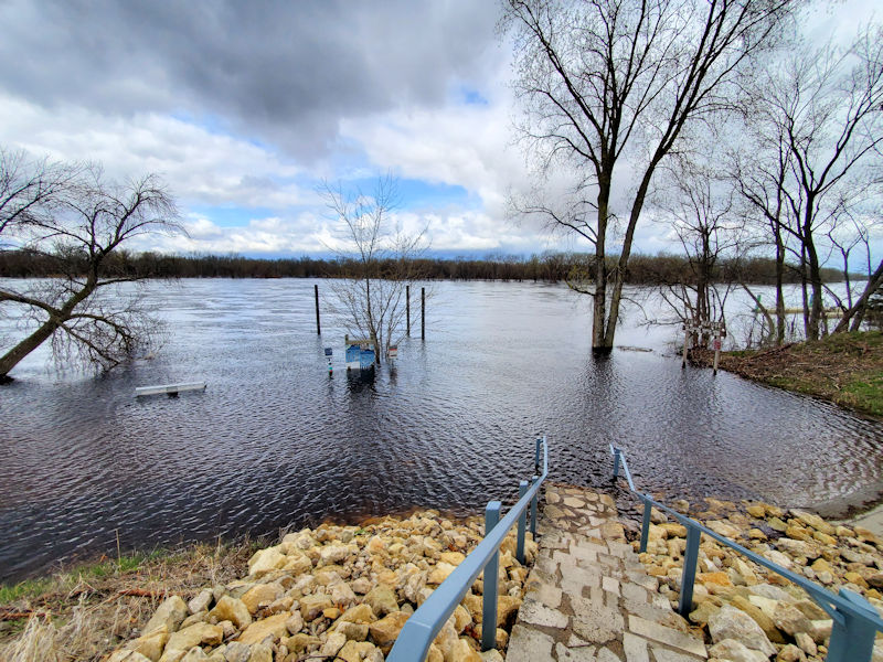
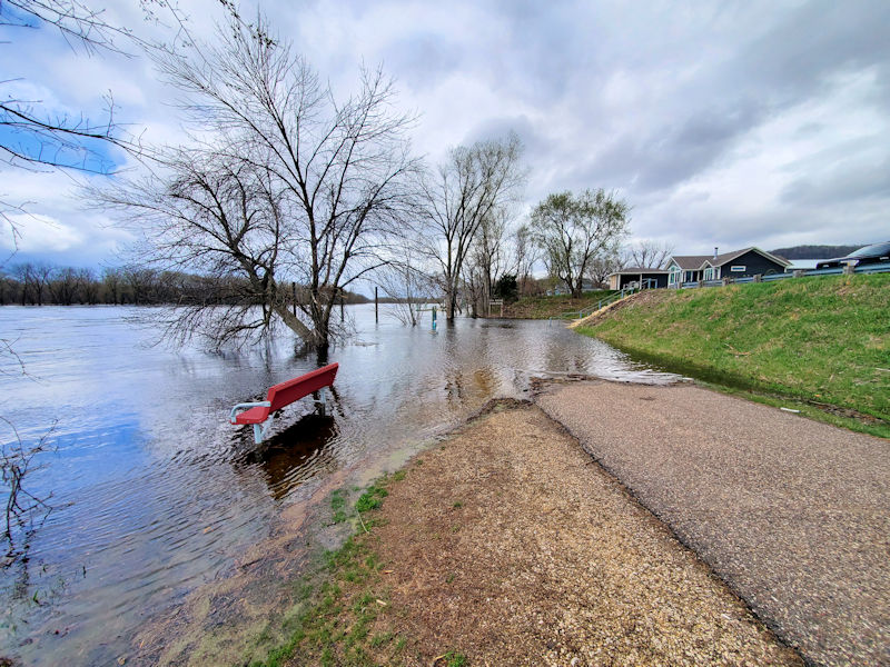
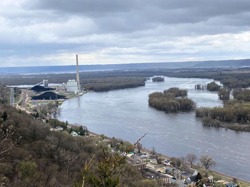
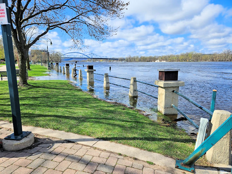
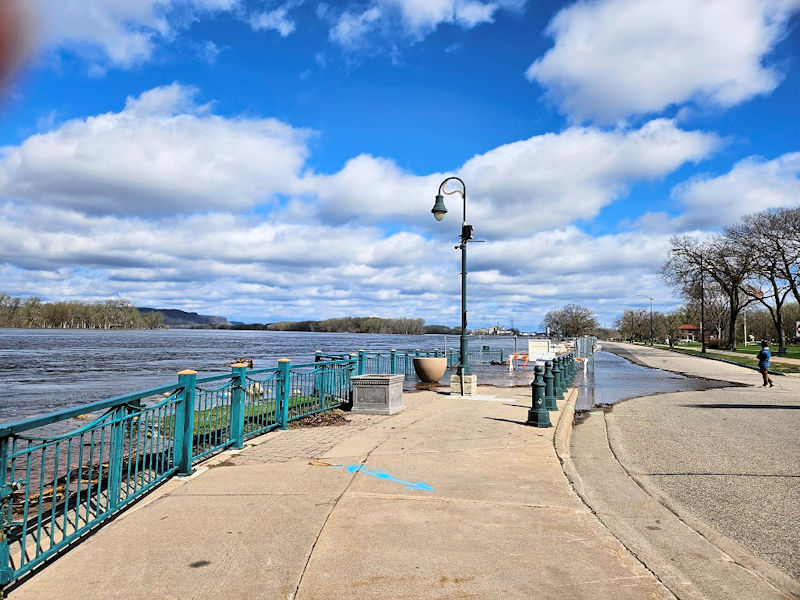
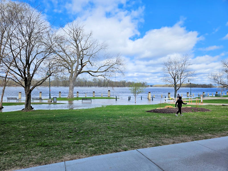
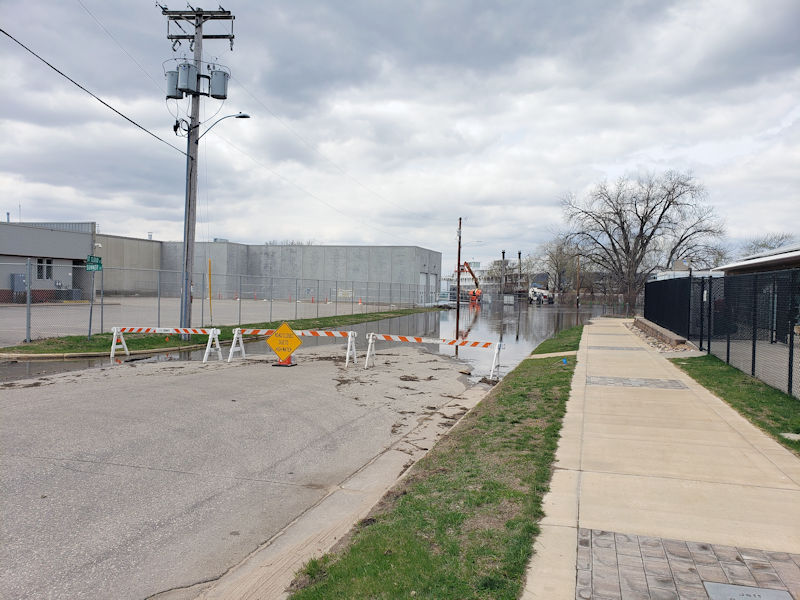
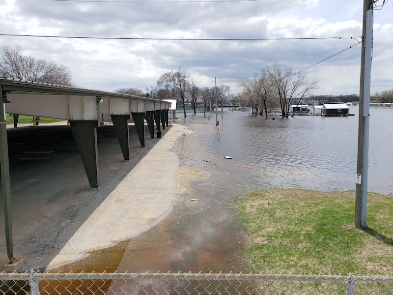
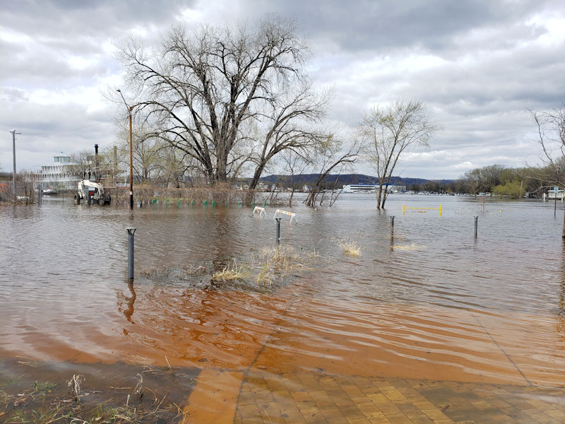
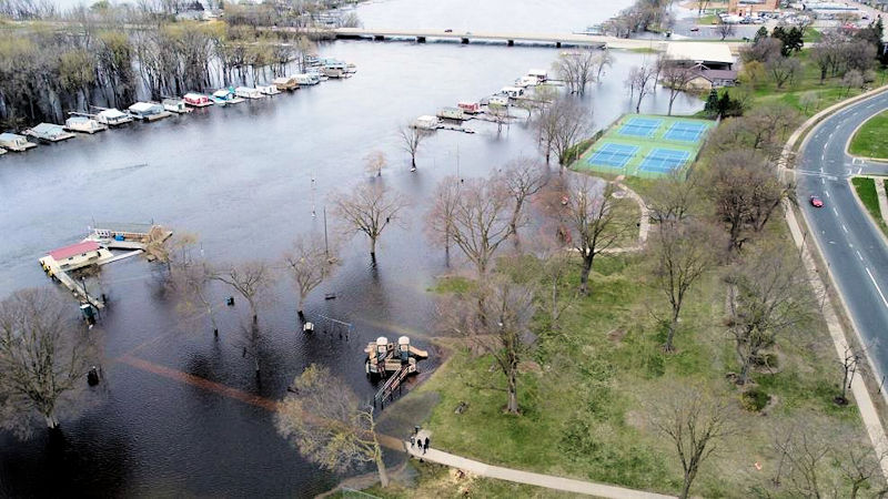
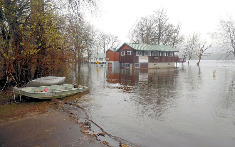
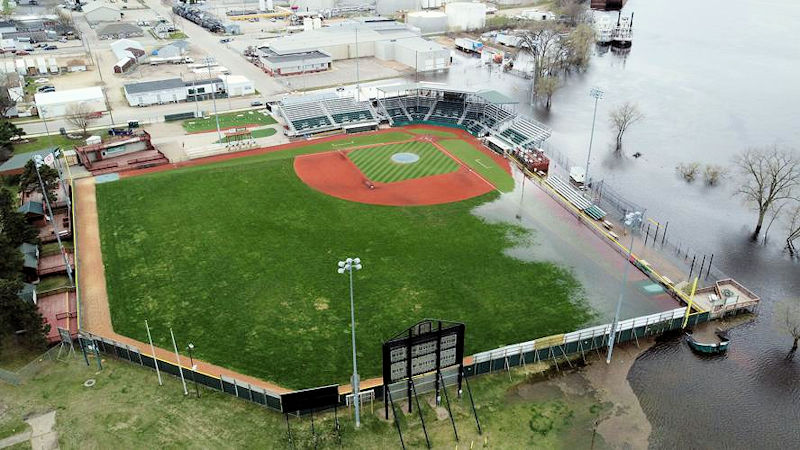
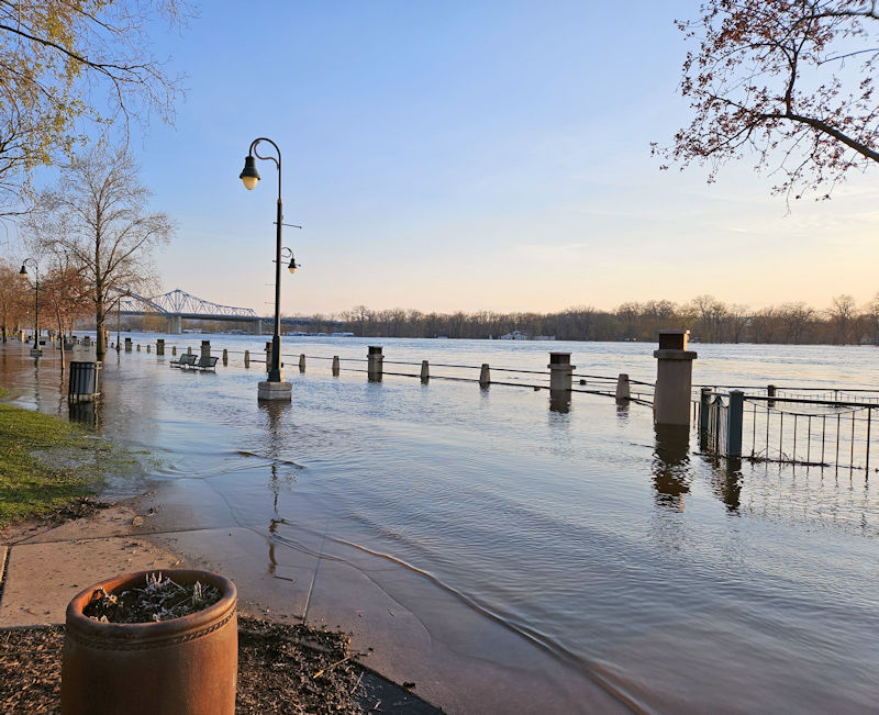
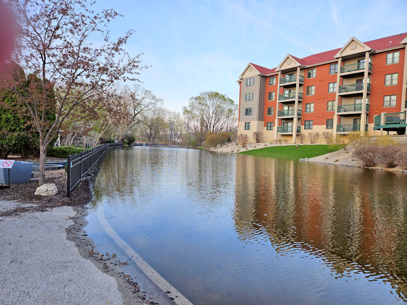
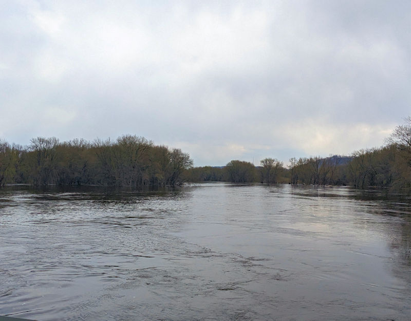
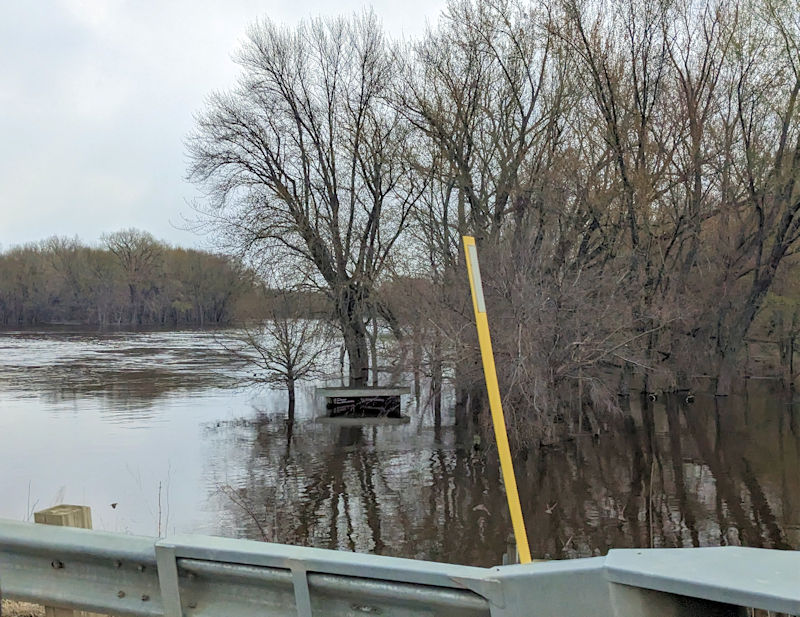
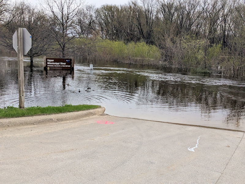
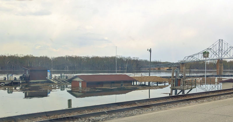
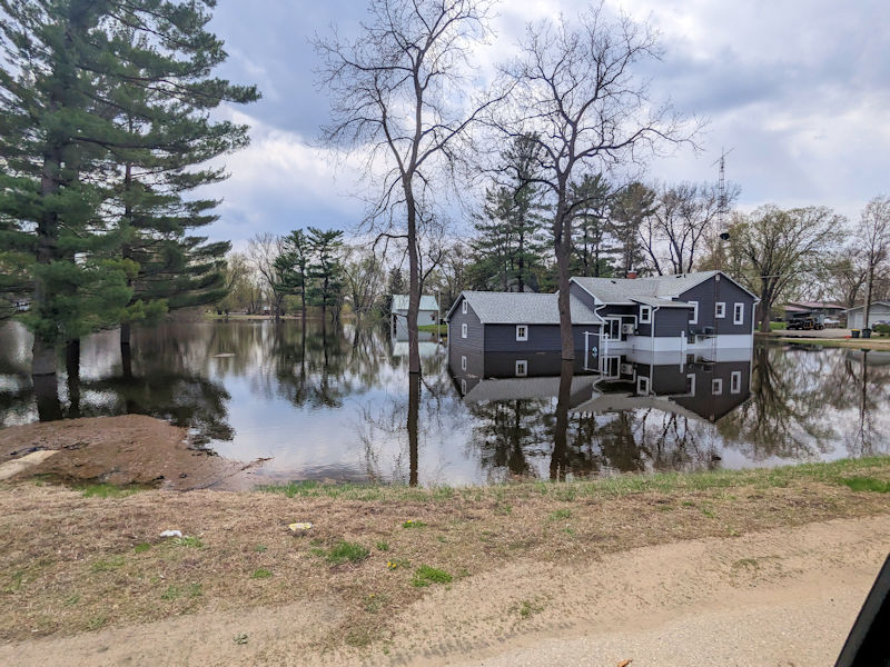
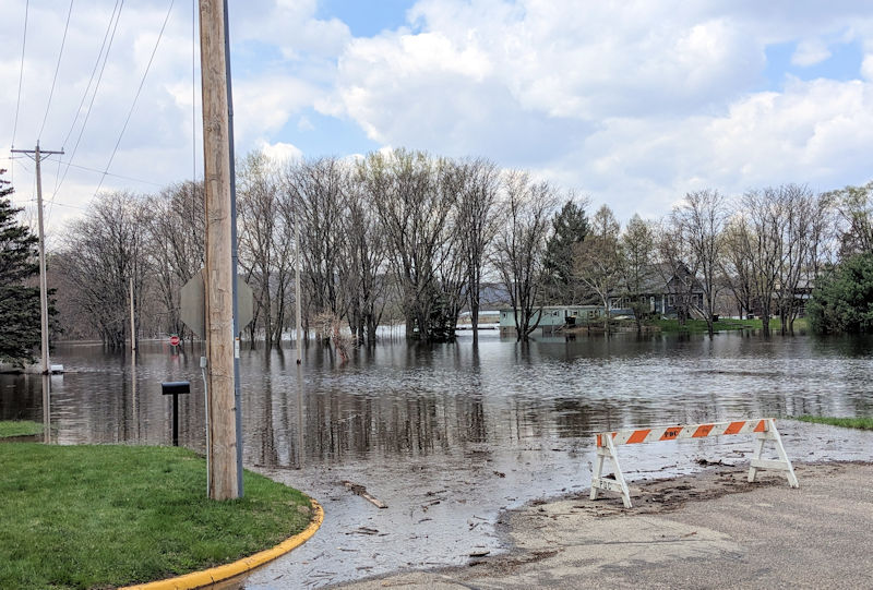
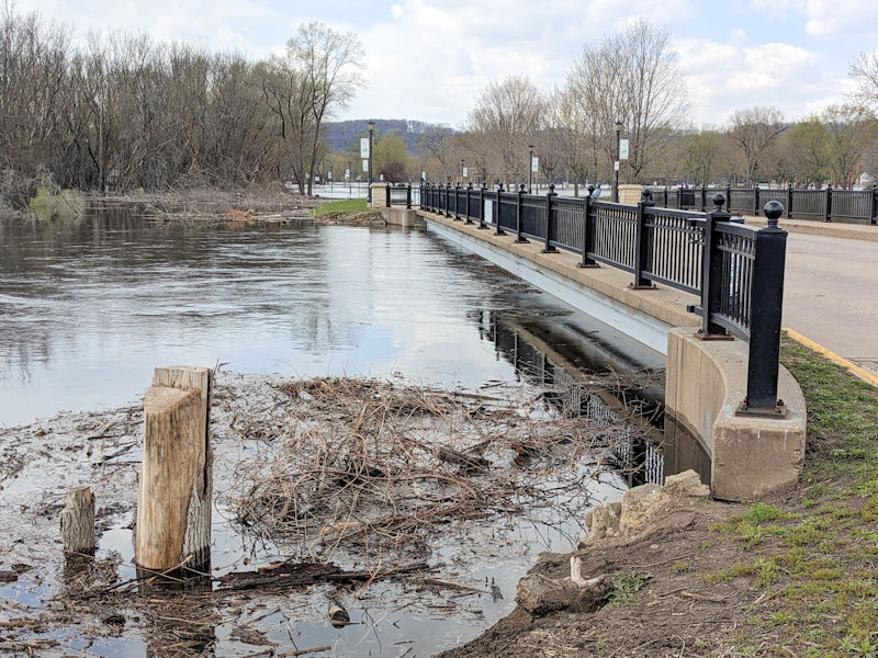
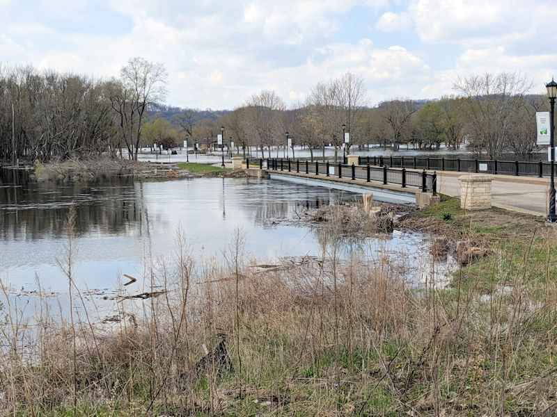
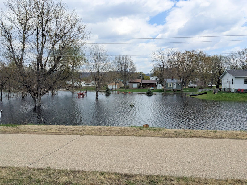
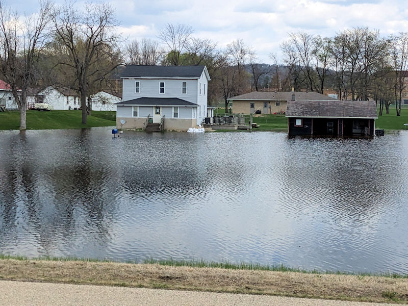
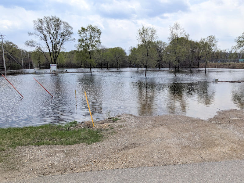
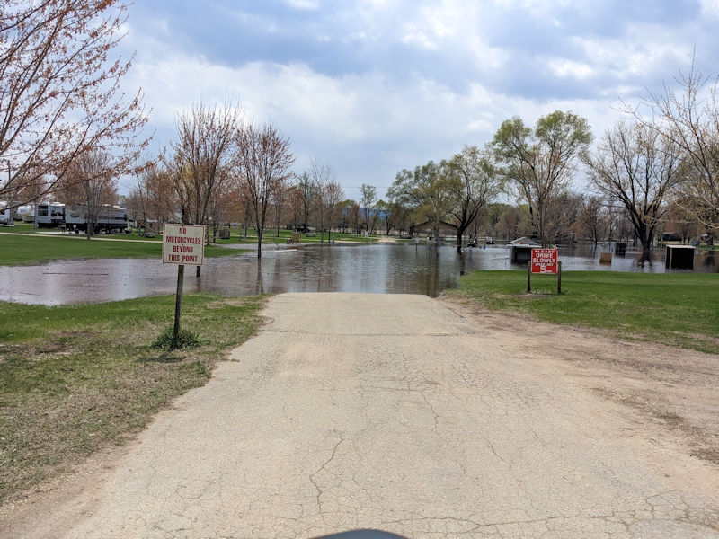
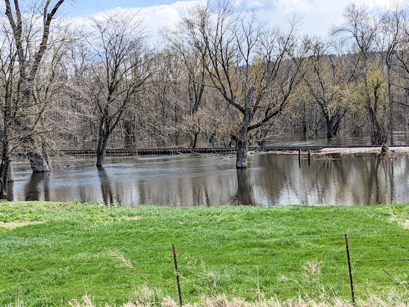
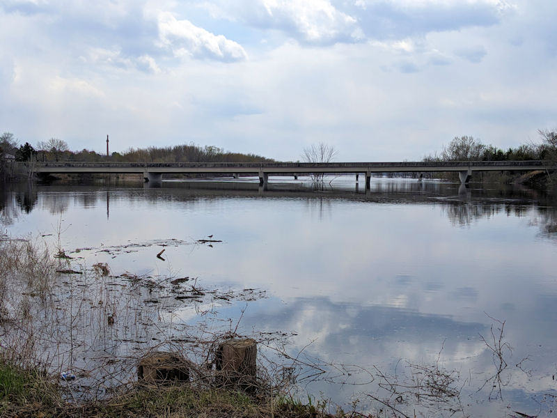
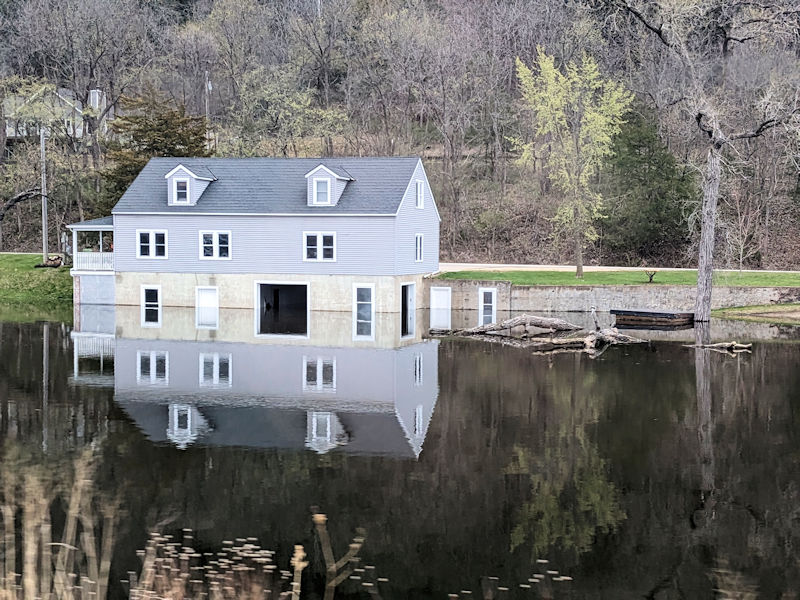
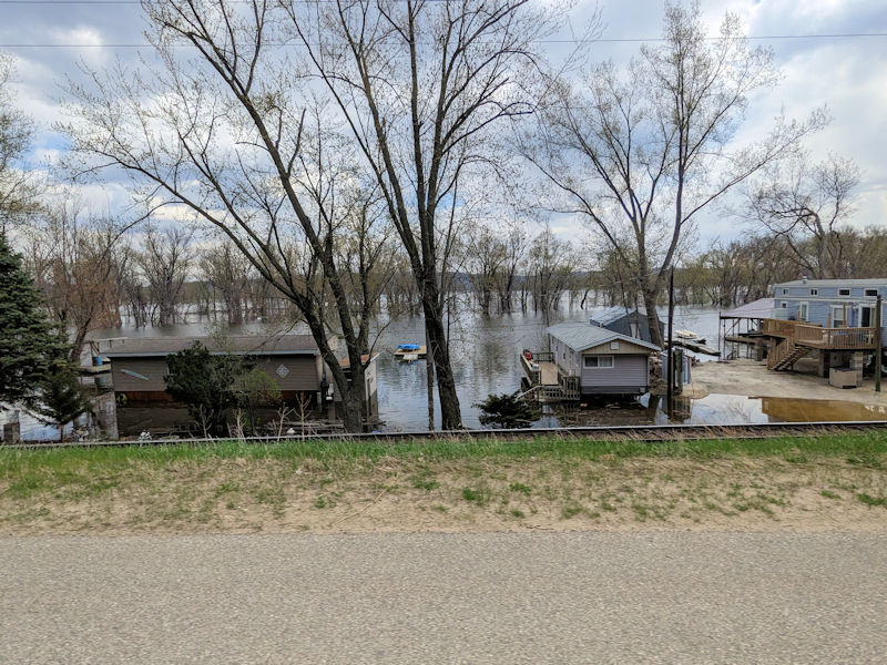
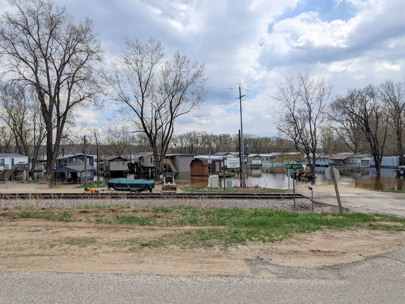
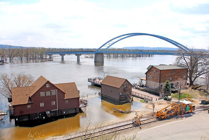
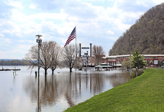
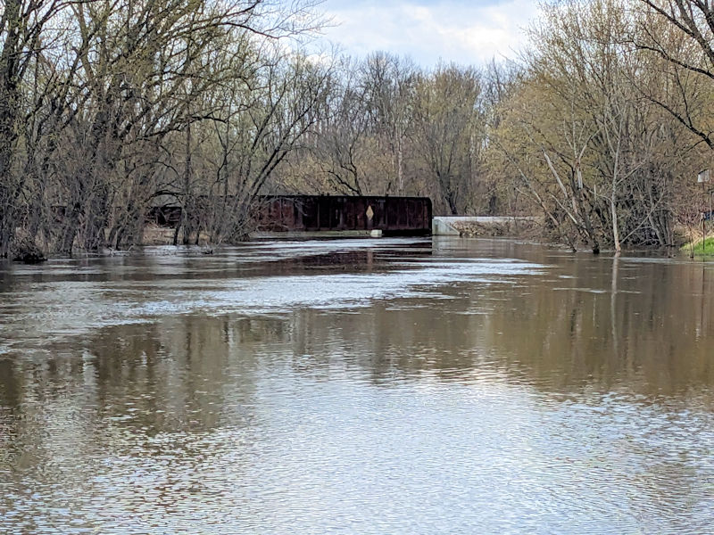
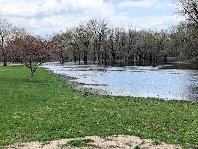
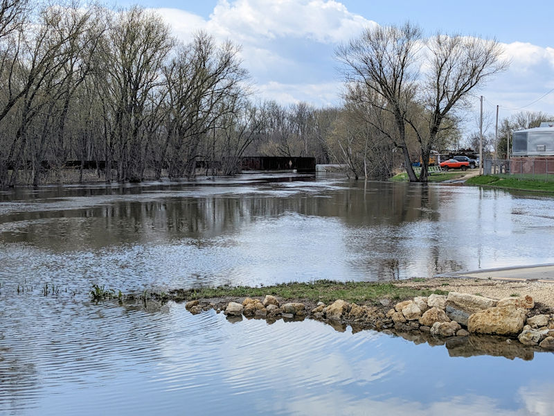
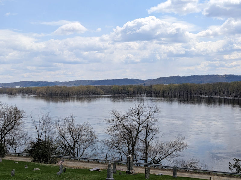
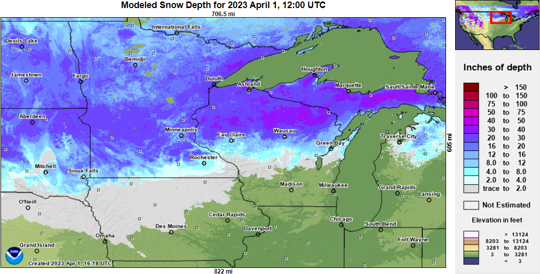
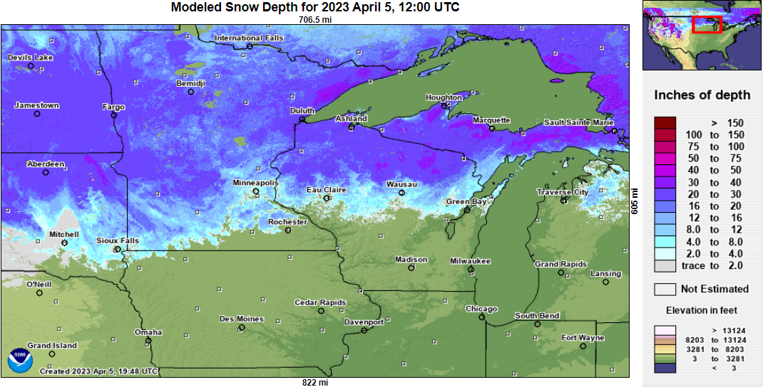
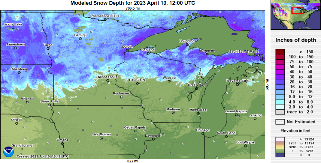
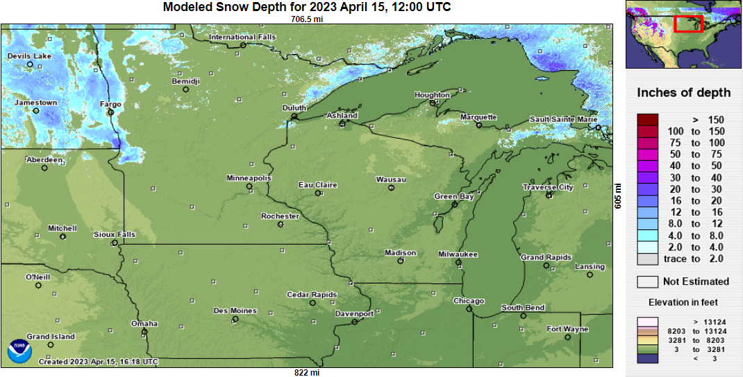
Major to moderate flooding impacted much of the Upper Mississippi River valley from late April through the early part of May 2023. Locations from Wabasha, MN down through Guttenberg, IA set Top 5 records for flooding, cresting about 1 to 1 1/2 feet under levels reached during the flood of 2001. Why so much water? There were several factors, highlighted by an abnormally deep snowpack across the headwaters of the Mississippi River and its northern tributaries (that feed it). A colder than normal March followed by a rapid warmup in April quickly melted the snow, dropping locations from over 20" of snow pack on April 1st to just a trace by mid month. While some of that snow melt was absorbed into the ground, much of it drained into the Mississippi River basin. In addition, April was an abnormally wet month, with rainfall aiding the snow melt and adding additional runoff in the river systems. Lastly, late season winter storms dropped more snow across northern parts of the region - providing another water resource to push river crests higher. In the end, much of this portion of the Mississippi River rose into flood toward the end of the 2nd week of April, cresting during the last week (24th through 28th). The flooding would not recede until the first and second weeks of May. Widespread low land flooding was experienced along the breadth of the Mississippi, impacting parks, campsites, roads, boat houses and near shore homes, docks, etc. Some roads and parks were closed for a period due to the flooding. |
 Mississippi River Crests Spring 2023 |
Hydrographs
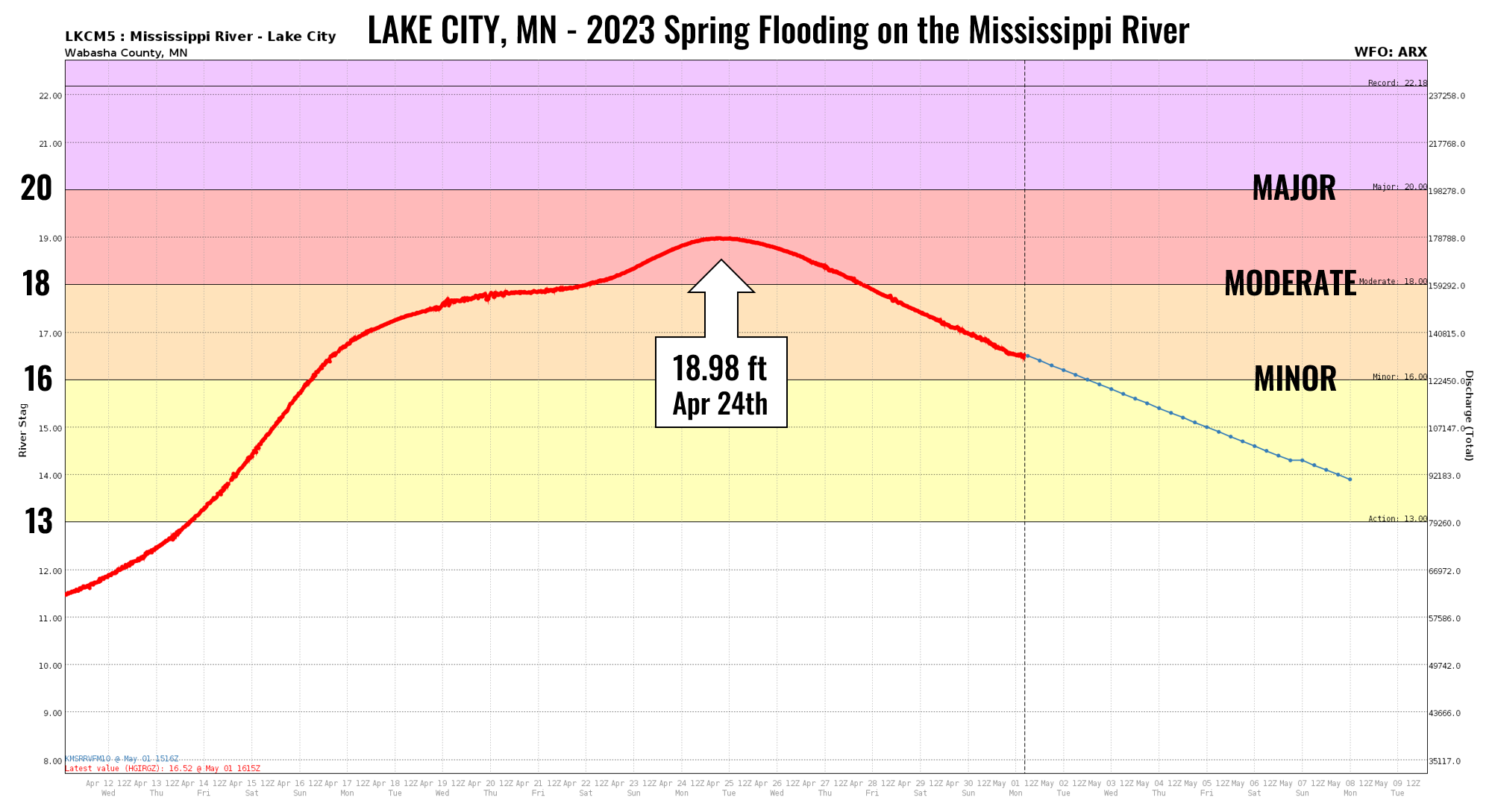
| Lake City PEAK CREST: 18.96 ft on April 24th |
 |
|
||||||||||||||
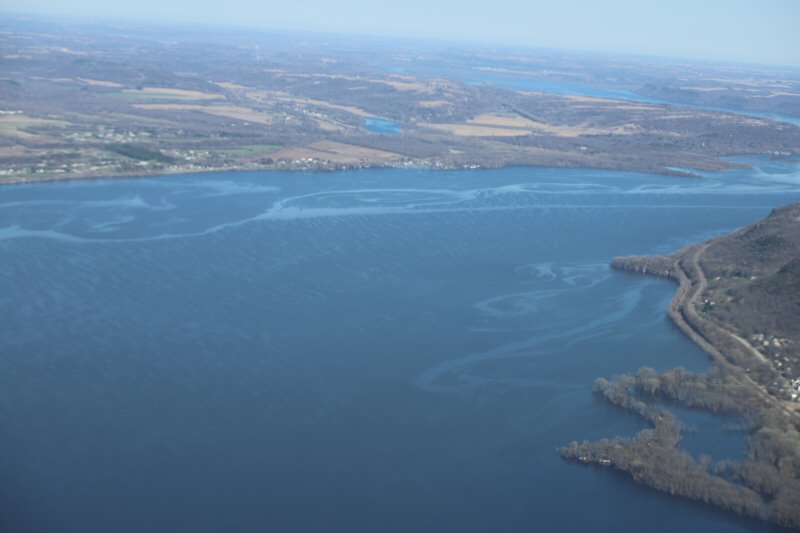 Lake Pepin (Photo by WIDNR) |
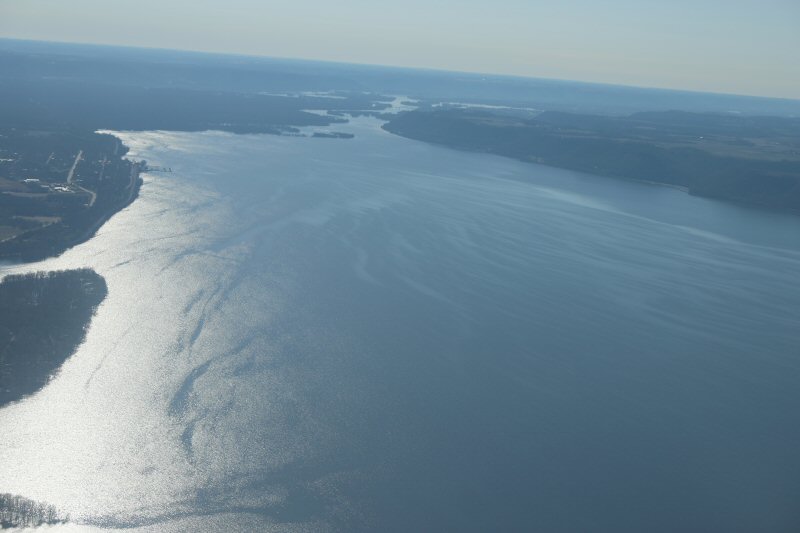 Lake Pepin (Photo by WIDNR) |
| WabashaPEAK CREST: 17.03 ft on April 25th |
 |
|
||||||||||||||
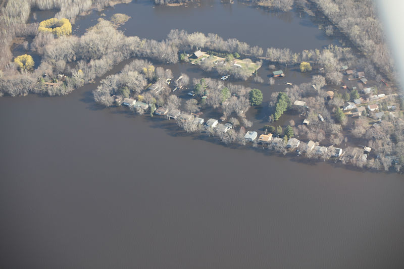 Wabasha, MN Apr 26th (Photo by WIDNR) |
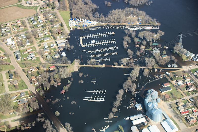 Wabasha, MN Apr 26th (Photo by WIDNR) |
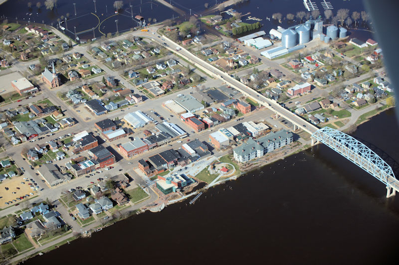 Wabasha, MN Apr 26th (Photo by WIDNR) |
 Wabasha, MN Apr 26th (Photo by WIDNR) |
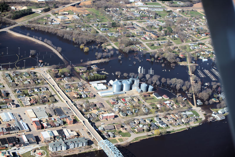
| AlmaPEAK CREST: 17.05 ft on April 25th |
 |
|
||||||||||||||
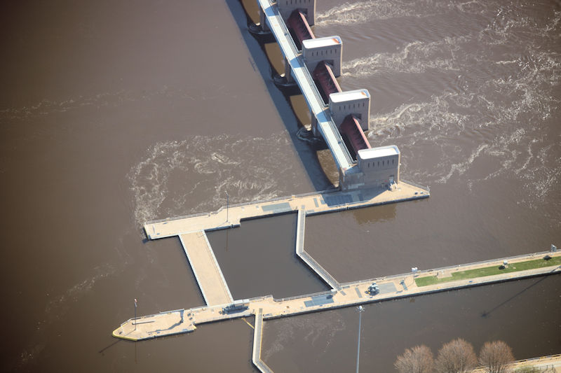
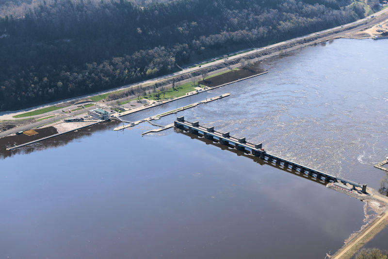
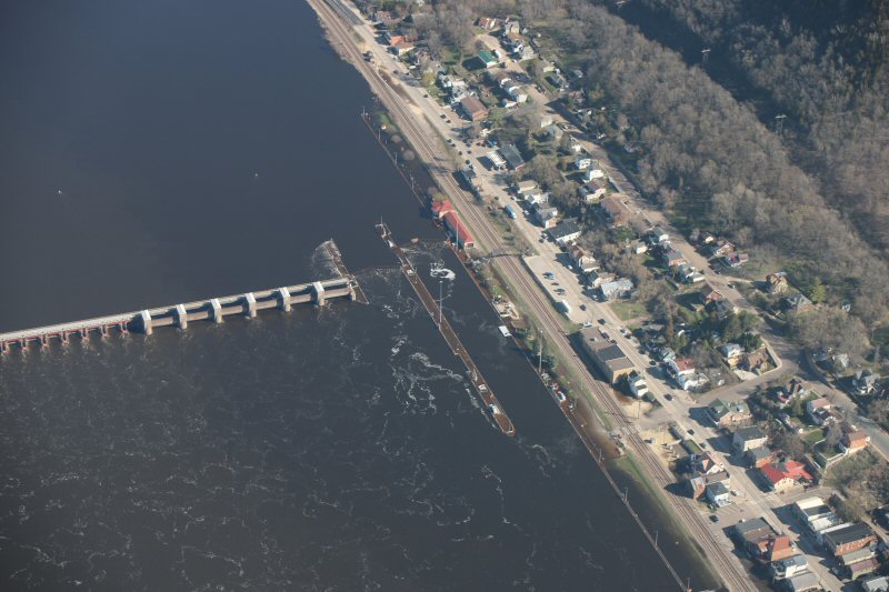 Lock & Dam 4 at Alma, WI (Photo by WIDNR) |
 Alma, WI Apr 26th (Photo by WIDNR) |
 Alma, WI Apr 26th (Photo by WIDNR) |
 Alma, WI Apr 21st (NWS La Crosse) |
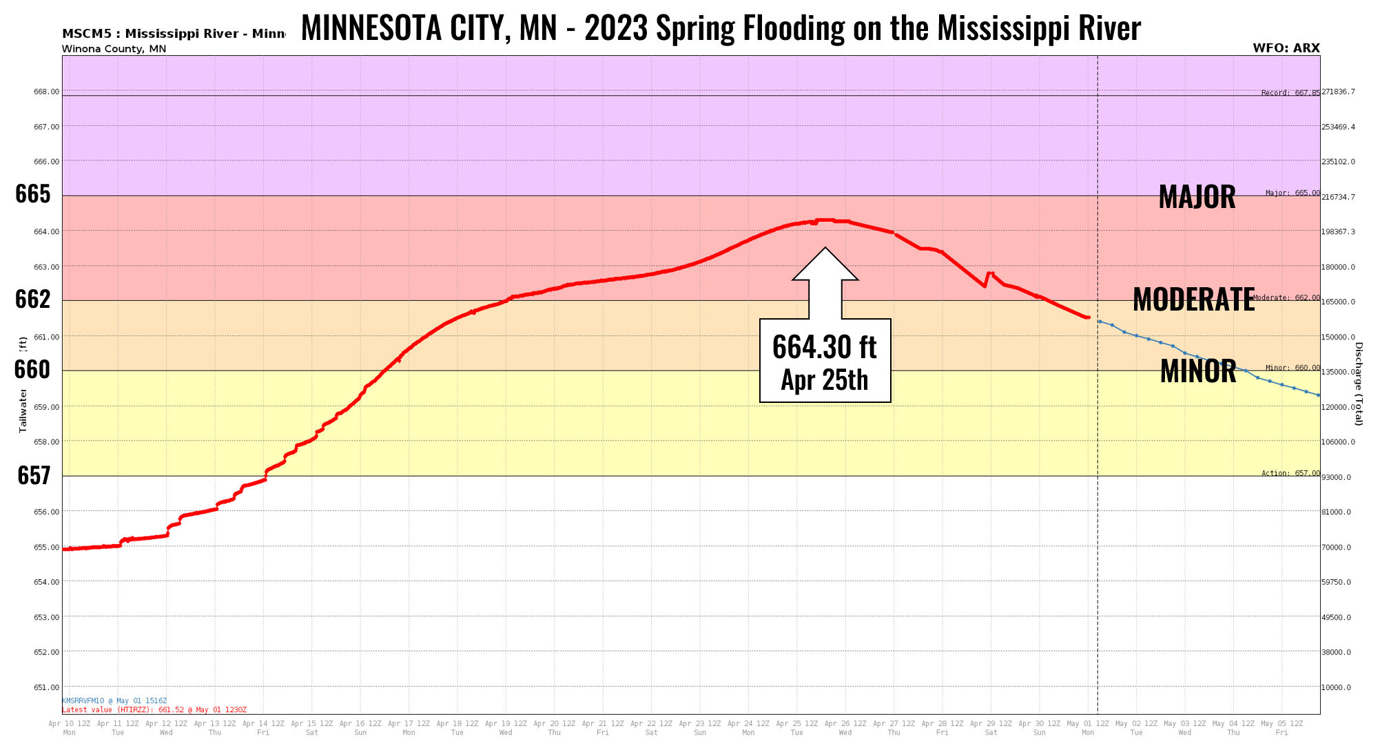
| Minnesota CityPEAK CREST: 664.30 ft on April 25th |
 |
|
||||||||||||||
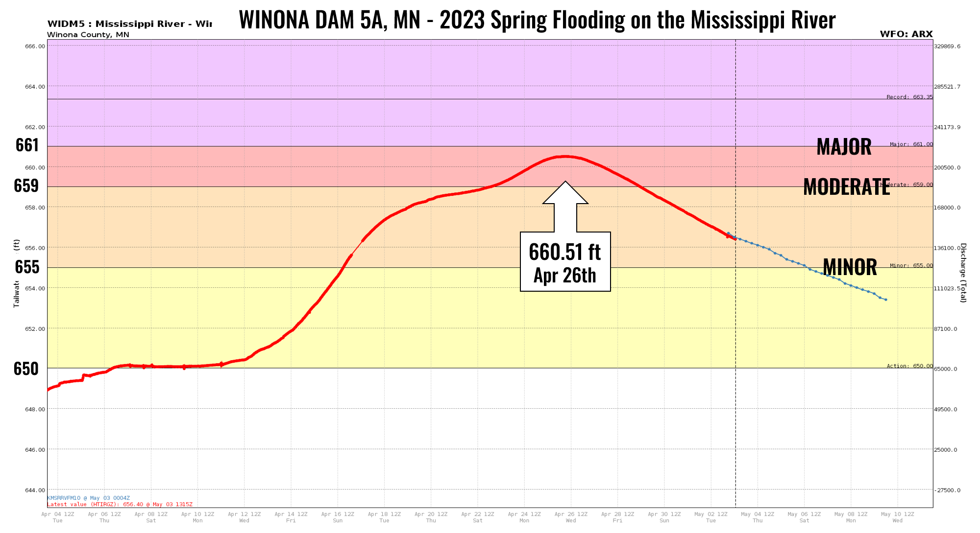
| Winona Dam 5APEAK CREST: 660.51 ft on April 26th |
 |
|
||||||||||||||
 Lock & Dam 5A Apr 26th (Photo by WIDNR) |
 Near Dam 5A (Breezy Point Ln) Apr 26th (Photo by WIDNR) |
 Across from Winona, MN Apr 26th (Photo by WIDNR) |
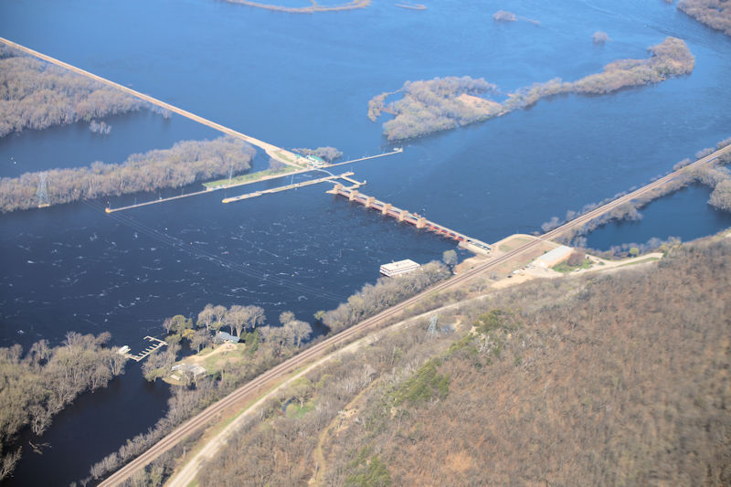
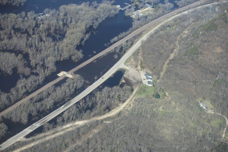
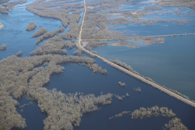
| WinonaPEAK CREST: 18.81 ft on April 26th |
 |
|
||||||||||||||
 Near Winona, MN Apr 26th (Photo by WIDNR) |
 Near Winona, MN Apr 26th (Photo by WIDNR) |
 Near Winona, MN Apr 26th (Photo by WIDNR) |
 Winona, MN Apr 25th (Photo by Winona Co. Emerg.Mgmt) |
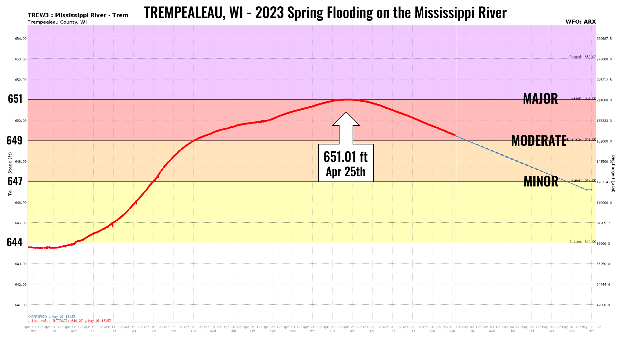
| TrempealeauPEAK CREST: 651.01 ft on April 25th |
 |
|
||||||||||||||
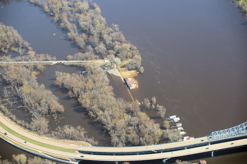
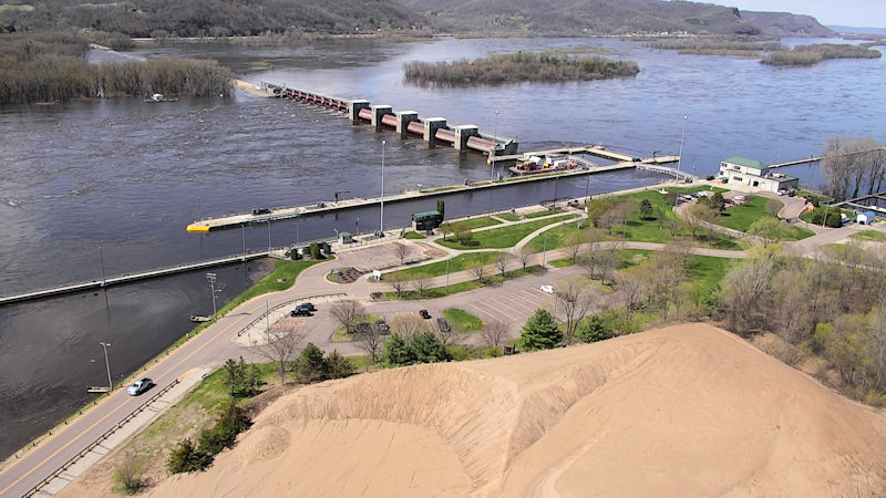 Lock & Dam 6 Trempealeau (Photo by WIDNR) |
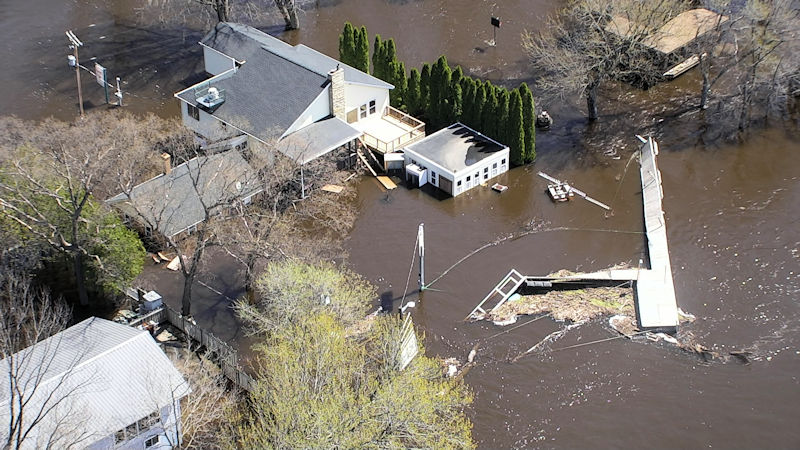 Near Trempealeau, WI (Photo by WIDNR) |
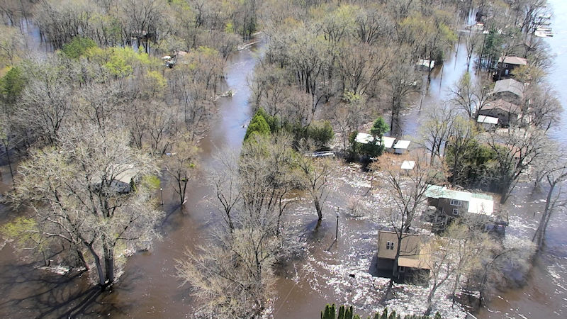 Near Trempealeau, WI (Photo by WIDNR) |
 Near Trempealeau, WI (Photo by WIDNR) |
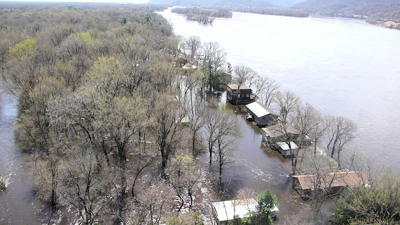
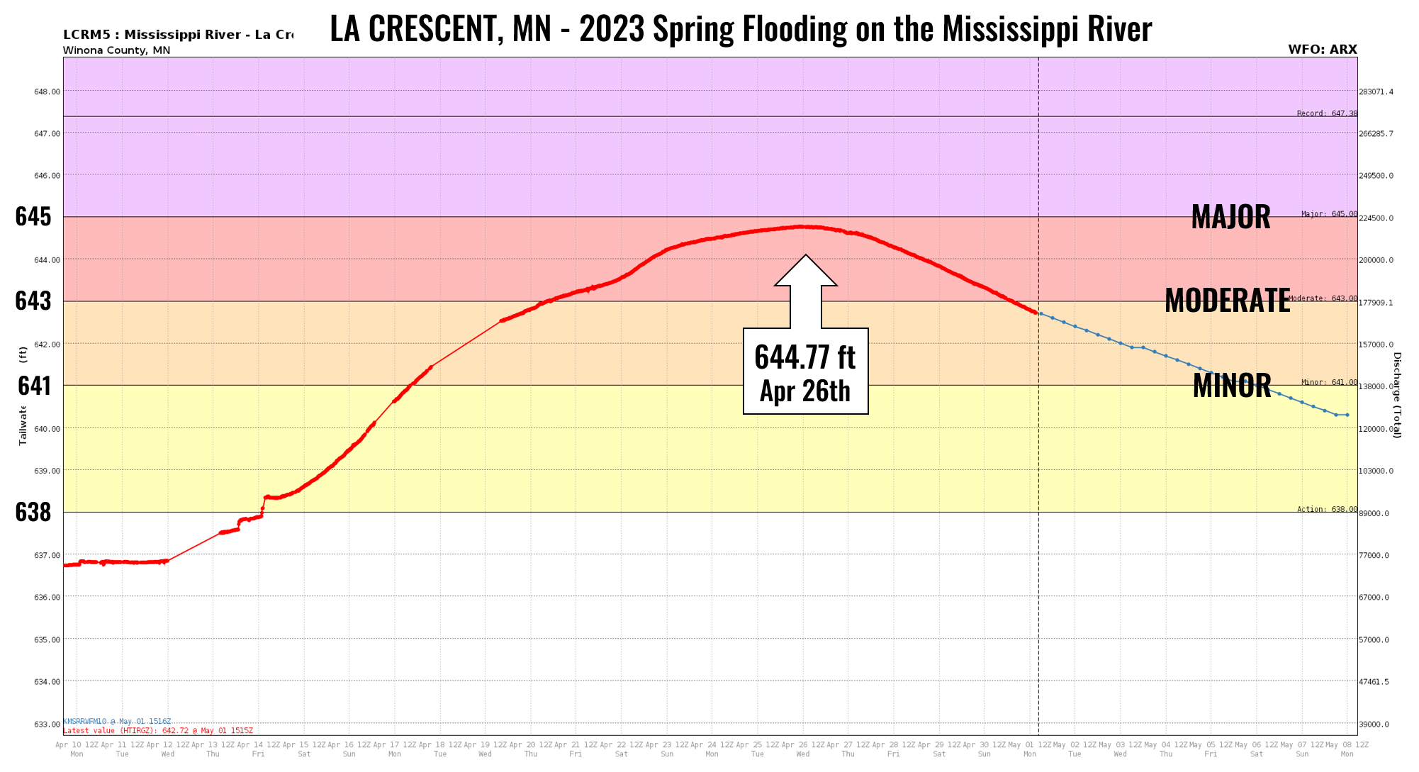
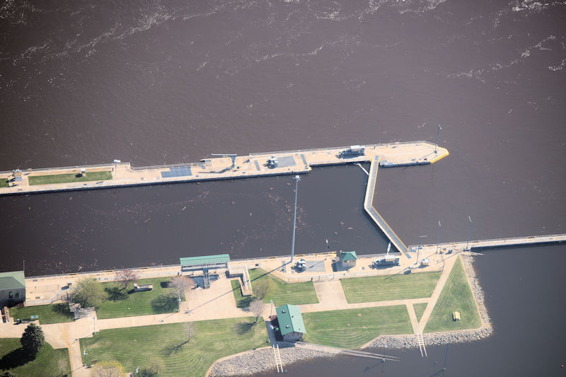
| La CrescentPEAK CREST: 644.77 ft on April 26th |
 |
|
||||||||||||||
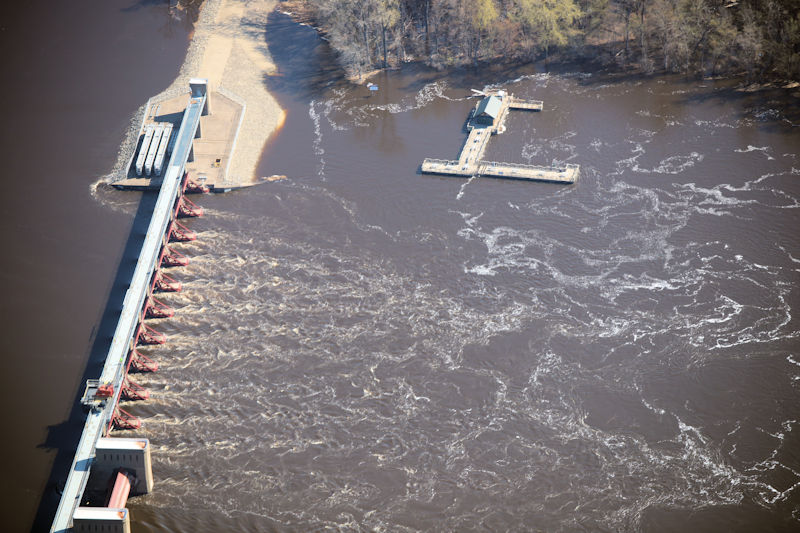 Lock & Dam 7 at Dresbach/La Crescent, MN (Photo by WIDNR) |
 La Crescent, MN Apr 26th (Photo by WIDNR) |
 La Crescent, MN Apr 26th (Photo by WIDNR) |
 Near La Crescent, MN Apr 26th (Photo by WIDNR) |
| La CrossePEAK CREST: 15.89 ft on April 26th |
 |
|
||||||||||||||
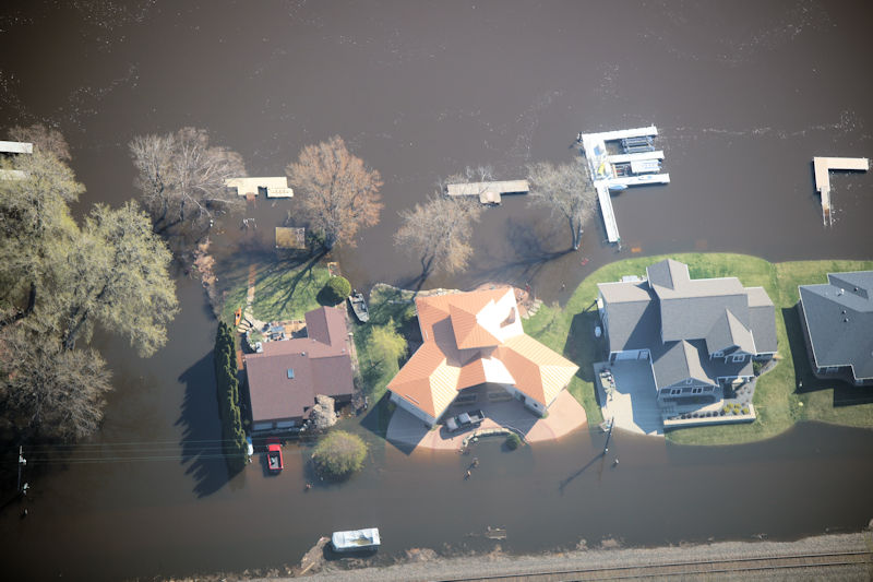
 La Crosse, WI Apr 26th (Photo by WIDNR) |
 La Crosse, WI Apr 26th (Photo by WIDNR) |
 La Crosse, WI Apr 26th (Photo by WIDNR) |
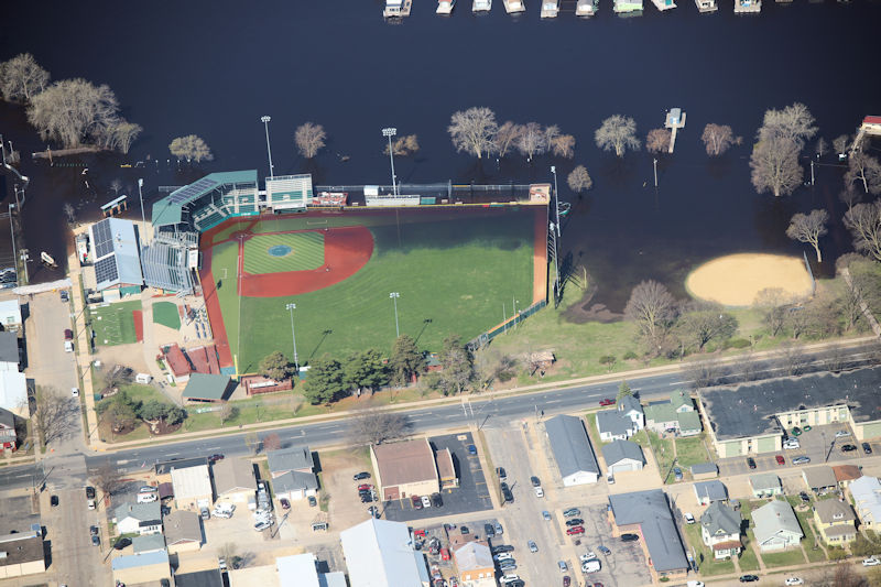 La Crosse, WI Apr 26th (Photo by WIDNR) |
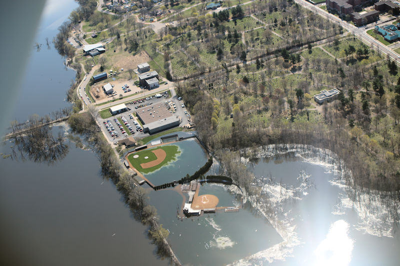
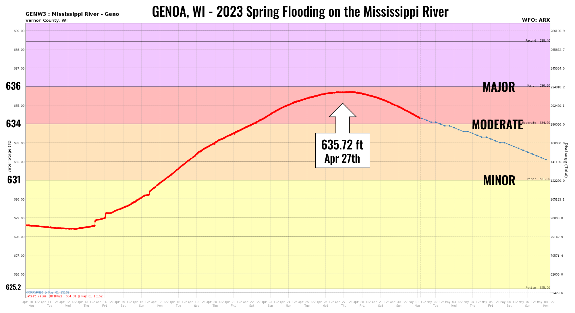
| GenoaPEAK CREST: 635.72 ft on April 27th |
 |
|
||||||||||||||
 Lock & Dam 8 Genoa, WI (Photo by WIDNR) |
 Genoa, WI Apr 26th (Photo by WIDNR) |
 South of Genoa, WI Apr 26th (Photo by WIDNR) |
 Stoddard, WI Apr 26th (Photo by WIDNR) |
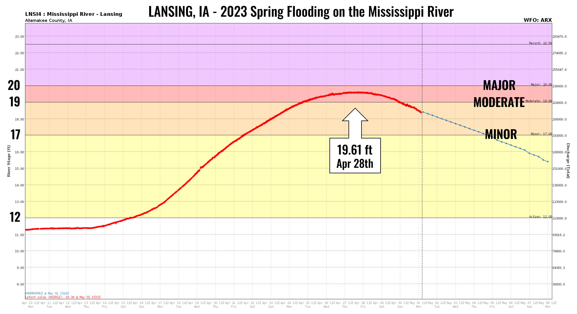
| LansingPEAK CREST: 19.61 ft on April 28th |
 |
|
||||||||||||||
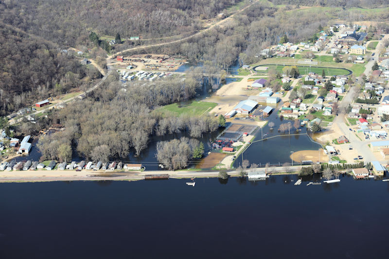 Lansing, IA Apr 26th (Photo by WIDNR) |
 Lansing, IA Apr 26th (Photo by WIDNR) |
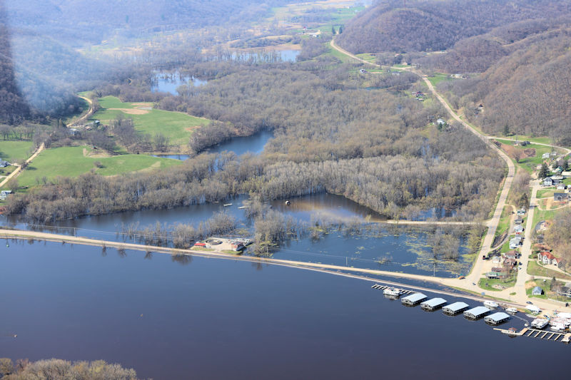
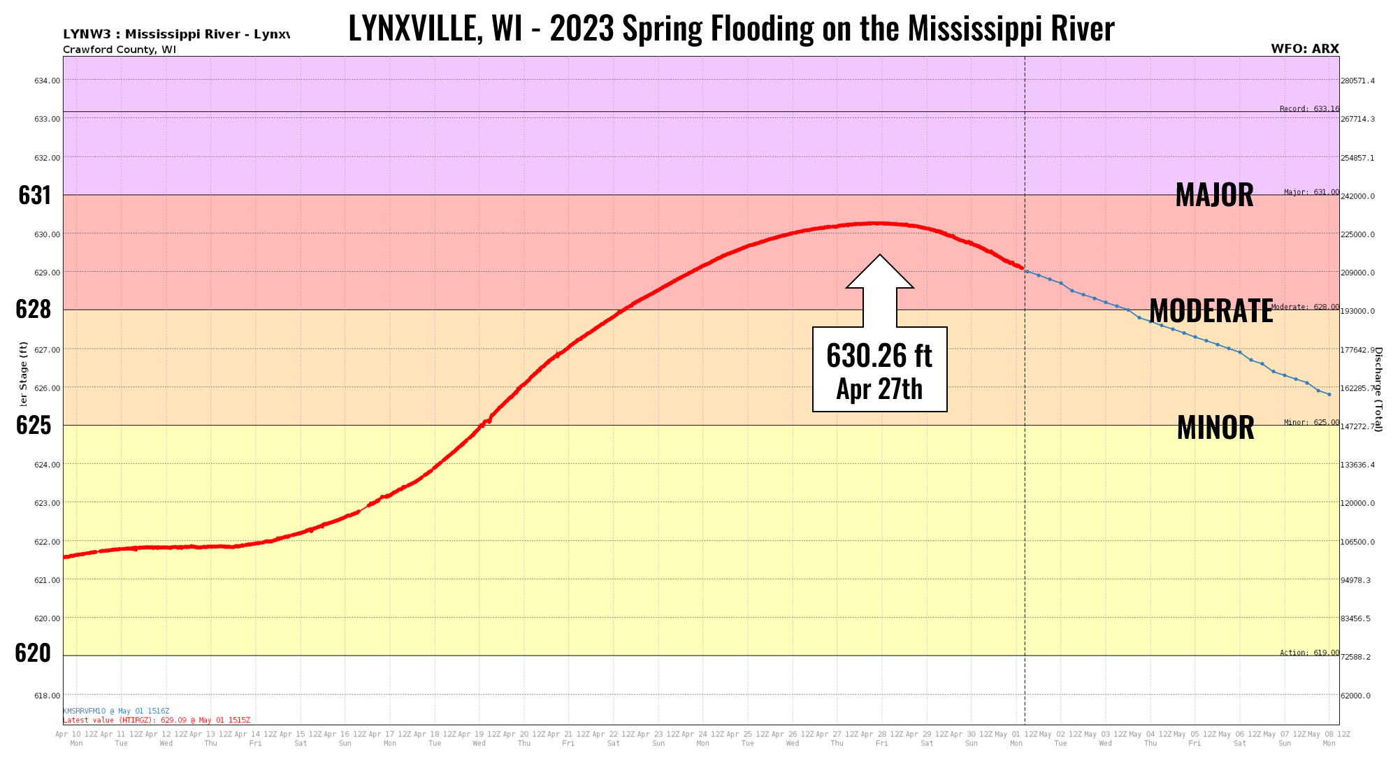
| LynxvillePEAK CREST: 630.26 ft on April 27th |
 |
|
||||||||||||||
 Frenchman's Landing Apr 26th (Photo by WIDNR) |
 Frenchman's Landing Apr 26th (Photo by WIDNR) |
 Apr 26th (Photo by WIDNR) |
 Apr 26th (Photo by WIDNR) |
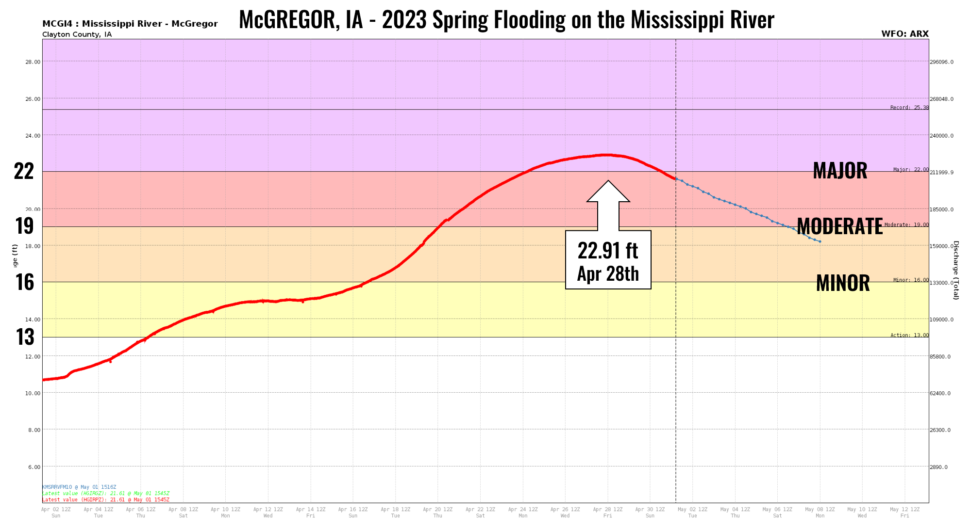
| McGregorPEAK CREST: 22.91 ft on April 28th |
 |
|
||||||||||||||
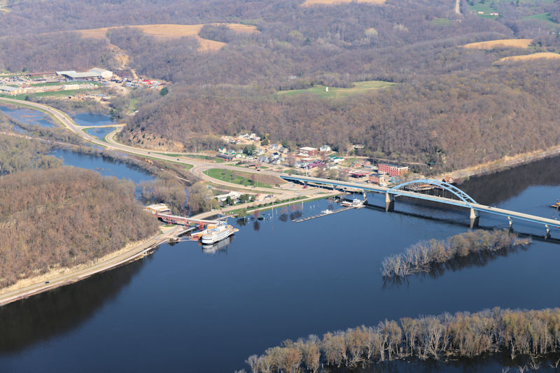 Marquette, IA Apr 26th (Photo by WIDNR) |
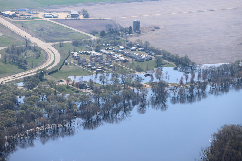 Prairie du Chien, WI Apr 26th (Photo by WIDNR) |
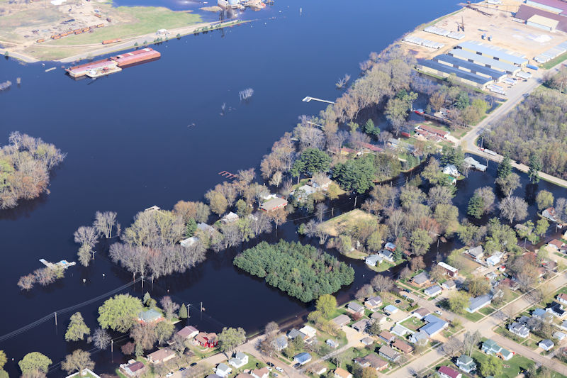 Prairie du Chien, WI Apr 26th (Photo by WIDNR) |
 Prairie du Chien, WI Apr 26th (Photo by WIDNR) |
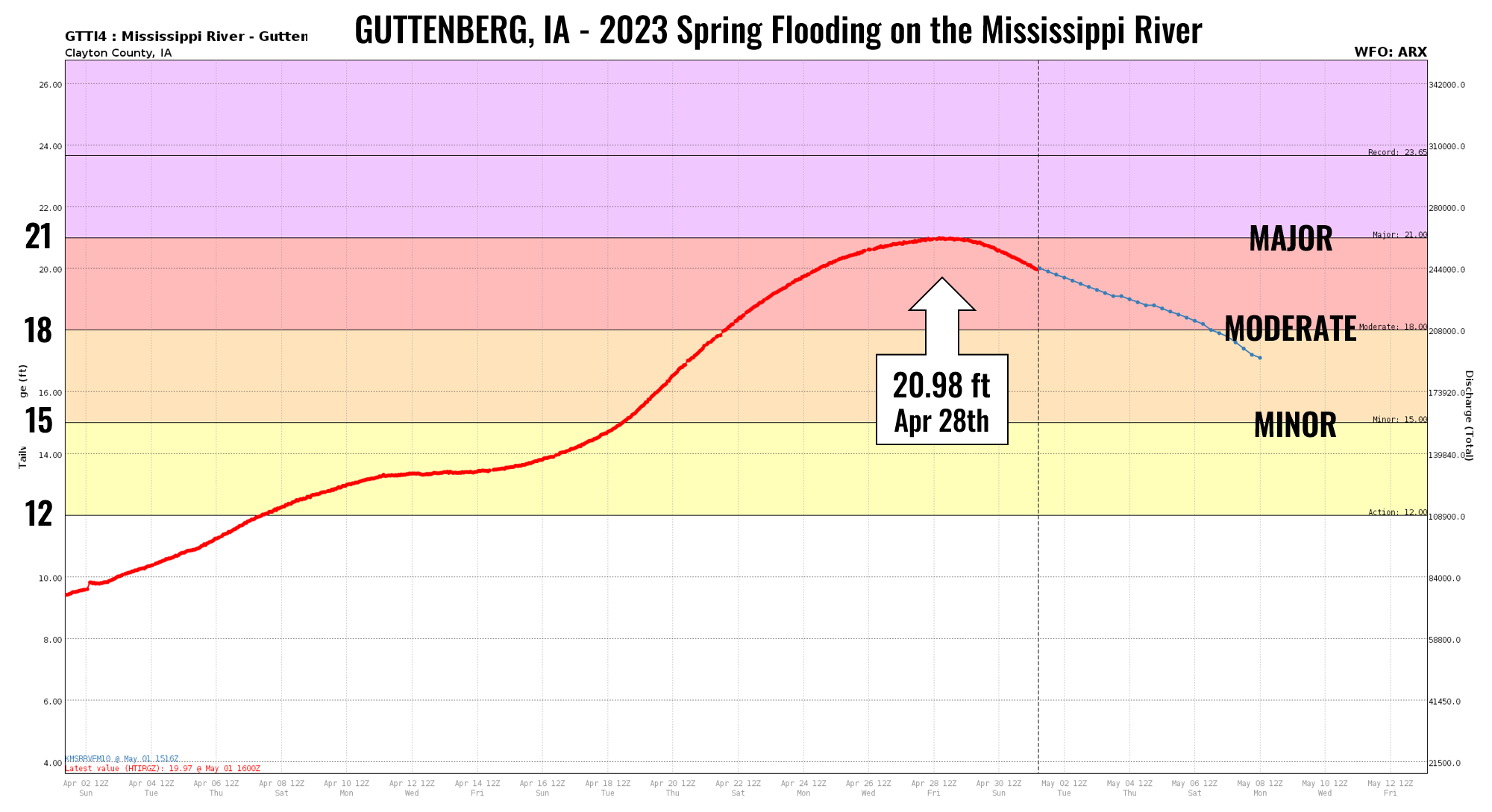
| GuttenbergPEAK CREST: 20.98 ft on April 28th |
 |
|
||||||||||||||
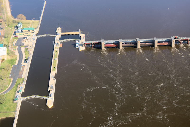 Lock & Dam 10 at Guttenberg, IA (Photo by WIDNR) |
 Near Guttenberg, IA Apr 26th (Photo by WIDNR) |
 Near Guttenberg, IA Apr 26th (Photo by WIDNR) |
 Near Guttenberg, IA Apr 26th (Photo by WIDNR) |
Photos
Alma
 |
|
 |
 |
| April 21st (NWS La Crosse) |
April 21st (NWS La Crosse) |
April 21st (NWS La Crosse) |
April 21st (NWS La Crosse) |
 |
 |
 |
 |
| April 29th (NWS La Crosse) |
April 29th (NWS La Crosse) |
Lock & Dam 4 at Alma (NWS La Crosse) |
April 29th (NWS La Crosse) |
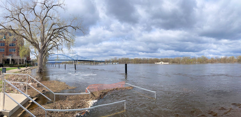
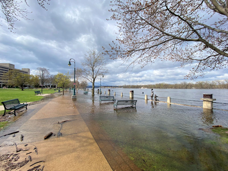
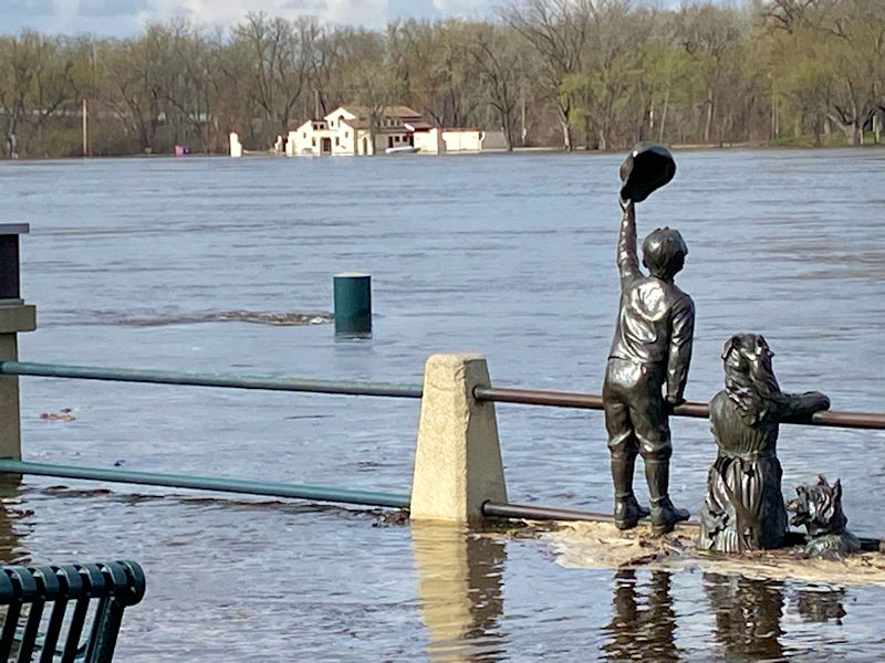
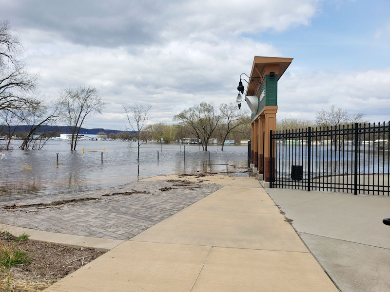
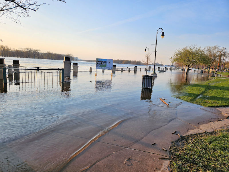
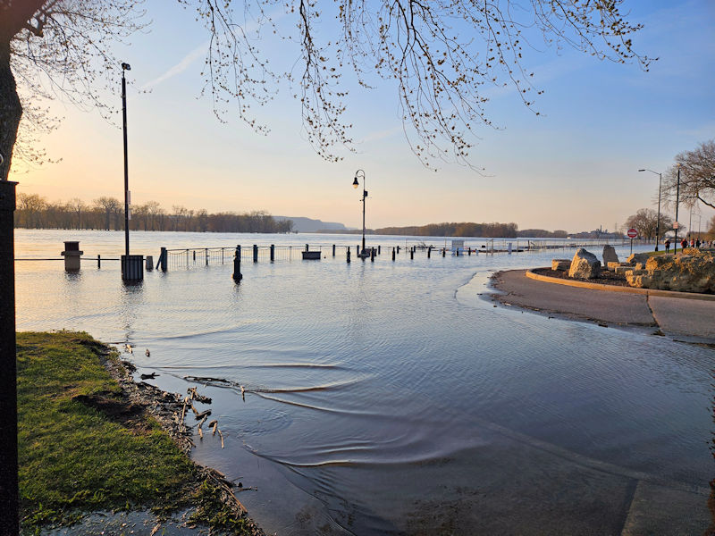
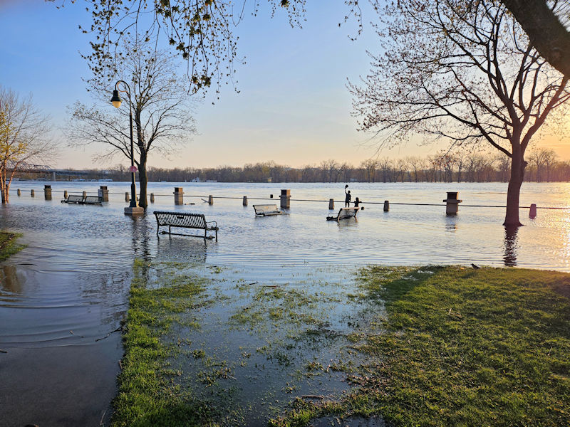
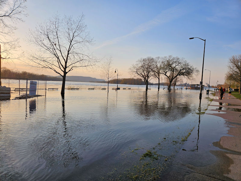
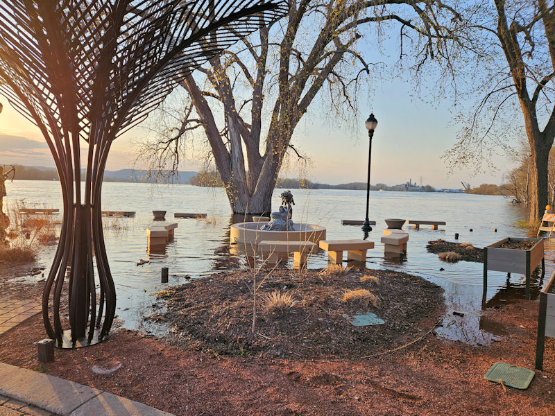
La Crosse Area
 |
 |
 |
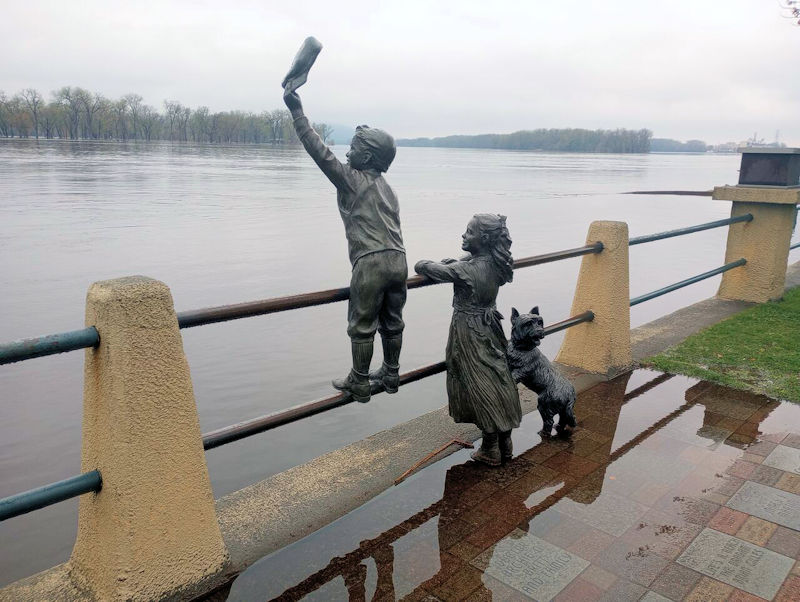 |
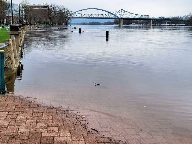
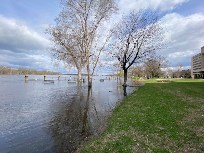
| Riverside Park April 20th (NWS La Crosse) |
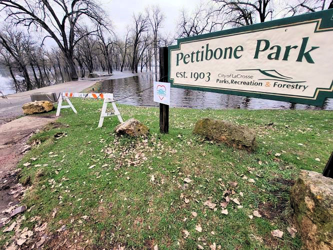
Pettibone Park April 20th (NWS La Crosse) |
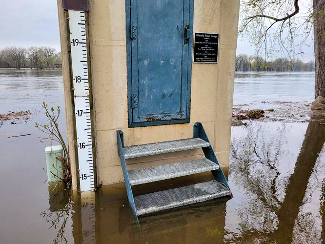
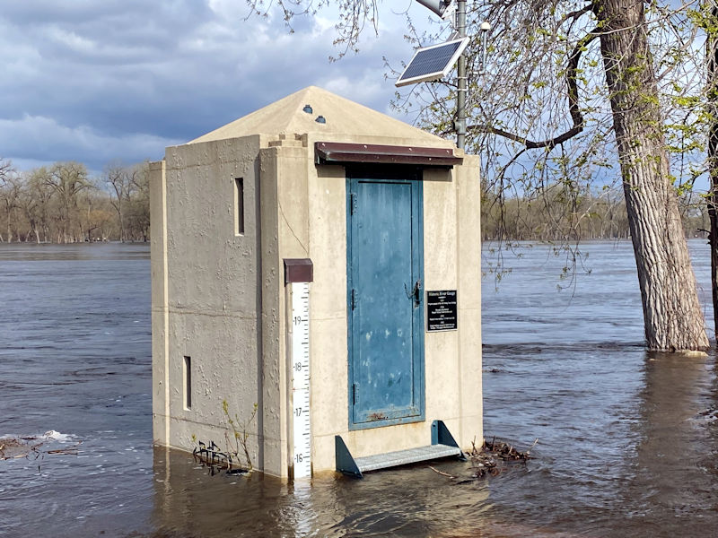
Historic River Gage April 21st (NWS La Crosse) |
Riverside Park April 20th (NWS La Crosse) |
 |
 |
 |
 |
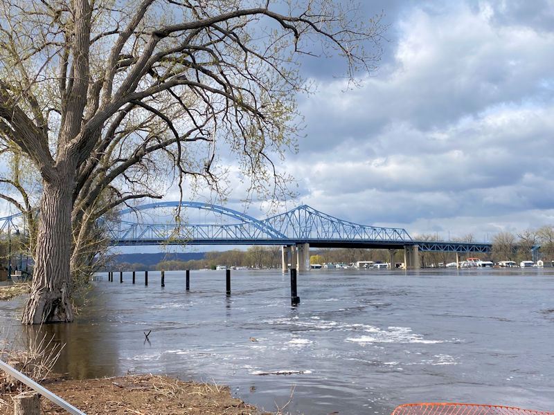
| Riverside Park April 21st (NWS La Crosse) |
Riverside Park April 21st (NWS La Crosse) |
Riverside Park April 21st (NWS La Crosse) |
Green Island Park April 21st (NWS La Crosse) |
 |
 |
 |
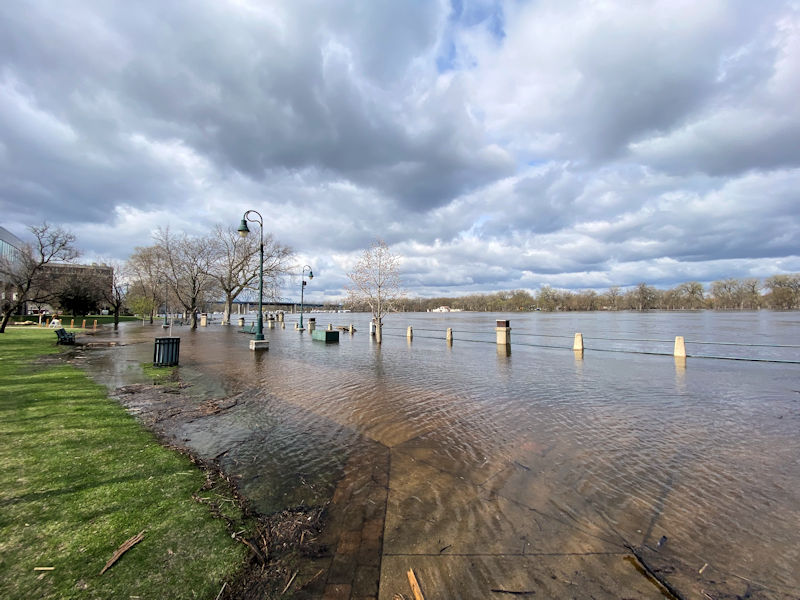 |
| Riverside Park April 23rd (NWS La Crosse) |
Riverside Park April 23rd (NWS La Crosse) |
Riverside Park April 23rd (NWS La Crosse) |
Riverside Park April 23rd (NWS La Crosse) |
 |
 |
 |
 |
| Riverside Park April 23rd (NWS La Crosse) |
Historic River Gage April 23rd (NWS La Crosse) |
Riverside Park April 23rd (NWS La Crosse) |
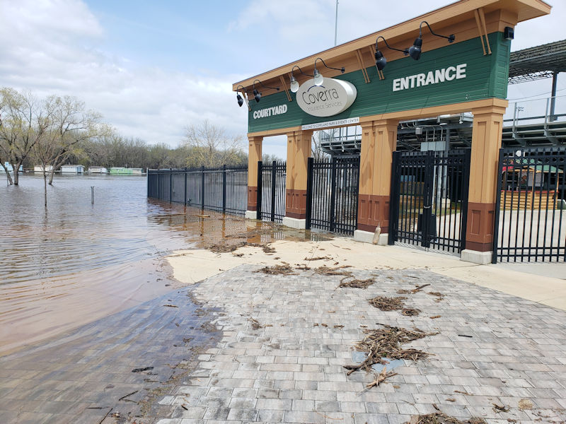
Copeland Park April 23rd (NWS La Crosse) |
 |
 |
 |
 |
| Copeland Park April 23rd (NWS La Crosse) |
Copeland Park April 23rd (NWS La Crosse) |
Copeland Park April 23rd (NWS La Crosse) |
Copeland Park April 23rd (NWS La Crosse) |
 |
 |
 |
 |
| Copeland Park April 24th (source) |
Trempealeau, WI April 24th (NWS La Crosse) |
Copeland Park April 24th (Photo by La Crosse Tribune) |
Riverside Park April 26th (NWS La Crosse) |
 |
 |
 |
 |
| Riverside Park April 26th (NWS La Crosse) |
Riverside Park April 26th (NWS La Crosse) |
Riverside Park April 26th (NWS La Crosse) |
Riverside Park April 26th (NWS La Crosse) |
 |
 |
||
| Riverside Park April 26th (NWS La Crosse) |
Riverside Park April 26th (NWS La Crosse) |
Caption (source) |
Caption (source) |
Lansing, IA
 |
 |
 |
 |
| Apr 24th (NWS La Crosse) |
Apr 24th (NWS La Crosse) |
Apr 24th (NWS La Crosse) |
Apr 24th (NWS La Crosse) |
Prairie du Chien, WI
 |
 |
 |
 |
| Apr 24th (NWS La Crosse) |
Apr 24th (NWS La Crosse) |
Apr 24th (NWS La Crosse) |
Apr 24th (NWS La Crosse) |
 |
 |
 |
 |
| Apr 24th (NWS La Crosse) |
Apr 24th (NWS La Crosse) |
Apr 24th (NWS La Crosse) |
Apr 24th (NWS La Crosse) |
 |
 |
||
| Apr 24th (NWS La Crosse) |
Apr 24th (NWS La Crosse) |
Others
 |
 |
 |
 |
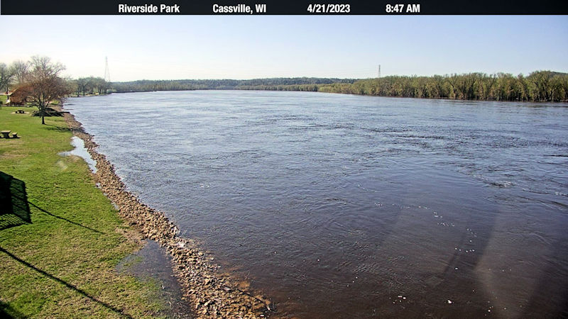
| Cassville, WI Riverside Park Apr 21st (source) |
South of Desoto, WI Apr 24th (NWS La Crosse) |
Harpers Ferry, IA Apr 24th (NWS La Crosse) |
Harpers Ferry, IA Apr 24th (NWS La Crosse) |
 |
 |
||
| Marquette, IA Apr 24th (NWS La Crosse) |
Marquette, IA Apr 24th (NWS La Crosse) |
Caption (source) |
Caption (source) |
Wauzeka, WI on the Kickapoo, River
 |
 |
 |
 |
| Apr 24th (NWS La Crosse) |
Apr 24th (NWS La Crosse) |
Apr 24th (NWS La Crosse) |
Boydtown Cemetery Apr 24th (NWS La Crosse) |
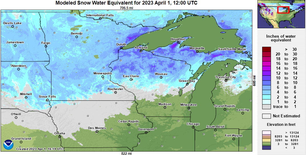
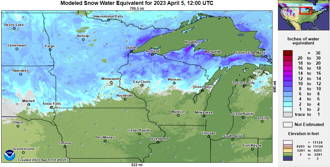
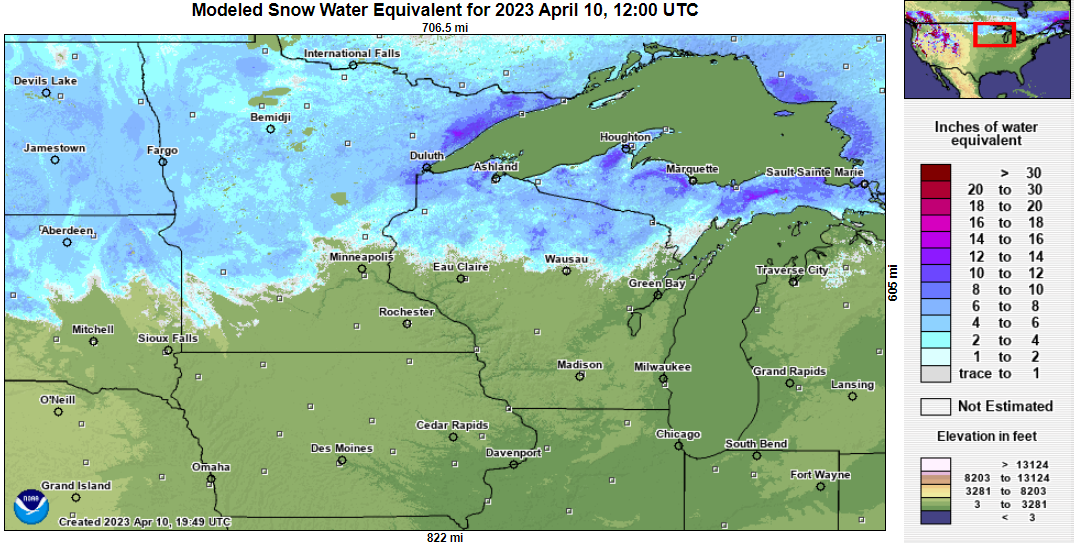
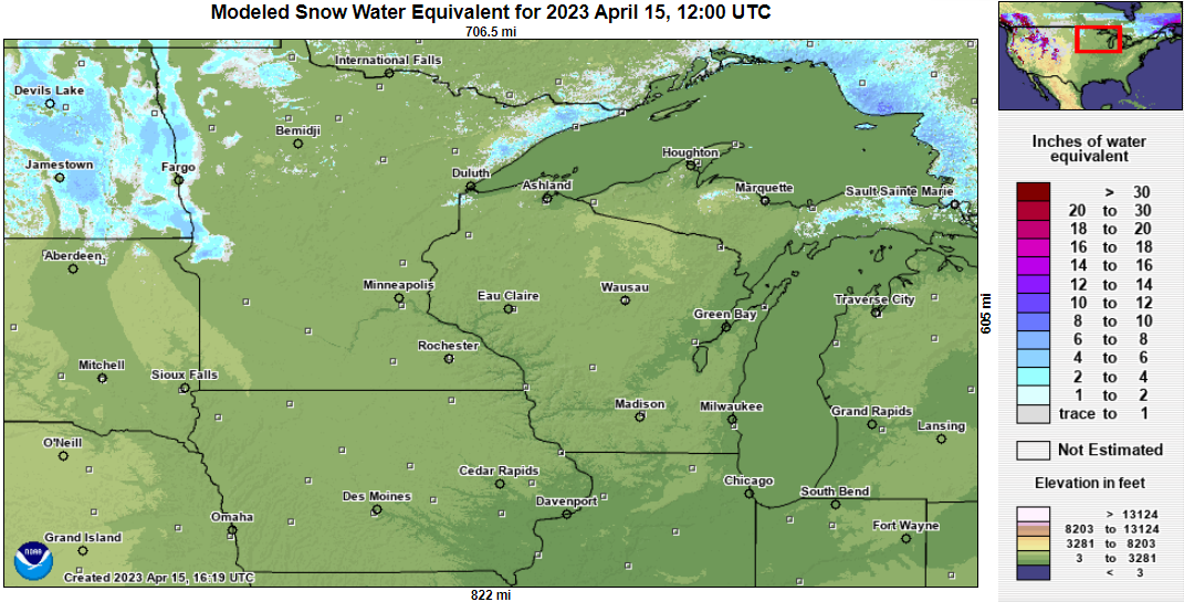
Why did the water level get so high?
Why was the flooding so high along the Mississippi River in 2023? The main drivers were the unseasonably deep snowpack across northern parts of the region - coupled with the rapid warm-up that led to swift melting.| National Water Center's Snow Water Equivalent (SWE) Flight Analyses | |||
| April 1st | April 5th | April 10th | April 15th |
 |
 |
 |
 |
| National Water Center's Snow Depth | |||
| April 1th | April 5th | April 10th | April 15th |
 |
 |
 |
 |
Historic Floods
 |
Media use of NWS Web News Stories is encouraged! Please acknowledge the NWS as the source of any news information accessed from this site. |
|


 Weather Story
 Weather Map
 Local Radar