La Crosse, WI
Weather Forecast Office
|
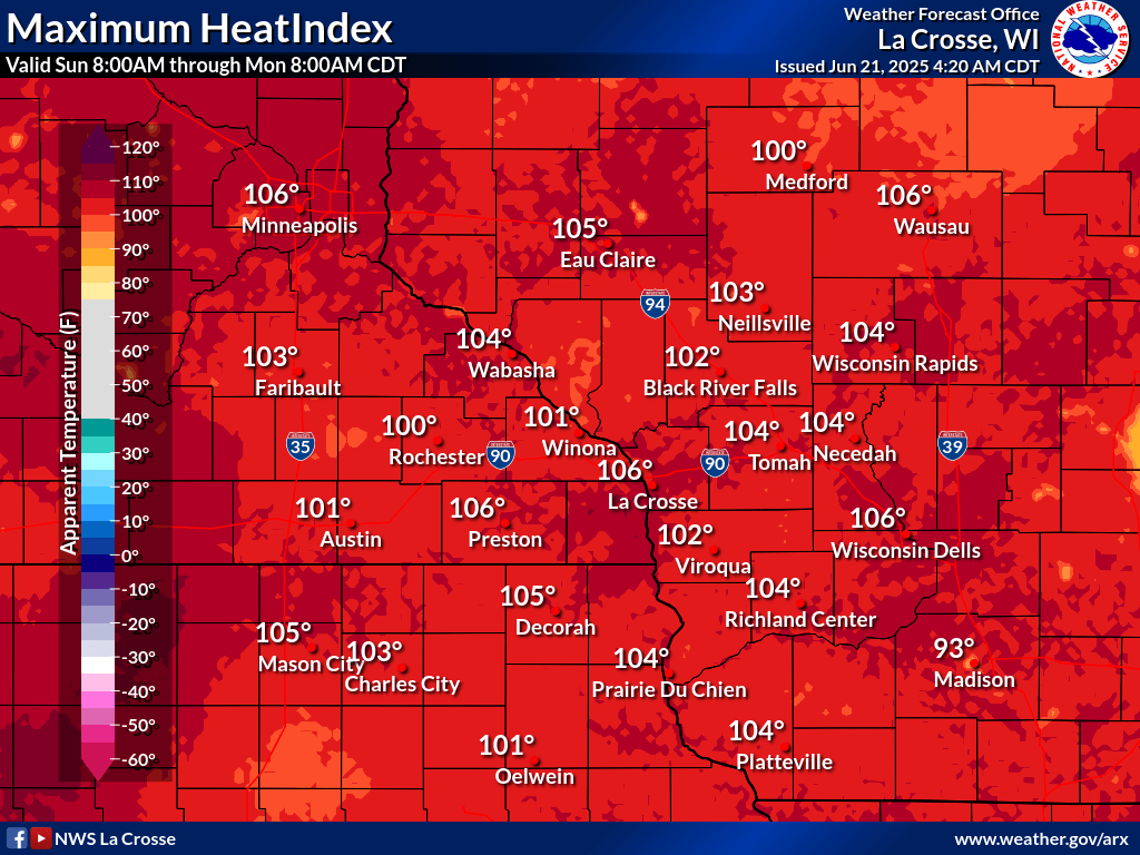
Even more heat will pool across the area post the passing storms early Monday morning. Heat indices for Monday afternoon are expected to top 100 degrees along and south of Interstate 94. Overnight: Strong To Severe Storms
Monday: Dangerous Heat
Additional Information:
|
• Submit Report • Severe Monitor Hydro Monitor Hazardous Weather Outlook Latest Weather Statement Storm Reports Latest Reports

Radar |
Our Office
Staff
Community Involvement
Station / Location Info
Follow Us On Social Media
Student Opportunities
Additional Information
Storm Summaries
Cooperative Observers
Educational Resources
Science / Research
Weather Phenomenon
Mayfly Tracking
Latest
Temp/Pcpn Summary
Precipitation Reports
Forecast Discussion
Hazardous Weather Outlook
Hourly Weather
Public Information Statement
Local Storm Report
Lightning Plot Archive
River Stages
Water Temp
Observations
Precipitation Plotter
Soil Temps
US Dept of Commerce
National Oceanic and Atmospheric Administration
National Weather Service
La Crosse, WI
711 County Road FA
La Crosse, WI 54601
608-784-7294
Comments? Questions? Please Contact Us.