HOME
FORECAST
Local
Graphical
Aviation
Marine
Rivers and Lakes
Hurricanes
Severe Weather
Fire Weather
Sunrise/Sunset
Long Range Forecasts
Climate Prediction
Space Weather
PAST WEATHER
Past Weather
Astronomical Data
Certified Weather Data
SAFETY
INFORMATION
Wireless Emergency Alerts
Brochures
Weather-Ready Nation
Cooperative Observers
Daily Briefing
Damage/Fatality/Injury Statistics
Forecast Models
GIS Data Portal
NOAA Weather Radio
Publications
SKYWARN Storm Spotters
StormReady
TsunamiReady
Service Change Notices
EDUCATION
NEWS
SEARCH
Search For
NWS
All NOAA
ABOUT
About NWS
Organization
For NWS Employees
National Centers
Careers
Contact Us
Glossary
Social Media
NWS Transformation
Local forecast by
"City, St" or ZIP code
Sorry, the location you searched for was not found. Please try another search.
Multiple locations were found. Please select one of the following:
Location Help
News Headlines
2026 Growing Season Begins Friday May 8th
2026 Skywarn Sessions Calendar - check back for updates
Customize Your
Weather.gov
Enter Your City, ST or ZIP Code
Remember Me
LOADING...
Bismarck, ND
Weather Forecast Office
North Dakota Partners Briefing Page
Weather.gov
>
Bismarck, ND
> North Dakota Partners Briefing Page
Current Hazards
Experimental Graphical Hazardous Weather Outlook
Storm and Precipitation Reports
Outlooks
Submit a Storm Report
Current Conditions
Local Ice Accumulation Reports
Satellite
Local Snowfall Reports
Observed Precipitation
Snowfall Analysis
Observations
Local Storm Reports
Official NWS Bismarck Snow Observation
Radar
Local Standard Radar (low bandwidth)
Local Enhanced Radar
Regional Standard Radar (low bandwidth)
Local Standard Radar (low bandwidth) Minot AFB
Williston, ND
Bowman, ND
Forecasts
Fire Weather
Experimental Probabilistic Quantitative Precipitation Forecast
Experimental Heat Risk
Winter Weather
Forecast Discussion
Hourly Forecasts
Rivers and Lakes
National Water Prediction Service (NWPS)
Climate and Past Weather
NOAA Climate Service
Event Summaries
Drought
Local
Local Programs
Publications
Blog
Student Volunteer Information
Lightning Archive
Bismarck Weather Station History
Bismarck Weather Education Center
Aviation Weather
Climate Records and Normals
Climate Top Ten Daily Weather Records
CoCoRaHs
Cold Advisory For Newborn Livestock (CANL)
COOP Program
El Nino and La Nina Information
Farm and Ranch Weather
ND Winter Briefing Page
ND Drought Briefing Page
Severe Weather History
SkyWarn
Storm Data
StormReady
Text Products
Weather Prediction Center
Winter Storm Severity Index
WFO BIS SA Display-Partners Quick Brief
Navigation Menu
Graphical Hazardous Weather Outlook (GHWO):
https://www.weather.gov/erh/ghwo?wfo=bis
Current Conditions, Watches, Warnings and Advisories
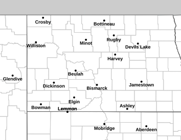
NWS Bismarck
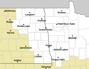
NWS Grand Forks
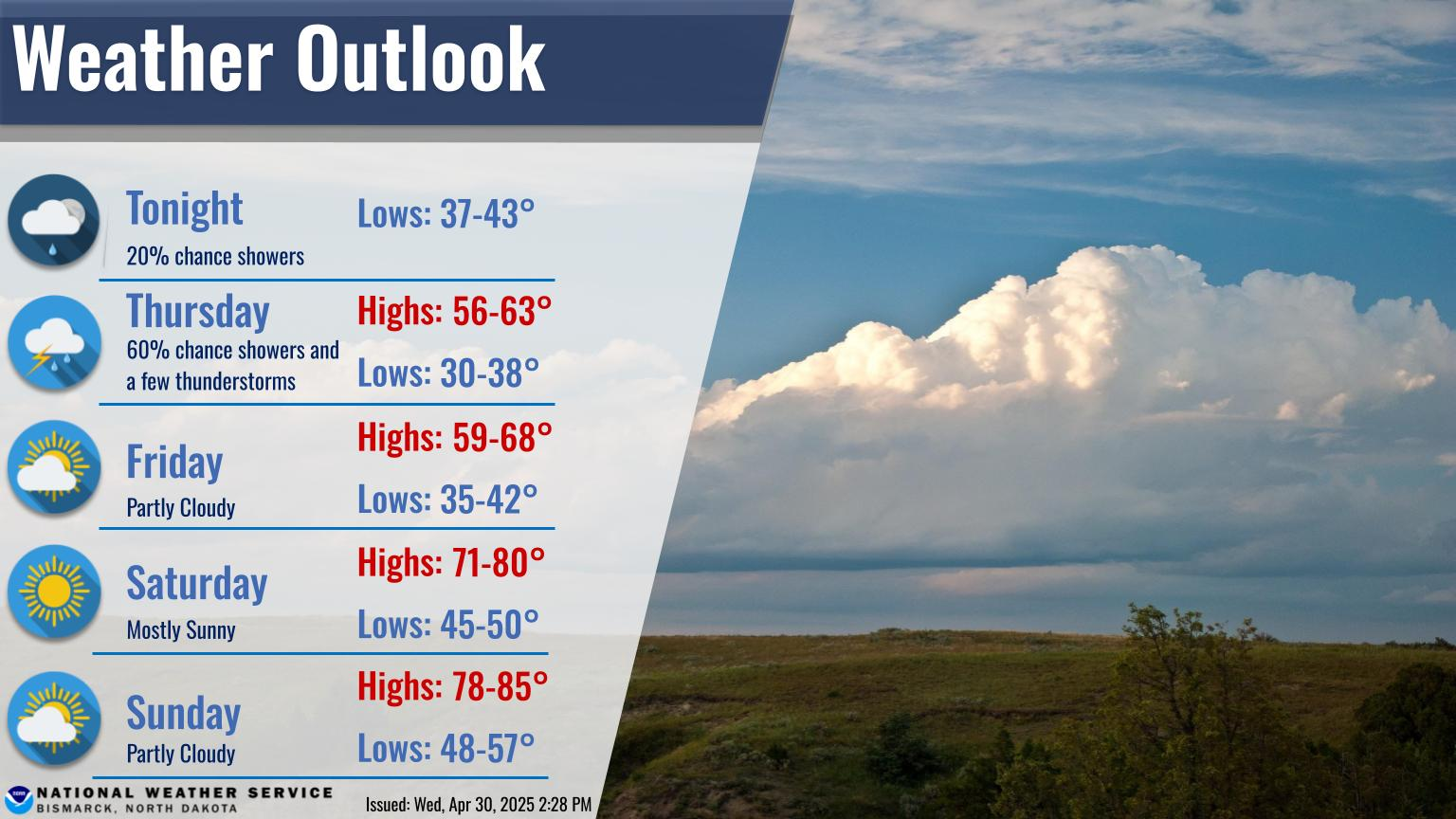
BIS Weather Story
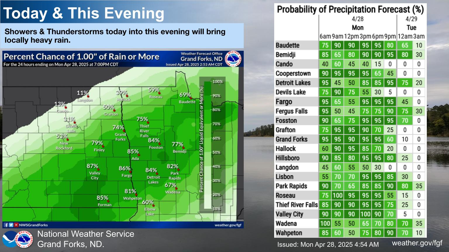
FGF Weather Story
US Radar
Upper Mississippi Valley
Bismarck
Minot
Mayville
Aberdeen
Glasgow
Billings
Geo-Color
Visible
Infrared
Water Vapor
Latest Surface Obs
Latest Fronts
Summer Severe and Fire Weather
Day 1 Severe
Day 2 Severe
Day 1 Fire Weather
Day 2 Fire Weather
*Click Here for ND Fire Danger Map*
Hydrology and Precipitation
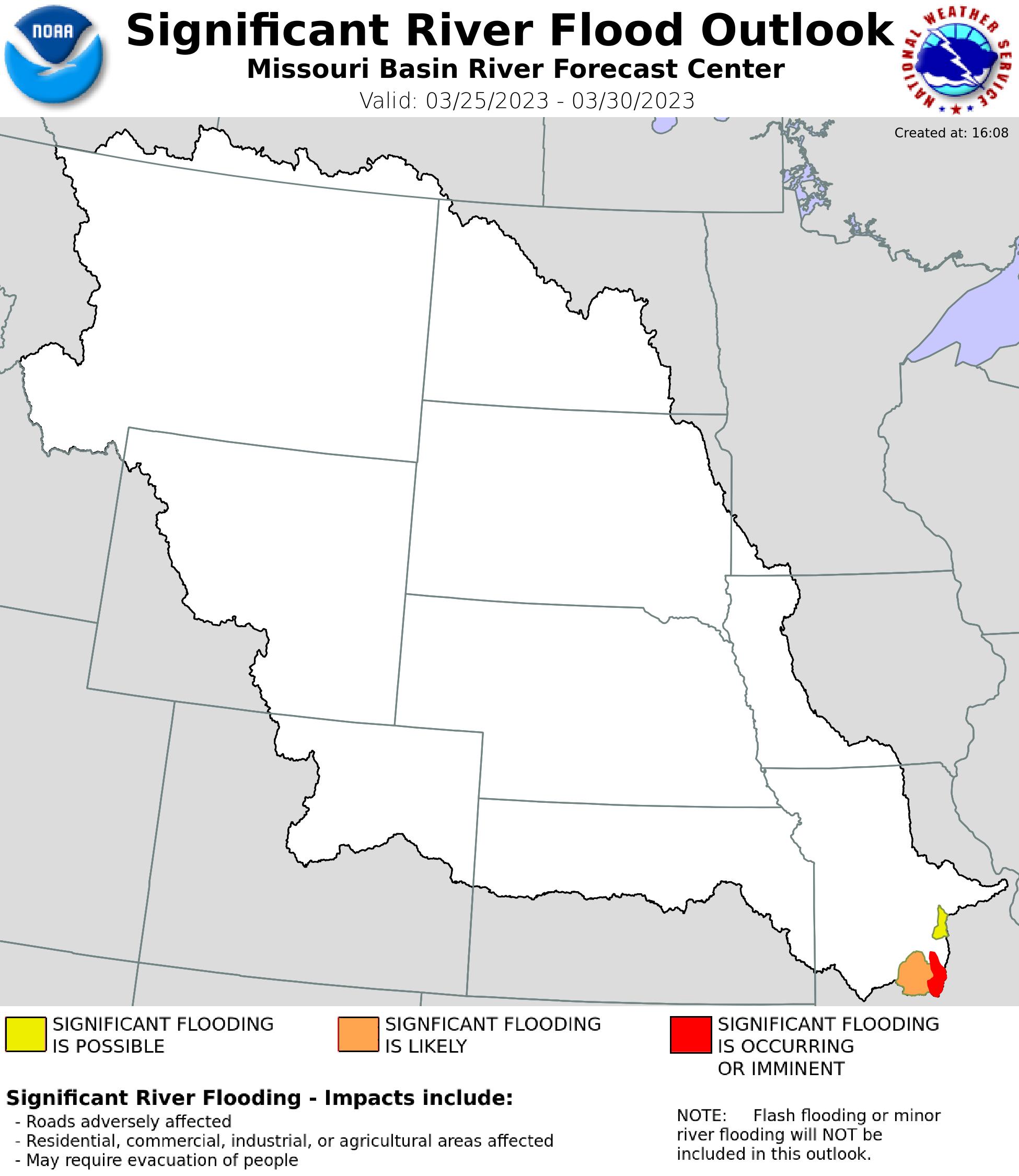
Missouri/James Basins
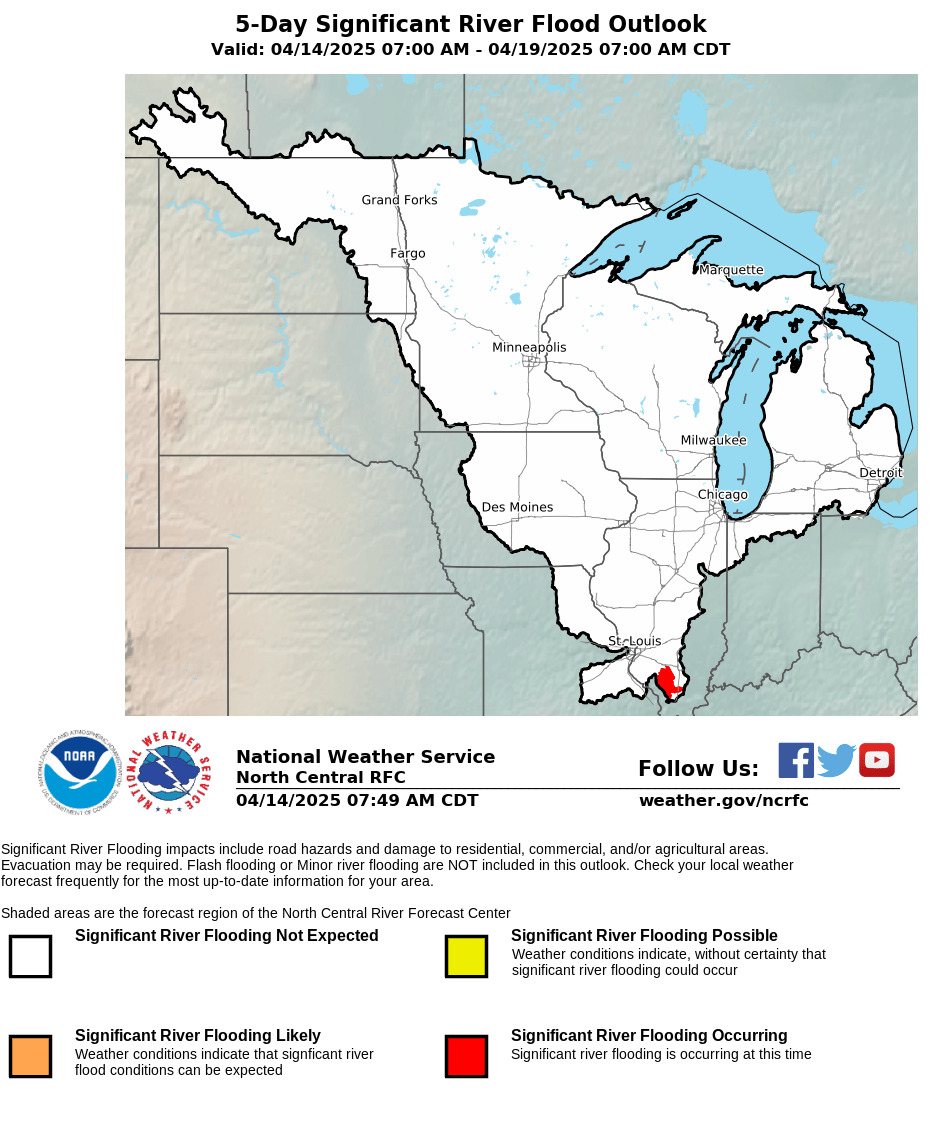
Red and Souris Basins
Day 1 Precip.
Day 2 Precip.
Day 3 Precip.
<
Winter
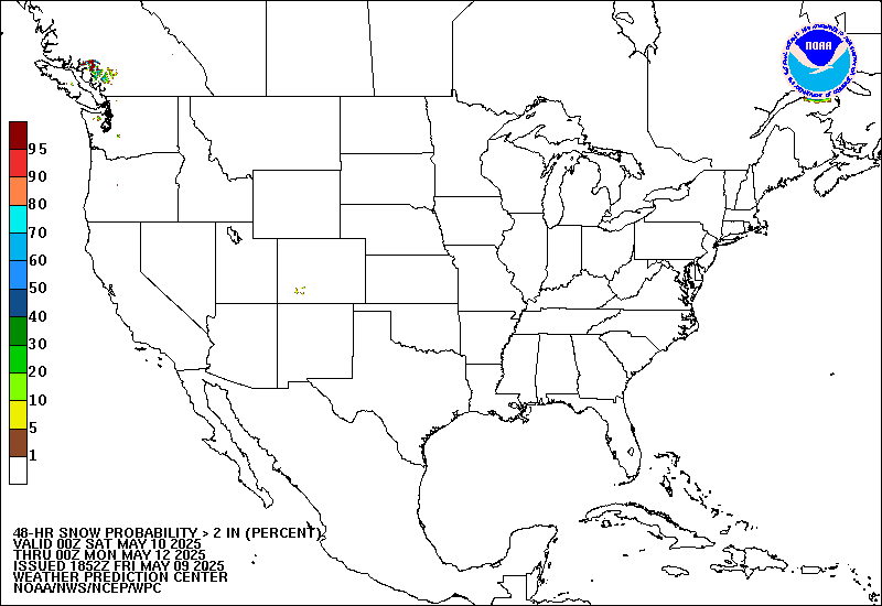
48 hr > 2 in. Snow
48 hr > 8 in. Snow
>
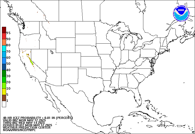
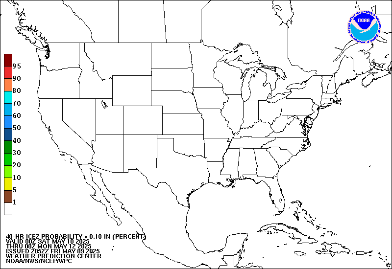
48 hr > 0.01 in Freezing Rain
48 hr > 0.10 in Freezing Rain
Climate
8-14 Day Temp. Outlook
8-14 Day Precip. Outlook
ND Drought Monitor
0-90 Day Temp.
0-90 Day Precip.
Follow us on X
Follow us on Facebook
Follow us on YouTube
BIS RSS Feed