Overview
|
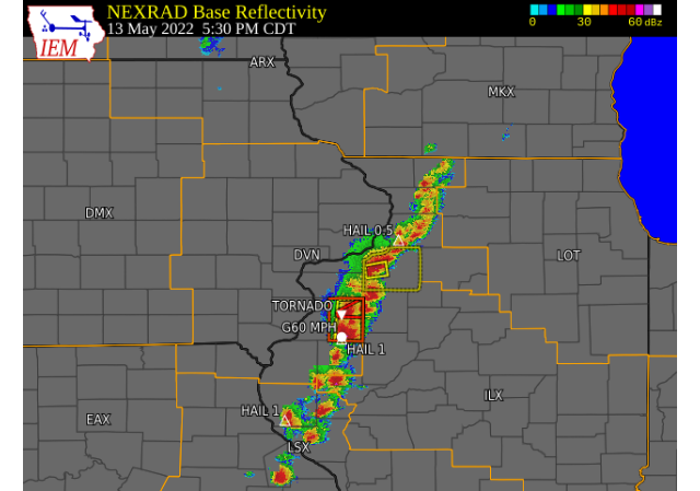
A line of showers and thunderstorms developed during the late afternoon of Friday, May 13, 2022 generally along and east of the Mississippi River in northwest Illinois. Some thunderstorms did become severe along that line, and produced all modes of severe weather including hail up to one inch, wind gusts to 60 MPH and two landspout tornados. One occurred near Good Hope IL, with the other just to the south of Monmouth IL. Some reports of flooding were also received, especially near Roseville IL. Storms gradually weakened in strength through the evening, and dissipated just before midnight |
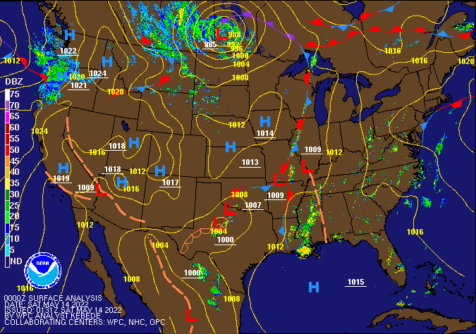
Surface Analysis (Courtesy of the Weather prediction Center) |
Tornadoes
|
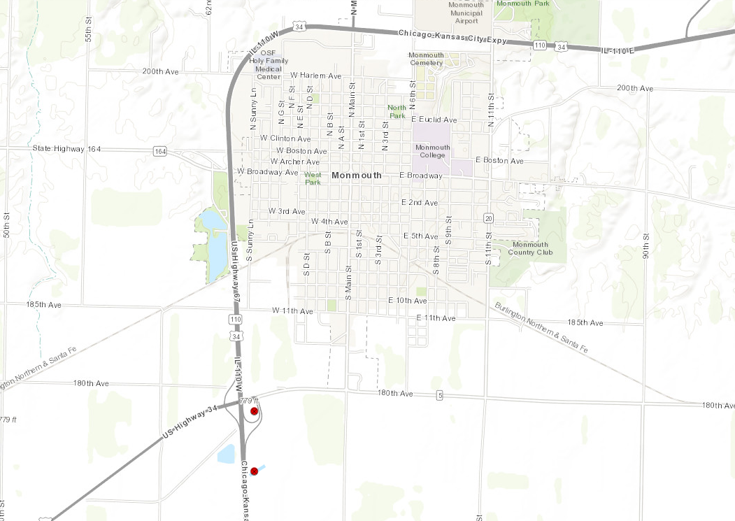
Monmouth, Illinois
|
||||||||||||||||
|
|
||||||||||||||||
|
Monmouth, Illinois #2
|
||||||||||||||||
|
|
||||||||||||||||
|
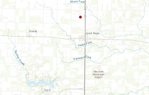
Good Hope, Illinois
|
||||||||||||||||
|
|
||||||||||||||||
The Enhanced Fujita (EF) Scale classifies tornadoes into the following categories:
| EF0 Weak 65-85 mph |
EF1 Moderate 86-110 mph |
EF2 Significant 111-135 mph |
EF3 Severe 136-165 mph |
EF4 Extreme 166-200 mph |
EF5 Catastrophic 200+ mph |
 |
|||||
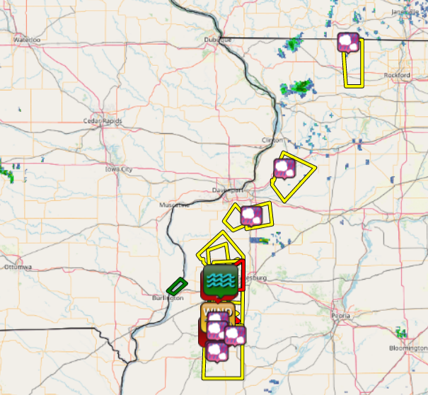
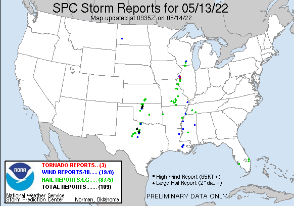
Storm Reports
| Interactive Storm Report Map (IEM) | SPC Storm Reports |
 |
 |
PRELIMINARY LOCAL STORM REPORT...SUMMARY
NATIONAL WEATHER SERVICE QUAD CITIES IA IL
1024 PM CDT FRI MAY 13 2022

..TIME...   ...EVENT...      ...CITY LOCATION...     ...LAT.LON...
..DATE...   ....MAG....      ..COUNTY LOCATION..ST.. ...SOURCE....
            ..REMARKS..

0543 PM     HAIL             ERIE                    41.66N 90.08W
05/13/2022  U0.50 INCH       WHITESIDE          IL   PUBLIC

            REPORT FROM MPING: HALF-INCH (0.50 IN.).

0508 PM     TORNADO          1 S MONMOUTH            40.90N 90.64W
05/13/2022                   WARREN             IL   EMERGENCY MNGR

            LANDSPOUT.

0509 PM     TSTM WND DMG     3 WSW MONMOUTH          40.89N 90.69W
05/13/2022                   WARREN             IL   PUBLIC

            REPORT FROM MPING: 3-INCH TREE LIMBS BROKEN;
            POWER POLES BROKEN.

0520 PM     TORNADO          2 SSW MONMOUTH          40.89N 90.66W
05/13/2022                   WARREN             IL   LAW ENFORCEMENT

            BRIEF TORNADO REPORTED BY LAW ENFORCEMENT.

0520 PM     TSTM WND GST     SWAN CREEK              40.67N 90.66W
05/13/2022  E60 MPH          WARREN             IL   TRAINED SPOTTER


0535 PM     HAIL             1 SSW SWAN CREEK        40.65N 90.66W
05/13/2022  E1.00 INCH       WARREN             IL   TRAINED SPOTTER


0450 PM     TORNADO          2 N GOOD HOPE           40.58N 90.68W
05/13/2022                   MCDONOUGH          IL   STORM CHASER

            LANDSPOUT NEARLY STATIONARY IN A FIELD. DUST
            AT THE GROUND.

0549 PM     HAIL             2 N GOOD HOPE           40.59N 90.67W
05/13/2022  E1.25 INCH       MCDONOUGH          IL   TRAINED SPOTTER


0511 PM     HAIL             ORION                   41.35N 90.37W
05/13/2022  M0.50 INCH       HENRY              IL   TRAINED SPOTTER
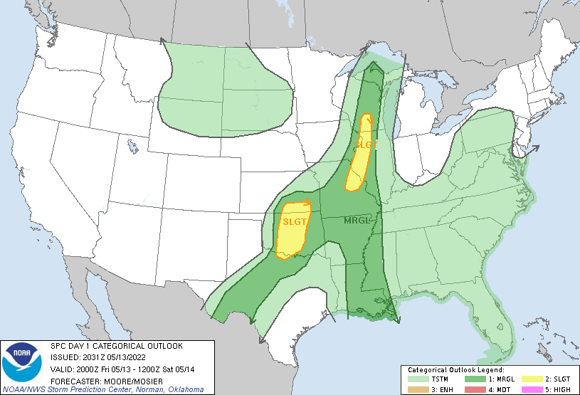
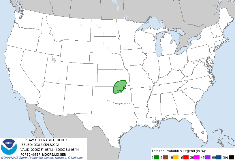
Environment
SPC EVENT REVIEW PAGE: 05/13/2022
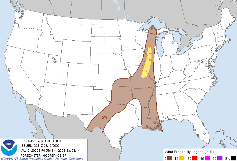
SPC Categorical/Tornado/Hail/Wind Outlooks
 |
 |
 |
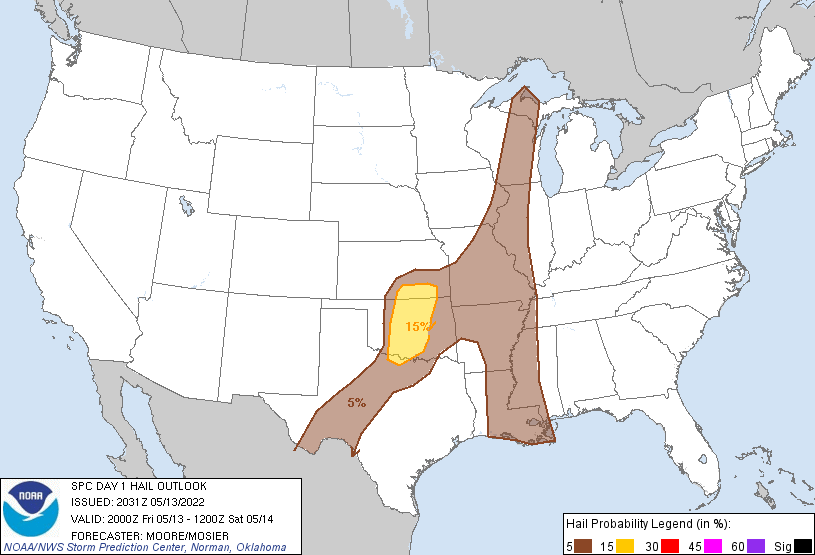 |
| SPC Categorical Outlook | Tornado Outlook | Wind Outlook | Hail Outlook |
DVN Observed Sounding Analysis
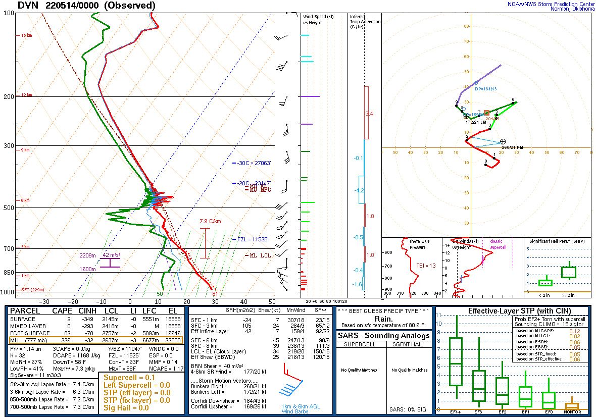 |
| 700 PM DAVENPORT, IA SOUNDING |
SPC Mesoscale Discussions
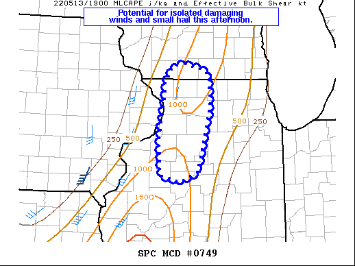 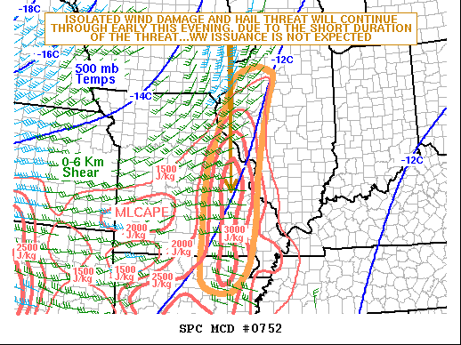 |
| MCD 0749 and 0752 |
Additional Information
 |
Media use of NWS Web News Stories is encouraged! Please acknowledge the NWS as the source of any news information accessed from this site. |
|