Overview
|
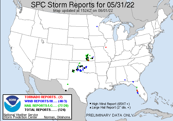
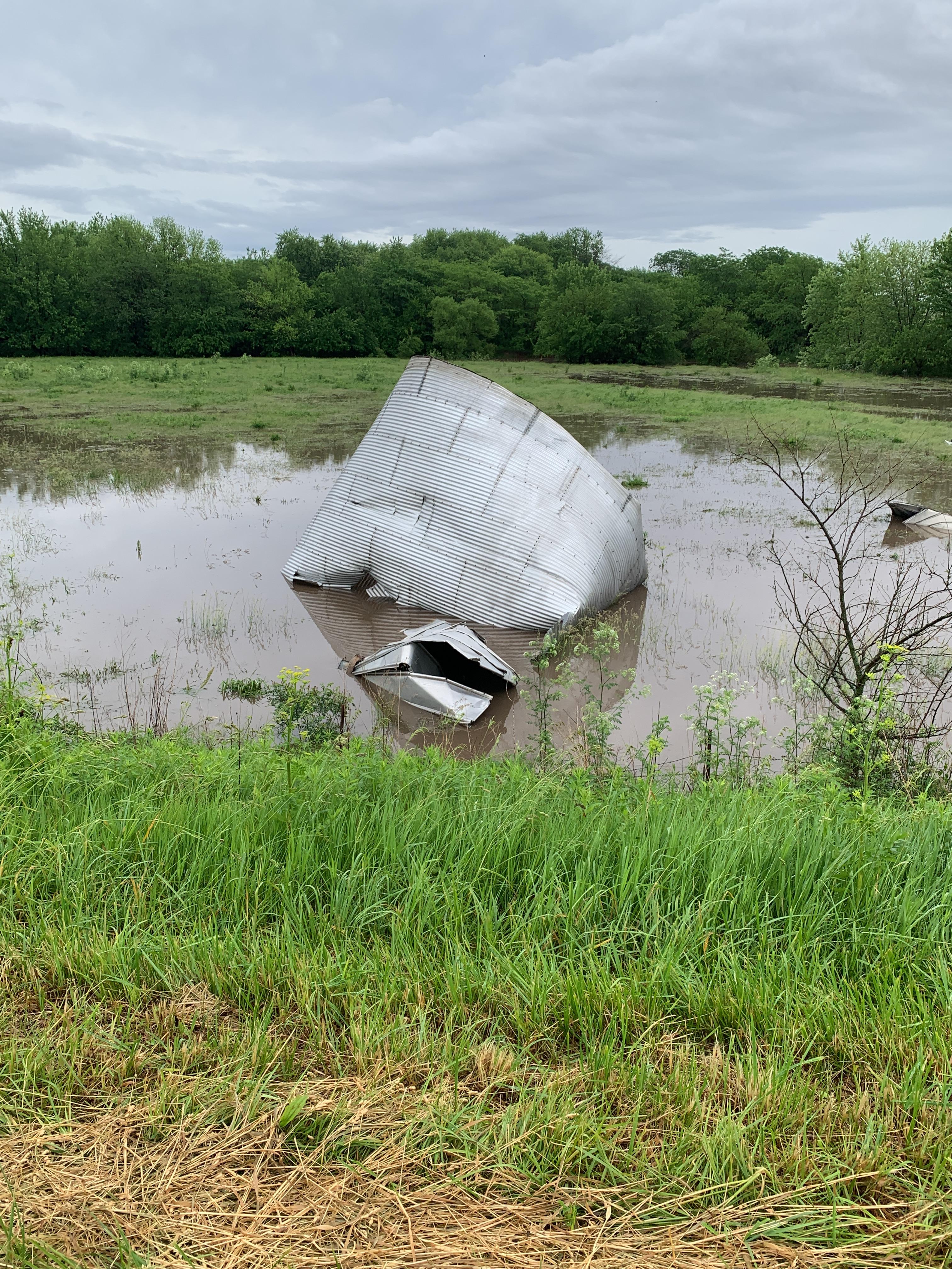
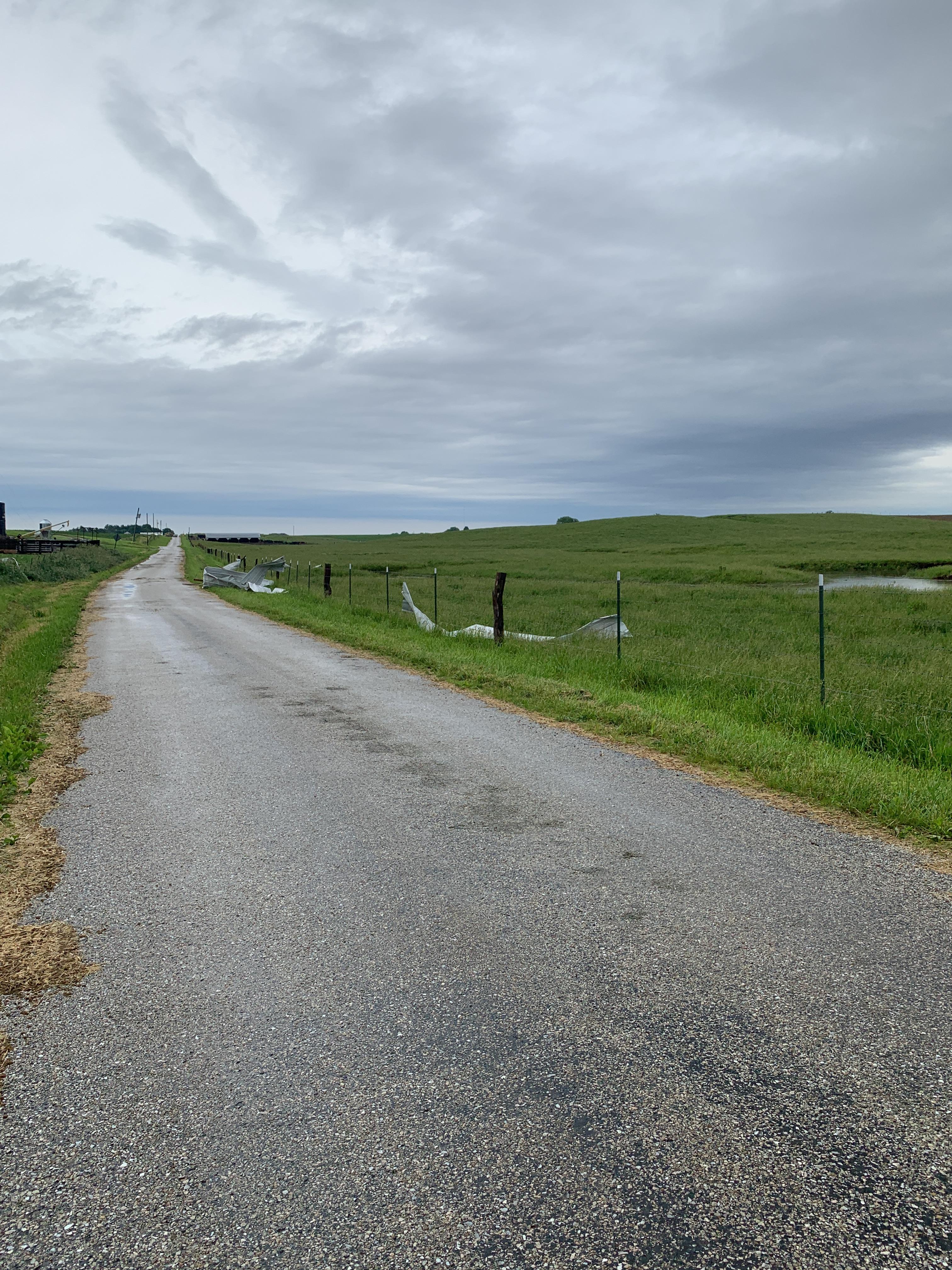
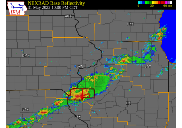
Summary Thunderstorms developed across all of eastern Iowa, northwest Illinois and far northeast Missouri on the afternoon and evening of May 31, 2022. Initially, storms were not severe as they worked through an environment that was lacking strong mid-level instability. This changed as storms reached west central Illinois, where some atmospheric recovery was able to take place during the late afternoon hours from cloud cover during the day. An outflow boundary was also present from previous storms during the early afternoon. A tornado warning was issued around 10:00 PM, followed by another tornado warning at 10:25 PM. A survey team has confirmed that an EF-1 tornado did touch down about 3 miles northwest of Industry, shortly after 10:30 pm, before lifting north of Industry near Highway 67. The tornado caused outbuilding, grain bin and power pole damage, but there were no injuries. In addition, torrential rain fell across the area and led to flash flooding across southern portions of Hancock and McDonough counties. Several roads were washed out and rivers were out of their banks. The La Moine River at Colmar rose to moderate flood stage as well.
|
Surface Analysis (Courtesy of the Weather Prediction Center) |
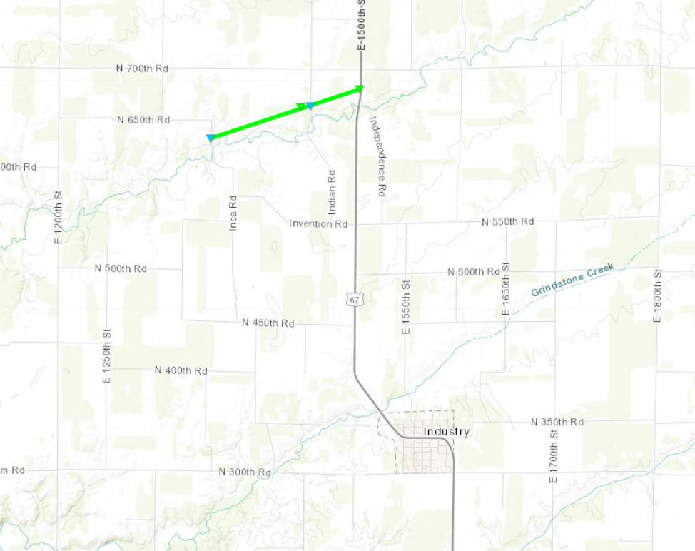
Tornado
|
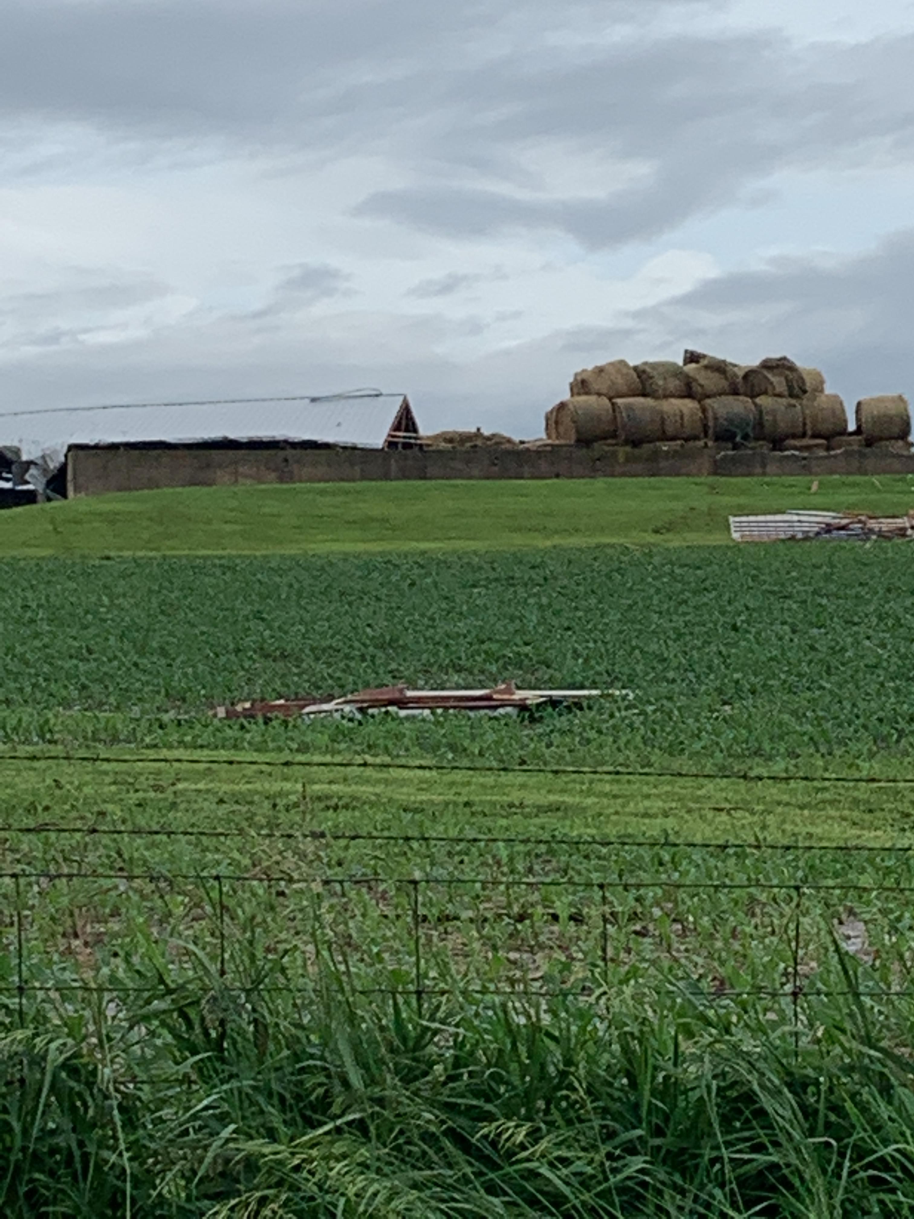
3.7 NW Industry, IL
|
||||||||||||||||
|
Pictures (NWS Survey)
|
||||||||||||||||
Rainfall Reports
| Local Rainfall Analysis | |
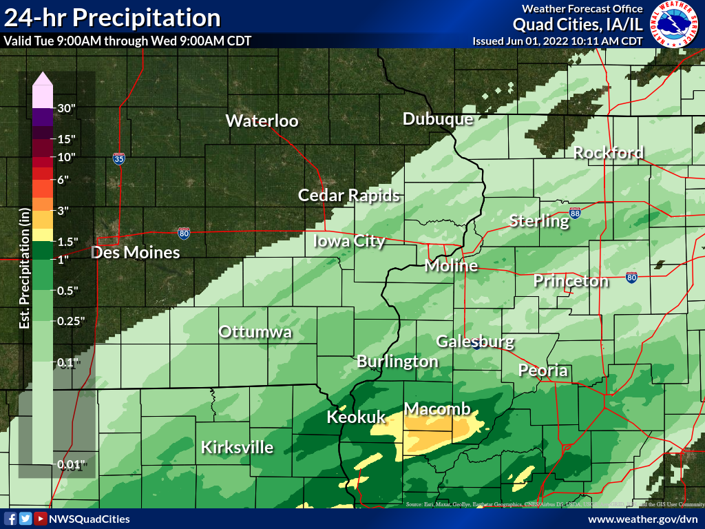 |
24 hour precipitation reports (in Inches),
for eastern Iowa, northwest and west central Illinois,
and northeast Missouri. Reported between Midnight and 9 AM,
Wednesday June 01, 2022.

....IOWA....
Keokuk LD19                      1.31
Burlington 6.5 SSW               1.02
Fort Madison 0.9 NE              0.69
Burlington Arpt                  0.50
Salem 3.1 ESE                    0.39
Salem 1S                         0.36
New London 1.5 SW                0.35
Washington 5.8 SW                0.32
Mt Pleasant 1 SSW                0.32
Centerville 0 NE                 0.32
West Point 7.5 NW                0.29
Washington                       0.26
Fairfield                        0.25
Wellman 4.0 E                    0.20
Rathbun Reservoir 2 N            0.20
Donnellson                       0.20
Keosauqua                        0.17
Wapello 5.4 SE                   0.16
Ottumwa ASOS 6 NNW               0.16
Riverdale 0.5 N                  0.15
Le Claire LD14                   0.15
West Branch 2.0 NNW              0.13
Bellevue LD12                    0.13
Iowa City                        0.11
Solon 0.3 ESE                    0.10
Parnell 0.1 SSW                  0.10
Wapello 0.2 S                    0.09
Davenport 0.9 WNW                0.09
Muscatine 2.1 N                  0.08
Charlotte 1.9 WNW                0.08
Wapello 4.7 N                    0.06
Tipton 0.7 N                     0.06
Anamosa 3 SSW                    0.06
Muscatine 2N                     0.06
Oskaloosa AWOS 9 ESE             0.05
Iowa City Arpt                   0.05
Davenport Arpt                   0.04
Oskaloosa 1 NNW                  0.04
Maquoketa                        0.04
Lowden                           0.03
North Liberty 0.7 SSW            0.02
Ely 0.5 SE                       0.02

....ILLINOIS....
Bentley                          2.53
Augusta                          2.18
Warsaw 5.8 SE                    2.08
Colchester 3.5 NE                1.62
Jacksonville 2E                  1.52
Macomb                           1.30
Dallas City 3.0 SSE              0.91
Stronghurst 0.4 SSW              0.77
Quincy Arpt                      0.73
Lincoln NWS                      0.65
Walnut 5.3 ENE                   0.51
Geneseo 2.0 NW                   0.48
Bloomington Airport              0.43
Prairie City 2S                  0.40
Aledo                            0.32
New Windsor 2.0 N                0.31
Steward                          0.28
Galesburg                        0.22
Gladstone LD18                   0.19
Coal Valley 2.6 E                0.18
Quad City Arpt                   0.18
Ill. City LD16 3 WNW             0.17
Mundelein                        0.16
Kewanee 1 E                      0.16
Woodhull 0.3 ESE                 0.14
Coal Valley 1.9 SE               0.13
Galva 2.7 NE                     0.12
Mount Carroll 6.8 NNW            0.11
Rochelle Arpt                    0.11
Peoria Arpt                      0.11
New Boston LD17                  0.10
Elizabeth                        0.08
Mendota 2 SE                     0.08
Princeton 1.1 SE                 0.07
Prophetstown 0.2 SW              0.07
Princeton                        0.07
Decatur Airport                  0.06
Stockton 3.4 NNE                 0.05
Ottawa 4 SW                      0.05
Winslow 4.3 ESE                  0.03
Mount Carroll                    0.02
Davis 0.5 N                      0.01
Rockford Arpt                    0.01

....MISSOURI....
Chillicothe Arpt                 1.90
Columbia Arpt                    0.94
Kirksville Arpt                  0.50
Memphis 0.1 S                    0.05
Environment
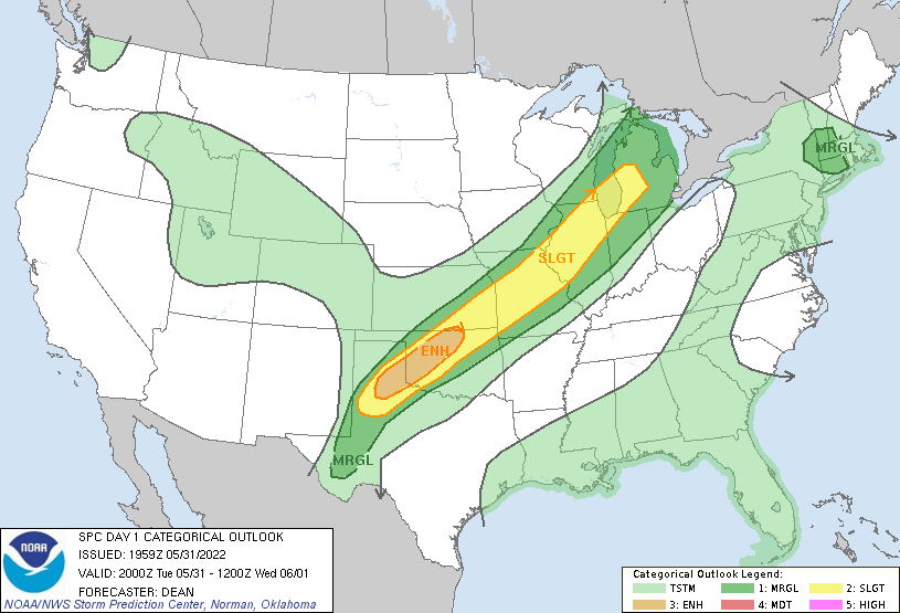
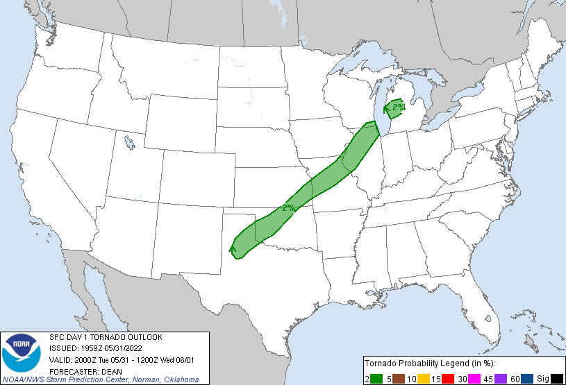
SPC EVENT REVIEW PAGE: 05/31/2022
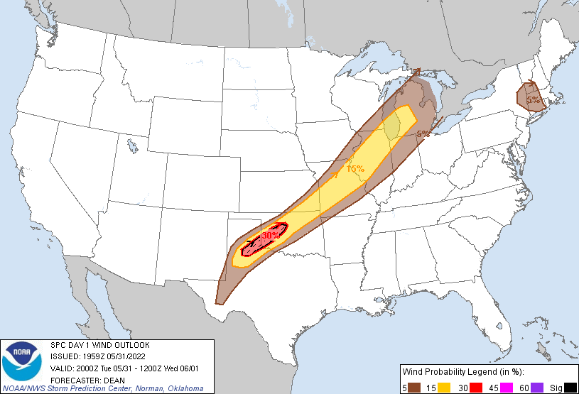
SPC Categorical/Tornado/Hail/Wind Outlooks
 |
 |
 |
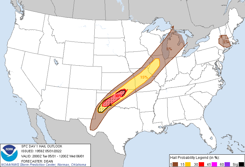 |
| SPC Categorical Outlook | Tornado Outlook | Wind Outlook | Hail Outlook |
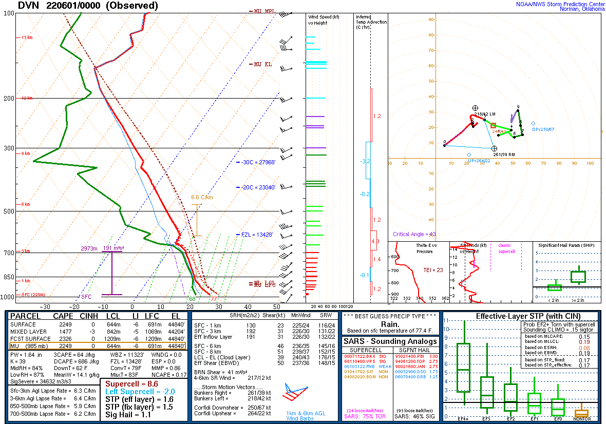
DVN Observed Sounding Analysis
 |
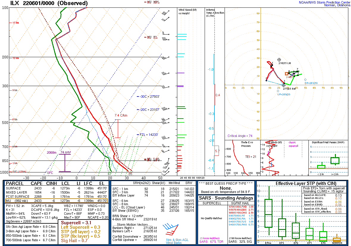 |
| 600 PM DAVENPORT, IA SOUNDING | 600 PM LINCOLN, IL SOUNDING |
SPC Mesoscale Discussions
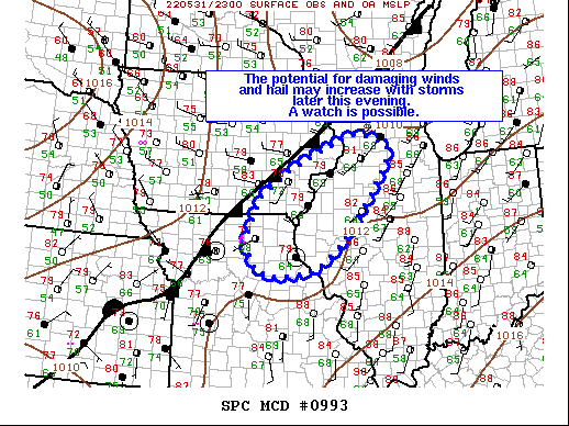 |
| MCD 0993 |
Additional Information
 |
Media use of NWS Web News Stories is encouraged! Please acknowledge the NWS as the source of any news information accessed from this site. |
|


.png)