
Dangerous and extreme heat will remain across portions of the southern U.S. this week. Heavy rainfall may bring significant flash flooding across portions of the Mid-Atlantic and Northeast through the night, and additional flash flooding concerns across New England on Wednesday. Monsoonal thunderstorms will bring a flash flood risk to the Four Corners region, especially in burn scar areas Read More >
The safest place to be during a severe
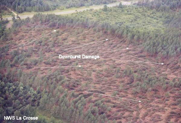
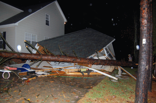
Fig. 6. One of the greatest dangers associated with downbursts in the western Carolinas and northeast Georgia is from falling trees. Every year, falling trees result in millions of dollars in damage to property across the region. Injuries and even fatalities also occur from time to time.
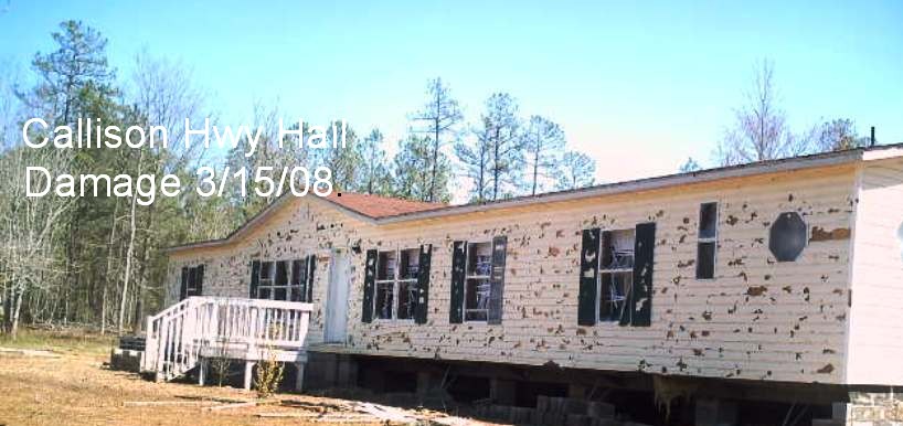
Fig. 7. Damage to a manufactured home by large hail up to the size of baseballs. Large hail is responsible for billions of dollars in property losses across the United States each year. The damage in this photo occurred on March 15, 2008 near Callison, SC. Photo courtesy of Greenwood County Emergency Management.

Fig. 8. Baseball size hail. Hail of this size is rare, but occurs once every couple of years across the area.
Large hail is mainly a threat to crops and property, rarely causing deaths or even significant injuries to people. However, crop and property damage losses number in the billions of dollars across the country during a typical year. You should always seek shelter indoors during a hailstorm, as injuries from very large and/or wind-driven hail can occur. Although your first priority should always be the safety of
| County | Nearest City | Date | Max Hail Size |
| Davie-NC | Mocksville | June 4, 1993 | Grapefruit |
| Cabarrus/Rowan-NC | Kannapolis | May 7, 1998 | Softball |
| Catawba-NC | Newton | June 3, 1998 | Softball |
| Spartanburg-SC | Spartanburg | August 20, 1999 | Grapefruit |
| Burke-NC | Morganton | May 24, 2000 | Softball |
| Oconee-SC | Westminster | April 28, 2002 | Teacup |
| Abbeville-SC | Calhoun Falls | May 6, 2003 | Grapefruit |
| Anderson-SC | Iva | March 15, 2008 | Grapefruit |
| York-SC | Clover | April 9, 2011 | Softball |
| Greenville-SC | Tigerville | May 10, 2011 | Teacup |
| Union-SC | Union | May 23, 2014 | Teacup |
| Spartanburg-SC | Greer | March 21, 2017 | Teacup |


 Hourly Weather