⚠️ Breezy onshore winds and rough surf conditions this afternoon will create a high rip current risk at the northeast FL beaches.
🌊 Surf heights may slowly build from Friday through the weekend, keeping a high risk in place at all area beaches.
🚨 A HIGH #RipCurrent Risk means the surf is dangerous for *ALL LEVELS* of swimmers.
🏖 Always follow the advice of local beach patrol & beach flags.
🕶 Be #BeachSmart!


 Jacksonville Radar
 Weather Map
 Regional Satellite
  DAY 1 Convective Outlook
 DAY 2 Convective Outlook
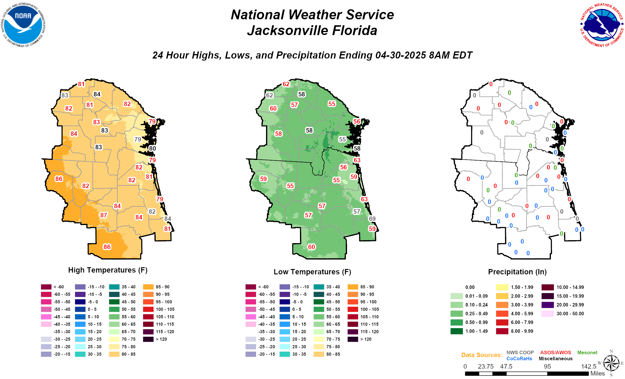 Daily Graphics
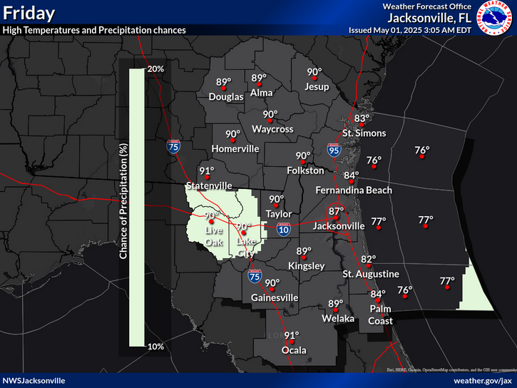