These graphics provide 'zoomed-in' visualization of where specific weather hazards may occur during a specific time frame or over a defined period of time. Data is typically updated daily between 3 and 4 am/pm. Additional Resources Daily Web Briefing NWS JAX Decision Support Website NWS JAX Social Media Jacksonville Fire Weather Dashboard
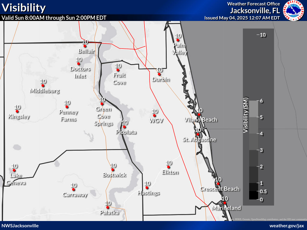
Visibility (Fog) Forecast (miles)
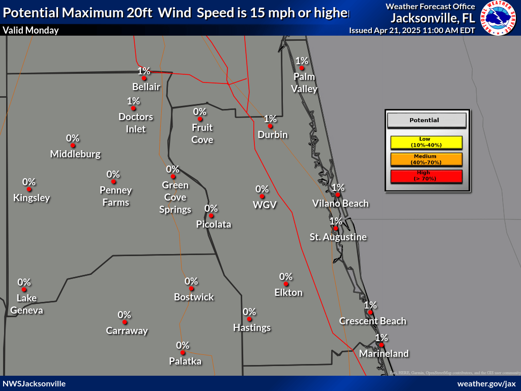
Probability 20 ft Wind Speed ≥15 mph
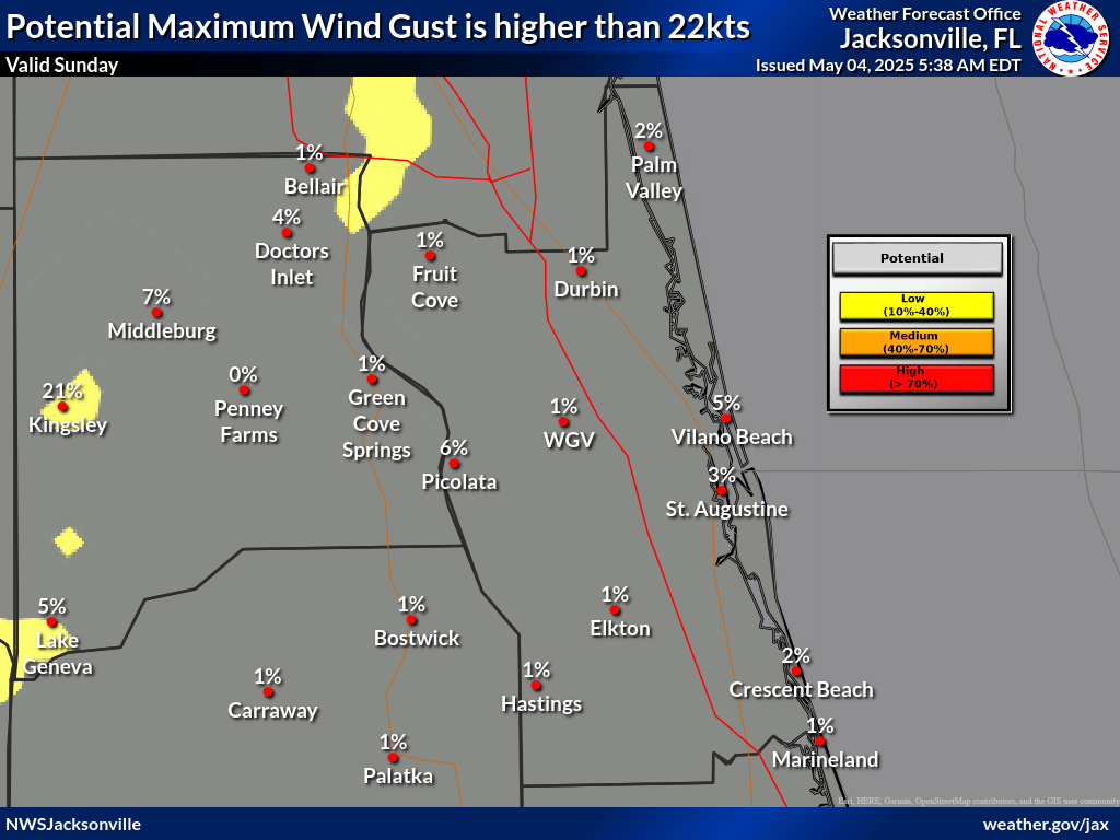
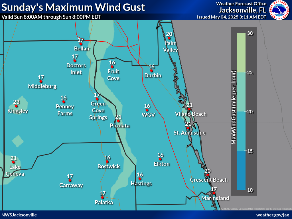
Probability Maximum Wind Gust ≥25 mph
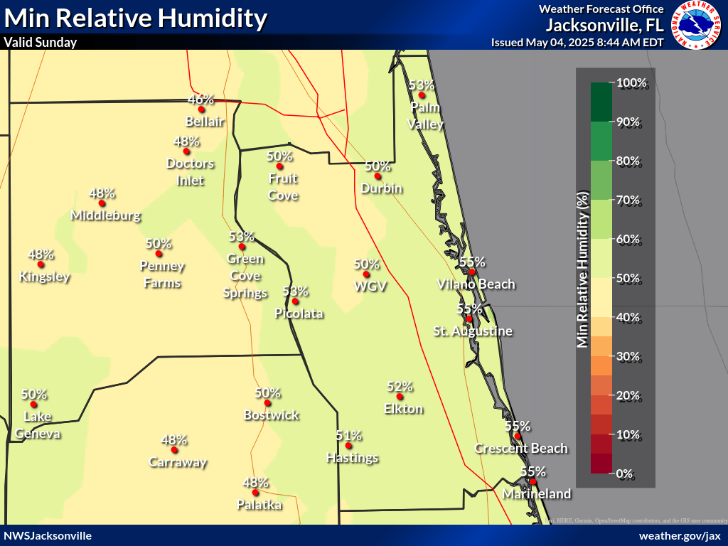
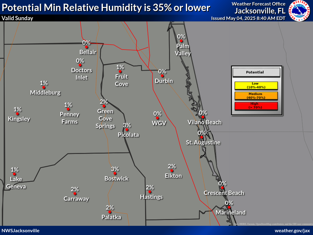
Minimum Relative Humidity Probabilities (%)
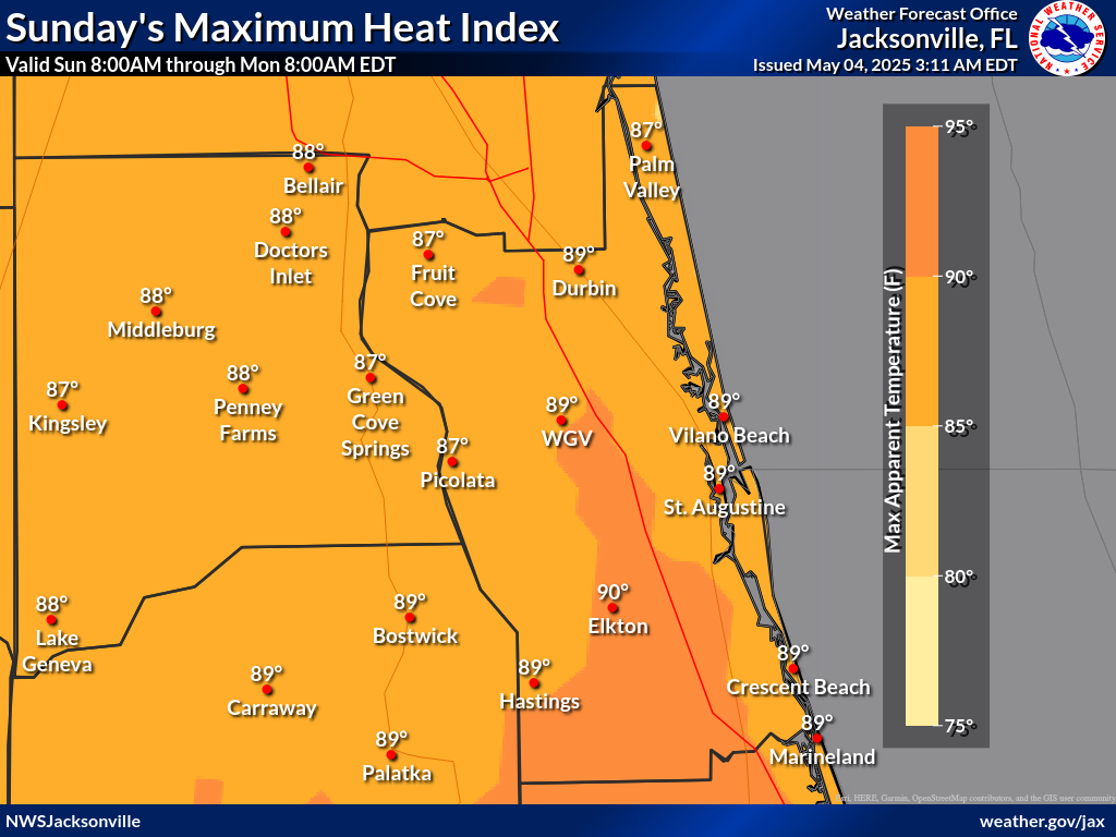
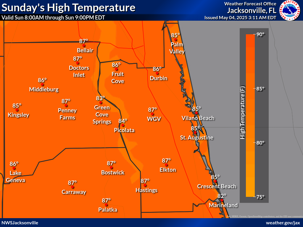
Maximum Heat Indexes (°F)
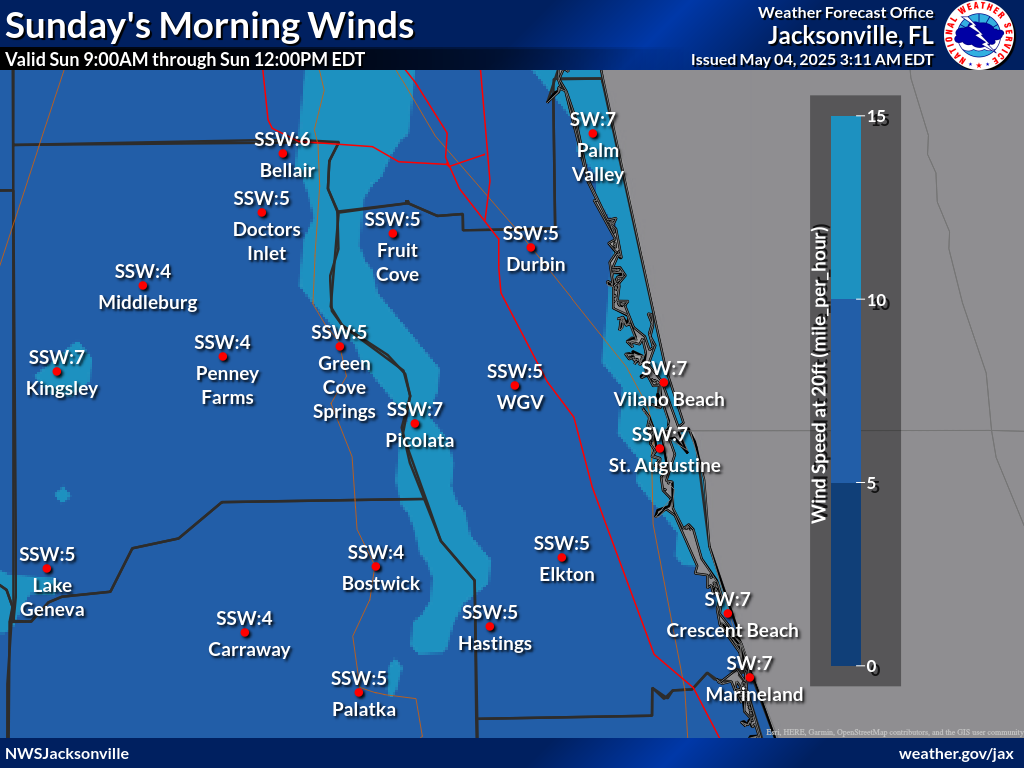
Wind 20ft Late Afternoon 9 am to Noon (mph)
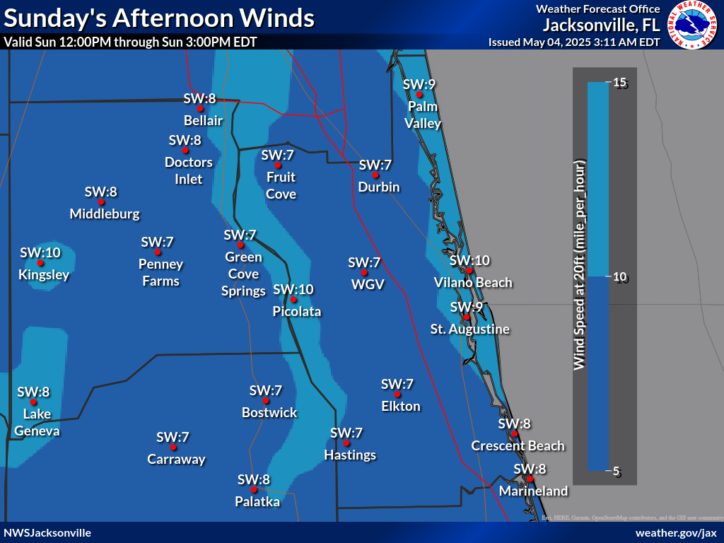
Wind 20ft Early Afternoon Noon to 3 pm (mph)
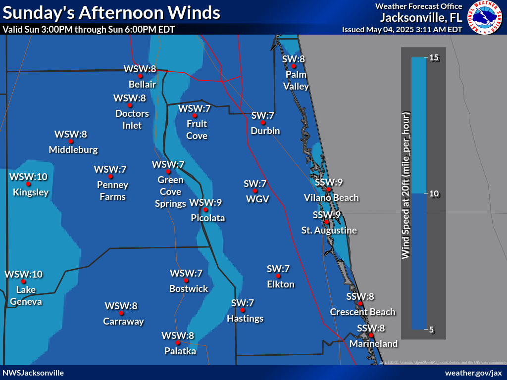
Wind 20ft Late Afternoon 3 pm to 6 pm (mph)
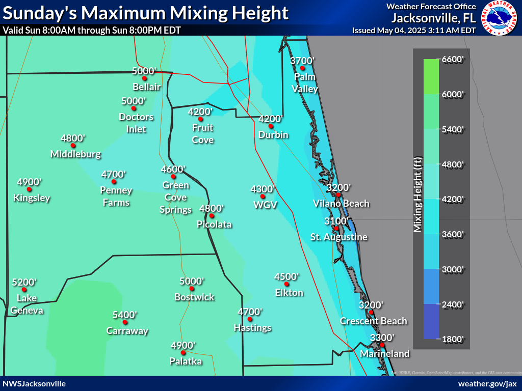
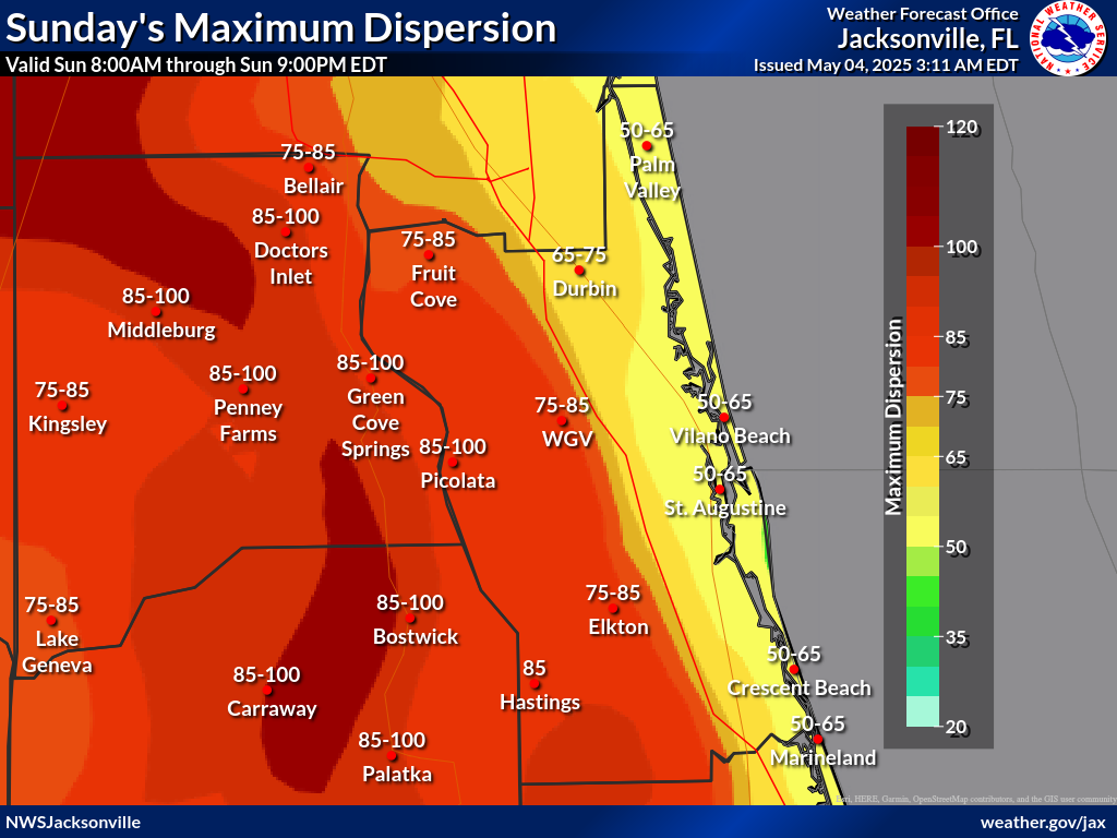
Max Daytime and Min Nighttime Dispersion
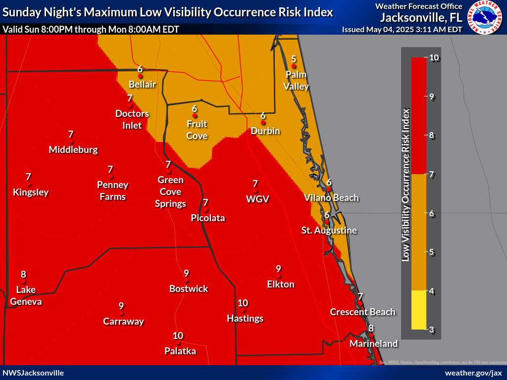
Maximum Low Visibility Occurrence Risk Index
Fire Temperature RGB Used to Highlight Fires
Click on any image below to view a full screen version
Drought Monitor SPC Fire Weather Outlook Monthly Wildland Fire Potential Outlook
Click anywhere to return