
Scattered thunderstorms with severe gusts, hail and a tornado risk are possible near a cold front from the Ohio Valley to the Mid-Atlantic tonight. Tropical Storm Bertha is expected to bring tropical storm conditions to portions of the Gulf Coast from the panhandle of Florida into Louisiana through Wednesday. Read More >
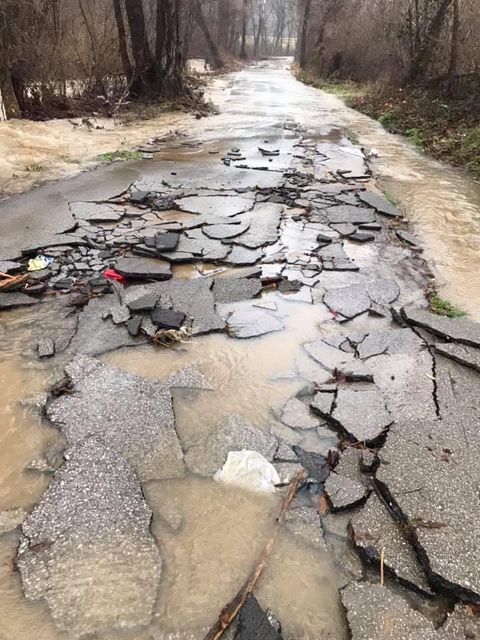
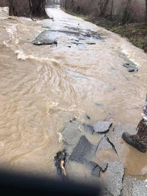
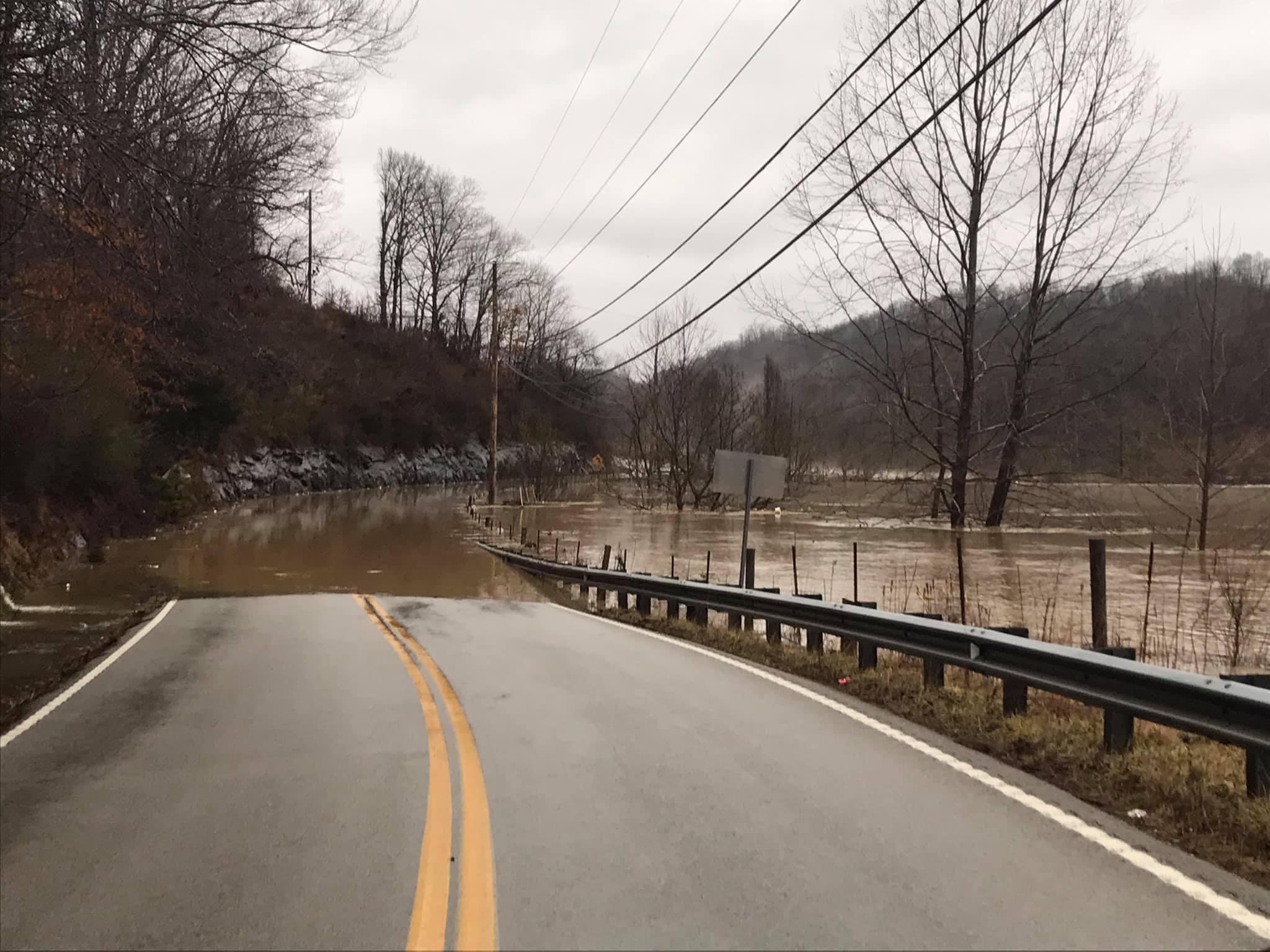
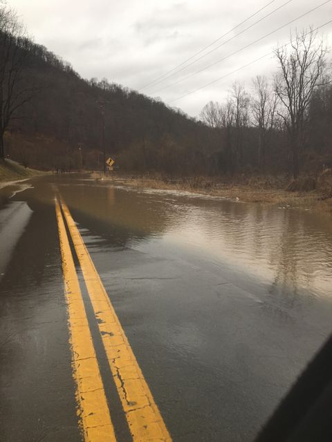
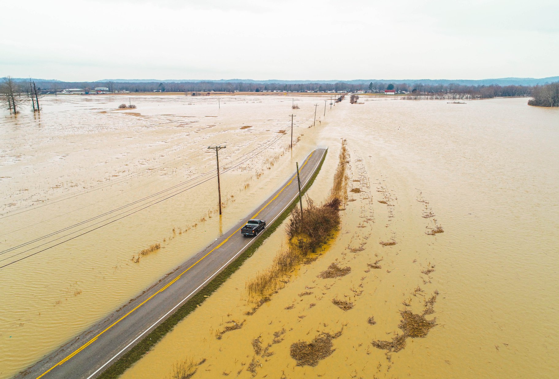
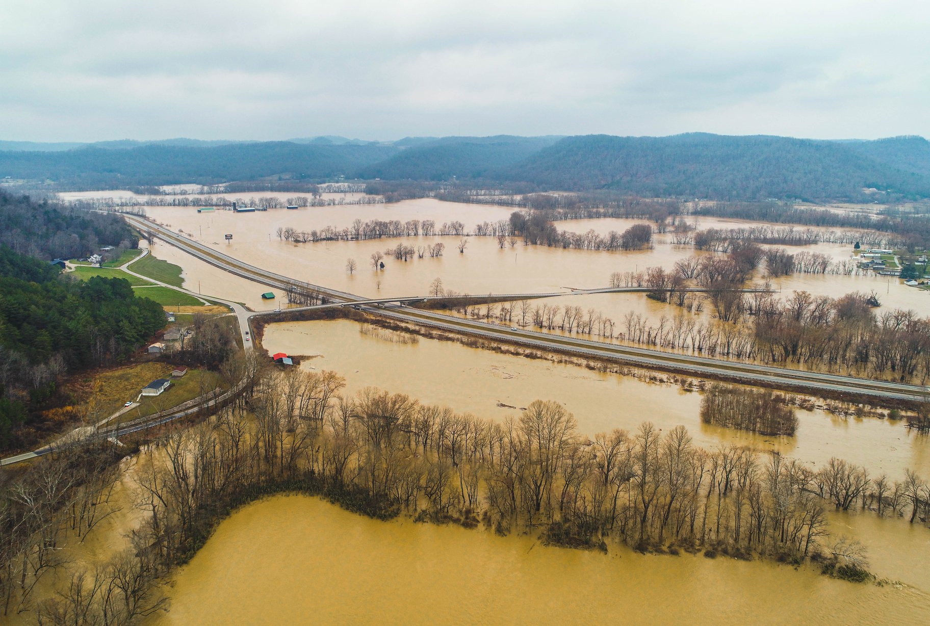
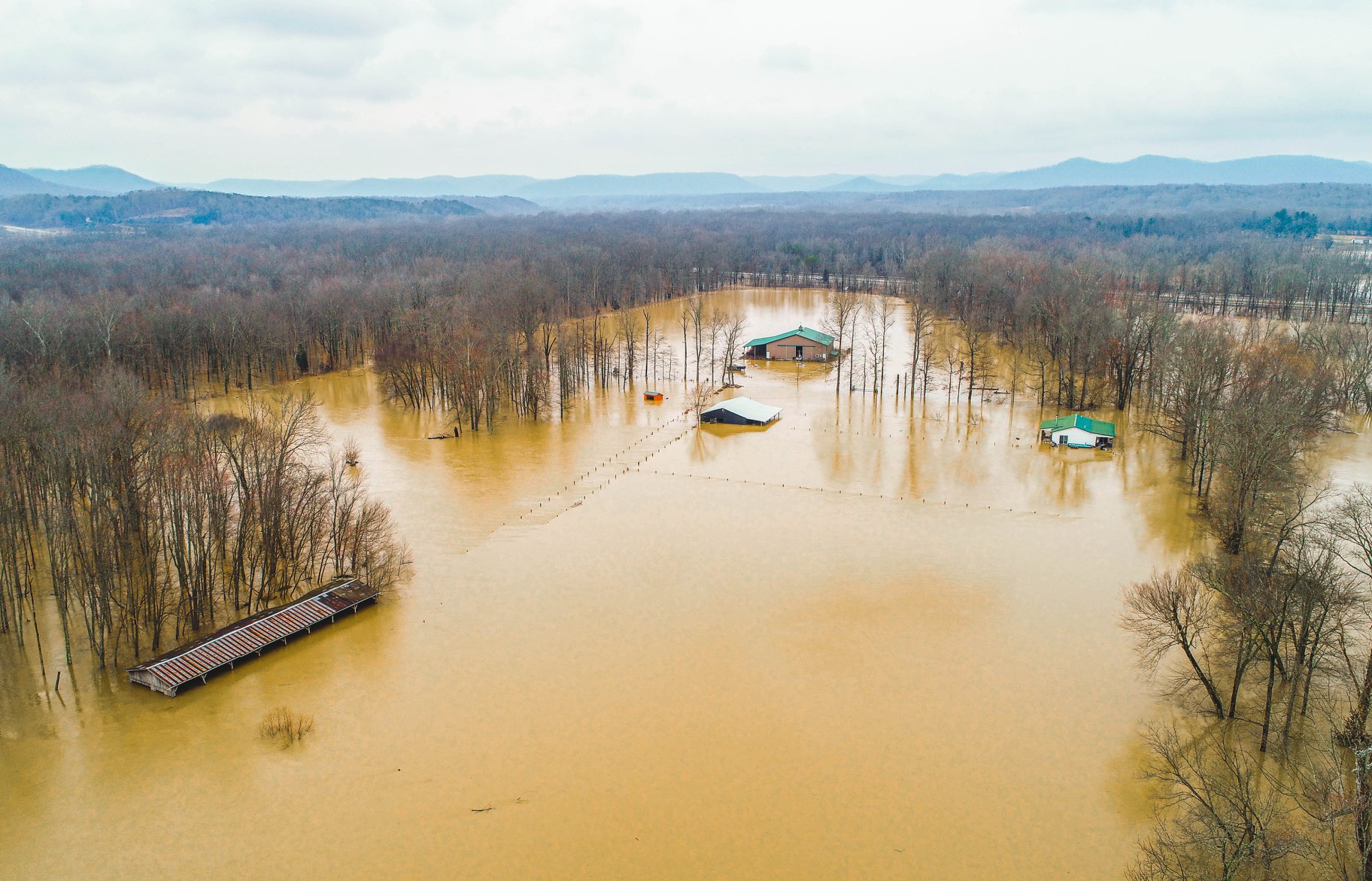
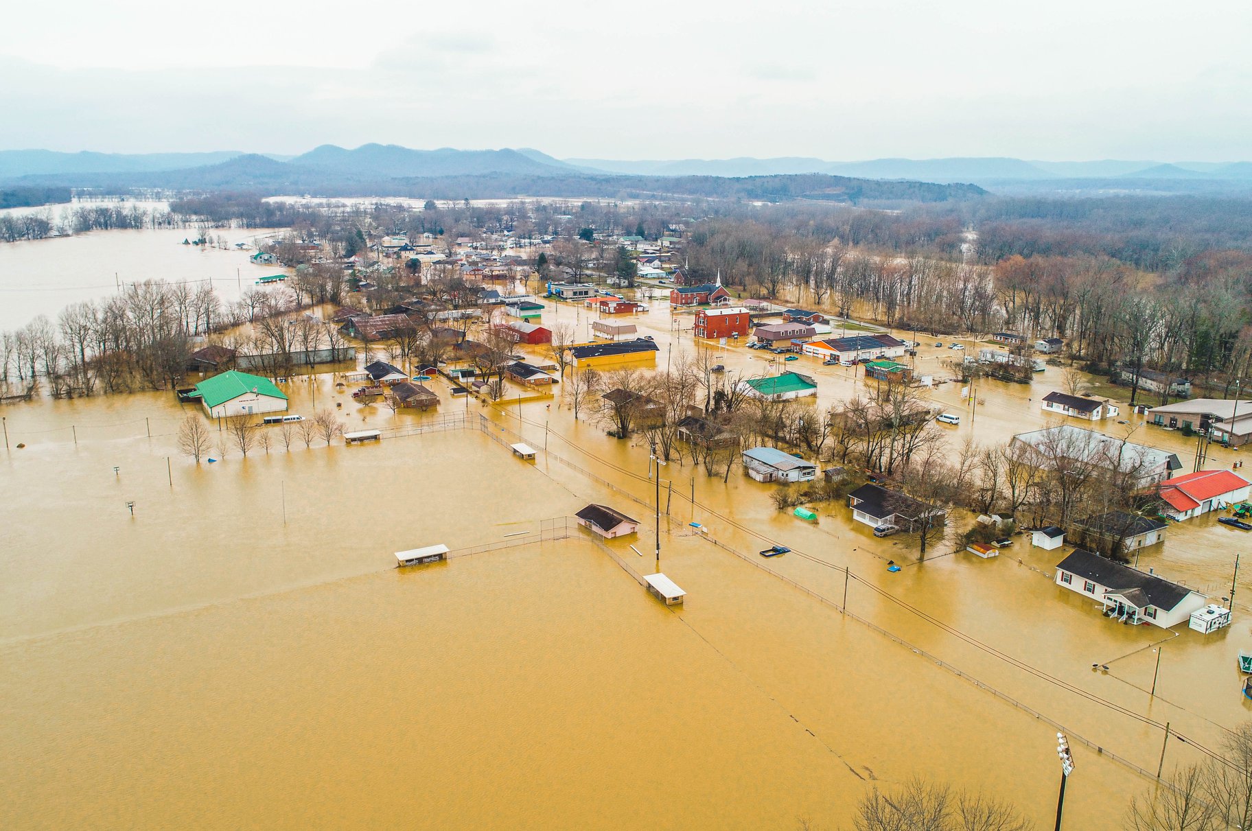
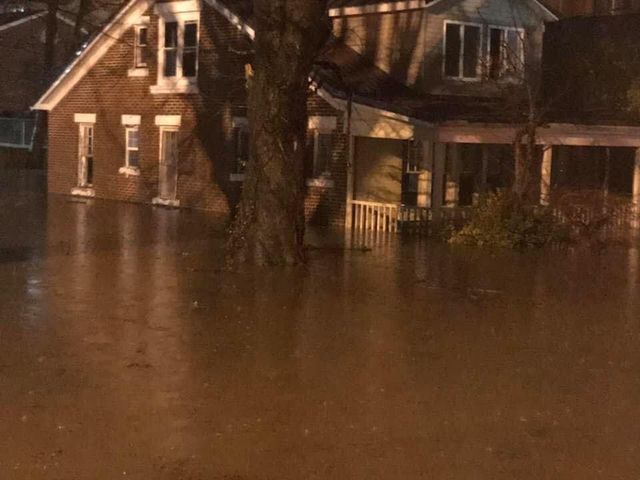
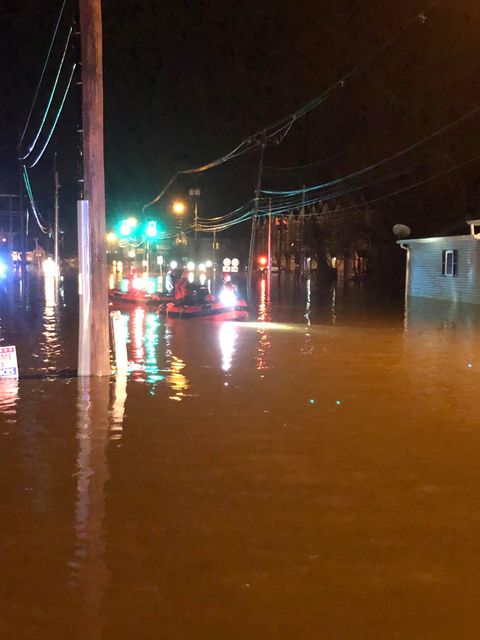
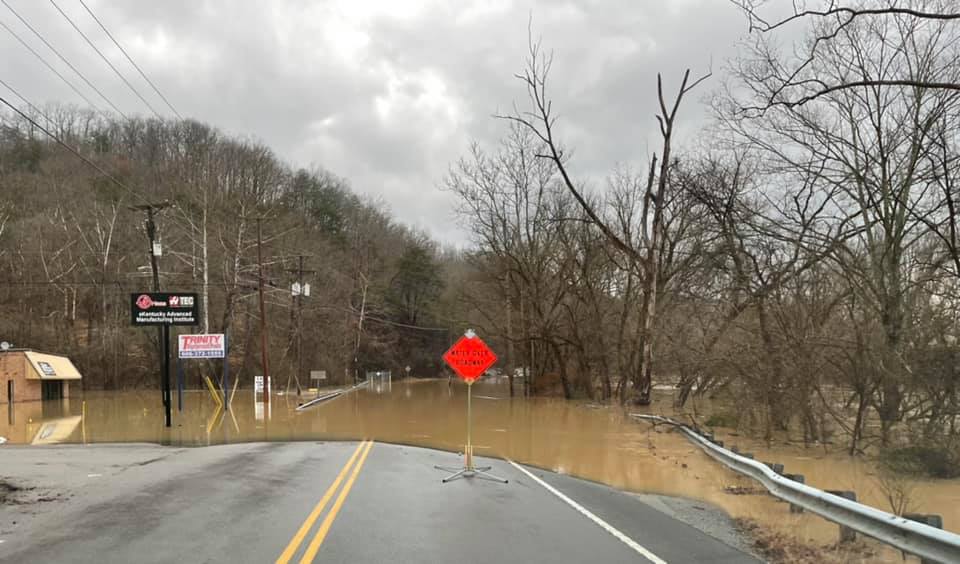
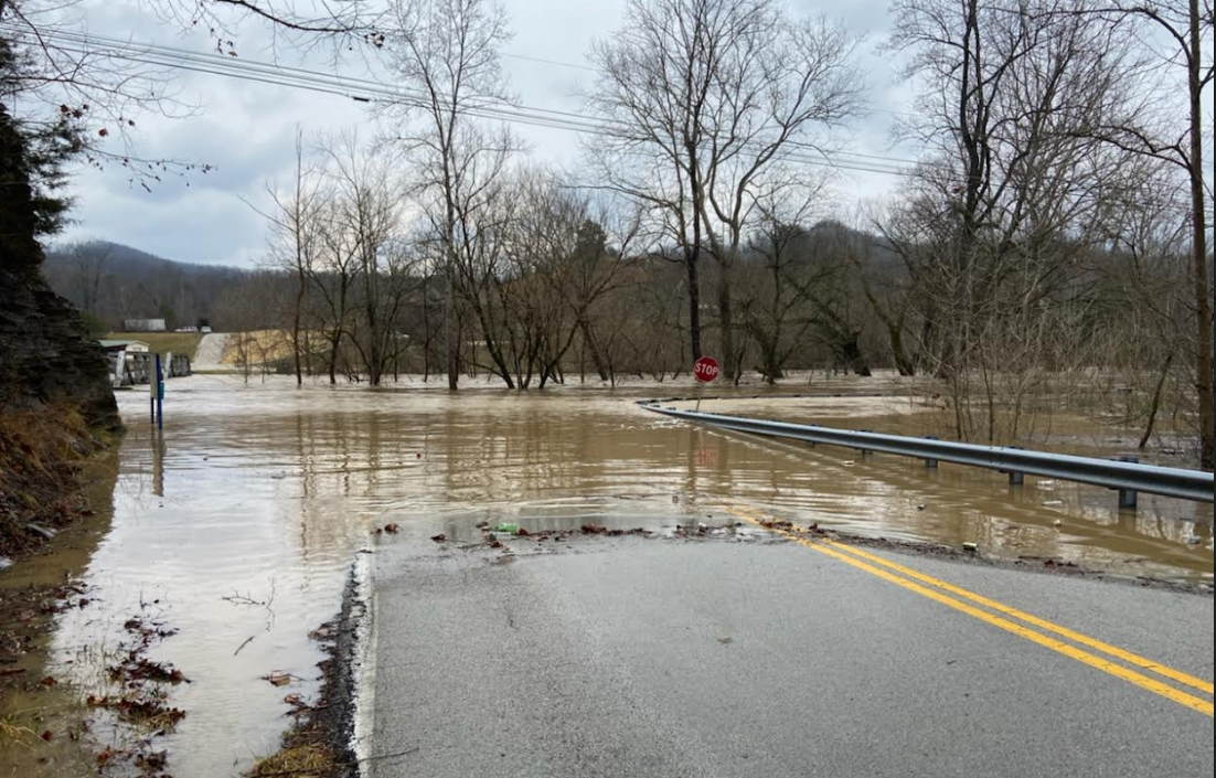
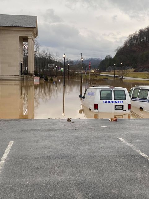
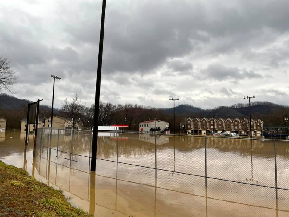
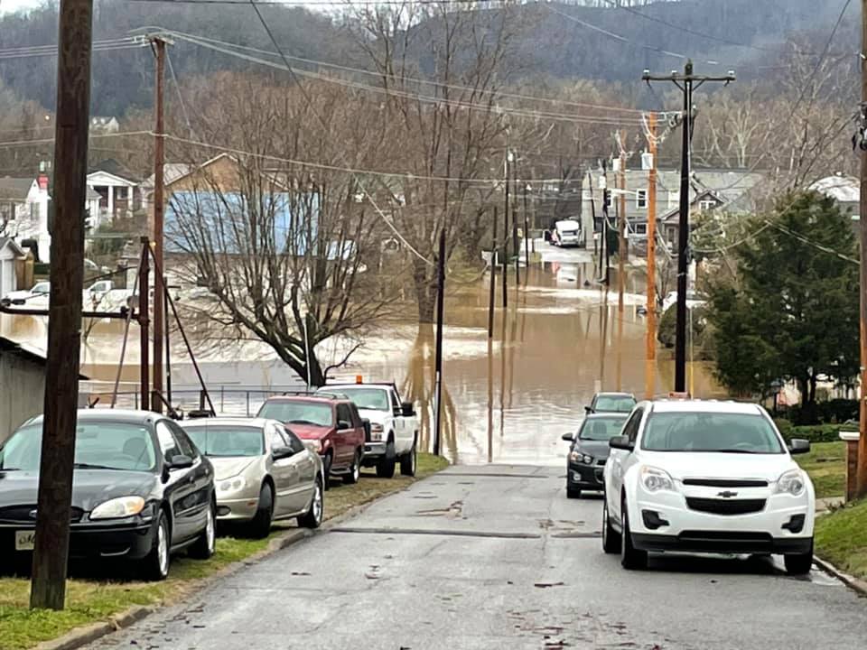
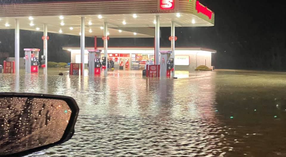
Several rounds of heavy rain moved across eastern Kentucky from late Friday, February 26th through early Monday, March 1st. The combination of all the heavy rainfall led to significant flooding across a good portion of central and east Kentucky. For some areas, this was the most significant flooding in the last 50 to 60 years or more.
The first round of heavy rain came through on the morning of Saturday, February 27th. This early rainfall targeted areas along the Hal Rogers Parkway, including Laurel, Clay, Perry, and Knott Counties. Flash flooding led to some closed roads for a short time in these areas.
The second round of rainfall came through late Saturday night as a warm front lifted northward across east Kentucky. The heavy rain stalled out over portions of Powell and Menifee Counties, leading to flash flooding in the early morning hours of Sunday.
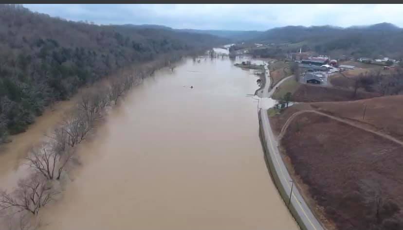
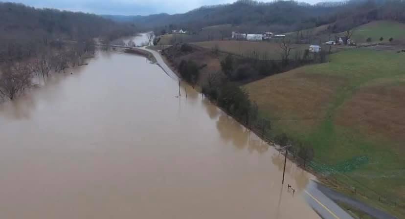
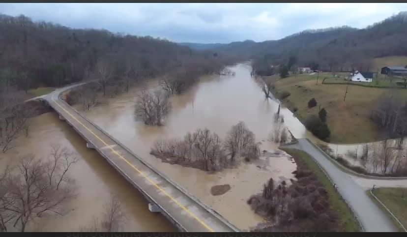
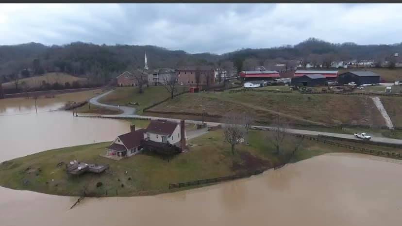
Finally, the third round of heavy rain came from late Sunday afternoon through Sunday night. Given that much of the area had already received significant amounts of rain from the earlier rain, this last round, caused widespread flash flooding across much of east Kentucky. This ultimately led to larger creek and river flooding. River levels on the Kentucky river were some of the highest readings ever recorded, namely at Booneville and Ravenna. Clay City, Heidelberg, Jackson, Paintsville, and Salyersville also saw significant river flooding of which hadn't been seen in 40 to 50 years.
The periods of heavy rain and flooding, led to numerous water rescues and mud/rock slides. Many areas were cut off or blocked due to the flooding. Power outages were also noted and reached as high as 12,000 during the peak of the flash flooding Sunday night.
River Flooding
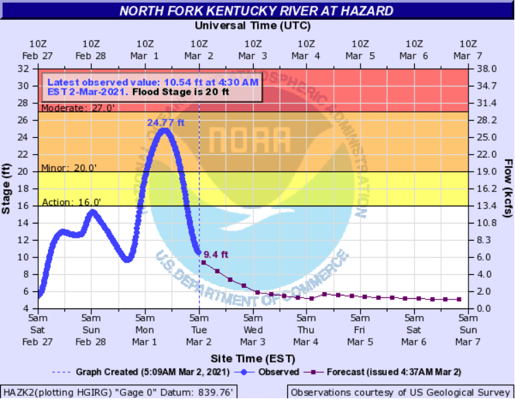
The North Fork of the Kentucky river at Hazard crested at 24.77 feet, which fell just short of the 26.00 foot crest just last year on February 7th, 2020.
The North Fork of the Kentucky river at Jackson crested at 39.04 feet. The last time the river exceeded this height was May 8th, 1984 when the river crested at 41.97 feet.
North Fork Kentucky River
 |
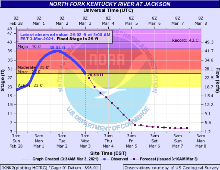 |
| Hazard | Jackson |
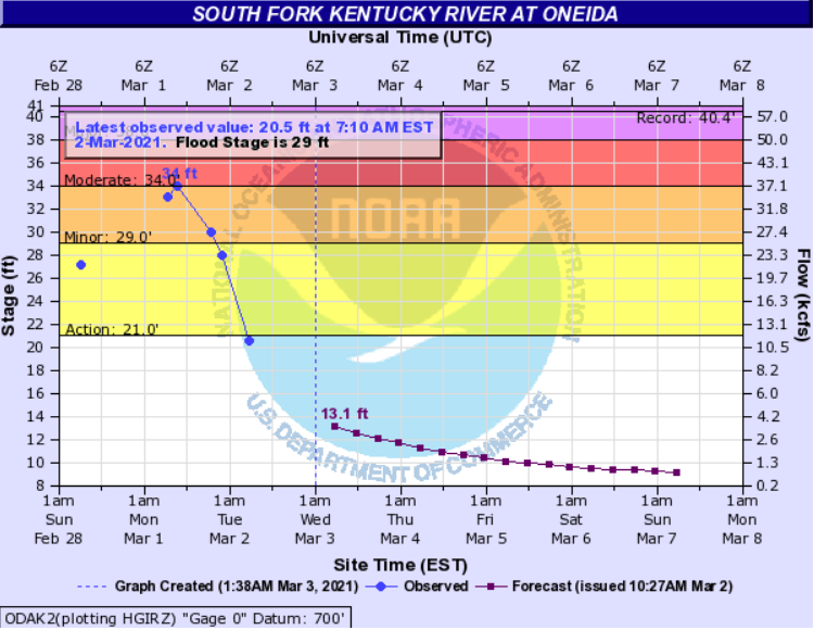
South Fork Kentucky River
Oneida, on the south fork of the Kentucky river, crested near 34 feet. The last time the river exceeded this height was on March 12, 1963, when the river crested at 36.89 feet. This was the 4th highest crest on record.
Booneville, on the south fork of the Kentucky river, set a new all time record crest of 44.33 feet. This broke the previous record crest of 43.40 feet, set on January 30th, 1957.
 |
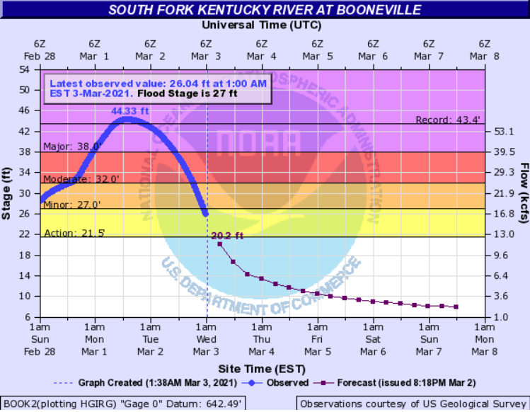 |
| Oneida | Booneville |
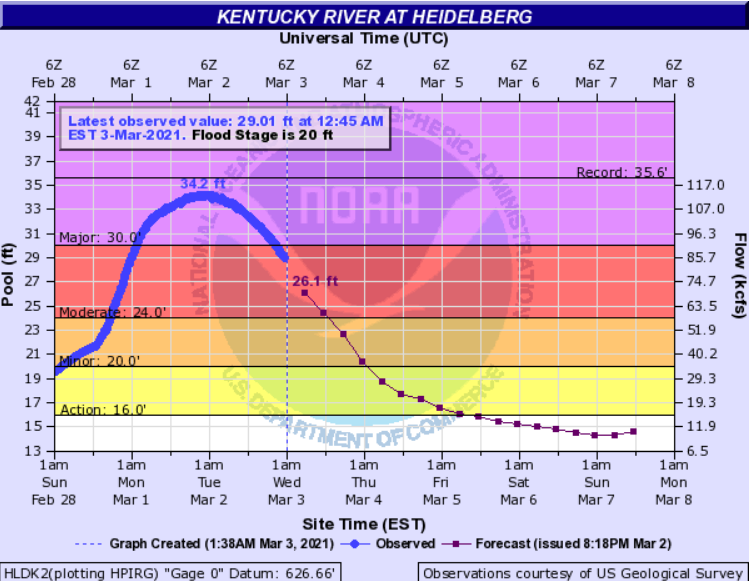
Kentucky River
Heidelberg, on the Kentucky river, crested at 34.2 feet, falling just short of the all time record of 35.60 feet, set on February 4th, 1939. However, this crest will fall within the top 5 crests of all time at Heidelberg.
Ravenna, on the Kentucky river, likely set a new all time record crest. The automated gage was knocked offline due to the flood waters. However, according to the United States Geological Service (USGS), the river crested near 41 feet. This record is preliminary until we can confirm the information. This will break the previous record crest of 39.37 feet, set on February 4th, 1939.
 |
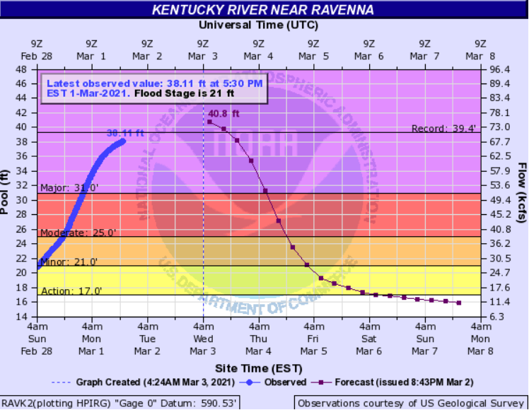 |
| Heidelberg | Ravenna |
Red River
Clay City, on the Red River, crested at 25.69 feet. This crest fell just short of the all time record crest of 26.75 feet, set on December 9th, 1978. This crest will end up being the 2nd highest crest on record at Clay City.
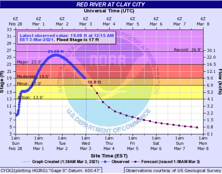 |
| Clay City |
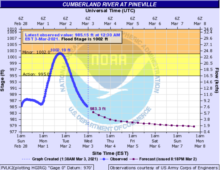
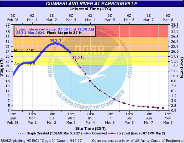
Cumberland River
While minor flooding was observed on the Cumberland River, the impacts were not as severe as locations farther north, where the axis of heavier rain occurred.
 |
 |
 |
| Pineville | Barbourville | Williamsburg |
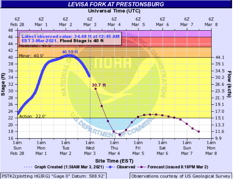
Levisa Fork of Big Sandy River
Minor to Moderate Flooding was observed on the Levisa Fork of the Big Sandy River. The most significant river flooding was at Paintsville. Paintsville crested at 39.74 feet. The river hasn't crested above this mark since May 9th, 1984, when the river reached 40.35 feet.
|
 |
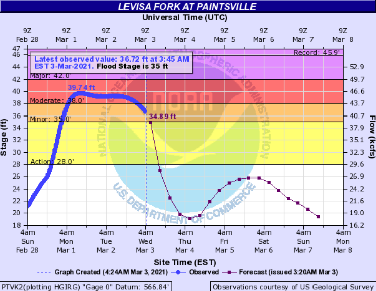 |
| Pikeville | Prestonsburg | Paintsville |
Licking River
Salyersville, on the Licking River crested at 20.36 feet. This was similar to the flood event on May 9th, 2009, when the river reached 20.67 feet.
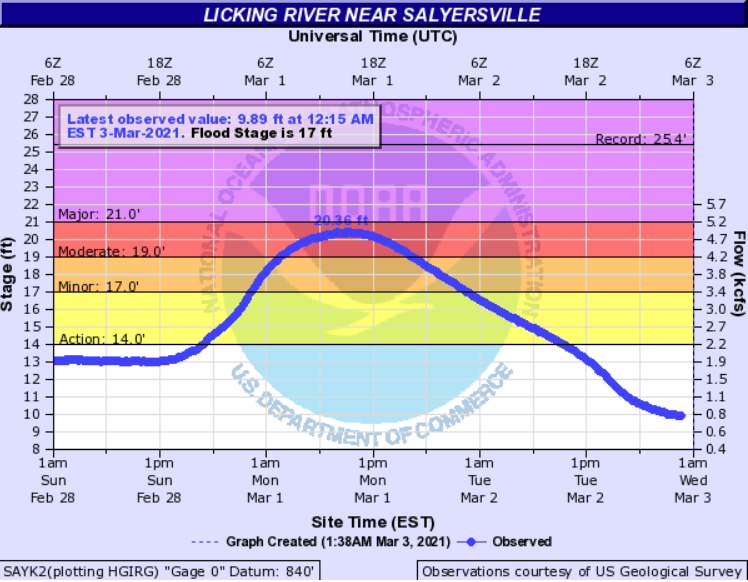 |
| Salyersville |
February 28th Clinton/Wayne County Tornado
|
Tornado - 2.5 SW of Cumberland City to 2 N Alpha
View of Tornado Damage Path 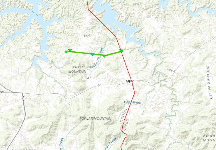
______________________________________________________________________ Zoomed in View of Tornado Damage Path 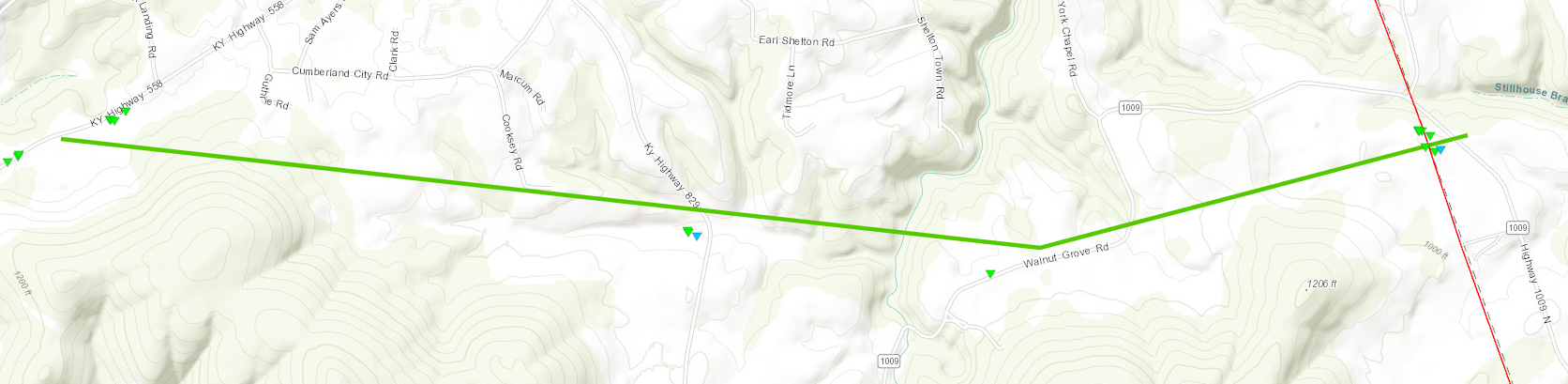 
______________________________________________________________________ Storm Survey Damage Photos in Wayne County 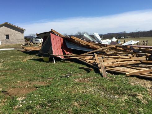 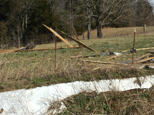 |
||||||||||||||||
The Enhanced Fujita (EF) Scale classifies tornadoes into the following categories:
| EF0 Weak 65-85 mph |
EF1 Moderate 86-110 mph |
EF2 Significant 111-135 mph |
EF3 Severe 136-165 mph |
EF4 Extreme 166-200 mph |
EF5 Catastrophic 200+ mph |
 |
|||||
Photos & Video
February 27th (Morning):
 |
 |
 |
 |
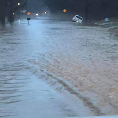
| Fish Trap area of Clay County (Roberta) |
Fish Trap area of Clay County (Roberta) |
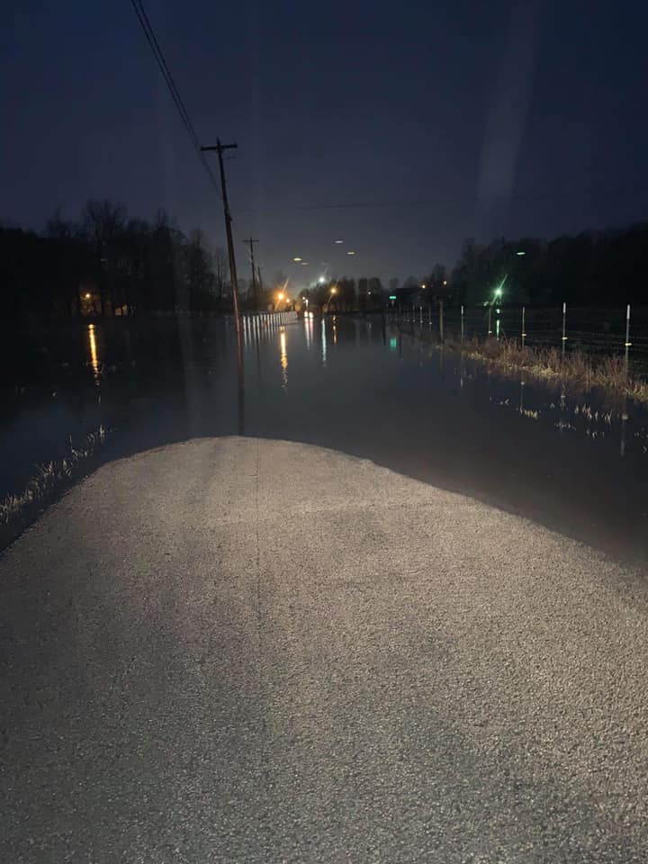
Old Highway 80 Between London and Manchester (Chris Meadows) |
Highway 550 in the Mousie area of Knott County (Kat) |
 |
 |
| Highway 638 in Laurel County (Roberta) |
Sally Branch Road in London (Ciera Holland) |
February 28th-March 1st:
 |
 |
 |
 |
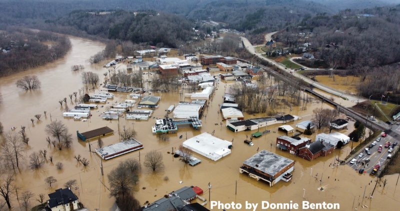
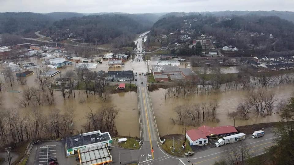
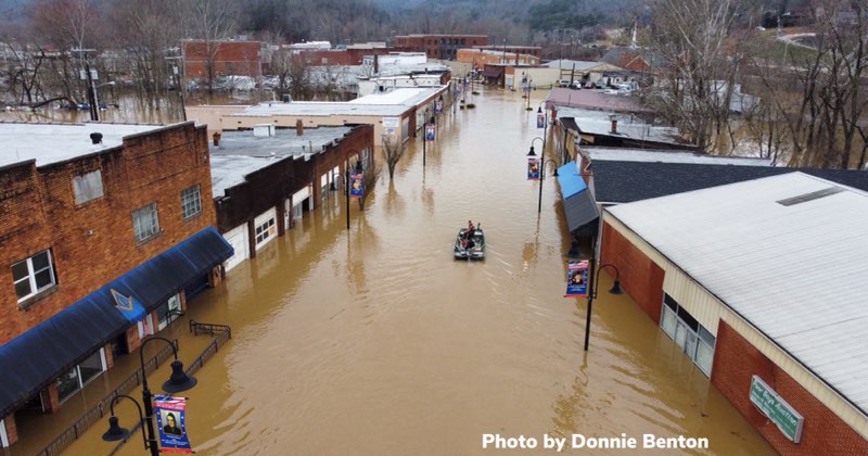
| Beattyville in Lee County (Donnie Benton) |
Beattyville in Lee County (Kendra Caudill) |
Beattyville in Lee County (Donnie Benton) |
Near Blackberry Fire Department in Pike County (WYMT) |
 |
 |
 |
 |
| Buckhorn High School in Perry County (Scott) |
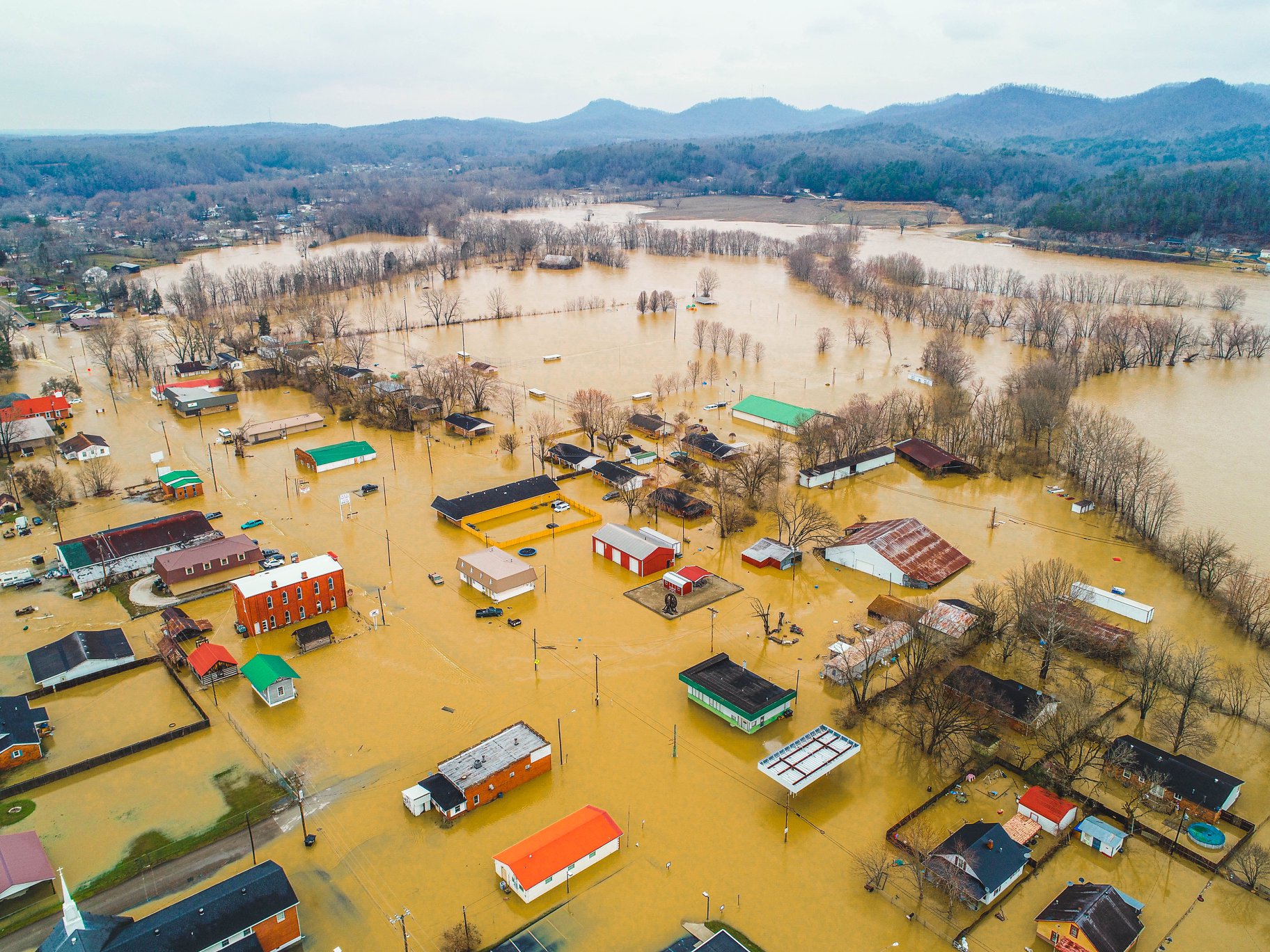
Clay City in Powell County (Ben Childers) |
Clay City area in Powell County (Ben Childers) |
Clay City area in Powell County (Ben Childers) |
 |
 |
 |
 |
| Clay City area in Powell County (Ben Childers) |
Clay City in Powell County (Ben Childers) |
Near Downtown Somerset in Pulaski County (Billy) |
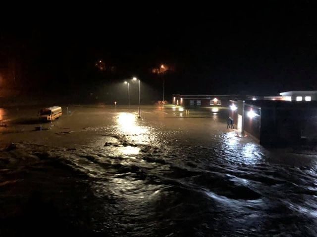
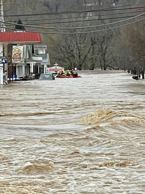
Highway 40 in Paintsville Water Rescues (Dennis) |
 |
 |
 |
 |
| Highway 40 in Paint Creek (J.R. VanHoose) |
Highway 421 top of Big Hill to Clover Bottom in Jackson County (Misty Richmond) |
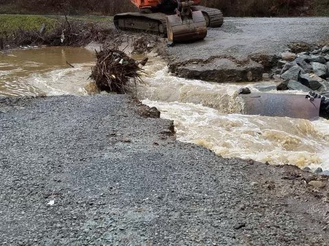
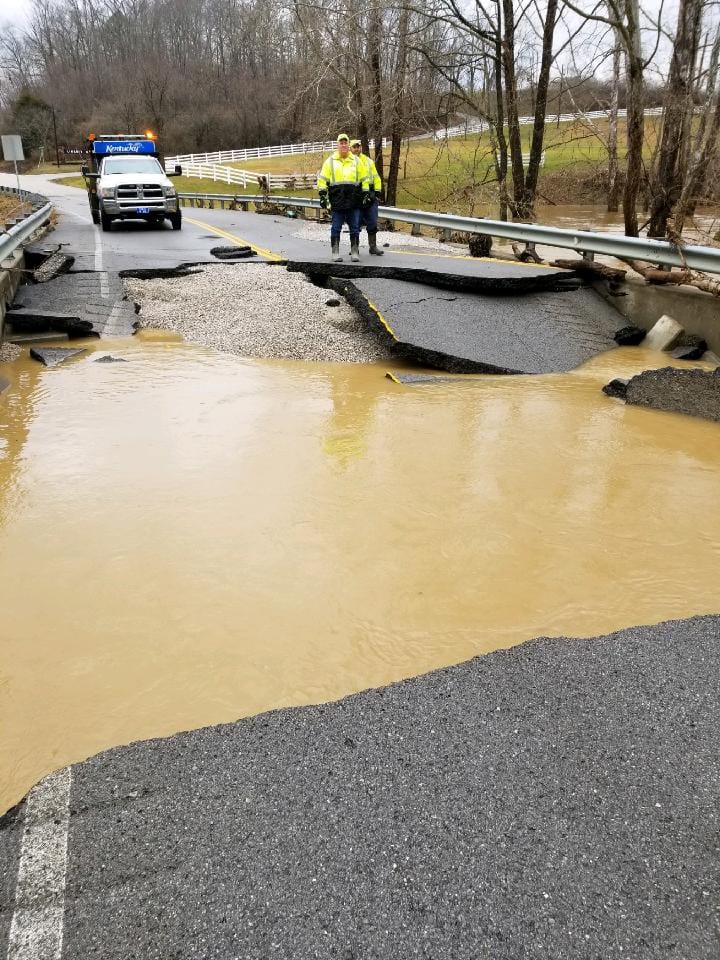
Highway 687 Bridge Collapse in Clay County (Clay County Sheriff) |
Highway 1010 E in Tolliver in Wolfe County (Tabitha Brewer) |
 |
 |
 |
 |
| Intersection of Highway 30W and Airport Rd (Jackson NWS office) |
Johnson County Courthouse (Tammy) |
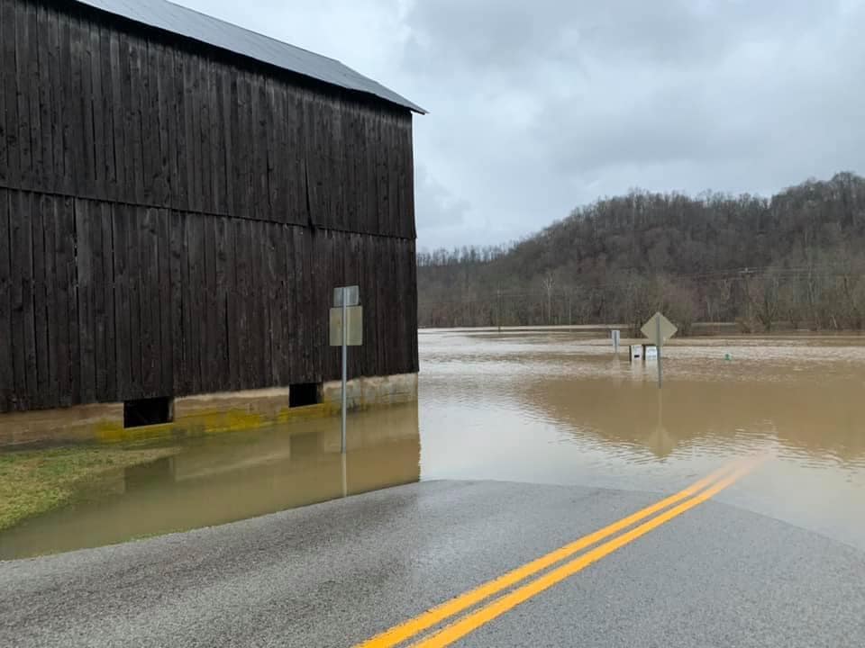
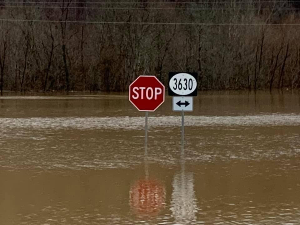
Intersection of Highway 2002 and Highway 3630 in Jackson County (JCHS Weather Team) |
Intersection of Highway 2002 and Highway 3630 in Jackson County (JCHS Weather Team) |
 |
 |
 |
 |
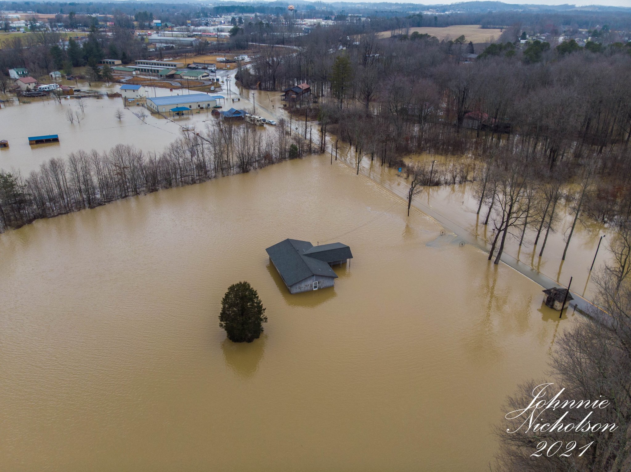
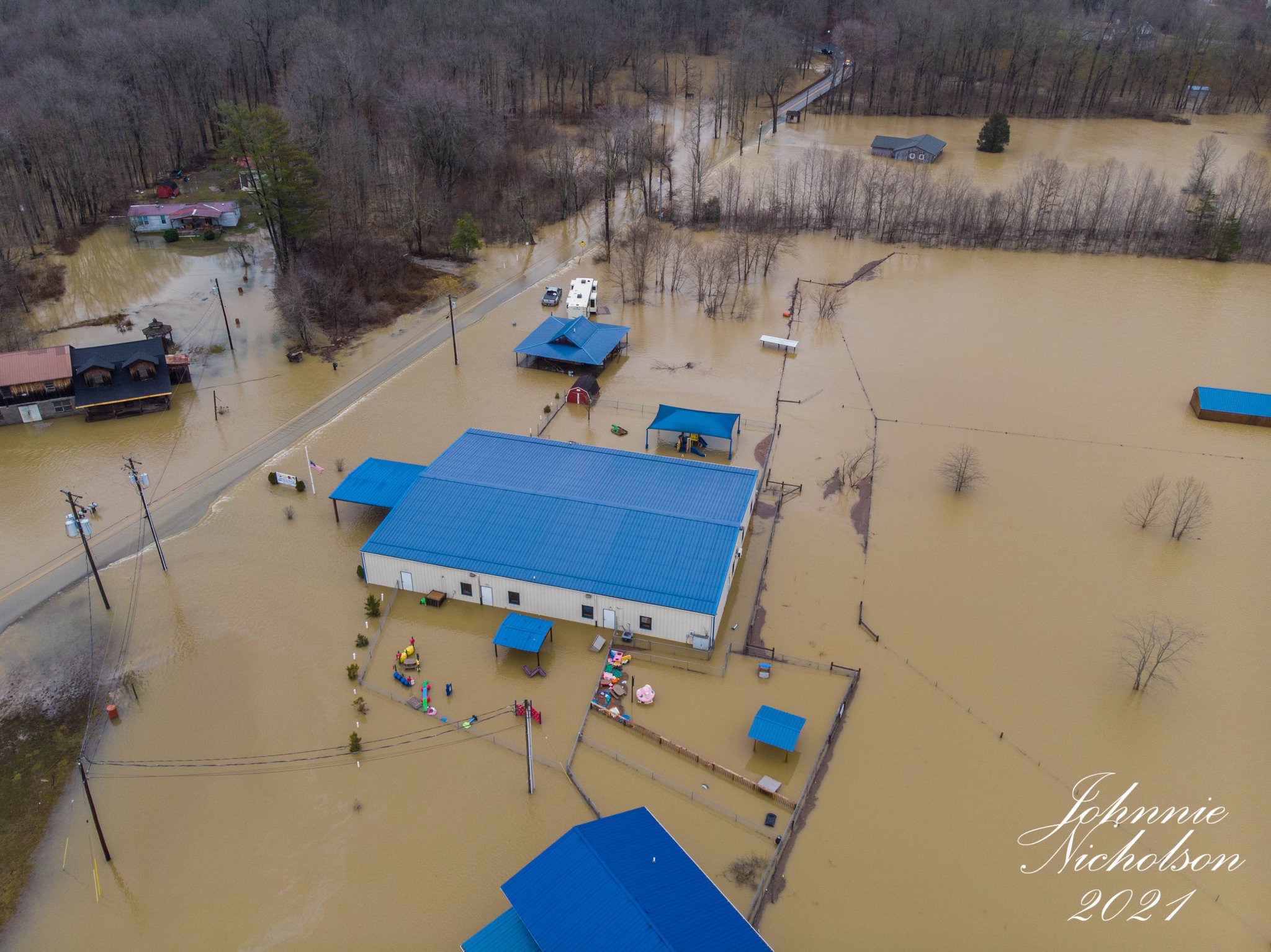
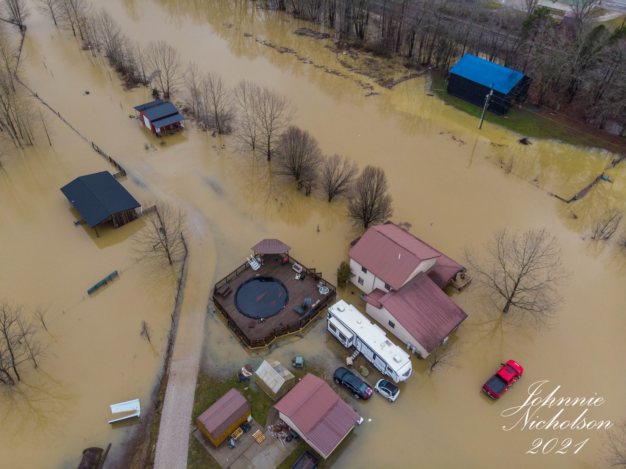
| Laurel County (Johnnie Nicholson) |
Laurel County (Johnnie Nicholson) |
Laurel County (Johnnie Nicholson) |
Martin in Floyd County (Mark) |
 |
 |
 |
 |
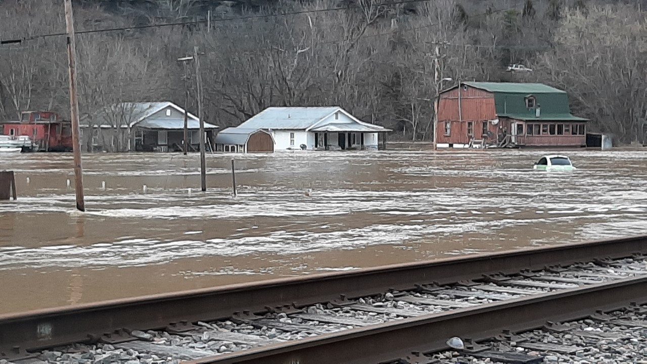
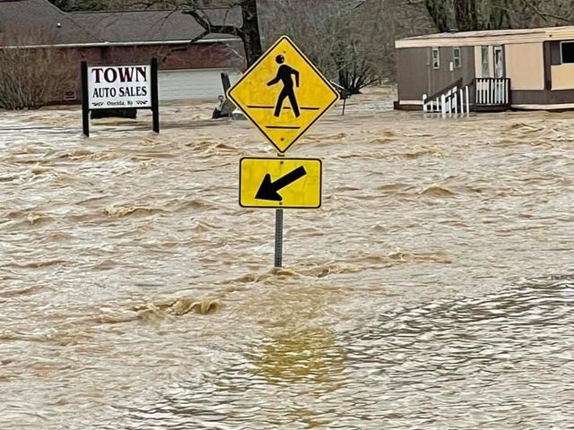
| Oneida in Clay County (Misty) |
Oneida in Clay County (Misty) |
Paintsville Little League Fields in Johnson County (J.R. VanHoose) |
June Buchanon School at Alice Lloyd in Pippa Passes in Knott County (Amanda Clark) |
 |
 |
 |
 |
| Preston Street in Paint Creek in Johnson County (J.R. VanHoose) |
Speedway in London in Laurel County (Blaine Storm) |
Highway 541 near Kentucky Mountain Bible College in Breathitt county (Marilu Collins) |
Highway 541 and Martha Layne Collins Bridge in Breathitt county (Marilu Collins) |
 |
 |
| Martha Layne Collins Bridge Crossing Kentucky River (Marilu Collins) |
Kentucky Mountain Bible College (Marilu Collins) |
| Garrett, KY in Floyd county (Lisa Dianne Harris) |
Hampton Road in London in Laurel County (City of London) |
| Water Rescues on Abbott Creek Rd. in Prestonsburg in Floyd county (Lyndsey) |
Salyersville, KY in Magoffin county (Kenton Dwayne Risner) |
| Clay City Flooding (Ben Childers) |
Radar
| Round 1: 10 PM February 26th Through 10 AM Saturday, February 27th |
| Round 2: 7 PM Saturday, February 27th Through 10 AM Sunday, February 28th |
| Round 3: 10 AM Sunday, February 28th Through 7 AM Monday, March 1st |
Storm Reports
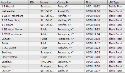
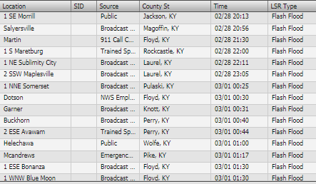
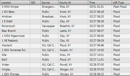
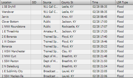
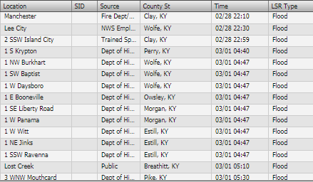
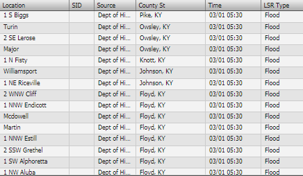
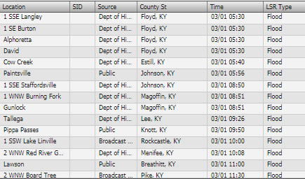
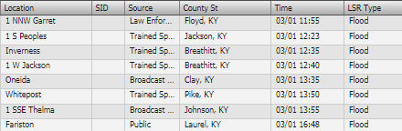
The local storm reports are preliminary and are subject to change.
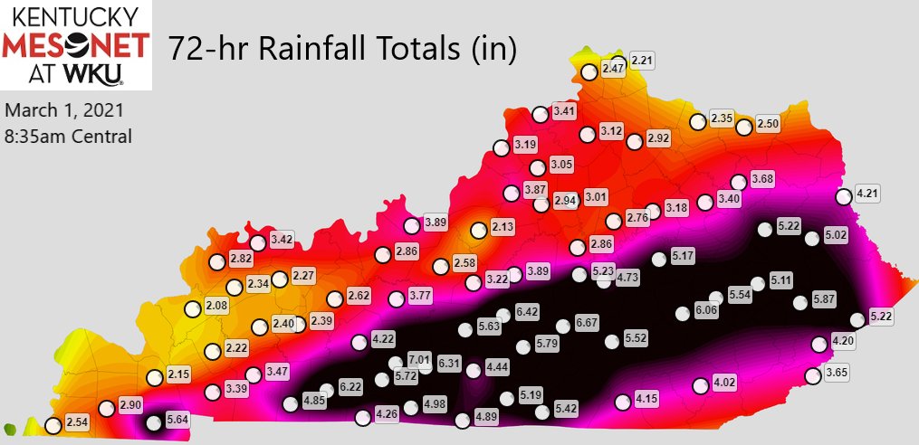
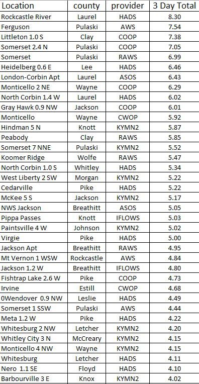
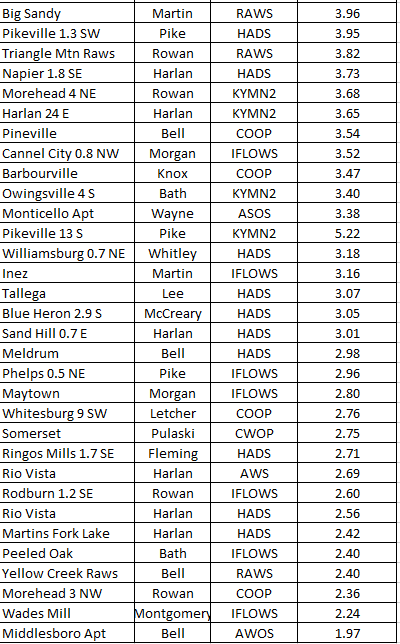
Rain Amounts Ending Monday Morning, March 1st
Environment
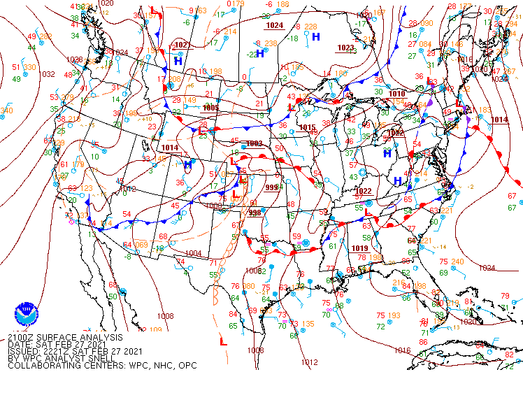
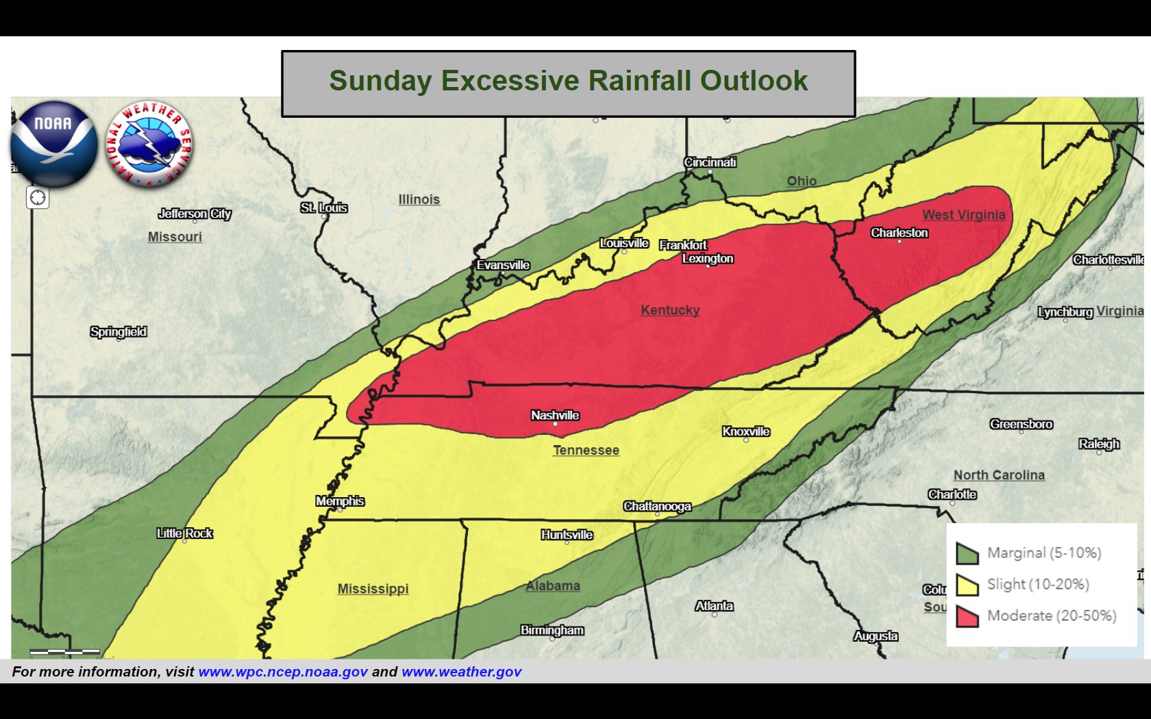
Several frontal boundaries (Figure 1) in the vicinity of eastern Kentucky, provided several rounds of heavy rain to eastern Kentucky. Given the potential for heavy rainfall, a flood watch (Figure 3) was issued Friday afternoon. After the first 2 rounds of heavy rainfall, we had a rare moderate risk for excessive rainfall (Figure 2) placed across much of eastern Kentucky early Sunday for the anticipated third round of heavy rainfall.
 |
 |
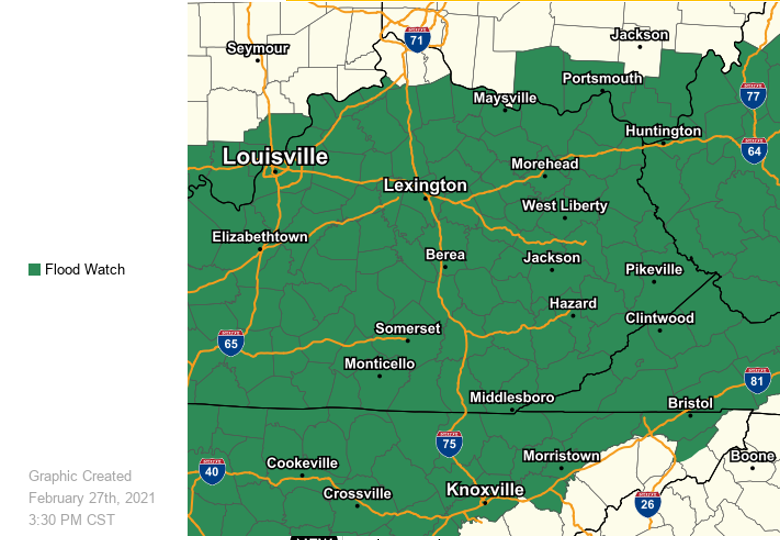 |
| Figure 1: Surface Map Analysis 4 pm Friday, February 27th Through 7 am Monday, March 1st | Figure 2: 24 Hour Excessive Rain Forecast Issued by Weather Prediction Center early Sunday morning | Figure 3: Flood Watch Issued Friday, February 26th at 323 pm |
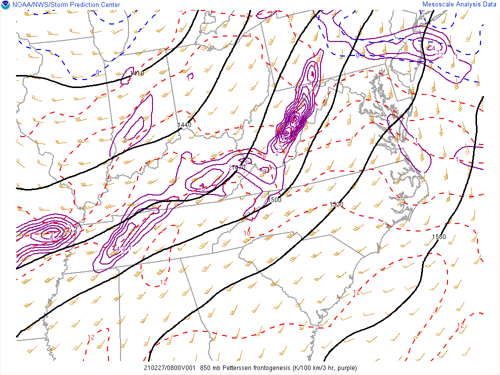
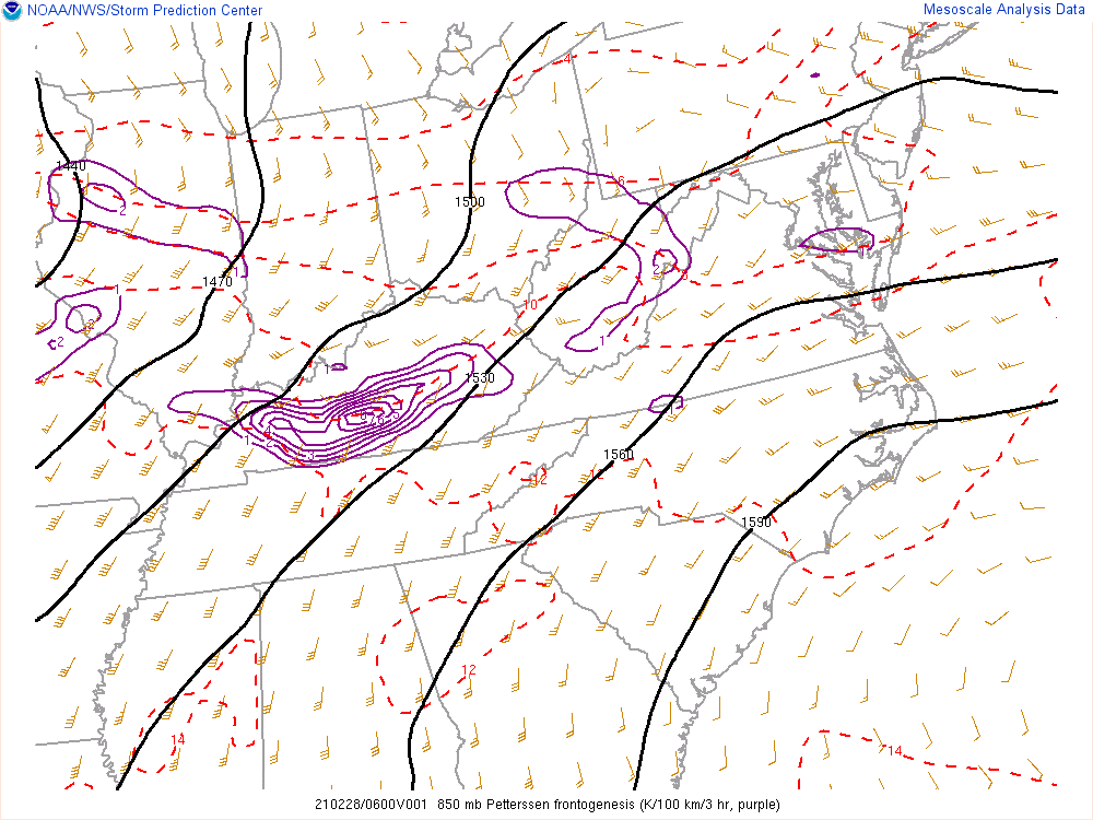
850mb Frontogenesis helped enhance rainfall rates across east Kentucky:
 |
 |
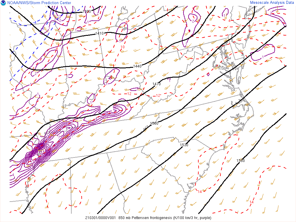 |
| Figure 4: 850mb Frontogenesis Early Saturday Morning (Associated with First Round of Rain) | Figure 5: 850mb Frontogenesis Early Sunday Morning Loop (Associated with Second Round of Rain) | Figure 6: 850mb Frontogenesis Sunday Evening (Associated with Third Round of Rain) |
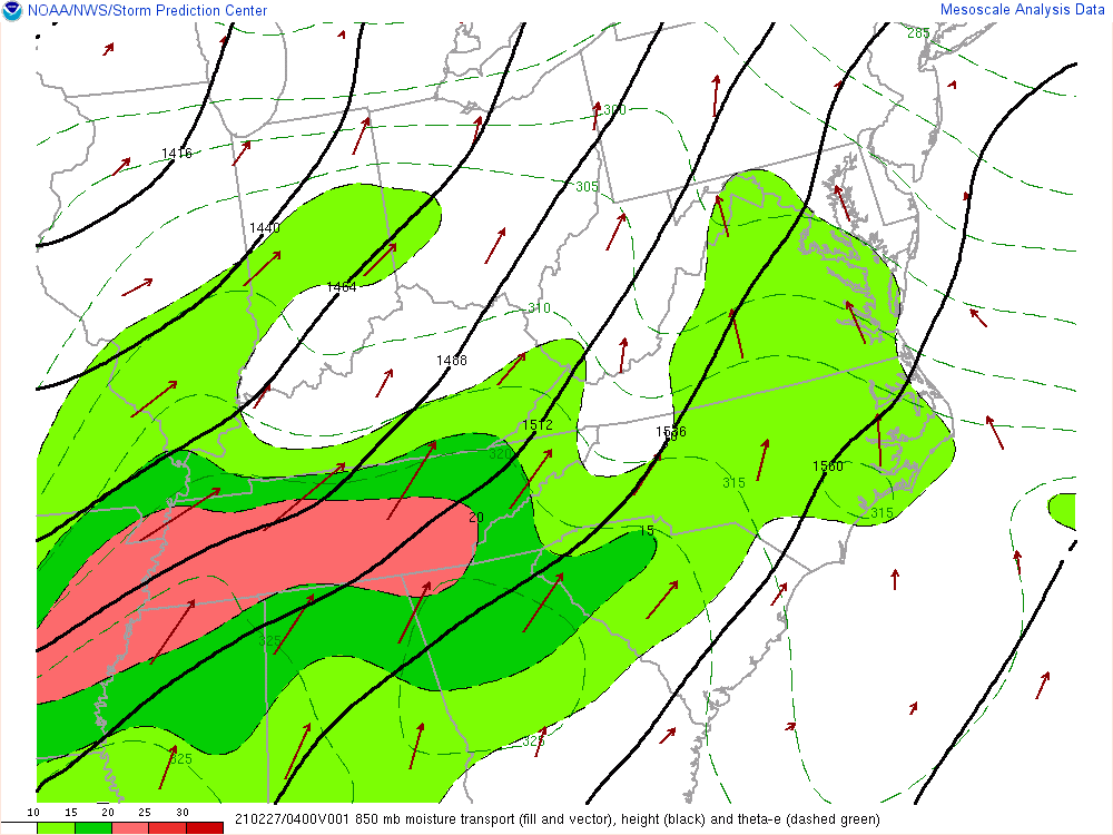
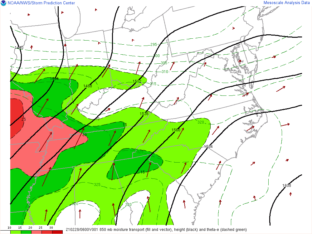
Precipitable water values (a measure of precipitation potential) (Figure 7) were exceptionally high for late February. Values above 1.30 inches are near record territory based upon Nashville, TN upper air climatology. 850mb Moisture Transport (Figure 8-10) was also a key player with strong advection of moist air into the area during all 3 round of heavy rainfall:
.gif) |
 |
 |
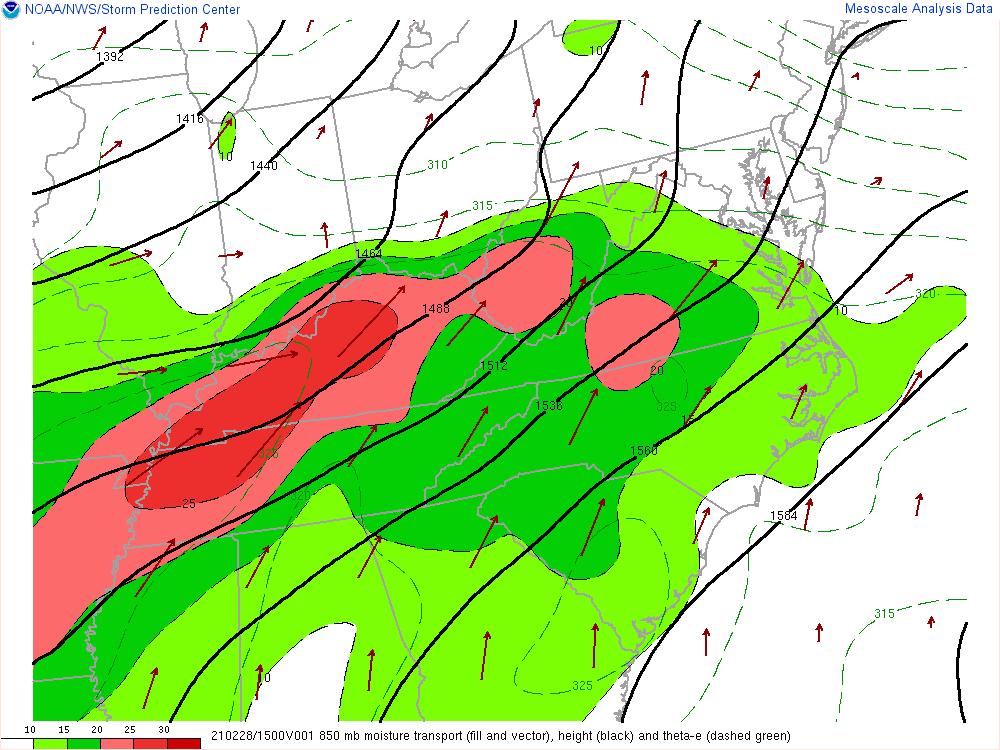 |
| Figure 7: Precipitable Water Values from the morning of Saturday, February 27th through the morning of Monday, March 1st | Figure 8: 850mb Moisture Transport Early Saturday Morning (Associated with First Round of Rain) | Figure 9: 850mb Moisture Transport Early Sunday Morning (Associated with Second Round of Rain) | Figure 9: 850mb Moisture Transport Sunday through Sunday Evening (Associated with Third Round of Rain) |
 |
Media use of NWS Web News Stories is encouraged! Please acknowledge the NWS as the source of any news information accessed from this site. |
|

