Numerous severe thunderstorms are expected across a broad region from the Ohio Valley to the Mid-Atlantic and Northeast States today into tonight. Swaths of damaging wind gusts are expected and some tornadoes are possible. Bertha is expected to bring tropical storm conditions to portions of the Gulf Coast from the Florida Panhandle westward to southeastern Louisiana later today and Wednesday. Read More >
Overview
|
Severe thunderstorms developed across eastern Kentucky during the evening hours of June 5, 2019. These thunderstorms developed ahead of an approaching frontal boundary and upper level disturbance. The main threat early on was large hail as storms were initially discrete. An organized line of showers and storms then moved in from the north, producing localized wind damage. Significant hail up to 2 inches in diameter was reported in Wolfe County with the early evening storms. There were also numerous trees blown down in areas, generally along and north of the Mountain Parkway. |
|
 |
 |
 |
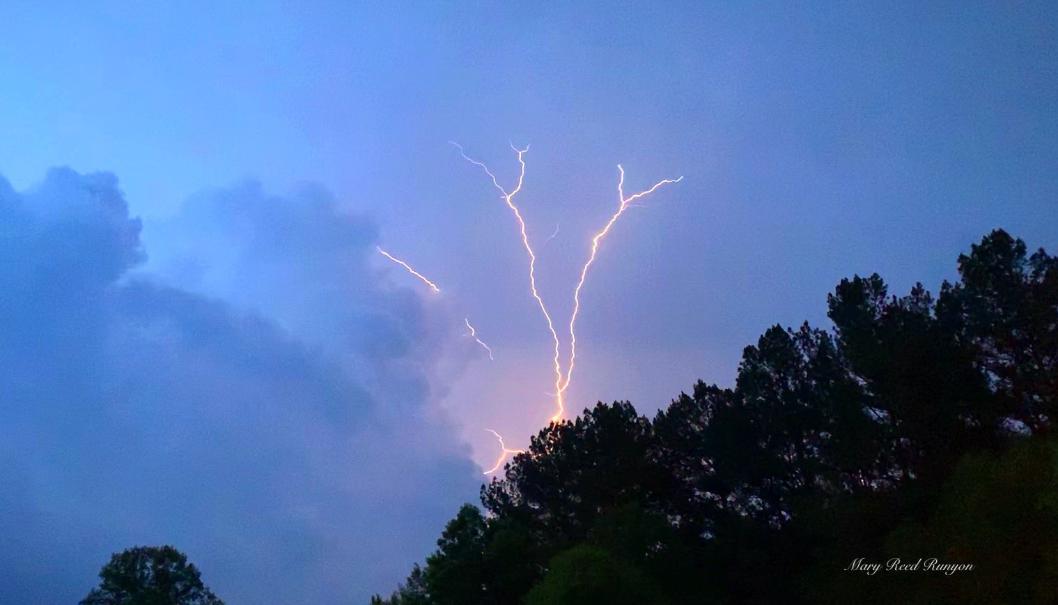
| Cloud-to-air lightning near Sidney, KY. Courtesy of Mary Reed Runyon. | Quarter sized hail near Ashers Fork. Courtesy of Hope Jackson. | Golf ball sized hail in Polksville. Courtesy of Michael Staton. |
 |
 |
 |
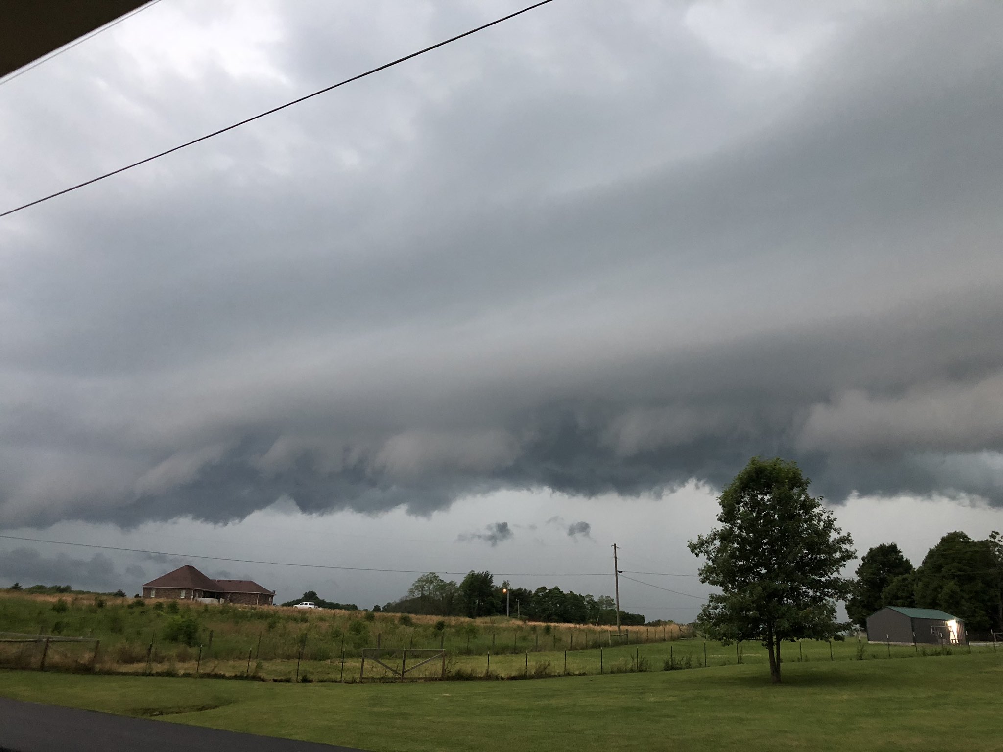
| A rock slide induced by heavy rain on Highway 1110 south of Highway 397. Courtesy of KYTC District 10. | A shelf cloud in Fleming County. Courtesy of Brent Wells. | A shelf cloud in Wallingford. Courtesy of Josh Carpenter. |
Radar
| 5 pm, June 5th - 2 am June 6, 2019 Radar Loop. |
Storm Reports
| Local Storm Reports received from June 5, 2019 | ||
 |
||
Environment
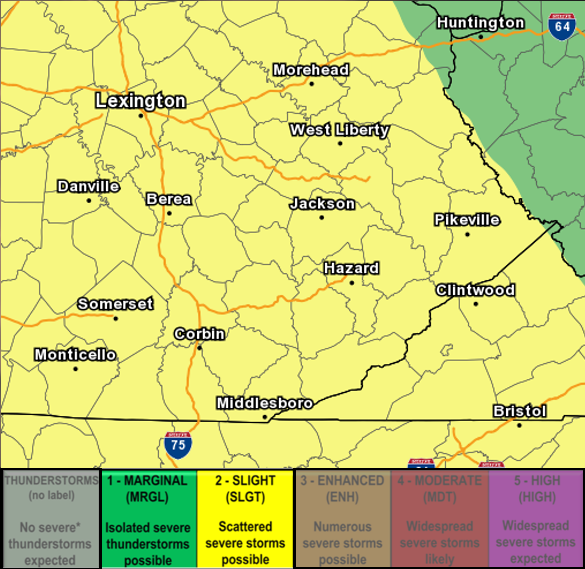 |
| Day 1 Severe Weather Outlook Issued by the Storm Prediction Center (SPC) in Norman, Oklahoma. |
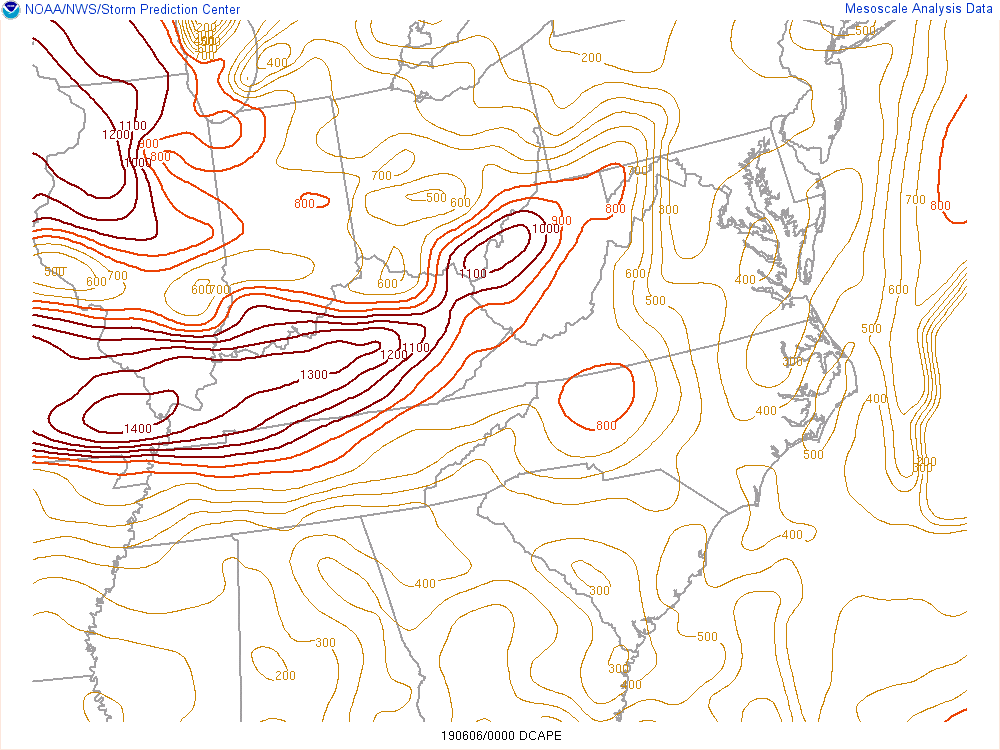 |
| DCAPE from 7 - 9 pm, June 5th, 2019 - The DCAPE (Downdraft CAPE) can be used to estimate the potential strength of rain-cooled downdrafts (damaging wind potential) within thunderstorms. Larger DCAPE values are associated with stronger downdrafts. Values around 1000 are generally considered favorable for strong winds. |
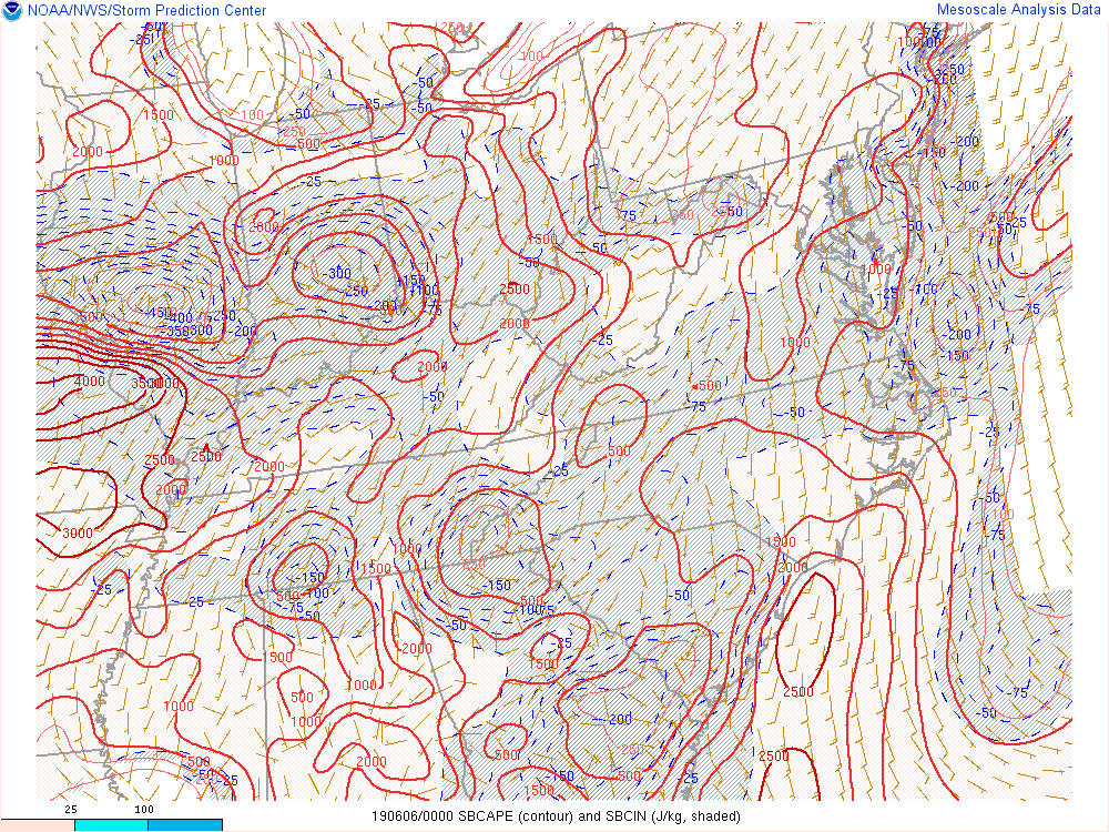 |
| Surface Based CAPE from 5 - 8 pm, June 5th, 2019. |
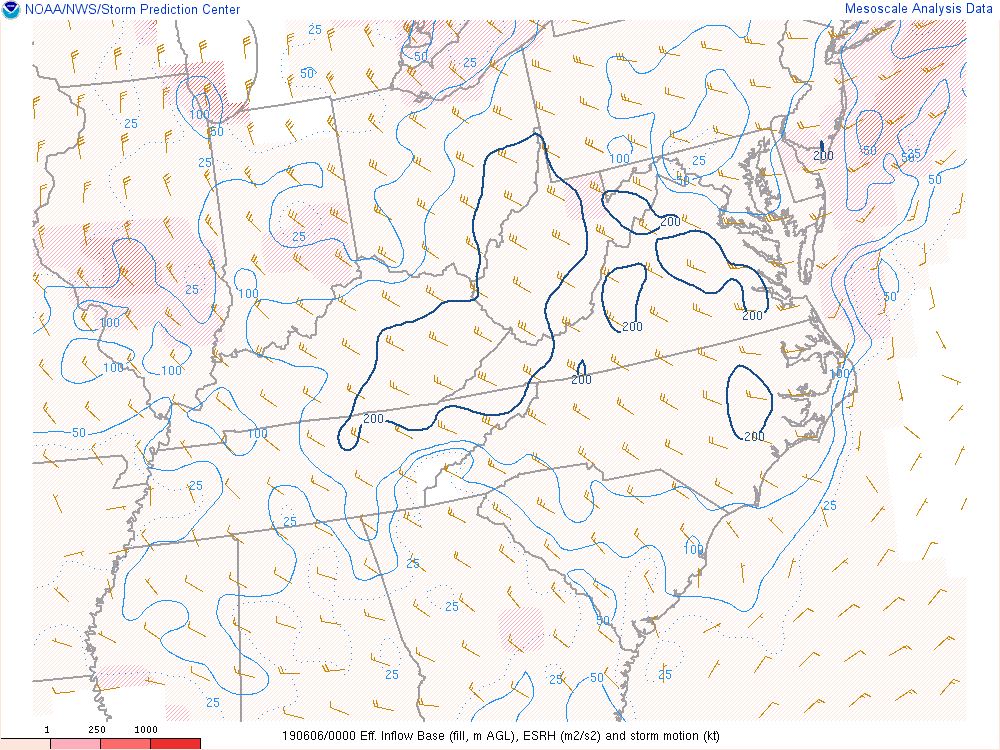 |
| Effective Storm Relative Helicity from 7 - 9 pm, June 5th, 2019. |
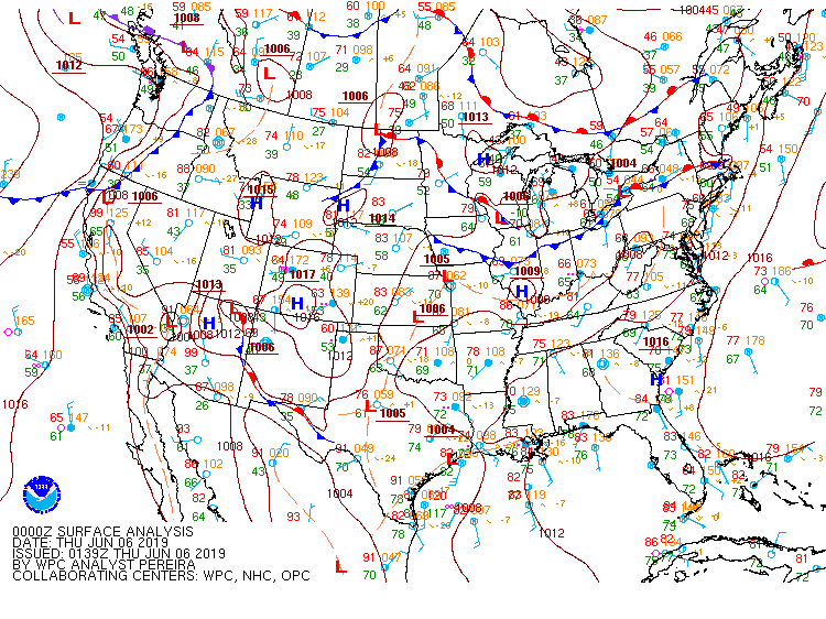 |
| 8 pm, June 5th Analyzed Surface Map by the Weather Prediction Center (WPC). |
 |
Media use of NWS Web News Stories is encouraged! Please acknowledge the NWS as the source of any news information accessed from this site. |
|