
Dangerous heat will expand from the Gulf Coast into the Southern Plains and Desert Southwest through week's end. Additional extreme heat impacting the Pacific Northwest will shift to the northern Plains by the weekend. Tropical Storm Bertha is expected to continue to impact portions of the northern Gulf Coast from the western Florida Panhandle to southeastern Louisiana through tonight. Read More >
Overview
|
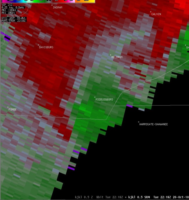
On October 26th 2010, an unusually deep Low pressure system was working its way across the Upper Midwest, pushing a strong cold front across the Mississippi Valley and through the Ohio and Tennessee Valleys. A strong upper level Jet Stream was in place, along with a 50 to 60 mph Low Level Jet feeding Gulf moisture into the area ahead of the front, creating a dynamic environment suitable for a severe weather outbreak that ranged from the Lower Great Lakes region to the Southern Appalachians. During the afternoon, over a dozen Severe Thunderstorm Warnings were issued throughout Eastern Kentucky as a line of storms developed along the front and began racing across Kentucky. |
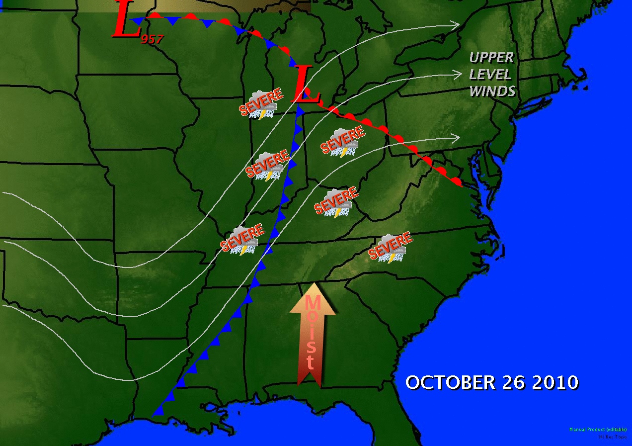 October 26, 2010 weather summary map |
Tornado:
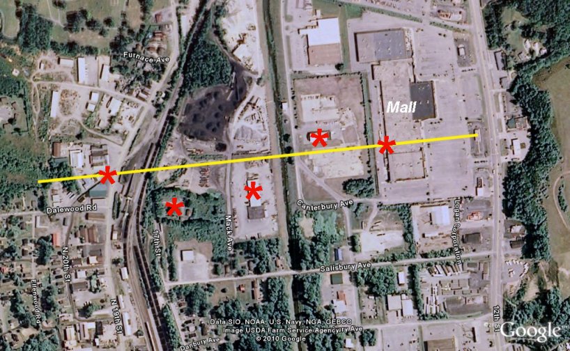
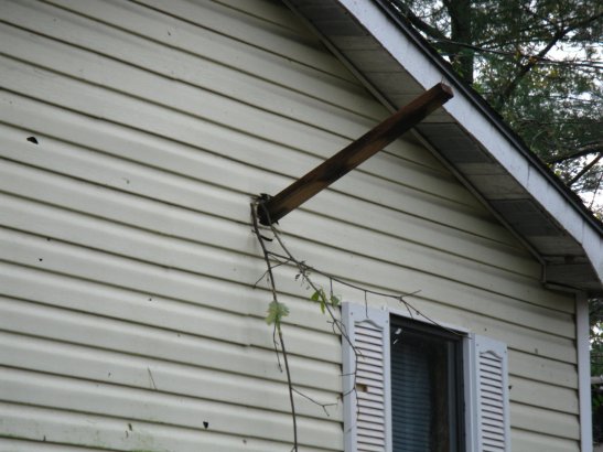
Shortly after 6 pm, a weakening thunderstorm over Bell County developed a tornado that touched down in Middlesboro, tracking about a quarter of a mile through the downtown area. Despite being rated as a weaker tornado than the one which struck Wayne County earlier in the year, the impact was actually greater because the event occurred in a more populated area. Although the tornado was short lived, accounts indicated that the twister was only on the ground for a couple of minutes, the damage along the path from 19th street to 12th street was extensive. Part of the roof on the mall was damaged, 2 cinder block buildings at a lumber yard were demolished, a roof was blown off of another building supplier, and 2 large steel doors were blown off of another business.
The National Weather Service in Jackson, KY conducted a damage survey and confirmed that an EF1 tornado touched down late in the afternoon on Tuesday October 26, 2010 in the city of Middlesboro, Bell County, Kentucky.
Time: Touchdown for approximately 1 to 2 minutes between 6:10 pm EDT and 6:15 pm EDT.
Location: From just West of State Hwy 2079 North of Fleetwood Road, East-Northeast to just West of Hwy 25E in Middlesboro.
EF-Scale: EF-1
Estimated Max Winds: 105 MPH
Path Width: 1/10th to 1/8th of a mile
Path Length: 7/10th of a mile
Injuries: None
Fatalities: None
 |
 |
 |
 |
 |
 |
 |
The Enhanced Fujita (EF) Scale classifies tornadoes into the following categories:
| EF0 Weak 65-85 mph |
EF1 Moderate 86-110 mph |
EF2 Significant 111-135 mph |
EF3 Severe 136-165 mph |
EF4 Extreme 166-200 mph |
EF5 Catastrophic 200+ mph |
 |
|||||
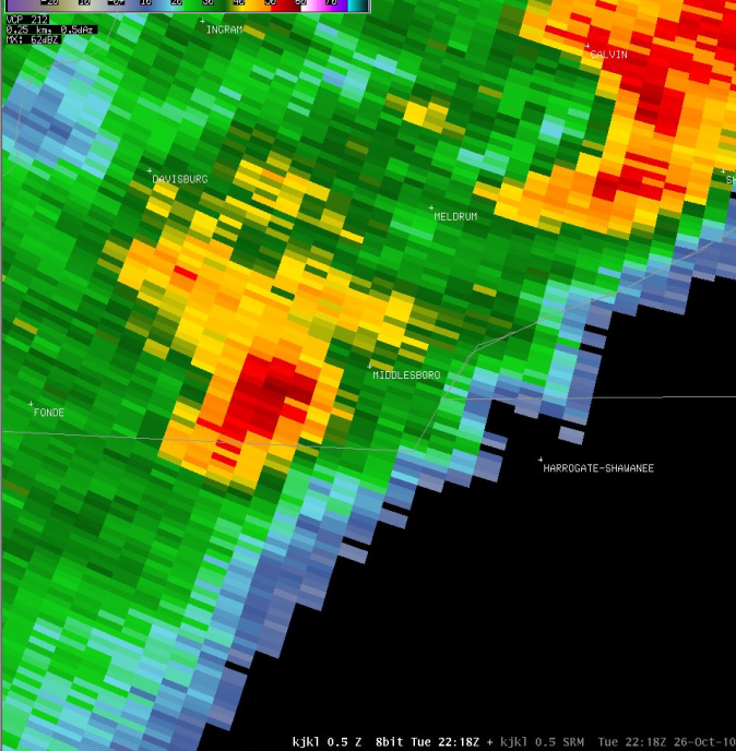
Radar:
 |
 |
 |
Media use of NWS Web News Stories is encouraged! Please acknowledge the NWS as the source of any news information accessed from this site. |
|

