Overview
|
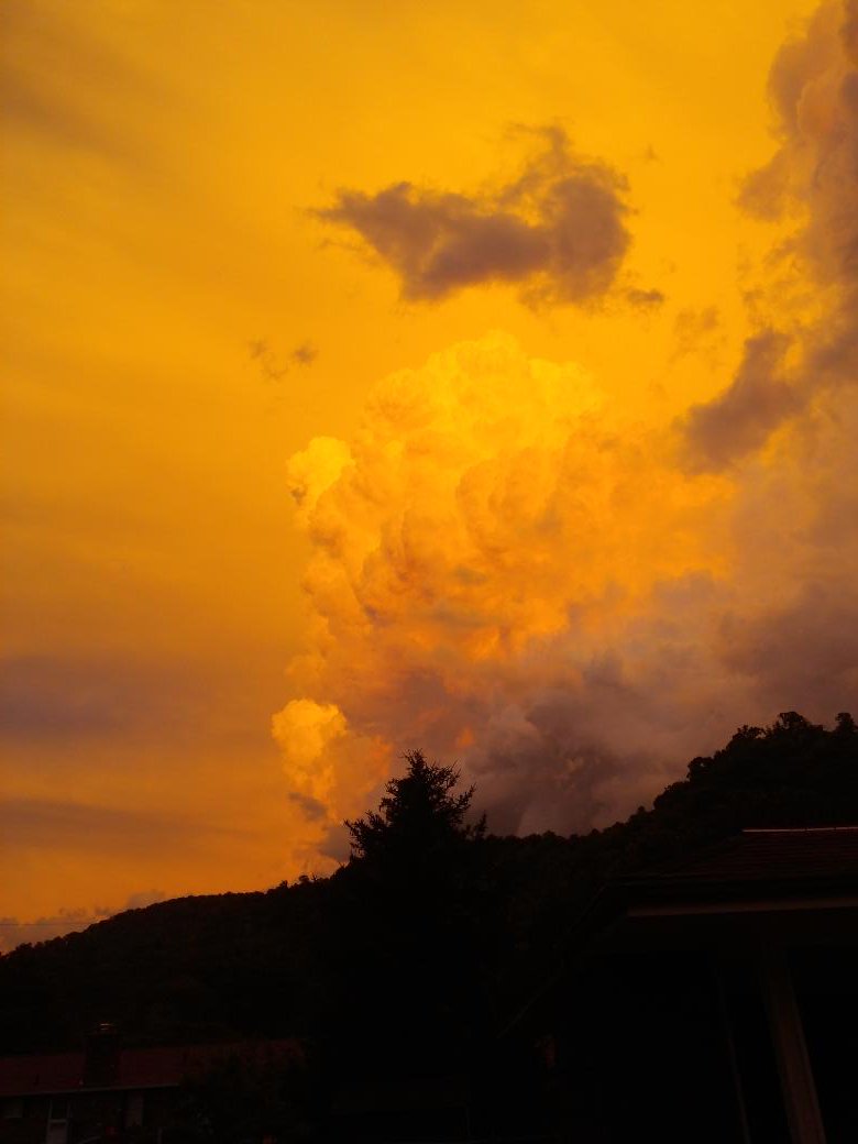
Isolated supercell thunderstorms developed Thursday evening June 16, 2016 across Pike County, while strong to severe storms also moved from south central Kentucky through far southeastern Kentucky. These storms were able to develop in a very unstable airmass as an upper level disturbance and cold front swung through the central Appalachians and all of Kentucky. Multiple trees were reported down across portions of Pike County as well as in Pulaski County, while quarter size hail was observed near Fedscreek and Elkhorn City in Pike County. Several individuals were kind enough to share their photos of the subsequent picturesque and vibrant sky prior to sunset. |
 Courtesy Kaye Willis. |
 |
 |
 |
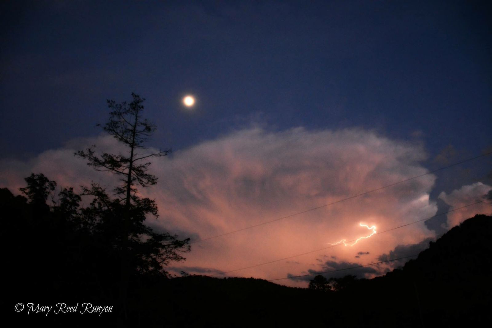
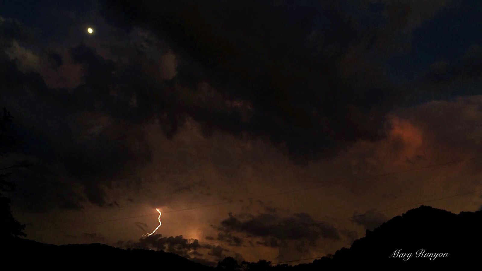
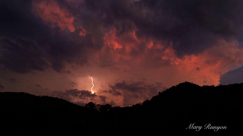
| From Hatfield, KY. Courtesy Mary Reed Runyon. | ||
 |
 |
 |
| From Hatfield, KY. Courtesy Mary Reed Runyon. | Anvil over Pikeville, taken from Floyd County. Courtesy Keith Arnett. | |
 |
 |
 |
| Mammatus clouds taken in Harlan County. Courtesy Kyle Howard (left/center) and Pamela Joseph (right). | ||
 |
 |
 |
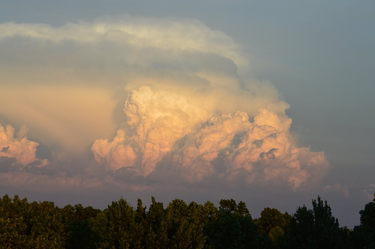
| Supercell about 60 miles away. Courtesy Cave Run Marinas. | Storm tower south of Pikeville. Courtesy Tristan Davis. | Courtesy Savanna Wilson. |
Radar
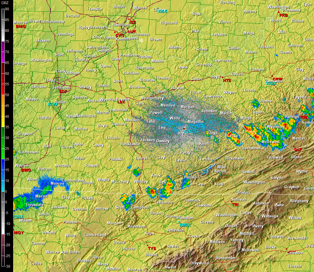 |
| Radar imagery from just after 8 pm EDT Thursday June 16, 2016. |
Storm Reports
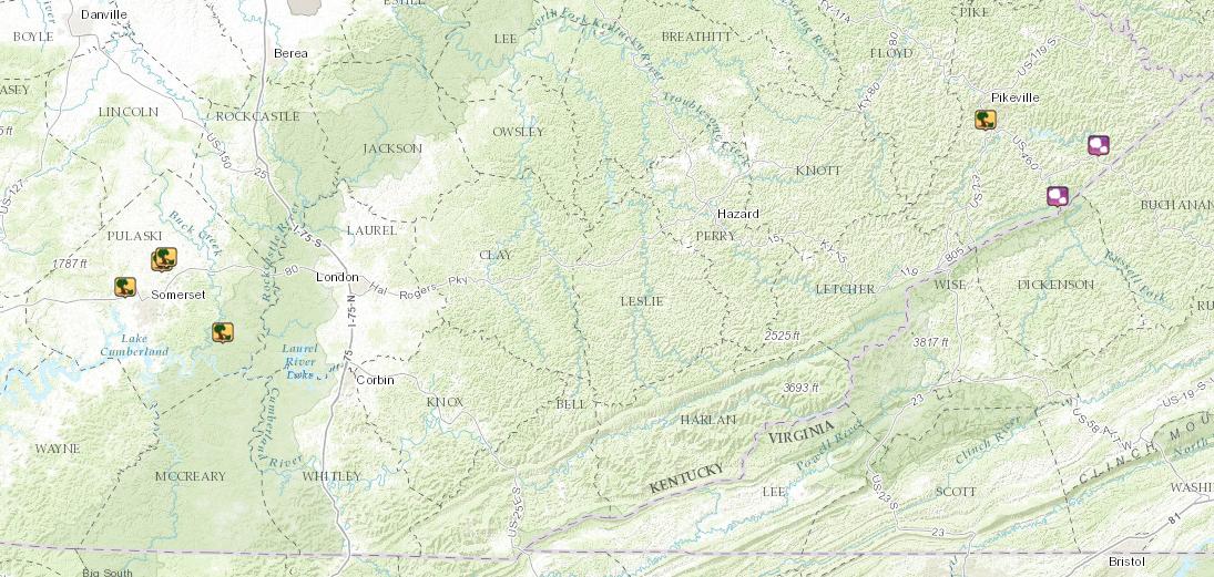 |
| Local Storm Reports in Pulaski and Pike Counties on Thursday June 16, 2016. |
Environment
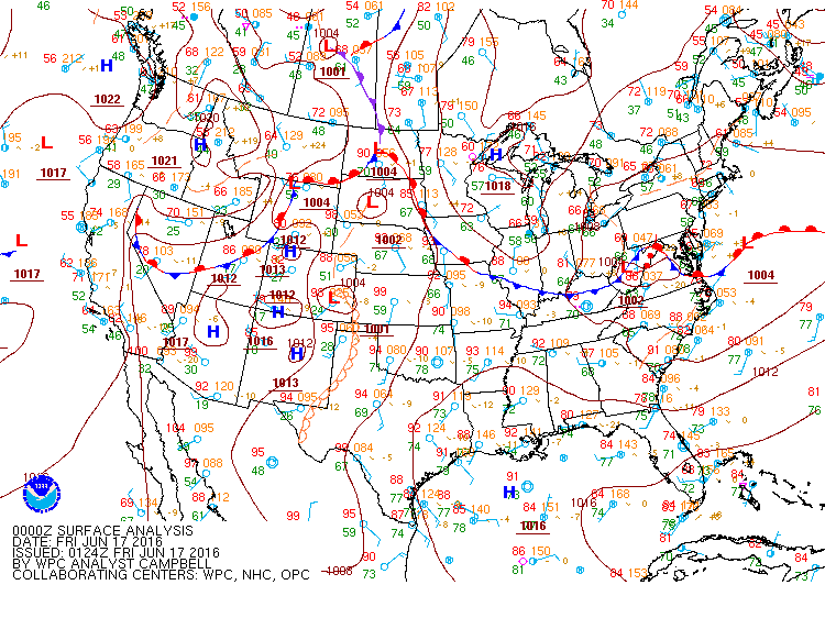 |
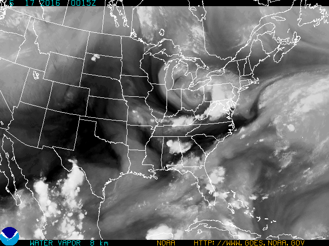 |
| Surface analysis depicting a cold front moving into an unstable airmass. | Water vapor imagery showing an upper level disturbance stretching from the Great Lakes into the Appalachians. |
 |
Media use of NWS Web News Stories is encouraged! Please acknowledge the NWS as the source of any news information accessed from this site. |
|

