
Heat expands across the Desert Southwest, Plains, Mississippi Valley and Midwest into Monday. Fire weather concerns continue for portions of the Intermountain West. Active monsoonal moisture fuels thunderstorms over the Southwest with possible flash flooding. Tropical cyclone Fausto in the Pacific, should weaken as it approaches Hawaii; Dangerous surf, swells and rip currents are expected. Read More >
Jackson, KY
Weather Forecast Office
Overview
|
Severe storms pummeled central portions of eastern Kentucky during the evening hours of May 26, 2019. These thunderstorms developed along a surface boundary, in tandem with a mesoscale convective vortex. These features helped to organize storms into a line, which swept across eastern Kentucky and produced several reports of damage. Numerous trees were blown down from Rockcastle to Martin and Pike Counties. This subsequently led to thousands of power outages across eastern Kentucky. |
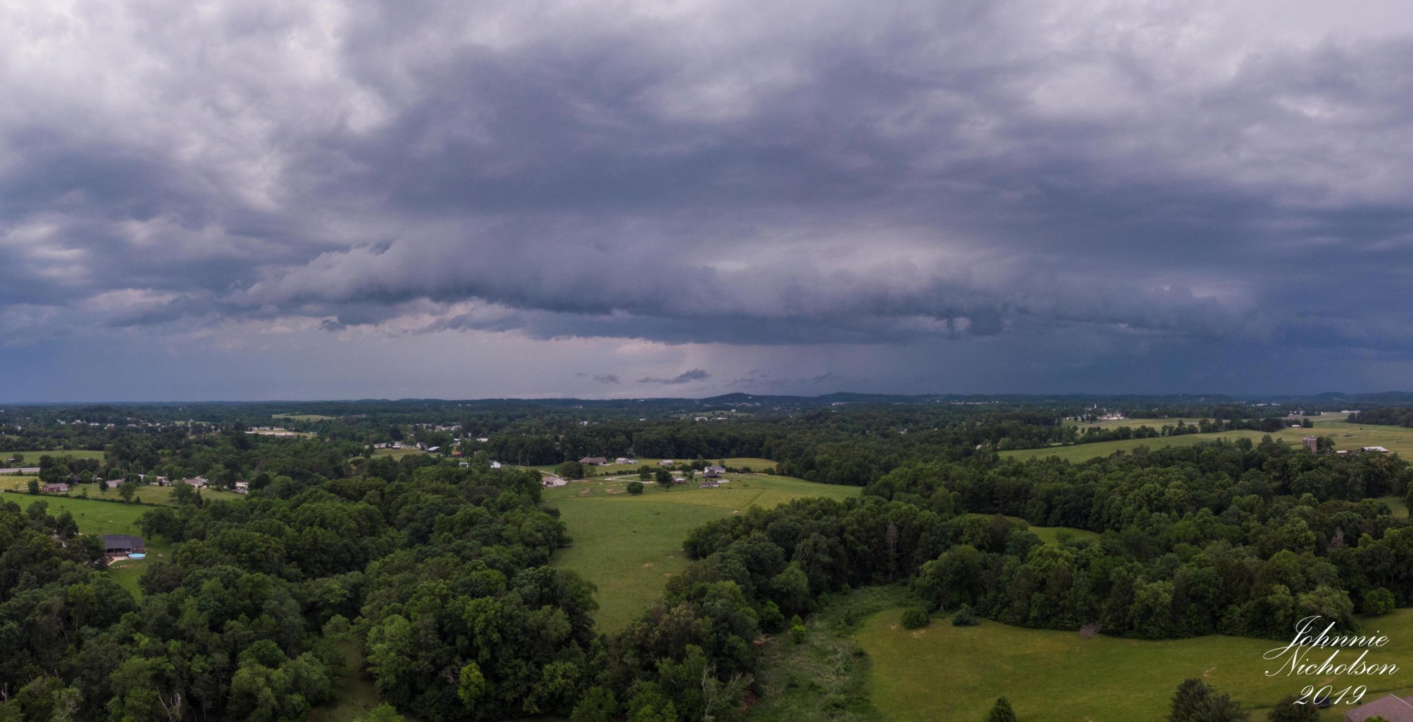 Shelf Cloud near London - Courtesy of Johnnie Nicholson. |
Radar
| /> |
| 5 pm - 9 pm May 26, 2019 Radar Loop. |
Storm Reports
| Local Storm Reports received from May 26, 2019 | ||
 |
||
Environment
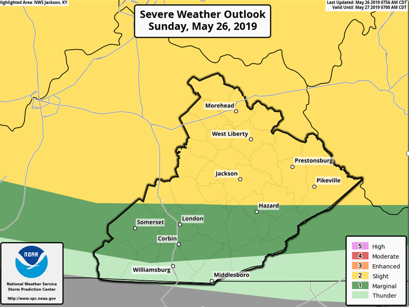 |
| Day 1 Severe Weather Outlook Issued by the Storm Prediction Center (SPC) in Norman, Oklahoma. |
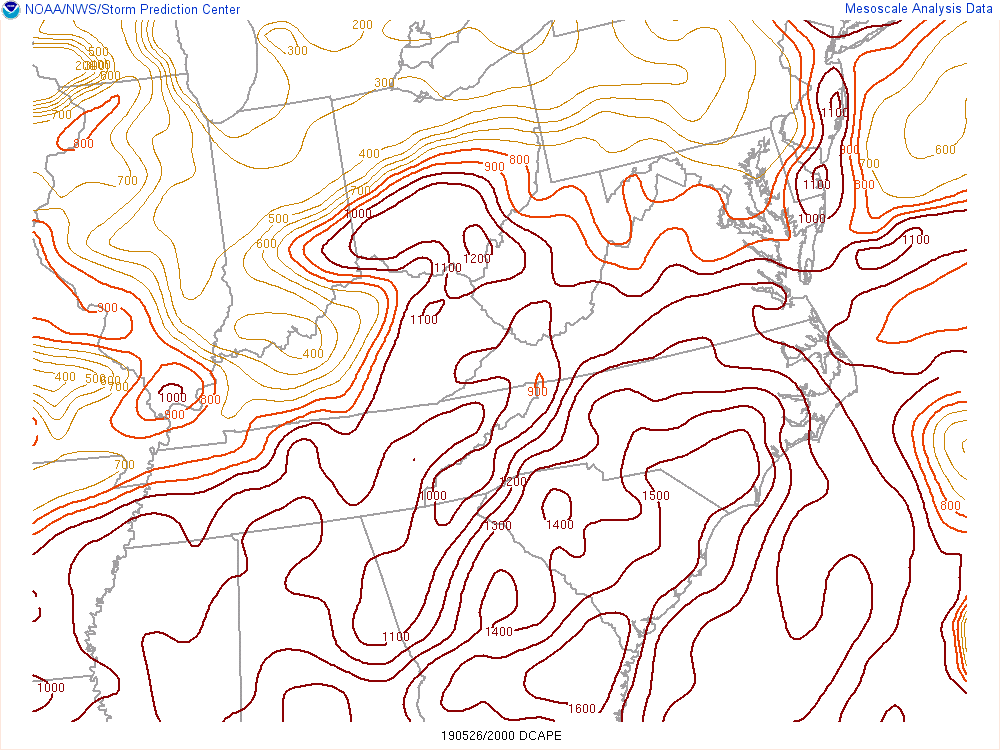 |
| The DCAPE (Downdraft CAPE) can be used to estimate the potential strength of rain-cooled downdrafts (damaging wind potential) within thunderstorms. Larger DCAPE values are associated with stronger downdrafts. Values around 1000 are generally considered favorable for strong winds. |
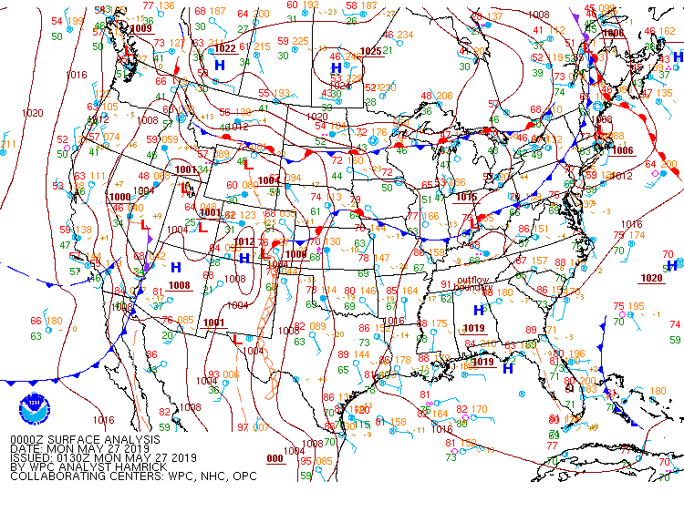 |
| 8 pm Analyzed Surface Map by the Weather Prediction Center (WPC). |
 |
Media use of NWS Web News Stories is encouraged! Please acknowledge the NWS as the source of any news information accessed from this site. |
|
Warnings/Hazards
Decision Support - Outlooks
Current Weather Hazards
Hazards Criteria
Weather Story Graphic
Recent Storm Reports
Submit a Report
Forecasts
Decision Support - Forecast
Aviation Forecasts
Fire Weather Forecasts
Hourly Weather Forecast
Activity Planner
River Forecasts
Forecast Discussion
Current Conditions
Regional Radar
Decision Support - Current
Rivers and Lakes
Hourly Airport Weather
Local Radar
Satellite
Kentucky Mesonet
Past Weather
Local Climate Info
Temp/Precip Summary
How Much Rain Fell?
How Much Snow Fell?
Past Weather Events
Drought Information
Local Coop Observers
US Dept of Commerce
National Oceanic and Atmospheric Administration
National Weather Service
Jackson, KY
1329 Airport Road
Jackson, KY 41339
606-666-8000
Comments? Questions? Please Contact Us.

