Numerous severe thunderstorms are expected across a broad region from the Ohio Valley to the Mid-Atlantic and Northeast States today into tonight. Swaths of damaging wind gusts are expected and some tornadoes are possible. Bertha is expected to bring tropical storm conditions to portions of the Gulf Coast from the Florida Panhandle westward to southeastern Louisiana later today and Wednesday. Read More >
Overview
Scattered thunderstorms developed very late during the afternoon and early evening of May 24th as a hot and humid air mass remained in place across eastern Kentucky. The hardest hit area by heavy rainfall was along the Hal Rogers Parkway and Highway 80 corridor, stretching from Leslie County to Floyd County.
A portion of Leslie County saw chunks of a roadway washed away, while parts of Perry and Floyd Counties had motorists stranded and rescued by first responders. Residences near Fisty in Knott County were inundated by quickly rising flood waters.
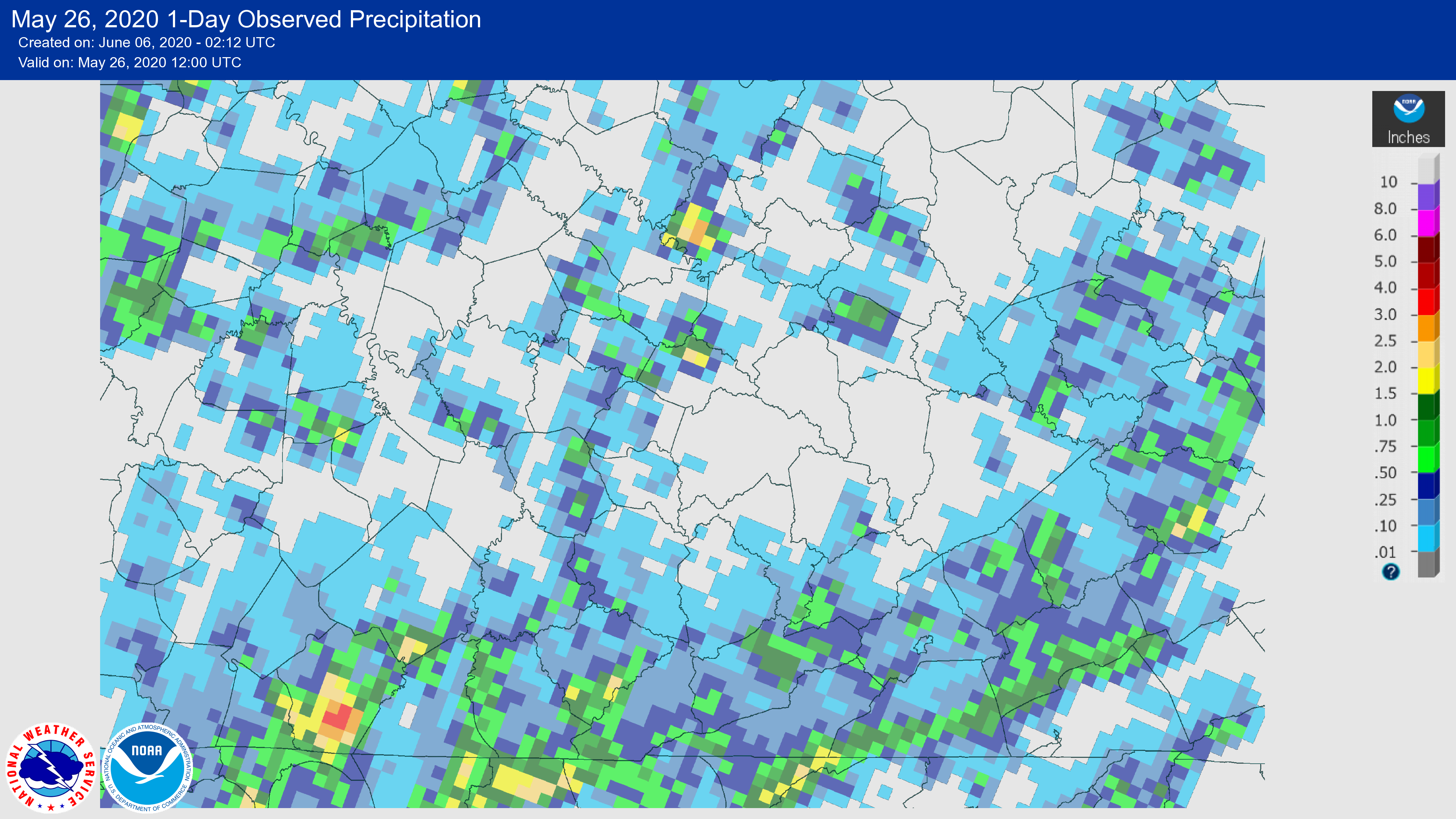
Isolated showers and thunderstorms developed late in the afternoon into the evening of May 25th. While these were overall weaker than those that occurred over the previous day or two in this persistent summer-like pattern, the slow movement of the storms led to flash flooding issues in Rowan and Bell Counties. Water rescues were performed in each county as water surrounded vehicles, while a tree toppled due to the flowing water near Morehead and landed on power lines, subsequently setting an apartment on fire. Additionally, a tree was downed near Gates in Rowan County as a thunderstorm briefly strengthened to severe limits.
Portions of Rowan County saw up to nearly 3 inches of rainfall, while western portions of Bell County saw amounts of 1 to 1.5 inches.
Photos
 |
|
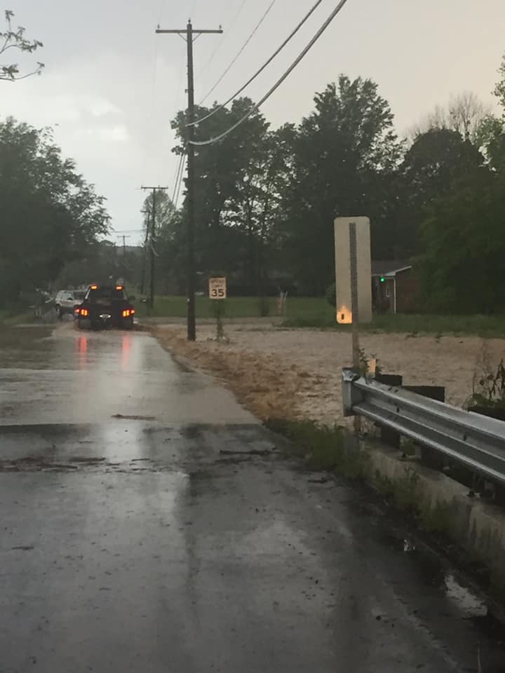 |
| Rough and Tough Road in Floyd County on May 24. Courtesy WYMT. | Lotts Creek in Knott County on May 24. Courtesy WYMT. | Rowan County on May 25. Courtesy Bubba Jones. |
Radar
| May 24, 2020 radar loop from 5 p.m. until 9 p.m. |
| May 25, 2020 radar loop from 2 p.m. until 10 p.m. |
Storm Reports
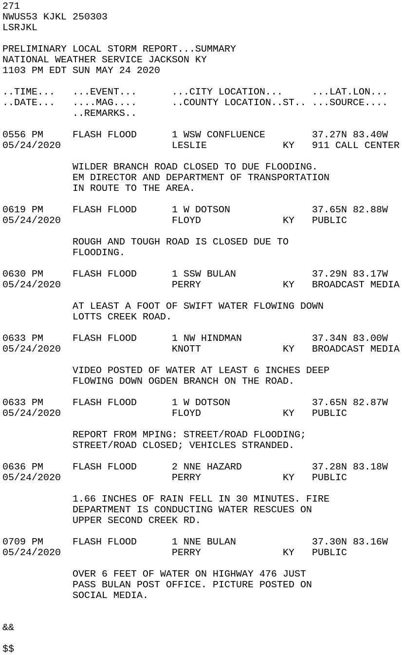 |
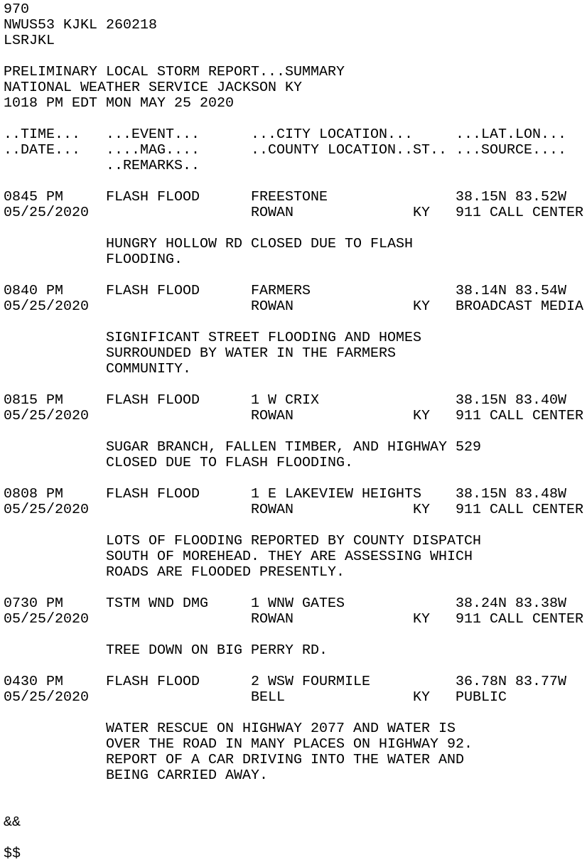 |
| May 24th Local Storm Reports. | May 25th Local Storm Reports. |
Rainfall
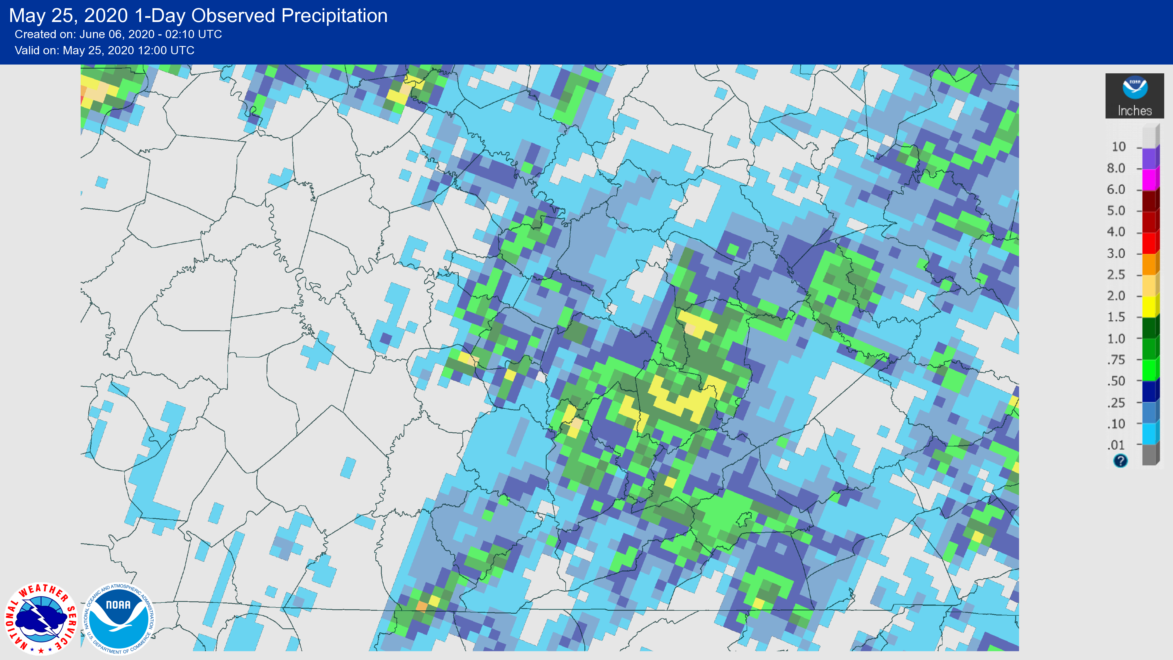 |
 |
| Radar estimated rainfall amounts from May 24th. | Radar estimated rainfall amounts from May 25th. |
 |
Media use of NWS Web News Stories is encouraged! Please acknowledge the NWS as the source of any news information accessed from this site. |
|