
Tropical Storm Bertha could bring tropical storm conditions to portions of the Florida Panhandle and Alabama coast through Wednesday, where a Tropical Storm Watch and Storm Surge Watch is in effect. Numerous severe thunderstorms with heavy rainfall are expected from the Ohio Valley into the Mid-Atlantic and Northeast Tuesday. Read More >
Overview
|
Periods of mostly light to moderate rain spread across eastern Kentucky on February 2nd and February 3rd as waves of low pressure rode along a slow-moving arctic cold front settling in from the northwest. The strongest and final wave of low pressure lifted across the Appalachians late February 3rd and into February 4th bringing with it a final round of rain changing over to a wintry mix and eventual snow flurries across eastern Kentucky. While 2-day rainfall amounts ranged from 1.5 to 3.0 inches across much of the area, rainfall rates were too low to cause more than the typical nuisance flooding of small streams and low-lying areas. Rivers reached elevated stages, but only the Red River at Clay City exceeded minor flood stage, spilling across farm fields and low-lying roadways. This system also produced heavy icing at many locations along and north of I-64. South of I-64, heavy icing became increasingly confined to the higher ridges with southeastward extent. The shallow cold layer with the cold front quickly moved into the Bluegrass on the morning of February 3rd, causing thermometers to fall to near freezing north of I-64 and along the southeast rim of the Bluegrass (down to around western Jackson and northern Rockcastle counties). Some limited daytime heating seemed to keep temperatures just warm enough for plain rain through much the day, but after sunset temperatures cooled just enough for icing to begin. The marginally sub-freezing temperatures and moderate rainfall rates led to runoff and inefficient ice accretion. Further southeast, the shallow cold layer struggled to make much progress into the East Kentucky Coalfield during the day; instead, temperatures largely held in the 40s and 50s through the afternoon. During the evening, the cold layer became deep enough to surge southeastward, bringing with it sub-freezing temperatures to the ridgetops. By the time precipitation tapered off early February 4th, an icy glaze coated the Southeast Bluegrass and many of the higher East Kentucky Coalfield ridges. Very slippery road conditions were reported as far south as Jackson County and Fleming County issued a Level 2 Weather Emergency due to the hazardous road conditions. However, many of the Coalfield Valleys of Southeast Kentucky remained just above freezing until after the rain ended, thus preventing notable icing. |
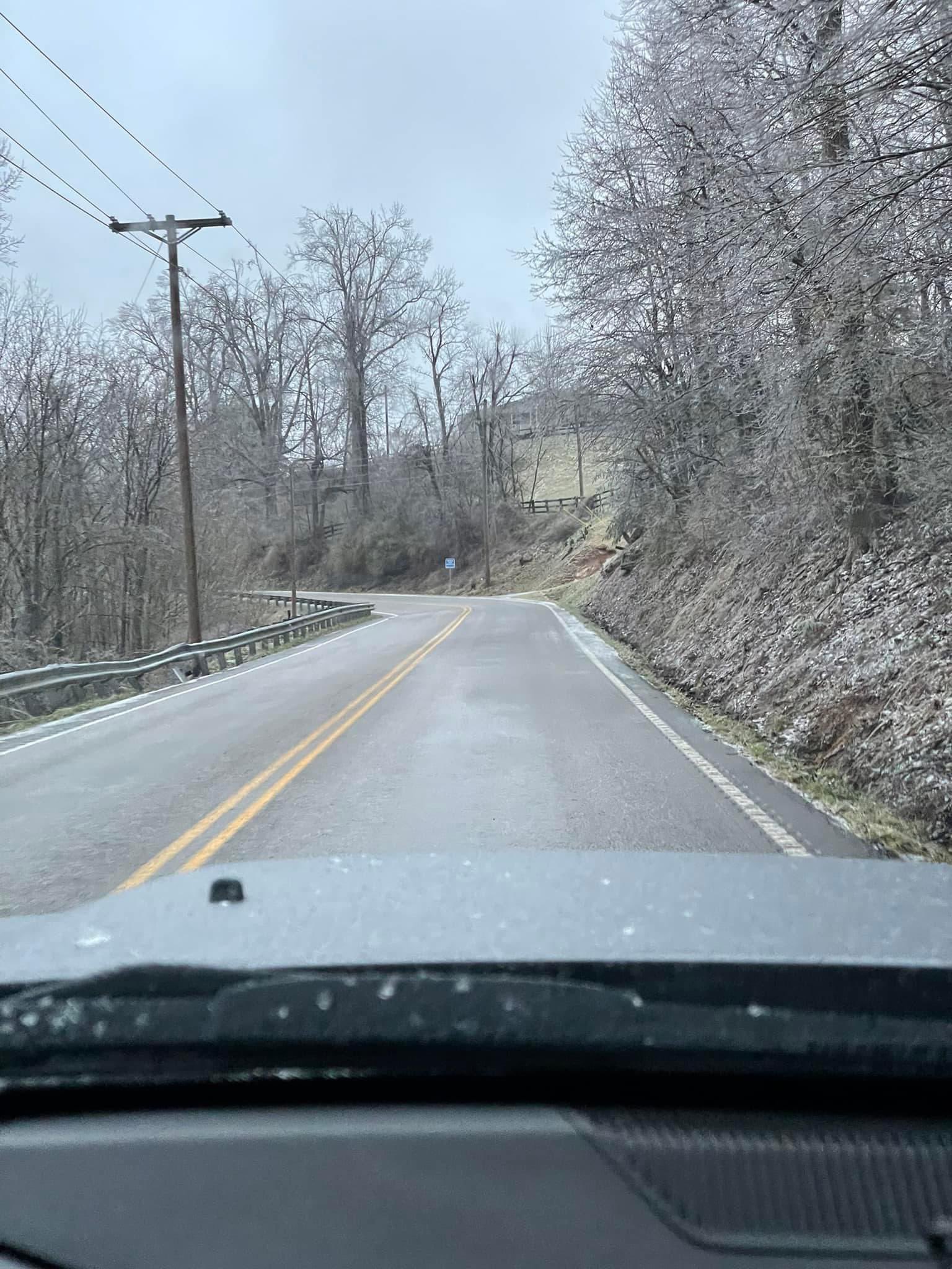
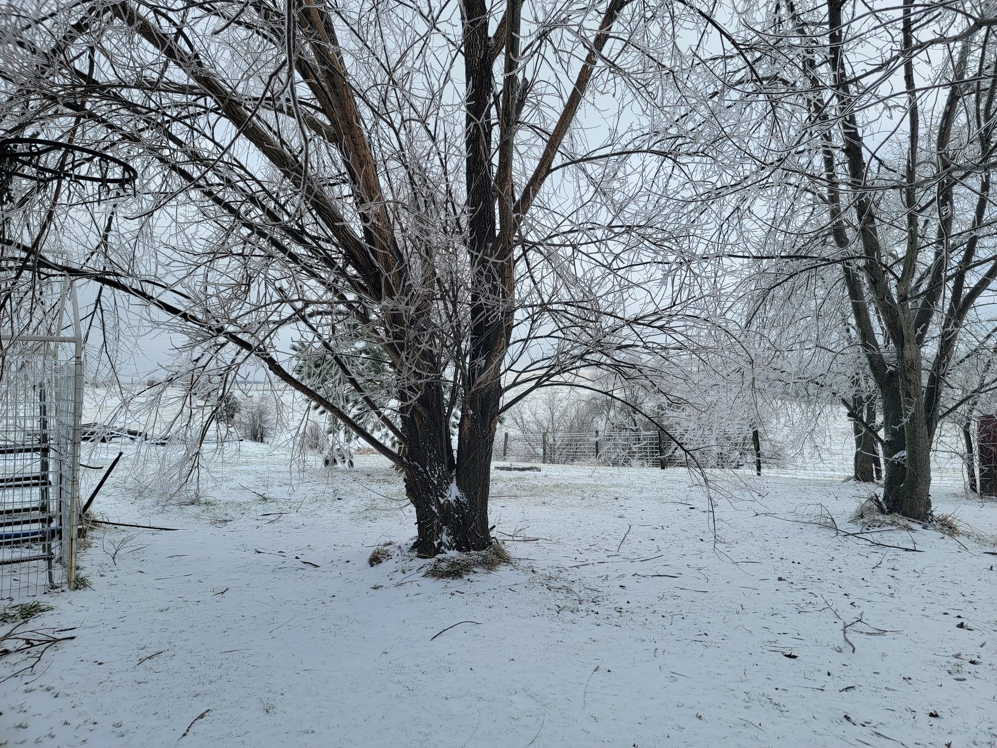
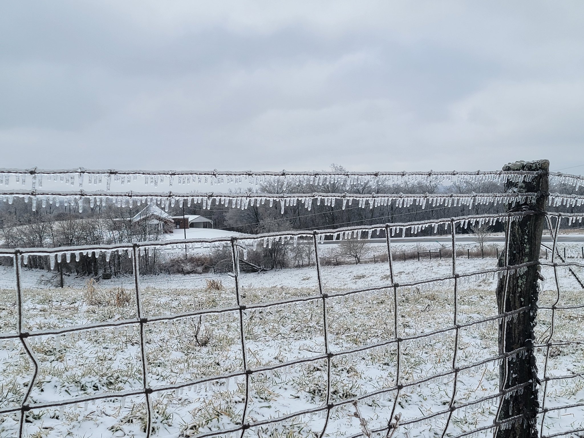
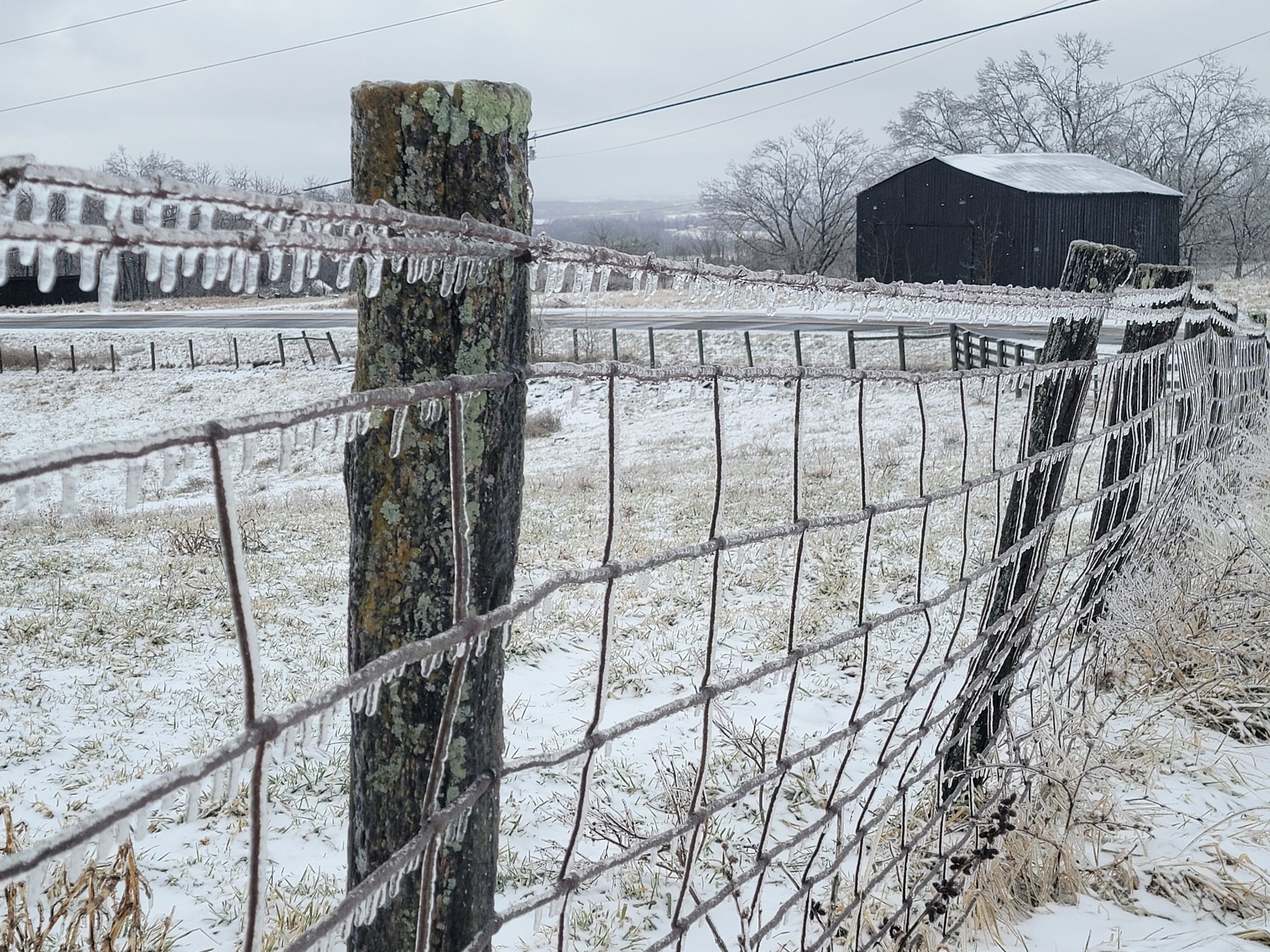 Icy Farm Scene along East Fork Rd, Bath County (Courtesy of Jeff Setter ) |
Storm Reports
..TIME...   ...EVENT...      ...CITY LOCATION...     ...LAT,LON...
..DATE...   ....MAG....      ..COUNTY LOCATION..ST.. ...SOURCE....
            ..REMARKS..

0953 AM     Freezing Rain    NWS Office/Julian Carro 37.59N 83.31W
02/04/2022  M0.20 inch       Breathitt          KY   ASOS

            Storm total ice accumulation of 0.2 inches
            per KJKL ASOS.

1030 AM     Freezing Rain    2 ENE Dotson            37.66N 82.83W
02/04/2022  E0.05 inch       Floyd              KY   Co-op Observer


0328 PM     Freezing Rain    1 SW Teetersville       36.81N 83.34W
02/04/2022  E0.10 inch       Harlan             KY   Co-op Observer


0945 AM     Freezing Rain    Campton                 37.73N 83.55W
02/04/2022  E0.10 inch       Wolfe              KY   Dept of Highways

            Ice accumulation reported on elevated surfaces.

0845 AM     Freezing Rain    9.3 SE Campton          37.64N 83.43W
02/04/2022  M0.04 inch       Breathitt          KY   NWS Employee

            Employee measured 0.04 inches of freezing rain.

0311 PM     Freezing Rain    1 SW Carcassonne        37.16N 83.00W
02/04/2022  U0.10 inch       Letcher            KY   TRAINED SPOTTER

            Trained spotter reported glaze of icing at 1,700 feet ASL.

0830 AM     Ice Storm        Sandy Hook              38.09N 83.12W
02/04/2022                   Elliot             KY   Dept of Highways

            Department of Highways reported 0.25 inches of freezing rain.

0915 AM     Ice Storm        1 SW Stanton            37.84N 83.87W
02/04/2022                   Powell             KY   Dept of Highways

            Department of Highways reported over 0.25 inch of ice on
            elevated surfaces.

0700 AM     Ice Storm        1 NNW Owingsville       38.15N 83.76W
02/04/2022                   Bath               KY   Emergency Mngr

            The Bath County EM reported 0.25 inches of ice accumulation.

0825 AM     Ice Storm        Flemingsburg            38.42N 83.73W
02/04/2022                   Fleming            KY   Emergency Mngr

            Greater than 0.25 inches of ice was measures at the Fleming
            County EOC.

0930 AM     Ice Storm        1 NNW Clearfield        38.18N 83.44W
02/04/2022                   Rowan              KY   Emergency Mngr

            The Emergency Management reported 0.25 inches of ice on
            elevated surfaces.

0700 AM     Ice Storm        3 SW Bean               37.91N 83.87W
02/04/2022                   Powell             KY   NWS Employee

            NWS Employee estimated 0.25 inch of ice accumulation on trees
            along KY-213 at the Powell/Montgomery County line.

0700 AM     Ice Storm        3 SW Bean               37.91N 83.88W
02/04/2022                   Montgomery         KY   NWS Employee

            NWS Employee estimated 0.25 inch of ice accumulation on trees
            along KY-213 at the Powell/Montgomery County line.

0750 AM     Sleet            2 SSE Farmers           38.12N 83.54W
02/04/2022  E0.5 inch        Rowan              KY   Co-op Observer


0325 PM     Sleet            Cressy                  37.83N 84.04W
02/04/2022  E0.1 inch        Estill             KY   Co-op Observer


0846 AM     Sleet            Ravenna                 37.68N 83.95W
02/04/2022  E0.1 inch        Estill             KY   Dept of Highways


0850 AM     Sleet            1 S Frenchburg          37.94N 83.62W
02/04/2022  E0.0 inch        Menifee            KY   Dept of Highways

            Trace of sleet, no freezing rain reported.

0852 AM     Sleet            2 ENE West Liberty      37.93N 83.23W
02/04/2022  E0.0 inch        Morgan             KY   Dept of Highways

            Trace of sleet and snow reported.

0900 AM     Sleet            Mount Sterling          38.06N 83.94W
02/04/2022  E0.3 inch        Montgomery         KY   Public

            0.1 inches of freezing rain reported.
Photos
 |
 |
 |
 |
| Heavy Icing on Flat Creek Rd., Bath County (Courtesy of Carol Meyers Donaldson) |
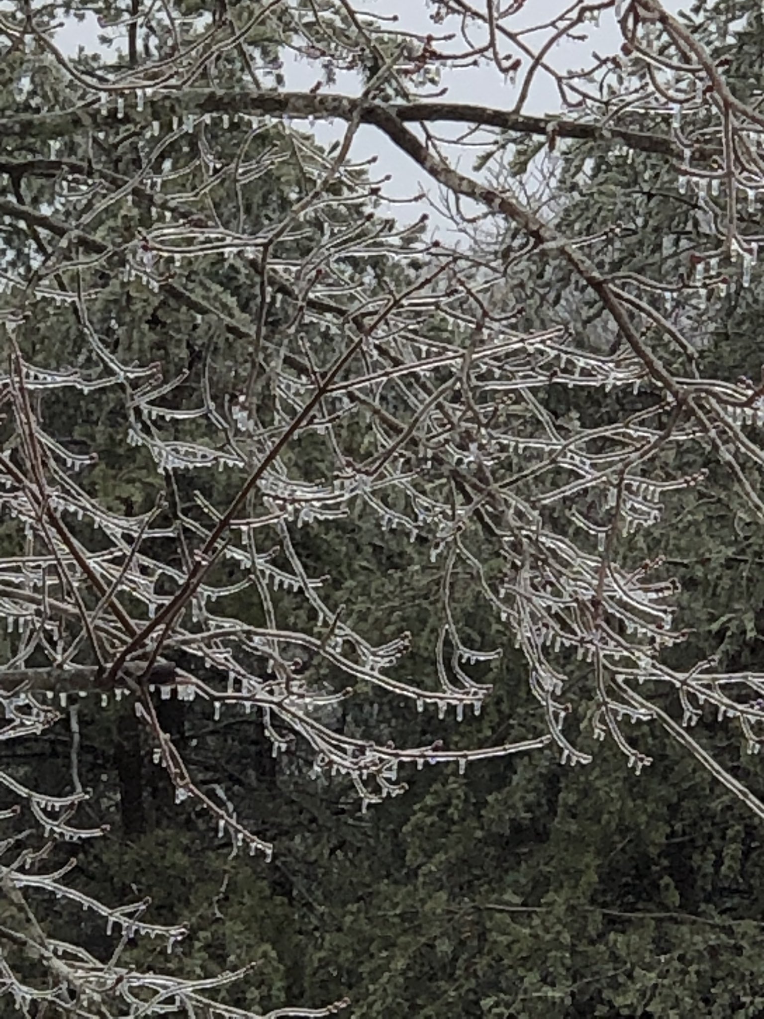
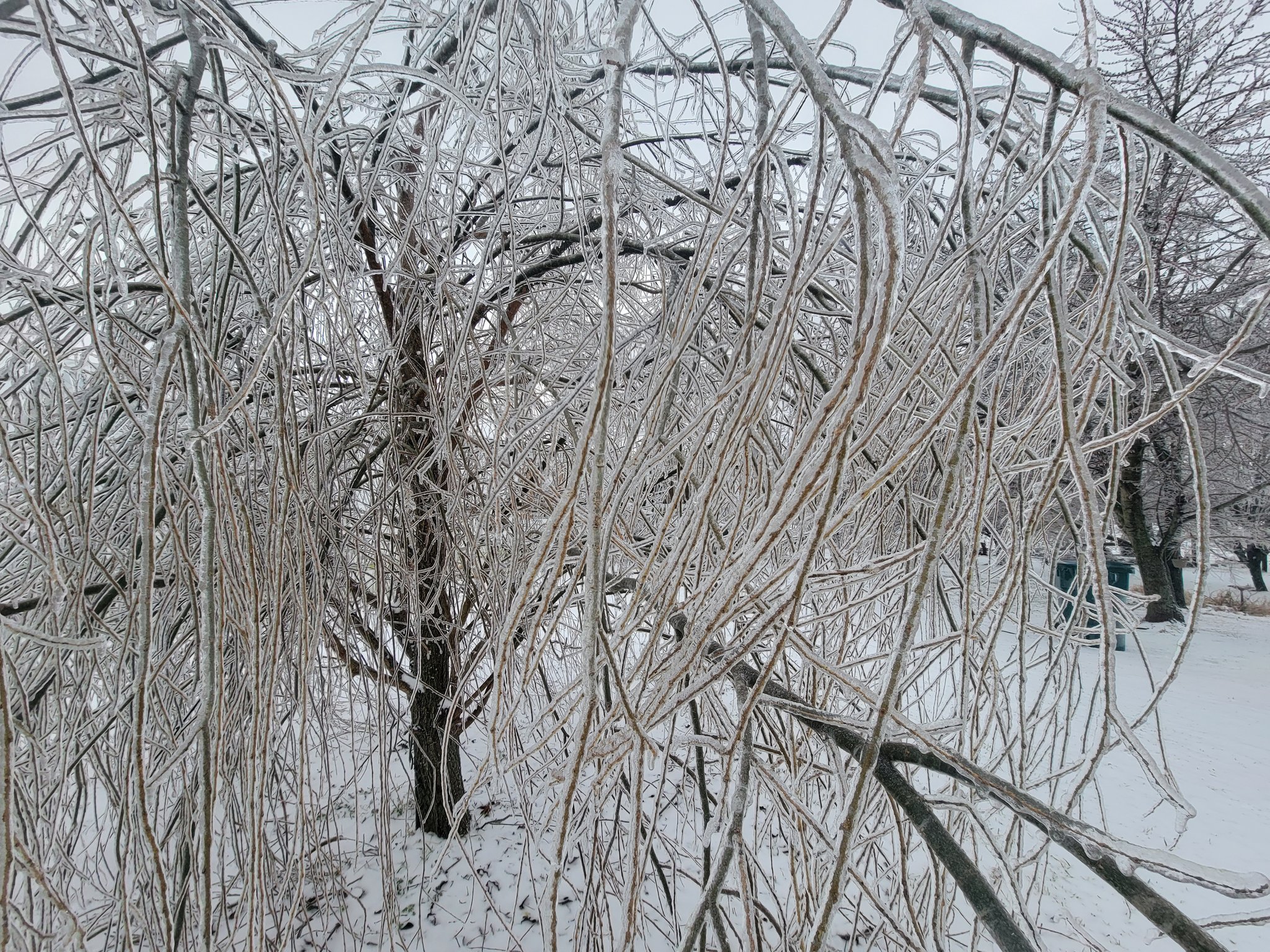
Icicles on a Tree in Crockett, Morgan County (Courtesy of TheKeetons) |
Ice-Covered Road, Montgomery County (Courtesy of Mongtomery Co. Sheriff David Charles) |
Ice along US-421, Jackson County (Courtesy of Jackson Co. Emergency Management) |
 |
 |
 |
 |
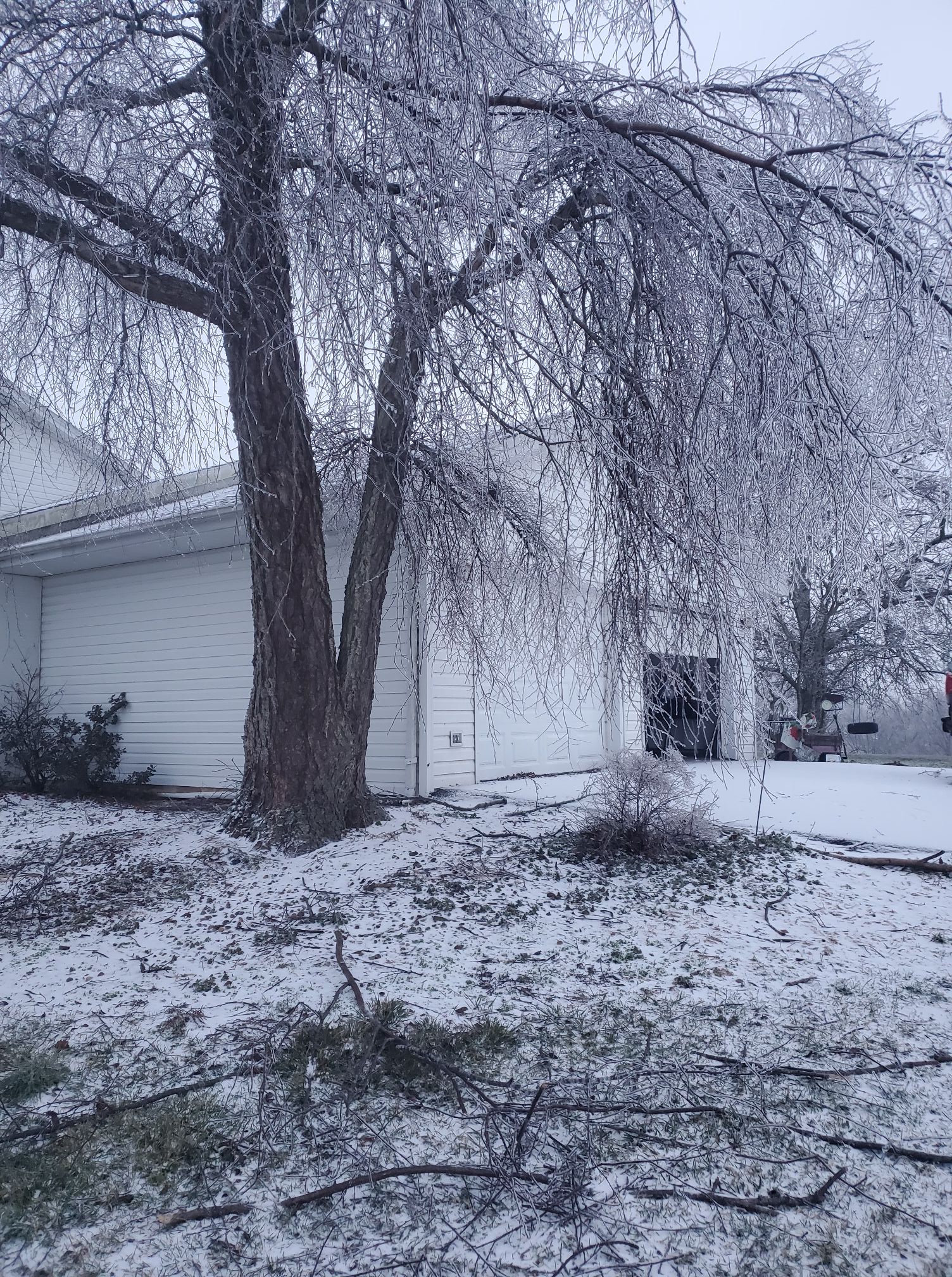
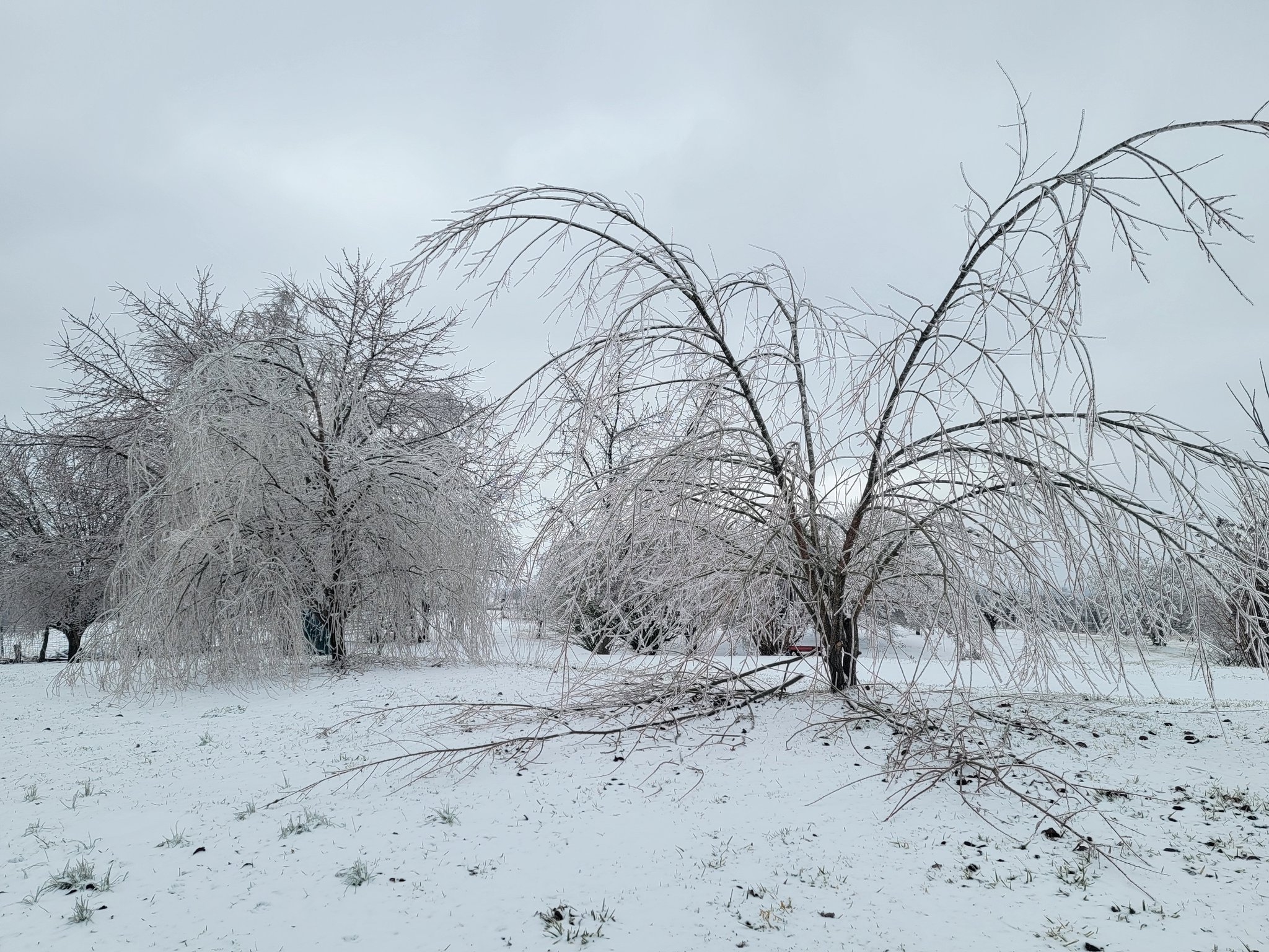
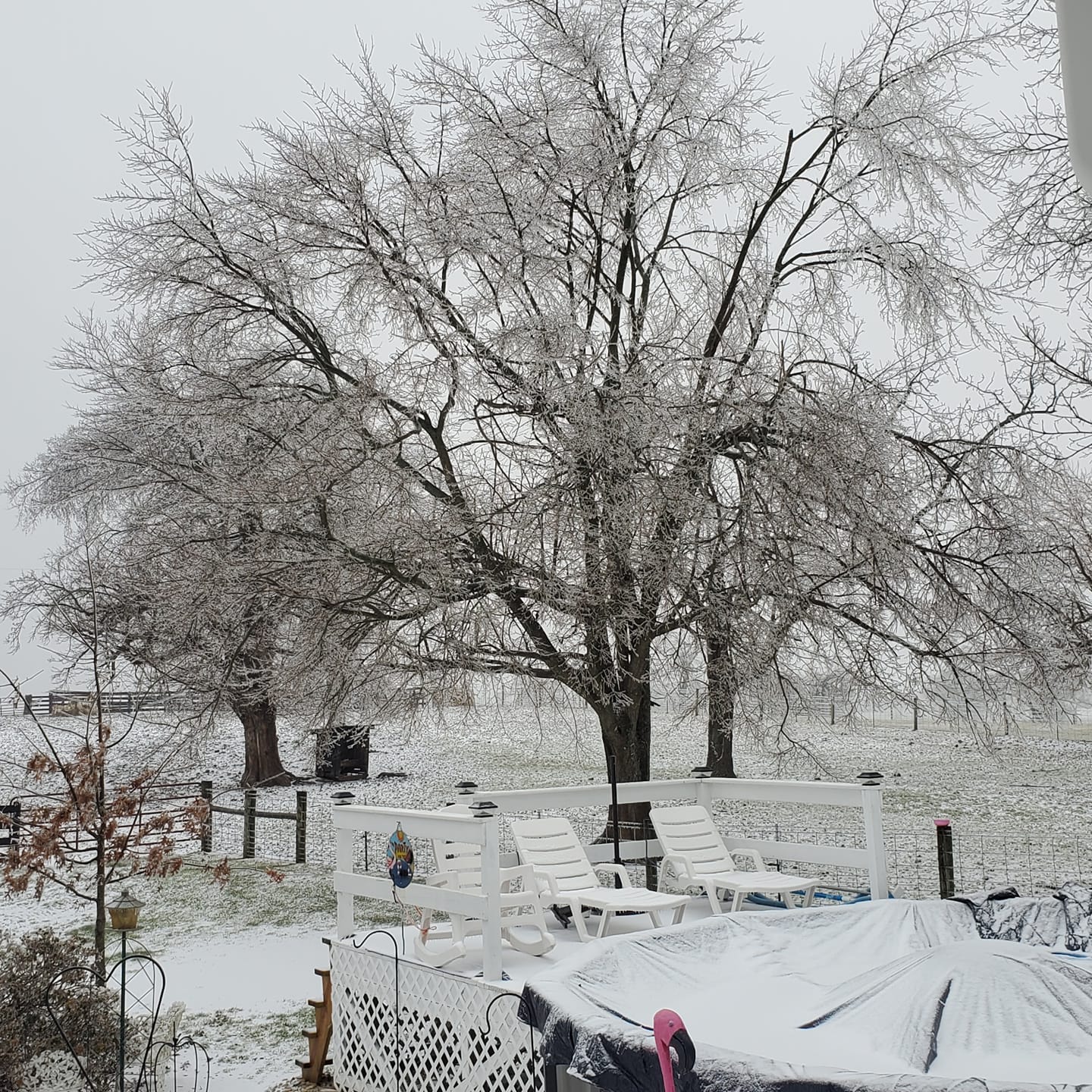
| Heavy Icing on East Fork Rd., Bath County (Courtesy of Jeff Setter) |
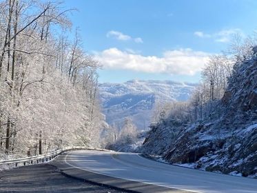
Icy View from US-119 atop Pine Mountain, Letcher County (Courtesy of WYMT) |
Heavy Icing on East Fork Rd., Bath County (Courtesy of Jeff Setter) |
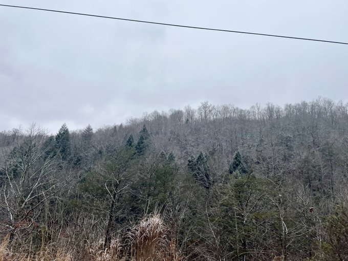
Icy Ridgeline,Perry County (Courtesy of Chris Hall) |
 |
 |
 |
 |
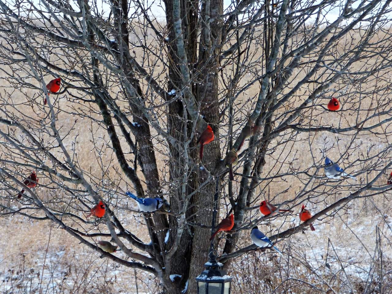
| Ice-glazed Tree with Birds, Montgomery County (Courtesy of Debbie Sands Woodard) |
Heavy Icing on East Fork Rd., Bath County (Courtesy of Jeff Setter) |
Heavy Icing near Sharpsburg, Bath County (Courtesy of Vonda Danny Harmon) |
Heavy Icing Reynoldsville Christian Church, Bath County (Courtesy of Jeff Setter) |
Environment
Multiple waves of low pressure lifted along a slow-moving cold front bringing an extended period of rainfall across eastern Kentucky from February 2nd into February 4th. A warm nose of air extended aloft behind the front. This allowed the rain to become freezing rain behind the boundary. Notice that the front was very slow to cross the East Kentucky Coalfields, the primary reason for why areas further to the south and east of the Bluegrass experienced less freezing rain.
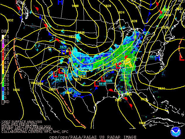 |
| Radar Loop: 700 AM February 2nd through 700 AM February 4th |
 |
Media use of NWS Web News Stories is encouraged! Please acknowledge the NWS as the source of any news information accessed from this site. |
|

