Scattered thunderstorms with severe gusts, hail and a tornado risk are possible near a cold front from the Ohio Valley to the Mid-Atlantic tonight. Tropical Storm Bertha is expected to bring tropical storm conditions to portions of the Gulf Coast from the panhandle of Florida into Louisiana through Wednesday. Read More >
Overview
|
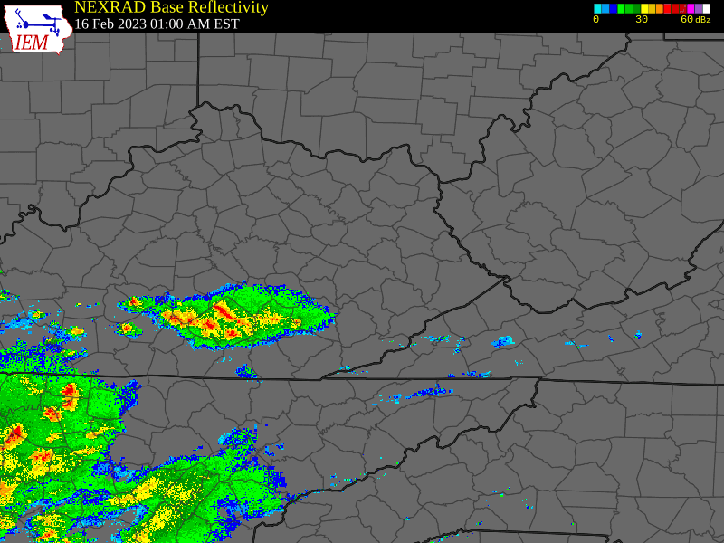
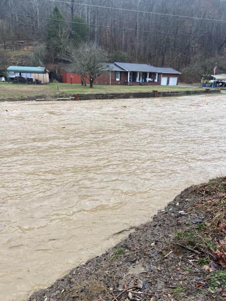
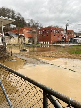
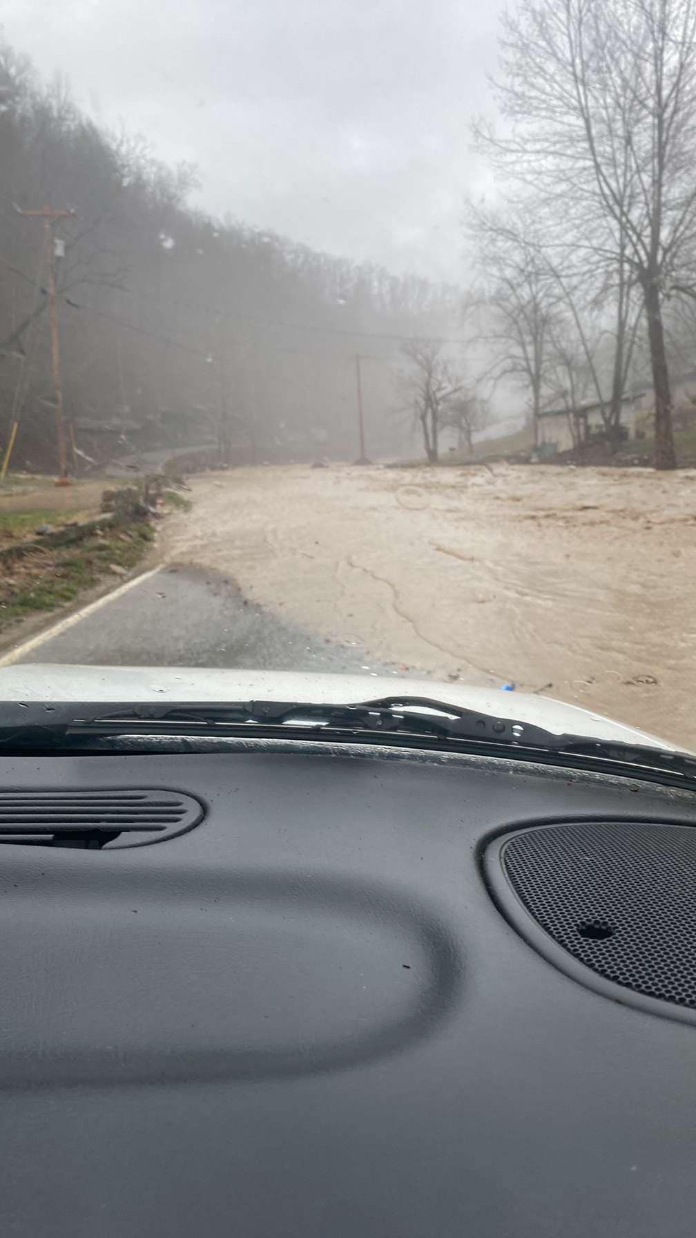
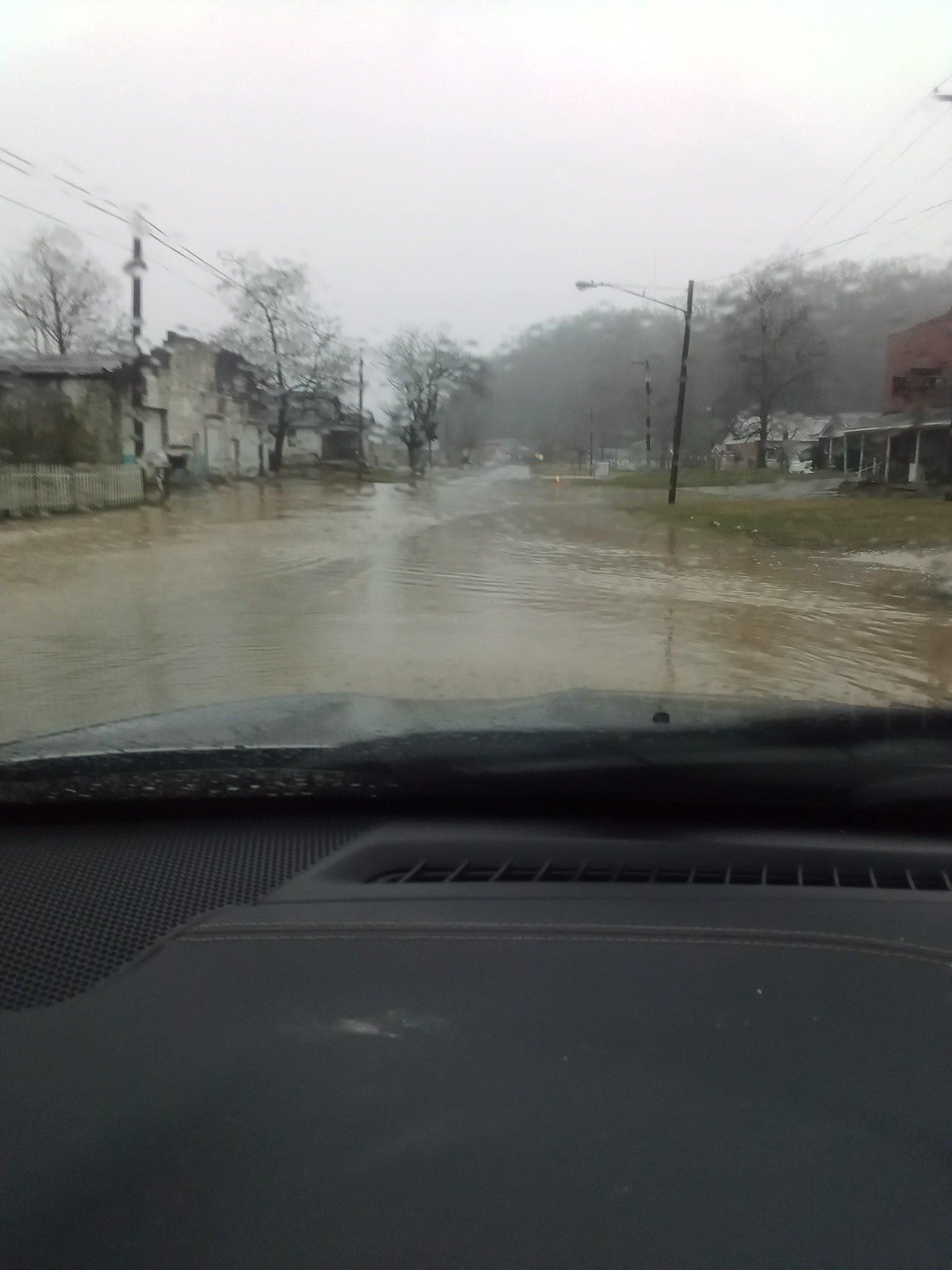
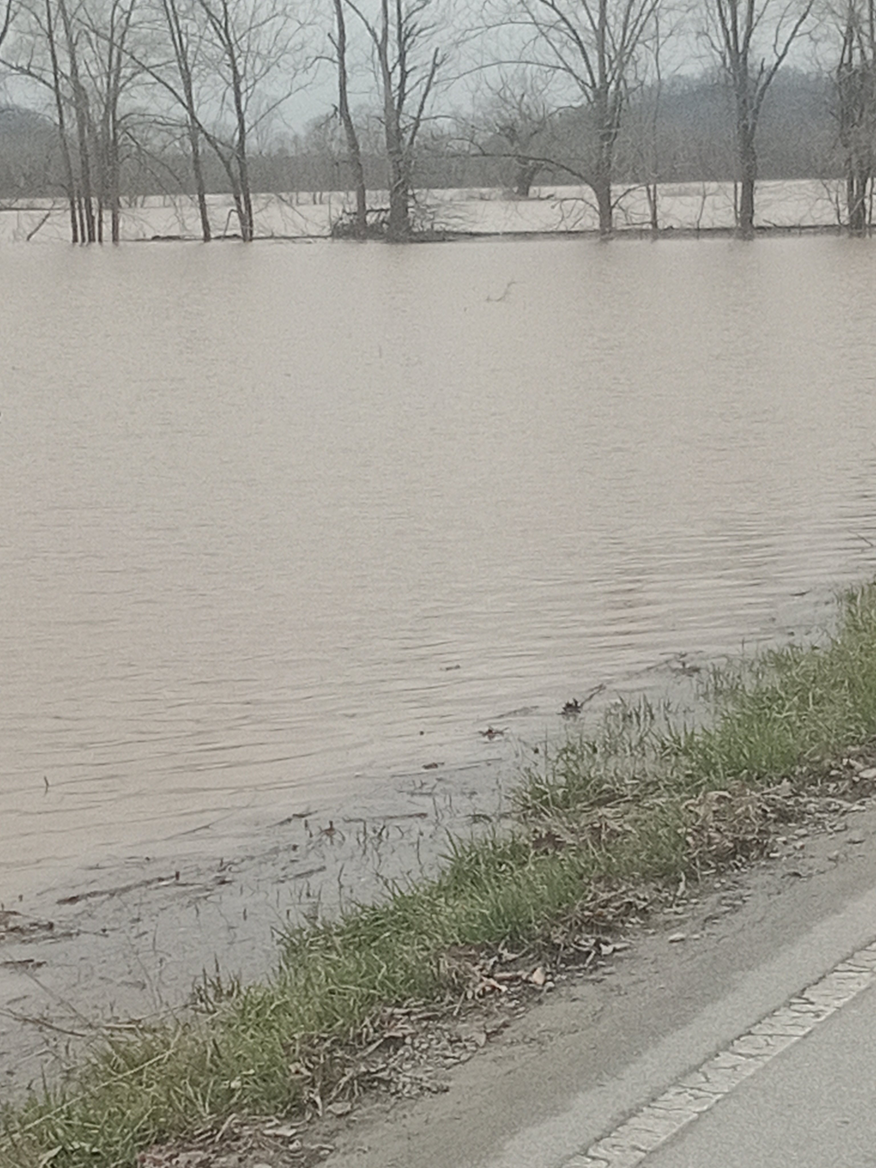
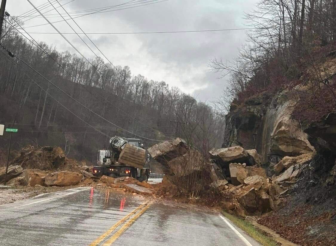
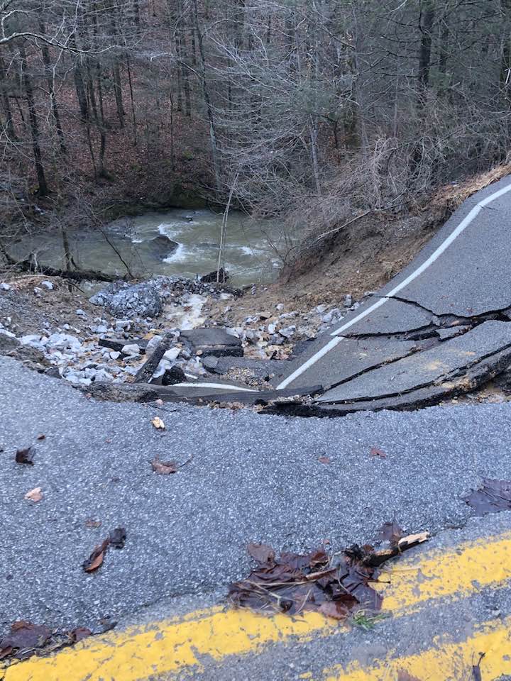
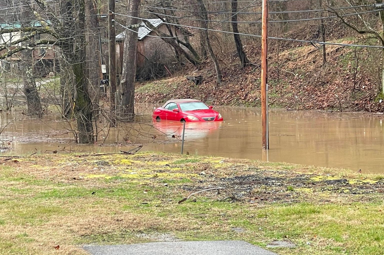
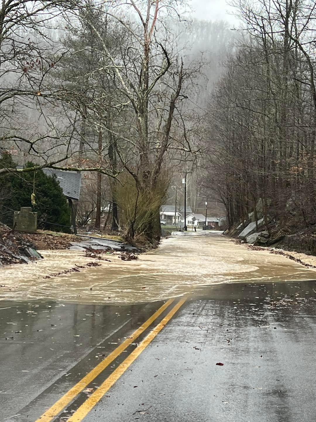
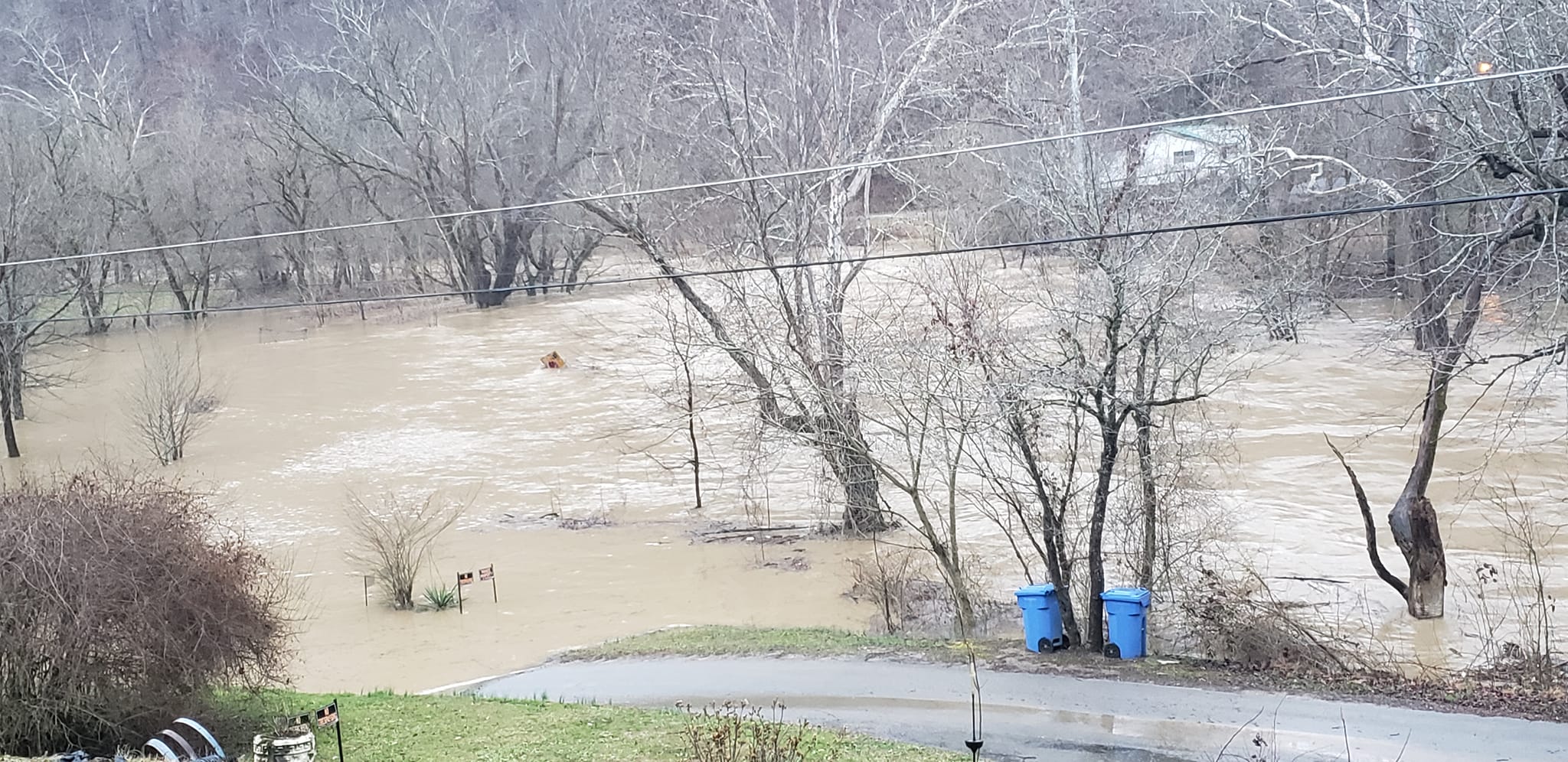
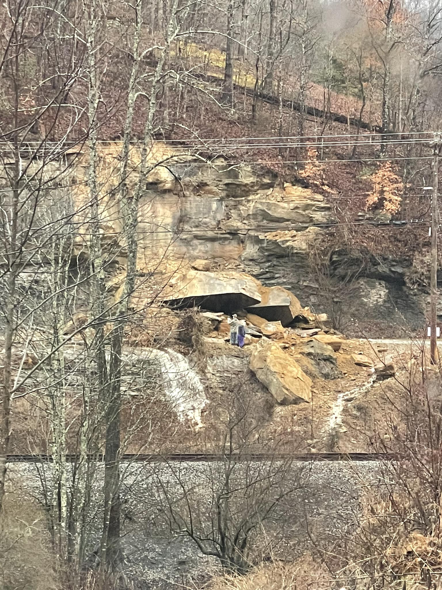
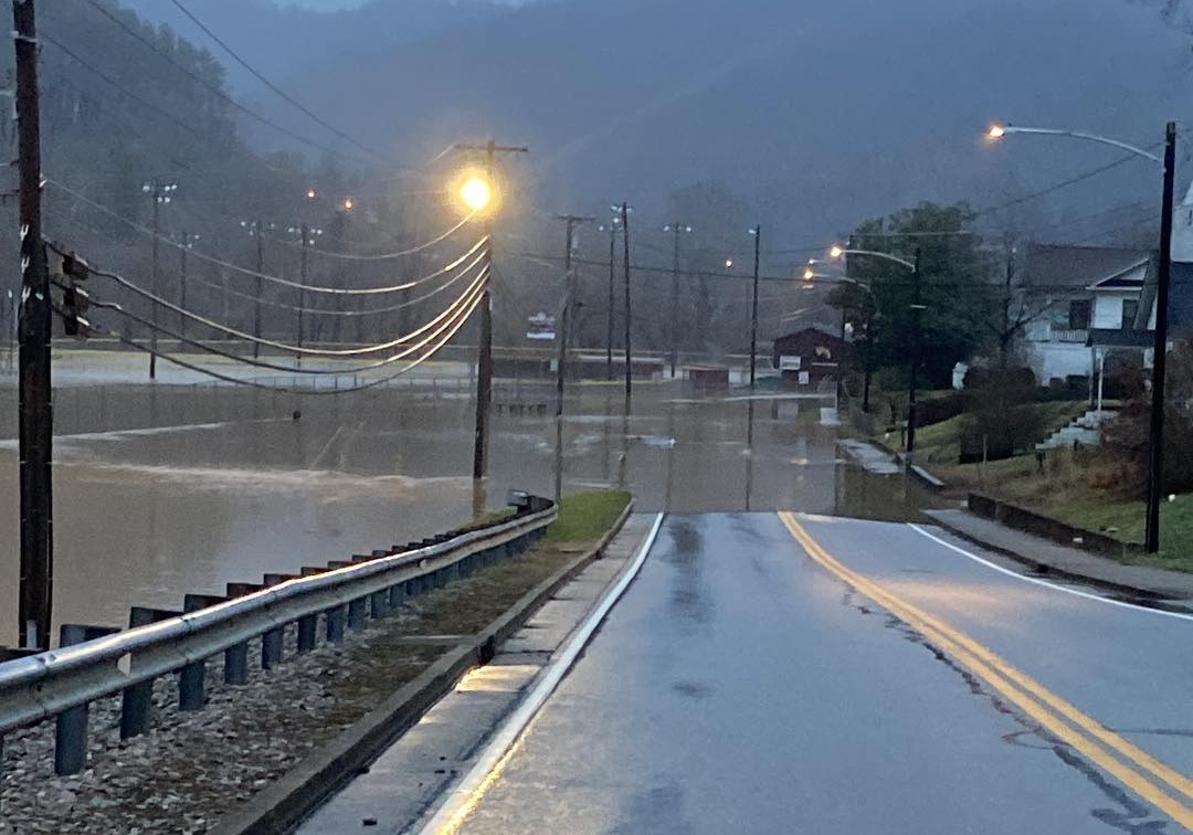
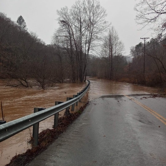
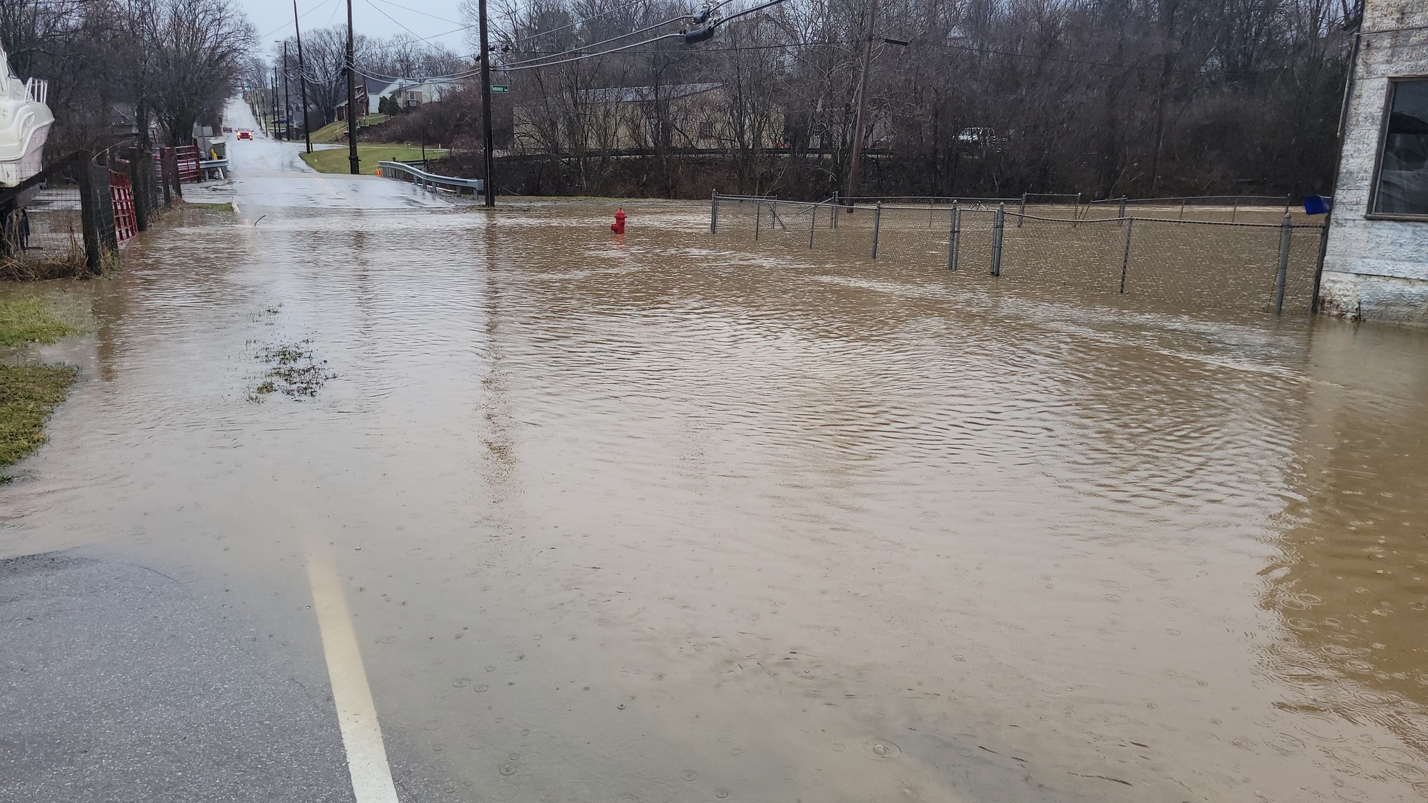
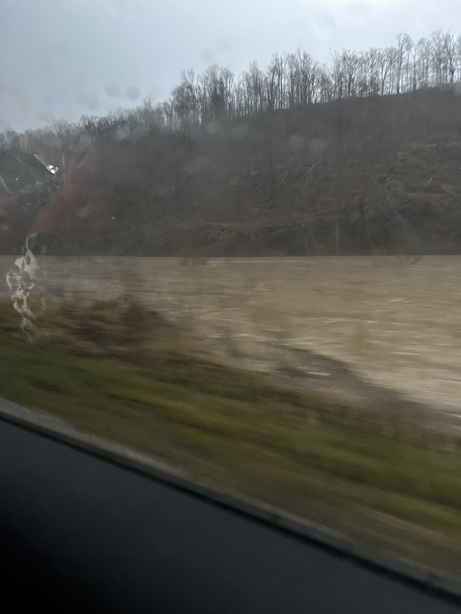
An unusually mild and moist air mass set up across eastern Kentucky in the days prior to February 16th as a wavering frontal boundary laid out along the Ohio Valley. The boundary separated a chilly winter air mass to the north from a mild and very moist air mass to the south. A persistent feed of warm, moist, and unstable air over the boundary, along with potent disturbances passing aloft, sparked rounds of training showers and thunderstorms for much of the day on the 16th. This was followed by a final round of showers and thunderstorms with the passage of a cold front during the evening of the 16th and early on the 17th. Rainfall amounts of 2.5 to 4.5 inches were common. Generally speaking, the heaviest and most persistent rain fell between the I-64 and Hal Rogers/Highway 80 corridors although some locations further southeast also picked up on the the heavier rainfall amounts. Scattered instances of flash flooding were observed along with many instances of urban and small stream flooding. Eventually, all of this rain led to significant rises on the main stem rivers, pushing river gauge points into action or flood stage on all of the primary rivers -- the Big Sandy, Licking, Red, Kentucky and Cumberland. The worst river flooding was observed along the Kentucky River at Ravenna where Major Flood stage was almost eclipsed and also along the Red River in Clay City where the river reached well into Moderate Flood stage. The flood waters appeared to remain just low enough to spare significant damage to homes, but there were many instances of inundated roads, road damage, and stranded vehicles. A large rockslide also occurred along KY-52 between Jackson and Beattyville. |
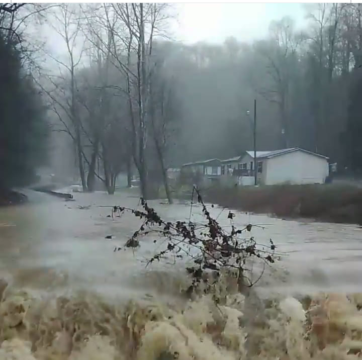
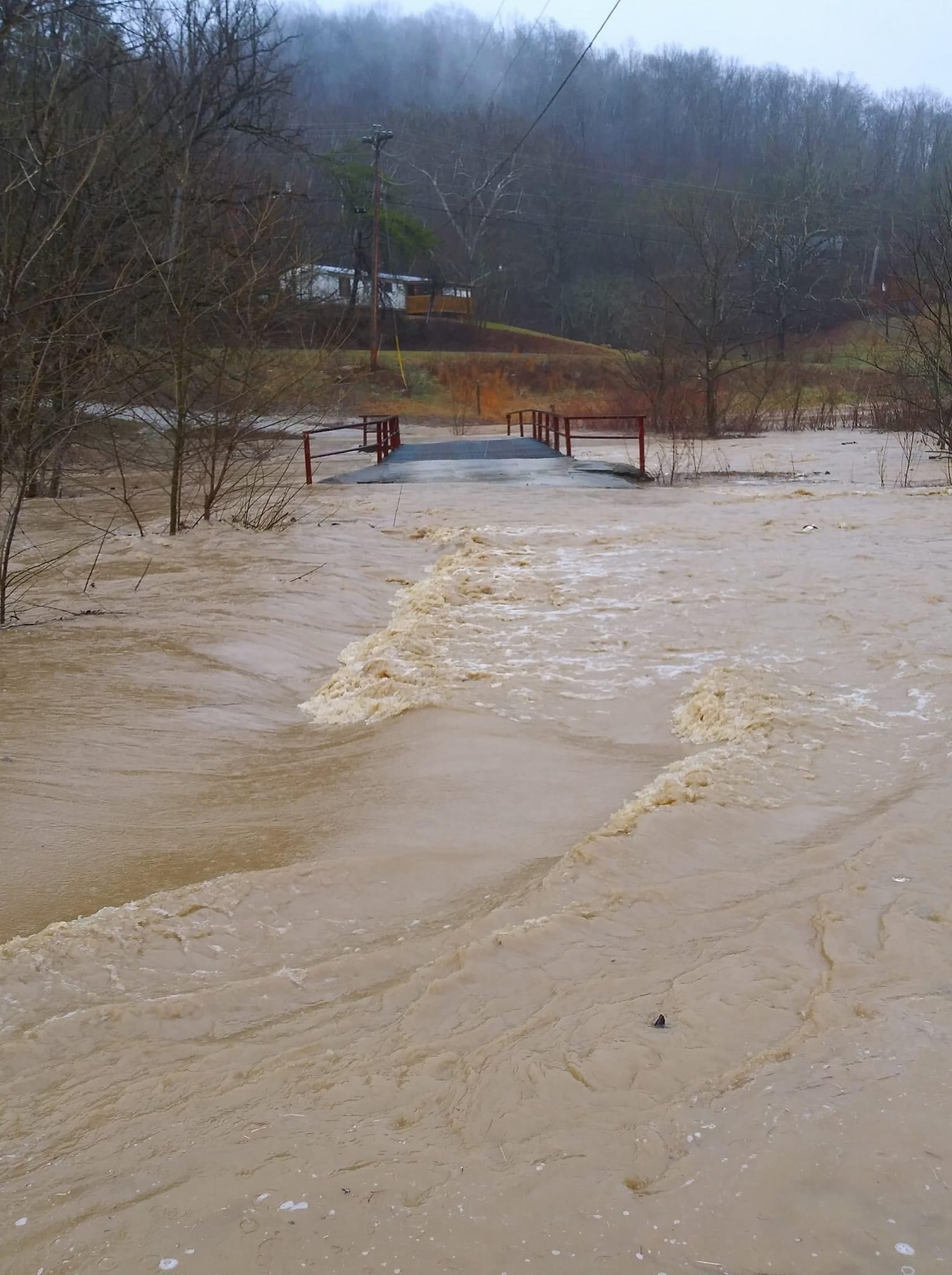
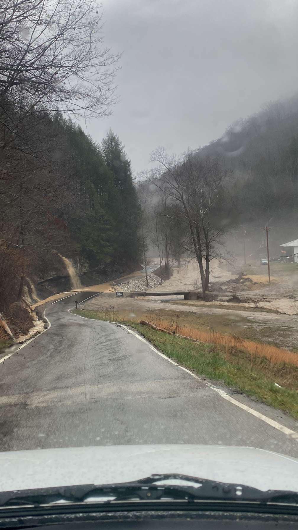 Flooding along Squabble Creek (Courtesy of Trinity Sizemore) |
Flooding
Hydrographs of those river forecast points which achieved at least action stage are listed below:
Kentucky River North Fork Gauge Points
 |
 |
 |
| North Fork Kentucky River at Whitesburg | North Fork Kentucky River at Hazard | North Fork Kentucky River at Jackson |
Kentucky River and Red River Gauge Points
 |
 |
 |
| Kentucky River at Heidelberg | Kentucky River at Ravenna | Red River at Clay City |
Cumberland River Gauge Points
 |
 |
 |
 |
| Cumberland River at Baxter | Cumberland River at Pineville | Cumberland River at Barbourville | Cumberland River at Williamsburg |
Russel Fork and Big Sandy Levisa River Gauge Points
 |
 |
 |
 |
| Russel Fork at Elkhorn City | Levisa Fork at Pikeville | Levisa Fork at Prestonsburg | Levisa Fork at Paintsville |
Licking River Gauge Points
 |
| Licking River at Salyersville |
Photos
 |
 |
 |
 |
| Squabble Creek Flooding (Perry County) (Courtesy of Misty Daniel) |
Evacuations (near Williamsburg) (Courtesy of WRIL) |
Flooding in Garrett (Floyd County) (Courtesy of Brandon Robinson) |
Belcher Fork Road (Breathitt County) (Courtesy of Johnny Feltner) |
 |
 |
 |
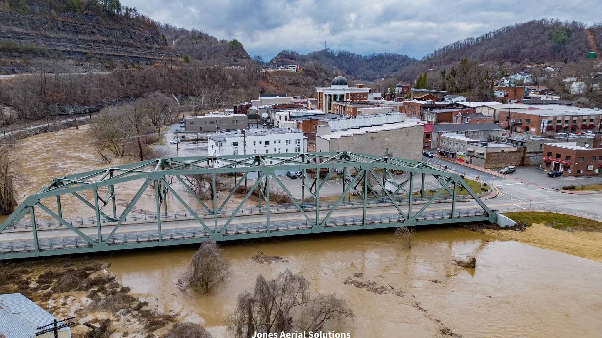
| North Fork Kentucky River at the Queen City of the Mountains(Hazard) (Courtesy of Kenny Jones) |
Flooding along Squabble Creek (Perry County) (Courtesy of Trinity Sizemore) |
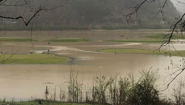
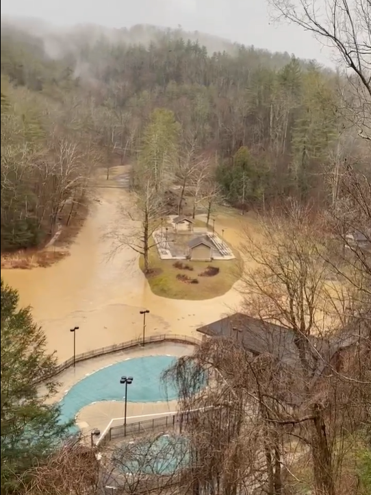
Flooded Wasioto Winds Golf Course (Bell County) (Courtesy of Wasioto Winds Golf Course) |
 |
 |
 |
 |
| 10th Street Flooding in Middlesboro(Bell County) (Courtesy of WRIL) |
Road Flooding (Jackson County) (Courtesy of JCHS Weather Team) |
Street Flooding(Magoffin County) (Courtesy of Stephanie H. DeBorde) |
Millers Creek Flooding near Ravenna (Estill County) (Courtesy of Danny Ashcraft) |
 |
 |
 |
 |
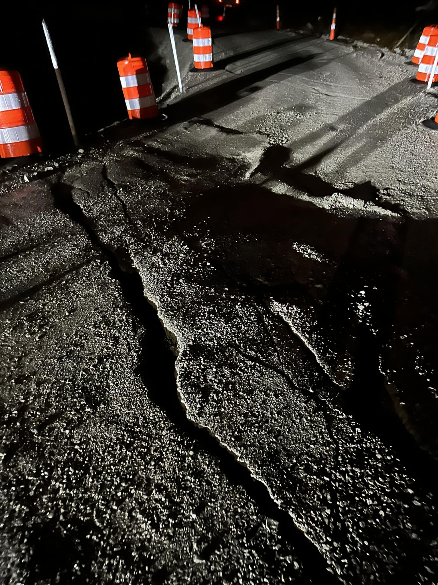
| KY-52 Rockslide Cleanup(Breathitt County) (Courtesy of Brandon Robinson) |
Roadbed Slip on KY-2009 (Harlan County) (Courtesy of Christy Miller) |
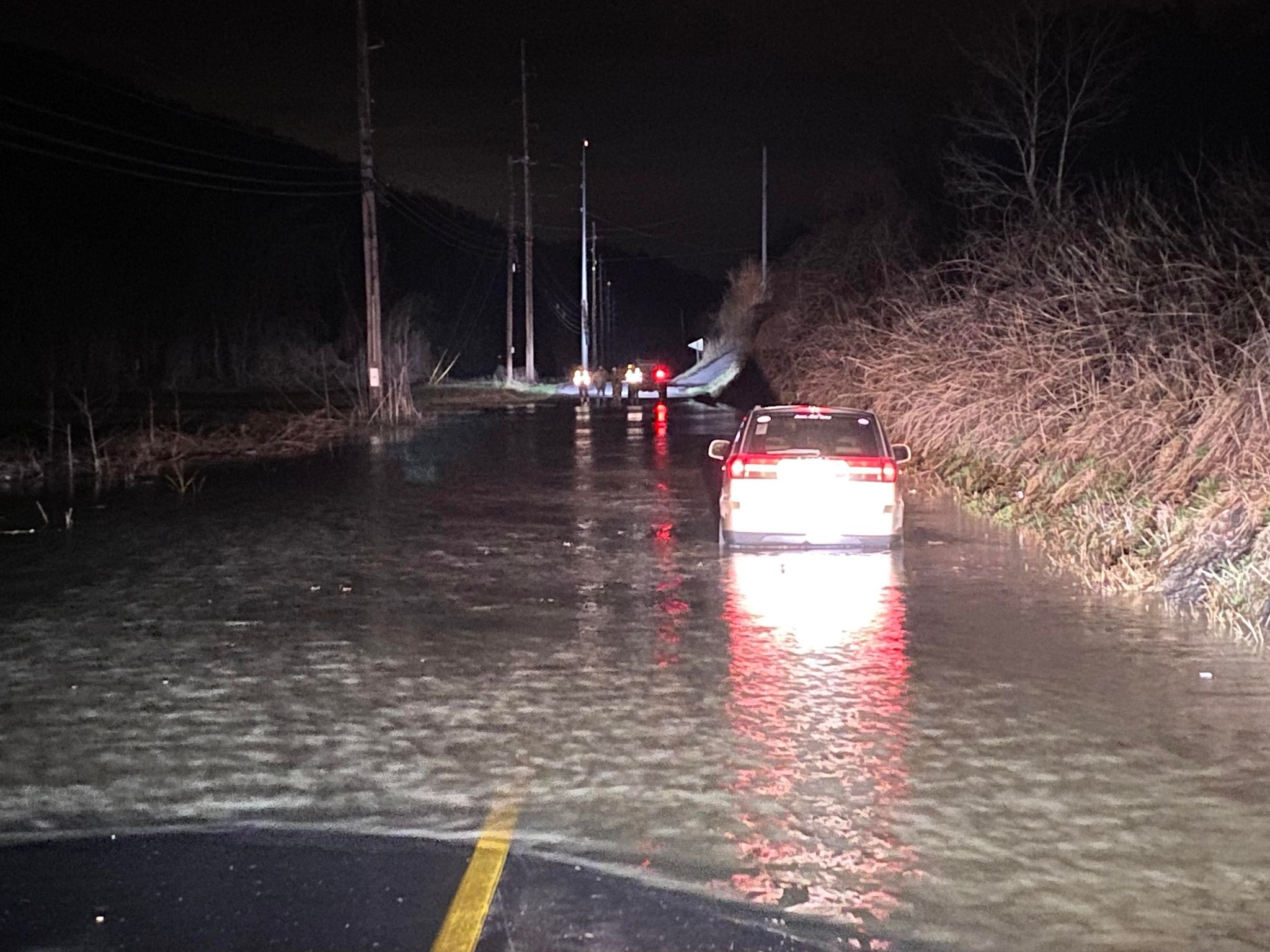
Car Stranded by Floodwaters on Old Pineville Pike(Bell County) (Courtesy of WRIL) |
Flooded Road at Hiner (Perry County) (Courtesy of Kenneth Hall) |
 |
 |
 |
| Flooding at Page Cutoff (Bell County) (Courtesy of Bobby And Sharon Miracle) |
KY-52 Rockslide (Courtesy of Jessica Neace) |
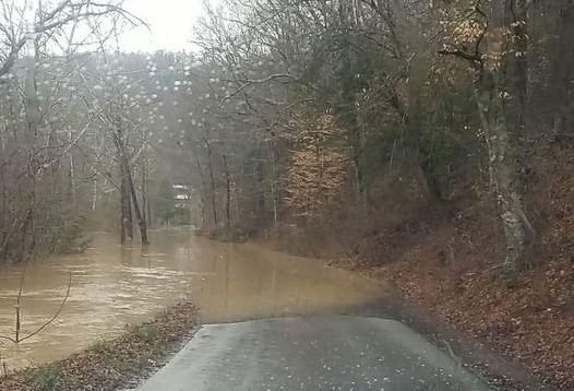
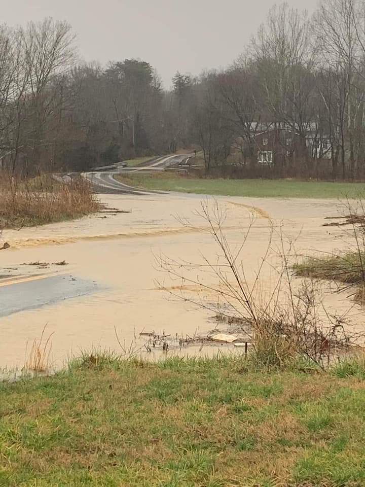
Flooded Road south of London (Courtesy of Johnnie Nicholson) |
 |
 |
 |
| Vehicle Stranded by Flooding on KY-2015 (Courtesy of WRIL) |
Flooding on Williams Branch (Bell County) (Courtesy of WRIL) |
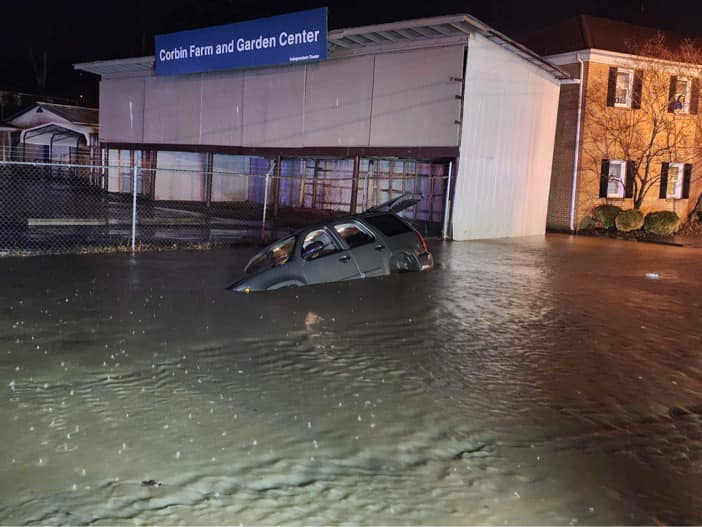
Vehicle Stranded by Floodwaters at Corbin (Courtesy of Corbin Fire Department) |
 |
 |
 |
| KY-66 at Newtown Inundated by Flood Waters (Courtesy of WRIL) |
Flood Waters Inundating KY-188 (Bell County) (Courtesy of WRIL) |
Flood Waters Over East Locust Street in Mount Sterling (Montgomery County) (Courtesy of City of Mount Sterling) |
 |
 |
 |
 |
| Johnson Fork Flood Waters Encroaching on Mountain Parkway (Magoffin County) (Courtesy of Natalie Perkins) |
Road Damage near McRoberts (Letcher County) (Courtesy of Bennie McCall) |
Flood Waters Over Old Campton Road (Powell County) (Courtesy of Johnny Ray Feltner) |
Flooding around Hoedown Island (Natural Bridge State Park) (Courtesy of Jerry Buck Deaton) |
 |
| Flood Waters Over KY-7 and Stranded Vehicle (Magoffin County) (Courtesy of Austin Gibson) |
Rain Reports
48-Hour Rainfall Amounts Ending Saturday Morning February 17th, 2023 (Sorted by County)

Location                    Amount    Time/Date       Lat/Lon

Bath County
4 S Owingsville             3.07 in   0700 AM 02/17   38.09N/83.76W

Bell County
Yellow Creek RAWS           3.67 in   0700 AM 02/17   36.60N/83.70W
Middlesboro-Bell County AP  2.99 in   0700 AM 02/17   36.61N/83.74W

Breathitt County
NWS Office/Julian Carrol AP 4.08 in   0700 AM 02/17   37.59N/83.32W

Clay County
Oneida                      4.13 in   0630 AM 02/17   37.27N/83.65W
Peabody RAWS                3.03 in   0700 AM 02/17   37.14N/83.58W

Estill County
Cressy                      3.17 in   0800 AM 02/17   37.83N/84.04W

Fleming County
2 ESE Ewing                 2.78 in   0700 AM 02/17   38.42N/83.83W

Floyd County
3 WSW Prestonsburg          3.64 in   0700 AM 02/17   37.66N/82.83W
2 S Grethel                 3.08 in   0700 AM 02/17   37.47N/82.65W

Harlan County
1 S Harlan                  3.42 in   0600 AM 02/17   36.83N/83.33W
3 N Harlan                  3.38 in   0745 AM 02/17   36.88N/83.31W
5 NE Baxter                 3.38 in   0700 AM 02/17   36.90N/83.24W
24 E Harlan                 2.07 in   0700 AM 02/17   36.92N/82.91W
2 ENE Evarts                1.66 in   0914 AM 02/17   36.88N/83.17W

Jackson County
5 S McKee                   4.60 in   0700 AM 02/17   37.36N/83.97W
8 W McKee                   4.49 in   0705 AM 02/17   37.43N/84.14W

Johnson County
1 E Paintsville             3.98 in   0700 AM 02/17   37.82N/82.79W
4 W Paintsville             3.21 in   0700 AM 02/17   37.83N/82.88W

Knott County
5 N Hindman                 3.21 in   0700 AM 02/17   37.41N/82.99W
Carr Creek                  2.56 in   0700 AM 02/17   37.23N/83.03W

Knox County
Barbourville                2.75 in   0700 AM 02/17   36.88N/83.88W

Laurel County
4 S London                  3.72 in   0600 AM 02/17   37.07N/84.09W
London-Corbin Airport       3.03 in   0700 AM 02/17   37.09N/84.07W

Lee County
4 N Beattyville             4.76 in   0905 AM 02/17   37.63N/83.72W
9 WNW Beattyville           4.11 in   0700 AM 02/17   37.62N/83.86W

Letcher County
Skyline                     2.67 in   0700 AM 02/17   37.09N/82.99W
2 SE Whitesburg             2.51 in   0700 AM 02/17   37.10N/82.80W
2 NW Whitesburg             2.49 in   0700 AM 02/17   37.13N/82.84W

Magoffin County
Salyersville Water Works    4.29 in   0800 AM 02/17   37.74N/83.10W

Martin County
2 E Inez                    3.29 in   0700 AM 02/17   37.87N/82.52W
Big Sandy RAWS              3.28 in   0700 AM 02/17   37.75N/82.64W

McCreary County
3 N Whitley City            3.14 in   0700 AM 02/17   36.77N/84.48W
1.5 S Stearns               2.91 in   0700 AM 02/17   36.67N/84.48W

Montgomery County
2 W Mount Sterling          3.13 in   0730 AM 02/17   38.07N/83.99W
5 N Mount Sterling          2.95 in   0700 AM 02/17   38.13N/83.96W
Mount Sterling AP           2.56 in   0700 AM 02/17   38.06N/83.98W

Morgan County
14 ENE West Liberty         3.91 in   0800 AM 02/17   37.96N/83.02W
2 SW West Liberty           3.88 in   0700 AM 02/17   37.90N/83.27W

Owsley County
4 ENE Booneville            4.43 in   0700 AM 02/17   37.50N/83.62W
2 S Booneville              4.14 in   0700 AM 02/17   37.45N/83.69W

Perry County
Buckhorn Lake               4.42 in   0700 AM 02/17   37.34N/83.47W
Hazard Water Works          3.17 in   0600 AM 02/17   37.25N/83.18W
1 N Viper                   1.37 in   0626 AM 02/17   37.19N/83.15W

Pike County
1 SE Fedscreek              2.60 in   0800 AM 02/17   37.39N/82.26W
13 S Pikeville              2.52 in   0700 AM 02/17   37.28N/82.51W

Powell County
2 W Stanton                 4.22 in   0800 AM 02/17   37.86N/83.90W
1 WNW Clay City             4.03 in   0700 AM 02/17   37.87N/83.93W

Pulaski County
Somerset RAWS               3.45 in   0700 AM 02/17   37.05N/84.61W
Somerset-Pulaski County AP  3.33 in   0700 AM 02/17   37.05N/84.61W
7 NNE Somerset              3.26 in   0700 AM 02/17   37.18N/84.56W
4 SSE Burnside              2.67 in   0700 AM 02/17   36.93N/84.58W

Rowan County
6 NE Morehead               3.18 in   0714 AM 02/17   38.24N/83.34W
Cave Run Lake               3.12 in   0700 AM 02/17   38.12N/83.53W
4 NE Morehead               2.99 in   0700 AM 02/17   38.22N/83.48W
Triangle Mountain RAWS      2.85 in   0700 AM 02/17   38.18N/83.41W

Wayne County
4 NW Monticello             2.35 in   0700 AM 02/17   36.87N/84.90W

Whitley County
7 SW Corbin                 3.56 in   0700 AM 02/17   36.87N/84.21W

Wolfe County
Koomer Ridge RAWS           3.36 in   0700 AM 02/17   37.78N/83.63W

Observations are collected from a variety of sources with varying
equipment and exposures. We thank all volunteer weather observers
for their dedication. Not all data listed are considered official.
Environment
An unusually mild stretch of weather continued into the morning of the 16th --temperatures on the prior afternoon had soared into the 70s for many locations. By the wee morning hours, a wavering boundary was situated along the Lower Ohio Valley. Upper level troughing and preceding pulses of energy ejecting from the Central Plains and a deep southwesterly flow of unstable Gulf moisture would soon interact with this boundary to produce a 24 to 36 hour heavy rainfall event across much of eastern Kentucky. The rain tapered off only gradually from northwest to southeast during the evening of the 16th and early morning of the 17th as a slow-moving low pressure lifting over the Ohio Valley dragged a cold front through eastern Kentucky.
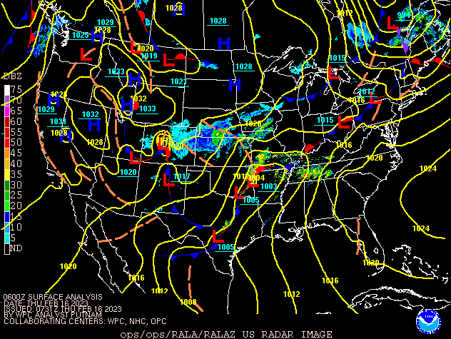 |
| Figure 1: Surface Analysis from 1 AM February 16th until 7 AM February 17th |
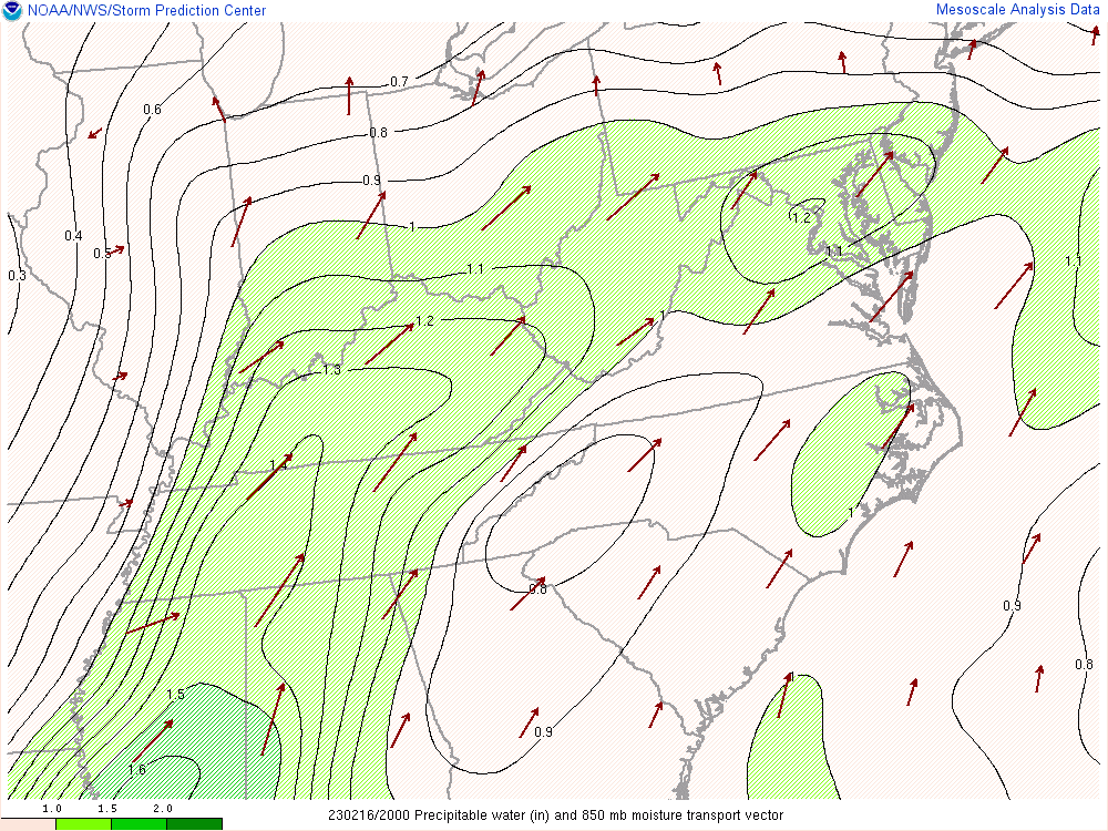
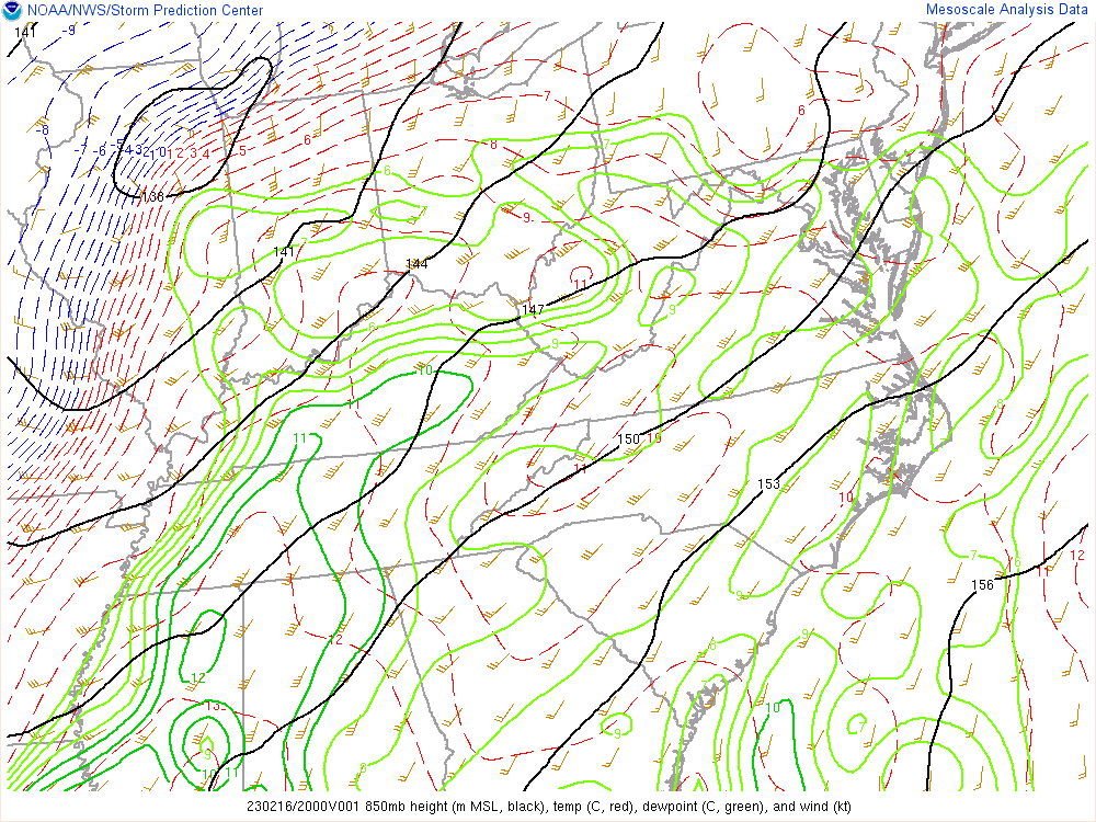
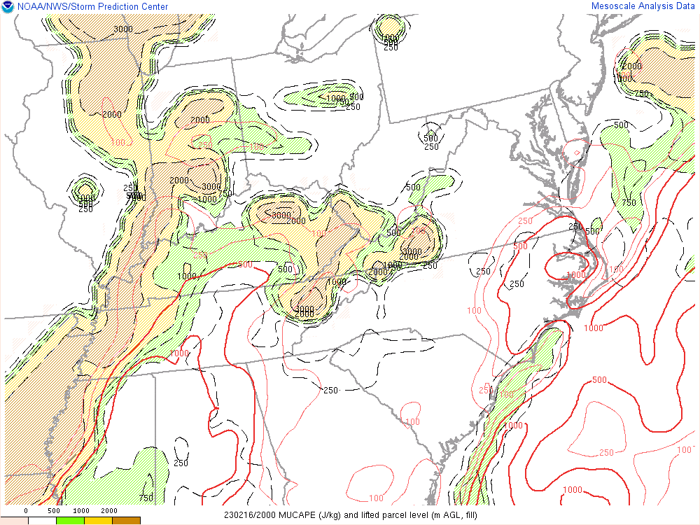
For the environmental analysis, all figures are from 3 PM (20z), February 16th, 2023. Though this is just one hour of analysis during a long-duration event, these figures show the general pattern that persisted from early on the morning of February 16th until the arrival of the cold front. In Figure 2, robust 850mb moisture transport was evident, causing PWATs to surge into the 1.2 to 1.3 inch range across most of eastern Kentucky--near climatological maximums for this time of the year. Figure 3 shows the strong 30-40 knot 850 mb jet advecting in that warm, high dew point (very moist) air mass into eastern Kentucky. Moisture convergence is evident in the 850 mb wind field (Figure 3) around the I-64 corridor, close to the stalled frontal boundary, and is much more apparent in Figure 4. As that moisture converged and rose, weak but sufficient instability (Figure 5) was present for convective shower and thunderstorm updrafts in an area near and under a zone of strong 300 mb divergence (Figure 6). This nearly ideal combination of ingredients led to efficient rainfall rates and many instances of flooding across eastern Kentucky.
 |
 |
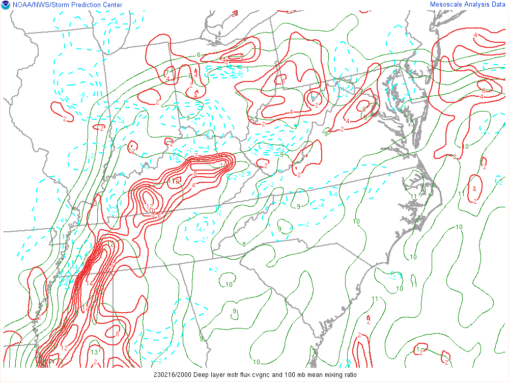 |
| Figure 2: Moisture Transport and Precipitable Water | Figure 3: 850 mb Analysis | Figure 4: Moisture Convergence |
 |
 |
| Figure 5: MUCAPE (J/kg) | Figure 6: 300 mb Analysis |
 |
Media use of NWS Web News Stories is encouraged! Please acknowledge the NWS as the source of any news information accessed from this site. |
|