Overview
|
Eastern Kentucky's first substantial severe weather day of 2024 occurred on April 2nd as a rapidly intensifying low pressure system tracked just northwest of the area. The first round of severe weather occurred between 9 AM and 12 PM as a line of severe thunderstorms raced eastward and impacted many locations near and north of the Mountain Parkway. Along this line, several surges and pockets of circulation developed over the Bluegrass. Bath County suffered the brunt of the line with many instances of straight line wind damage though substantial damage was also observed in Fleming and Rowan counties. Pockets of damage were also noted in most other counties along and north of the Parkway. An NWS storm survey estimated that winds reached 70 to 90 mph in three northwest to southeast-oriented swaths across Bath County. A couple of brief spin-up tornadoes also appear to have occurred within two of the swaths near the communities of Sharpsburg and Reynoldsville. Once the late morning thunderstorm activity weakened, a messy mixture of showers and a few thunderstorms lifted across eastern Kentucky through the afternoon. Severe weather was not observed again until early evening when a couple of supercell thunderstorms developed over central/eastern Tennessee and moved into southeast Kentucky. The first storm, tracking northeast just east of Pine Mountain, produced a swath of hail up to half dollar size, though much of it likely fell in remote and rugged terrain. A second supercell thunderstorm moved northeast across the Cumberland River basin and eventually weakened over the basin of the South Fork Kentucky River. This storm produced pockets of wind damage, the most severe of which was observed in northeast Whitley County where many trees, multiple structures and an RV park suffered significant damage. An NWS storm survey found damage consistent with winds gusts of 80 to 90 mph in this area about 7 miles southwest of Corbin. Additional details on this straight line wind event in Whitley County and also the straight line wind/tornado event in the Bluegrass are available here and here, respectively. |
 Blown-in Grain Silo in Rowan County Blown-in Grain Silo in Rowan CountyCourtesy of NWS Storm Survey |
Tornadoes:
|
Tornado - Sharpsburg
Track Map 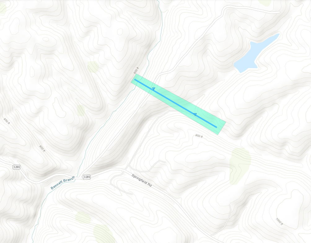 
|
||||||||||||||||
The Enhanced Fujita (EF) Scale classifies tornadoes into the following categories:
| EF0 Weak 65-85 mph |
EF1 Moderate 86-110 mph |
EF2 Significant 111-135 mph |
EF3 Severe 136-165 mph |
EF4 Extreme 166-200 mph |
EF5 Catastrophic 200+ mph |
 |
|||||
 |
 |
 |
 |
| Damaged Ceiling in Home Courtesy of NWS Storm Survey |
Roof Damage on Home Courtesy of NWS Storm Survey |
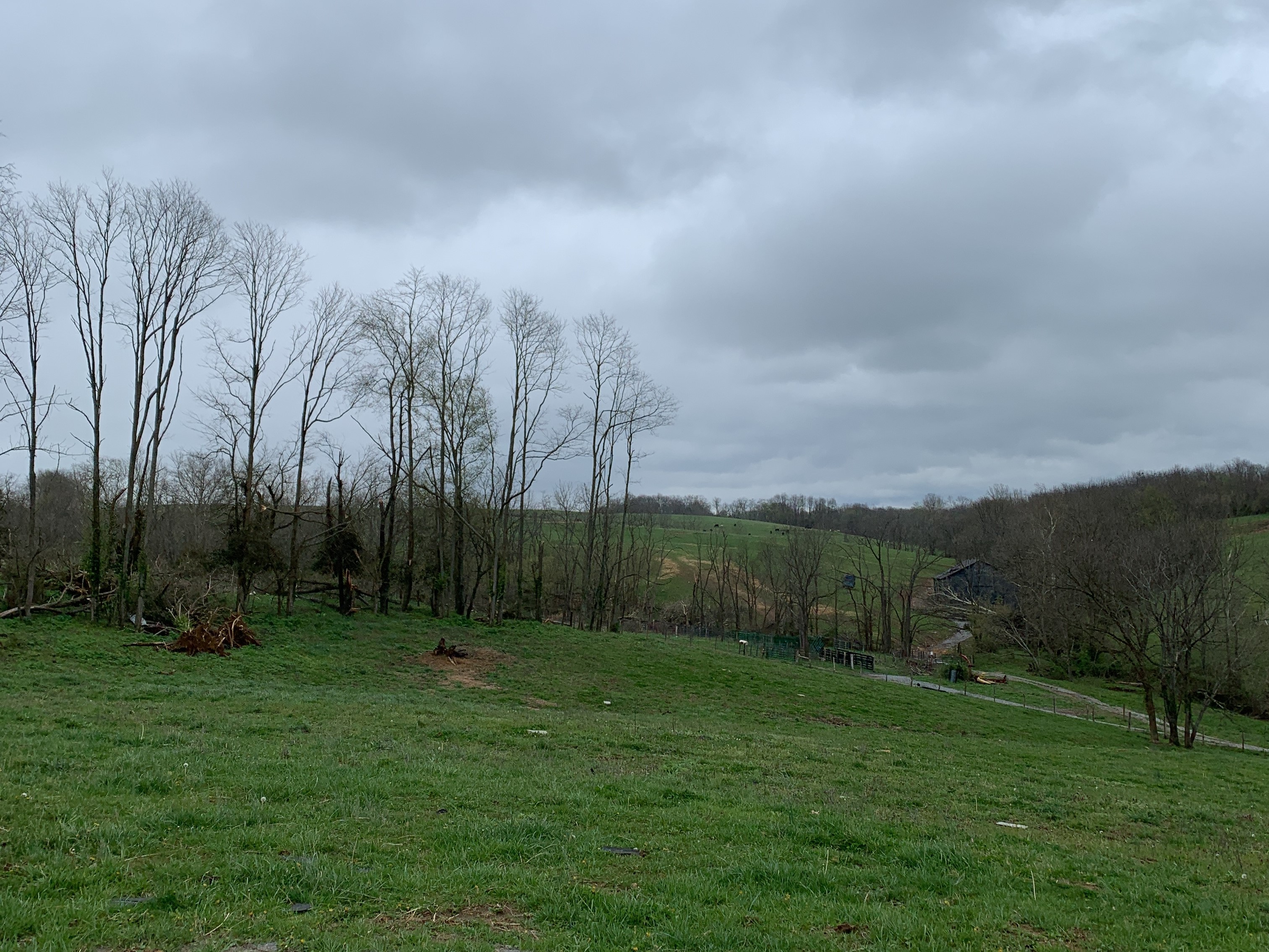
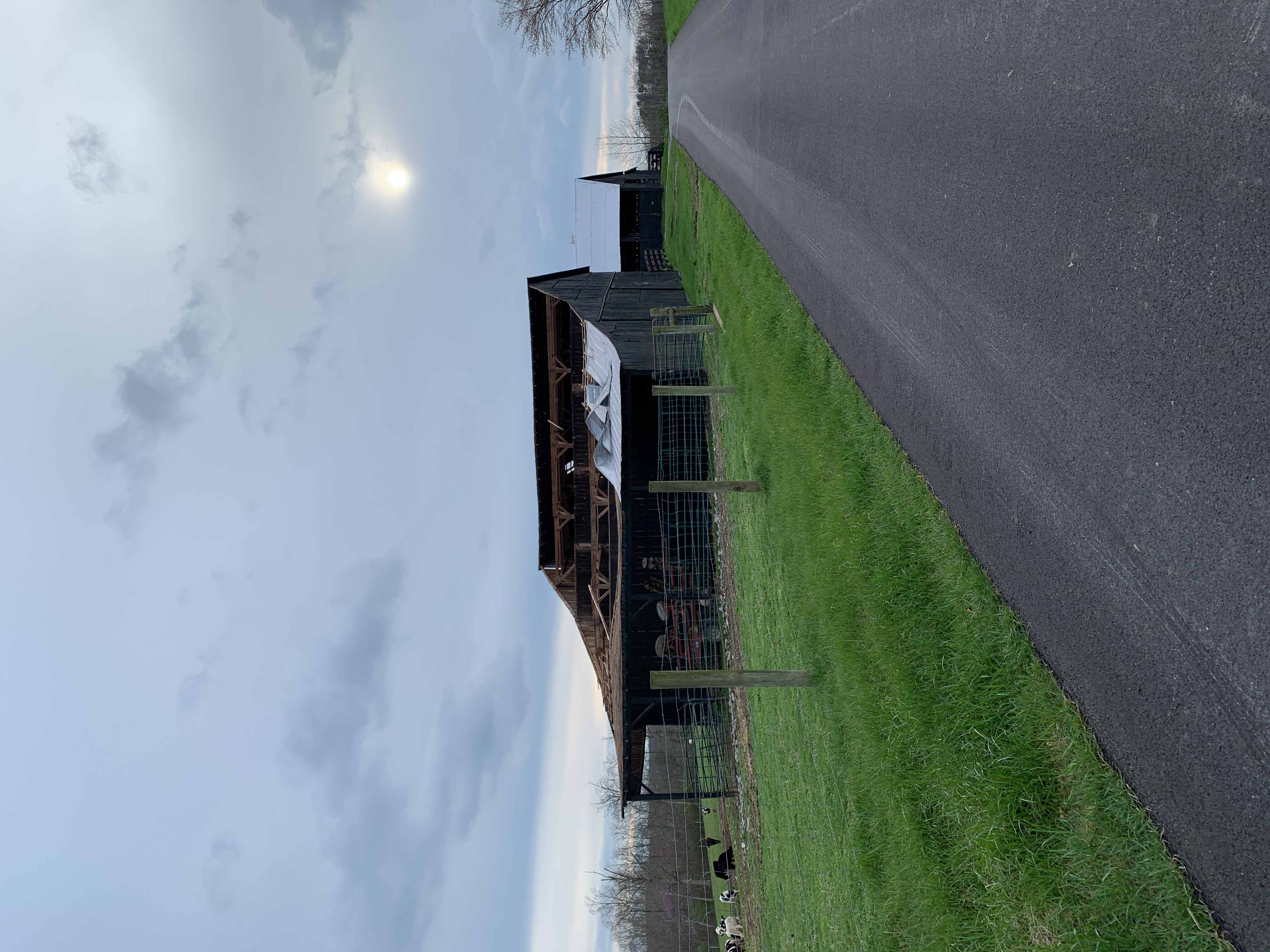
Battered Treeline and Barn Downstream from Home Courtesy of NWS Storm Survey |
Damaged Barn Courtesy of NWS Storm Survey |
|
Tornado - Reynoldsville
Track Map 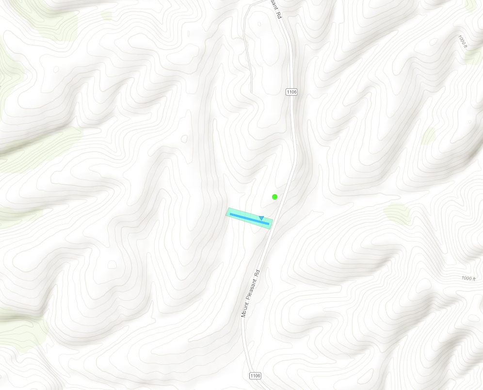
|
||||||||||||||||
The Enhanced Fujita (EF) Scale classifies tornadoes into the following categories:
| EF0 Weak 65-85 mph |
EF1 Moderate 86-110 mph |
EF2 Significant 111-135 mph |
EF3 Severe 136-165 mph |
EF4 Extreme 166-200 mph |
EF5 Catastrophic 200+ mph |
|
|||||
 |
 |
 |
| Damaged Side of Home Courtesy of NWS Storm Survey |
Home Missing Roof Courtesy of NWS Storm Survey |
Debris Scattered into Nearby Trees Courtesy of NWS Storm Survey |
Photos & Video
 |
 |
 |
 |
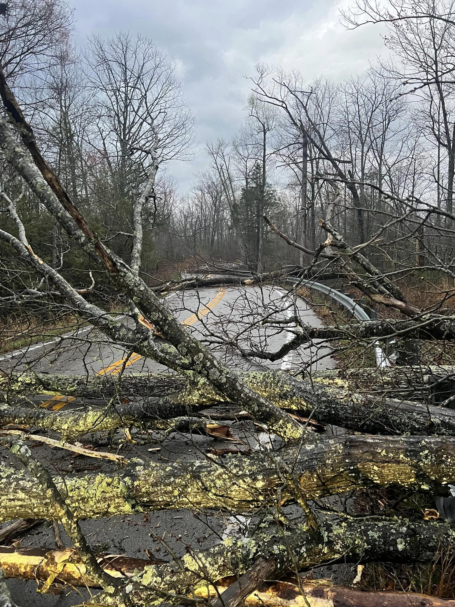
| Trees Blown Down onto KY-90 (Whitley County) Courtesy of Shawn Cowden |
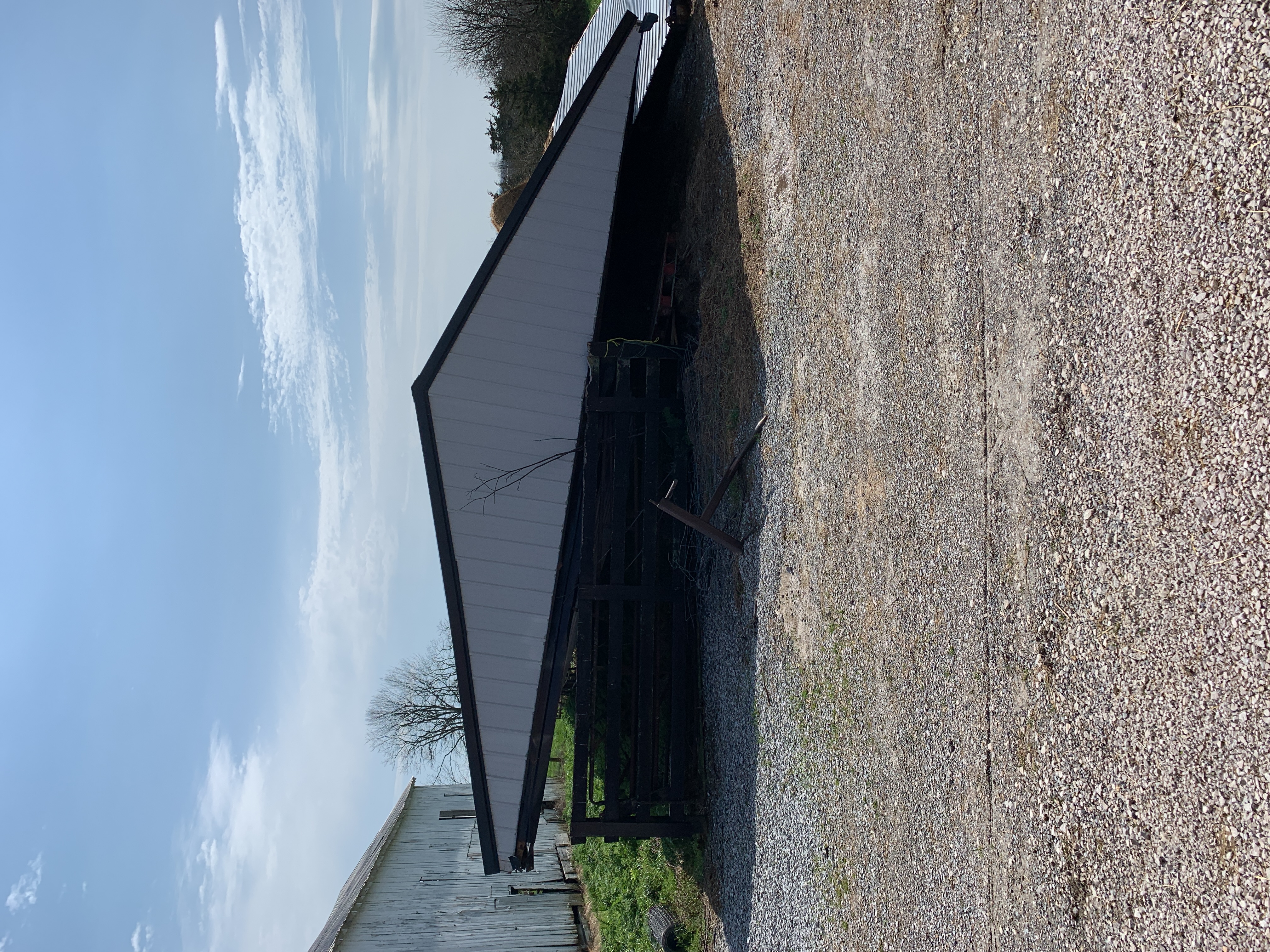
Barn Missing Roof (Fleming County) Courtesy of NWS Storm Survey |
Tree on Home (Whitley County) Courtesy of NWS Storm Survey |
Collapsed Chimney (Rowan County) Courtesy of NWS Storm Survey |
 |
 |
 |
 |
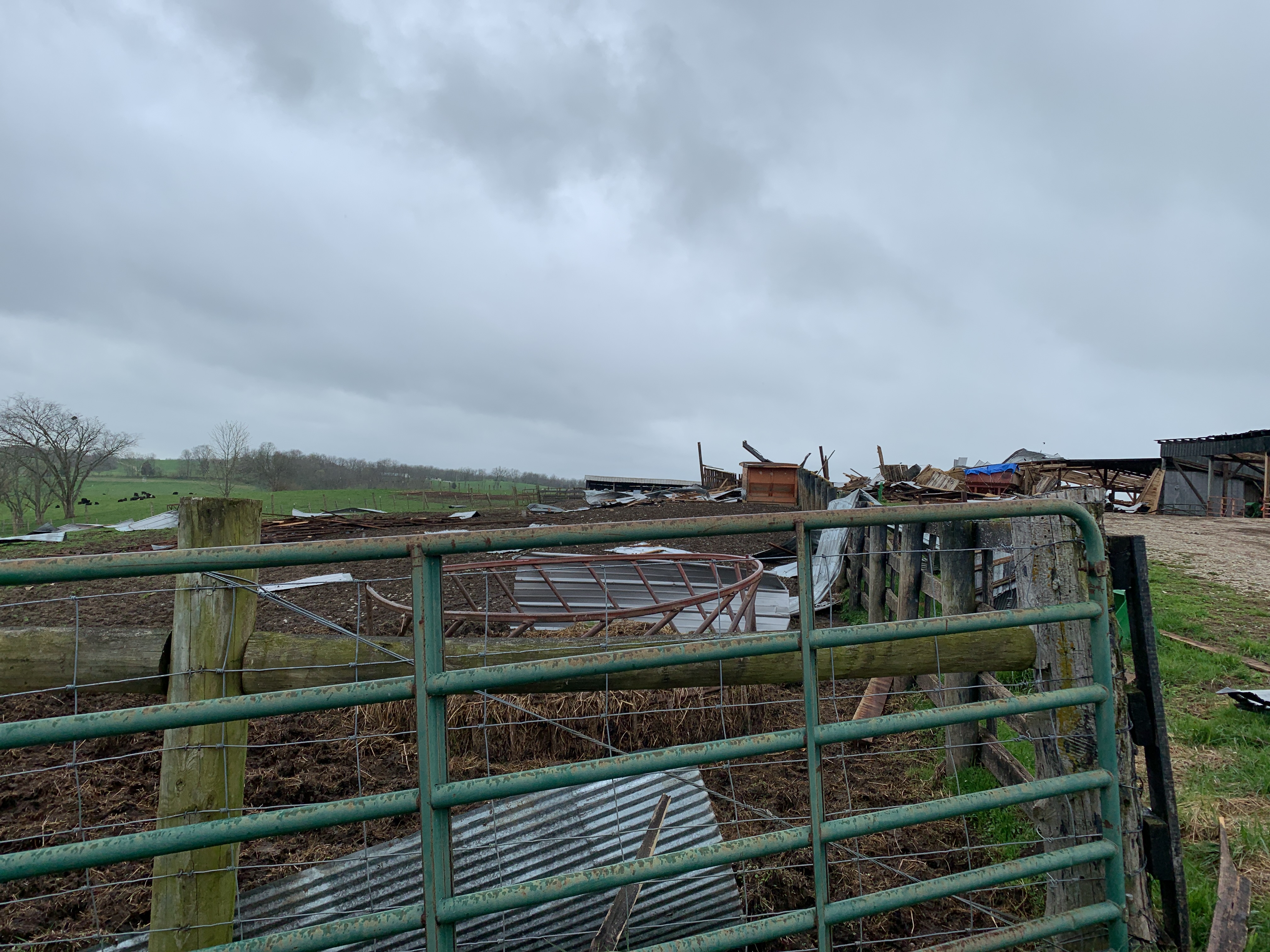
| Collapsed Shed (Bath County) Courtesy of NWS Storm Survey |
Debris from Barns (Bath County) Courtesy of NWS Storm Survey |
Barn Roof Damage and Downed Trees (Bath County) Courtesy of NWS Storm Survey |
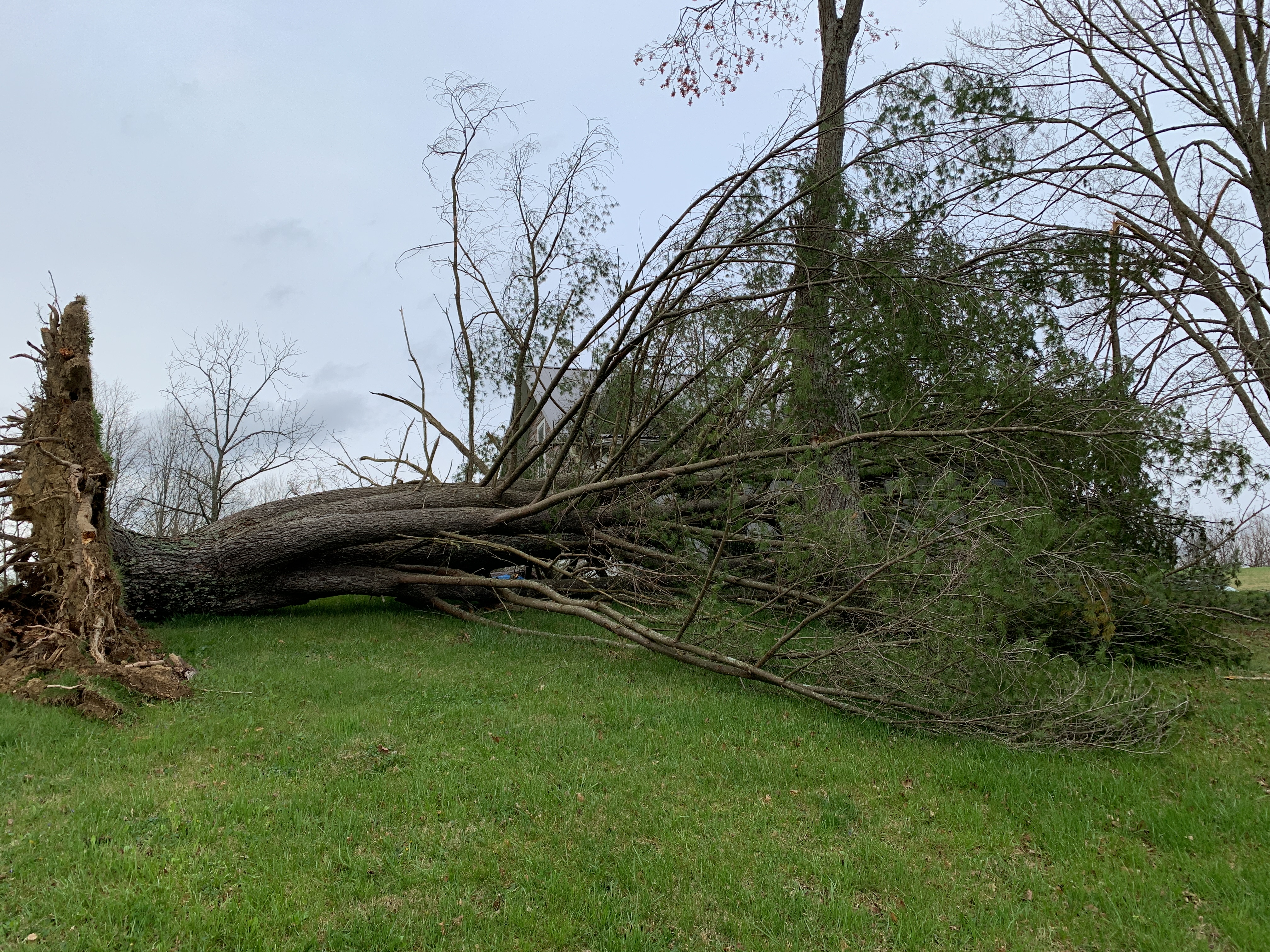
Large Downed Pine Tree (Rowan County) Courtesy of NWS Storm Survey |
 |
 |
 |
 |
| Barn with Damaged Roof (Montgomery County Courtesy of NWS Storm Survey |
Home with Roof Damage/Collapsed Chimney Courtesy of NWS Storm Survey |
Damaged Barn (Bath County) Courtesy of NWS Storm Survey |
Auction Barn with Missing Roof (Bath County) Courtesy of NWS Storm Survey |
|
Drone Footage of Straight Line Wind Damage in the Frankfort School Road and Bee Creek Area, Whitley County |
 |
 |
| Large Hail at Calvin (Bell County) (Courtesy of Melissa Hoskins Caldwell) |
Hail Accumulation at Calvin (Bell County) (Courtesy of Missy Brigmon) |
Radar
 |
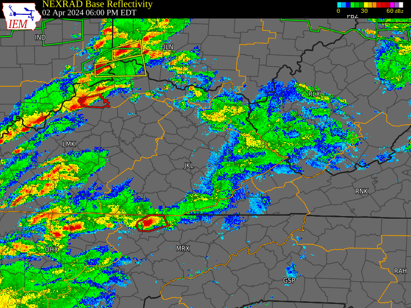 |
| 9 AM EDT to 12 PM EDT, April 2nd, 2024 (Courtesy of Iowa State University) |
6 PM EDT to 9 PM EDT, April 2nd, 2024 (Courtesy of Iowa State University) |
Environment
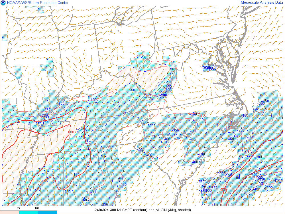
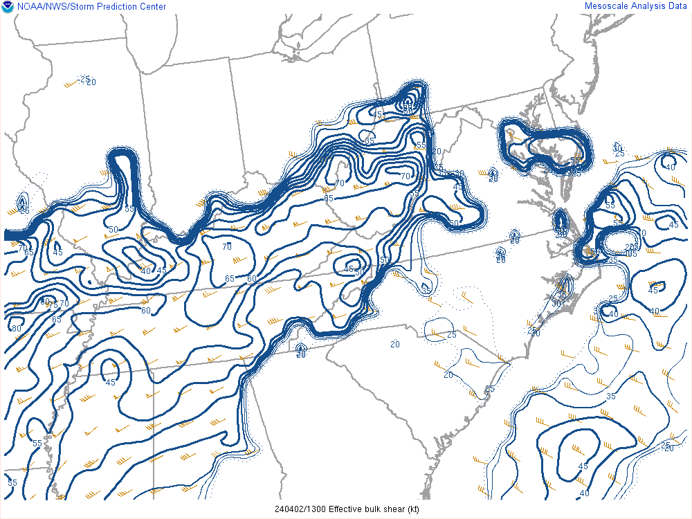
Low pressure developed over the Southern Plains on April 1st and then rapidly deepened as it tracked northeast through the Mid-Mississippi and Lower Ohio Valleys on April 2nd and into the southern Great Lakes on April 3rd (Figure 1). A line of storms organized over the Mid-Mississippi Valley early in the morning on April 2nd and quickly translated eastward into Central Kentucky by mid morning. This line of storms encountered a classic cool season low instability/high shear environment over Central and Eastern Kentucky. The mesoscale analysis at 9 AM EDT shows a mere 100 to 500 J/kg of MLCAPE (Figure 2) while effective shear values range from 60 to 70 kts (Figure 3). Across locations near and north of I-64, the 0-3 km Bulk Shear vector (Figure 4) was analyzed as westerly at near 50 knots and was strongly orthogonal to that portion of the thunderstorm line. This orientation of the shear vector of this magnitude relatively perpendicular to a line of thunderstorms can favor brief spin-up tornadoes and damaging straight line winds. Indeed the radar data capture from 939 AM (Figure 5) shows that this is exactly the case with multiple velocity notches, particularly over Bath County, and corresponding enhancements in the rotational velocity. The southwesternmost area of rotation had just produced a brief tornado while a tornado was likely ongoing under the middle area of rotational enhancement. As the line of thunderstorms moved into eastern Kentucky, it gradually became oriented more parallel to the shear vector as shown under the Radar data tab and lost intensity.
A messy mixture of showers and thunderstorms then developed and persisted for much of the day and evening hours with generally sub-severe storms, except over southeastern Kentucky where a few supercell thunderstorms moved northeast out of Tennessee and produced severe weather between 6 and 9 PM.
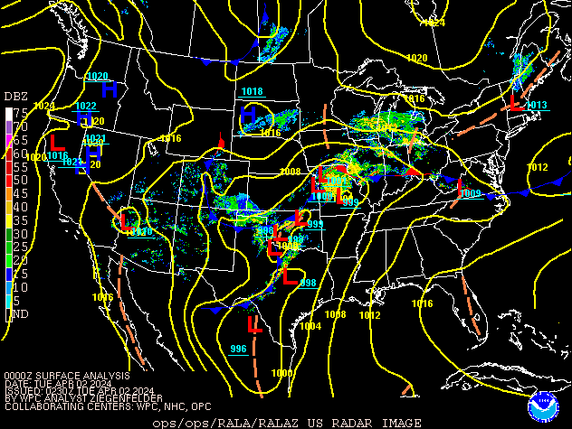 |
| Figure 1: Surface Analysis 8 PM EDT Monday, April 1st through 2 AM EDT Wednesday, April 3rd, 2024 |
 |
 |
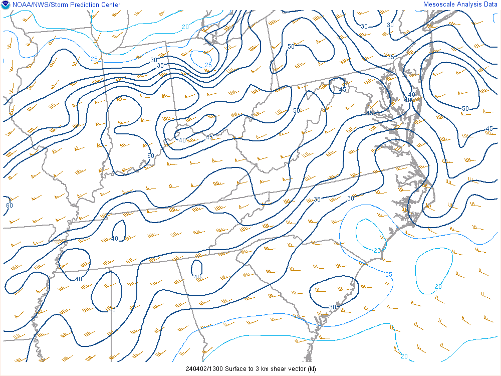 |
| Figure 2: ML CAPE @ 9 AM EDT, April 2nd | Figure 3: Effective Shear @ 9 AM EDT, April 2nd | Figure 4: Bulk Shear @ 9 AM EDT, April 2nd |
.png) |
| Figure 5: Radar Data @ 939 AM EDT: Upper Left - Base Velocity, Upper Right - Storm Relative Velocity. Lower Left - Base Reflectivity, Lower Right - Normalized Rotation |
 |
Media use of NWS Web News Stories is encouraged! Please acknowledge the NWS as the source of any news information accessed from this site. |
|

