
Showers and thunderstorms, along with high-elevation snow, will begin to develop over parts of the Southwest late tonight and is expected to continue through Wednesday morning. Mountain snow over parts the Northeast will continue through Tuesday. A few strong to severe storms and heavy rainfall are possible across portions of the Lower Ohio Valley Tuesday. Read More >
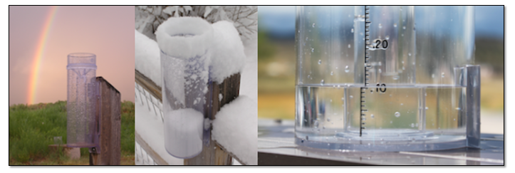
CoCoRaHS (pronounced KO-ko-rozz) is a grassroots volunteer network of backyard weather observers of all ages and backgrounds working together to measure and map precipitation (rain, hail and snow) in their local communities. By using low-cost measurement tools, stressing training and education, and utilizing an interactive website, the goal is to provide the highest quality data for natural resource, education and research applications.
Why do you need to know how much precipitation fell in my backyard?
Even in the day and age in which we live with Doppler Radar scanning the skies and automated weather observing equipment in many communities, we still need humans manually measuring the precipitation in their backyards. These manual observations serve as ground truth for the precipitation estimates we get from Doppler Radar and automated station measurements. Manual observations also fill in gaps where automated equipment doesn’t exist. Plus, there are no automated instruments in our region that measure the snow. So, we rely heavily on manual human observations to know how much snow fell.
Here’s an example of the snowfall observations received following a snow storm in January 2024:
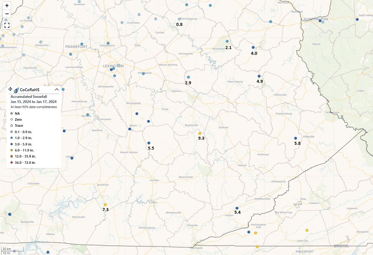
There are several CoCoRaHS observers in eastern Kentucky. However, most counties have no observers at all. We need more observers to accurately map the precipitation across our region.
How do I become a CoCoRaHS observer?
Contributing your precipitation measurements each day takes less than 5 minutes (there’s even an app for that!) and it’s a fun way to learn about the wonderful natural resource that falls from the sky. Here’s how to join and start sharing your precipitation measurements:
Have additional questions or want to learn more?
The CoCoRaHS website is a great resource to visit in order to learn more about the network and to look at precipitation measurements being collected right now across our region. Each state has coordinators that can also help answer any questions you may have. A link to the contacts for Kentucky is included below:

