Dangerous heat will expand from the Gulf Coast into the Southern Plains and Desert Southwest through week's end. Additional extreme heat impacting the Pacific Northwest will shift to the northern Plains by the weekend. Tropical Storm Bertha is expected to continue to impact portions of the northern Gulf Coast from the western Florida Panhandle to southeastern Louisiana through tonight. Read More >
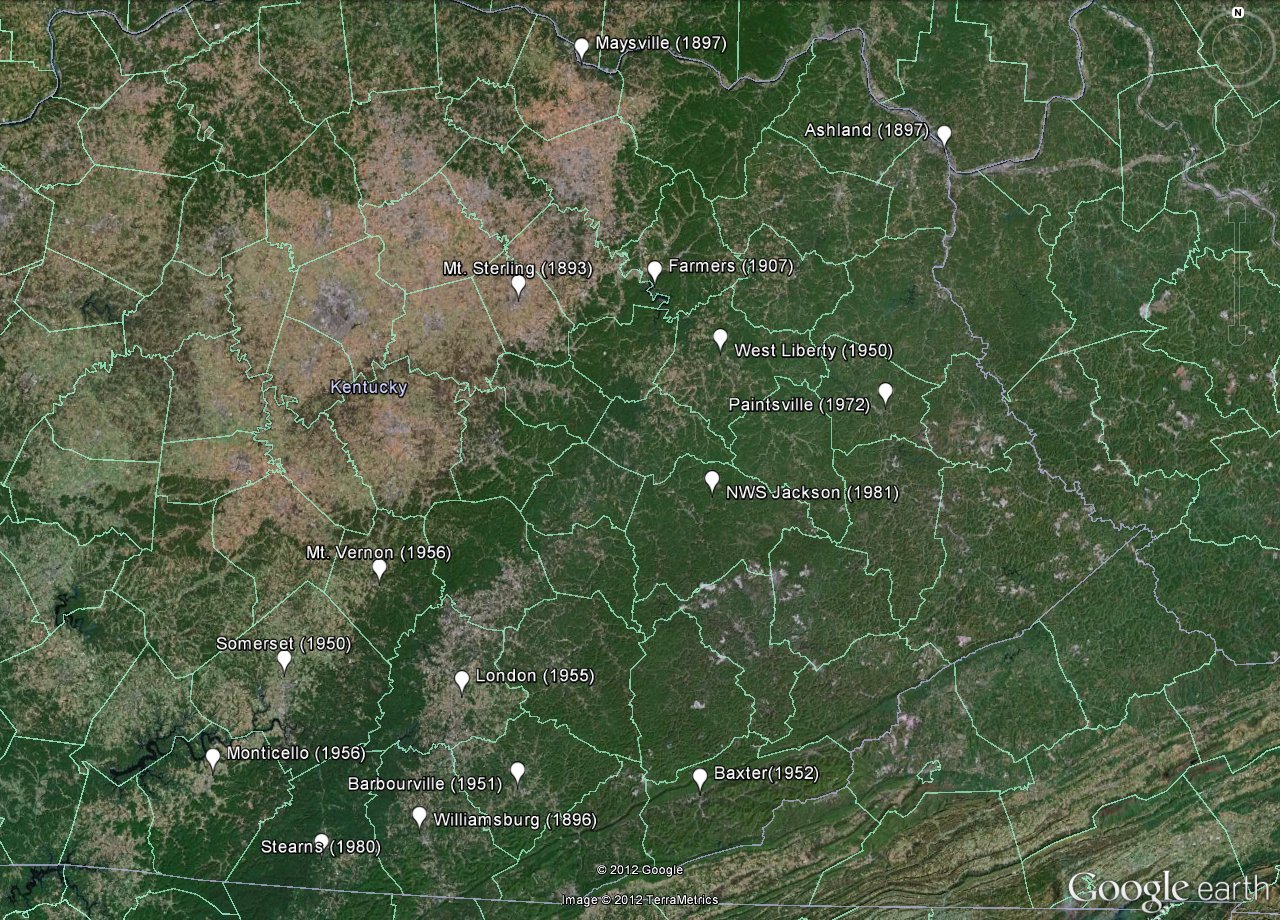
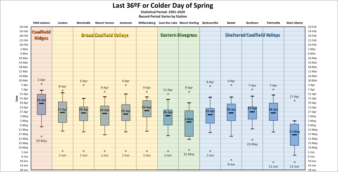
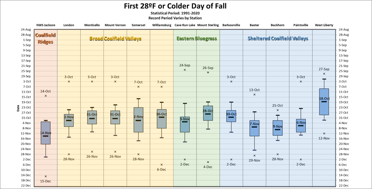
Dates of the last 28ºF, 32ºF and 36ºF temperatures each spring and the first 36ºF, 32ºF and 28ºF temperatures each fall were analyzed using a percentile rank analysis for several surface observing sites over east Kentucky. The observing sites include first-order reporting stations, such as the Jackson National Weather Service Office and the London-Corbin Airport as well as several long-running cooperative weather observing stations.
 |
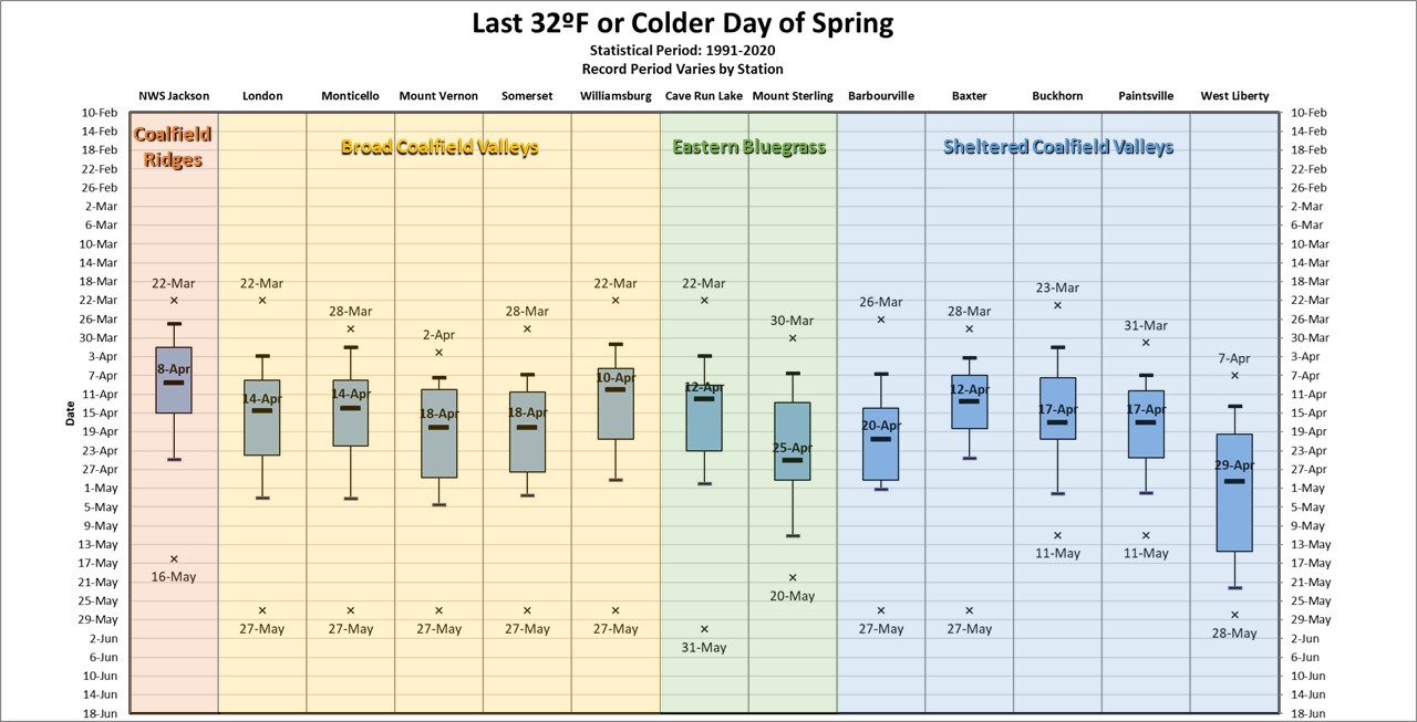
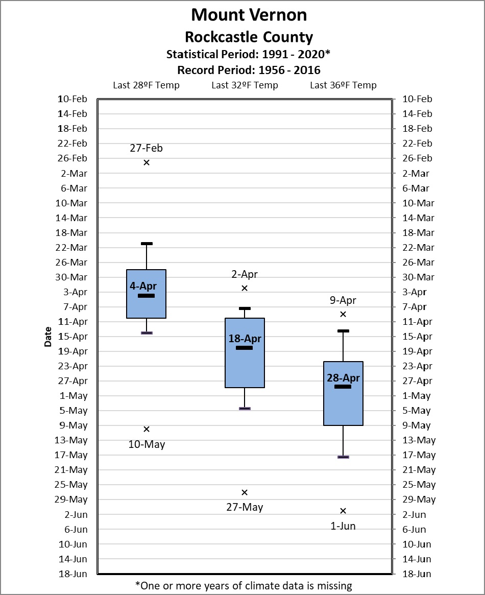
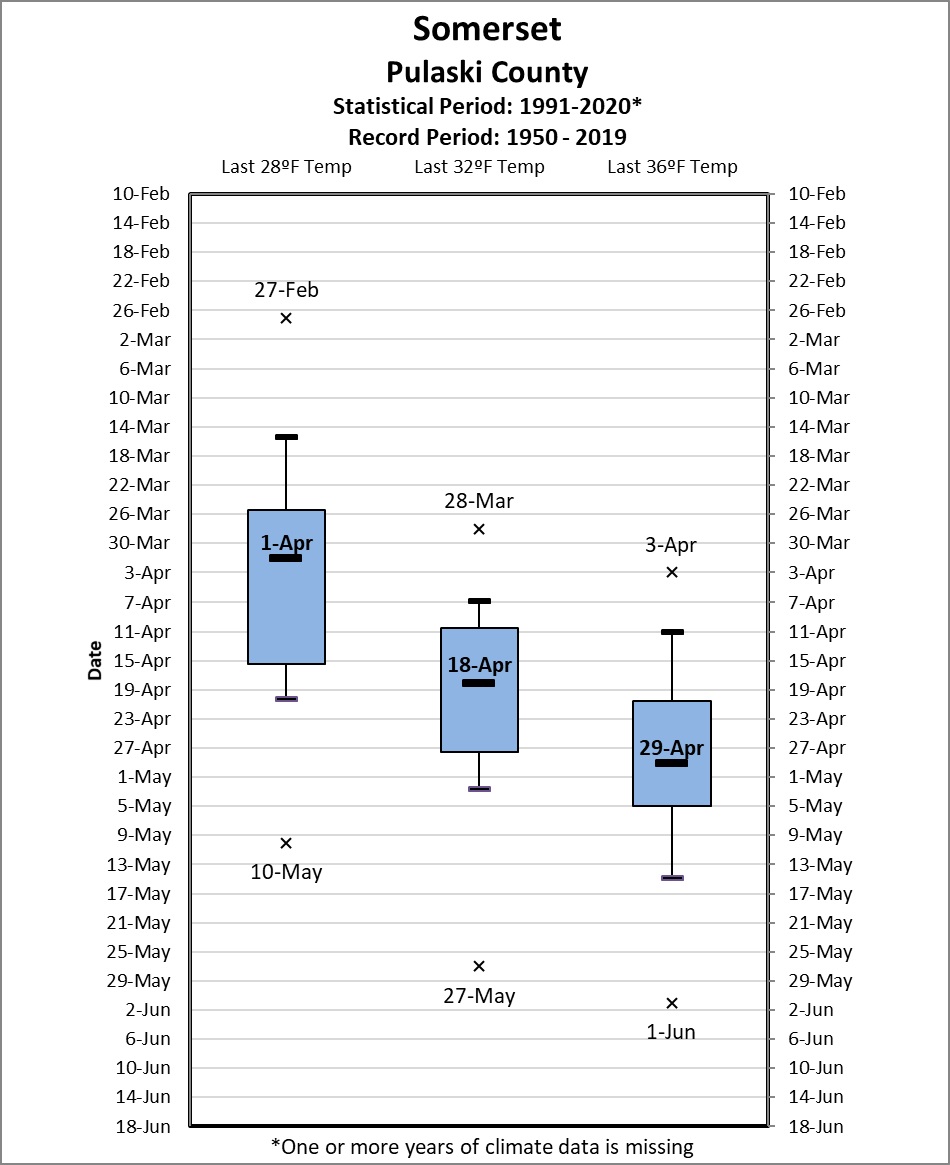
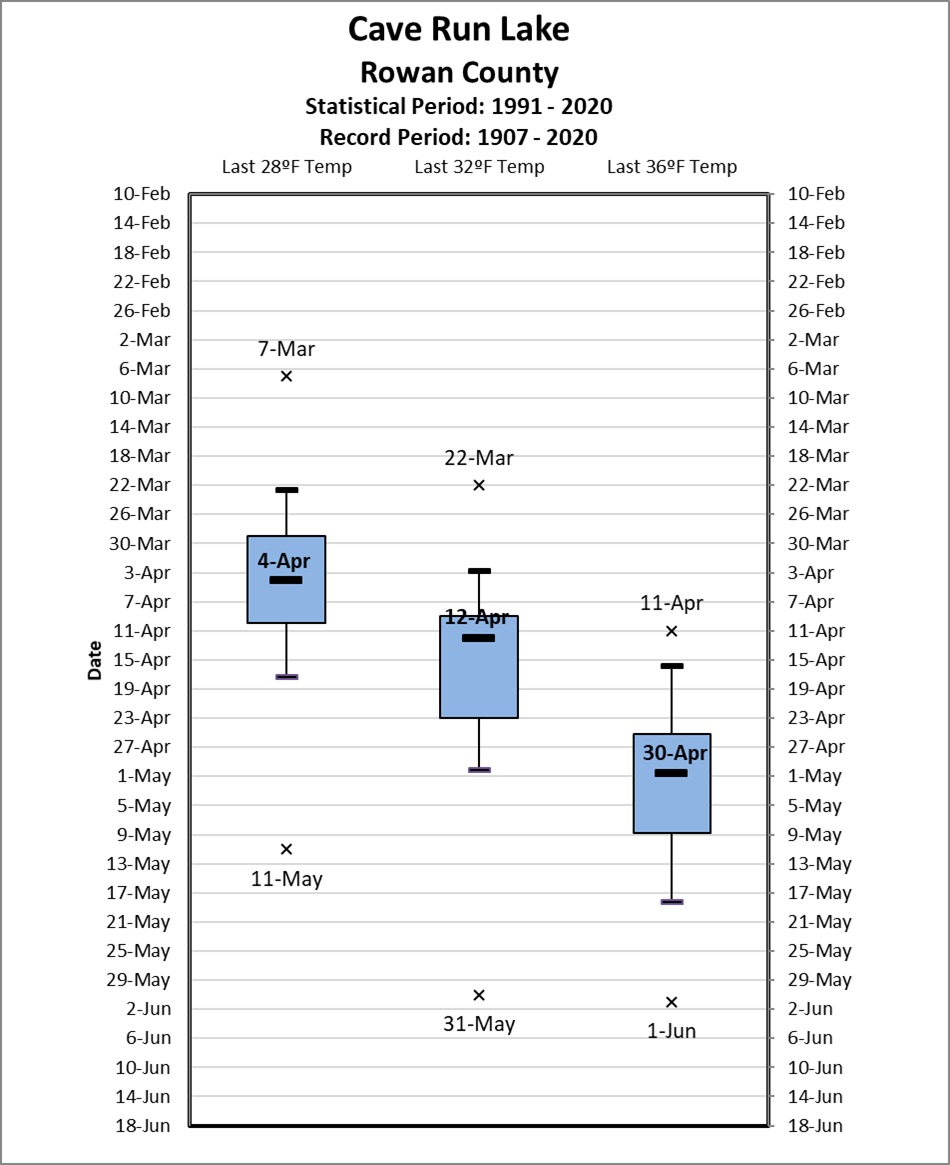
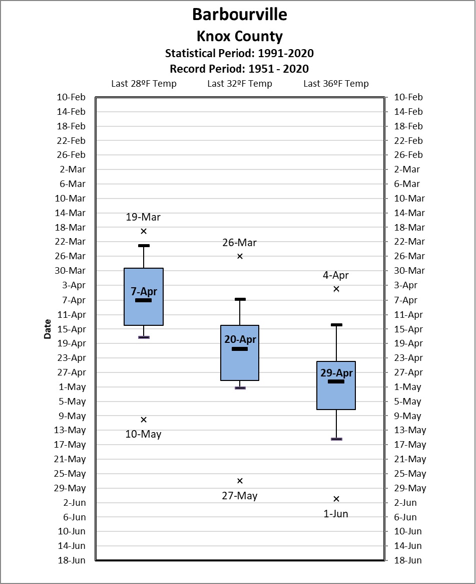
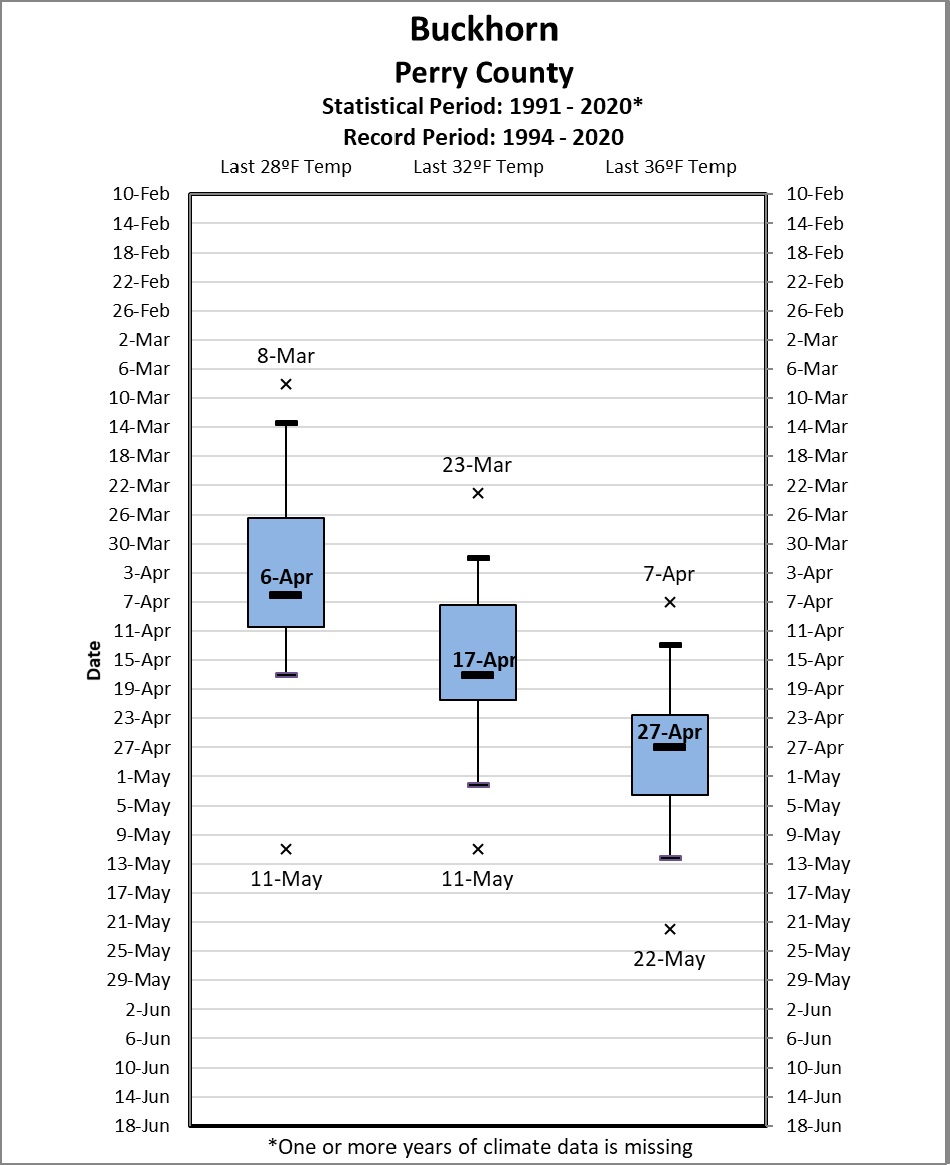
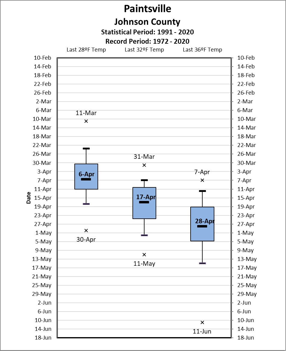
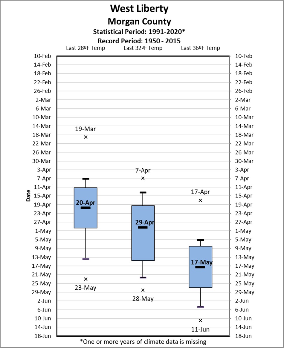
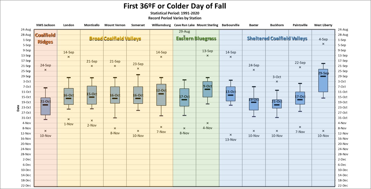
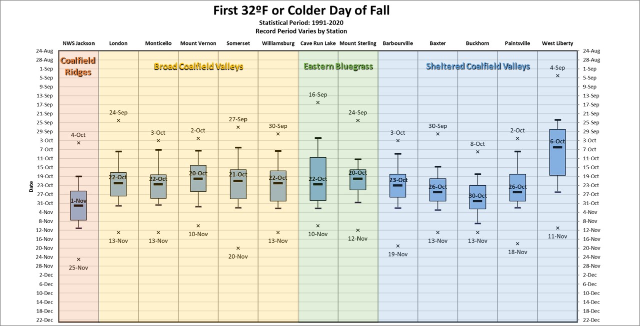
The first/last 36ºF temperature was used to approximate the date of first/last frost for the growing season, 32ºF being the date of first/last freeze and 28ºF approximating the date of first/last hard (killing) freeze for the growing season.
|
|
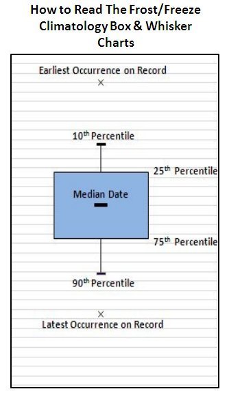
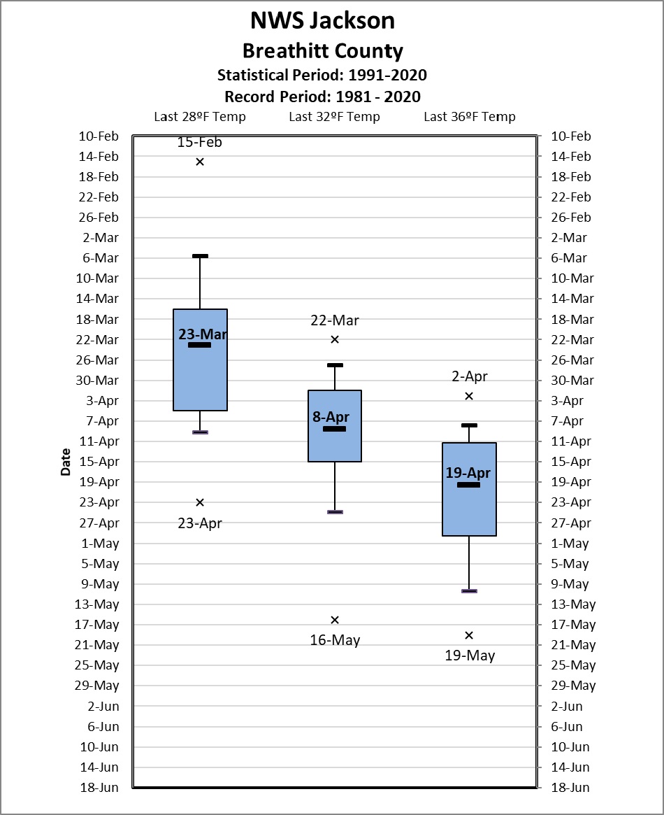
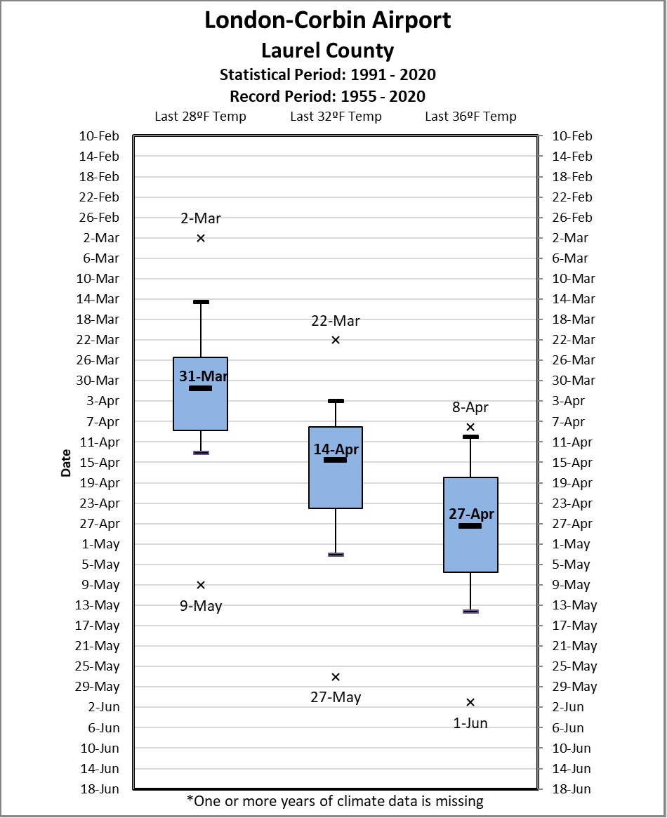
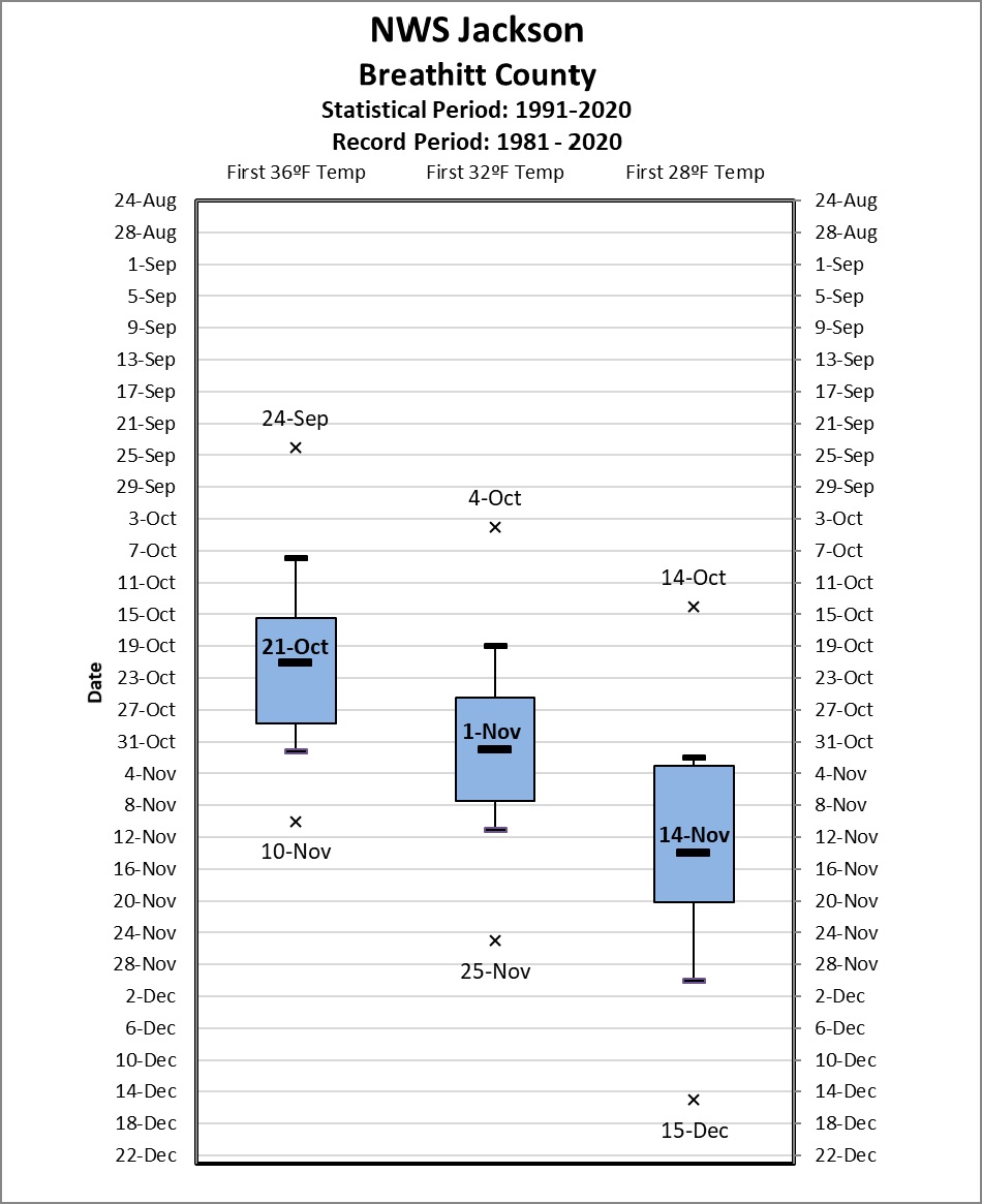
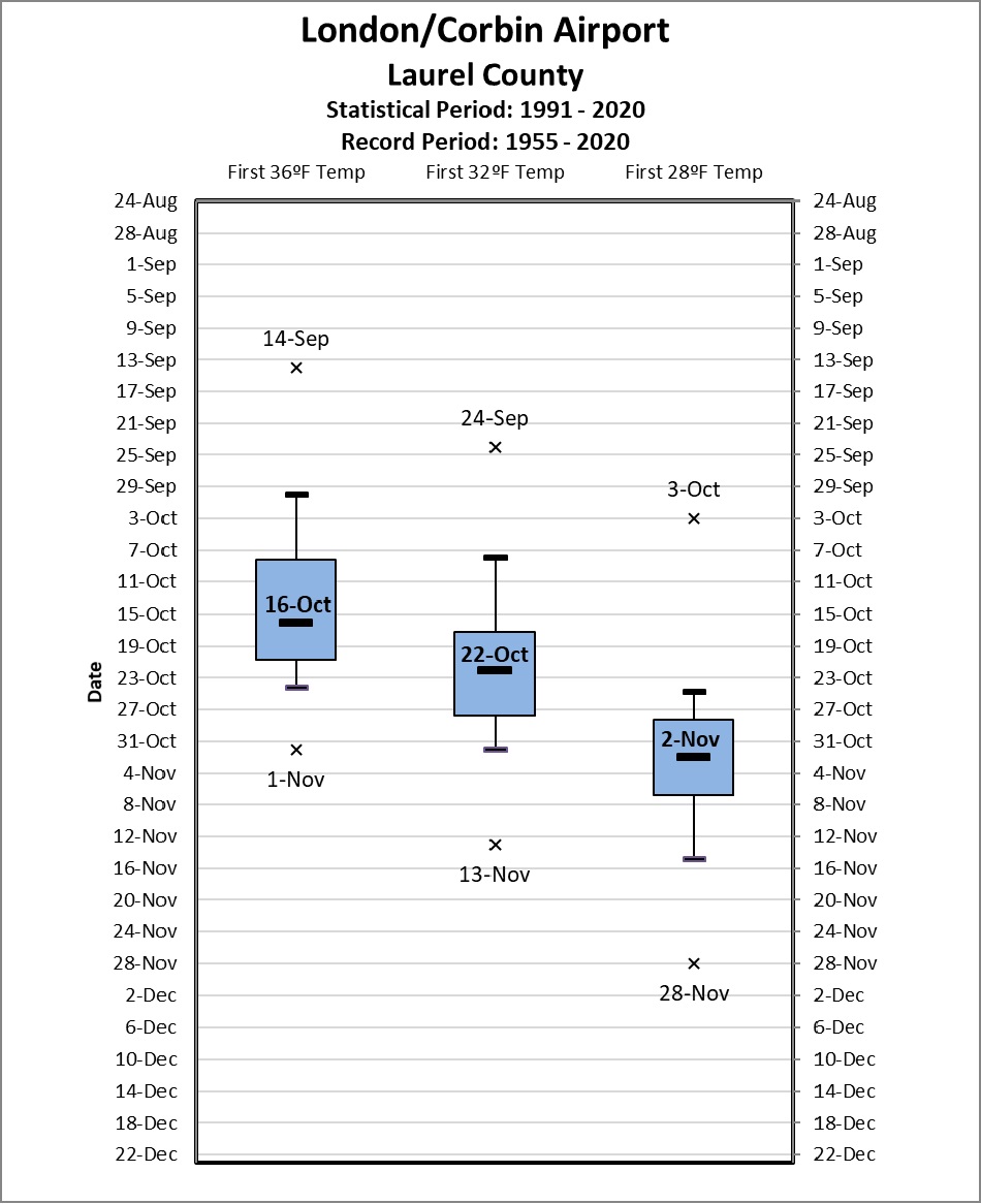
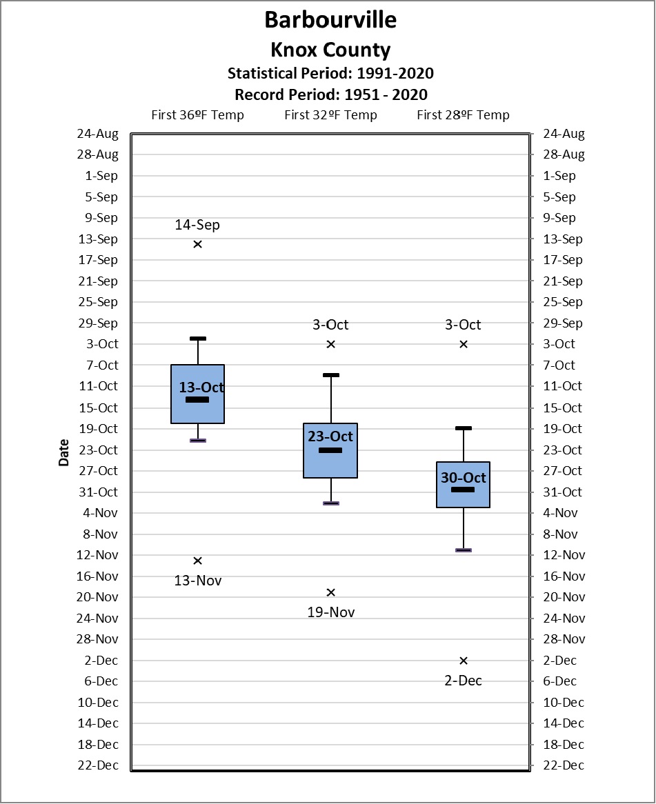
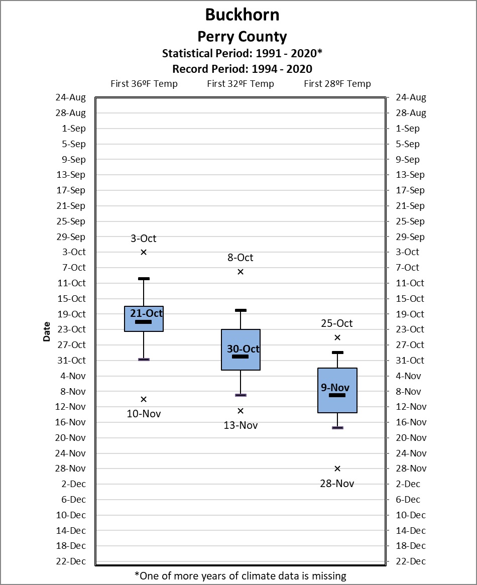
Box and whisker diagrams were employed to view the data. An example of the diagram format is shown at left. The shaded region of each graph (i.e., "the box") shows the middle 50% of the range of first and/or last frost/freeze dates. The top of the box is the 25th percentile and the bottom is the 75th percentile. The solid line within the box shows the median (or 50th percentile) first and/or last frost/freeze date for that location. The lines extending upward and downward from the box (i.e., "the whiskers") reach to the 10th and 90th percentile of the data distribution. That is, only 10% of the data lies above and below the ends of the whiskers. Lastly, the "x" indicates the extreme (record) freeze date during the period of record for that particular location. The intent of the box and whisker format is to give a comprehensive view of the range of first and last frost/freeze dates at individual sites, and facilitate comparison between different locations.
|
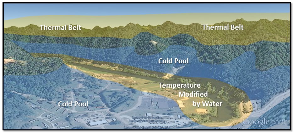
Much of the eastern third of Kentucky, known as the Eastern Coalfields physiographic region, is characterized by rugged, steep terrain. While elevation differences between valley bottom and adjacent ridge tops do not usually exceed 1000 feet, the steepness of the slope creates many sheltered valleys (and hollows), especially east of Interstate 75. The resultant sheltering from the mean wind and earlier sunset/later sunrise promote rapid inversion development during high pressure regimes (light winds, clear skies, etc.), thus maximizing cooling. Nighttime fog often forms in the valleys of main stem rivers and larger tributaries, modifying temperatures and producing a later first frost/freeze date than the narrow hollows in the fall, and a corresponding earlier last frost/freeze date in the spring. Finally, with the cold air pooling in the valley bottoms, a warm layer of air often forms at ridge top level. This is known as the thermal belt and it causes a much later first frost/freeze date to be found on the ridges in the fall, and an earlier last frost/freeze date in the spring, as evident by data from atop Sugar Camp Mountain where National Weather Service Jackson is located. It is also important to note that the Coalfields region from near I-75 westward to the Escarpment is flatter, with population centers largely occurring in broad valleys or even on plateau-like locations. Though some localized significant variations undoubtedly exist in this portion of the Coalfields, the frost/freeze dates in this area tend to be more equable from location to the next. The topographic variations in location create the most dramatic differences in frost/freeze climatology for eastern Kentucky, not necessarily how far north or south a station lies.
 |
|
Idealized illustration of cold pool and thermal belt structure typically found during clear, calm nights in the mountainous terrain of east Kentucky. Also illustrated is an example of temperature modification due to a body of water, in this case a small lake. |
The other significant physiographic regions of east Kentucky, the Eastern Bluegrass or “Knobs” and Mississippian (or Pennyroyal) Plateau region have less rugged terrain when compared to the Coalfields, and typically less variation in temperature from location to location. For the purposes of this article, Somerset and Monticello (which lie in the transition zone between the Pennyroyal Plateau and Coalfields regions) are included as Broad Coalfield Valley locations.
 |
| click on image for more detail |
 |
| click on image for more detail |
 |
| click on image for more detail |
Individual Spring Station Statistics (click on images for more detail)
 |
|
National Weather Service Office Jackson Climate Station
|
 |
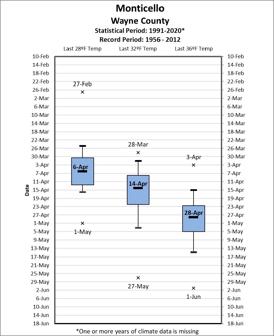 |
| London-Corbin Airport Climate Station | Monticello 3NE COOP Station |
|
|
|
 |
 |
|
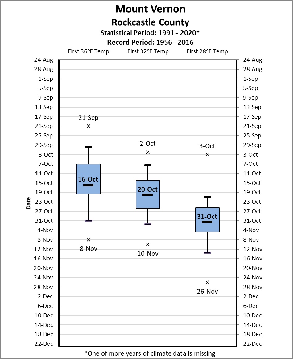
Mount Vernon COOP Station
|
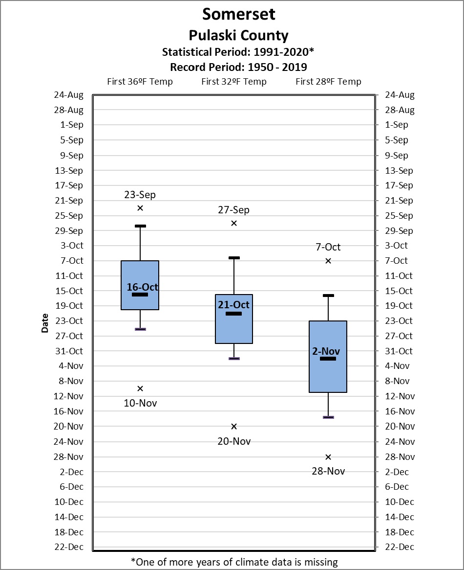
Somerset 2 N COOP Station |
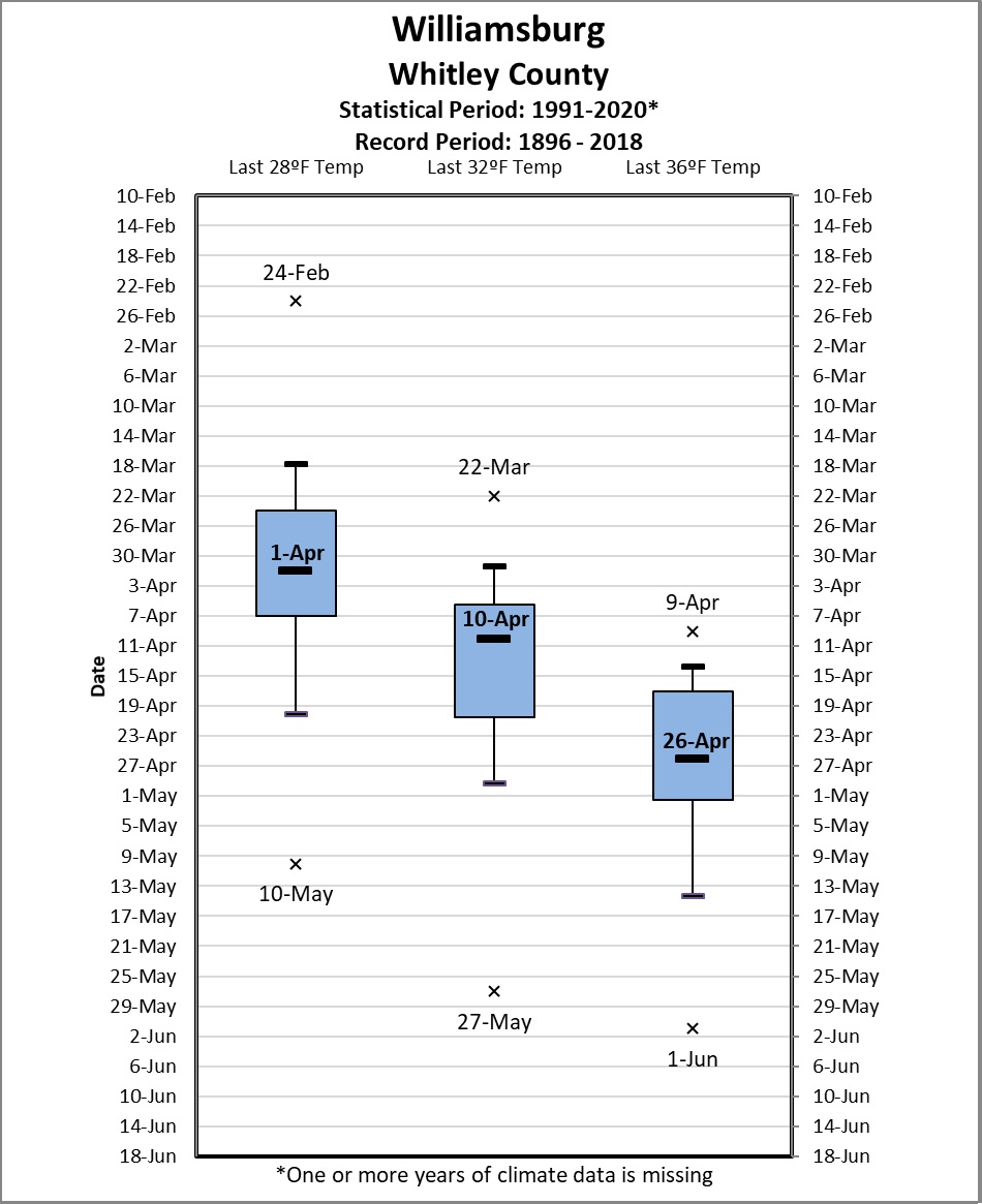 |
| Williamsburg and Williamsburg 1 NW COOP stations |
 |
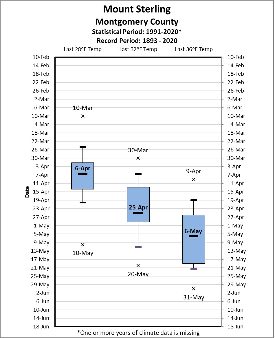 |
| Farmers 2 S COOP Station | Mount Sterling COOP Station |
 |
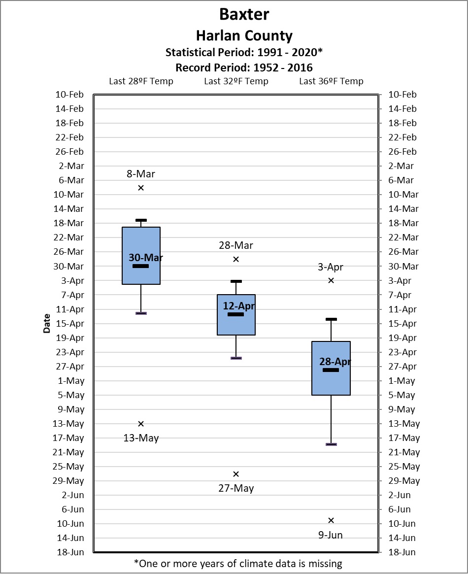 |
| Barbourville COOP Station | Baxter COOP Station |
|
|
|
 |
 |
|
Buckhorn Lake COOP Station
|
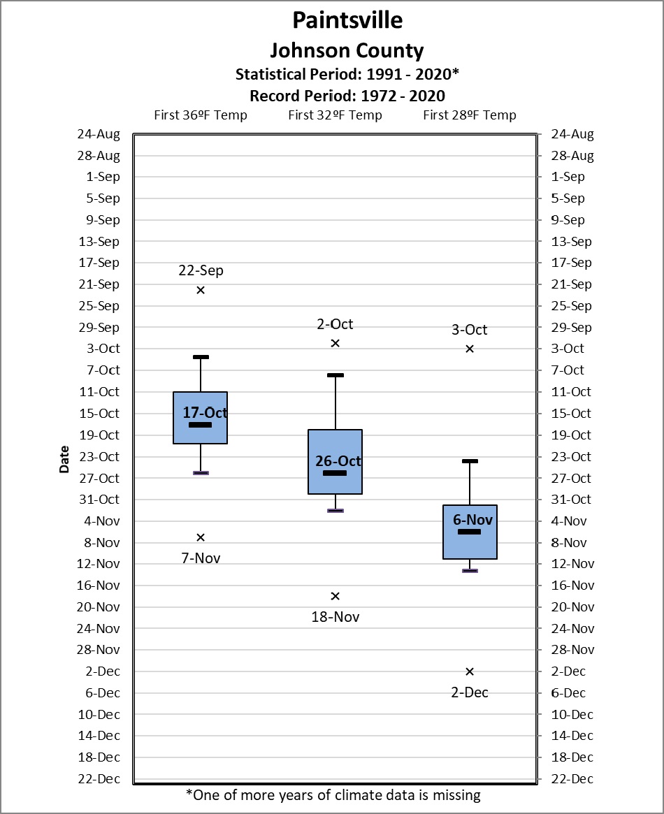
Paintsville 1 E COOP Station |
 |
|
West Liberty 3 NW COOP Station
|
 |
| click on image for more detail |
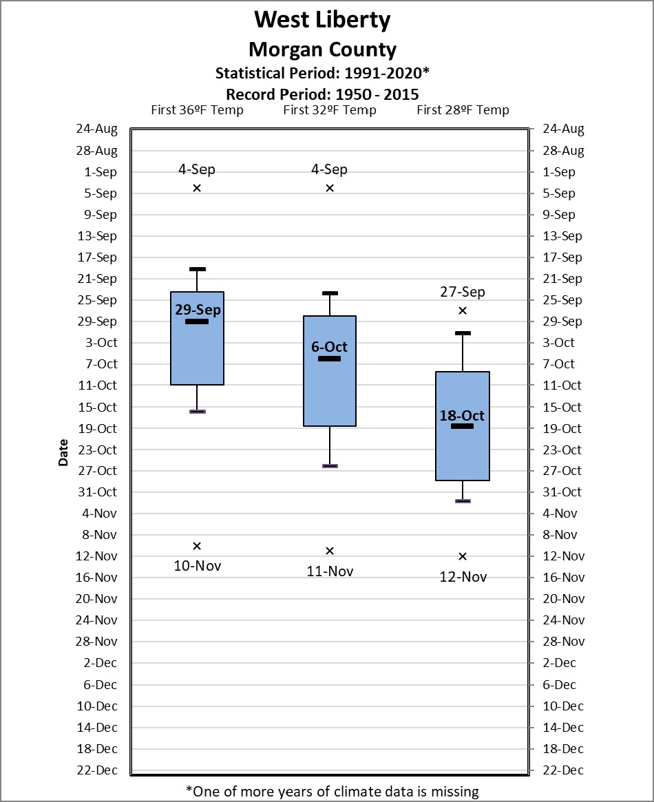
Fall Freeze Climatology
 |
| click on image for more detail |
 |
| click on image for more detail |
Individual Fall Station Statistics (click on images for more detail)
 |
|
National Weather Service Office Jackson Climate Station
|
 |
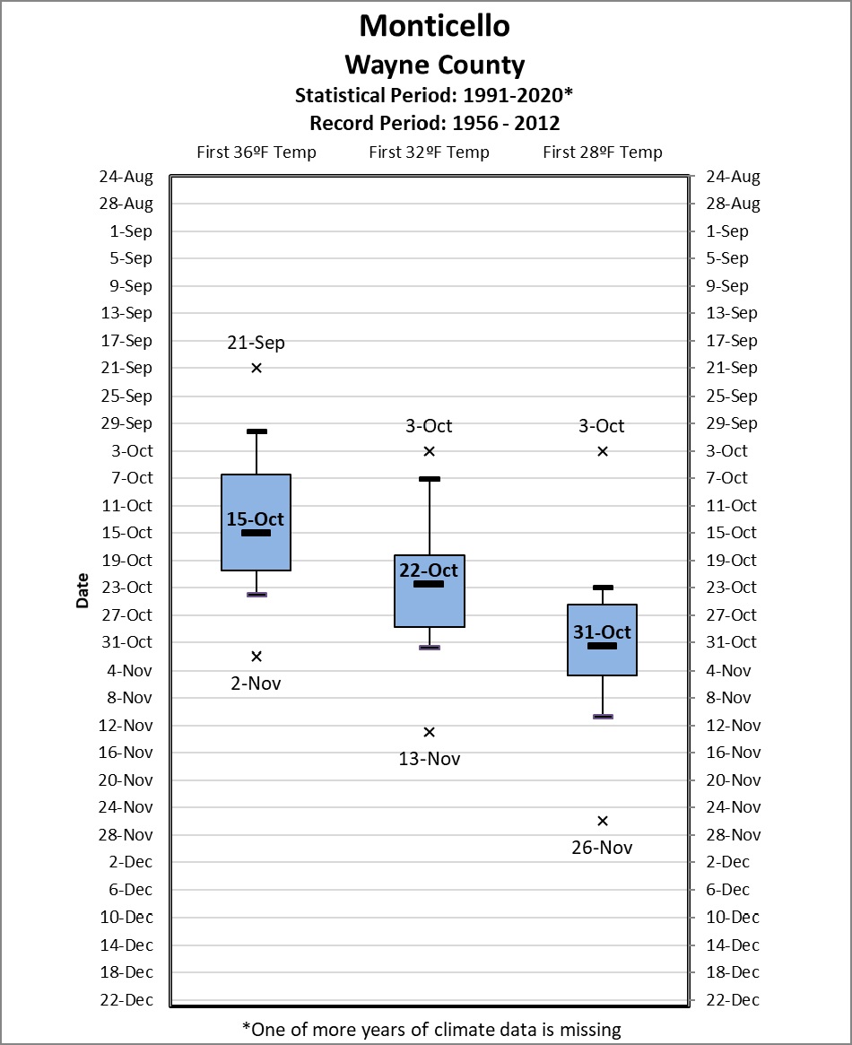 |
| London-Corbin Airport Climate Station | Monticello 3NE COOP Station |
|
|
|
 |
 |
|
Mount Vernon COOP Station
|
Somerset 2 N COOP Station |
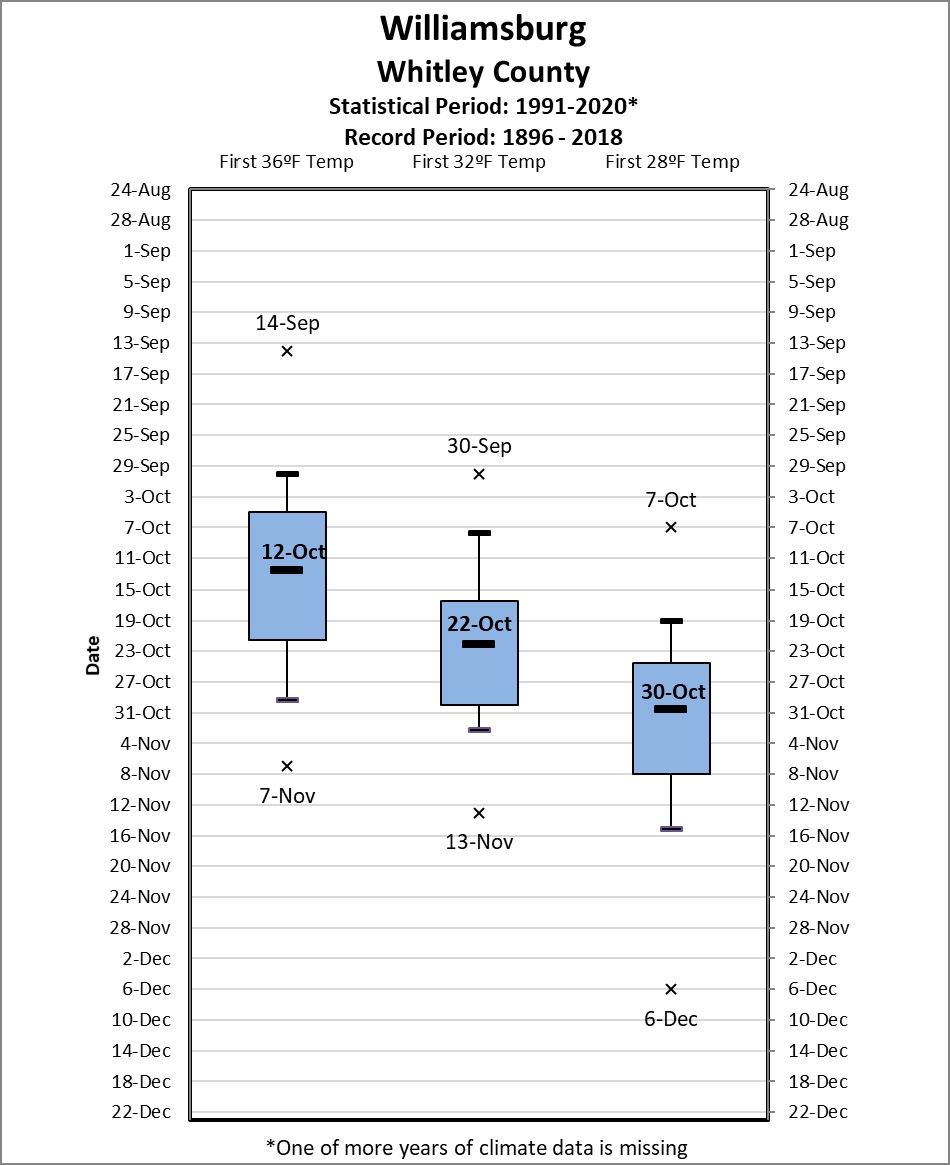 |
| Williamsburg and Williamsburg 1 NW COOP stations |
 |
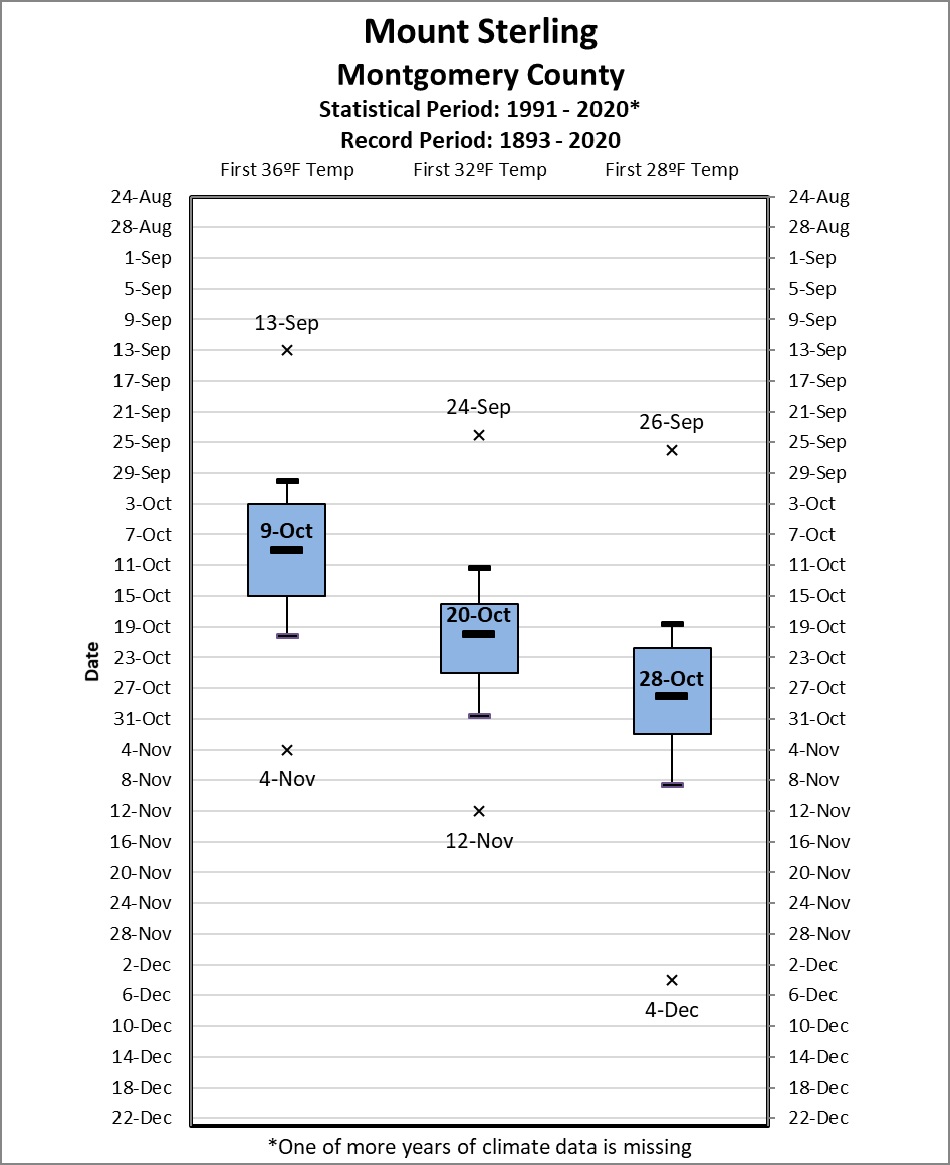 |
| Farmers 2 S COOP Station | Mount Sterling COOP Station |
 |
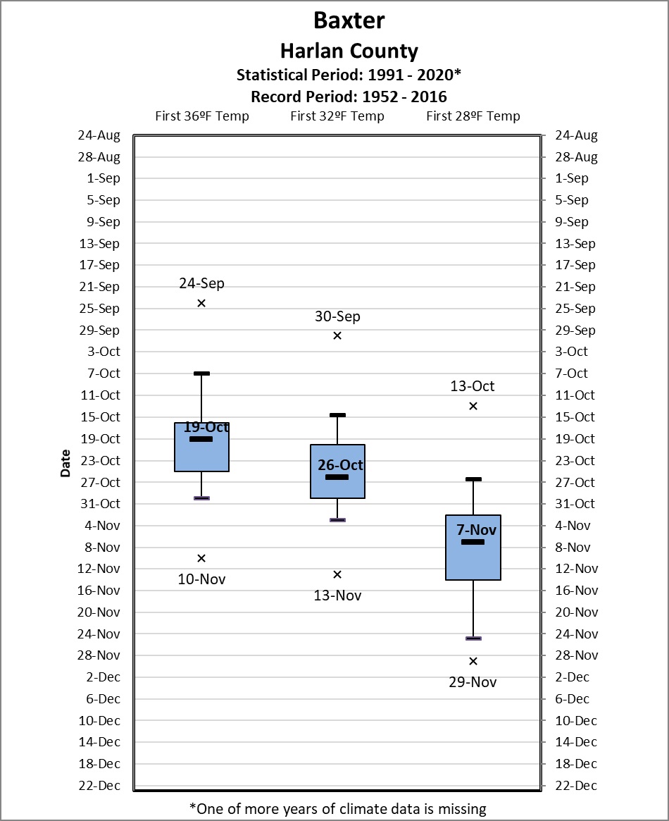 |
| Barbourville COOP Station | Baxter COOP Station |
|
|
|
 |
 |
|
Buckhorn Lake COOP Station
|
Paintsville 1 E COOP Station |
 |
|
West Liberty 3 NW COOP Station
|