 |
 |
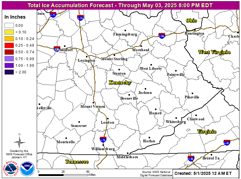 |
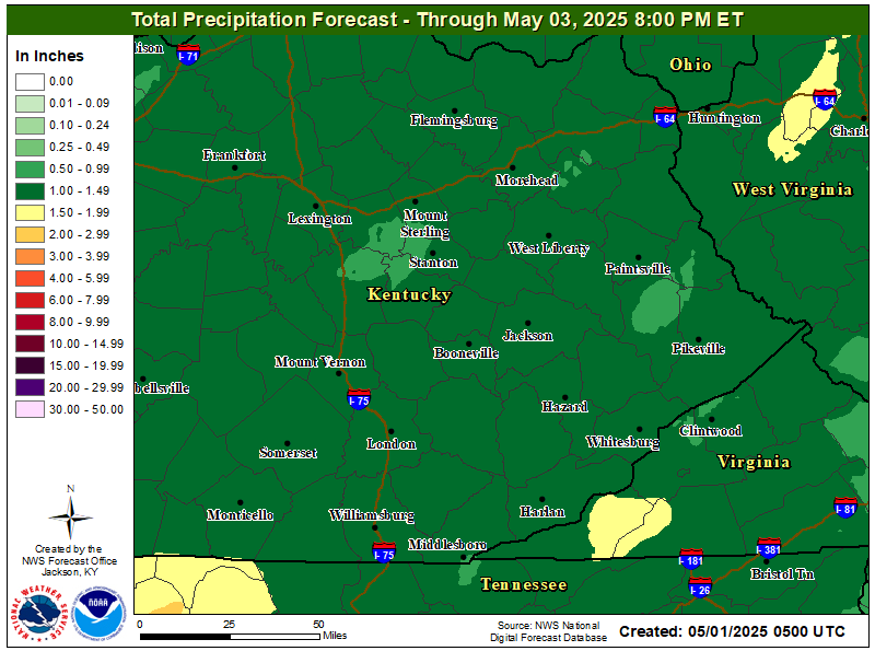
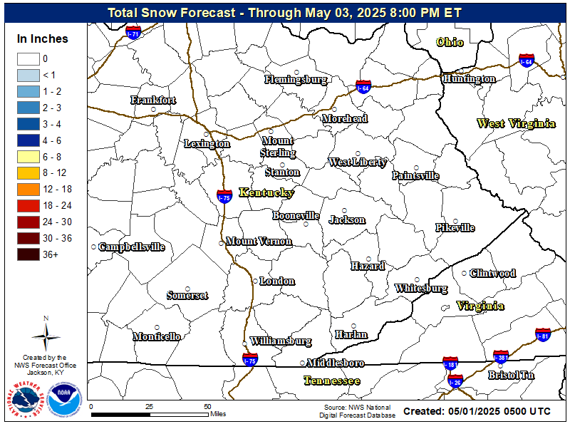
| Precipitation | Snowfall | Ice |
| For location specific precipitation timing and amounts, click on the location below... | |||||
| Barbourville | Elkhorn City | Jackson | Middlesboro | Pikeville | South Williamson |
| Beattyville | Flemingsburg | Jeffersonville | Monticello | Pineville | Stanton |
| Booneville | Frenchburg | Inez | Morehead | Prestonsburg | West Liberty |
| Campton | Harlan | Irvine | Mt. Sterling | Salyersville | Whitesburg |
| Clay City | Hazard | London | Mt. Vernon | Sandy Hook | Whitly City |
| Corbin | Hindman | Manchester | Owingsville | Somerset | Williamsburg |
| Cumberland | Hyden | McKee | Paintsville | Click Here for Additional Locations | |


