Read the Hazardous Weather Outlook (click to read)
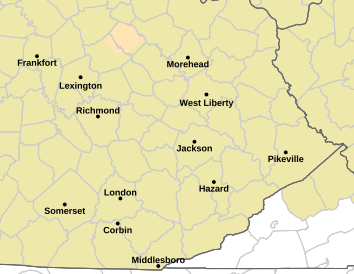
775 FLUS43 KJKL 240725 HWOJKL Hazardous Weather Outlook National Weather Service Jackson KY 325 AM EDT Sun May 24 2026 KYZ044-050>052-058>060-068-069-079-080-083>088-104-106>120-250730- Fleming-Montgomery-Bath-Rowan-Estill-Powell-Menifee-Rockcastle- Jackson-Pulaski-Laurel-Wayne-McCreary-Whitley-Knox-Bell-Harlan- Elliott-Morgan-Johnson-Wolfe-Magoffin-Floyd-Lee-Breathitt-Knott- Owsley-Perry-Clay-Leslie-Letcher-Martin-Pike- 325 AM EDT Sun May 24 2026 This Hazardous Weather Outlook is for a portion of eastern Kentucky. .DAY ONE...Today and tonight. Scattered showers and thunderstorms today and tonight could bring locally heavy rainfall where they are most persistent, leading to the possibility of localized minor flooding. .DAYS TWO THROUGH SEVEN...Monday through Saturday. Thunderstorms are possible at times through the period, with a potential for locally heavy rainfall. .SPOTTER INFORMATION STATEMENT... Spotter activation is not expected at this time. $$ GREIF
Read the Area Forecast Discussion (click to read)
581 FXUS63 KJKL 241422 AFDJKL AREA FORECAST DISCUSSION National Weather Service Jackson KY 1022 AM EDT Sun May 24 2026 .KEY MESSAGES... - Localized heavy rainfall may occur with showers & thunderstorms today. - Wet weather will last through most of the upcoming week, but some drying may occur by next weekend. && .UPDATE... Issued at 1022 AM EDT SUN MAY 24 2026 Have incorporated trends from the latest model runs into today`s forecast, with the greatest emphasis for precip being this afternoon in our northern and western counties. UPDATE Issued at 730 AM EDT SUN MAY 24 2026 No significant changes were made to the forecast with mainly just the inclusion of the latest obs and trends for the T/Td/Sky grids. These minor adjustments have been sent to the NDFD and web servers along with a freshening of the zones. && .SHORT TERM...(Today through Monday) Issued at 450 AM EDT SUN MAY 24 2026 08Z sfc analysis shows a large area of relatively weak low pressure over the Ohio Valley while stronger area of high pressure is located east of the Appalachians. This is keeping the pattern fairly locked in place with a stalled front to the east and another west of Kentucky - all supporting a pooling of moisture and instability through eastern Kentucky. As a result, we are still dealing with a cluster of occasional CG producing thunderstorms lifting northeast through the western part of the JKL CWA even during this typical diurnal convective minimum in the middle of the night. This slow, but at least progressive, cluster of showers and storms has been able to leave behind some excessive rainfall with a couple of Flood Advisories for the western Cumberland Valley. Satellite shows these colder cloud tops steadily lifting north with a weakening trend, though additional activity appears to be developing in its wake. The local sfc pattern has left skies mostly cloudy but did leave enough clear patches to allow for patchy fog - locally and briefly dense. The moist air mass in place also makes for quite high humidities and consequently dewpoints are close to temperatures. These are holding in the mid 60s, amid light and variable winds - away from that thunderstorm cluster. The models, and their individual ensemble suites, remain in pretty good agreement aloft, through the short term portion of the forecast. They all depict eastern Kentucky caught between strong 5h ridging off-shore of the Southeast Coast while dynamic troughing is found to the northwest - through the Upper Midwest. This longwave pattern is supporting a steady stream of southwest mid-level flow through Kentucky with plenty of embedded energy impulses. The latest of these waves is moving into the state to the west in conjunction with the 5h trough line shifting east toward the area. The moist and active southwest mid-level flow continues tonight even as the main trough axis passes through the Great Lakes and northern Ohio Valley. The periodic energy that moves through the flow will continue to be sustained by a developing 5h trough over eastern Texas through Memorial Day and beyond. Given the continued good agreement among the models, the NBM was used as the starting point for the short term grids with little changes needed. The main adjustments to the initialization included adding higher resolution timing and placement details for the PoP grids through Monday evening from the latest CAMs guidance. Sensible weather features a continuation of our humid and unsettled weather with periodic showers and thunderstorms plaguing the area through rest of the Memorial Day weekend - messing up cookouts and other outdoor activities. The heavier activity will likely be scattered around enough to forgo a flood watch, but definitely some localized high water issues could develop where training of the convective cells occur. Expect the ongoing scattered showers and occasional thunderstorms to expand in coverage through the morning with a trend toward more thunder into the afternoon. Thereafter, much of the deeper moisture appears to temporarily shift southeast into and through the night as a sfc boundary shifts that direction. This will limit the convection to our far southeast towards dawn Monday, but will likely work back northwest during the day as weak high pressure to the north lifts out of the area. Despite the high PoPs through the short term period, the QPF does not appear to be too concentrated per the CAMs consensus with daily lulls probably enough to prevent any more than isolated and localized flood concerns. However, this certainly primes the area with this pattern seemingly remaining in place for a while and especially should a stronger, more definitive, boundary develop or move into the area - providing a distinct focusing and lifting mechanism for the convection. The changes to the NBM starting point again mainly consisted of including PoP and thunder details from the latest CAMs guidance through Monday. As for temperatures and dewpoints, they were not adjusted much given the moist air mass - but did shave the highs back toward modeled hourly temps each afternoon and likewise brought the lows up a tad at night as the high dewpoints limit nightly temperature drops. .LONG TERM...(Monday night through Saturday) Issued at 510 AM EDT SUN MAY 24 2026 The main change to the extended forecast this morning was to add in a touch of terrain distinction to nighttime temperatures Monday night into Tuesday morning where some very limited and temporary drying is expected. Also, the rain making pattern this week continues to keep a rain axis overhead or nearby. However, there is indications that we may at least briefly get to dry out over the next weekend. The previous long term discussion follows: The forecast period starts with a surface low moving eastward out of the Ohio Valley. This surface low is progged to drag a cold front through the area first thing Monday morning. This will provide showers and storms early in the day, followed by a lull in activity for the afternoon. However, by late afternoon, a surface wave moving through the Deep South is forecast to eject north and lift a warm front through the CWA. Showers and storms are expected to increase in coverage Monday afternoon and persist through the overnight hours before the front stalls as a stationary boundary, oriented west to east across the Commonwealth for Tuesday. This wavering boundary is forecast to stall Tuesday and remain the focus for shower and thunderstorm development throughout most of next week. Forecast PWs, driven by stout moisture advection, alongside skinny CAPE soundings, continue to hint at efficient rainfall production along this boundary. This supports a forecast total QPF ranging from over 1.25 inches in the Bluegrass/I-64 corridor to up to 2.00 inches farther south toward the Tennessee border. These numbers will certainly fluctuate depending on convective activity and where mesoscale bands or heavier rainfall set up. However, long-term guidance does hint at a breakdown of this wet and stormy pattern late in the week as the stationary front drops south as a cold front, bringing an end to the precipitation. Lastly, temperatures are forecast to remain rather seasonal with highs in the upper 70s to lower 80s and overnight lows in the low to mid 60s. Once the front sags south, temperatures will cool a few degrees, with lows dropping into the 50s. In summary, an active and unsettled weather pattern will dominate the region into next week as a stationary boundary stalls across the Commonwealth. Seasonal temperatures will remain overhead, but persistent rainfall, which will be heavy at times, could bring an increasing threat for river and flash flooding. && .AVIATION...(For the 12Z TAFS through 12Z Monday morning) ISSUED AT 750 AM EDT SUN MAY 24 2026 Conditions were primarily VFR at TAF issuance outside any ongoing scattered showers and thunderstorms. Coverage of the convective activity should generally increase through the day, with renewed flight category reductions. However, forecast confidence on details and timing is less than ideal at this time. Winds will be light and variable, outside of any thunderstorms. && .JKL WATCHES/WARNINGS/ADVISORIES... None. && $$ UPDATE...HAL SHORT TERM...GREIF LONG TERM...VORST/GREIF AVIATION...GREIF |
||||||||||||||