Dangerous heat will expand from the Gulf Coast into the Southern Plains and Desert Southwest through week's end. Additional extreme heat impacting the Pacific Northwest will shift to the northern Plains by the weekend. Tropical Storm Bertha is expected to continue to impact portions of the northern Gulf Coast from the western Florida Panhandle to southeastern Louisiana through tonight. Read More >
| Hurricane Nicholas | |||||||||||||||||||||||||||||||||
| September 12-17, 2021 | |||||||||||||||||||||||||||||||||
|
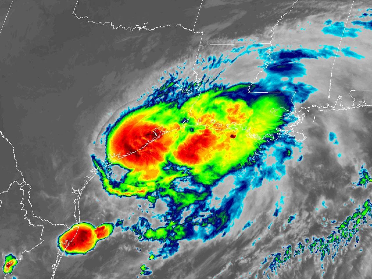
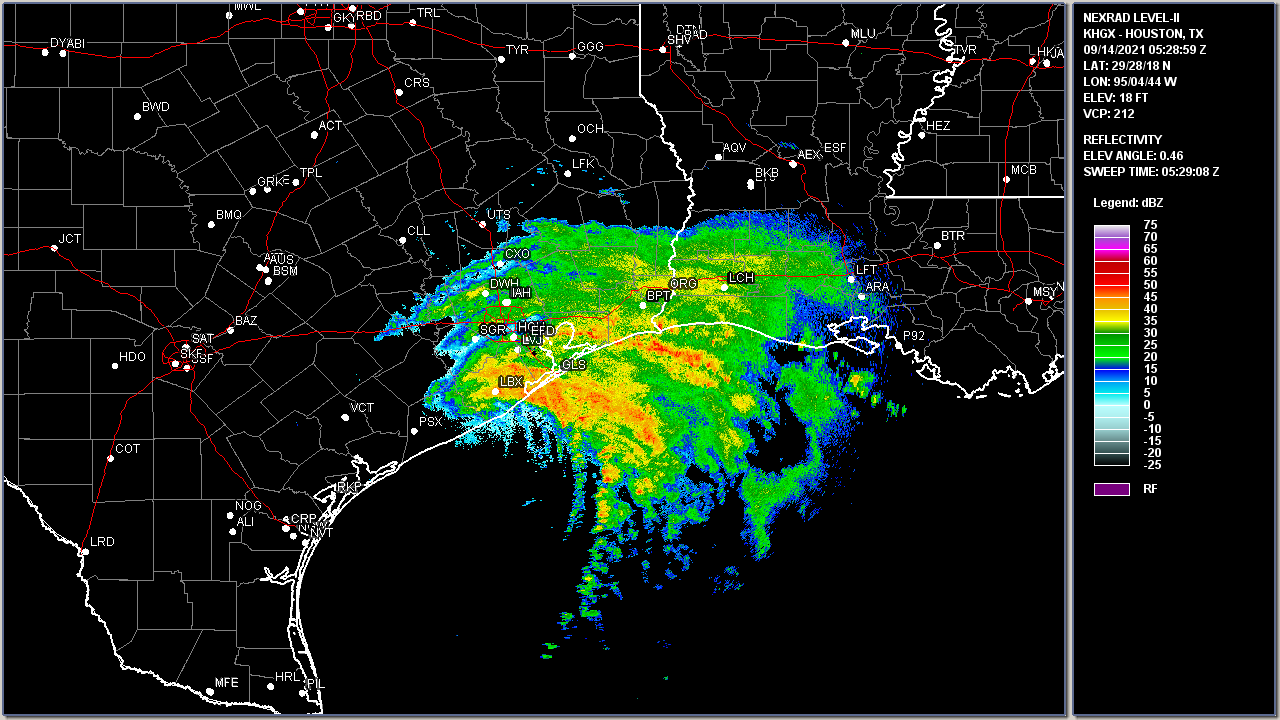
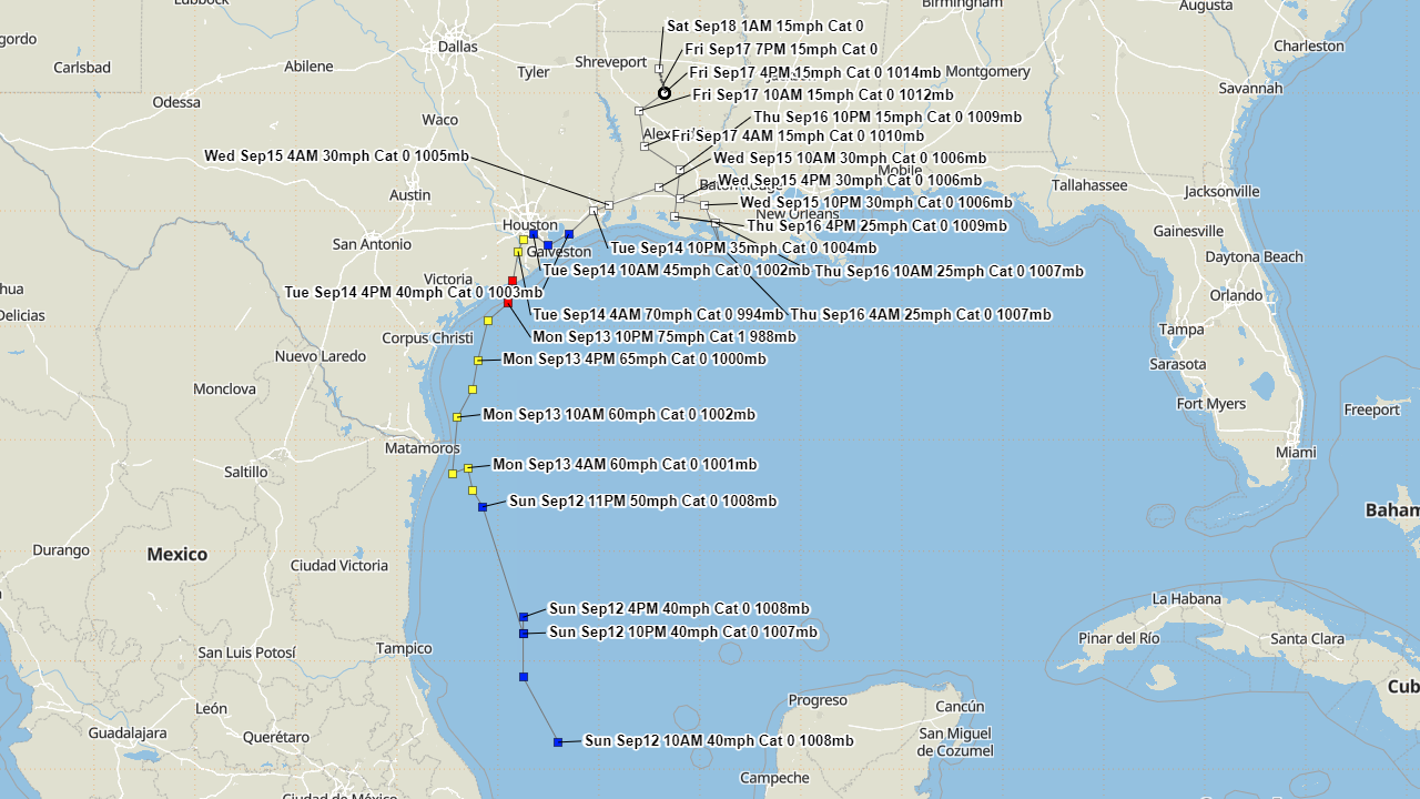
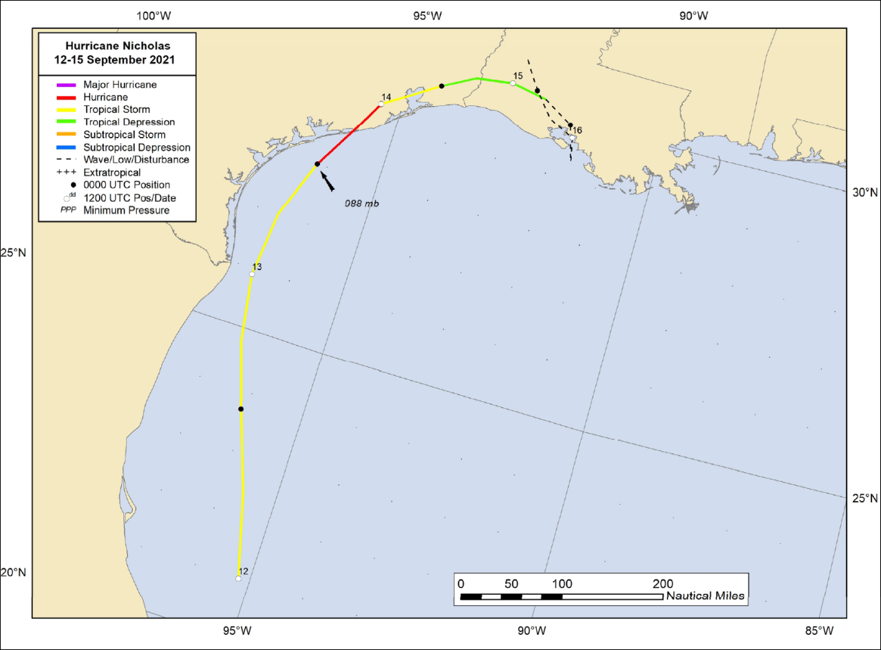
On September 9th, the National Hurricane Center began monitoring a tropical wave over the western Caribbean Sea for potential development. By September 12th, the system became better organized over the Bay of Campeche. Air Force reconnaissance aircraft investigated the system after daybreak, and found minimal tropical storm force winds, thus being upgraded to Tropical Storm Nicholas at 10 A.M. CDT. Nicholas had trouble remaining organized as it moved north-northwest towards the Texas coast due to persistent west to southwesterly wind shear. On the evening of September 12th, the center of Nicholas re-formed about 170 miles to the north-northwest of the previous center, confirmed by aircraft reconnaissance and Brownsville radar, placing it around 95 miles southeast of the Mouth of the Rio Grand River. Despite the warm Gulf waters in the mid to upper 80s, continued wind shear kept Nicholas from rapid strengthening the rest of night through most of the day on September 13th. Later that evening, an intense burst of convection over Nicholas’s center was enough to bring the intensity up to 75 mph (65 knots) and a minimal central pressure of 988 millibars (29.18 inches) and was upgraded to a hurricane by 10 P.M. CDT. Hurricane Nicholas made landfall at 75 mph (65 knots) and a minimal central pressure of 991 millibars (29.26 inches) near 12:30 A.M. September 14th on the eastern part of the Matagorda Peninsula, about 10 miles west-southwest of Sargent Beach, Texas. Nicholas moved further inland and weakened back to a tropical storm by 4 A.M. CDT. Nicholas continued weakening as it turned more east-northeast, traveling coastal Southeast Texas for the remainder of the day, weakening to a tropical depression by 10 P.M. CDT near Beaumont, Texas. From September 15-16th, Tropical Depression Nicholas continued slowly eastward across Southern Louisiana, making an anticyclonic loop on the 16th. Nicholas was designated post tropical due to the lack of convection early on the 17th while it headed northward across Central Louisiana, dissipating later that evening across North Louisiana. For a complete summary of all the effects of Nicholas across our region, see the Post Tropical Cyclone Report issued by the National Weather Service Lake Charles, LA.
|
|||||||||||||||||||||||||||||||||