
Canadian wildfire smoke will push into the Midwest, worsening air quality. A frontal system brings severe storms from the Northern Plains to the Mid‑Atlantic the next few days. Heavy Gulf Coast rain is possible as we closely monitor tropical development, while monsoonal storms persist in the Southwest with heavy rainfall. Hazardous heat expands from the Plains into the Lower Mississippi Valley. Read More >
Summary
|
Tornadoes
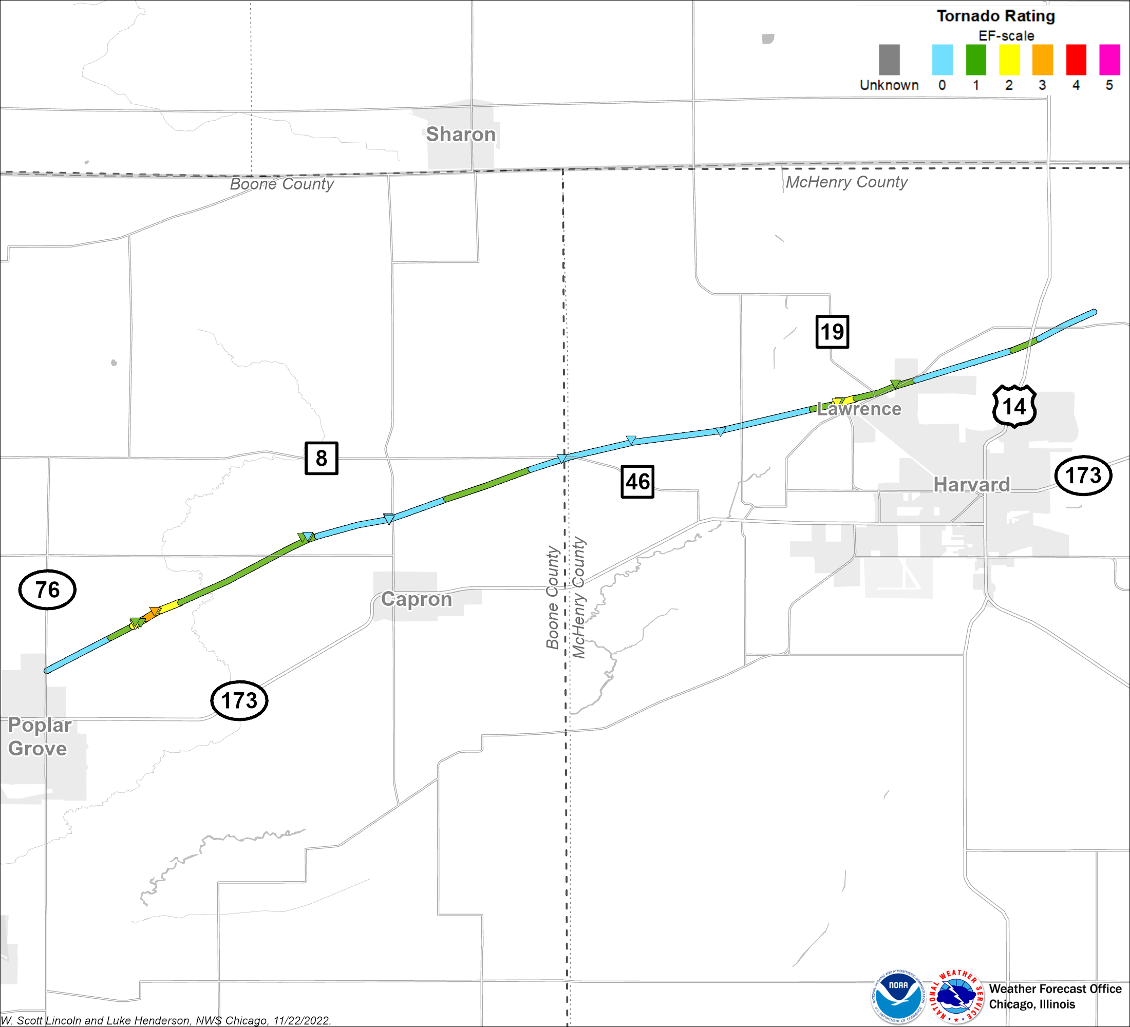
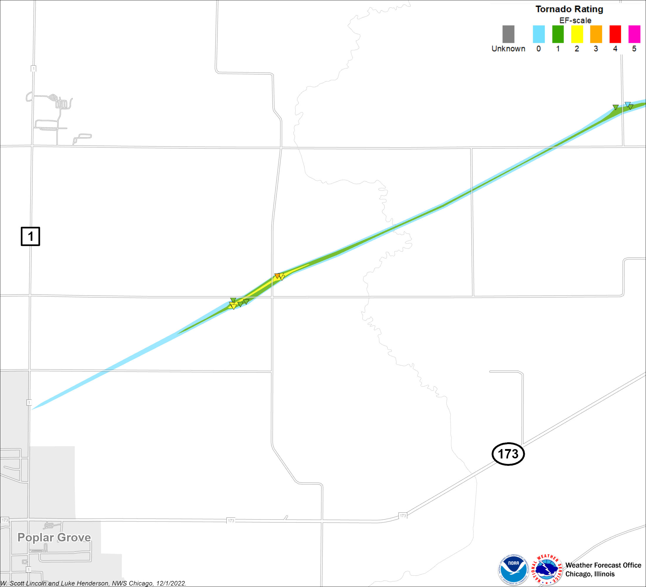
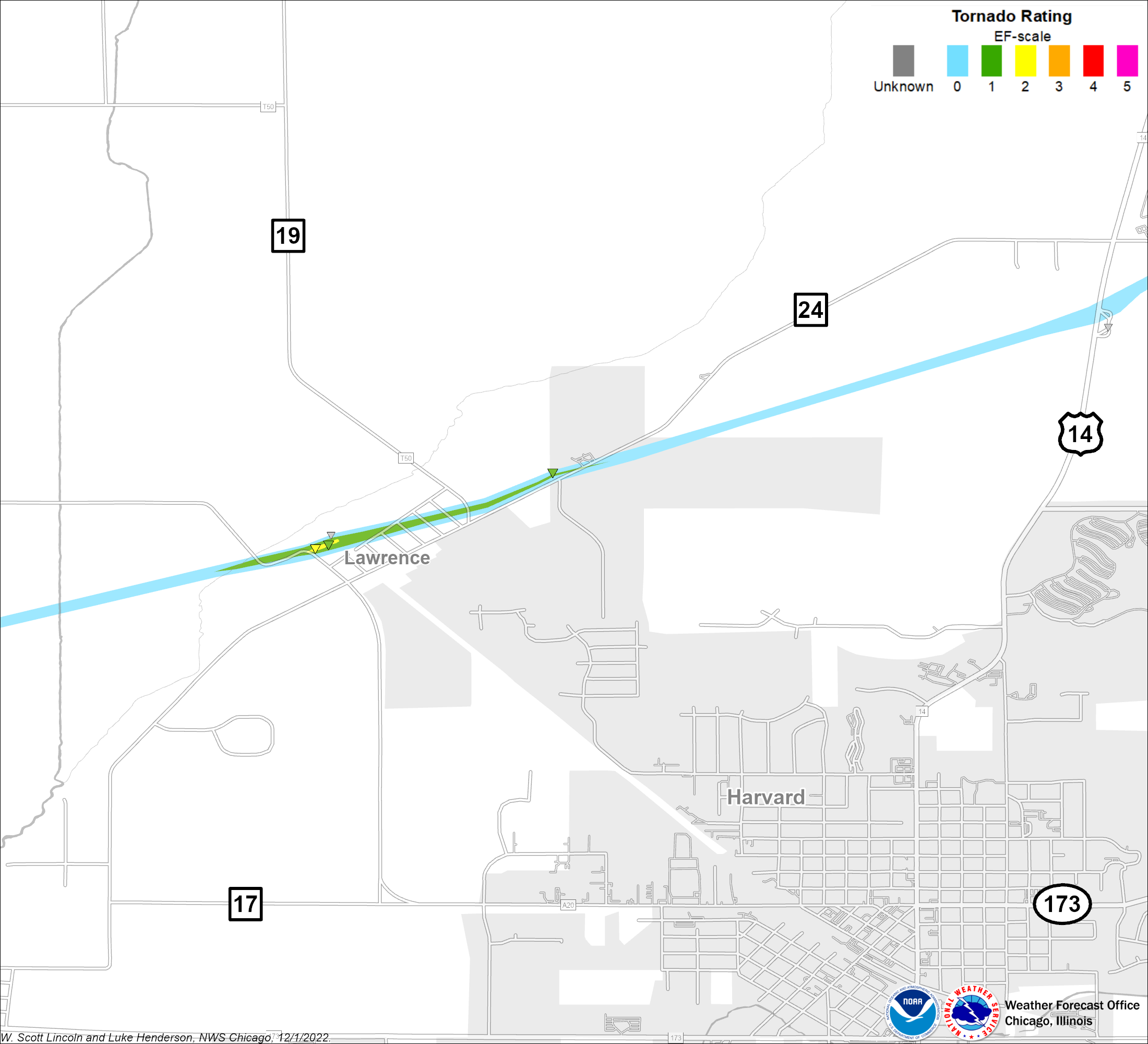
Damage surveys conducted by National Weather Service personnel revealed a continuous path from a single tornado beginning at around 3:30 PM about 1.2 miles north of Poplar Grove in Boone County and ending at around 3:48 PM about 3.2 miles north-northeast of Harvard in McHenry County.
Poplar Grove - Harvard EF3
Summary: A tornado began at around 330 pm CST about 1.2 miles north of Poplar Grove in Boone County and ended at around 348 pm about 3.2 miles north northeast of Harvard in McHenry County. The first signs of damage were at Quail Trap Road just east of Popular Grove Road, where trees were damaged and sections of roofing were removed from a shed. The tornado intensified to EF2 intensity at Edwards Apple Orchard on Centerville Road. A large barn was destroyed and other buildings were severely damaged. Large trees were snapped or uprooted. The tornado reached its maximum intensity of EF3 at the northeast corner of Centerville Road and Beaverton Road. A two story farm house and garage were leveled and large trees were stripped of all branches. The tornado was about 100 yards wide through this area. The tornado continued east northeast across Stimes Road and eventually crossed the Boone McHenry County line near Hunter Road. At Ryan Road, the tornado was at EF0 intensity and caused mainly minor tree damage. It crossed White Oaks Road, then uprooted a hardwood tree and snapped off pine trees at their base along Maxon Road. This damage continued to be EF0 damage with winds estimated to 80 mph. The tornado intensified as it moved toward the community of Lawrence, where it produced the worst damage in McHenry County. Significant damage occurred in Lawrence, particularly at a house that had more than half of its roof ripped off and garage blown down. The tornado then moved across the Chicago and Northwestern Railroad, where it blew 12 railroad freight cars of the track. The train was moving at the time the tornado hit it, so as the main engine stopped, the remaining cars on the track continued along it and slammed into the front part of the train. This caused a few more cars to derail, including one containing hazardous materials that caused the evacuation of the town of Lawrence. The damage in Lawrence was rated as EF2 with winds up to 110 mph. As the tornado moved east of Lawrence, it once again started to weaken while producing some tree damage and tearing shingles off of a few houses on the northeast side of the community. It then ran along Oak Grove Road for a stretch, where it produced EF1 damage, snapping a hardwood tree at its base and knocking over an old, weakly structured barn. The tornado then tracked across farm fields and headed for Highway 14, where it damaged a metal barn and sheared a few trees. As it crossed Highway 14, it flipped a semi-trailer and injured the driver at a truck stop weigh station. It continued across Oak Grove Road where it lifted. Four injuries were reported in Boone County, with one injury in McHenry County. |
The Enhanced Fujita (EF) Scale classifies tornadoes into the following categories:
| EF-0 Weak 65-85 mph |
EF-1 Moderate 86-110 mph |
EF-2 Significant 111-135 mph |
EF-3 Severe 136-165 mph |
EF-4 Extreme 166-200 mph |
EF-5 Catastrophic 200+ mph |
 |
|||||
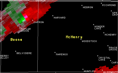
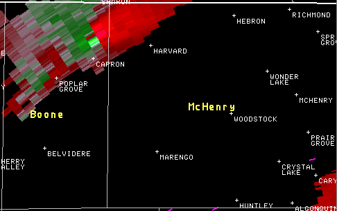
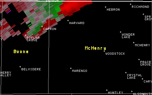
Radar
|
|
|
|
|
|
|
|
|
|
|
|
|
|
|
Environment
This weather event was unusually intense and climatologically very rare. The National Weather Service has tornado records dating back to 1950. In the 58-year period of record leading up to the day of this tornado, only one other tornado has ever been documented anywhere in north central or northeast Illinois in the month of January. That tornado occurred on January 25, 1950 in Momence in Kankakee County and was rated F2 on the Fujita scale. That day was similar to January 7, 2008 with temperatures in the middle 60s. In fact, Chicago set its all time record high for the month of January, with a temperature of 67 degrees, on that date.
Photos
 |
 |
 |
 |
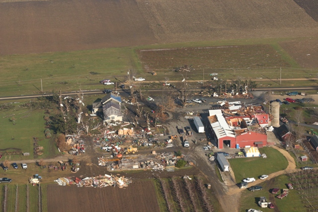
| EF2 damage at Edwards Apple Orchard northeast of Poplar Grove near the intersection of Beaverton Road and Centerville Road. (courtesy of Civil Air Patrol) |
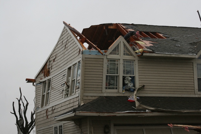
EF3 damage to a house near intersection of Beaverton Road and Centerville Road. (courtesy of Civil Air Patrol) |
EF3 damage to a house near intersection of Beaverton Road and Centerville Road. (NWS Damage Survey) |
EF2 damage to a house at Edwards Apple Orchard. (NWS Damage Survey) |
 |
 |
 |
 |
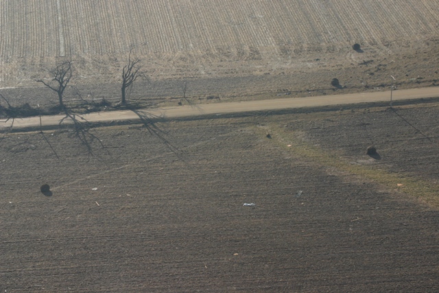
| Tracks showing where large hay bales were rolled through a field by the storm, near Boone School Road. (courtesy of Civil Air Patrol) |
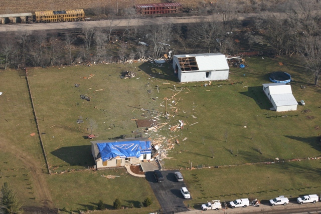
EF1 damage to garages and machine shed on Leroy Center Road. (courtesy of Civil Air Patrol) |
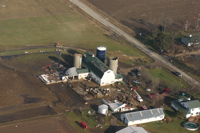
Hay barn collapsed on Capron Road. (courtesy of Civil Air Patrol) |
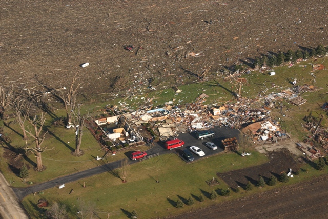
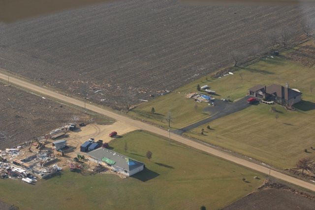
Homes damaged and train derailed at Lawrence. (courtesy Civil Air Patrol) |
 |
|||
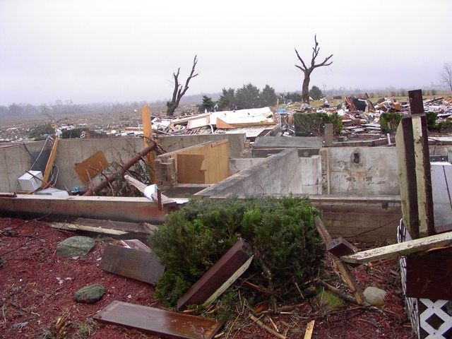
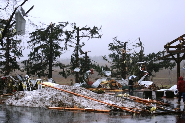
| Snow covered by tornado debris and surrounded by topped trees and twisted metal siding. (NWS Damage Survey) |
 |
Media use of NWS Web News Stories is encouraged! Please acknowledge the NWS as the source of any news information accessed from this site. Additional recaps can be found on the NWS Chicago Past Events Page |
|


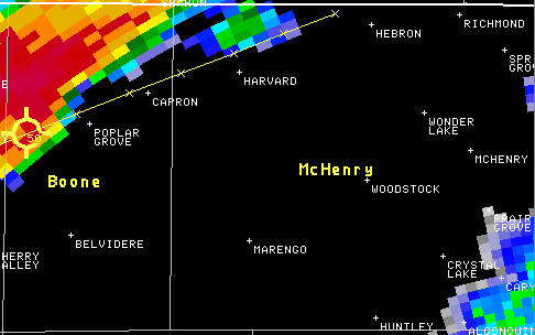
 Radar storm-relative velocity at 325 PM CST
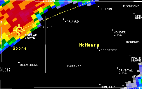
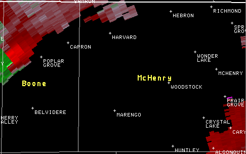
 Radar storm-relative velocity at 330 PM CST
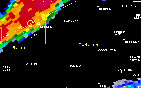
 Radar storm-relative velocity at 335 PM CST
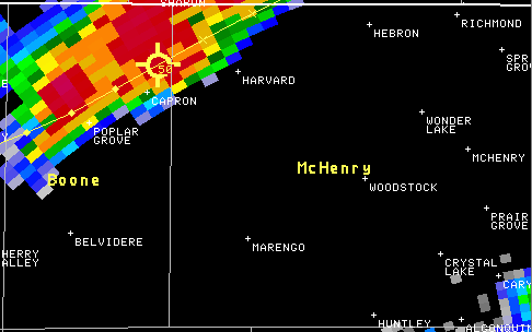
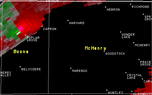
 Radar storm-relative velocity at 339 PM CST
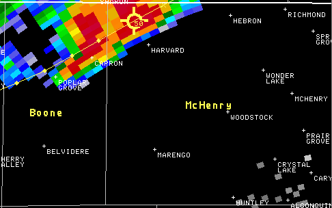
 Radar storm-relative velocity at 345 PM CST