Chicago, IL
Weather Forecast Office
|
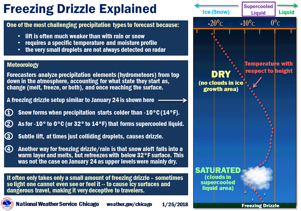
There is a very small margin of error in determining primarily light snow vs. light freezing drizzle for forecasters. However, the difference in impacts between these two precipitation types is often significant, with freezing drizzle prone to quickly cause slick surfaces, even with only trace amounts. |
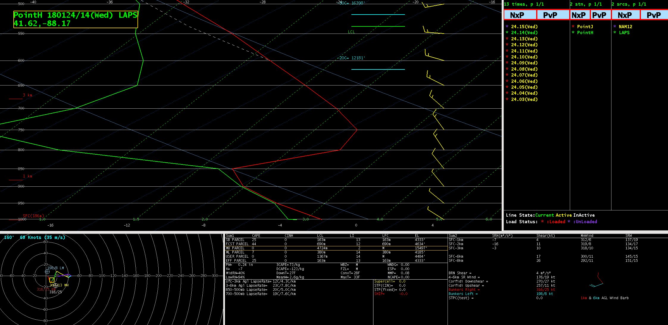 An 8 am model analysis sounding near Romeoville, IL, indicating a saturated layer that was within temperatures close to both flurries/snow grains and supercooled liquid for freezing drizzle. |
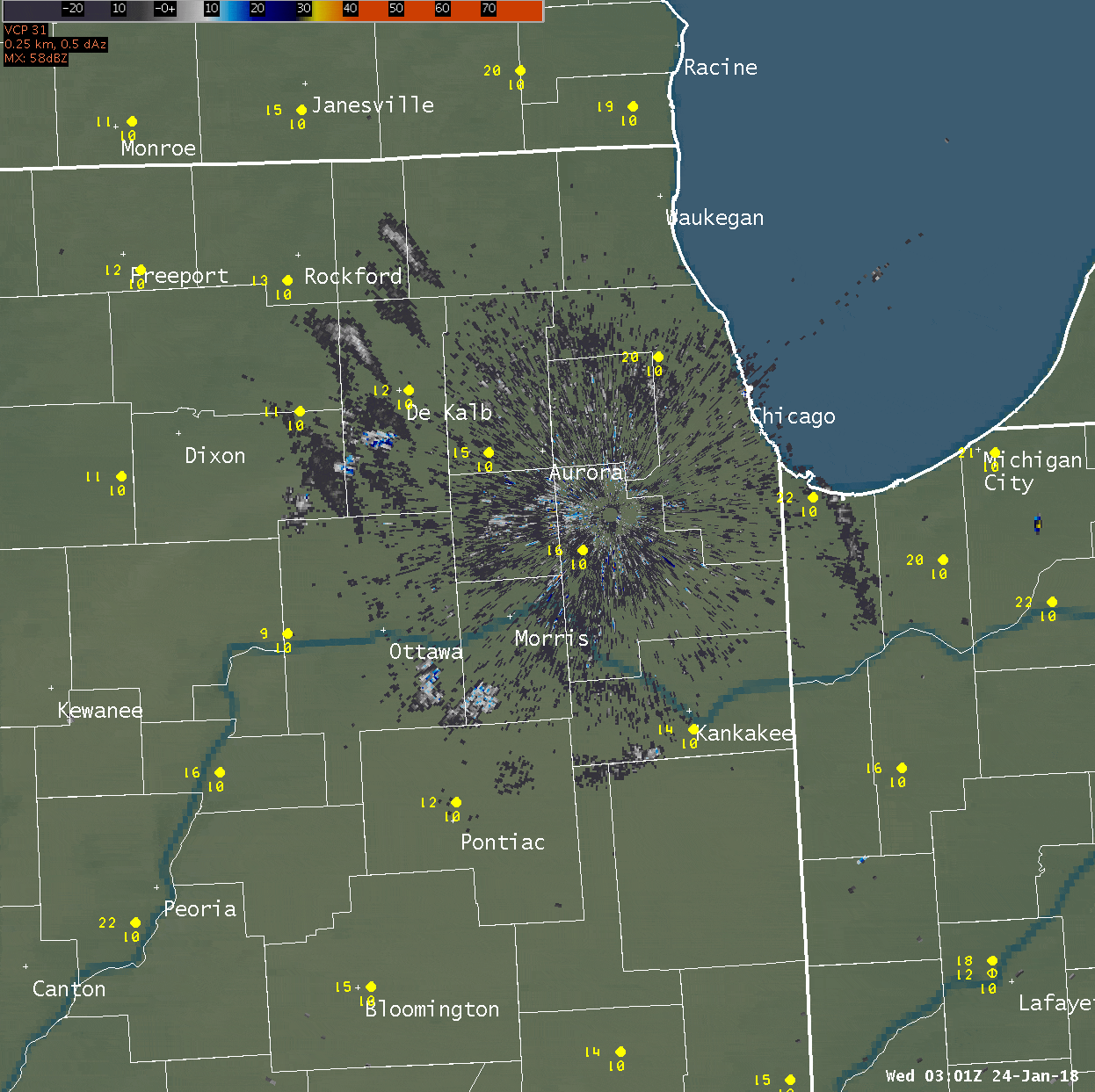 Radar loop and observations during from 9 pm January 23 through 12 pm January 24. A gradual expansion in light echoes occurs during the overnight/early morning of the 24th. There are some embedded heavier echoes that are likely light freezing rain showers. As an indication of that, NWS Chicago recorded 0.05" of liquid during the morning of January 24. |
.
Hazards
Enhanced Hazardous Weather Outlook
Hazardous Weather Outlook
National Briefing
Storm Spotter Training and Seminars
Outlooks
Watch/Warning/Advisory Criteria
Snow Squall Warnings
Local Forecasts
Marine
Aviation
Fire
Text Products
Great Lakes Marine Portal
Lake Michigan Beach Forecast
El Nino
Snow and Ice Probabilities
US Dept of Commerce
National Oceanic and Atmospheric Administration
National Weather Service
Chicago, IL
250 George J Michas Dr.
Romeoville, IL 60446
815-834-1435 8am-8pm
Comments? Questions? Please Contact Us.