Scattered thunderstorms with severe gusts, hail and a tornado risk are possible near a cold front from the Ohio Valley to the Mid-Atlantic tonight. Tropical Storm Bertha is expected to bring tropical storm conditions to portions of the Gulf Coast from the panhandle of Florida into Louisiana through Wednesday. Read More >
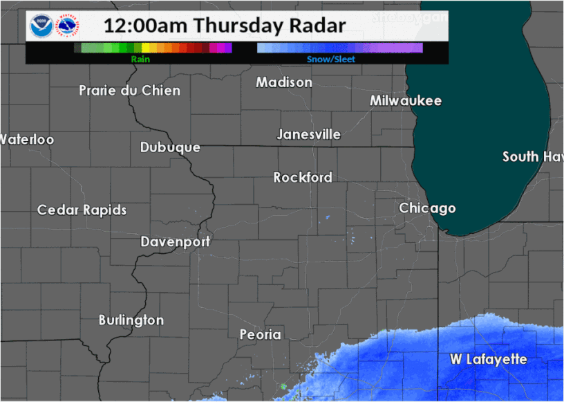
| Thursday, November 15 saw early morning snow from a major weather system to our south spread northwest over northwest Indiana and northern Illinois. The solid snow shield brought 2" to 4" of accumulation in parts of east central Illinois into northwest Indiana by mid-morning. Then a single band of snow continued to move northwest across the Chicago metro area, pivoting, and then weakened as it moved back southeast (though did briefly re-intensify). This band produced mainly 1-2", although there was isolated 2" in Lake County, IL. |
|
Fast Facts
Snow/Ice Totals
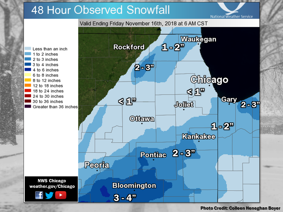 |
| Observed snowfall map from 11/15/18. Also visit the Storm Reports map. |
Text Listing of Snowfall Reports from Volunteer Observers
Storm Reports
Map of Snowfall Local Storm Reports
210

NWUS53 KLOT 210314

LSRLOT


Preliminary Local Storm Report

National Weather Service Chicago IL

1014 PM CDT Mon Jul 20 2026


..TIME...   ...EVENT...      ...CITY LOCATION...     ...LAT.LON...

..DATE...   ....MAG....      ..COUNTY LOCATION..ST.. ...SOURCE....

            ..REMARKS..


0730 PM     Misc Mrn/Srf Hzd 3 NNW Lake Station      41.62N 87.26W

07/19/2026                   LMZ744             IN   Local Official


            *** 1 FATAL ***

            The Indiana DNR is reporting that a 22 year

            old man drowned in Lake Michigan at

            Marquette Park Beach. Preliminary

            information is that the individual jumped

            into waves and drifted into deeper water.

            Wave heights were estimated between 2 and 3

            feet at the time.


&&


$$


BB
Meteorology and Additional
Meteorology
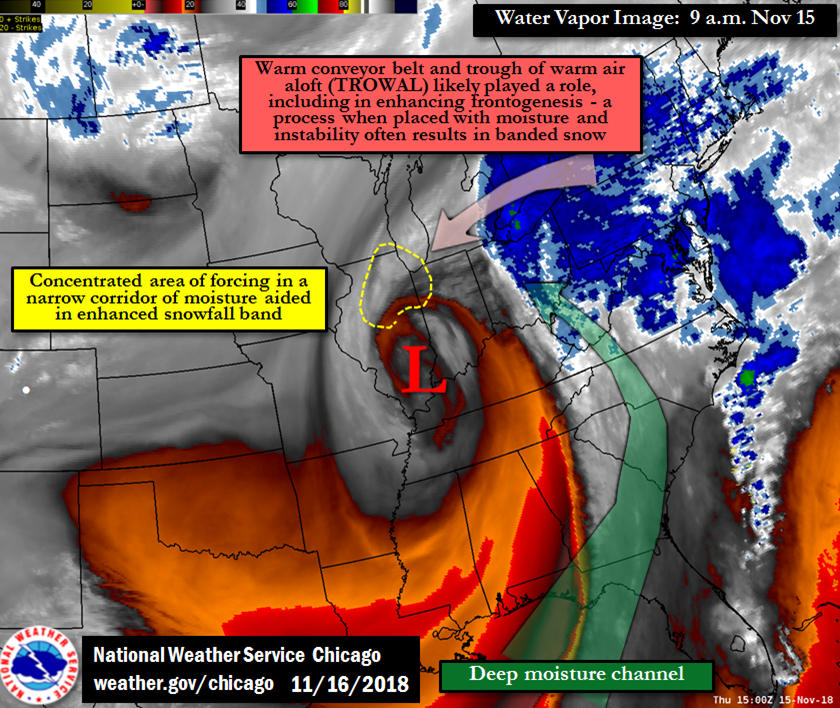 |
| Water Vapor Image |
Links
 |
Media use of NWS Web News Stories is encouraged! Additional recaps can be found on the NWS Chicago Science & Past Events Page. |
|